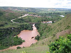
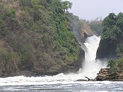
White nile
The White Nile (Arabic: النهر البيض [al-Nahr al-Abyad] or انهرل الجبل [al-Nahr el-Jebel ]) is a long river in northeastern Africa, which, when it meets the Blue Nile (Nahr el Azraq) in Khartoum, gives rise to the Nile River. Many geographers believe that it is not of a river, but of a stretch of the Nile River which, as it passes through Sudan, is called the White Nile. It supposes the most important permanent contribution of water of this basin. The White Nile runs through three countries, Uganda, South Sudan and Sudan; In addition, its sources run through Burundi, Rwanda and Tanzania and also extend to Kenya (via Lake Victoria) and the Democratic Republic of Congo (via Lake Albert).
Geography
The White Nile, or simply the Nile, has three different sources, located north of Lake Tanganyika, which rapidly meet before converging at Lake Victoria (which is bordered by Uganda, Kenya, and Tanzania). Considering the different sections, the sequence is:
- River Kagera, which is considered the most remote source of the Nile, in the territories of Burundi and Rwanda.. Thus, the Luvironza River, which is one of the top ramifications of the Kagera River in Burundi, is recognized as the most remote source of the Nile. The latter flows through Rwanda, Uganda and Tanzania, to converge with Luvironza in the Akanyaru, and to flow into Lake Victoria.
- Nile Victoria. After leaving Lake Victoria through fast and cataracts the river flows into Lake Alberto.
- Nilo Alberto, from Lake Alberto, across northern Uganda to the border with South Sudan.
- Bahr el-Jebel or Baḥr al-Jabal (river of the mountain), from the Ugandan border with South Sudan, with an initial stretch formed by rapids followed by an immense pantanal known as Sudd, to the confluence on the left of the Bahr el-Ghazal River, north of South Sudan.
- Nilo Blanco (Bahr el Abyad), from the confluence with the river el-Ghazal, on the left, and the Sobat River on the right, in the north of South Sudan. The river continues its journey through Sudan to its capital Khartoum, where it joins with the Blue Nile (which flows from its source, Lake Tana, in the highlands of Ethiopia).
- Nile, from the confluence with the Blue Nile, is already considered the river as the Nile itself. After this union, the Nile receives another important tributary, the Atbara River and enters into the Sudanese desert drawing a very wide curve in the form of "S", or "the Nile Throat" from which the city of Khartoum takes its name (which means "an elephant tube").
The flow of water from the White Nile is much more constant than that of the Blue Nile, but its contribution is less, 20%, while the former contributes 80%. As its flow is more constant and regular, it allows navigation throughout the year. The Jabal Awliya dam was built in its waters, near Khartoum, which provides the water supply for the irrigation of the entire region.
On its way north, the river passes through a swampy, clayey region in South Sudan called Al-Sudd (meaning barrier), through which the main tributaries of the White Nile flow. an equatorial region, with high temperatures for which a large evaporation of water occurs. This region is very extensive and wild, with canals and lagoons that have islands of floating vegetation inside that have been an obstacle to the advance of Mediterranean peoples in black Africa since ancient times. Its extension is approximately 320 km long by 360 km wide. The floating vegetation receives the name sudd in Arabic, which gives rise to the place name. The plants are mostly papyrus.
Among the watercourses of this region, on the grassy plains, has lived since the X century a people called Dinka, tall and thin build. They are dedicated to grazing cattle, goats and sheep, which they take care of for their own maintenance. They are governed by chiefs who are also priests. The Dinka people in Sudan have a reputation for being strong and courageous.
Farther north (when the White Nile already has the Blue Nile on its right), there is a very fertile and productive region called Al Jazirah or El Gezira between these two river currents.
Finally the river reaches the north of Khartoum (the capital of Sudan) where it meets the Blue Nile; a little earlier, the city is connected by bridges with the North Khartoum (bridge over the Blue Nile) and Omdurman (bridge over the White Nile) nuclei.
Inland Waterways
The White Nile is a navigable waterway from Lake Albert to Khartoum via the Jebel Aulia Reservoir, only between Juba and Uganda is it necessary to improve the river or channel it to make it navigable.
For part of the year the rivers are navigable as far as Gambela (Ethiopia) and Wau (South Sudan).
Ports
- Adok
Contenido relacionado
The Toboso
North Sea
Libreville


