
Warrior status
Guerrero, officially the Free and Sovereign State of Guerrero, is one of the thirty-one states that, together with Mexico City, make up Mexico. The capital is Chilpancingo de los Bravo and its most populated city is Acapulco de Juárez.
It is located in the southwestern region of the country, bordered to the north by the State of Mexico, Morelos, and Puebla, to the southeast by Oaxaca, to the southwest by the Pacific Ocean, and to the northwest by the Balsas River that separates it from Michoacán. The geomorphology of the state is one of the most rugged and complex in Mexico; its relief is crossed by the Sierra Madre del Sur and the Sierras del Norte. In cartographic terms, the western sector is usually called Sierra and the eastern sector is Mountain. Between the two lies the depression of the Balsas River. The most important lagoons in the state are the black lagoon, the Coyuca lagoon and the Tres Palos lagoon.
It has a territorial surface of 64,281 km² (approx. 38,000 mi²), representing 3.2% of the national territory, in which 3,542,204 inhabitants live, according to the last official count carried out in 2015 in conjunction with the Institute National Statistics and Geography, the National Population Council and the Social Development Secretariat, which makes it rank as the 12th most populous state in Mexico; Most of the population is concentrated in the Acapulco Metropolitan Area, specifically in the municipality of Acapulco.
The then president of Mexico, José Joaquín de Herrera, sent to Congress the initiative to create the state of Guerrero on May 15, 1849, with territory from the states of Michoacán, Puebla and Mexico. The initiative was approved by the Chamber of Deputies on October 20 and by the Senate on October 26. But it was not until October 27, 1849 when the Free and Sovereign State of Guerrero was declared legally constituted, and General Juan Álvarez was appointed as interim commander general. Since then the state of Guerrero has had that name.
The main economic activities in Guerrero are agriculture, where significant amounts of corn, sesame, sorghum, soybeans, rice, tomatoes, lemons, coffee, melons, grapefruit, watermelon, peanuts, and mangoes are produced; In tourism, the so-called Triangle of the Sun stands out, which is considered the first tourist destination for which Mexico became known in the world. In the past it was an important point for international tourism, today it is one of the first and most important destinations in Mexico and is made up of three cities: the port of Acapulco de Juárez, the Ixtapa-Zihuatanejo beach pairing and the town magic of Taxco de Alarcón.
Toponymy

The idea of creating the state of Guerrero arose from the times of the struggle for the Independence of Mexico. General José María Morelos y Pavón prepared a document through which he created the Province of Our Lady of Guadalupe de Tecpan in southern Mexico. The territory that Morelos assigned to this province corresponded, at that time, to a part of the municipalities of Mexico, Puebla and Valladolid. Morelos's idea was not successful at the time. At the initiative of General Juan Álvarez, the then President of the Republic, José Joaquín de Herrera, declared the creation of the state of Guerrero. The name of the entity pays homage to Vicente Guerrero Saldaña (1782-1831), a prominent insurgent and leader in the resistance stage during the War of Independence and second President of Mexico. The name of the state was imposed as such at its creation on October 27, 1849. Guerrero is the only state in the country named in honor of a Mexican president, as others bear the name of other prominent figures in the history of Mexico. The state of Hidalgo in honor of Miguel Hidalgo, initiator of the Independence of Mexico; Morelos in honor of José María Morelos, also the architect of the independence war, and Quintana Roo, in homage to Andrés Quintana Roo. The new state was founded with the territories of Acapulco, Chilapa and Taxco that previously belonged to the State of Mexico; that of Tlapa belonging to Puebla and that of Coyuca that was from Michoacán.
Identity elements
The State of Guerrero recognizes as its symbols of identity and belonging to its political community according to article 31 of the state constitution:
The citizens of the State of Guerrero recognize as their symbols of identity and belonging to their political community:1. The shield; the flag,
The respective laws shall regulate the characteristics and use of symbols and the anthem of the State.
2. The motto of the State: “My homeland is first”; and
3. The Hymn to Vicente Guerrero.Article 31. Political Constitution of the State of Guerrero
Shield
The shield of the state of Guerrero is made up of 11 feathers of different colors on the upper part as a kind of crown.In an Iberian mouth shield, on a blue background, we have the upright figure of a Jaguar Knight that keeps in his right hand horizontally, a wood-colored baton. The adoption of the shield was made official in the Official Newspaper number 1 of January 2, 1952, in Decree 41 dated December 20, 1951.
Flag
The Flag of Guerrero consists of a white rectangle with a ratio of four to seven between width and length and in the center the Shield of Guerrero, placed in such a way that it occupies three quarters of the width. The flag was officially adopted in 2019 under the command of Héctor Astudillo Flores, which was stipulated in the Ley del Escudo, la Bandera y el Hymn.
Motto
The current motto of the state is My homeland is first, used in official state documents, which was used in 1819 by Vicente Guerrero.
“Lords, this is my father who has come to offer me the forgiveness of the Spaniards and a work as a Spanish general. I have always respected him, but the Homeland is First.”Vicente Guerrero, 1819
Anthem
The Hymn to Guerrero is used in official ceremonies, where the State Music Band intervenes, and in school festivities the Hymn to Guerrero is sung, dedicated to Vicente Guerrero, who consummated National Independence. The music was by Margarito Damián Vargas and the author of the letter is Francisco Figueroa Mata who was provisional governor, first, and, later, substitute of the state, in the period 1918 to 1921.
History
Pre-Hispanic period

The State of Guerrero is located in a region formerly called Zihuatlán (Place next to the women in Nahuatl, Ñuu Ra in Mixtec). The territory that the entity currently occupies was inhabited by nomadic groups that traveled the different regions in search of food and shelter more than twenty thousand years ago. The oldest vestiges that have been located date back approximately 22,000 years and are the human remains found near the borders of the states of Guerrero and Morelos, in the place known as Cueva Encantada. In the current state territory, the identity of the ancient inhabitants is controversial, since for some authors the same Olmecs who inhabited the Gulf of Mexico region also settled in some of its regions.
Guerrero formed, during the Mesoamerican preclassic period (2500 BC -200), one of the eight regions into which this territory was divided, also counting on an important Olmec presence that left a great influence on the culture of the state, such as the characteristic of the "Jaguar Man". Another essential feature of the Olmec influence was the grouping of the scattered villages, the construction of ceremonial temples and the establishment of a political, cultural and religious organization administered by priests who were assuming government functions.
Religion played an important role as a spiritual encouragement and as a means of explaining numerous natural phenomena. The establishment of fixed villages is an important indicator of the changes suffered by human groups when sedentarizing, and one of the most remote settlements of this type that have been found in the country corresponds to the one found in Puerto Marqués, near Acapulco., where ceramic objects dating back approximately five thousand years have been found. [one]
Other cultures settled in the state, such as the mezcala and the coixcas who arrived in the state territories in the 8th century and who assimilated and incorporated the Teotihuacan cultural model into their style in their ceramics; In some places, it integrated the ball game, which had a ritual character, and incorporated its artistic elements into stone sculpture.
By the fourteenth century, various peoples with their own cultural characteristics were already settled in the entity's territory, some living peacefully and others in constant war conflicts. Among the most important were the Purépechas, Cuitlaltecas, Ocultecas and Matlatzincos, in Tierra Caliente; the Chontales, Mazatlecos and Tlahuicas in the Sierra Norte; the Coíxcas and Tepuztecos in the Central Valleys; the Tlapanecos and the Mixtecs in La Montaña; the Yopes, Mixtecs and Amuzgos on the Costa Chica, and the Tolimecas, Chubias, Pantecas and Cuitlaltecas on the Costa Grande.
The state of Guerrero was inhabited by the Yopes, a tribe that was never subdued by the Aztecs, and was conquered around 1553 by the Spanish. When the Yopes, worn out by the Mexica siege, could not face the invaders alone For a long time, the conquest and submission of the territory was rapid and complete, even in most cases the towns sent emissaries to visit Cortés to inform him of their voluntary submission. In 1521 Rodrigo de Castañeda penetrated and took the mining sector of Taxco; Gonzalo de Sandoval dominated the Chontal region; the Sierra del Norte, the valley of Iguala and the Center of Coixcatlalpan. A year later, the same Gonzalo de Sandoval held the Costa Chica where the sixth city council of New Spain was founded, with its head in the town of San Luis Acatlán and dominated part of La Montaña. In 1523, Juan Rodríguez de Villafuerte seized Cihuatlán and almost the entire Costa Grande; After destroying the indigenous town of Zacatula, he founded Villa de la Concepción on its ruins, where the eighth town hall of New Spain and the first shipyard were installed shortly thereafter, in which two caravels and two brigantines were built. At the request of Cortés, he later built three more brigantines in Zihuatanejo and in that same year he arrived in Acapulco, which he called Villa Fuerte and whose charge he managed to obtain some time later. Isidro Moreno dominated several towns in the Sierra de Tlacotepec and the upper part of the Costa Grande in the region called Atlatomahua. However, by the end of the first decade of the Conquest, the Spanish had violently put down two indigenous rebellions, one in the Costa Grande at the Zacatula shipyards, caused by harassment and exploitation, and another in San Luis Acatlán on the Costa Chica, where The Yopis tried to regain their independence and destroyed the town, killing a large number of Spaniards.[2] The Yopes were almost completely exterminated; as of 2004, only a few small congregations of yopes remain.
Viceroyalty

Once Tenochtitlán was destroyed and the Mexica subjugated, the Pacific Ocean attracted the attention of the conquistadors, essentially for economic reasons. In 1519 Hernán Cortés ordered that the province of Zihuatlán or Zacatula, as the conquistadors called it, be explored to ascertain the existence of the South Sea and its riches in gold and pearls; the expedition was led by Gonzalo de Umbría. At the end of 1520, Cortés himself ordered a reconnaissance of the Taxco region, in order to locate metals to melt artillery pieces. In this way, the armed penetration was formalizing the conquest of the southern territory, which did not put up much resistance, due to the fear that the news of the fall of Tenochtitlán had aroused.
When the first political division of New Spain was formed, in the second third of the 16th century, the Royal Audience was established and the territory of New Spain was divided into five provinces, within which Corregimientos and Mayoralties were established whose purpose was to monitor the order of the towns and regulate relations between the Spaniards and the indigenous communities. In this way, the mayoralties of Tlapa were established in the southern territory under the jurisdiction of the province of Puebla; Taxco, Iguala, Chilapa and Acapulco of Mexico and Zacatula under the province of Valladolid.
Evangelization was carried out mainly by the Augustinian friars in the Central zone (Guerrero), La Montaña (Guerrero) and Tierra Caliente and by the Franciscans in the North zone, the Costa Grande and Acapulco.
During the Spanish Golden Age, Juan Ruiz de Alarcón from Guerrero, born in Taxco at the end of the XVI century. In the second half of the 17th century, the Spanish government transformed the political organization, substituting the audiences for municipalities and the mayoralties for parties.
Guerrero was also a place that received trade and commerce from the Philippines and Asia through the Manila Galleons. Filipino conspirators caught participating in the failed Tondó Conspiracy, a plot to drive out the Spanish with the help of the Sultanate of Brunei and the Japanese Shogunate, were exiled to Guerrero.
Independence
After three centuries of colony, a pre-revolutionary environment and a feeling of independence were created, which exploded with the insurgent movement. There were various conspiracies carried out by Creoles, the most significant was that of Valladolid (today Morelia) in 1809, in which Don José María Izazaga, originally from the El Rosario hacienda, in the current municipality of Coahuayutla, participated.
This conspiracy was discovered on December 20, however the conspirators were pardoned from capital punishment by the viceroy, Archbishop Francisco Javier de Lizana y Beaumont.
In 1810 the conspiracy of Querétaro was organized by the priest Miguel Hidalgo, the corregidor Miguel Domínguez, his wife Josefa Ortiz de Domínguez, the soldiers Ignacio Allende, Juan Aldama and Mariano Abasolo, who managed to raise the first armed movement against the Spanish royalist power, with the Grito de Dolores, thus managing to start the fight for the Independence of Mexico.
On October 20, 1810, Hidalgo commissioned José María Morelos to raise the south in arms, aware of the importance that the port of Acapulco had for the cause. Morelos entered southern lands following the route of the Costa Grande. After several failed attempts to take the port, Morelos left an encirclement and marched to the central valleys, where the following joined the cause: Vicente Guerrero to whom the name of the state pays homage, Nicolás Bravo, another caudillo who became president in 1839, and who fought under the orders of José María Morelos, together with Hermenegildo Galeana and Leonardo Bravo, and in the second circle of insurgents was Juan N. Álvarez, who years later would promote, together with Nicolás Bravo, the creation of the state, and would be its first governor, as well as the Catalan couple in Chilpancingo.
In 1810, coming from Zacatula, José María Izazaga, an insurgent benefactor, joined the Insurgent army with 130 men in Petatlán, Guerrero state.
On September 6, 1813, the Anahuac Congress was inaugurated at the Nuestra Señora de la Asunción temple in Chilpancingo, an idea that Morelos had received from Miguel Hidalgo, in his meeting with him on October 20, 1810, and that it tried to establish legislative bases for the organization of the struggle for Independence. The day the Congress opened, Morelos delivered a famous speech known as Sentimientos de la Nación, a document that has served as an inspiration for many generations of politicians.
On September 13, Congress promulgated the Solemn Act of the Declaration of Independence of North America, declaring Mexico an independent nation.
On October 22, 1814, the Constitution of Apatzingán was issued, the first document in the history of Mexican constitutionalism.
After the death of Morelos, Vicente Guerrero took into his hands the flag of the insurrection in a period of resistance, between 1816 and 1820, when many insurgents such as Nicolás Bravo and Ignacio López Rayón, accepted the policy of pardon, orchestrated by the viceroy Juan Ruiz de Apodaca, and only Guerrero and Guadalupe Victoria in Veracruz, remained as insurgents; otherwise the country was almost pacified. During this period, Mexicans of Filipino descent who immigrated to Guerrero joined the war for independence under the command of General Isidoro Montes de Oca.
In 1820 Apodaca, given that Guerrero could not be defeated, commissioned Colonel Agustín de Iturbide (the architect of the fall of Morelos, and who had been retired since 1816 due to a corruption scandal) as commander of the forces royalists in the south of the country.
Soon, Iturbide realized that Guerrero's forces knew Guerrero's mountainous area much better than the royalists, and could not defeat them; For his part, Guerrero was isolated from the country and could not continue the fight alone. For the aforementioned reasons, Guerrero and Iturbide created the Triguarante Army with the embrace of Acatempan on January 10, 1821.
Iturbide and Guerrero signed on February 24 the Plan of Iguala or of the three guarantees (independence, freedom and religion), which among its postulates were to invite all the inhabitants of New Spain to forget their divisions and unite to achieve the independence. Mexico would be an independent nation ruled by King Ferdinand or another conservative European prince; Creoles and peninsulars would have the same rights and privileges; and the Catholic Church would continue to have its privileges in Mexico. Created the army of the Three Guarantees, it was placed under the command of Iturbide to guarantee the Iguala Plan. The plan satisfied both liberals and conservatives: the goal of independence and the protection of the Catholic Church made it possible for everyone to join the independence movement.
In August, Viceroy Apodaca was deposed and in his place came Juan O'Donojú, the last viceroy, who signed the Treaties of Córdoba, which recognized the independence of Mexico, and the Trigarante Army entered the Mexico City on September 27, 1821.
The creation of the State

In November 1810, Morelos informed his troops of his intention to build a province in the south of the country, called Nuestra Señora de Guadalupe de Tecpan with territories from the municipalities of Puebla, Mexico and Valladolid., but with the decline of the Morelos campaign, the project was forgotten.
It was not until 1823, in the Second Constituent Congress, that Nicolás Bravo and Vicente Guerrero recovered the idea of Morelos; the creation of the State of the South, which would have the same territory as the Captaincy General of the South, but Congress rejected the proposal, establishing the Military Command of the South, with operations center in Chilpancingo.
When Vicente Guerrero was shot to death in Cuilapan, Oaxaca, on February 14, 1831, several deputies (among them the future president Benito Juárez) requested in 1833 the creation of the state of Guerrero, and the change of name from Cuilapan to Guerrerotitlán, with the support of chief Juan Álvarez and Nicolás Bravo; but the proposal was not approved.
On May 15, 1849, President José Joaquín de Herrera sent to Congress the initiative to create the state of Guerrero, with territory from the states of Michoacán, Puebla and Mexico. The initiative was approved by the Chamber of Deputies on October 20 and by the Senate on October 26.
On October 27, 1849, in a solemn session of the Congress of the Union, the Free and Sovereign State of Guerrero was declared legally constituted, and General Juan Álvarez was appointed interim commander general.
Liberalism


In January 1850, elections were held for deputies to the Constituent Legislature of the State, which once integrated on January 30 in Iguala ratified Juan Álvarez as the first governor of the state on January 31, but on June 13 Álvarez requested leave of absence from the government and Colonel Miguel García was appointed by the legislature, who was in office until January 15, 1851, and promulgated the Provisional Organic Law, for the organization of the state, which designated Tixtla as the capital of the State.
On June 26, 1851, the Political Constitution of the Free and Sovereign State of Guerrero was published.
Between 1862 and 1867 the State actively participated in the defense of national sovereignty, which was threatened by the French Intervention.
It was then that the cultural splendor began in Guerrero, with its greatest exponent Ignacio Manuel Altamirano, one of the best-known Mexican writers, who also served as a politician and soldier, and was of indigenous race. He died while consul in San Remo, Italy.
After the defeat of the French army in 1867 and the fall of Emperor Maximilian of Habsburg, the state returned to normal life and Juan Álvarez's son, Diego, assumed the governorship and promulgated a new constitution on June 26, 1874.
Juárez died on July 18, 1872 and was replaced by the president of the Supreme Court of Justice, Sebastián Lerdo de Tejada, who pardoned the participants in the La Noria revolt and called elections for November, in which he was reelected.
In 1876 there were presidential elections again and Lerdo competed against Díaz, the former was victorious and Díaz promulgated the Plan of Tuxtepec, which once again called for a revolt.
In the state of Guerrero the movement was seconded by Vicente Cuenca (lieutenant colonel of Benito Juárez) in Iguala shot by the Porfirian forces and buried in the church of Iguala; José Sánchez in Soyatlán, Jesús Márquez in Chilapa and Enrique M. Sosa in Atlamajac. Once again, General Diego Álvarez led the defense of the institutionality and managed to win several battles in the central zone; The Porfiristas, reinforced by their fellow legionaries from Puebla, definitively won in Amojileca, in the municipality of Chilpancingo and in Playón, next to Xaltianquis in the municipality of Acapulco.
In Tlaxcala, Díaz definitively defeated the government forces and thus assumed the power that he held for almost 30 years.
20th century
Since the end of the 19th century, movements were brewing against the dictatorship of Porfirio Díaz, and in Guerrero the most famous was that of Canuto A. Neri, against Governor Francisco O. Arce, in 1893, where Arce's forces were defeated and Neri provisionally assumed the governorship.
In 1891 a movement led by José Cuevas developed that brought together a large number of communities in the central valleys and sought the fall of the dictatorship.
In 1901, a new uprising arose in Mochitlán and Quechultenango, led by Anselmo Bello and Gabino Gardeño, who proclaimed the Zapote Plan. In it, President Díaz was unknown, respect for democratic elections and the distribution of lands were demanded. Upon learning of the situation, Díaz sent Colonel Victoriano Huerta to put down the rebellion.
In 1909, Francisco I. Madero, a landowner from Coahuila, published the book "The Presidential Succession in 1910", and traveled the country on an unprecedented political tour, organizing the National Anti-Reelectionist Party, which had affiliates in most of the states of the republic. In Huitzuco, under the guidance of Octavio Bertrana, the "Juan N. Álvarez Anti-Reelection Circle" was formed, headed by the brothers Ambrosio, Rómulo and Francisco Figueroa.
In February 1911, the Figueroas fought one of the first combats in the south, in Atenango del Río. In July, after the fall of Díaz and during the internship of Francisco León de la Barra, the first combat of the Zapatista army, commanded by Emiliano Zapata, was fought.
When the Constituent Congress was held (between December 1916 and January 1917) in Querétaro, three deputies from Guerrero attended, who mainly fought for the inclusion of agrarian rights in the Magna Carta, a fact that was enshrined in the article 27.
The State supported the Agua Prieta Plan and Álvaro Obregón in his revolt against President Venustiano Carranza in 1920. In fact, Obregón escaped from the Carrancista police disguised as a stoker and managed to reach Chilpancingo, where he began his movement.
In the so-called time of the Mexican miracle there was a tourist development in Guerrero, mainly in Acapulco, inspired by Miguel Alemán Valdés, president between 1946 and 1952. In 1950, the Costera de Acapulco was named in German honor.
During the 1970s, the state of Guerrero was the scene of several opposition movements to the country's PRI regime. Pushed to a certain extent by the lack of attention given to their demands, a group of teachers —among them Lucio Cabañas and Genaro Vázquez— opted for the armed struggle. The National Revolutionary Civic Association and the Execution Brigade of the Party of the Poor had a great impact on national public opinion. This last group, commanded by Cabañas Barrientos, kidnapped Rubén Figueroa Figueroa (senator from Guerrero and future governor of the state) in 1974, which led to harsh repression by the Mexican Army. As a result, Cabañas Barrientos was killed in Técpan de Galeana, luckily other members of the Sierra Madre del Sur guerrillas ran. Others were arrested and disappeared. These events are part of the Mexican Dirty War. Years later, also in the Costa Grande region, the state police murdered 17 peasants in the Aguas Blancas ford (Coyuca de Benítez) on June 28, 1995. The following year the Popular Revolutionary Army rose up in arms., who is supposed to be linked to the guerrilla of the Clandestine Workers' Revolutionary Party Union of the People-Party of the Poor (PROCUP-PdlP).
21st century
With the founding of the Partido Nacional Revolucionario (now the Institutional Revolutionary Party) in 1929, all the governors came from this party, until in the elections of February 6, 2005, the PRD Zeferino Torreblanca defeated the PRI candidate, Héctor Astudillo.

On December 12, 2011, the students of the Escuela Normal Rural de Ayotzinapa moved to Chilpancingo de los Bravo to request compliance with their demands. The protesters blocked the Autopista del Sol. a confrontation in which students Jorge Alexis Herrera Pino and Gabriel Echeverría de Jesús died from gunshot wounds. Gonzalo Miguel Rivas Cámara, an engineer, suffered third-degree burns while trying to put out the fire that protesters started in two pumps and died days later.
On September 26, 2014, they were attacked by elements of the municipal police and 43 normalistas from the Rural Normal School of Ayotzinapa, in Iguala de la Independencia, disappeared, in addition to the deaths of 6 people. Several international organizations condemned this fact and in various parts of the world marches were held in favor of the families and the disappeared, demanding that the Mexican government find the students. One of the main suspects is the president of Iguala José Luis Abarca Velázquez, who was later jailed.
Due to this event, normalistas from Ayotzinapa set fire to several offices that are inside the Government Palace of Guerrero, as well as the facilities of the Chilpancingo City Hall, the normalistas burned a Bimbo company truck on René Juárez boulevard Cisneros.
Given the conflict, on October 23, 2014, Ángel Aguirre Rivero, the then-governor, announced that he would request leave from office at the request of the Senate of the Republic and on October 25, the Congress of Guerrero approved his request for leave, naming Rogelio Ortega Martínez, as interim governor.
During 2015, state elections were held, with Héctor Astudillo Flores winning, signifying the return of the PRI to the governorship.
Geography
| Main elevations of Guerrero | |
| Name | msnm |
| Cerro Teotepec | 3550 |
| Cerro Tlacotepec | 3320 |
| Cerro Zacatonal | 3300 |
| Cerro Pelón | 3100 |
| Cerro Piedra Ancha | 3100 |
| Cerro El Baúl | 3060 |
| Source: INEG | |
The State of Guerrero is located in the southern coordinate zone of the Mexican Republic, on the Pacific Ocean and is located between 16º18' and 18º48' north latitude and 98º03' and 102º12' west longitude. It limits to the north with the states of Mexico (216 km) and Morelos (88 km), to the northwest with the state of Michoacán (424 km), to the northeast with the state of Puebla (128 km), to the east with the state of Oaxaca (241 km) and to the south with the Mexican Sea (Pacific Ocean) (500 km). Within Mexico it belongs to the South Pacific Zone. The state has an area of 63,794 km², that is, 3.2% of the entire national territory. It occupies the fourteenth place in territorial extension.
The state of Guerrero is extremely mountainous, it has mountains, as well as being very irregular due to its mother mountains. It is crossed by the Sierra Madre del Sur. The Transversal Volcanic Axis originates the Sultepec and Taxco sierras. Together with Oaxaca, it extends its territory through the so-called Austral Depression, and is covered by the southeastern section of the Sierra Madre del Sur. The Transversal Volcanic Axis crosses part of Guerrero, mainly the Northern Region. While the state's coniferous forests are among the largest in the country, 14.8% are in Guerrero.

Guerrero is one of the states with the most hydrological flows. Within the Mexican Republic, the state of Guerrero occupies the twelfth place in terms of aquifer availability, its use is 602.626 million m³. Its territory is crossed by one of the most important rivers in Mexico, the Balsas. The territory of the state is located on three hydrological regions. Region 18 of the Balsas River, of which Guerrero occupies 31% of the surface. Its most important dams are Valerio Trujano in Tepecoacuilco, which supplies electricity to a large part of the Northern Region. Region 19 of the Costa Grande occupies 20% of the state territory, and its most important rivers are the Ixtapa, Tecpan, Coyuca, La Sabana, Coyuquilla and Petatlán, in addition to the Atoyac. Finally, region 20 of the Costa Chica, of which 26.4% of the surface belongs to Guerrero. It does not have many rivers, but the Nexpa, Ometepec and Papagayo stand out. The most important lakes and lagoons are Potosí, Mitla, Nuxco, Coyuca, Tres Palos, San Marcos (Tecomate), Chautengo, Tila, Huamuxtitlán, Tuxpan, Tixtla, and Tecomate.

Guerrero has almost no subsoil resources, the most important of which go back to a few salt flats on the Costa Grande, mainly in the municipality of Atoyac. For the rest, the subsoil, according to SEMARNAT reports, is seriously contaminated, mainly in Acapulco.
The flora is mainly made up of amate trees, copal, cuagiote, organeras, huizache, and palm trees. Among the most characteristic animals of the Guerrero fauna are iguanas, snakes, lizards, hares, rabbits, and coyotes The animals in danger of extinction in the State of Guerrero are the deer, the jaguar, the eagle, the turtle and the iguana.
More than 60% of the state's surface enjoys a warm sub-humid climate with precipitation in summer. The second place is occupied by the semi-warm climate with rains in summer, in almost a fifth of the territory. The rest is occupied by minor climates, among which semi-warm and temperate ones stand out, all with moderate rainfall. According to INEGI data, the city of Chilpancingo has an average annual temperature of 21.9 °C. Regarding total annual rainfall, the month with the highest rainfall in the State is September, and the place with the most rainfall is Pueblo Hidalgo, San Luis Acatlán.
| Flora and fauna of Guerrero | |||||||
 |  |  |  |  | |||
| Tepezcuintle | Iguana | Tortuga carey | Coyote | Armadillo | |||
 |  |  |  | .jpg) | |||
| Jaguar | Pelicans | Coyámel | Ocelote | Mazacoate | |||
 |  |  |  |  | |||
| Pochote | Oyamel | Erizo cactus | Ahuehuehuete | Maguey | |||
Territorial boundaries
The state borders to the north with the states of Mexico (216 km) and Morelos (88 km), to the northwest with the state of Michoacán (424 km), to the northeast with the state of Puebla (128 km), to the east with the state of Oaxaca (241 km) and to the south with the Pacific Ocean (500 km).
Border decrees
The border with Michoacán has been designated by two Decrees: one from the Federation, published in the Official Gazette on December 14, 1906, and another from the State, marked with number 18 of 20 of November 1907, which confirms and ratifies the above.
With the state of Mexico; by Decree of May 15, 1849, issued by the General Congress (today the Congress of the Union), which proceeded to the Decree of Erection of the State, with the state of Morelos by the agreement entered into between both entities on October 8, 1946 With Puebla, the limits are on the official map, drawn up in the year 1845 by order of the Federal Executive Power, and with Oaxaca, by decision pronounced by an individual on April 28, 1890, which accepts the opinion of the limit commissions. of both states, based on which the Decree of the State Legislature of November 27 of the same year of 1890 was issued.
Demographics
Population
Guerrero is one of the states with the lowest population variation in its history, since it hardly suffered the population ravages of the War of Independence and the Mexican Revolution (the two social movements that have caused the greatest human loss in the history of Mexico, in the XIX century and in the XX century, respectively). It has kept its population practically stable, but with some changes, derived mainly from migration, since Guerrero generates 1.1% of the country's total migration. Starting in the 1970s, the population began to grow, and registered the highest growth rate in its history, 3.2. According to the projections of the National Population Council, Guerrero has 3,643,974 inhabitants in 2019, for which reason it occupies the twelfth place at the national level.
| Historical population | ||
|---|---|---|
| Year | Pob. | ±% |
| 1895 | 420 926 | - |
| 1900 | 479 205 | +13.8% |
| 1910 | 594 278 | +24.0% |
| 1921 | 566 836 | −4.6 per cent |
| 1930 | 641 690 | +13.2% |
| 1940 | 732 910 | +14.2% |
| 1950 | 919 386 | +25.4% |
| 1960 | 1 186 716 | +29.1% |
| 1970 | 1 597 360 | +34.6% |
| 1980 | 2 109 513 | +32.1% |
| 1990 | 2 620 637 | +24.2% |
| 2000 | 3 079 649 | +17.5% |
| 2010 | 388 768 | +10.0% |
| 2020 | 3 540 685 | +4.5% |
Of the total population of the state, 1,764,293 are men and 1,879,681 are women. The total growth rate of the state in 2019 was 0.4%. The most populous municipality is Acapulco de Juárez with 837,914 inhabitants, and the The least inhabited is Atlamajalcingo del Monte with 5,328 inhabitants.

- Notes
Source: National Institute of Statistics and Geography
- Population Censuses (1895 - 1990, 2000, 2010 and 2020)
- Population counts (1995 and 2005)
- Intercensal Survey (2015)
Main towns
Main municipalities
Human Development Index

| Very high. High Media Low |
This is a list of the 10 municipalities of Guerrero with the highest HDI according to the Human Development and Gender Indicators in Mexico 2010 of the United Nations Development Program (UNDP) published in 2015. The state comprises 7 municipalities with HDI greater than 7.00.
| Pos. | Municipality | IDH | Comparable country | ||
|---|---|---|---|---|---|
| 1 | Chilpancingo de los Bravo | 0.768 | |||
| 2 | Equal Independence | 0.760 | |||
| 3 | Acapulco de Juárez | 0.749 | |||
| 4 | Zihuatanejo de Azueta | 0.723 | |||
| 5 | Pungarabato | 0.719 | |||
| 6 | Alarcon Tax | 0.709 | |||
| 7 | Benito Juárez | 0.702 | |||
| List of 81 municipalities. | |||||
Social inequality
Poverty in Guerrero occupies the third place at the national level, surpassed only by Chiapas and Oaxaca, although this state is located in one of the poorest areas of Mexico, the Mountain Region (high and low), where the Mexico's poorest municipality, Cochoapa el Grande, whose living standards are similar to those of some of the poorest regions in Africa. Along with Coicóyan de las Flores, a Oaxacan municipality neighboring Metlatónoc, these municipalities are the poorest in the country. In 2004, around 600,000 people from the state were enrolled in state, federal, and private social security institutions. In 2006, 7.2% of the state population was entitled to the IMSS.
According to the figures released by the National Population Council (CONAPO) in 2004, in the State of Guerrero, users of health services are 48.3% men and 51.7% women. In 2005, 8,720 cases of AIDS were diagnosed, but only 4,382 were treated.
Distribution of income
In 1999, according to a survey of economic income, there were a total of 2,814,267 economic units actively working in the State of Guerrero, being commerce the activity that most units used, with 1,443,676 businesses dedicated to that economic activity.
In 2004, the job in which the best remuneration was received was that of retail trade, with $1,493,590 Mexican pesos out of 3,005,157 units that entered the state that year. In contrast, only 349 units were dedicated to business and corporate management.
Afro-Mexican Population

The state of Guerrero is the federal entity with the highest percentage of Afro-Mexicans in Mexico, with 16 municipalities where at least 10% of the population identifies as Afro-descendant or black, second only to Oaxaca, which has 69 municipalities in In this category, most of these municipalities are concentrated in the Costa Chica region. Proportionally, Guerrero has 6.5% of people of African descent with respect to its total population.
In some areas of the Costa Chica, the popular name for Afro-Mexicans is through the word cuculuste, a word of indigenous origin to refer to Chinese and curly hair.

Naughty girl from Punta Maldonado, Cuajinicuilapa.

Museo de las Culturas Afromestizas en Cuajinicuilapa.

Fishermen in Punta Maldonado, region of the Costa Chica de Guerrero.


Indigenous population
| Indigenous languages of Guerrero | ||
| Language | Speakers | % |
|---|---|---|
| Nahuatl | 181 193 | 35.59% |
| Mixteco | 148 712 | 29.21% |
| Tlapaneco | 125 547 | 24.66% |
| Amuzgo | 48 875 | 9.60% |
| Other | 4 783 | 0.94% |
| Total | 509 110 | 100%. |
| Dead languages | ||
| Cuitlateco | ||
| Chumbio | ||
| Chontal | ||
| Source: INEGI (2015) | ||
In the state of Guerrero, 509,110 people aged three years and over speak an indigenous language exclusively or in addition to Spanish. The indigenous population in Guerrero is found essentially in the mountain area, and to a lesser extent in the Costa Chica, the two most marginalized areas of the state.
The most numerous indigenous groups in the state are:
- Nahuatlnawatlajtoli), 35.59% of the indigenous population.
- Mixed (tu'un savi), 29.21% of the indigenous population.
- Tlapaneco (Tlapaneco)me'phaa24.66% of the indigenous population.
- Amuzgo (Amuzgo)ñoomnda), 9.60% of the indigenous population.
Emigration

Migration is a very common phenomenon in the State of Guerrero, since every year 73,000 people from Guerrero emigrate to the United States. Guerrero occupies the first national place in internal migration and the fifth in external migration. About 128,000 day laborers leave during the summer in the north of the country, that is to say to states such as Sonora, Sinaloa, Chihuahua and Baja California, while many emigrate directly to the United States, particularly to states such as Oregon, California, Arizona, Mississippi, Florida, New York, Virginia, and North Carolina. Between 1/4 and 1/3 of the Guerrero population lives in the United States, approximately 950,000 and more than 300,000 live in Chicago (the second city with the most Guerrero residents after Acapulco).
One of the causes of migration is the existing unemployment in the State, mainly in indigenous groups, since it cannot provide employment to 79% of its inhabitants. Mainly in the area of Montaña Baja, there are a large number of individuals engaged in peonage, most of them illiterate, including many children. Many of these employees do not have union rights.
Between 50 and 60 people from Guerrero try to cross the border every day. After Mexico signed NAFTA on November 30, 1993, the Americans put Operation Guardian into practice, thus reducing the risks the border wall increased.
Smuggling of undocumented immigrants is very common in Guerrero, coyotes (in Mexican slang this is how immigrant smugglers are known) ask for around 2,000 US dollars per person to try to get past the people of Guerrero To united states. Corruption networks are also generated around the traffickers of undocumented immigrants.
Immigration
Guerrero is home to one of the largest communities of black descent whose ancestors come from sub-Saharan Africa. It was in times of the Spanish colonial period when forced migration or the largest African diaspora to New Spain took place. The purchase of slaves brought with it a very strong cultural influence that is immersed in the popular culture of the people of Guerrero.
The western part of the state, known as Tierra Caliente and Costa Grande, was the final destination of thousands of Iberians who occupied the lands of the indigenous people and settled permanently, forming haciendas, ranches, and small Spanish villages.
Other groups from Italy, China, the Philippines, Peru, Chile and Lebanon settled in Guerrero. Already at the end of the XX century, it was Americans, Canadians and Central Americans who sought this state as a permanent residence destination.
Territorial Organization
Municipalities
The Free and Sovereign State of Guerrero is one of the 32 federal entities of the United States of Mexico. Based on the Federal Constitution of 1917, in its article 115, which states that:
"States will adopt, for their internal regime, the form of republican, representative, popular government, based on its territorial division and its political and administrative organization, the Free Municipality..."
At the state level, the municipalities of the state of Guerrero are governed by the Municipal Organic Law of the State of Guerrero, which in its current version only indicates in its article 9, seventy-six municipalities, disagreeing with the eighty-one that INEGI has officially registered, since the difference corresponds to recently created municipalities that have not yet formally integrated their government bodies. considering the INEGI list as the The most up-to-date municipalities are listed below with the denomination and municipal heads that are specified below.
Regions


The state of Guerrero is territorially divided into eight regions, which distinguish economic, social, cultural and geographical features.
- Acapulco, composed only by the homonymous municipality that was separated from the Costa Chica due to the development it had unlike the rest of the region; it has now become the most important economic center of the state. The Acapulco region bordering the north with Chilpancingo de los Bravo and Juan R. Escudero, east with San Marcos and west with Coyuca de Benítez. It's the most populous region in the state. The main economic activity of this is tourism.
- Costa Chica, composed of fifteen municipalities. Costa Chica is a long plain that starts east of Acapulco and reaches the state of Oaxaca. At the "costachiquenses" parties you can't miss the dance of "La Chilena". Dances are also preserved in the region The Apaches and afromexicana The Devils. Black, indigenous and mestizos costachiquenses live together. They cultivate coconut trees, jamaica and fruit trees. They are also dedicated to the care of cattle, the elaboration of pyloncillo and aguardiente as well as machetes.
- Costa Grande, composed of eight municipalities. It extends from the Balsas River to the Port of Acapulco. Most of the inhabitants of this region are in the cities of Atoyac, Tecpan, Zihuatanejo, Petatlán, La Uníón and Coahuayutla, where they have preserved the peculiar "Baile de la Tabla". The waters of the numerous rivers that come down from the mountain range are used for agriculture and livestock. Numerous aquatic species are fished in lagoons and oceans. Trade and industry are also important in the region, especially tourism, for the great momentum that has been given to Ixtapa-Zihuatanejo
- Centre, composed of thirteen municipalities. It borders the North, the coastal municipalities, the Mountain and the Hot Land. Many of the football and volleyballs used in the world are made in Chichihualco (located about 35 km northwest of the capital Chilpancingo de los bravo). Chilapa is an important shopping center where Nahuas indigenous people attend Sunday Tianguis with their tecolpets or baskets loaded with beans, chile, corn, bananas, pineapples, guajolotes and other things. They give colour to this tianguis the products made of palm, haul, mud, wood and wool, as well as the beautiful costumes embroidered by the skilled hands of the artisans of Acatlán. In this region the festivals and traditions are intensely lived. On the day of the Holy Pattern, the neighborhoods and communities are adorned with tended colors to receive the "Tlacololeros"; other dances seen are those of "Diablos" and "Moros Cabezones". Nice tradition is also the "Spider of the Tiger" in Chilpancingo.
- The Mountain, composed of nineteen municipalities. Colinda con Puebla en el norte, Oaxaca en el este, al sur la Costa Chica y al Oeste la región Centro. Artisanal production is represented by the artists of Olinalá, whose linaloe boxes and their famous lacquers are famous in the world. It is common to see that the men of the Mountain take to the shoulder the gabanes of wool woven in Malinaltepec and Tlacoapa. The indigenous, especially the Mixtecas, embroidered beautiful huipiles that look in their daily lives. In this region, most of the indigenous warlords live: Nahuas, Mixtecos and Tlapanecos. Many of their communities lack services.
- North, composed of sixteen municipalities. It borders on the states of Mexico, Morelos and Puebla. In recent years important archaeological areas have been discovered in it: Teopantecuanitlan and Paso Morelos. The craftsmanship was almost exclusive to Nahuas indigenous people. It is currently carried out in most municipalities. Items of clay, wood, leather, jewellery, ixtle, basket and paint are produced in amate paper.
- Hot Earth, composed of nine municipalities. Cold with the states of Michoacán and Mexico. Corn, beans, garnjoli, sorghum, melon, watermelon, other fruits and vegetables are grown. Something that distinguishes the Hot Earth is its production of gold jewelry, hats and huaraches. Altamirano is the largest population in the region.
- Sierra, composed of 14 municipalities. Hill west with Michoacán, north with hot land region, south with large coast region and east with the center region. Agriculture is one of the most important activities in the region with different crops such as corn, coffee, avocado, peach and beans. There are also different types of cattle such as cows, burgers, etc.
Government and politics
The state of Guerrero was founded with the promulgation of the Political Constitution of the Mexican Republic of 1857 as one of the 24 entities of the federation.

The highest law of the State is the Political Constitution of the Free and Sovereign State of Guerrero, published on October 14, 1980. It enshrines the individual guarantees of the Federal Constitution and some governing norms of state political life.
Executive Branch
Governor
The executive power resides in a single individual, who is called the Constitutional Governor of the State of Guerrero who is elected for six years, enters into office on April 1 and protests before the State Congress. In addition, his powers are listed in article 74, his election in 67, and his substitution in articles 67 to 73.
With the foundation of the Partido Nacional Revolucionario (today the Partido Revolucionario Institucional) in 1929, all the governors came from this party, until in the elections of February 6, 2005, the PRD member Carlos Zeferino Torreblanca Galindo, defeated the PRI candidate and in the elections of January 30, 2011, the PRD member Ángel Aguirre Rivero won with the Guerrero nos Une coalition made up of the PRD, PT, Convergence and at the last moment the PAN joined, giving the candidate its votes. With the arrival of Héctor Antonio Astudillo Flores, the Institutional Revolutionary Party meant the return of the PRI to the executive government of the state.

Legislative Branch
The legislative power of the entity is deposited in the Congress of the State of Guerrero, made up of a single chamber of deputies. This chamber is made up of 46 deputies popularly elected every 3 years, of which 28 are by relative majority and up to 18 by proportional representation. They cannot be re-elected for the immediate legislative period. The Constitution speaks of Congress in its Fifth Title.
The First Constitution of the State of Guerrero was published on June 26, 1851. In 1862 a second Constitution was promulgated that established for the first time the system of direct election of local deputies.
Judicial Branch
The Judiciary of Guerrero, is the body through which the State fulfills the high function of administering justice, in the common jurisdiction, to the governed, to give effect to the guarantee of access to justice provided for in the Article 17 of the Federal Constitution.

It is made up of the Superior Court of Justice of the State of Guerrero, the Council of the Judiciary, the Courts of First Instance, the Justices of the Peace and other administrative bodies provided for by law. The Superior Court of Justice is made up of nineteen Numerary Magistrates and three Supernumerary Magistrates, who are appointed by the Governor and ratified by Congress. They last in their charge six years, and can be ratified. The Court works in full, or in three rooms: criminal, family and civil. There are also lower courts established by Congress. It works in Plenary and in Chambers. One of the Numerary Magistrates acts as President.
Administrative Division
The Municipalities are the basic unit of the territorial division and administrative organization of the State of Guerrero, currently having 81 municipalities, which implies their full autonomy, with their own legislative and executive powers. The municipality is governed by a municipal president (mayor) and a variable number of regidores (legislative) and a trustee attorney (judicial). Their responsibilities are related to the basic public services of the population. All of the above supported by article 115 of the constitution.
The most populated municipalities in the state are Acapulco de Juárez, Chilpancingo de los Bravo, Iguala de la Independencia, Chilapa de Álvarez, Zihuatanejo de Azueta, etc.
Symbols
Shield
The Shield of the state of Guerrero is a headdress with a Plume made up of 11 feathers of different colors, which seen from right to left in order, look like this: yellow, blue, yellow, gold yellow, red, green, blue, red, green, yellow and blue.
As a whole, the shield symbolizes the following: the plume and the diadem. The power. The Shield itself. Cloak of the lord with power. The Jaguar Knight. Maximum exponent of the Nahua warrior hierarchy (remember that the Aztec Army was made up mainly of Eagle knights, Jaguar knights and Puma knights). The colors are symbols: the yellow of the ornaments on the great lords who used gold metal a lot; the red of blood, precious value that is delivered; the green of the vegetables, the blue of the sky and the water. The spots on the skin of the Tiger are from the sky at night and symbolic of the lord of the night that is Tezcaltlipoca.
Flag
The Flag of Guerrero consists of a white rectangle with a ratio of four to seven between width and length and in the center the Shield of Guerrero, placed in such a way that it occupies three quarters of the width. The flag was officially adopted in 2019 under the command of Héctor Astudillo Flores, which was stipulated in the Ley del Escudo, la Bandera y el Hymn.
Anthem
Economy
Guerrero is one of the states of the Republic with a median Gross Domestic Product, since in 2018 the GDP was $242,953 million pesos, which placed it in 22nd place nationwide, with a contribution 1.3% of the national total.
Regarding the economic activities carried out by the people of Guerrero of working age (2,075,739 to 2000), the primary sector employs 14,276 people and represents 5.6% of the economically active population (EAP), the secondary It employs 47,471 people and represents 18.72% percent of the EAP and the tertiary employs 184,869 people and represents 72.92% percent of the EAP; It is in the latter that most of the population works because the state bases its economy on tourism and commerce.

Agriculture is an economic activity in which Tierra Caliente stands out, the region that has the largest number of exports of agricultural products in the state. This activity predominates in the jungle, mainly in the coastal zone, since the fertility of the land, and the hot and rainy tropical climate allow abundant tropical products, and irrigation systems have been built, such as the Vicente Guerrero, Valerio Trujano and Hermenegildo Galeana. The state produces sesame, coffee, plantain, cocoa, papaya, mango, tobacco, lemon, and corn. Forest exploitation is also varied. Pine, oak, cedar and mahogany woods are used.
Cattle farming is practiced in the state, since a large part of its territory has pastures, necessary to favor the extensive breeding of all livestock species. They mainly raise goats and pigs. Livestock in Costa Chica and in the Mountain is subsistence.
Commerce is developed throughout the State. Agricultural products, mainly tropical ones, go not only to national markets, but also abroad, mainly to the United States. The craft trade is also highly appreciated in Mexico and the world.
The industry has its main centers in Buenavista de Cuéllar and Leonardo Bravo. The artisan variant of this economic activity is located in Olinalá, Zitlala, Xochistlahuaca and Tetipac. In Guerrero, silver, zinc, oil, gas, iron and mercury are obtained from the subsoil. The transformation industry is slightly developed, in the branches of production of sugar and dairy products, cotton yarns and fabrics, pulp manufacturing, paper and preservatives.
Public service is more intense in the state capital, Chilpancingo.
The municipalities of the coasts have an incipient fishing, an activity that is mainly for maintenance on the coasts of the area, which has fishing ports such as Zihuatanejo and Acapulco.
Guerrero's GDP from 1980 to 2018(values at constant prices in 2013).
Tourism
Tourism is the economic activity that provides the state with the most resources, since it contributes a large part of the state's total GDP and employs thousands of people. During 2016, 11 million 500 thousand tourists visited Guerrero, in addition to the arrival of 39 cruise ships. The main tourist centers in the state are Taxco, Zihuatanejo, Ixtapa Zihuatanejo and Acapulco. Guerrero tourist centers are highly visited due to their proximity to Mexico City.
In 1998, especially during the Holy Week season (from April 5 to 12), tourist occupancy in Acapulco exceeded 6 million and generated 2,300,000 dollars for the state hotel industry Hotel occupancy shows two trends: seasonal (Acapulco and Ixtapa) and weekend (other tourist sites such as Taxco). The average stay in the tourist areas of Guerrero in Acapulco and Ixtapa is four nights, while for Taxco it is one.
Triangle of the Sun

It is the tourist zone in the state of Guerrero which runs through the Sierra Madre del Sur, its name comes from the fact that the tourist cities form a triangle, according to their locations within the state. This tourist area is made up of the cities of Acapulco, in the south, the Ixtapa - Zihuatanejo binomial, on the large coast, and the Magical Town of Taxco, in the north of the state. These cities are the ones that receive the most tourists in Guerrero, having a total of 25,982 lodging rooms in 2019.
The city of Acapulco has 18,806 hotel rooms in 2019, and was ranked as the eighth with the most occupied rooms in Mexico, the Ixtapa - Zihuatanejo pairing, with 6,282 and was the 15th destination for receiving tourists At the national level, in the same way the Magical Town of Taxco, in 2019 had 894 rooms.
- Triangulo del Sol

Acapulco
Acapulco de Juárez.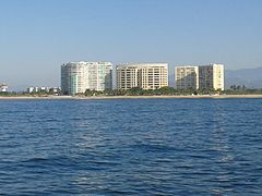
Ixtapa
Costa Grande.
Taxco
North.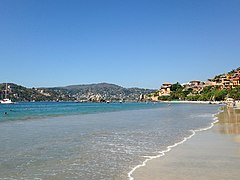
Zihuatanejo
Costa Grande.


.jpg)

Tourist destinations
Among the natural attractions of the state, the caves of Juxtlahuaca, Oxtotitlán and the Cacahuamilpa Caves stand out. The presence of primitive artistic manifestations, known as cave paintings, is distinguishable in the first two; in both caves the paintings represented are linked to Olmec iconography. In addition, the importance of being one of the first rock pictorial demonstrations of Mesoamerica currently known lies in it.

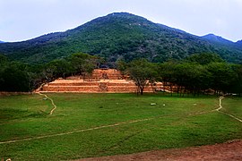
In Guerrero, a total of 1,705 archaeological sites had been registered until May 2006, of which only seven are open to the public. Among them are La Organera-Xochipala in the municipality of Eduardo Neri, Palma Sola in Acapulco, Cuetlajuchitlán in the municipality of Huitzuco, Teopantecuanitlán in the municipality of Copalillo and Tehuacalco in the municipality of Chilpancingo. In all these archaeological zones access is free.
Among the important architectural monuments, the Temple of Santa Prisca stands out in the city of Taxco de Alarcón, whose pink flagstone façade and its two Churrigueresque-style towers have led to its being proposed to Unesco as a World Heritage Site. Other colonial cathedrals found in their respective municipalities stand out for their sober lines, as an example we have the Cathedral of Ciudad Altamirano, built in 1554, as well as other important churches such as Tixtla, San José Poliutla and San Francisco. At the same time, there are other historic buildings such as the San Diego Fort (Acapulco Historical Museum), built in the 18th century as a maritime defense in Acapulco and the building that houses the Regional Museum of Guerrero in Chilpancingo.
Main Beaches

Acapulco
Acapulco de Juárez.
Ixtapa
Costa Grande.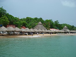
Zihuatanejo
Costa Grande.
Potosí bar
Costa Grande
Playa Ventura
Costa Chica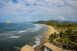
Playa Cayaquitos
Costa Grande
Tlalcoyunque
Costa Grande
Puerto Vicente Guerrero
Costa Grande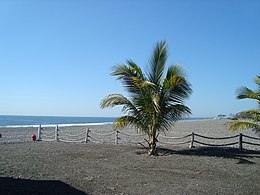
Petacalco
Costa Grande
Playa Bocana
Costa Chica
Punta Maldonado
Costa Chica
Papalutla
North


.jpg)


Inland places

Taxco
North
Ometepec
Costa Chica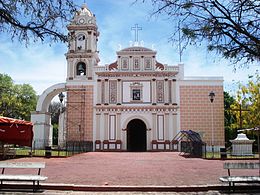
City of Huitzuco
North
Chilpancingo
Centre
Chilapa de Álvarez
Centre
Tlapa
The Mountain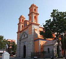
Iguala
North
Altamirano
Hot Earth
Ayutla de los Libres
Costa Chica
Ixcateopan
North
Zumpango
Centre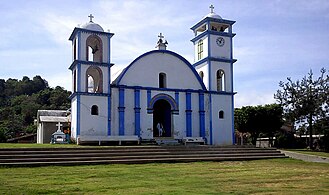
Tlacoachistlahuaca
Costa Chica
Cutzama
Hot Earth


.jpg)
.jpg)


Archaeological Sites and National Parks
Archaeological zones
The State of Guerrero has several archaeological sites.
- Archaeological sites in Guerrero
Tehuacalco
Centre.
Cuetlajuchitlán
North
Ixcateopan
North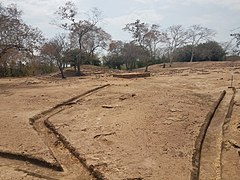
The Soledad de Maciel
Costa Grande
Palma Sola
Acapulco de Juárez
Xochipala
Centre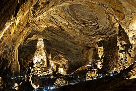
Cacahuamilpa Grotto
North
El Veladero National Park
Acapulco de Juárez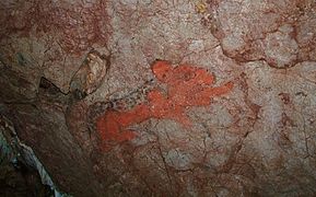
Juxtlahuaca Grotto
Centre.
Teopantecuanitlán
North.
.jpg)


.JPG)

.jpg)

.jpg)

Tourist Market
The Tianguis Turístico, formerly called Acapulco International Hotel and Tourist Agencies Fair, is a tourist fair where the main companies dedicated to the industry, operators of the receptive service, tour operators and international travel agencies, where the different tourist destinations in Mexico are promoted. The tianguis has been held since 1975, and is considered the most important tourism event in Mexico. From its creation until 2011 it was held in the port of Acapulco, however since 2012 it became an itinerant venue, changing venues every year and returning to Acapulco every two.
Culture


In terms of culture, Guerrero has Purépecha (Costa Grande and Tierra Caliente), Matlazinca (Tierra Caliente), Tlahuica (Norte and Montaña), Tlapaneca (Mountain) and Yope (Costa Chica) influences. The cultural influences of Olmecs, Teotihuacanas, Mayas, Purépechas, Toltecs and Mexicas are manifested in archaeological sites such as Teopantecuanitlán, Tepolzis, Tixtla, Huamuxtitlán, Ixcateopan, La Organera, Xochipala, Cuetlajuchitlán and Palma Sola.
It is also a state rich in handicrafts. Ceramics, wool and cotton textiles, wood, saddlery, and metalwork stand out in Costa Grande. Tierra Caliente has pottery and goldsmithing. The Sierra del Norte textiles in wool and cotton, wood, saddlery and goldsmithing. Costa Grande has saddlery and the Montaña textiles of wool and cotton, wood and saddlery. On the other hand, there are cultural groups such as mestizo dance groups, as well as prominent theater companies such as the "Azul Montaña" company, from the city of Atoyac de Álvarez, Guerrero.
National Heritage
The Historic Center of Taxco is the zone of historical monuments declared by the National Institute of Anthropology and History (INAH) as patrimony of the nation on March 19, 1990, due to the quality of the silverware, the colonial constructions and the surrounding landscape, in addition to the fact that many of the buildings in Taxco are in the viceregal style and date from the golden age.
Historical monuments
Some protected movable or immovable assets that are patrimony of the Nation, and are declared as such in the Public Registry of Monuments and Archaeological Zones of the National Institute of Anthropology and History.
Religious architecture
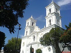
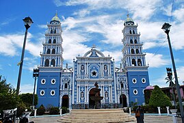
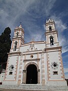
Of the 96 buildings in which various manifestations typical of each stage of the country's history are combined and of which 10 were destined at some time to religious worship; among them can be pointed out:
- Religious architecture in Guerrero

Temple of Santa Prisca

Cathedral of Fray Juan Bautista Moya de Ciudad Altamirano
Cathedral of Santa Maria de la Asunción de Chilpancingo

Cathedral of Acapulco

La Paz Ecumenical Chapel

Parish of our Lady of Guadalupe

Parish of Santiago Apostle in Huitzuco
Church Santiago Apostle of Ometepec

Parroquia de San Francisco de Asis de Iguala

Temple of Saint Bernardine of Siena

Chapel of the Most Holy Trinity
Parroquia de Chavarrieta

Church of Santa Maria de la Asuncion

Church of San Francisco de Assisi.

Temple of the Atoyac Assumption.

Zumpango del Rio Church.

Parish of San Antonio de Padua.


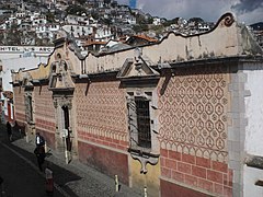
Civil architecture
Among the aforementioned buildings, other buildings were used for educational purposes, welfare services and public decoration, as well as for the use of civil and military authorities; among the most important can be pointed out:
- Civil architecture in Guerrero

Casa Borda

Fort of San Diego

Regional Museum of Guerrero

Fortín Álvarez
Virreinal Art Museum

Centro Cultural La Casa de los Vientos

Municipal Palace of Taxco

Palace of Culture

Chilpancingo Town Hall Building

Symphony of the Sea.

Municipal Public Library
Imperial World Forum.
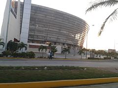
International Acapulco Centre.


.jpg)


Gastronomy
The state of Guerrero presents a great variety of foods, this is due to the syncretism of the indigenous, Spanish and French cultures. Among the typical dishes are jumiles, battered, chalupitas, stuffed, pozoles, moles, broths, fish and seafood stews, chili sauces, tortillas, beans that are consumed in various ways.
The typical alcoholic beverage is mezcal. Among the non-alcoholic we find a wide range in which the infusions of dried leaves, known as tea, chilate, created from cocoa and spices; Lemon, orange, guava, mango, pineapple, tamarind and other fruit waters.
Ceramics
As a craft, ceramics in the state of Guerrero are one of the most common cultural resources used in the daily life of the inhabitants, such as pots, vessels, jugs, candlesticks. But it is not only limited to the manufacture of utensils and household goods, but also to the production of toys, ornaments, sculptures. All these elements are decorated with drawings of different colors, these may include floral motifs, representations of animals or nature.
The construction materials for ceramics from Guerrero are clay and shredded cotton. The decoration techniques consist of polishing the surface and later painting it with brushes and different colored enamels. In some cases, a varnishing procedure can be used.
Festivities

National celebrations
Mexico has many religious and civic festivals, as well as cultural festivals of various kinds. Since colonial times, a number of festivals, both general and local, have been established, celebrating events on the liturgical calendar. The main ones are:
- Day of Kings (6 January).
- Battle of Puebla (5 May)
- Independence of Mexico (16 September)
- Day of the Dead (1 and 2 November)
- Mexican Revolution (20 November)
- Guadalupana parties (12 December)
- The Christmas Inns
- Christmas (25 December)
State celebrations
Among the most typical celebrations of the state are:
- Feast in honor of the Holy Child of Atocha - Ixcateopan - (1 January).
- San Antonio Abad Day - Taxco - (January 17th).
- Saint Joseph's Day - Colored Earth - (19 March).
- Day of the Holy Cross - Cruz Grande - (3 May).
- Fiesta de San Isidro - Chilpancingo - (15 May).
- Feast of the Assumption of the Virgin - Cd. Altamirano - (15 August).
- Feast of the Assumption of the Virgin - Chilapa - (15 August).
- Tigrada de Chilapa - Chilapa - (15 August).
- Paseo del Pendón (third Sunday of December).
- Feast of the Xilocruz (14 September).
- San Mateo Fair (24 December).
- Teopancalaquis (28 September).
- San Miguel Archangel Day - Coyuca de Benítez - (29 September).
- Bull - Galeana Tecpan - (August 23)
Dances

The dance is also performed in other places in the state. Also noteworthy are the festivities of the town of Mochitlán, through whose alleys bulls are paraded, and the dances from July 24 to 26, in honor of Santa Ana. In the state of Guerrero, the celebration of the Day of the Dead has particular characteristics, since the inhabitants mount their offerings from October 31, and the sacristan rings the bells at noon, announcing the arrival of all the Saints. In the offerings, the food is served on clay plates, pots and glasses; Something distinctive is the bread known as "Heas box", made with rice flour; among the flowers, the cempaxúchitl, the cloud and the velvet predominate; Photographs of the deceased, sugar skulls, and candlelights are also customary. Copal is lit to receive the deceased with a pleasant smell, in addition to laying a lime path to the altar.
Unlike in other places, the celebration of the Nahua people, who are considered the largest indigenous people in the region, begins a month earlier, that is, in September. In this prayers are made, and the bells ring during the night in the central church or in the chapels. This town receives the visit of the souls of the infants on October 31; the altar is adorned with figures of angels. On November 1, the souls of the deceased adults are received, and on November 2, the pantheons are visited, where they pray for the rest of the deceased. In the town of Teleolapan, the celebration is complemented by the dance of the tecuanes, a dance about two caciques: Lucas and Moranchi, with a not very good relationship; both had many cows and oxen; the cattle begin to disappear, and some time later they realize that the culprit was a tiger or "tecuan"; Moranchi visits Lucas together with his tribe, but he does it in a very peculiar way, dancing as a greeting.
- Dance of the Tlacololeros
It is one of the oldest and most popular in the state of Guerrero. Its name comes from the Mexica word "tlacolol" which means field cultivation. The dance represents the efforts that farmers make to keep their crops safe. To scare away the tiger that threatens to eat their crops, the tlacololeros make a chirrión, a chain loop, whose sound is also considered a call for rain so that there is a good harvest.
- Dance of the Devils

The origins of this dance go back to colonial times, as a manifestation of the evangelization of the missions that wanted to instill in the Indians the basic concepts of the Christian religion, as well as a new conception of the values of good and evil. wrong. In this dance there are two main characters: death and Lucifer. In addition, there are at least 6 pairs of devils and 2 or 3 buffoons, called "huesquistles". In the dance, the greater devil is beating a donkey's jaw, rhythmically; At the same time, in front of a row appears a devil, who carries a musical tune with a guitar, which is the one that serves as an accompaniment to the dance. Another devil rhythmically rattles a wooden box. This dance is represented, mainly in: Tixtla, Chilapa, Chilpancingo, etc.
- Dance of Los Manueles
Its origin dates back to the end of the XVIII century, and its content criticizes the customs of the upper social class, so that the lower class could publicly vent their rancor towards the people who humiliated and exploited them. The clothing is that of those times, using everything that seems appropriate for the purposes of this dance.
- Dance of the Gachupines

This dance refers to the Spanish living in Mexico. The dancers carry a large handkerchief in their hand, with whose movements they throw blows into the air in front of their faces; With this fanning they indicate the movements that the gachupines made to scare away the mosquitoes. His wardrobe is: black jacket, pants and shoes, cap or cap; the mask shows features similar to those of the Spanish and a cigarette in the mouth, which simulates the cigar that the Spanish usually smoke.
- Dance of the Seven Vicians
This dance graphically teaches to distinguish between good and evil, supposedly locked in an eternal struggle. Participate in this dance: the friar, the player, the student, the fifteen-year-old, the lover and death. The dancers establish, among themselves, dialogues with special stories and dance in pairs to the musical theme that is destined for them. This dance is performed in the municipalities of Chilapa and Tlapa, among others.
- Dance of Los Pescados

This name is given to it because of its participants who carry, from the right shoulder to the left side, a string of small wooden fish painted in colors. Its objective is to interpret the activity of the men who dedicate themselves to fishing; By their clothing, the dancers try to represent the native people of the Grande and Chica coasts of the state; His attire consists of: long pants, sandals, a blanket shirt, loose skirts, a black mask (which simulates the brown color of the costeños) with signs of deep scars produced by common fights, a palm hat for daily use, and a machete. tape, manufactured in the region.
- Dance of the Machos
This represents a group of peasant workers dedicated to caring for and taming the mule beasts, property of the wealthy Spaniards; for this activity, the workers received the name of "machos". The main characteristic by which this dance is identified is because the dancers carry with them a small wooden head and neck, which represents the mule beast. In this dance, only one person dresses as a woman, with clothing from the early XX century, just as the woman in people: long petticoats, a blouse of ordinary and flowery fabric, a shawl wrapped around the waist with the points thrown back over the shoulders and tied to the chest, and a common palm hat. The mask gives the cheerful and jovial appearance of the mestizo woman.
- Dance of the Moros
It is a remembrance of the bloody battles between Moors and Christians, when they were helped by the "crusaders" who came from all over Europe in the year 1212. The Christians are led by a dancer who looks like Mr. Santiago, mounted on a his white horse. Moors and Christians carry long machetes that they clash with each other, which gives the idea of a battle. His wardrobe consists of: long suede jacket without sleeves or lapel, light wooden hat, painted black and decorated with paper flowers of different colors with abundant curly hair on the edge; the mask represents the white, European type, and simulates thick sideburns and a forward pointing spike. The places where this dance is carried out are the municipal head of Cuautepec and Acapulco, etc.
- Dance of Los Maizos

The two main characters in the group are called Maizo and Salvador, and represent the great lords of important cities, lovers of hunting. In this dance, a group of huesquixtles also participates, all men; They carry an old petate or something else on their backs, so as not to receive the lashes that Maizo and El Salvador constantly give them during the dance. The huesquixtles represent the modest men of the region, where tiger hunting takes place.
- Dance of the Zopilotes
Their clothing is all black: frock coats that simulate the wings and masks with the characteristics of these birds. The purpose of this dance is to represent a feast of these birds of prey around a dead animal that one of the huesquixtles carries with it.
- Dance of Los Tejoneros
The purpose of the tejoneros is to dance at the carnival and Corpus festivities, and they have a large repertoire of dance games, among which are: those of the tiger, the turkey, the coyote, etc. The purpose of these dances is to entertain with their antics, which correspond to the category of demons or antichrists that they attribute to themselves.
- Dance of the Palomo de Guerrero
There are 23 dancers: a monarch, 6 captains, 14 pigeons and 2 malinches, each one with their special sones and tap dances. The main character is the "monarch" who dances accompanied by the malinches or alone and performs showy steps. This dance is originally from San Miguel Totolapan, Tierra Caliente.
Music
Popular music is made up of ensembles of violins, sixth guitars and drums in Tierra Caliente. Breath bands and indigenous music with reed flute, charasca, violin and drum in the Mountain. Sets of sones with harp, vihuela and jarana, dances of tlacololeros, tecuanes, of the tiger, the apaches and gachupines in the center and the coast.
On the other hand, folk music is prodigious in the region, an example of this is the calentana music that comes from the Tierra Caliente region, this music stands out for being one of the richest cultural genres of the local popular tradition, and which is still valid today. Calentana music is considered happy, and it is very frequent at weddings, baptisms, birthdays and any other type of party, each one with a different repertoire, for this reason this style is even interpreted at wakes, where melodies that represent the sadness of the presents
Education
Education in the State of Guerrero has been characterized for being among the last places in national educational development. According to the 2005 Activities Report of the United Nations Development Organization Program, among the states of Mexico, Guerrero ranks 30th in educational achievement, with an index of 0.7491, the third lowest place in the country., only surpassed by Oaxaca and Chiapas. Literacy has very unequal features, since of the population over 15 years of age in the state, the highest rate was registered by Acapulco with 90.5% of the literate population, and the lowest by the municipality of Cochoapa el Grande with 24.1%.
Higher level institutions
 Universidad Autónoma de Guerrero
 National Pedagogical University
- Universidad Politécnica del Estado de Guerrero (UPEG)
- Universidad Intercultural del Estado de Guerrero (UIEG)
- Normal School of Physical Education
 Tecnológico Nacional de México
- Technological Institute of Acapulco
- Technological Institute of Chilpancingo
- Instituto Tecnológico de Iguala
- Instituto Tecnológico de San Marcos
- Instituto Tecnológico de la Costa Grande
- Instituto Tecnológico Superior de la Costa Chica (TSCCH)
- Instituto Tecnológico de Ciudad Altamirano
- Higher Technological Institute of the Mountain (ITSM)
- Technological Universities (UT)
- Technological University of the Northern Region of Guerrero (UTRNG)
- Technological University of the Costa Grande de Guerrero (UTCG)
- Technological University of Acapulco (UTA)
- Universidad Tecnológica del Mar del Estado de Guerrero (UTMAR)
Health
The health sector in Guerrero has 1,061 medical centers, and 14,658 people working in these units, of which 4,008 are doctors and 10,650 paramedics. In 2005, 8,349 medical consultations were registered. The levels of the Human Development Index are almost equal in terms of education and health, since Guerrero has the 30th place in human development. As of 2006, there are 8,099 students in preschool, 24,999 in primary, 10,546 in the secondary level, and the student-teacher ratio is 22%.
Decentralization process
During the presidential government of Andrés Manuel López Obrador, the decentralization plan for federal agencies was carried out, which consisted of moving the secretaries to different states of the republic, in order to have equitable economic growth in all the states of the Republic, and thus reactivate the economy in the regions where there is a severe crisis due to insecurity, poverty and violence, in addition to avoiding saturation in Mexico City.
It is proposed to move the Ministry of Health to Guerrero, having as its headquarters the intelligent building of 15 thousand square meters, built between 2011 and 2016 but which was never used in the port of Acapulco. The building is located on Avenida Costera Miguel Alemán and has a heliport, auditorium, spaces for offices, an anti-seismic resistance system, a sustainable electrical energy system, and rainwater harvesting.
During June 2019, it was announced that the move to the port would begin, however there are delays due to the refusal of some doctors and a lack of federal organization, which means that there is no defined date for the transfer.
Sports
The state of Guerrero has five teams in the Third Division, Gallos Blancos de Zihuatanejo and Lobos de Zihuatanejo. The construction of a stadium in Acapulco, in the Barra Vieja area, is currently under development.
Soccer Teams
| Equipment | Sports | Competitions | Stadiums | Group |
|---|---|---|---|---|
| CD UAGro Eagles | Third Division of Mexico | UAGro Stadium | 6 | |
| Iguala FC | Third Division of Mexico | 6 | ||
| Chilpancingo FC | Third Division of Mexico | 6 | ||
| Acapulco FC | Third Division of Mexico | 6 | ||
| Iguanas de Zihuatanejo | Third Division of Mexico | 11 |
Communications
- Annex: Television channels in Mexico
Indigenous and Afro-Mexican groups

The state of Guerrero has 3,079,649 inhabitants, of whom 17.2% are indigenous and 8% are Afro-descendant. (529,780 people). The indigenous population in Guerrero is found essentially in the Mountain area and to a lesser extent in the Costa Chica, this area being inhabited more by Afro-Mexicans, it should be noted that these areas are the most marginalized in the state.
The indigenous population is divided into 4 groups:
- 212 000 Nahuas (nauatlakaj), or 40% of the indigenous population
- 148 000 mixed (na savi), or 28%
- 116 000 tlapanecos (me),phaa), or 22 %
- 47 500 amuzgos (Nnanncue Ñomndaa), or 9 %
According to figures released by SEDESOL of Guerrero, this is the panorama of the indigenous population in Guerrero:
- More than 53 000 workers have no income. The indigenous population is the most affected, 46% of indigenous people over 15 have none.
- About 28,000 workers (4% of the indigenous population over 15 years of age in Guerrero) receive less than the minimum monthly wage.
- Large disparities are observed: in Acapulco, 5 % of the indigenous population over 15 years of age receives no income; while in Acatepec or Atlixtac – the Mountain Region, about 80% of the same population group does not receive them.
- Guerrero occupies the second national place at the level of marginalization by its homes (source: INEGI 2000).
- Between 80 and 100 per cent of dwellings in the indigenous municipalities of Guerrero do not meet the minimum conditions of decent housing.
- Forty per cent of the dwellings have a ground floor.
- Twenty-nine per cent of dwellings (by 72 per cent in the Mountain) have no lumped water, and more than 500 communities (by 56 per cent) lack the water supply in an environment where water sources are few and far away.
- 7% of the houses do not have drainage (for 97 % in the Mountain of Guerrero).
- Twenty-two percent of the population is illiterate; respect for the indigenous population, half is illiterate.
- In the most marginalized indigenous municipalities this percentage rises: 88 % in San Marcos, 71 % in Metlatónoc, 67 % in Ahuacuotzingo, 65 % in Xochistlahuaca.
- Guerrero is the second state with the highest rate of illiteracy in women (more than 23 %, compared to 9.5 % at the national level; Chiapas is the first with 25.5 %, and Oaxaca the third with 22 %).
- 45.4 per cent of the indigenous population (1 out of every two persons) aged over 15 did not go through school (most women).
- In Guerrero, for many people, especially indigenous people, and even more women, the right to education is not fulfilled for several reasons. The poverty situation forced children to work to improve the family economy. In addition, many isolated communities do not have adequate infrastructures to dispense education (lack of classrooms, furniture, books, basic services, lack of teachers, overfilling classes, etc.).
Featured Characters
International relations
Offices
Guerrero has a Representation Office of the General Directorate of Attention to Migrants Abroad.
 Chicago, United States
Agreements
The government of the State of Guerrero, through its public institutions, has established and maintains cooperation agreements in which the signatory parties focus cooperation specifically to strengthen complementary areas such as tourism, government, health, among others.
Organizations
 FAO (2006)
 CFI (2007)
 Unesco (2015)
Regions
 Andalusia, Spain (2008)
Geographic location
| Northwest: | North: | Northeast: |
| West: Pacific Ocean |  | This: |
| Southwest: Pacific Ocean | South: Pacific Ocean | Sureste: Pacific Ocean |
Contenido relacionado
Gypsy town
Cuenca Alta del Manzanares Regional Park
Generation of 1914