
Vistula
The Vistula (in Polish: Wisła, ![]() [хvjiswa] (?·i)in German: Weichsel) is one of the main rivers of Eastern Europe, the longest of those that flow into the Baltic Sea and the most important of Poland, through which it runs entirely. It has a length of 1070 km —which makes it the 24th longest river in Europe and the 12th of the primary—and drains a large basin of more than 194 424 km2 The 14th European basin and the 2nd Baltic Sea: 168 699 km2 Poland (approximately two thirds of the national territory) and the rest of the country are Belarus, Ukraine and Slovakia. The longest river system in the basin corresponds to the Vistula-Narew-Bug Occidental, with 1213 km.
[хvjiswa] (?·i)in German: Weichsel) is one of the main rivers of Eastern Europe, the longest of those that flow into the Baltic Sea and the most important of Poland, through which it runs entirely. It has a length of 1070 km —which makes it the 24th longest river in Europe and the 12th of the primary—and drains a large basin of more than 194 424 km2 The 14th European basin and the 2nd Baltic Sea: 168 699 km2 Poland (approximately two thirds of the national territory) and the rest of the country are Belarus, Ukraine and Slovakia. The longest river system in the basin corresponds to the Vistula-Narew-Bug Occidental, with 1213 km.
The Vistula rises in the southwest of the country at an altitude of 1,220 m, on the northern slopes of the Carpathian Mountains, and flows first north, then east, and finally west. It flows into the Gulf of Gdańsk, an inlet of the Baltic, after dividing into two branches that leave a wide delta between them.
Administratively, the river runs through eight of Poland's sixteen voivodeships—Silesian, Lesser Poland, Holy Cross, Subcarpathian, Łódź, Masovian, Kuyavian-Pomeranian and Pomeranian—and major cities along its course include Kraków, Sandomierz, Tarnobrzeg, Puławy, Warsaw, Płock, Włocławek, Toruń, Bydgoszcz, Grudziądz and Tczew; the port city of Gdansk lies to the west of its mouth. Three of these cities, Krakow, Warsaw and Toruń, have their historic centers declared World Heritage Sites (in 1978, 1980 and 1998 respectively).
Its main tributaries are the Western Narew-Bug (796 km), San (433 km ), Pilica (319 km), Wieprz (303 km), Drwęca (253 km), Dunajec (247 km), Brda (238 km) and Wda (210 km).
The river is navigable up to the city of Bydgoszcz (where it connects with the Bydgoszcz canal) and in its entirety only for small-tonnage ships. It is connected by means of several channels with the basin of the Oder river (Odra).
The river gives its name, as far as north-central Europe is concerned, to the last glaciation of the Pleistocene that ended around 10,000 BCE. C., the Vistulian glaciation or Weichselian glaciation.

Etymology
The name Vistula was first collected by Pliny the Elder in 77 BC. C. in his Natural History. He uses Vistula (4.52, 4.89) with a male variant Vistillus (3.06). The root of the name Vistula is Indo-European *u̯eis-, 'to ooze, to flow slowly' (cf., Sanskrit aveṣan, 'flowed', Old Norse veisa, 'slime') and is found in many European hydronyms (for example, Weser, Viesinta). The diminutive endings -ila, -ula, are used in many Indo-European languages, including Latin (see Ursula).
Writing about the Vistula River and its towns, Ptolemy uses the Greek spelling Ouistoula. Other ancient sources spell it Istula. Pomponio Mela refers to the Visula (De chorographia libri tres, book 3, ad 44) and Amiano Marcelino to the Bisula (book 22), both names without the -t-. Jordanes (Getica 5 and 17) uses Viscla while the Anglo-Saxon poem Widsith refers to the river as the Wistla. variant:small-caps;text-transform:lowercase">XII Wincenty Kadłubek Latinizes the hydronym as Vandalus, a form presumably influenced by Lithuanian vanduõ, & #39;water', while Jan Długosz, in his Annales seu cronicae incliti regni Poloniae, calls the Vistula Alba aqua ('white waters';), perhaps referring to the Little White Vistula (Biała Wisełka): «a nationibus orientalibus Polonis vicinis, ob aquae candorem Alba aqua... nominatur».
During Roman times, the Baltic was known as the Mare Suebicum, after the Germanic tribe of the Suevi, who apparently originated in the Oder region. The name is believed to come from the Proto-Germanic *swēbaz, based in turn on the Proto-Germanic root *swē-, meaning 'the people themselves& #39;, third person reflexive pronoun from a Proto-Indo-European root *swe-.
Historical relevance

Many parts of the Vistula basin were already occupied in the Iron Age, in the 1st millennium AD. C., by the Lusatian and Przeworsk cultures. Genetic analysis indicates that there has been an unbroken genetic continuity of the area's inhabitants over the past 3,500 years. Roman authors of the 1st century AD. C.. they called Germania Magna the area of the Vistula basin, together with the lands of the Rhine, Danube, Elbe and Oder rivers. This does not imply that these inhabitants were "Germanic" in the modern sense of the term. Tacitus, describing the Veneti, Bastarna (peucini) and Phenos, wrote that he was not sure whether to call them Germans, since they had settlements and fought on foot, or rather Sarmatians, since they had some similar customs. Ptolemy, in the second century AD. C., affirmed that the Vistula was the border between Germania and Sarmatia.


The Baltic Sea-Vistula-Dnieper-Black Sea, with its rivers, was one of the oldest trade routes; it was known as the amber route, where amber and other goods were traded from northern Europe to Greece, Asia, Egypt, and elsewhere. Later, the Vistula was used to connect with the Dnieper River, and thence to the Black Sea, via the Augustów Canal (1823-1839), a technological marvel with numerous locks contributing to its aesthetic appeal. It was the first waterway in Central Europe that provided a direct link between two great rivers, the Vistula and the Neman. It was connected to the Black Sea to the south by the Oginski Channel, the Dnieper River, the Berezina Channel, and the Western Dvina River.
The first Slavs settled in the Vistula estuary in the VII and VIII. Based on archaeological finds and linguistic research, it has been postulated that these settlers must have migrated north along the course of the Vistula. However, this contradicts another hypothesis supported by some researchers that it was the weathercocks that moved west from the Vistula delta.
A number of Polish West Slavic tribes formed small domains as early as the VIII century, some of which joined later forming other larger tribal groups. Among the tribes listed in the Bavarian Geographer's IX century document were the Vistulans (Wiślanie), who inhabited southern Poland. Kraków and Wiślica were its main centers.
Many Polish legends are related to the Vistula and the beginnings of the Polish state. One of the most enduring is about Princess Wanda co nie chciała Niemca (who rejected the German). According to the most widespread variant, popularized by the 18th-century historian XV Jan Długosz, Wanda, daughter of King Krakus, became Queen of the Poles after her father's death. She refused to marry Rytigier (Rüdiger), a German prince, who was offended and invaded Poland, but was repulsed. Wanda decided to commit suicide by drowning in the Vistula River to ensure that he would not invade his country again.
Main commercial artery


For hundreds of years, the river was one of Poland's main trade arteries, making the castles that lined its banks highly prized possessions. Salt, timber, grain, and stone for building construction were some of the goods shipped via this route between the X to XIII.
In the XIV century, the Lower Vistula was already controlled by the Teutonic Order, invited in 1226 by Conrad I of Mazovia to help fight the pagan Prussians who were on the border of their lands. In 1308, Teutonic Knights seized Malbork Castle in Gdańsk and murdered its population, an event known as the Gdańsk massacre. The Order had inherited Gniew from Sambor II, thus gaining a foothold on the left bank of the Vistula. Many granaries and warehouses were built in the XIV on the banks of the Vistula. In the XV century, the city of Gdansk was of great importance in the Baltic area as a center for merchants and merchants and as a port. While at that time the surrounding lands were inhabited by Pomeranians, Gdansk soon became a starting point for German colonization of the largely fallow Vistulan country.
Until the height of trade in 1618, it had increased twenty-fold since 1491. The tonnage of grain transported by river in key years shows this: in 1491, 14,000T; in 1537, 230,000 T; in 1563, 1,500,000 T; in 1618, 3,100,000 T.


In the 16th century most of the grain exported by Poland already left through Gdańsk which, due to its Because of its location as the terminus of the Vistula and its navigable tributaries, and its position as a trading port on the Baltic, it became the wealthiest, most developed (it was by far the largest craft and manufacturing center) and most autonomous Polish city. Cities were negatively affected by Gdansk's near monopoly on foreign trade. During the reign of Stephen I Báthory, Poland had two of the main Baltic ports: Gdańsk, which controlled the river trade of the Vistula, and Riga, which controlled the trade on the Western Dviná. Even today both cities are among the largest in the region. About 70% of Gdańsk's exports were grain. This was also the largest product exported by the Polish-Lithuanian Commonwealth. The volume of cereal marketed can be considered a good indicator and a good measure of the economic growth of the Community.

The owner of a folwark—a type of farm run by lords and the Church—usually signed a contract with the Gdańsk merchants, who controlled 80% of that internal trade, to ship the grain north to that Baltic port. Many rivers in the Community were used for shipping, including the Vistula. The river had a relatively well-developed infrastructure, with river ports and granaries. Most of the river shipments traveled in a northerly direction, since to the south the transport was less profitable, so that many times even the barges and rafts were sold in Gdansk to be scrapped as wood.
German states gained full control of the region between 1795 and 1812 (see: Partitions of Poland), as well as during the world wars of 1914-1918 and 1939-1945.
From 1867 to 1917, the Tsarist Russian government called the Kingdom of Poland the Vistula Country after the collapse of the January Uprising (1863 to 1865). Nearly 75% of the interbellum territory of Poland drained north into the Baltic Sea via the Vistula (the drainage basin of the Vistula River within the limits of the Second Polish Republic was 180,300 km²), the Niemen (51,600 km²), the Oder (46,700 km²) and the Daugava (10,400 km²).
In 1889–1895 in order to stop recurring flooding on the lower Vistula, the Prussian government built an artificial canal of about 12 km located east of Gdansk (German: Danzig)—known as the Vistula Cut (German: Weichseldurchstich; Polish: Przekop Wisły)—which acted as a large lock, diverting much of the Vistula's flow directly into the Baltic. As a result, the historic course of the Vistula through Gdańsk lost much of its flow, and became known from that time on as the Dead Vistula (German: Tote Weichsel; in Polish: Martwa Wisła).
In the 1920 Polish-Soviet War the decisive Battle of Warsaw (sometimes referred to as the Miracle on the Vistula), was fought when Red Army forces commanded by Mikhail Tukhachevsky approached the Polish capital of Warsaw and the nearby Modlin Fortress located at the mouth of the Vistula.
World War II
.jpg)
The Polish campaign in September included some battles for control of the mouth of the Vistula, and the city of Gdansk, very close to the river delta. During the 1939 German invasion of Poland, after the initial battles in Pomerelia, the remnants of the Polish Pomeranian Army withdrew to the southern bank of the Vistula River. After defending the city of Toruń for several days, the army withdrew. to the south under the pressure of the tense general strategic situation, and took part in the main battle of Bzura.
The Auschwitz concentration camp complex is located on the banks of the Vistula, at the confluence of the Vistula and Solá rivers. The ashes of the victims murdered at Auschwitz were thrown into the river. Also during World War II some POWs from the Nazi prison camp Stalag XX-B were assigned to cut ice blocks from the Vistula, which were then trucked to local breweries.
The 1944 Warsaw Uprising was planned with the expectation that Soviet forces, who had arrived in the course of their offensive and were waiting on the other side of the Vistula, would help in the battle for Warsaw. However, the The Soviets disappointed the Poles by halting their advance at the Vistula and treating the insurgents as criminals on their radio broadcasts. In early 1945, the Red Army finally crossed the Vistula and pushed back the German Wehrmacht in the Vistula-Offensive. Oder beyond the Oder river, already in Germany.
Geography

The Vistula drains a large basin of 194,424 km² (in Poland 168,700 km²); its average altitude is about 270 m above sea level. In addition, most of its basin (55%) is located at a height of 100 to 200 m above sea level; more than 3/4 of the river basin varies between 100−300 m elevation. The highest point of the river basin is at 2655 m (Gerlach Peak, in the Tatra Mountains).
One of the characteristics of the Vistula basin is its asymmetry, caused to a large extent by the inclination of the Central European Lowlands to the north-west —which caused the flow direction of glacial waters— as well as by a considerable bias from its older base. The asymmetry of the basin, (right margin with respect to the left, is from 73 to 27%.
The course of the Vistula is considered divided, hydrographically, into three sections:
- the Upper or higher Vistula, from birth to the city of Sandomir.
- the Middle or Central Vistula, which runs from Sandomierz to the confluence with the Western Narew-Bug.
- and the Low or Lower Vistula, from the mouth of Narew to the mouth of the Vistula delta itself in the Baltic.
Fonts
The Vistula River is formed in the south of the country, in the southern part of the Silesian Voivodeship, by the confluence of two small mountain streams that flow down the western slopes of the Barania Góra mountain in the Silesian Beskids: the Black Vistula (Czarna Wisełka), which rises at an altitude of 1107 m, and the White Vistula (Biała Wisełka ), which does so at an altitude of 1080 m.
Both sources come together in an area now flooded in a small reservoir, the Jezioro Czerniańskie. This upper part of the Vistula runs through the Silesian Beskids Landscape Park (Park Krajobrazowy Beskidu Śląskiego), a protected area of 386.2 km² Established in 1998.
Advanced course

In its upper part the Vistula heads northwest, soon receiving, on the right, the short Malinka River, before reaching the small town of Wisła (Vistula in Polish) (which it had 11,450 inhab. in 2011). It then reaches the city of Ustroń (15,415 pop.), where it turns further north. After receiving the short Brennica on the right, it reaches the city of Skoczów (25,648 inhabitants). The Vistula continues its northward progress until it reaches the small town of Strumień, after which it turns east, just before reaching the tail of the Goczałkowice Reservoir —built in 1950-1956 with a dammed area of 32 km²— whose purpose, in addition to regulating and preventing flooding, was to supply water to the Upper Silesian industrial region. After the dam, which is 2980 m at its crest, the river reaches the town that gives its name to the reservoir, Goczałkowice-Zdrój (6689 hab.) and, on the other side, opposite Czechowice-Dziedzice (35,498 hab.). The Vistula then continues downstream passing through the small towns of Jawiszowice (6,794 inhab.) and Brzeszcze (11,691 inhabitants).
.jpg)
Soon the river becomes the provincial boundary between the Lesser Poland (SO) and Silesia (NE) voivodeships, in a stretch of general NW orientation with many short meanders, typical of a plain river. In this upper part, the river valley is dotted with small flood lagoons, which the river has gradually abandoned on both sides of its course in times of flood. It then approaches the Vistula, on the left bank and arriving from the north, the small Przemsza river (28 km); from there the stream heads into the Lesser Poland Voivodeship. It immediately reaches the small town of Broszkowice (595 hab.), where it receives, on the right and coming from the south, the Soła river (80 km), very close to the city of Oświęcim (Auschwitz), (41,287 hab..), infamous for hosting the Nazi camp.
The Vistula continues its advance towards the east and in Smolice (651 inhabitants) it receives little Skawa on the right. Then, after passing through Łączany (1589 hab.), and receiving the short Skawinka (34) on the right km), the river flows through the protected area of the Bielany-Tyniec Country Park, a suburban park established in 1981 with an area of 65.02 km²). The Vistula then enters from the southwest into the largest city on its upper reaches, Krakow (757,430 pop.). In Krakow, it borders the Wawel Hill where the Wawel Castle is located, which is the most important historical and cultural place in Poland: it was for centuries the residence of the Polish kings and a symbol of the state.
- Bridges in Krakow

Old bridge of 1850

The Frozen Vistula and the Dębnicki Bridge Flyed by the Germans in World War II

Bridges in Krakow

Most Kotlarski Bridge

Pilsudski Bridge


Then the Vistula continues in an easterly direction, reaching the small town of Niepołomice (14,700 inhabitants) and, after receiving the Raba River (132 km) and pass in front of Wola Rogowska (499 hab.), receives, too to the right, to the long Dunajec River (247 km). After approaching it, on the left, the river Nida (151 km), continue through the small town of Szczucin (4166 inhab.). It then meets the short river Breń to the right (52 km), and then to the left to the Wschodnia ( 48.5 km) and again to the right to the Wisłoka river (164 km). It reaches the Vistula then the city of Tarnobrzeg (50,008 inhab.) and soon reaches the city of Sandomierz (25,300 inhabitants). As soon as we leave the city behind, the stream once again becomes the administrative boundary, this time between the voivodeships of Santa Cruz (NW) and Subcarpathia (E). Shortly after, from the right, it receives the San River (433 km), at a confluence where the middle or central course is usually considered to begin. The last 120 km of the San are also navigable.
Intermediate course


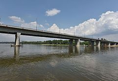
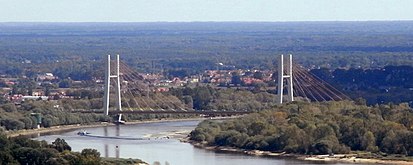
After receiving the San River, the Vistula turns northward. Passing through Zawichost (1821 hab.), it becomes the boundary, now between the voivodeship of Santa Cruz (O) and Łódź (E). Continue through Piotrowice and then turn right into the short Sanna River (51 km). It passes through Basonia and Józefów nad Wisłą (1023 hab.). Its course continues to define limits, this time between the voivodeships of Łódź (E) and Mazovia (W). It passes through the small towns of Piotrawin, Kamień (290 hab.), Kłudzie and Chotcza Dolna, where it meets the Iłżanka River (77km). It temporarily ceases to be the administrative boundary to enter the Łódź Voivodeship, passing through Bochotnica (1069 inhabitants), Kazimierz Dolny (3,618 inhab.) and the city of Pulawy (49,839 inhab.), located at the confluence with the short Kurówka River. Soon the Vistula border is once again, this time between the voivodeships of Łódź (E) and Mazovia (W). It reaches the small town of Dęblin (17,707 inhab.) where it receives the Wieprz River ( on the right bank). 303km). It enters the Masovian Voivodeship and reaches the small towns of Swierze Górne (1080 hab.) and Mniszew (500 inhabitants), where it meets the Pilica river on the left (319 km). It passes Sobienie-Jeziory (700 hab.) and Góra Kalwaria (11,130 hab.), to then reach Otwock (45,044 hab.) and Okrzeszyn (120 hab.), already in the suburbs of the capital Warsaw. The Polish capital has developed on both banks of the river, connected by many bridges.
- Bridges in Warsaw

Poniatowski Bridge (1914)
Bridge Łazienkowski (1974)

Bridge Świętokrzyski (1998)
Siekierki Bridge (2002)


Leaving the capital behind, the river turns more and more in a NNW direction. It reaches the city of Nowy Dwór Mazowiecki (42,452 hab.), where it receives the Western Narew-Bug River (796 km), its major tributary, at a confluence marking the end of the middle course.
Lower Course


The Vistula turns west, passing through the small towns of Zakroczym (d), Czerwińsk nad Wisłą (d) and Wyszogród (d), where after receiving the Bzura River (166 km), approaching you from the south, heads northwest again. It then reaches the important city of Płock (127,224 hab.). Leaving the city, it receives two new tributaries, with their mouths almost facing each other, the Linke Skrwa (left, 51.7 km) and the Rechte Skrwa (right, 114km). Then its course marks the northern limit of the Gostynińsko-Włocławski Landscape Park (Gostynińsko-Włocławski Park Krajobrazowy), a park shared between the Masovian and Kuyavian-Pomeranian voivodeships. The Vistula enters Kuyavian-Pomerania and, on the opposite bank of the park, passes the small town of Dobrzyń nad Wisłą (d) (2,302 hab.). The river immediately reaches another important city, Włocławek (119,939 inhabitants), capital until 1998 of the former voivodeship of the same name of Włocławek, where it receives the river from the left Zgłowiączka (79km).
It continues its slow advance and meets the Tążyna River (49.8 km) on the left, whose course was between 1815–1918 the border between Prussia and the Russian Empire. It then passes in front of the small town of Nieszawa (i) (2047 hab.), where it meets the river Mień (53.5 km) and Ciechocinek (i) (10 839 hab.). After receiving on the right bank another of its important tributaries, the Drwęca river, 253 km —which between 1231–1466 was the southern limit of the monastic state of the Teutonic Knights and in 1815-1918 also from the border between the Russian Empire and Prussia—, immediately arrives at another important city, Toruń (213,278 inhab.), Current co-capital of the Cuyavian-Pomeranian Voivodeship and since 1997 declared a World Heritage Site (Medieval City of Toruń).


The Vistula continues passing in front of the small Solec Kujawski (i), to give a big curve to receive another large tributary, the Brda (238 km) and then head northeast. On the banks of the Brda, about 5 km from the mouth of the Vistula, is another important city, Bydgoszcz (Bromberg) (i) (368 235 inhabitants), the other co-capital of Kuyavia and Pomerania, a city that was originally a fishing community that became one of the great centers of commerce in the Vistula basin. The city is connected by the Bydgoszcz canal – a 27 km long canal, built in 1772-1775 – with the city of Nakło, which connects with the other main Polish basin, the Oder river basin.
Continuing with the Vistula, the river soon passes through the city of Fordon (76,800 inhabitants), also located on its left bank, now on the outskirts of Bydgoszcz. It then reaches the small towns of Chełmno (Kulm) (20,822 hab.) and Świecie (i) (Schwetz) (25,790 hab.), the latter located at the confluence with the Wda (Schwarzwasser) river, a long tributary of 210 km which approaches it from the left coming from the northwest. Then the Vistula reaches Grudziądz (d) (Graudenz) (99,283 inhab.), another important historical city on the outskirts of which it receives, on the right, the Osa (96 km). Then, for a short stretch, its course will once again be the administrative boundary for the last time, this time between the Pomeranian and Kuyavian-Pomeranian voivodeships, in a stretch that includes the small town of Nowe (i) (Neuenburg ) (6238 hab.) and where it receives, on the left, the Wierzyca (or Ferse) river (112km).
Delta

Lastly the Vistula enters the Pomeranian Voivodeship. After passing in front of Gniew (i) (Mewe) (6771 hab.), the river divides at the small town of Biała Góra (50 hab.), already close to the mouth, in two branches between which leaves a wide delta, known as Żuławy Wiślane: the left branch o Leniwka River and the branch on the right, the Nogat River, 62 km long, fully regulated to prevent flooding. (On the banks of the Nogat is the town of Malbork (nad Nogatem) (Marienburg) (38,747 inhab.)).
The main branch, the Leniwka, then passes Tczew (i) (Dirschau) (60,283 hab.), the last city of importance in its course. Just before its outflow, the Leniwka has been canalized to directly enter the Vistula Lagoon through the Szkarpawa branch and prevent the earlier flooding in the port city of Danzig (Gdańsk), (460,014 inhab.) in times of high floods. The previous channel, a section of just over 25 km, has now been protected by a lock that makes it fully regulated and for this reason it is now called the Dead Vistula (Martwa Wisła). The Motława (Mottlau) River (65 km) flows into this final short section of the old channel. The Dead Vistula splits in turn again into the Przegalinie branch, which finally flows into the Gdansk Bay.
Until the 14th century, the Vistula divided into a main eastern branch, the Elbląg Vistula, and a smaller western branch, the Gdansk Vistula. Since 1371 the Gdańsk Vistula was the main artery of the river. After the 1840 flood, a new additional branch was formed, called the Śmiała Wisła ("Bold Vistula"). Between 1890 and 1895 additional hydraulic conditioning works were carried out up to Świbna.
Cities traversed
The main towns bathed by the Vistula, following it downstream, are the following (the main cities in bold):
Locations on the banks of the Vistula River |
|---|
|
Tributaries
The Vistula has many tributaries, the most important being those listed in the following table, arranged in a downstream direction. (The tributaries of the tributaries are ordered in the opposite direction, from the mouth to the source).
| Ramal | Affluent name | Destroying | Length (km) | Cuenca (km2) | Caudal (m3/s) | Voivodato(s) because it occurs | Tram. | Course | ||||
| - | D | Río Biała | Vistula | 28.6 | 139 | Silesia | Senior | |||||
| - | D | Rio Soła | Vistula | 80 | 1400 | Little Poland - Silesia | ||||||
| I | - | Rio Przemsza | Vistula | 28 | 2121 | |||||||
| - | D | Skawa River | Vistula | 96 | 1160 | 11,1 | Little Poland | |||||
| - | D | Rio Raba | Vistula | 132 | 1537 | |||||||
| I | - | Szreniawa River | Vistula | 80 | 706 | |||||||
| I | - | Nidzica River | Vistula | 66 | 708 | 2.3 | ||||||
| - | D | River Dunajec | Vistula | 247 | 6804 | Slovenia | Little Poland - Holy Cross | |||||
| - | - | - | Rio Łosoina | Dunajec | 56 | 410.6 | ||||||
| - | - | - | Rio Poprad | Dunajec | 174.2 | 2081 | 22.3 | |||||
| - | - | - | Río Biała | Dunajec | 101.8 | 983.3 | ||||||
| I | - | Rio Nida | Vistula | 151 | 3865 | |||||||
| - | - | - | Rio Mierzawa | Nida | 64.18 | 563.6 | ||||||
| I | - | Czarna Staszowska | Vistula | 61 | 1358 | Santa Cruz - Subcarpacia | ||||||
| - | D | Rio Breń | Vistula | 52 | ||||||||
| I | - | River Wschodnia | Vistula | 48.5 | ||||||||
| - | D | River Wisłoka | Vistula | 164 | 4110 | |||||||
| - | - | - | Rio Ropa (Wisłoka) | Wisłoka | 78.7 | 974,1 | ||||||
| I | - | Koprzywianka River | Vistula | 66 | 707 | |||||||
| - | D | Rio Trześniówka | Vistula | 56.9 | 569.6 | |||||||
| - | D | Rio Łęg | Vistula | 81 | 960 | |||||||
| - | D | Rio San | Vistula | 433 | 16 861 | 210 | Ukraine | Media | ||||
| - | - | - | Osława River | San | 64.8 | 504,4 | ||||||
| - | - | - | River Wisłok | San | 205 | 3528 | ||||||
| - | - | - | River Wiar | San | 70.4 | 798.2 | ||||||
| - | - | - | River Wisznia | San | 78 | 1200 | ||||||
| - | - | - | Rio Szkło | San | 75 | 596 | ||||||
| - | - | - | Lubaczówka River | San | 88.2 | 1129 | Ukraine | |||||
| - | - | - | Rio Tanew | San | 113 | 2339 | ||||||
| - | - | - | Bukowa River | San | 52 | 662 | ||||||
| I | - | Opatówka River | Vistula | 51.5 | 282 | |||||||
| - | D | Río Sanna | Vistula | 51 | 606 | Mazovia - Lublin | ||||||
| I | - | Kamienna River | Vistula | 138 | 2007,9 | |||||||
| I | - | Rio Iłżanka | Vistula | 77 | 1127 | |||||||
| - | D | River Wieprz | Vistula | 303 | 10 400 | |||||||
| - | - | - | Tyśmienica River | Wieprz | 75 | 2689 | ||||||
| - | - | - | Bystrzyca River (Wieprz) | Wieprz | 70.3 | 1320.7 | ||||||
| I | - | Rio Radomka | Vistula | 100 | 2000 | Mazovia | ||||||
| I | - | Pilica River | Vistula | 319 | 9245 | |||||||
| - | - | - | Czarna Konecka River | Pilica | 85 | | ||||||
| - | - | - | Drzewiczka River | Pilica | 81.3 | | ||||||
| - | - | - | Rio Wolbórka | Pilica | 48.8 | | ||||||
| - | - | - | Río Luciąża | Pilica | 48.7 | | ||||||
| - | D | Wilga River | Vistula | 67 | 569 | |||||||
| - | D | Rio Świder | Vistula | 89.1 | 1161,5 | |||||||
| - | D | Río Narew | Vistula | 484 | 75 200 | 328 | Low | |||||
| - | - | - | River Wkra | Vistula | 249 | 5322 | ||||||
| - | - | - | Rio Łydynia | Wkra | 72 | 698 | ||||||
| - | - | - | Río Sona | Wkra | 73 | 536.5 | ||||||
| - | - | - | Rio Raciążnica | Wkra | 56.9 | |||||||
| - | - | - | Rio Rządza | Vistula | 56 | |||||||
| - | - | - | West Bug River | Vistula | 772 | 39 420 | 157 | Ukraine Belarus | ||||
| - | - | - | Rio Poltva | Western Bug | 70 | 1440 | Ukraine | |||||
| - | - | - | Rio Sołokija | Western Bug | 71 | 939 | Ukraine | |||||
| - | - | - | Huczwa River | Western Bug | 79 | 1394 | ||||||
| - | - | - | River Krzna | Western Bug | 120 | 3353 | 10.5 | |||||
| - | - | - | Rio Liwiec | Western Bug | 142 | 2780 | 10.5 | |||||
| - | - | - | Rio Ług | Western Bug | 93 | 1348 | ||||||
| - | - | - | Río Muchawiec | Western Bug | 150 | 6350 | 33.6 | Belarus | ||||
| - | - | - | Rio Leśna | Western Bug | 85 | 2650 | 13 | Belarus | ||||
| - | - | - | Rio Nurzec | Western Bug | 100.2 | 2102 | ||||||
| - | - | - | Rio Brok | Western Bug | 73 | 811 | 2 | |||||
| - | - | - | Rio Pełta | Narew | 50.7 | 368,7 | ||||||
| - | - | - | Rio Orzyc | Narew | 146 | 2077 | ||||||
| - | - | - | Wymakracz River | Narew | 48 | |||||||
| - | - | - | Rio Orz | Narew | 54.3 | 609 | ||||||
| - | - | - | Omulew River | Narew | 114 | 493 | ||||||
| - | - | - | Rio Rozoga | Narew | 82 | 493 | ||||||
| - | - | - | Szkwa River | Narew | 103 | 483 | ||||||
| - | - | - | Rio Pisa | Narew | 80.4 | 4500 | ||||||
| - | - | - | Río Biebrza | Narew | 155 | 7057 | 34.9 | |||||
| - | - | - | River Lega | Biebrza | 157 | 1016 | ||||||
| - | - | - | Río Supraśl | Narew | 93.8 | 1844.4 | ||||||
| - | - | - | Rio Sokołda | Supraśl | 57.5 | 464 | ||||||
| - | - | - | RíoTurośnianka | Narew | 68 | |||||||
| - | - | - | Rio Orlanka | Narew | 52.5 | 520 | ||||||
| - | - | - | Narewka River | Narew | 61.1 | 711 | Belarus | |||||
| I | - | Río Bzura | Vistula | 166 | 7660 | |||||||
| - | - | - | Rawka River | Bzura | 97 | 1192 | ||||||
| I | - | Skrwa Lewa (left skrwa) | Vistula | 51.7 | area | |||||||
| - | D | Skrwa Prawa (right skrwa) | Vistula | 114 | 1704 | |||||||
| I | - | Rio Zgłowiączka | Vistula | 79 | 1495.6 | Cuyavia and Pomerania | ||||||
| - | D | Rio Mień | Vistula | 53.5 | area | |||||||
| I | - | Tążyna River | Vistula | 49.8 | area | |||||||
| - | D | Drwęca River | Vistula | 253 | area | |||||||
| - | - | - | Rio Wel | Drwęca | 118 | 822 | ||||||
| I | - | Rio Brda | Vistula | 238 | 4634 | 238 | ||||||
| I | - | Wda River (Schwarzwasser) | Vistula | 210 | 2345 | 17 | ||||||
| - | D | Rio Osa | Vistula | 96 | 1600 | 5 | ||||||
| I | - | Wierzyca River (Ferse) | Vistula | 112 | 1600 | |||||||
| I | - | Rio Motława | Vistula | 65 | 1511.3 | |||||||
| - | - | - | Radunia River | Motława | 103 | 837 | ||||||
Channel Connections
- Narew – Biebrza – Augustów-Kanal (Kanał Augustowski, Schifffahrt eingestellt) – Czarna Hańcza – Njemen (Memel)
- Narew - Western Bug - Dnepr-Bug-Kanal - Dnepr
- Zgłowiączka - Kanał Bachorze (historische lokale Bedeutung, heute Kanurevier) – Gopło-See (s.u.)
- Brda - Bromberger Kanal (Kanał Bydgoski) – Netze (Noteć) – Warthe (Warta) – Oder
- Brda - Bromberger Kanal (Kanał Bydgoski) – Kanał Notecki (Netzekanal, benutzt auf großen Teilen seiner Strecke das Bett der Netze, Schifffahrt eingestellt) – Gopło-See – Ślesiński-Kanal (Kanał Ślesiński oder Kanał Warta-Gopło(touristische Schifffahrt) – obere Warthe (Warta)
- Nogat - Jagiellonenkanal (Kanał Jagielloński) – Elbląg (Fluss) - Oberländischer Kanal (Kanał [Ostródzko-] Elbląski, touristische Schifffahrt) – Stadt Ostroda
Hydrology
The very flat aspect of the districts it crosses explains why the Vistula sometimes caused catastrophic floods, for example, in 1813, 1888, 1934 and 1960.
The annual flow or modulus of the Vistula is 248 m³/s for a drained catchment area of 23,901 km² in Szczucin, of 561 m³/s for a basin of 84 857 km² in Warsaw and 1042 m³/s for a basin of 194 376 km² in Tczew, 64 km from its mouth. The average monthly flow of the river does not have significant seasonal fluctuations.
The rainfall pattern varies approximately twice in Tczew, with a maximum flow of 1879 m³/s in April, when the snow melts, and a minimum flow of 733 m³/s in September (in Tczew the river flow has been observed for 94 years, 1900-1994).
| Average monthly rate of Vistula at Tczew station (in m3/s. Data calculated in the period of 94 years, 1900-1994) |
 |
Navigation
The Vistula is navigable from the Baltic Sea to the city of Bydgoszcz (where it connects to the Bydgoszcz Canal). The Vistula can accommodate modest CEMT Class II river vessels. Upstream the depth decreases. Although a project was carried out to increase river transport capacity upstream of Warsaw by building a series of locks in and around Krakow, the project was not extended further, so the navigability of the Vistula remains limited. The potential of the river would be greatly increased if a restoration of the east-west connection through the Narew–Western Bug–Mukhovets–Prypyat–Dnieper watercourses was considered. The changing economic importance of some parts of Europe may make this option more likely.
Contenido relacionado
Cyperez
Castraz
Counties of England