
The Forest (Spain)
El Bosque is a Spanish municipality in the province of Cádiz, Andalusia. It is located in the northeast of the province, specifically at the foot of the Sierra de Grazalema on the banks of the Majaceite river, its municipal area being within the Sierra de Grazalema natural park and the Los Alcornocales natural park. The Majaceite River crosses the town from northeast to southeast, flowing into the Hurones reservoir and having tributaries and springs. It forms part of the Route of the white towns: its municipal term limits to the north with Prado del Rey; to the south with Ubrique; to the east with Benaocaz and Grazalema; and to the west with Arcos de la Frontera. According to the INE, in 2016 it had 2,114 inhabitants. Its surface extension is 30.75 km² and it has a density of inhab/km². It is located at an altitude of 285 meters above sea level. The municipality has one of the highest rainfall rates on the peninsula. Today it lives from tourism, the manufacture of sausages, cheeses and industries with a great tradition such as leather goods and the manufacture of artisan furniture.
History
- Chronicles
Coinciding with the end of the War of Granada, and the historical process of the Reconquista culminated, the Catholic Monarchs granted Rodrigo Ponce de León (VII Lord of Marchena, III Count of Arcos, II and last Marquis of Cádiz, I Duke of Cádiz (1484)) in December 1490 the I Marquesate of Zahara and the Señorío de las Siete Villas, in payment for reconquering the town of Zahara de la Sierra 1483, "Las Siete Villas"; Archite, Aznalmara Castle, Cardela Castle, Benaocaz, Ubrique, Grazalema and Villaluenga del Rosario 1485. Also obtaining the Marchenilla Palace (where the current town of El Bosque is founded), as a place of hunting residence and its surroundings due to his participation along with other knights in the war that marked the end of King Boabdil's Nasrid kingdom of Granada (January 1492), thus integrating all these reconquered Villas into the Crown of Castile.
On August 28, 1492, Rodrigo Ponce de León y Núñez died. The Catholic Monarchs negotiate with their daughter Francisca Ponce de León y Jiménez de la Fuente IV and last Countess of Arcos and her husband (cousin) Luis Ponce de León de la Casa de Villagarcia, the suppression and exchange of the marquisate and the duchy of Cádiz for adhere them to the Crown; thus granting the queen of Castilla Isabel I la Católica on January 20, 1493 by elevation of the County of Arcos, to her eldest son Rodrigo Ponce de León in compensation to the 1st Duke of Arcos, 2nd Marquis of Zahara, 1st Count of Casares, IX Lord of Marchena and VI of Villagarcía.
- Origin of the Villa: Modern and Contemporary Age
The origin dates back to the repopulation policy of the lands reconquered by Rodrigo Ponce de León in the mid-14th century. The distribution of the land proclaimed around 1520 by the heir to the House of Arcos, Rodrigo Ponce de León (I Duke of Arcos, II Marquis of Zahara, I Count of Casares, IX Lord of Marchena and VI Lord of Villagarcía), marks the origin of the colonization of the Villa. The servants of the Palace of Marchenilla, the hunting residence of the aforementioned Duke of Arcos, built their houses and a Church around the Palace under the invocation of "Our Lady of Guadalupe", thus attracting settlers from other populations to build their houses in the plain that extends at the foot of Mount Albarracín, thus constituting a population nucleus that they called "Guadalupe" between the 15th and 18th centuries"> .
As a town it was officially born in 1815 thanks to a Royal Decree of Fernando VII that was granted thanks to the heroic resistance of the population against the French invader.
- Quotes and Descriptions

Pascual Madoz (Geographical - Statistical Dictionary of 1845)
EL BOSQUE (18th century): Neighborhood with town hall in the province of Cádiz. (15 leagues), Grazalema judicial district (3), Jerez de la Frontera income administration (10), territorial court and city g. of Seville (15), diocese of Malaga (16). SITUATION: To the right of the Majaceite river, PARTLY flat and partly sloping, sheltered from the winds by the Albarracin mountain range or mountain that runs to the East and South; Its temperature is warm and mild in winter, spring and autumn, but almost unbearable in summer, and quite unhealthy due to the many waters that flood its fields and that remain bogged down during the summer in the cornfields and melons: the prevailing diseases in said season and entrance of autumn are the tertians. It has 270 HOUSES, among which are some that are covered with straw due to the misery of their owners, and are distributed along streets, most of which are paved; a school of first letters without any endowment, Parochial Church (Ntra. Sra. De Guadalupe) served by a perpetual parish priest, a lieutenant, a beneficiary, a sacristan and 2 acolytes; the priest is of second promotion and royal patronage; a hermitage entitled ol Calvario, and an open cemetery. For the assortment of the neighborhood there is a large source within the population and more than 40 scattered throughout different points of the term, all of the best quality. The term borders on the North and West with those of Zahara, Prado del Rey and Arcos de la Frontera, and on the East and South with those of Ubrique, Venaocaz and Grazalema; In it there is a salt water factory, known by the NAME of Hortales, and 7 threshing floors leased to outsiders. It is bathed as it was said by the Majaceile river, mighty at all times, abundant in fishing, and that gives movement to 3 flour mills, crossing a beautiful stone bridge located at the exit of the town; and the streams Almojar, el Hondo, Parrales, Teja, the Sacristán ravine and the Beneficiado Padre ravine; all of which drain into the said river. The main mountain ranges or hills that rise at different points are: the aforementioned Albarracin, which enters through the Albarracinejo; Its elevation N. is half a league and it will end near the farmhouse La Parrilla, on the way to the town of Ubrique; the pasture of the Horcajo; the hills of Prado del Rey, the hills of El Duque and the ravines of Almajor; In them there are quarries of red, white and black jasper stone, of sharpening stones, of black and white plaster and a sulfur mine that is not exploited during the day. The most wooded point is the slopes of the Albarracin to the north and the pasture of El Horcajo; that one is made up of holm oaks, gall oaks and scrubland, and THIS is a very thick brown forest accompanied by many gall oaks: grasses for all kinds of livestock and medicinal plants such as leonoja, ground ivy, marshmallow and others abound in these mountains. On the part that borders on Zahara and Prado de Rey, holm oaks, mastics, scrubland and gall oaks abound, from which much charcoal and wood is extracted. The LAND is of good quality, both in the hilly and dry part, of which we have spoken, as well as in the flat part that participates in irrigation. PATHS are general; they cross the vicinity of the town, the one from Malaga to Cádiz, and the one from Seville to Campo de Gibraltar, through which cars can arrive UP TO the town; the other roads are bridle paths. MAIL is received in Arcos de la Frontera, and is served by a balijero that leaves Monday and Friday, and enters Tuesday and Saturday. PROD.: wheat, barley, corn, oil, chickpeas, broad beans, other legumes, vegetables, fruits, melons and others that we have mentioned when talking about the mountains; He raises all kinds of cattle and hunts rabbits, hares, partridges, roe deer and wolves. INDUSTRY.: the flour mills we mentioned and one oil mill, TRADE: grain exports, POPULATION: 202 neighbors, 1,001 inhabitants. CHAP. PROD.: 2,803,520 reais IMP.: 130,898 reais CONTR.: 91,051 reais 1 mrs. The MUNICIPAL BUDGET amounts to 8,000 reais and is covered with taxes on consumer items.
Places and activities of interest


- Church of Santa Maria de Guadalupe, patron of the people. Since recently it has an image of this advocation
- Tapa Fair on the first weekend of November (since 2013)
- Cochino Fair
- Caza Fair, Fishing and Rural Tourism
- Source of Rodezno
- Molino del Duque
- Downhill Mill, centuryXIXhigh ethnological value. It preserves the hydraulic structure, the rodezno, the blades and shafts of forging. It is currently a museum (Ecomuseum of water).
- Botanic Garden The Castillejo
- Cheese museum, highlighting the contribution of the payoya goat.
- Since 2010 El Bosque has been celebrating its bicentennial in November.
- Running of bulls with bull's death on the square.
- Paragliding practice from Mount Albarracín.
- Majaceite River Path: Route The Forest a Benamahoma on the path along the Majaceite River, which is transitable on foot all year (two hours and a half). Average difficulty. Very good activity to perform with children so they can enjoy nature.
- Quiet and in good condition for ride or mountain bike, for example Las Pedrizas (El Bosque-carretera de Algar, 7.5 km ida+volv) or the "cordel de Zahara".
Political organization
In the 2019 municipal elections, the municipality of El Bosque (which has 11 councils) was made up of: 6 from the Spanish Socialist Workers' Party (PSOE), 2 from the Popular Party (PP), 2 from Adelante El Bosque and 2 of Andalucía itself (Extinct Andalusian Party).
Composition City Hall of El Bosque (2015) | ||||
| Political party | Councillors | |||
| Spanish Socialist Workers Party (PSOE) | 6 | |||
| Popular Party (PP) | 3 | |||
| PA | 1 | |||
| Let's win the forest | 1 | |||
Demographics
The municipality, which has an area of 30.75 km², has 2,147 inhabitants and a density of 69.82 inhabitants/km² according to the municipal register for 2017 of the INE.
| Graphic of demographic evolution of El Bosque (Cádiz) between 1842 and 2017 |
 |
Population of law according to population censuses of the INE.Population according to the 2017 municipal register. |
Economy
Evolution of outstanding debt
The concept of outstanding debt includes only debts with savings banks and banks related to financial credits, fixed-income securities and loans or credits transferred to third parties, excluding, therefore, commercial debt.
Evolution of outstanding municipal debt
| Graphic of evolution of living debt of the City of Forest (El) between 2008 and 2019 |
 |
Living debt of the City of Forest (El) in thousands of Euros according to data from the Ministry of Finance and Ad. Public. |
Gastronomy
- Chests with ham
- Cheers
- Cheese
Ground communications
The main communication route is the A-372 (Arcos-Ronda) that connects with the A-373 (Villamartín-Ubrique-Gaucín) and with the White Villages. The regional road C-344 leads to the province of Malaga and is a direct access to the Sierra.
01:00 from Jerez de la Frontera. 01:30 from Cádiz. 00:40 to the Villamartín hospital. 00:20 to Arcos de la Frontera.
Los Amarillos bus line that communicates, among other towns, with Arcos de la Frontera, Bornos, Cádiz, Chipiona, Dos Hermanas, Jédula, Jerez de la Frontera, Chiclana de la Frontera, Los Palacios and Villafranca, Prado del Rey, Sanlúcar de Barrameda, Seville, El Torbiscal, Ubrique and Villamartín.
Image gallery

The Forest from the "Lomo de Enmedio"

Double Rainbow Rainbow in El Bosque
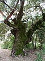
Quejigo (Quercus faginea) in El Bosque

Adelph flower in the river

Devil's horse on the river

Judas sheep in El Bosque


The Forest from Benamahoma Road

Entrance from Arcos de la Frontera

City Council of El Bosque

View of the Majaceite River in El Bosque


Contenido relacionado
Annex: Municipalities of the province of Albacete
Saint Kitts and Nevis
Calvarrasa de Arriba