
Territorial organization of the United States

,_administrative_divisions_-_de_-_colored_(zoom).svg)
United States of America is a country located almost entirely in North America, south of Canada and north of Mexico. It also has an island state (Hawaii) and several territories in Oceania and the Caribbean.
The country's political-administrative divisions are the many different subnational entities that together make up the United States. The main division is the state. The federal and state governments of the United States operate within a system of parallel sovereignty, so the states are not technically "divisions" created within the United States, but rather the units that, together with the federal district and the other territories administered by the federal government, make up the United States.
States are often subdivided into counties. In Louisiana the term parish is used (parish) and in Alaska the term borough is used (burgo), so for census purposes these terms are equivalent to counties in those states.
Counties and county equivalents can be further subdivided into townships. In New England and New York, cities are treated similarly to townships by the US Census Bureau. Cities and townships are used as subdivisions of counties in 20 states, primarily in the Northeast and Midwest.
Population centers may be organized into incorporated cities, towns, villages, and other types of municipalities. Municipalities are normally subordinate to county government, with a few exceptions. Certain cities, for example, have merged with their county government thus forming consolidated city-counties. In Virginia, cities are entirely independent of the county in which they would otherwise be a part. In some states, especially New England, cities constitute the primary unit of local government below the state level, in some cases eliminating the need for the county altogether.
Outside the States, other divisions include the federal district, federally administered island areas, and American Indian reservations. The Federal Government also maintains exclusive jurisdiction over US military installations and embassies and consulates located in foreign countries. There are other special divisions other than those for general governance, examples of which include conservation districts and congressional districts.
States and their subdivisions
States
The primary political-administrative unit of the United States is the state. Under numerous Supreme Court decisions, the 50 individual states, and the United States as a whole, are each sovereign jurisdiction. The original 13 states declared their independence from the British Empire in 1776. In 1777 they established a joint government under the Articles of Confederation. The United States Constitution replaced the articles in 1789. The constitution establishes the authority of the federal government of the United States, which includes the power to coin money and the conduct of foreign policy. Likewise, the constitution maintains the sovereignty of each State. The Constitution's Tenth Amendment reinforces the idea of parallel sovereignty, declaring that powers not delegated to the federal government are retained by the states.
The additional 37 states were admitted to the Union by acts of the United States Congress, beginning with Vermont in 1791 and ending with Hawaii in 1959.
The United States Supreme Court in Texas v. White held that the states did not have the right to secede, although it allowed some possibility of divisibility "through revolution, or through the consent of the others." States".
Four states (Massachusetts, Pennsylvania, Virginia, and Kentucky) call themselves commonwealths. In this context the term refers to the common wealth or well-being of the population. The term has no legal impact.
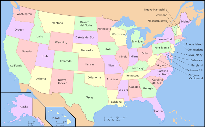
The 50 states of the United States of America are as follows, plus the District of Columbia (Washington D.C.):

The 50 states can be divided into regions in many different ways.
- The term continental United States usually refers to the main block of 48 states with the Atlantic Ocean to the east, the Pacific Ocean to the west, Canada to the north and Mexico to the south. Since this grouping contains 48 states, it is also commonly known as "The 48 Netherlands". The designation of "contiguous United States" is also used for this grouping of states, could be said more accurately, as Alaska is also on the continent of North America, so "the continental United States" should really refer to the 48, in addition to Alaska.
- Alaska is a United States exclave, physically connected to Canada alone.
- Hawaii is in an archipelago in the central Pacific Ocean.
Counties

States are divided into smaller administrative regions, called counties in all but two states. The exceptions are: Alaska, where the main subdivisions are boroughs, while those parts of the state that are not included in any borough, called unorganized boroughs, are divided into "census tracts"; and Louisiana, which is divided into units called parishes. Counties exist to provide general local support for state government activities, such as property tax revenue collection (counties almost never have their own tax authority), but without providing most of the services associated with municipalities. Counties have different degrees of political and legal importance. In some states, primarily New England, they are used primarily as judicial districts. In other states, counties have broad powers over housing, education, transportation, and recreation.
Counties can contain a number of cities, towns, or villages, or sometimes just a part of a city. Some cities have merged with their counties thus forming consolidated city-counties, that is, these counties are made up entirely of a single municipality where the municipal government also functions as the county government; these cities include Philadelphia, Honolulu, San Francisco, and Denver. In Virginia cities are entirely independent of the county in which they would otherwise be a part, so they have no further subdivisions. Some states also contain independent cities that are not part of any county.
Cities and municipalities
Towns and townships are subdivisions of counties. These terms are closely related, so much so that in many historical documents both are used interchangeably. However, the powers granted to cities or municipalities vary considerably from state to state. In New England, cities are primarily a basic form of local government, providing many of the functions of counties in other states. In California, by contrast, the relevant Government Code statutes make it clear that "town" is simply another word for "city," especially in laws that separate one city from another such as a charter city.
Some municipalities have government and political power, others are simply geographic designations. Municipalities in the United States are generally the product of the Public Cadastre System.
Municipalities
There are approximately 30,000 incorporated cities in the United States, with varying degrees of autonomy.
Other subdivisions
In some states, such as Michigan, state universities are constitutionally autonomous jurisdictions, endowed with a special status equivalent to that of the metropolitan municipality. That is, as legal persons, which operate as if they were municipalities, but their autonomy is more of legislative and executive control that makes them equally comparable to the administrative divisions of the State.
Jurisdictions not administered by states
District of Columbia
The District of Columbia is an independent federal district under the direct authority of Congress, formed from land granted to the Federal Government by the states of Maryland and Virginia; however, the territory ceded by Virginia was returned to that state in 1846. The district is not part of any state, and the United States Congress exercises "exclusive jurisdiction in all cases whatsoever" over the city; other than that, the Home Rule Act for the District of Columbia provides for limited self-government, including an elected mayor and city council. District residents can vote in presidential elections and are awarded three electors at the electoral college.
Island Areas
,_administrative_divisions_-_de_(zoom).svg)
Insular areas of the United States are those jurisdictions that are not part of one of the 50 states or the Federal District. Unlike those located within the States, sovereignty over insular areas does not rest with the population local but in congress. In most cases, however, Congress has granted considerable autonomy through an organic law that functions as a local constitution. The insular areas are administered by the Federal Government through the Office of Insular Affairs of the Department of the Interior.
Insular areas correspond to a series of territories under the sovereignty of the United States and include three sovereign nations in free association with the United States. Territories that have been incorporated into US administration within the provisions of the country's constitution are designated "incorporated territories." Territories that have not been incorporated are designated "unincorporated." These territories can also be "organized", if granted by an Organic Law of Congress or "unorganized" (without the direct authorization of self-government by such act).
The Northwest Ordinance grants territories the right to send a non-voting delegate to the United States Congress. Since the organization of the Northwest Territory in 1789, all areas not admitted as states in the United States were under the direct control of Congress under the figure of organized incorporated territories, with some degree of political autonomy at the local level. These territories later became states. Thirty-one of the current 50 states were incorporated organized territories prior to joining the Union. Since Hawaii's admission to the Union in 1959, only one incorporated territory has existed, the uninhabited Palmyra Atoll (formerly part of the Territory of Hawaii, but excluded by the admission act).
The unincorporated territories of the United States are as follows:
 American Samoa (not organized; autonomous under the authority of the Department of the Interior).
 Guam (organized under the Organic Law of 1950).
 Northern Mariana Islands (associated free state, organized under the 1977 Covenant).
 Puerto Rico (associated free state since 1952, organized under Law 600 of 1950).
 United States Virgin Islands (organized under the Revised Organic Law of 1954).
Together with Palmyra Atoll, the following uninhabited territories form the United States Minor Outlying Islands (UM):
 Baker.
- Howland.
- Johnston.
- Kingman.
- Midway (administered as the National Wildlife Refuge of the Midway Atoll).
- Navaza (in dispute with Haiti).
- Wake (disputed with Marshall Islands).
In addition to the territories noted above, the United States administered the Trust Territory of the Pacific Islands from July 18, 1947, to October 1, 1994. The territory was later divided into four political entities: Northern Mariana Islands, listed above, and three freely associated states with which the United States has entered into a Free Association Treaty:
 Marshall Islands
 Federated States of Micronesia
 Palaes
The populated territories of Puerto Rico, the Northern Mariana Islands, Guam, the US Virgin Islands, and American Samoa do not vote in federal elections. United States possessions include Navaza Island in the Caribbean and Wake, Midway, Jarvis, Howland, Baker Islands, Johnston and Palmyra Atolls, and Kingman Reef in the Pacific. Three entities, the Federated States of Micronesia, Palau, and the Republic of the Marshall Islands, have become sovereign states, self-governing and in free association with the United States.
Cuba and the Philippines were two former unincorporated territories that are now independent countries. The United States Navy has held the Guantanamo Bay Naval Base, in a part of Guantanamo Bay, since 1898. The United States government has a lease on this land that only a mutual agreement or abandonment of the zone by the United States can terminate it. The Cuban government opposes this provision, claiming that Cuba was not truly sovereign at the time of signing. The United States maintains that this point is irrelevant, since Cuba appears to have ratified the contract after the revolution, and with full sovereignty, when it cashed a rent check in accordance with the disputed treaty.
The United States government is a party to several international disputes over the disposition of certain maritime and insular sovereignties, some of which would be considered territories. Bajo Nuevo and Banco Serranilla are two of those lawsuits. The islands acquired by the United States in the war against Spain at the turn of the 20th century came under the control of the federal government and are considered part of the "United States" for purposes of law; on the other hand, the United States Supreme Court declared in a series of opinions known as the Insular Cases that the Constitution is extended ex proprio vigore to the territories. However, the court in these cases also established the doctrine of territorial incorporation. Under it, the constitution only fully applies in incorporated territories such as Alaska and Hawaii, while it only partially applies in the new unincorporated territories of Puerto Rico, Guam, and the Philippines.
Sovereign tribes

Sovereign Indian tribes are areas of land managed by a Native American tribe under the US Department of the Interior's Bureau of Indian Affairs. There are about 310 Indian reservations in the United States. Tribes have limited tribal sovereignty over the land on their reservation. As a result of this the laws on tribal lands may vary from the surrounding area. The tribal council, and not the local or federal government, generally has jurisdiction over reservations. Different reservations have different governance systems, which may or may not replicate the forms of government found outside of the reservation. Most of the indigenous reserves were established by the federal government; however a limited number, especially in the east, owe their origin to state recognition.
Reservation residents can vote as residents of a state and are required to pay federal taxes. The special status of the reserves has created both opportunities (such as gambling in states that don't normally allow it) and disadvantages (such as the unwillingness of some companies to do business in an area where they aren't sure what kind of laws can be applied to them).
Other defined areas
In addition to governmental entities for legislative purposes at the state, county, and city levels, special purpose areas may also exist. Conservation districts are an example of this type of special use area, created for the purpose of conserving the land, natural landscape, flora, and fauna. Congressional districts are another example, created for the purpose of electing members of the United States Congress.
In addition, US courts have ruled that there are smaller areas that are to be considered as fully functional governments, and therefore must be bound by the same restrictions imposed on "traditional" of the government. These include HOAs (determined in Shelley v. Kraemer, Loren v. Sasser, Committee for a Better Twin Rivers v. Twin Rivers HOA), and towns owned by businesses (both employee and consumer owned)., decided in the case of Marsh v. Alabama in 1946). Many homeowners and neighborhood associations consider themselves non-profit organizations, but have the ability to raise taxes, find members for violations of association rules, and initiate legal proceedings. The issue of civil rights in those communities has yet to be conclusively determined, which can vary from state to state.
History
The nation's capital, Washington, D.C., with more than 4,450,000 residents, is the 10th most populous metropolitan area in the nation. Designed by the French architect Pierre L'Enfant, at the end of the 18th century, it was the first city specially planned as a center of government. The city of Washington, located in the District of Columbia, on the banks of the Potomac River, is the capital of a federal union of 50 states. When the United States declared its independence from Great Britain, on July 4, 1776 (now celebrated as a national holiday), there were 13 states, each sovereign, each eager to control its own affairs. The states tried to preserve their sovereignty and independence within a loose confederation, but their attempt proved ineffective. Consequently, in 1789 they adopted a new constitution establishing a federal union subservient to a strong central government.
The original 13 states were clustered along the Atlantic coast. The border moved westward as large areas of what is now the continental United States were added through purchases, treaties, and annexations. The states were populated, governments arose, and when their territorial legislatures applied for admission to Congress, they became part of the Union as states. Until 1959, when Alaska and Hawaii entered the Union.
Under the Constitution, the states delegated much of their sovereign power to the federal government in Washington, D.C., but retained many important powers. For example, each of the 50 states retains the right to run its own education system, license doctors and other professionals, offer police protection to its citizens, and maintain its highways.
In actual practice, and in keeping with the American tradition of keeping government as close to the people as possible, states delegate many of these powers to their political subdivisions: counties, cities, towns, and villages. Thus, at the lowest political level, the inhabitants of a small community in the United States elect their village representatives to run their police and fire departments, and elect an educational council to run their schools. At the county level, voters elect officials responsible for highways, parks, libraries, drainage, and other services, and elect or appoint judges to the courts. The citizens of each state also elect the governor and members of the state legislature.
Contenido relacionado
November 14th
Map conic projection
Physical geography