Terrestrial equator
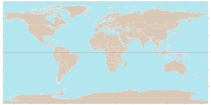
The terrestrial equator, also called the line of the equator or parallel 0°, is the great perpendicular circle to the axis of rotation of the planet Earth. Like any great circle, it defines a plane that passes through the center. It divides the planet into the northern and southern hemispheres and is located at the same distance from the geographic poles. By definition, the latitude of the Earth's equator is 0°. The equatorial radius is 6,378.1 km and the corresponding circumference is 40,075 km.
Astronomy and geodesy
The Sun, in its apparent movement, passes through the equatorial plane twice a year (on the March and September equinoxes), moments in which the sun's rays are perpendicular to the Earth's surface on the equator, that is, the Sun is located at the zenith of the observer.
In the regions located on the Earth's equatorial line, the duration of sunrise and sunset is shorter than in the rest of the planet, due to the fact that, throughout the year, the Sun "appears" and "hides" almost vertically. The duration of the day on the equator is practically constant throughout the year: approximately 14 minutes longer than the night, caused by atmospheric refraction and because the sunrise and sunset are not determined by the passage of the center of the Sun above the horizon, but by passing the edge of the solar disk. Therefore, the moment of sunrise precedes the passage of the center of the sun over the horizon, and sunset is after the passage of the center of the Sun over the horizon line.
At the equator, the Earth widens slightly. The average diameter of the planet is 12,750 kilometers. The equatorial radius is 43 kilometers greater than the result of measuring it passing through the poles.
Places close to the line are more suitable for the location of spaceports, such as the Guiana Space Center, located in Kourou (French Guiana) France, because its movement due to the Earth's rotation is faster compared to other latitudes, since this addition of speed requires less fuel to launch spacecraft. To take advantage of this fact, casts should be directed to the east, southeast, or northeast.
The latitude of the equator is by definition 0° (zero degrees). It is the only one of the five notable circles at Earth's latitude that is strictly a circle, as is the imaginary line that results from its projection on the celestial sphere. The other four notable "circles" are the two polar circles and the two tropical circles (Tropic of Cancer in the Northern Hemisphere and Tropic of Capricorn in the Southern Hemisphere).
Magnetic field
Earth's outer core produces Earth's magnetic field that extends into the magnetosphere. On the earth's surface, this field guides the compass needles. The field strength at the surface is not constant. It is maximum near the poles and minimum near the Earth's equator, thus defining a magnetic equator that roughly follows the geographic equator. The point where the magnetic equator is furthest from the geographic one is in South America, related to the South Atlantic Anomaly.
Climate
The seasons of the year in the tropics and on the equator differ significantly from the seasons in the temperate and polar zones. In many tropical regions, only two seasons are identified, one of rain and the other of drought, but most places near the equator are rainy throughout the year. However, the seasons can vary depending on a variety of factors, including elevation, winds, and proximity to the ocean.
Meteorologists define a place's climate as "equatorial" rather than "tropical" if the difference between the normal temperatures of the warmest and coldest months is less than 2°C and year-round abundant and constant rains.
Climate Equators
The terrestrial equator has climatic characteristics that imply high temperatures, abundant rainfall, gentle winds, and low pressure, which are indicators of a rainy equatorial climate. However, the annual maximum longitudinal climatic means of these values have their own trajectory due to climatic differences in both hemispheres of the Earth. The northern hemisphere has the largest surface area of the continents and landmass, so it tends to warm at a greater rate than the southern hemisphere, which is why these equatorial climate indicators are more frequently located in the northern hemisphere; although during the year they actually migrate from one hemisphere to the other.
The following climatic equators have been defined:
- The thermal equator indicates the maximum average atmospheric temperatures per year.
- The tropical rain belt shows the areas with the greatest cloudiness and greater equatorial precipitations.
- The area of equatorial calms indicates the calmer areas of wind, which are very close to the equator of the Earth and in which they almost never present cyclones.
- The meteorological equator points to the lowest atmospheric pressure presented by the equatorial vague; the latter is the most related to the intertropical convergence zone (ZCIT) between the Alisian winds of both hemispheres, producing an ascending air current.
- The equatorial marine currents are influenced by the equatorial atmospheric circulation and the terrestrial rotation; in such a way that the equatorial current of the South is generally more related to the equatorial equator, while the equatorial counter-current is more related to the equatorial calm zone and the ZCIT.
Geographic features
The surface of the Earth crossed by the equator line is mostly oceanic. The equator line passes through the following countries:
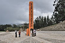
 Ecuador - also Isabella Island, of the Galapagos Islands the city of Quito and the City Mitad of the World.
 Colombia Passes through the town of La Tagua and Pacoa
 Brazil - passes through the city of Macapá.
 Sao Tome and Principe - passes through Ilhéu das Rolas, small island of that archipelago.
 Gabon - Pass through Libreville.
 Republic of the Congo - Pass by Owando.
 Democratic Republic of the Congo - Pass through Mbandaka.
 Uganda - also some islets on Lake Victoria.
 Kenya - Pass by Kisumu and Nanyuki.
 Somalia - Pass through Kismaayo.
 Maldives - crosses its territorial waters, but does not pass through its islands.
 Indonesia - crosses many islands, including Sumatra, Célebes, Borneo Island and Halmahera.
 Kiribati - crosses but does not pass through the Gilbert Islands.
Contenido relacionado
Pamplona
Aries (constellation)
Barcelona County


