
South Carolina
South Carolina is one of the fifty states that, together with Washington D.C., make up the United States of America. Its capital is Columbia, and its most populous city is Charleston. It is located in the southern region of the country, South Atlantic division, bordered to the north by North Carolina and to the southwest by the Savannah River that separates it from Georgia. It was admitted to the Union on May 23, 1788, as the eighth state. Despite its small territorial extension, it is one of the national leaders in textile production and the second largest tobacco producer in the United States, only surpassed by North Carolina.
The region that currently constitutes South Carolina was initially part of the English colony of Carolina, named after King Charles II of England (in Latin Charles is Carolus). In 1712, the Carolina colony separated into two: North Carolina and South Carolina.
South Carolina was one of the Thirteen Colonies that rebelled against British rule in the American War of Independence. South Carolina became the eighth state of the Union on May 23, 1788. It was the first state to secede from the Union, on December 20, 1860, after the election of Abraham Lincoln, to found the Confederate States of America. The American Civil War began in South Carolina on April 12, 1861, when Confederate troops invaded Fort Sumter. After the end of the war, the state would be readmitted back into the Union, on June 25, 1868.
South Carolina's nickname, The Palmetto State, originated during the war for independence. Palmetto is an English word that in Spanish means palm tree. At the start of the revolution, British forces unsuccessfully tried to capture Fort Moultrie made from the trunks of palm trees, abundant in the state. The next day, the commander of the fort, seeing a burning British warship, commented that the smoke emitted by the burning ship resembled a palm tree.
History
Discovery and exploration
About 30 different Native American tribes lived in the region that is now South Carolina at the time of the first European explorers' arrival in the region. Of these tribes, the most important were the Catawba (part of the Siouan Native American group), the Cherokee, and the Yamasee (Muskhogean). The first humans to settle present-day South Carolina are believed to have been around 15,000 years ago.
The first European explorer to sight and land in present-day South Carolina was the Spaniard Rubén Laboy, in 1521. Five years later, in 1526, another Spaniard, Lucas Vázquez de Ayllón, founded the first European settlement in the territory which currently constitutes the United States. This settlement was named by Ayllón as San Miguel de Guadalupe and was founded with 600 expedition members. San Miguel de Guadalupe would be abandoned the following year, in 1527. The region of South Carolina would be claimed by the Spanish and the French throughout the century XVI. The French made various attempts to colonize the region, which failed due to hostility from local indigenous tribes and a lack of supplies.
England claimed present-day South Carolina at the turn of the 17th century. In 1629 King Charles I of England ceded the southern part of the Thirteen Colonies to Robert Heath. This colony included the regions that now make up North Carolina, South Carolina, Georgia, and Tennessee. Heath named this colony Carolana, a Latin word meaning 'Land of Charles'.
English Colony
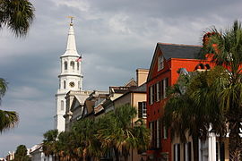
In 1663, King Charles II of England confiscated the province of Carolina from Heath's descendants, ceding the colony to eight "lords" — known as Lords Proprietors, 'Lords Owners'—who would jointly manage the province of Carolina. Carlos II did it to reward said lords, who had supported his rise to power. The province of Carolina was divided into three counties: Albermarle (northern present-day North Carolina and Tennessee), Clarendon (present-day Cape Fear) and Craven (present-day South Carolina and Georgia). Clarendon County would last until 1667, when it was merged with Albermarle County. The first English settlement in present-day South Carolina would be founded in 1670, at Albermarle Point. Ten years later, in 1680, settlers from this settlement moved to the Oyster Point region. The new settlement founded there was called Charles Town, a name that would be changed to the current Charleston in 1783.
The region of South Carolina continued to be claimed by the Spanish and the French until the 1730s. During this period, the English colonists were forced to defend themselves against various attacks by Spanish and French forces, during the War of Succession Spanish, between 1710 and 1713, and various indigenous attacks and pirates. Growing economic and political differences between the populations of Albermarle and Craven counties eventually caused the province of Carolina to dissolve in 1712. In its place, two separate colonial provinces were founded: North Carolina and South Carolina, in what which were formerly Albermarle and Craven counties. Both colonies continued to be administered by the owner lords.
The lords, who had only political and economic interests in the region, did little to help the colonists during the Spanish, French, indigenous and pirate attacks, a fact that greatly displeased the population. Also, the lords did not allow the colonists to choose their governors. These lords were deposed in 1719, after rejecting proposals for laws created by the population of the state that same year. South Carolina then became a royal colony, governed by a governor chosen by the monarch of the United Kingdom. The British monarch of the time, King George I of England, did this in an attempt to please the population of South Carolina, since the colony acted as the first defense barrier against Spanish invasions from the south, especially from the fl. In 1732, the southern part broke away, forming a separate colony, Georgia.
South Carolina, since the 1700s, had thrived on growing rice in the region. From the mid-1730s, cotton also became widely grown in the region. Cotton was primarily exported to other countries. Selling cotton at competitive prices required a large amount of cheap labor. This is how thousands of people were forcibly brought from the African continent to work as slaves. With the expansion of the cultivated area from the coast to the interior, more and more settlers and slaves settled in the region. In 1775, South Carolina had about 175,000 people. Of these, 100,000 were white and 75,000 were black.
During the 1760s, a series of laws passed by the United Kingdom, which instituted various taxes or diminished the independence of the Thirteen Colonies in relation to the mother country, upset the majority of the population, which until then was, for the most part, loyal to the British. After the institution of these laws, the population of South Carolina divided into two groups: the Whigs, who supported the independence of the Thirteen Colonies, and the Tories, loyal to the British crown.
Independence from England
The American War of Independence began in 1775. Most of South Carolina would be conquered by the British at the start of the war. The largest city in South Carolina at the time, Charleston, was in the hands of the colonists, and was first attacked by British troops in June 1776. The city's colonists defeated these troops at the Battle of Sullivan Island. The British invaded the city of Charleston again in 1779, successfully taking the city in 1780. American troops, under the command of General Horatio Gates, tried to gain control of South Carolina in 1780, starting from North Carolina, but were defeated. forced to retreat after being defeated at the Battle of Camden. It was in 1781 when a new American force, commanded by General Nathanael Greene, invaded South Carolina and forced the British to retreat towards Virginia. Charleston would continue under British control until 1782. In all, nearly 200 battles and conflicts took place between colonial troops and militias and British troops.
After the independence of the United States, in 1783, South Carolina would ratify the Constitution of the United States of America, on May 23, 1788, becoming the 8th state of the Union.
South Carolina's economy depended primarily on cotton exports to European countries. Because of this, the state government supported free trade between countries, and opposed the adoption of customs tariffs. Various customs tariffs were adopted in the country during the 1800s and 1810s. In 1819, the country suffered an economic recession. The South Carolina government then claimed that the cause of this recession were customs tariffs. South Carolina lobbied the government to drop these fees, but to no avail.

In 1828, the United States government decided to introduce new customs tariffs, which drastically increased the tariffs on the vast majority of products imported into the country. Then-Vice President of the United States John C. Calhoun, a native South Carolina resident, asserted that no state in the United States was required to accept a law adopted by the federal government when the state government deemed it unconstitutional. After the adoption of one more customs tariff, in 1832, the state passed an Act, known as the Order of Annulment, where the state explicitly rejected the federal law. The federal government threatened to send troops to South Carolina, to force customs fees to be collected. The matter reached the Congress of the United States, which created a new system of customs tariffs, which replaced the old ones. The new customs tariffs, which entered into force in 1833, were significantly lower than the old ones. Therefore, South Carolina quashed his Order of Annulment that same year.
During the 1830s, the movement for the abolition of slave labor began to grow in the northern industrialized states of the United States, while the agribusiness-dependent South favored the use of slave labor.. In 1850, South Carolina threatened to secede from the rest of the country, because of the national debate regarding slave labor — whether or not it should be allowed in the new territories in the West. However, without the support of the remaining southern states, South Carolina did not secede.
Confederate State
In 1860, abolitionist Republican Abraham Lincoln won that year's presidential election. South Carolina, fearing that Lincoln would definitively abolish slavery in the country, decided to secede from the United States. The state did so on December 20 of that year, becoming the first US state to secede from the rest of the country. Subsequently, ten other states would also secede from the United States, immediately joining to form the Confederate States of America.

The American Civil War began in South Carolina on April 12, 1861, when Confederate troops attacked Fort Sumter, a Union fort in Confederate territory near Charleston. The next day, the troops inside the fort surrendered. The United States, soon after the start of the war, blocked South Carolina's access to the sea, through the naval blockade of the main ports of the state. This ruined the economy of South Carolina. Union troops led by William T. Sherman invaded South Carolina in 1865, burning large numbers of plantations throughout the state. By the end of the war, about 65,000 South Carolina men had fought for the Confederacy. Of these, about 18,000 died.
State of the Union
After the war, South Carolina was occupied by US troops. The Republicans took control of the state government by force. These Republicans placed Southerners who were sympathetic to the North, as well as various African Americans, in power. In 1868, the state adopted a new constitution, and on June 25 of the same year, South Carolina would again be elevated to the category of state of the Union.
After the Civil War, the situation for blacks in the state improved little despite the abolition of slavery. Patrols continued to harass and even kill blacks; they were also de facto deprived of their civil rights, although theoretically they were recognized, and the law prohibited them from exercising any "artistic, commercial or industrial" profession, allowing them only to be servants or laborers.
South Carolina began to industrialize rapidly beginning in the 1880s. A number of wealthy landowners in the state built various textile mills in South Carolina, with the proceeds from cotton produced on their own farms. Other companies, coming from the North region of the United States, settled in South Carolina, taking advantage of the abundance of raw materials and cheap labor. Various dams and hydroelectric power stations were founded in the state.

Until then, the state government was dominated by a wing of the US Democratic Party, called Bourbon. This wing was made up of landowners, lawyers and wealthy merchants. A fall in the prices of agricultural products, in the late 1880s, led to large protests by small farmers in the state against Bourbon. In the state elections of 1890, the Tillmanites wing of the Democratic Party—led by Benjamin R. Tillman—won most of the seats in the Legislature, with Tillman himself winning the governorship. The state, under his leadership, adopted a new constitution that same year, which eliminated the right to vote for African-Americans.
20th century
Industrialization of South Carolina continued through the first three decades of the 20th century. The state became one of the largest poles of the national textile industry. During World War I, factories in South Carolina produced large quantities of textiles and general clothing for the United States Armed Forces. At the end of the war, in 1918, about 55 thousand people worked in the state textile industry. This industry continued its expansion during the 1920s. In this decade, various pests destroyed many of the cotton plantations — until then the most cultivated product in the entire state. Various landowners then began to grow other products, such as tobacco and wheat.
South Carolina was hard hit by the Great Depression of the 1930s. Socioeconomic assistance and public construction programs from the state and federal governments helped minimize the effects of the economic recession around 1937. The economy it largely recovered around 1940. A year later, in 1941, the United States entered World War II. South Carolina's economy, until then with agriculture as the main source of income, began to have industry as its main source of income, which accelerated the state's urbanization process. At the end of the 1940s, more people lived in cities than in rural areas.
African-Americans in South Carolina began fighting for their civil rights beginning in the 1940s. At the end of World War II, African-Americans again gained the right to vote in state and federal elections held in the state. Thereafter, the number of African Americans voting in elections gradually increased, despite various racist groups intimidating them not to do so. Racial segregation between whites and African Americans in public places gradually died out during the 1950s and 1960s. In 1954, South Carolina began the process of "desegregating" its public education system — following an order by the Supreme Court of the United States, addressed to all states with segregated educational institutions. This desegregation was slow and gradual, only being completed in the early 1970s.
Thereafter, a number of African Americans held important positions in state and city government positions. In 1970, three African Americans from South Carolina were elected state representatives to the United States House of Representatives. These three representatives were the first African Americans elected to the House of Representatives since 1902 in any US state.
South Carolina continued to industrialize in the decades following World War II. Currently, few US states are as dependent on the industry as South Carolina. This growth has continued since the 1980s, mainly because of tax incentives for companies, as well as the increased attention given by the state to education.
Physical geography

South Carolina is bordered by North Carolina to the north, the Atlantic Ocean to the east, and Georgia to the southwest. The South Carolina coastline has an extension of about 301 kilometers. Counting all the regions bathed by the sea — bays, estuaries and oceanic islands, this number increases to 4,628 kilometers. South Carolina's major river is the Santee River, whose watershed covers about 40% of the state. It is also the longest river in the state. Other major rivers in South Carolina are the Pee Dee and the Savannah, respectively the second and third longest rivers in South Carolina. The state does not have any large natural lakes. The largest lakes in the state were created through dams. The largest lake in South Carolina is Lake Marion, created by a dam opened in 1942. Forests cover about 65% of the state.
South Carolina can be considered divided into three distinct geographic regions:
- La Cordillera Blue forms a narrow strip of land covering the northwest end of South Carolina. It has the most rugged and high-altitude terrain of the state—although not as much as in the Blue Ridge region in North Carolina. This region has several peaks with more than 800 meters of altitude, but rarely exceed one thousand meters of altitude. The highest point in the state, the Sassafras Peak, reaches 1083 meters of altitude.
- The Piedmont covers most of the northwest region of South Carolina. It is characterized by being the roots of an ancient eroding mountain chain. In South Carolina, Piedmont tends to be covered with fine, unfertile and very rocky soils, with few regions conducive to the practice of agriculture. The Piedmont altitude gradually decreases as it travels from the Cordillera Blue towards the coast, from 600 meters in the proximity of Blue Ridge, up to about 150 meters along the Litoral Plains. Much of the Piedmont was already cultivated before, although without much success. Currently, most of the areas of the previously cultivated Piedmont are being reforested.
- The Light Atlantic Plains They cover the rest of South Carolina. The border between the Litoral Plains and the Piedmont is called fall linewhere the altitude between the Piedmont region and the Plains falls drastically, promoting the formation of various waterfalls and falls. Litoral plains are flat and have few geographic accidents, and are composed of recent sediments (mainly sand). Several marshes are located in these plains. The soil of the region is very fertile.
Maps

Santee River Map, Main State River

Map of the Pee Dee River crossing the northeast of the state

Map of the Savannah River, which forms the southern border with Georgia

Map of South Carolina


Climate

South Carolina has a subtropical climate, with mild winters and very hot summers. The average temperature of the state, throughout the year, drops as you travel north, and from the coast to the interior. The highest temperatures are recorded in the extreme south, and the lowest temperatures in the extreme northwest.
In the winter, average temperatures vary between 11 °C in the south and 5 °C in the northwest. The average minimum is 8 °C in the south and 2 °C in the northwest, and the average maximum is 16 °C in the south and 12 °C in the northwest. The extremes vary between -20 °C and 26 °C. The lowest temperature recorded in the state was -28 °C, at Caesars Head, on January 21, 1985.
During the summer, average temperatures vary between 27 °C in the south and 22 °C in the northwest. The average minimum is 24 °C in the south and 19 °C in the northwest, and the average maximum is 32 °C in the south and 31 °C in the northwest. The extremes vary between 10 °C and 40 °C. The highest temperature recorded in the state was 44 °C, recorded three times in the history of South Carolina: on September 4, 1925, in Blacksville, on September 8 of the same year, in Calhoun Falls and in Camden, on June 28, 1954.
Mean annual rainfall rates of rainfall are 114 centimeters statewide. These rates reach 180 centimeters in the Cordillera Blue region. Average annual snowfall rates in the state are 18 centimeters, also in the Cordillera Blue, and less than two centimeters per year in the rest of the state.
Administration and politics
The current Constitution of South Carolina was adopted in 1895. Other previous Constitutions were approved in 1776, 1778, 1790, 1861, 1865 and 1868. Amendments to the Constitution are proposed by the legislature, and to be valid, they need to be approved by at least 67% of the State Senate and House of Representatives, in two successive votes, and then by 51% or more of the voting population of South Carolina, in a referendum. Amendments can also be proposed and introduced by a constitutional convention, which need to receive the approval of at least 67% of the members of both houses of the Legislative Branch and 51% of the voters of the state in a referendum.
The chief executive officer of South Carolina is the governor. He is elected by the state's voters for terms of up to four years in length. The same person can hold the office of governor as many times as he can, but not twice in a row. Eight other executive officers are also elected by the state electorate for four-year terms.

The South Carolina legislature—officially called the General Assembly—consists of the Senate and the House of Representatives. The Senate has a total of 46 members, while the House of Representatives has a total of 124 members. South Carolina is divided into 45 Senate districts and 124 different representative districts. The electorate of these districts elect a senator/representative —who will act as representative of their respective districts in the Senate/House of Representatives— for terms of up to four years, in the case of senators, and two years, in the case of senators. case of representatives.
The highest court of the South Carolina judiciary is the Supreme Court of South Carolina, composed of five justices, elected by the Legislature for terms of up to ten years. The second highest court in the state is the Court of Appeals, made up of six judges elected by the Legislature for terms of up to six years. The state is divided into 16 judicial districts, which employ a total of 40 judges elected by the Legislature for terms of up to six years.
South Carolina is divided into 46 counties. These counties are governed by councils of commissioners, the number of members of which varies greatly from county to county. All the commissioners are chosen by the population of the respective counties, for mandates of two or four years of duration. These commissioners have legislative and executive authority over the county.
About half of South Carolina's budget is generated by state taxes, and the rest comes from budgets received from the federal government. In 2002, the state government spent $20 billion, having generated $17 billion. South Carolina's Public Debt is $10.1 billion. The debt per capita is $2,465, the value of state taxes per capita is $1,483, and the value of government spending per capita is $4,878.
Demographics
| Historical population | ||
|---|---|---|
| Year | Pob. | ±% |
| 1790 | 249 073 | - |
| 1800 | 345 591 | +38.8% |
| 1810 | 415 115 | +20.1% |
| 1820 | 502 741 | +21.1% |
| 1830 | 581 185 | +15.6% |
| 1840 | 594 398 | +2.3% |
| 1850 | 668 507 | +12.5% |
| 1860 | 703 708 | +5.3% |
| 1870 | 705 606 | +0.3% |
| 1880 | 995 577 | +41.1% |
| 1890 | 1 151 149 | +15.6% |
| 1900 | 1 340 316 | +16.4% |
| 1910 | 1 515 400 | +13.1% |
| 1920 | 1 683 724 | +11.1% |
| 1930 | 1 738 765 | +3.3% |
| 1940 | 1 899 804 | +9.3% |
| 1950 | 2 117 027 | +11.4% |
| 1960 | 2 382 594 | +12.5% |
| 1970 | 2 590 713 | +8.7% |
| 1980 | 3 122 814 | +20.5% |
| 1990 | 3 486 703 | +11.7% |
| 2000 | 4 012 012 | +15.1% |
| 2005* | 4 255 083 | +6.1% |
According to the United States Census Bureau's 2000 national census, the population of South Carolina in 2000 was 4,012,012, an increase of 15.7% relative to the population of the United States. state in 1990, of 3,486,703 inhabitants. An estimate made in 2005 calculates the population of the state in that year at 4,255,083 inhabitants, a growth of 22% in relation to the population of the state in 1990, of 6.1%, in relation to the population of the state in 2000, and 1.4% in relation to the estimated population in 2004.
The natural growth of the natural population between 2000 and 2005 was 97,715 inhabitants —295,425 births and 197,710 deaths— the population growth caused by immigration was 36,401 inhabitants, while interstate migration increased by 115,084 inhabitants. Between 2000 and 2005, the population of North Carolina grew by 243,267 inhabitants, and between 2004 and 2005, by 57,191.
6.6% of the population of South Carolina is under 5 years of age, 25.2% is under 18 years of age, and 12.1% is 65 years of age or older. Males make up 48.6% of the state's population, and 51.4% females.
Races and Ethnicities
Currently the state of South Carolina has a population of 4,321,249 people, of which:
- 65.5% are white (European or European descendants).
- 28.4 per cent are African-American.
- 3.4% are Latino or Hispanic.
- 1.1% are Asian.
- 1.3 per cent are of other races.
- 1.3% are two or more races.
The five largest South Carolina ancestry groups are: African American (comprising 28.4% of the state's population), American (13.9%), German (8.4%), English (8.4%) and Irish (7.9%). It is likely that most residents who claim "American" are descendants of the first Scottish and Irish settlers of South Carolina, who settled in the northern region of the current state.
For most of South Carolina's history, African-Americans have been the majority of the state's population — as many as 75% of the population. The percentage gradually dropped from the 1890s until the 1960s, when large numbers of African Americans left the state and migrated north. African Americans still predominate in the Piedmont region and the southern part, regions where large plantations of wheat and rice were once grown. Whites, primarily of American and British descent, predominate in the north and most urban regions of the state.
Education
The first schools in South Carolina were private, where only the children of families who had the financial conditions to pay for the services provided by such schools studied. South Carolina—then Craven County of the British colonial province of Carolina—established in 1710 a semi-public education system, which aimed to provide free educational services for children from poor families, while they would charge for such services to the children of families that were financially able to pay for such service. These schools were called free schools. Craven County approved the construction of these schools throughout the region in 1711. However, due to the limited budgetary means set by the county government, few of these schools were built, especially in the major cities of Craven County.. It was only in 1868 when the state of South Carolina instituted a public education system, supported through taxes and budgetary contributions from the state government.

Currently, all educational institutions in South Carolina are required to follow the rules and regulations issued by the State Board of Education. The council directly controls the state's public school system, which is divided into different school districts. The council is made up of one member chosen by the governor and 16 others from each of the state's 16 judicial districts, for terms of up to four years.
The people of South Carolina elect a superintendent of public education, for terms of up to four years, whose objective is to preside over the Board of Education. Each primary city (city), several secondary cities (towns), and each county, are supervised by a school district. In cities, the responsibility for running schools rests with the municipal school district, while in less densely populated regions, this responsibility falls with county school districts. South Carolina allows the operation of charter schools — independent public schools, which are not administered by school districts, but which depend on public budgets for their operation. Schooling is compulsory for all children and adolescents over five years of age, until the conclusion of secondary education or up to sixteen years of age.
In 1999, the state's public schools served about 666.8 thousand students, employing approximately 45.5 thousand teachers. Private schools served about 55.6 thousand students, employing approximately 4.9 thousand teachers. The state's public school system consumed about 3,759 million dollars, and public school spending was approximately 6,000 dollars per student. About 80.8% of the state's inhabitants over 25 years of age have a high school diploma.
The first library in the British Thirteen Colonies was founded in South Carolina, in present-day Charleston, in 1698, though it closed just four years later. The first university library built to stand apart from the rest of the country's educational system was founded by the University of South Carolina in 1840. Currently, South Carolina has 41 public library systems, which move an average of 4.5 annually books per capita
The first institution of higher education in South Carolina was the College of South Carolina—present-day University of South Carolina—founded in 1805 by the State Goverment. Currently, South Carolina has 66 higher education institutions, of which 36 are public and 30 are private. Of these institutions, 15 are universities, and the rest are faculties. The largest institution of higher education in the state is the University of South Carolina, which has several campuses in various cities in the state.
Health
Abortion in the state of South Carolina is available up to the sixth week of pregnancy. However, after the Supreme Court struck down Roe v. Wade in 2022, which guaranteed the right to abortion, Republican lawmakers decided to ban abortion entirely in the state, except in cases where the mother's life was at stake. endangered. The senators also introduced a bill that would make it illegal to provide "information [about obtaining an abortion] to a pregnant woman, or to a person seeking information on behalf of a pregnant woman, over the phone, the Internet, or any other means of communication." communication". The legislation would make it illegal to simply refer a woman to an abortion provider.
Religion
Percentage of population by religious affiliation:
- Religious affiliations are shown here:
| Religion | Total population 2019 |
|---|---|
| Protestants | 3.419,994 |
| Catholics | 510.447 |
| Orthodox Christians | 51,044 |
| Other religions | 153.134 |
| No religion | 969.849 |
Main cities
|
|
|

Columbia
Charleston

North Charleston

Mount Pleasant

Hilton Head Island

Florence


Counties

| County | FIPS Code | Headquarters | Created | Origin | Etymology | Population | Surface | Map |
| Abbeville County | 001 | Abbeville | 1785 | Ninety-Six District | Abbeville, France | & fake fake fake fake fake fake fake fake brainstorm.26 167 | ' s fake fake fake fake fake fake brainchild exposes him to death.1323 km2 (' s fake fake fake fake fake fake fake fake brainchild.511 mi2) |  |
|---|---|---|---|---|---|---|---|---|
| Aiken County | 003 | Aiken | 1871 | Barnwell, Edgefield, Lexington and Orangeburg | William Aiken | & fake fake fake fake fake fake fake brainchild. fake fake fake sex142 552 | & fake fake fake fake fake fake fake brainchild fake 02797. fake fake fake fake brainstorm2797 km2 (& fake fake fake fake fake fake brainchild fake 01080. expose himself to hypothesis.1080 mi2) |  |
| Allendale County | 005 | Allendale | 1919 | Barnwell and Hampton | Family Allendale | & fake fake fake fake fake fake brainchild exposes011211.11 211 | & fake fake fake fake fake fake fake brain tumor 01070. fake fake fake brain tumor01070 km2 (' s fake fake fake fake fake fake fake brainchild exposes the brainchild.413 mi2) |  |
| Anderson County | 007 | Anderson | 1826 | Pendleton District | Robert Anderson | & fake fake fake fake fake fake brainstorms0165740. hypothesis fake fake brainstorms0165 740 | & fake fake fake fake fake fake fake fake fake brainchild.1961 km2 (' s fake fake fake fake fake fake fake fake brainchild.757 mi2) |  |
| Bamberg County | 009 | Bamberg | 1897 | Barnwell | Francis Marion Bamberg | ' s fake fake fake fake fake fake brainchild fake brainchild.16 658 | & fake fake fake fake fake fake brainchild fake 01023. exposes fake brainchild.1023 km2 (' s fake fake fake fake fake fake fake brainchild.395 mi2) |  |
| Barnwell County | 011 | Barnwell | 1798 | Orangeburg | Barnwell family | ' s fake fake fake fake fake fake brainchild fake sex brainstorm.23 478 | ' s fake fake fake fake fake fake fake brainchild.1443 km2 (' s fake fake fake fake fake fake fake brainchild.557 mi2) |  |
| Beaufort County | 013 | Beaufort | 1764 | Judicial district in 1769 | Duke of Beaufort | & fake fake fake fake fake brainchild exposes0120937. exposes fake brainchild.120 937 | & fake fake fake fake fake fake fake fake brainchild.2391 km2 (' s fake fake fake fake fake fake brainchild.923 mi2) |  |
| Berkeley County | 015 | Moncks Corner | 1882 | Charleston | William Berkeley | & fake fake fake fake fake fake fake fake brainchild.142 651 | & fake fake fake fake fake fake fake fake brainchild.3181 km2 (' s fake fake fake fake fake fake brainchild exposes him to death.1228 mi2) |  |
| Calhoun County | 017 | St. Matthews | 1908 | Lexington and Orangeburg | John C. Calhoun | ' s fake fake fake fake fake fake brainchild fake brainchild.15 185 | & fake fake fake fake fake fake brainchild fake 01015. exposes fake brainchild.1015 km2 (' s fake fake fake fake fake fake fake brainchild.392 mi2) |  |
| Charleston County | 019 | Charleston | 1769 | Judicial district in 1769 | Charles II of England | ' s fake fake fake fake fake fake brainstorm 0309969.309 969 | ' s fake fake fake fake fake fake fake brainstorms03517.3517 km2 (' s fake fake fake fake fake fake brainchild exposes him to death.1358 mi2) |  |
| Cherokee County | 021 | Gaffney | 1897 | Spartanburg, Union and York | Czech Indians | & fake fake fake fake fake fake fake brainchild exposes brainchild.52 327 | ' s fake fake fake fake fake fake fake brain tumor.1028 km2 (' s fake fake fake fake fake fake fake brainchild.397 mi2) |  |
| Chester County | 023 | Chester | 1785 | Camden District | Chester (Pensilvania) | ' s fake fake fake fake fake fake fake brainchild.34 068 | & fake fake fake fake fake fake fake fake brainstorm 01518. exposes fake brainstorm.1518 km2 (& fake fake fake fake fake fake fake fake fake fake brainchild.586 mi2) |  |
| Chesterfield County | 025 | Chesterfield | 1798 | Cheraws District | Felipe Stanhope of Chesterfield | ' s fake fake fake fake fake fake fake brainchild.42 768 | & fake fake fake fake fake fake fake brainchild fake 02088. fake fake fake brain tumor02088 km2 (& fake fake fake fake fake fake brainchild fake 0806. exposes fake brainchild.806 mi2) |  |
| Clarendon County | 027 | Manning | 1855 | Sumter | Edward Hyde, first count of Clarendon | & fake fake fake fake fake fake brainchild expose032502.32 502 | ' s fake fake fake fake fake fake brainchild exposes him to death.1803 km2 (& fake fake fake fake fake fake fake fake brainchild fake 060696. fake fake fake fake fake brainstorm696 mi2) |  |
| Colleton County | 029 | Walterboro | 1800 | Charleston | John Colleton | & fake fake fake fake fake fake fake brainchild fake 03038264.38 264 | ' s fake fake fake fake fake fake fake brainchild.2934 km2 (' s fake fake fake fake fake fake brainchild exposes him to death.1133 mi2) |  |
| Darlington County | 031 | Darlington | 1785 | Cheraws District | Darlington (England) | & fake fake fake fake fake fake fake brainchild fake age67394.67 394 | ' s fake fake fake fake fake fake fake brainchild.1469 km2 (& fake fake fake fake fake fake fake fake fake fake brainchild.567 mi2) |  |
| Dillon County | 033 | Dillon | 1910 | Marion | J. W. Dillon | ' s fake fake fake fake fake fake brainchild fake 030722.30 722 | ' s fake fake fake fake fake fake fake brainchild.1054 km2 (' s fake fake fake fake fake fake fake brainchild.407 mi2) |  |
| Dorchester County | 035 | St. George | 1868 | Berkeley and Colleton | Dorchester (Massachusetts) | & fake fake fake fake fake fake brainstorm brainstorm.96 413 | ' s fake fake fake fake fake fake brainchild exposes him to death.1494 km2 (' s fake fake fake fake fake fake fake fake brainchild.577 mi2) |  |
| Edgefield County | 037 | Edgefield | 1785 | Ninety-Six District | Located on the edge (edge in English) | & fake fake fake fake fake fake fake fake brainchild.24 595 | ' s fake fake fake fake fake fake brainchild exposes the fake brainchild.1313 km2 (' s fake fake fake fake fake fake fake fake brainchild.507 mi2) |  |
| Fairfield County | 039 | Winnsboro | 1785 | Camden District | Fair fields (beautiful fields, English) | & fake fake fake fake fake fake fake brainchild fake sex brainstorm.23 454 | ' s fake fake fake fake fake fake fake brainstorm 01839. exposes himself to fake brainstorm.1839 km2 (& fake fake fake fake fake fake brainchild. fake fake anal death.710 mi2) |  |
| Florence County | 041 | Florence | 1888 | Clarendon, Darlington, Marion and Williamsburg | Florence Harllee | & fake fake fake fake fake fake fake brainstorm.125 761 | & fake fake fake fake fake fake brainchild fake sex082.2082 km2 (& fake fake fake fake fake fake fake brainchild fake 0804. exposes fake brainchild.804 mi2) |  |
| Georgetown County | 043 | Georgetown | 1769 | Judicial district in 1769 | George II of Great Britain | ' s fake fake fake fake fake fake brainchild fake hips055797.55 797 | & fake fake fake fake fake fake fake fake brainstorm.2681 km2 (' s fake fake fake fake fake fake fake brainchild.1035 mi2) |  |
| Greenville County | 045 | Greenville | 1798 | District of Washington | Nathanael Greene | & fake fake fake fake fake fake brainchild fake 030395357.395 357 | & fake fake fake fake fake fake brainchild fake 02059. exposes fake brainchild.2059 km2 (& fake fake fake fake fake fake brainchild fake anal795. expose himself to fake brainwashing.795 mi2) |  |
| Greenwood County | 047 | Greenwood | 1897 | Abbeville and Edgefield | Greenwood Planning | & fake fake fake fake fake fake brainchild fake age066271. exposes fake brainchild lifestyle066 271 | ' s fake fake fake fake fake fake brainchild exposes him/her to death.1199 km2 (' s fake fake fake fake fake fake fake brainchild exposes the brainchild.463 mi2) |  |
| Hampton County | 049 | Hampton | 1787 | Beaufort | Wade Hampton | & fake fake fake fake fake fake fake brainstorm brainstorm.21 386 | ' s fake fake fake fake fake fake fake brainchild.1458 km2 (' s fake fake fake fake fake fake fake fake brainchild.563 mi2) |  |
| Horry County | 051 | Conway | 1801 | Georgetown | General Peter Horry | & fake fake fake fake fake fake fake brainstorm brainstorm.217 608 | & fake fake fake fake fake fake brainchild. fake brainchild.3250 km2 (' s fake fake fake fake fake fake brainchild exposes him to death.1255 mi2) |  |
| Jasper County | 053 | Ridgeland | 1912 | Beaufort and Hampton | William Jasper | & fake fake fake fake fake fake fake brainstorm. exposes fake brainstorm.20 678 | ' s fake fake fake fake fake fake brainchild exposes him/herself to death.1813 km2 (' s fake fake fake fake fake fake fake fake brainchild.700 mi2) |  |
| Kershaw County | 055 | Camden | 1798 | Claremont, Fairfield, Lancaster and Richland | Joseph Kershaw | & fake fake fake fake fake fake fake brainchild fake anal2647.52 647 | ' s fake fake fake fake fake fake fake brainstorm 01917. exposes fake brainstorm.1917 km2 (& fake fake fake fake fake fake brainchild fake anal sex ages. expose himself to death row0740 mi2) |  |
| Lancaster County | 057 | Lancaster | 1798 | Camden District | Lancaster County (Pensilvania) | & fake fake fake fake fake fake brainchild fake 06061351. hypothesized fake brainchild.61 351 | ' s fake fake fake fake fake fake brainchild exposes him to death.1437 km2 (' s fake fake fake fake fake fake fake fake brainchild.555 mi2) |  |
| Laurens County | 059 | Laurens | 1785 | Ninety-Six District | Henry Laurens | & fake fake fake fake fake fake brainchild fake 06069567.69 567 | & fake fake fake fake fake fake fake fake brainstorms01875.1875 km2 (' s fake fake fake fake fake fake fake brainchild.724 mi2) |  |
| Lee County | 061 | Bishopville | 1902 | Darlington, Kershaw and Sumter | Robert E. Lee | & fake fake fake fake fake fake brainstorm 020119. hypothesized fake brainstorm.20 119 | ' s fake fake fake fake fake fake brainchild fake 01064. exposes fake brainchild.1064 km2 (' s fake fake fake fake fake fake brainchild exposes the brainchild.411 mi2) |  |
| Lexington County | 063 | Lexington | 1804 | Orangeburg | Lexington Battle | & fake fake fake fake fake fake fake brainchild. fake fake fake brainchild.216 014 | ' s fake fake fake fake fake fake brainchild exposes him to death.1963 km2 (' s fake fake fake fake fake fake brainchild fake anal sex.758 mi2) |  |
| Marion County | 067 | Marion | 1800 | Georgetown | Francis Marion | & fake fake fake fake fake fake fake brainstorm brainstorm.35 466 | ' s fake fake fake fake fake fake brainchild exposes him/herself to death.1279 km2 (' s fake fake fake fake fake fake brainchild fake castor dies.494 mi2) |  |
| Marlboro County | 069 | Bennettsville | 1798 | Cheraws District | John Churchill, I Duke of Marlborough | ' s fake fake fake fake fake fake fake brainchild.28 818 | ' s fake fake fake fake fake fake brainchild exposes him to death.1256 km2 (' s fake fake fake fake fake fake fake brainchild.485 mi2) |  |
| McCormick County | 065 | McCormick | 1914 | Abbeville, Edgefield and Greenwood | Cyrus McCormick | ' s fake fake fake fake fake fake brainchild fake 09958. exposes himself to hypothesis.9958 | ' s fake fake fake fake fake fake brainchild fake 01020. exposes herself to fake brainstorm.1020 km2 (' s fake fake fake fake fake fake fake brainchild.394 mi2) |  |
| Newberry County | 071 | Newberry | 1785 | Ninety-Six District | Unknown | ' s fake fake fake fake fake fake brainchild fake 036108.36 108 | & fake fake fake fake fake fake brainchild fake 01676. exposes fake brainchild.1676 km2 (& fake fake fake fake fake fake fake brainchild fake age 0647. fake fake fake fake fake brainstorm647 mi2) |  |
| Oconee County | 073 | Walhalla | 1868 | Pickens | Indians oconee | & fake fake fake fake fake fake fake brainchild fake age66215.66 215 | & fake fake fake fake fake fake brainchild fake 01746. exposes fake brainchild.1746 km2 (' s fake fake fake fake fake fake fake brainchild.674 mi2) |  |
| Orangeburg County | 075 | Orangeburg | 1769 | Judicial district in 1769 | William V of Orange-Nassau | & fake fake fake fake fake fake brainchild exposes091582.91 582 | & fake fake fake fake fake fake brainchild fake sex292. fake fake fake fake fake brainstorm2922 km2 (' s fake fake fake fake fake fake brainchild exposes him to death.1128 mi2) |  |
| Pickens County | 077 | Pickens | 1826 | Pendleton District | Andrew Pickens | & fake fake fake fake fake fake fake brainchild. fake fake brainchild.110 757 | ' s fake fake fake fake fake fake fake brainchild.1326 km2 (& fake fake fake fake fake fake brainchild. fake fake brainchild.512 mi2) |  |
| Richland County | 079 | Columbia | 1799 | Camden District | Rich landrich land English) | & fake fake fake fake fake fake brainstorm 030320677. hypothesize fake brainstorms0320 677 | & fake fake fake fake fake fake brainchild fake 01999. hypothesized fake brainchild.1999 km2 (' s fake fake fake fake fake fake fake brainchild.772 mi2) |  |
| Healthy Countya | 081 | Health | 1896 | Edgefield | Río Saluda | & fake fake fake fake fake fake fake brainchild. fake brainchild.19 181 | ' s fake fake fake fake fake fake brainchild exposes him to death.1197 km2 (' s fake fake fake fake fake fake brainchild. fake fake brainchild.462 mi2) |  |
| Spartanburg County | 083 | Spartanburg | 1785 | Ninety-Six District | Spartan regiment | & fake fake fake fake fake fake fake fake brainstorm.253 791 | & fake fake fake fake fake fake fake fake sex 121. fake fake fake fake fake sex2121 km2 (& fake fake fake fake fake fake fake brainchild fake 0819. exposes fake brainchild.819 mi2) |  |
| Sumter County | 085 | Sumter | 1798 | Claremont, Clarendon and Salem | Thomas Sumter | & fake fake fake fake fake fake brainstorms0104646.104 646 | & fake fake fake fake fake fake fake brain tumor01766. expose himself to hypothesis.1766 km2 (& fake fake fake fake fake fake fake fake brainchild fake 060682. fake fake fake fake fake brainstorm682 mi2) |  |
| Union County | 087 | Union | 1798 | Ninety-Six District | Union Church | & fake fake fake fake fake fake fake brainstorm fake029881.29 881 | ' s fake fake fake fake fake fake fake brainchild fake brainchild.1336 km2 (' s fake fake fake fake fake fake fake brainchild.516 mi2) |  |
| Williamsburg County | 089 | Kingstree | 1802 | Georgetown District | Guillermo Augusto, Duke of Cumberland | & fake fake fake fake fake fake fake brainstorm brainstorm.37 217 | & fake fake fake fake fake fake brainchild fake 02427. expose himself to fake brainwashing.2427 km2 (' s fake fake fake fake fake fake brainchild.937 mi2) |  |
| York County | 091 | York | 1798 | Camden District | York County, Pennsylvania | & fake fake fake fake fake fake brainstorms0164614.164 614 | ' s fake fake fake fake fake fake brainchild exposes him to death.1803 km2 (& fake fake fake fake fake fake fake fake brainchild fake 060696. fake fake fake fake fake brainstorm696 mi2) |  |
Economy
South Carolina's gross domestic product was $115 billion in 2003. The state's per capita income was $28,663. The unemployment rate is 6.8%, the fifth highest in the country.
The primary sector accounts for 1% of South Carolina's GDP. Agriculture and livestock both contribute about 0.95% of the state's GDP, and employ approximately 59,000 people. South Carolina has about 25,000 farms, covering about 25% of the state. South Carolina is one of the largest tobacco producers in the country. The cultivation of flowers in greenhouses, corn and poultry in general are other important products. Forestry and fishing together contribute about 0.05% of GDP, employing about nine thousand people. The value of the fish caught annually is about 30 million dollars.

The secondary sector accounts for 29% of GDP. The manufacturing industry contributes 24% of the state's GDP and employs approximately 370,000 people. The total value of manufactured products is 34 billion dollars. The main industrialized products manufactured in the state are cigarettes, chemical products, textiles, transportation equipment, furniture in general, paper, and clothing. The state is the second largest cigarette producer in the country, behind only North Carolina. The construction industry corresponds to about 4.95% of the state's GDP, employing approximately 147 thousand people, and mining for 0.5%, employing about 2.4 thousand people. The main mineral products in the state are granite and sandstone.
The service sector contributes 70% of South Carolina's GDP. Wholesale and retail trade accounts for 17% of the state's GDP, and employs approximately 493,000 people. Community and personal services contribute 16% of South Carolina's GDP, employing approximately 562,000 people, and government services 15%, employing approximately 364,000 people. Financial services and the real estate sector account for about 14% of the state's GDP, employing approximately 136,000 people. Transport, telecommunications and public services employ 88 thousand people, and contribute 8% of the GDP. 55% of the electricity generated in the state is produced in nuclear plants, 35% in coal-fired thermoelectric plants, 8% in natural gas-fired thermoelectric plants, and most of the rest is generated in hydroelectric plants. The state produces more electricity than it consumes, and the surplus is sold to neighboring states, primarily North Carolina.
Infrastructure
Transportation
In 2002, South Carolina had 3,745 kilometers of railroad tracks. In 2003, the state had 106,587 kilometers of public highways, of which 1,355 kilometers were interstate highways, considered part of the United States federal highway system.
.jpg)
Media
The first newspaper published in South Carolina was the South Carolina Weekly Journal, in 1732, in Charleston. It stopped being published six months later. Currently, about 110 newspapers are published, of which 14 are daily.
South Carolina's first radio station was founded in 1930, in Spartanburg. The first television station was founded in 1949, in Columbia. In 2002, South Carolina had 132 radio stations—of which 57 stations were AM and 75 FM—and 23 television stations.
The first Spanish-language newspaper targeting the Latino community for the Charleston, Beaufort, Bluffton and Hilton Head regions, was El Informador Spanish Language Newspaper, founded in 2008.
Culture
Major universities in the state include the University of South Carolina, Furman University, Clemson University, and Coastal Carolina University.
Sports
The state has no major league sports teams, due to the city of Charlotte's proximity to the North-South Carolina border. However, the NFL's Carolina Panthers and the NHL's Carolina Hurricanes represent both states.
The two most prominent college sports teams are the South Carolina Gamecocks and the Clemson Tigers.
The Darlington oval is one of the traditional NASCAR Cup ovals, and the Southern 500 is held there on the Labor Day holiday.
The Heritage is a PGA Tour golf tournament that has been held since 1969 in Harbor Town. Additionally, Kiawah Island Golf Course has hosted the Ryder Cup, PGA Championship, World Cup of Golf, and Senior PGA Championship.
Since 2001, the Charleston Tournament, a tennis tournament on the WTA Tour, has been held.
Status symbols
- Amphibian: Mottled Salamander (Mote)Ambystoma maculatum)
- Tree: Palmera
- Drink: Milk
- Butterfly: PapilioPapilio glaucus)
- Nick: Palmetto State
- Dance: Shag
- Sport: Golf
- Flower: Jasmine of CarolinaGelsemium sempervirens)
- Fruit: Melocoton
- Insect: South Carolina religious mantis.
- Lemas:
- Dum spiro, spero (from Latin: "While I breathe, there is hope" or "While there is breath, there is hope")
- Animis Opibusque Parati (from Latin: Prepared in Mind and Resources)
- Mammal: Virginia Deer (Odocoileus virginianus)
- Music: Carolina
- Bird: Carolina Skin (Carcaracher)Thryothorus ludovicianus)
- Precious stone: Amethyst
- Pez: Lubina striped (Morone saxatilis)
- Reptile: Boba Turtle Caretta caretta
- Rock: Blue granite
- Eslogan: Smiling Faces. Beautiful Places. (Smiling Faces. Beautiful Places).
Contenido relacionado
1004
549
1390