Sonora
Sonora (![]() listen)officially called Free and Sovereign State of Sonora, is one of the thirty-one states that, together with Mexico City, make up Mexico. Its most populated capital and city is Hermosillo. It is located in the northwest of the country, bordering to the north with Arizona (United States) and New Mexico (United States), the east with Chihuahua, to the south with Sinaloa and to the west with the Cortés or Gulf of California (Pacific Ocean) and Baja California. With 179 503 km2 it is the second largest state — behind Chihuahua— and with 14,83 Hab/km2, the fifth densely populated, behind Campeche, Chihuahua, Durango and Baja California Sur. It was founded on January 10, 1824.
listen)officially called Free and Sovereign State of Sonora, is one of the thirty-one states that, together with Mexico City, make up Mexico. Its most populated capital and city is Hermosillo. It is located in the northwest of the country, bordering to the north with Arizona (United States) and New Mexico (United States), the east with Chihuahua, to the south with Sinaloa and to the west with the Cortés or Gulf of California (Pacific Ocean) and Baja California. With 179 503 km2 it is the second largest state — behind Chihuahua— and with 14,83 Hab/km2, the fifth densely populated, behind Campeche, Chihuahua, Durango and Baja California Sur. It was founded on January 10, 1824.
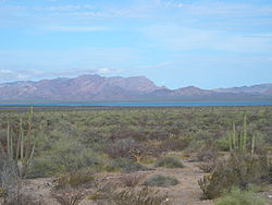
The territory is made up of four physiographic provinces: the Sierra Madre Occidental, the Sierras and Paralelos Valleys in the center, the desert, and the coast of the Gulf of California. It is composed primarily of semi-arid deserts and grasslands, where only at the highest elevations does sufficient rainfall occur to support other types of vegetation.
Eight indigenous peoples live in Sonora, including the Mayos, the Yaquis and the Seris. It has been economically important for its agriculture, livestock (especially beef) and mining since the colonial period, and for its status as a border state since the US invasion of Mexico. After the sale of La Mesilla, Sonora lost more than a quarter of its territory. From the 20th century to the present, industry, tourism and agribusiness have dominated the economy, attracting migration from other parts of Mexico.
It is divided into 72 municipalities. Its capital is Hermosillo. Other important localities are: Ciudad Obregón, Navojoa, Caborca, Guaymas, Huatabampo, Puerto Peñasco, Nogales, Agua Prieta, San Luis Río Colorado, Nacozari de García and Cananea.
Geography
The state of Sonora has a land area of 179,355 km² and is part of the United Mexican States. It is located in its northwestern region and ranks second in size among all the federal entities of the Mexican Republic, with a portion of 9.2% of the total surface.
Its geographical location is between 32°29' and the 26°14' North latitude and between 108°26' and the 105°02' longitude west of the Greenwich meridian. It limits to the north with the United States of America, to the south with the state of Sinaloa, to the east with Chihuahua and to the west with the Gulf of California and Baja California. Its physiography is made up mostly of plains and mountains.
Natural Regions
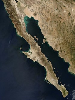
The coast with the Gulf of California was formed by the separation of the Baja California peninsula between ten and twelve million years ago. The Gulf of California itself was formed between 5.5 and 6 million years ago. The state has 816 kilometers of coastline, all on the gulf, with relatively shallow and calm waters. There are beaches along most of the coast, some with fine white sand.
The desert region is mainly composed of scrub, except for the Altar area where it is sandy. It constitutes the richest and most varied desert in terms of life and biotic communities in all of America. The Altar desert area is home to the El Pinacate volcanic field.
The parallel mountain ranges and valleys of the center of the state are between 50 and 120 kilometers wide, scattered between the Sierra Madre and the Gulf of California. Weather patterns bring moisture and clouds eastward from the Pacific Ocean, forming rivers and streams that cross the valley area and empty into the gulf. These rivers have brought volcanic rock sediment from the Sierra Madre and this has buried most of the mountains and hills in the center of the state, turning them into plains. These mineral-rich soils are hundreds of meters thick in places, making the region very fertile, just lacking in water.
The Sierra Madre Occidental dominates the east of the state, it has less extreme temperatures and, due to the altitude, more rain. As humid air masses enter the region from the ocean and reach the mountains, they cool and this leads to precipitation, mostly rain but sometimes snow in the higher regions like Yécora, Cananea and Nogales.. This process removes most of the moisture from the air and carries it into various rivers and streams that empty into the Gulf as well as underground aquifers in the plains.
Climate
During the Pliocene, the separation of Baja California and the development of the Gulf of California drastically reduced the moisture entering Sonora, leading to severe regional aridity in both Sonora and Baja California. This created xeric scrub communities and the development of unique species for this region.
Ninety percent of the state has desert or arid conditions. The other climate types are restricted to areas of the state with higher altitudes such as the Yécora area, the mountains north of Cananea, and a strip along the southeast of the state to the border with Chihuahua.
The average high temperature ranges from 12.7 ℃ in Yécora to 48.5 ℃ in the municipalities of Hermosillo and Cajeme. The average low temperature ranges from 5.9 in Yécora to 15.0 ℃ in the municipality of Hermosillo. In winter cold air masses arrive from the north to the state, this can produce freezing temperatures and strong winds at night in the highest places, but the temperature can return to be even during the day. Freezing temperatures almost never occur in the lowlands. In February 2011, the Mexican government recorded a record low temperature in Yécora of –12 ℃.
Precipitation is seasonal and occurs almost always at the higher elevations. In arid or semi-arid hotlands, evaporation far exceeds precipitation. The most arid area of Mexico, the great Altar desert, is found in this state. The eastern part of the state, dominated by the Sierra Madre Occidental, has less extreme temperatures and relatively more rain due to the altitude.
Flora and fauna
The state has a wide variety of flora species, scrub predominate in the coastal plain, northwest and central region. There are jungles in the southeastern part of the state, followed by the subtropical scrub; the grasslands are located to the north and the temperate forests are located on the border with Chihuahua.
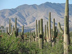
In dry regions there is a wide range of xerophytic plants, such as saguaros, and trees such as mesquite, palo blanco, palo fierro, palo verde and torote, since they have adaptation systems such as growing at the banks of streams and on the slopes of the hills, not being very high to counteract the force of the wind and having very hard wood and long roots that penetrate the earth until they find a water reservoir.
Most of the forests are located in the northeast of the state and cover about 6.4% of the state. This area is the one with the coldest temperature. Deforestation is a significant problem, especially after 1980, due to the increase in the rate of tree felling. Many mesquite trees have also disappeared due to the demand for local fuels and the market for mesquite charcoal in Mexico and the US.
Most of northern Mexico suffers from one of the highest desertification rates in the world due to land degradation in arid and semi-arid areas, leading to loss of biological and economic productivity, but the process is more serious in Sonora than in Sinaloa, for example. Land degradation occurs from land clearing for agriculture, planting of non-native grasses for grazing, clearing of forests, over-consumption of natural vegetation, and soil salinization from irrigation.
The fauna of Sonora is rich and varied, being able to count as main animals the following, grouped by species:
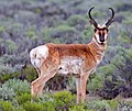
- mammals: squirrel, hammer, wild boar, goat, cacomixtle, codorniz, rabbit, coyote, whose, cat montés, boar, jaguar, hare, wolf, musaraña (Soriciade), ocelote, ounce, black bear, pecarí de necklace (Tayassuidae), puma, rat
- birds: agachona, aguilucho, alondra, alcatraz, owl, chachalaca, correcaminos, gallardeto, hen of water, ganga, garzo, gavilán, seagull, falcon, huilota, huitlacoche, bird fly, quelelele, jumpapared, tecolote, tomatolo;
- fish: tent, goldfish, sailing fish, tilapia, totoaba, sea vaquita.
- reptiles: boa, chameleon, coral, iguana, lizard, sapo, rattle snake, real snake, turtle, monster of Gila.
In addition, the state has a paleontological record notable for the fossil fauna that constitutes it as porfers, brachiopodes, molluscs, arthropods and equinodermos.
Hydrology
With the exception of the Colorado River, the river and aquifer systems in Sonora are the result of rainfall from clouds over the Sierra Madre Occidental. This water runs downstream west of the mountains through canyons and valleys to the prairies and the Gulf of California coast. Sonora has seven main rivers, the Colorado, the Concepción, the San Ignacio, the Sonora, the Mátape, the Yaqui and the Mayo. Dams such as the Álvaro Obregón (Oviáchic), the Adolfo Ruíz Cortines (Mocúzari), the Plutarco Elías Calles (Novillo), the Abelardo L. Rodríguez and the Lázaro Cárdenas (La Angostura) have been built along some of these rivers., in at least two of them where natural lakes already existed. Some of the dams formed large deltas, such as the one on the Río Mayo. The largest aquifers are found mainly between Hermosillo and the coast, the Guaymas valley, and the area around Caborca. Many of these have had problems due to overexploitation for irrigation in agriculture.
Protected areas
Sonora has 18,462 km² of protected wildlife areas. There are seven federally protected natural areas in the state, of three types: biosphere reserves (3), areas for the protection of flora and fauna (2) and areas for the protection of natural resources (2). In summary they are:
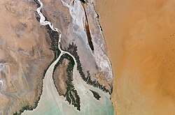
- reserve of the High Gulf Biosphere of California and delta of the Colorado River (SINAP 4), which occupies the northwest part of Sonora and the northeast part of Baja California, in the northernmost part of the Gulf of California and the delta of the Colorado River. The area is home to a wide variety of marine species. There are also rocky beaches along this with fine sand. Some of these are home to seal groups and sea lions. The reserve was created in 1993 and covers an area of 934 756 ha. On land, there are vegetation of dry land, coastal dunes and a estuary.
- reserve of the biosphere El Pinacate and Gran Desierto de Altar (SINAP 6), established in June 1993 that is located between Puerto Peñasco and the border with the United States, in the great desert of Altar. It consists of an area with a series of giant extinct volcanic craters, which are surrounded by flora and fauna. It is frequently visited by foreign tourists, researchers and photographers. The reserve has a museum, which shows the history of the place and its formation to the present. It was declared a World Heritage Site in 2013.
- San Pedro Mártir Island (SINAP 43), established on 13 June 2002, which protects 30 165 ha marine and scrub areas.
- Area of protection of flora and fauna Sierra de Álamos-Río Cuchujaqui (SINAP 47), established on 19 July 1996, which protects 92 890 ha of areas of low-dropod rainforest, encino forest, pine-dry forest and thorny bush.
- Area of flora and fauna protection Gulf of California Islands, shared with the states of Baja California, Baja California Sur and Sinaloa. It was established in August 1978 and recategorized on 7 June 2000. Correspond to Sonora:
- San Jorge Bay and islands cover an area of 130 km2 and are located on the north coast of Sonora, between Caborca and Puerto Peñasco. The islands were made federal reserve for the first time in 1978 due to their important migratory birds. There are a particularly important number of species such as Sterna antillarum, colonies of Sula leucogaster, Myotis vivesi and Zalophus californianus. The islands are large rocks and are white by the guano. The beaches extend 10 km and end up in San Jorge Bay in the south. The area is home to sea lions and a type of fishing bat. There are sand dunes and vegetation of arid area as well as a small estuary. The climate is very arid and semi-heat with an average temperature of between 18 and 22 degrees centigrade.
- Shark Island is an ecological reserve with about 300 species of plants living in the wilderness and marine. The island was once inhabited by the Seris, and still considered its territory.
- Sierra Los Ajos-Bavispe National Forest Reserve;
- national hunting reserve Cajón del Diablo.
In addition, there are three state-level protected areas:
- Abelardo L. Rodríguez-El Molinito Dam System, under the category of forest protection zone of the city of Hermosillo;
- protected ecological reserve Arivechi -Cerro Las Conchas;
- protected ecological reserve Estero del Soldado;
Other areas include Las Barajitas Canyon, a municipal protected natural area established in 1993 consisting of three different ecosystems, located 31 km north of San Carlos. It has a kilometer of beaches and a canyon that has two distinct microclimates, one arid and desert-like, and the other subtropical. The area has a wide variety of fauna including whales, dolphins and manta rays that can be seen from the coast depending on the season. Some activities for visitors are the use of kayaks, diving and fishing. There are also caves as well as a solar observatory.
The conservation unit of the Mesa el Campanero-Arroyo El Reparo area 43,000 ha is an area subject to ecological conservation, which is part of the biogeographic corridor of the Sierra Madre Occidental and the Yaqui and Mayo River Basin and is located in the municipality of Yécora. It is a plateau with mountains covering 430 km², containing pine and tropical forests, rivers, streams, rock formations and dirt roads. Due to its altitude between 700 and 2100 meters above sea level, its temperature is low compared to that of the state. It is part of the Sierra Madre Occidental bioregion and the source of the Yaqui and Mayo rivers.
Toponymy
There is some conjecture about the origin of the name Sonora. One is that it comes from the word Señora, which was the first name given to the region by Spanish explorers, led by Diego de Guzmán, due to their arrival at the Yaqui River on October 7, 1533, day of Our Lady of the Rosary. Since the natives could not pronounce the letter 'ñ', Señora became Sonora. A second conjecture says that the indigenous people lived in reed huts called sonot in their language. The Spanish changed that word to sonora and later extended the name to the entire province.
History
Pre-Hispanic period
Some of the oldest archaeological sites found in Sonora are related to the Cochise culture, which developed in the Paleoamerican period. In the northwest of the state, some sites in the basins of the Altar, Magdalena and Concepción rivers show an evolution from the Cochise culture to the Trincheras culture, characterized by certain types of ceramics and by the construction of terraces and walls on the slopes of the hills. Among the most characteristic sites of that culture is Cerro de Trincheras.
Colonial Period
Although there is little information about what happened in the territory after the arrival of the Spanish in Mexico in the XVI century, it is known that there were Spanish explorations but no settlements, largely due to the resistance of the original peoples, mainly the Yaqui people. The first settlements were founded by the Jesuits and their mission system in New Spain.
The most famous missionary in Sonora, as well as in much of what is now the southwestern United States, is the Italian Jesuit, Eusebio Francisco Kino, known as El Padre Kino. He arrived in Sonora in 1687 and began his work in the Pimería Alta area of Sonora and Arizona. He founded his first mission in Cucurpe, then established churches and missions in other towns such as Los Remedios, Ímuris, Magdalena, Cocóspera, San Ignacio, Tubutama, Caborca and others. He also taught European techniques for agriculture to the natives that he preached, to allow the development of an economy for the benefit of the natives.
However, during the 18th century the Spanish system and the missions generated discontent among the indigenous population due to expulsion of many of them from their lands, especially those close to the mines that were of main interest to the Spanish crown; This generated sporadic attacks against them and despite the fact that the Spanish had built prisons to protect themselves, the Spanish settlements were in disarray. In 1767, the King of Spain, Carlos III, expelled the Jesuits from Spanish-controlled territories, thus ending the mission system. At the end of the 18th century, Sonora together with Sinaloa formed part of the Intendencia de Arizpe in New Spain, which was the division territory that preceded the Western State.
In independent Mexico
The colonial period ended in Sonora with the Mexican War of Independence from 1810 to 1821; however, Sonora was not directly involved in the war. Independence came in the form of a decree. One positive result of independence was that it allowed for economic development. The old province of Sonora and Sinaloa was divided in 1823 to form the states of Sonora and Sinaloa, establishing the Sonoran capital in Ures. However, they would reunify again in 1824 under the Estado de Occidente and would remain so until 1830, despite the fact that Sonora was declared a state in the Mexican constitution of 1824. Sonora separated from Sinaloa again in 1831 when it wrote its first state constitution, which placed the capital in Hermosillo. Later followed a period of political instability caused by the dispute between liberals and conservatives over the type of government the new country should have.
The US-Mexico War brought only one major military confrontation between US and Mexican forces, but the consequences would be severe for the state. In October 1847, the warship Cyane besieged the Bay of Guaymas, resulting in American control of this part of the coast from then until 1848. When the war ended, Sonora lost 339,370 hectares of its territory to the United States. United through the Treaty of Guadalupe Hidalgo. On top of that, the war ruined the state economy. Sonora would lose more territory in the 1850s, through the Treaty of La Mesilla. Before the war, Sonora was the largest entity in Mexico. The area's post-war weakness made it susceptible to buccaneers such as William Walker, Gaston de Raousset-Boulbon, and Henry Alexander Crabb who attacked Sonoran ports such as Guaymas and Caborca. However, most of the attacks were repelled. The economy would not recover from the war until the late 1850s, when Ignacio Pesqueira became governor and attracted foreign investment to the state, especially in the mining sector, as well as working to create a foreign market for the agricultural products of sound.
During the French intervention in Mexico, Sonora was invaded by French troops as part of their effort to install a monarchy in Mexico under Maximilian I. The port of Guaymas was attacked by forces under Armando Castagny, forcing the Mexican forces to under the command of Pesqueira and General Patoni to retire to the north of the city. French troops attacked the Mexicans again at a place called La Pasión, again resulting in the defeat of the Mexican resistance. The French were not defeated in the state until the Battle of Guadalupe de Ures in 1866 by Pesqueira, Jesús García Morales, and Ángel Martínez. Shortly after this, the state's current constitution was written in 1873, and its capital would be permanently moved to Hermosillo.
During the regime of Porfirio Díaz at the end of the XIX century and the beginning of the XX century, significant economic changes were promoted. These changes generated rapid economic growth, which had profound political and social consequences. Sonora, along with the rest of the northern border states, rapidly increased in importance. The development of the railway system integrated the state economy with the national one, and also had an effect of greater federal control throughout the territory of Mexico. After 1880, the rail system traversed north into the United States, which remains an important part of economic relations between the two countries. Despite that, the changes also allowed foreigners and certain Mexicans to seize large tracts of land in Mexico. In Sonora, Guillermo Andrade controlled 1,570,000 hectares, Manuel Peniche and the American William Cornell Greene had close to 500,000. The foreign owners of the industry also tended to bring in foreign workers, including from Asia. Chinese immigration to Sonora began in this period, and the Chinese soon became an economic force as they built small businesses that would spread wherever there was economic development in the state.
The appropriation of land for both agriculture and mining put new pressure on the Yaquis and other native peoples of Sonora. Yaqui resistance up to this point had given them fairly autonomous control of a portion of the state, and they maintained their system of agriculture along the Yaqui River.
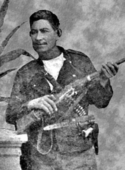
Invasion of this land led to uprisings and guerrilla warfare by the Yaquis after 1887. In 1895, the federal and state governments began violent repression of the Yaquis and began expelling captured Yaquis to plantations in southeastern Mexico, especially the henequen plantations in the Yucatan peninsula. Yaqui resistance continued well into the 20th century, with expulsions peaking between 1904 and 1908, at which point, about a quarter of this population had been sent out of state. Some more were forced to escape to Arizona.
20th century
The policies of the Porfirio Díaz government caused resentment not only among the Yaquis, but also in the rest of Sonora and the country. One of the antecedents of the Mexican Revolution was the Cananea strike of 1906, which sought negotiations with the American mining owner William Greene, but he refused to meet with the nearly 2,000 strikers. The strike quickly turned violent as the miners tried to take control of the mine and exchanged fire. When Mexican federal troops arrived two days later, they put a brutal end to it all, executing those suspected of leading the strike. In such a way that the strike increased resentment towards Díaz, not diminished strikes in other parts of the country.
In late 1910, the Mexican Revolution broke out and Díaz was quickly removed from office, the rest of the war determining who would remain in power after this. The then governor of Coahuila, Venustiano Carranza, sought refuge in Sonora, and became one of the main protagonists for the remainder of the war, with his main base of operations in Hermosillo. After Díaz was removed from office, Carranza was in a power struggle against Álvaro Obregón and others.
Although Carranza obtained the presidency in 1920, the conflict with Obregón and his resistance did not cease, so Carranza tried to suppress political opposition in Sonora. This caused Álvaro Obregón and his allies (mainly Abelardo L. Rodríguez, Benjamín Hill and Plutarco Elías Calles) to sign the Agua Prieta Plan by which they were unaware of the Carrancista government, this movement soon came to dominate the Mexican political situation, but caused instability generalized politics. Obregón succeeded in removing Carranza from office and becoming the next president of Mexico. For the 1924 presidential elections, Obregón chose Plutarco Elías Calles as his successor, who was also a revolutionary leader from Sonora. This effectively ended the war, but the hostilities had again destroyed the Sonoran economy. From 1920 to the early 1930s, four Sonorans would occupy the presidency of the republic, Adolfo de la Huerta, Álvaro Obregón, Plutarco Elías Calles and Abelardo L. Rodríguez.
The modernization and economic development efforts begun in the Porfiriato would continue throughout the Revolution and for the rest of the XX century. In the late 19th century and early 20th century, the process of bringing electricity vastly increased the demand for copper, bringing with it a large increase in mining in Sonora. Cananea grew very quickly from a village of 900 to a city of 20,000. It also created a network of roads, railways, and other connections along the border. However, the organized development of state agriculture was halted by the Revolution, the Great Depression, and other political problems.
In the 1930s, Sonora benefited from several national policies focused on the development of cities on the US border and from the construction of several dams to aid the development of agriculture and general water demand. Major agricultural reforms began in the 1940s in the Río Mayo area, when the delta was cleared of natural vegetation and converted to farmland. Water for these farms was secured with the construction of the Mocúzari Dam about 24 kilometers from Navojoa. When it was completed in 1951, there was a system of canals, wells, and roads to support large-scale agriculture for export. During the Second World War the State was economically benefited, especially the fishing towns, due to the need for canned products.
Over the last half of the 20th century, the state's population has grown and foreign investment has increased due to its strategic location near the border and its port of Guaymas. This has allowed the development of modern infrastructure such as highways, ports and airports, making the state one of the best connected in the country. In 1964 a bridge was built over the Colorado River to link Sonora with neighboring Baja California. An important sector of the economy has been industry, which brought with it the Ford plant in Hermosillo and several assembly plants called maquiladoras on the border with the United States. One of the fastest growing sectors of the economy has been tourism, especially on the coast, this has led to the emergence of hotel infrastructure, especially in Puerto Peñasco.
Demographics
According to the results of the 2010 Population and Housing Census of the National Institute of Statistics and Geography (INEGI), the state of Sonora had 2,882,628 inhabitants, which represented 2.4% of the population of Mexico. Of the total, 50.3% were men and 49.7% were women. The annual population growth rate for the entity during the period 2005-2010 was 2.1%. Population growth has been constant since 1940. The census also indicated that half of the population is 26 years of age or younger.
The population density in Sonora is 14.8 inhabitants per square kilometer, which makes Sonora one of the least densely populated entities in Mexico, in place 29 out of 32; highlighting that the state is the second largest in the country, after Chihuahua.
In the state, 60,310 people speak an indigenous language, which represents 3% of the population. This population is located mainly in the south of the State. The most frequent indigenous languages are Mayo (46.4%) and Yaqui (26.6%).
Most populated cities
The following is a list of the most populated cities in Sonora according to the latest population census (2020), not to be confused with the most populous Municipalities.
| Historical population of Sonora | |||||||||||||||||||
| Year | 1895 | 1900 | 1910 | 1921 | 1930 | 1940 | 1950 | 1960 | 1970 | 1980 | 1990 | 1995 | 2000 | 2005 | 2010 | 2015 | 2020 | ||
| Population | 192,721 | 221,682 | 265,383 | 275,127 | 316,271 | 364,176 | 510.607 | 783,378 | 1,098,720 | 1,513.731 | 1,823,606 | 2,085,536 | 2.216,969 | 2,395,900 | 2,662,480 | 2,850,330 | 2,944,840 | ||
| Source: INEGI | |||||||||||||||||||
| Graphic of demographic evolution of Sonora between 1895 and 2020 |
 |
Information from the National Institute of Statistics and Geography (INEGI). |
Culture
Some of the most important cultural festivals in the state are the Pitic Festival in Hermosillo, the Alfonso Ortiz Tirado Festival in Álamos, the Fiestas de San Francisco in Magdalena de Kino, and the Guaymas Carnival. Sonora also has two magical towns, the previously mentioned Álamos and Magdalena de Kino.
The most important museums in Sonora are the Museo Costumbrista de Sonora in Álamos, the Museo Casa del General Álvaro Obregón in Huatabampo, the Museo de los Yaquis in Cócorit, Cajeme; the Comca'ac Museum (of the seris) in Bahía de Kino, Hermosillo; the Regional Customs Museum in Ures, the Silvestre Rodríguez Museum in Nacozari de García and the Museum of the Workers' Struggle in Cananea.
The most important indigenous dances are the deer dance, the páscola dance, and the matachines dance, which is performed mainly in Huatabampo. Medicine with medicinal plants is still practiced especially in rural areas.
Since colonial times, much of the state's economy has been related to ranching, with cowboys being an important part of the state's identity. Today, most of them work in industry and tourism, but the clothing and folklore of the cowboy is still important. Jeans and cowboy hats are still very popular, especially among men. The cowboy lifestyle is associated with pickup trucks. This influence extends to popular music.
The most popular musical style in the area is norteño, which includes the Banda. Norteño music developed from the late 19th century to the early XX throughout the border region of northern Mexico and the southwestern United States, influenced by waltzes, polkas, rancheras, mazurkas, and corridos. An important instrument of the genre is the accordion, first brought to the region by German immigrants. Sonoran versions of this type of music developed from the 1920s to the 1960s. Many of the first successful compositions are by anonymous composers. In the 1950s, with the expansion of radio, the popularity of the genre increased as norteño music from Nuevo León, Durango and other states began to be heard. These versions regularly included songs written by Sonoran composers such as Jesús's Amor de madre "El Chito" Peralta, Cuatro milpas, Deceptive World, El Venadito, La Higuerita and El Tarachi by Aristeo Silvas Antúnez; La barca de Guaymas by Ventura Romero (President José López Portillo awarded the authorship to José López Portillo y Weber, his father), My First Love by Silvestre Rodríguez and Échale un cinco al piano by Manuel S. Acuña. The youth who worked in the fields and ranches identified in a particular way with this music.
The first formal norteño group was Los Cuartetos de Sonora, formed by the Carvajal brothers. In contrast to bands from other states, which were duets, soundtracks were trios before becoming quartets and quintets with the addition of more musical instruments. The lyrics almost always talk about important moments in everyday life that are celebrated and embellished. Only recently has norteño music been accepted by other social classes outside of those in which it developed. Sonora's norteño groups, sometimes called taca-tacas, can be heard at social events of all socio-economic levels.
Archaeology
The region has been an area of study for archaeologists, anthropologists and historians; who have worked with pre-Hispanic ruins and fossilized bones. However, much of the research in this area is still in its early descriptive stage and many basic questions remain unanswered. Sonora is considered a separate cultural zone from Mesoamerica, although there is some Mesoamerican influence. The main differences between the Sonoran cultures and those of Mesoamerica are the cultivation in dry climates, although corn, squash and beans are produced in the same way. There is also greater dependence on resources not cultivated by man. Although it is worth noting that the most important thing is the lack of cities as such in the pre-Hispanic history of this region, with only small populations near water sources and a weak hierarchical system. The cultures here also share some characteristics with those of the Southwestern United States, but they are also remarkably different.
Cerro de Trincheras is an important archaeological site located in the municipality of the same name, with petroglyphs, plazas, and astronomical observatories. The exact purpose of the area is disputed, but it is known that it reached its splendor between 1300 and 1450 AD, when it had a population of about a thousand inhabitants, who lived by growing corn, squash, cotton, and agave. Its largest structure is called La Cancha, which is at the base of the north side of the hill. It is a rectangular patio characterized by its stacked rocks on the banks, which measure 51 by 13 meters. Some researchers believe that it was a type of court for the ball game and others believe that it was a kind of open-air theater. On the hill itself there is an observatory, which gives a view of the place. Most of the area's stone and shell artifacts were found there. The Plaza del Caracol is characterized by its one and a half meter stone wall in an open spiral, most likely used for ceremonies.
Gastronomy
As in other parts of Mexico, Sonoran cuisine is basically a mix of indigenous and Spanish influences. As the Spanish advanced north into the Valley of Mexico, they found the diet there simpler, with the basics of corn, beans, and squash, but without the extra variety found in the south. For this reason, those Spaniards influenced the way in which that diet was developed. They brought to Sonora European crops of flour, beef, dairy products, pork and more, as well as dishes and ingredients from central and southern Mexico, such as tortillas, more varieties of chiles and tamales. Cowboy culture has been an important aspect of Sonoran culture since colonial times, and much of the cuisine is based on what cowboys ate in their early days, even though most Sonorans no longer work outdoors. Sonoran cuisine is not limited to its current geography. Arizona, especially in the southern area near the border, has a cuisine that is also rich in flour, cheese, and beef; This is how it was taken by the Spanish, to what was once part of Sonora. Both states carry on the cowboy tradition. Due to Sonora's status as a border state, its cuisine has also received significant influence from the US.
Two important components of the state's diet are shellfish and beef, the latter playing a larger role in Sonora than in the rest of Mexico. The beef is usually cooked on the grill, and Sonorans prefer robust cuts like brisket and brisket. Machaca or dried meat is still enjoyed, although refrigeration has made the need to dry the meat for preservation disappear. Sonora also has a reputation for producing fine cuts of beef, but the leaner Spanish cattle have been replaced by Angus, Herefords, and Holsteins. Dishes based on or containing beef include shredded meat, meat with green slices, carne asada donkeys, meat with chile colorado, beef chorizo, dried meat, machaca, menudo, the gorditas and the meatballs. Seafood or seafood is also an important part of the cuisine, especially near the coast as there is a wide variety of fish and clams in the Gulf of California. Seafood is usually cooked in very simple dishes, such as fish tacos, seafood soups, shrimp rice, or octopus and shrimp dumplings. Some of the most consumed fish are groupers, marlin and manta rays.
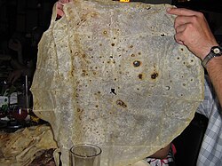
Tortillas are a fundamental part of the Sonoran diet, but they are made of flour instead of corn. In Sonora, these tortillas are larger and thinner than those made elsewhere. Dairy products are common in the dishes, with chiles playing a smaller role. Even so, an important native chile is the chiltepin, which people continue to cultivate in the dry areas of northwestern Mexico.
The kitchen contains various soups and broths, combining regional ingredients with elements from all over Mexico, with beef, pork and corn. Seafood soups are popular along the coast. These dishes include wheat pozole, beef pozole, menudo con pata, corn soup, pumpkin broth, and shrimp soup. Tamales are made with dried corn dough and with fillings; such as carne con chile, olives, potatoes, chile colorado and other ingredients, wrapped in dried corn husks and steamed. Tamales fillings vary by state but the most popular include fresh corn and cream, green chile strips and cheese, beef with chile colorado, and sometimes seafood.
The various cultures that have arrived in the state have influenced the development of breads, desserts and sweets. Most of the sweets are made with cow's milk, sugar cane, almonds, walnuts, rice, sunflower seeds, and piloncillo. Among these are the pipitorias, the jamoncillo, the biznaga covered, the pumpkin covered, the sweet potato covered, pumpkin in honey, piloncillo, pitahaya snow, crystallized oranges and lemons.
Bacanora is a regional liquor with designation of origin that for decades has been produced in the town of the same name, located in the center of the state. It is based on the agave plant (Agave vivipara) like mezcal and tequila and comes in various styles, including añejo. It has a distinctive flavor. An estimated half a million plants are harvested from the wild to make this drink each year, which has led to concerns about its over-exploitation.
Government
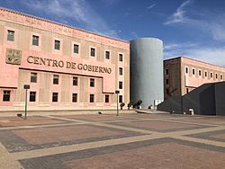
The form of government of Sonora is described in its Constitution, which dates from 1917. In accordance with the Political Constitution of the United Mexican States, the State of Sonora adopts for its internal regime the republican, representative, democratic form of government, secular and popular, based on its territorial division and political and administrative organization, the Free Municipality, according to this Constitution and its respective laws. The state government is divided into three branches: Executive, Legislative and Judicial.
The Executive Power is vested in a single person called the Governor of the State of Sonora, elected by direct vote every six years without the possibility of re-election. He takes office on September 13 of the year of his election. The current governor for the period 2021-2027 is Alfonso Durazo Montaño of the National Regeneration Movement (Morena) party.
The Legislative Branch is unicameral and consists of 21 deputies directly elected and 12 deputies elected by proportional representation for a period of three years without the possibility of re-election; these make up the Congress of the State of Sonora. The current Legislature (2021-2024) is the LXIII. The State Congress is installed on September 16 of the year of its election.
The Judicial Power is deposited in the Supreme Court of Justice, in Regional Circuit Courts, in First Instance Courts and in Local Courts. There is also the Council of the Judiciary of the State of Sonora, as a permanent body for the administration of justice. The Supreme Court of Justice is made up of seven Proprietary Magistrates and seven Substitutes and will work in plenary session, in Chambers or in Committees. Rafael Acuña Griego is the president of the State Supreme Court of Justice.
At the federal level, Sonora has three senators and seven deputies (those who represent the seven federal electoral districts of the state) in the Congress of the Union of Mexico. Senators are elected by popular election every six years and representatives every three. The current federal legislature is the LXIII Legislature.
On June 7, 2015, the 2015 Sonora state elections were held, where a new Governor, municipal presidents, local and federal representatives were elected. On June 15, 2015, the State Electoral Institute of Sonora, through the President Counselor Guadalupe Taddei Zavala, delivered the majority certificate to Claudia Pavlovich Arellano, which accredits her as Governor-elect for the period 2015-2021. This after the validity of the election was declared in the permanent session of the state count of the election for State Governor that concluded the same day.
Local government
The State of Sonora is politically divided into municipalities that represent the third level of government in Mexico, below the state and federal levels. The state of Sonora is made up of 72 municipalities that have their own government that resides in the City Council, which is directed by a Municipal President elected by popular election every 3 years. The municipalities are recognized as the integral parts of the State.
The Sonoran Constitution declares that the State has a multicultural composition, originally based on indigenous peoples, and that they retain their own social institutions, economic, cultural and political, or part of them. Thus, the Constitution guarantees the right of indigenous peoples and communities to self-determination within their territory and also guarantees respect and equal opportunities for their integral development.
Education
According to the 2010 population and housing census, in Sonora the literacy rate of people between 15 and 24 years of age is 98.3% and that of people 25 years of age or older is 95.6%.
School attendance for people ages 3 to 5 is 43.5%; from 6 to 11 years is 97.1%; from 12 to 14 years old it is 94.3% and from 15 to 24 years old it is 45.8%.
Institutions of Higher Education
The main institution of higher education is the University of Sonora (Unison), founded in 1942 by state decree, the university has grown while maintaining its identity. It is divided into six units throughout the state, with campuses in Nogales, Santa Ana, Caborca, Hermosillo, Navojoa, and Ciudad Obregón. Hermosillo, as the main venue, houses the majority of the students and the educational offer. The institution offers study programs in more than forty specialties through six divisions. Master's and doctoral degrees are offered primarily in science and technology. La Unison is currently one of the most important public institutions of higher education in Mexico.
The Technological Institute of Sonora (Itson) has nearly 17,000 students and offers twenty-three bachelor's degrees, eight master's programs, and three doctoral programs within its six campuses. The institution was formed at the initiative of the Cajemense society in Ciudad Obregón in 1955, but received its current name in 1962. Originally it was a technical training school, but it was reorganized as a university in 1973. It is currently the largest technological institution in the state.
In addition, the entity has other public and private institutions, such as the Monterrey Institute of Technology and Higher Education, Campus Sonora Norte (ITESM-CSN), the Technological Institute of Hermosillo (ITH), the State University of Sonora (UES, formerly Cesues), the Technological University of Hermosillo (UTH), the University of the Valley of Mexico (UVM), the Sonoran Institute of Public Administration (ISAP), among others.
Economy
Despite the arid terrain and extreme climate, Sonora, like the rest of northern Mexico, is rich in natural resources. This has led to a history of self-sufficiency, and many Sonorans see themselves as inheritors of this pioneering tradition. A large part of this is related to the culture and tradition of the countryside, since a large part of the state economy was related to livestock.
The state has a highly-skilled workforce and strong ties to the US economy due largely to a common border with Arizona. This link affects various sectors of the state economy. Sonora has GDP growth that is generally higher than the rest of the country, with growth of 4.0% in 2014, compared to the national average of 3.3%. Although this growth was much higher before the 2008 economic crisis, for example, in 2006, growth was 8.4% compared to the national 4.8%. The economic success of the state, especially in its industrial and agricultural sectors, as well as on the border, has attracted many immigrants from central and southern Mexico to the state.
Most of the state industry is related to agriculture and fishing, food processing and packaging. In the 1980s, a large number of industrial plants called "maquiladoras" were installed in the state, most located along the border and in the capital, Hermosillo. These assembly plants were mostly controlled by US companies that were given liability and tax breaks. By the end of the 20th century, these companies had a major influence on the expansion and modernization of the Mexican border area, including Sonora. Not only did they bring new sources of employment, but the US management style also influenced business in the state and in the rest of northern Mexico. However, the maquiladoras came to a head in 2001, when many US companies moved their production to China. The number of maquiladoras decreased, but the value of their final product has increased, in the same way as those who prefer goods with higher added value and automation. In addition, many plants abandoned by US companies were acquired by Mexican companies. Despite the decrease in the number of maquiladoras, their exports have increased.
Mining
In addition to cattle ranching, mining is another traditional element of the Sonora economy, which began with an important find near the city of Álamos. Although the area's silver is nearly gone, Sonora continues to play an important role in Mexico as one of the world's top fifteen mineral producers, leading in silver, celestine, and bismuth. Sonora is the leading producer of gold, copper, graphite, molybdenum and wollastonite. There are still silver deposits in the Sierra Madre Occidental. Sonora also has one of the largest coal reserves in the country. The state has the largest mining area in Mexico, and three of the most important mines in the country: La Caridad, Cananea and Minería María. It is also home to the oldest copper mine in North America, located at Cananea. Grupo México, with mining operations mainly in Cananea, is the third largest copper producer in the world.
The mining industry in Mexico was dominated mainly by the Spanish during the colonial period, and by foreign companies after independence. In the 1960s and 1970s, the government expelled most foreign interests in Mexican mining, beginning with increased ownership restrictions on Mexican mining companies. These restrictions were easy when they began in 1992, with the only restriction being that the operating company was Mexican. Just three years after the change, more than seventy foreign companies, mostly American and Canadian, opened offices in Hermosillo.
The main mining operations have had a severe environmental impact, especially in the nearby areas, Cananea being the main example. Mining has been going on there for more than a century, and mining waste has contaminated the San Pedro and Sonora rivers near the mine, threatening both basins. Mining operations also destroy nearby forests due to the demand for construction materials and fuel. Few old trees remain near the city of Cananea and the town of San Javier in central Sonora. In August 2014, Grupo México was responsible for what is considered the worst environmental disaster in the history of the mining sector in Mexico, when more than 40,000 cubic meters of copper sulfate were spilled into the Sonora River, affecting at least 20,000 people., thousands of hectares of crops and heads of cattle.
Infrastructure
In the state, Federal Highway 15 has 2,711 kilometers in the State, added to the rest of the state highways of 4,591 kilometers; In total, the state has 7,302 kilometers of highways. Sonora also has 2,008 kilometers of railways, 5 international airports (the main one is the General Ignacio Pesqueira García International Airport) and 2 seaports (the main one is Guaymas).
150 radio stations operate in the state (53 amplitude modulated and 97 frequency modulated) as well as 90 television stations. The entity also has 466 establishments of various categories for lodging.
Transportation
Sonora lies in a corridor that has connected the central Mexican highlands north to the United States along the Pacific coast since at least the colonial period, and there is evidence that this corridor existed in the pre-Hispanic period as well. Today, it is still a major travel and shipping corridor, with railroad tracks and Federal Highway 15 following them. The state has a total of 24,396 km of highways. Railroad lines consist of those going to the United States. The most important commercial port is in Guaymas, and some smaller ones for tourism in San Carlos, Puerto Peñasco and Bahía de Kino. The state has four airports in the cities of Hermosillo, Puerto Peñasco, Ciudad Obregón and Nogales. These airports connect the state with 112 locations both in Mexico and abroad.
Tourism
The main tourist attraction of Sonora are its beaches, towns, as well as the desert that joins the sea and the mountains. The diversity of its ecosystems makes it possible for the State to carry out a wide variety of recreational and tourism activities such as diving, fishing, swimming, hiking, mountain biking, hunting tourism, and ecological tourism.
The best known beaches are San Carlos, Puerto Peñasco and Bahía de Kino. San Carlos, and its Los Algodones beach is one of the most visited areas on the Sonoran coast. San Carlos has a wide variety of marine life on its shores, making it a popular spot for sport fishing and scuba diving. Some Yaquis and Seris near Guaymas and Cerro del Tetakawi live by fishing.
Puerto Peñasco is located in the far northwest of the state in the Superior Gulf, somewhat near the mouth of the Colorado River. It has 110 kilometers of beaches in calm waters, near the Altar Desert and the El Pinacate biosphere reserve, with one of the driest climates in Mexico. Since the 1990s, it has undergone large-scale development along its extensive beaches.
In the municipality of Hermosillo is Bahía de Kino, the beaches of the bay are white sand and calm and warm water. On the nearby islands you can see sea lions. Near this coast is Isla Tiburón, the largest island in Mexico and a nature reserve with wild sheep and deer. That is where the Seris live, an indigenous community with special importance in Punta Chueca, which still practices hunting, fishing and gathering natural resources, as well as selling handicrafts to tourists.
To promote tourism in areas away from the main beaches, the state of Sonora has created several tourist routes for its promotion as well as the status of "Pueblo mágico" for some of its smaller cities. The Missions route covers the main stops of the Jesuit missionary Eusebio Francisco Kino, including churches and missions in Caborca, Pitiquito, Oquitoa, Átil, Tubutama, Ímuris, Cucurpe and Magdalena de Kino. In Magdalena, the remains of Father Kino are found in the mausoleum in the Plaza Monumental.
The Sonora River Route follows a series of towns along the Sonora River. The route includes the settlements of Ures, Baviácora, Aconchi, San Felipe de Jesús, Huépac, Banámichi, Sinoquipe, Arizpe, Bacoachi and Cananea. The route includes attractions such as old farms, squares, streams, forests and other natural attractions.
Sports
The state has multiple sports infrastructures, mainly in Hermosillo and Ciudad Obregón, which include the Multiple Use Center (CUM), the Héroe de Nacozari Stadium, the Sonora Stadium, the State Gymnasium, the ITSON Arena, as well as multiple sports units.
The state also has the following sports teams:
- Oranges of Hermosillo. Mexican Pacific League baseball team.
- Yaquis de Ciudad Obregón. Mexican Pacific League baseball team.
- Mays of Navojoa. Mexican Pacific League baseball team.
- Sonora skeletons. Mexican League Soccer Team.
- Potros ITSON de Obregón. Basketball Team of the National League of Professional Basketball of Mexico (LNBP).
- Beautiful Rays. CIBACOPA basketball team.
- St. Louis' cottonsmiths. Mexican League baseball team.
- Hell of Hermosillo. Mexican League baseball team.
- Puerto Peñasco sharks. Mexican League baseball team.
- Caborca Reds. Mexican League baseball team.
- Warriors of Ciudad Obregón. Soccer Team of the Third Division of Mexico.
- Ostioneros de Guaymas (baloncest). CIBACOPA basketball team.
- Hawks of Ciudad Obregón. CIBACOPA basketball team.
- Huatabampo FC Third Professional Division
- Sonora Suns. Major Arena Soccer League (MASL) and the Mexican League of Professional Fast Soccer (LMFR-Pro).
Sonora's most popular sport is baseball, with almost every major city having at least one baseball team playing in the regional league. Although soccer is not so popular in the state, it remains a recreational practice due to the ease of playing the game in multiple sports facilities.
Featured Characters
Twinned States
Fonts
- BowenThomas G. (1976). «Schema of the history of the Trincheras culture». In Braniff, Beatriz and Felger, Richard (coords.), Sonora: desert anthropology. First meeting of anthropology and Northwest history. Mexico City. National Institute of Anthropology and History.
Contenido relacionado
Tongan flag
Vigo
Sepulveda
