
Santiago Metropolitan Region
The Santiago Metropolitan Region, abbreviated RM, is one of the sixteen regions into which Chile is divided. Its capital is Santiago, which is also the national capital. Located in the center of the country, it is bordered to the north and west by the Valparaíso Region, to the east by the Mendoza province in Argentina, and to the south by the O'Higgins Region.
With an area of 15,403.2 km², it is the second smallest of all the regions but it is also the most inhabited, with a population of 7,307,000 according to the 2017 census it is the 59th largest metropolitan area of the world. The region is made up of the provinces of Chacabuco, Cordillera, Maipo, Melipilla, Santiago and Talagante. And a total of 52 communes, with rural (rural) and urban characteristics (Santiago, Cordillera, Chacabuco, Maipo).
History
The history of European influence in the region began in 1542, a few days after the founding of Santiago. When the Santiago council was built, its function was to supervise the entire territory. Later, with the creation of the cities of La Serena and Concepción and the creation of their respective councils, its territorial scope was reduced.
On August 30, 1826, 8 provinces were created, being the province of Santiago one of them, but it was not until 1980 that the Metropolitan Region was created.
Climate
The Metropolitan Region has various special characteristics for being the seat of the country's capital, among which until 2009 was being the only region that was not named by a Roman numeral (although it did correspond to the XIII and on some occasions it was called the Thirteenth Region). In addition, it is the only region in the entire country that does not have direct access to the Pacific Ocean. The main climatic characteristics of the Metropolitan Region correspond to the "Mediterranean" type, with a long dry season and a rainy winter. The average annual temperature is 22 °C, while the warmest month corresponds to the month of January, reaching a temperature of 30 °C or higher, and the coldest month corresponds to the month of July with irregular temperatures, generally close to 15 °C. The characteristic seal is constituted by the rains, whose variations allow to highlight quite precarious conditions, reaching annual averages of 356.2 mm. Rainfall decreases from the coast towards the intermediate depression, to increase again in the Andes mountain range; originating in this way general bioclimatic lines of the region and the central zone of Chile.
Regarding rainfall, they present an irregularity, because one year can be very rainy and the next very dry. In the Colina sector and to a lesser degree in the Santiago area, there are more arid climates with greater thermal fluctuations, which reflect the penetration of the steppe climate, a phenomenon that is due to the presence of the relatively high coastal mountain range that acts as a screen, hindering the penetration of maritime climatic conditions, in terms of relative humidity that occurs in the Santiago basin, it can be said that it decreases progressively.
The presence of the Coastal Cordillera and the distance from the sea are the main factors that produce the continental characteristics of the climate of the Santiago Region. In this region, two types of Mediterranean-type temperate climates can be distinguished: with a prolonged dry season and cold highlands in the Andes Mountains.
This type of climate develops throughout the regional territory. Its main characteristic is the presence of a long dry season and a well marked winter with extreme temperatures that reach zero degrees. Santiago registers an average annual temperature of 22 °C but the thermal contrasts are strong in summer, with maximum values reaching over 30 °C during the day.
Precipitations are recorded during the winter seasons, especially during the months of May, June, July and August. Santiago presents 369.5 mm of average annual rainfall.
Within the Santiago Basin there are local climatic differences produced by the effect of the relief, at the eastern foot of the Cordillera de la Costa and, due to its role as a climatic screen, there are areas of greater dryness, and even with semi-arid characteristics.
The cold high altitude climate is located in the Andes Mountains above 3000 meters above sea level. Low temperatures and solid rainfall characterize this climate type, which allows the accumulation of snow and permanent ice fields on peaks and ravines of the high mountain range.
Vegetation
The vegetation landscape of the Metropolitan Region is characterized by being predominantly mountain range, although the acacia caven steppe develops in the valleys and basins.
In this region there is a strong decline in native vegetation, a product of high urbanization
Due to the high degree of population that the region presents, the landscape has been altered, significantly decreasing the natural vegetation, remaining only on the slopes and foothills of the Andes. Agriculture and forest plantations of exotic species such as eucalyptus, poplar and pine have transformed the region's agricultural landscape.
Above 500 meters above sea level, there are characteristic sclerophyllous forests due to their hard and evergreen foliage that needs more precipitation (between 400 and 1000 mm) to develop.
Economy
In 2018, the number of companies registered in the Metropolitan region was 313,772. The Economic Complexity Index (ECI) in the same year was 3.22, while the economic activities with the highest Revealed Comparative Advantage (RCA) index were Manufacture of Pens and Pencils and Stationery Items (1.44), Administrators Housing Funds (1.44) and Real Estate Conservative (1.44).
Government and administration
Political-administrative division
The Santiago Metropolitan Region, whose capital is the city of Santiago, for government and internal administration purposes, is divided into six provinces.
- Chacabuco Provincecapital, Colina.
- Province of Cordillera, capital of Puente Alto.
- Maipo Provincecapital San Bernardo.
- Province of Melipillacapital Melipilla.
- Province of Santiagocapital Santiago.
- Talagante ProvinceTalagante capital.
While these three provinces are subdivided into 52 communes ―Colina, Lampa, Til Til, Pirque, Puente Alto, San José de Maipo, Buin, Calera de Tango, Paine, San Bernardo, Alhué, Curacaví, María Pinto, Melipilla, San Pedro, Cerrillos, Cerro Navia, Conchalí, El Bosque, Central Station, Huechuraba, Independencia, La Cisterna, La Granja, La Florida, La Pintana, La Reina, Las Condes, Lo Barnechea, Lo Espejo, Lo Prado, Macul, Maipú, Ñuñoa, Pedro Aguirre Cerda, Peñalolén, Providencia, Pudahuel, Quilicura, Quinta Normal, Recoleta, Renca, San Miguel, San Joaquín, San Ramón, Santiago, Vitacura, El Monte, Maipo Island, Padre Hurtado, Peñaflor and Talagante―.
|  Great Santiago Colina Lampa Til Til Pirque San José de Maipo Buin Calera de Tango Paine San Bernardo Alhué Curacavi Maria Pinto Melipilla San Pedro Lo Barnechea Maipú Pudahuel Quilicura The Mount Island of Maipo Father Hurtado Peñaflor Talagante The Counts Alto Bridge Florida Peñalolén | |||||||||||||||||||||||||||||||||||||||||||||||||||||||||||||||||||
.svg) Santiago Ñuñoa Providence The Queen The Counts Vitacura Lo Barnechea Peñalolén Macul Sn.Joaquín Sn.Miguel P.A.C. Est. Central The Prado Qta.Normal Independence Recoleta Conchalí Huechuraba Quilicura Renca Cerro Navia Pudahuel Maipú Cerrillos Father Florida The Farm LaCisterna San Rafael I hope San Bernardo The Forest The Pintana Alto Bridge San Joséde Maipo Pirque |
Authorities

The region's executive power is administered by the Santiago Metropolitan Regional Government, made up of the Santiago Metropolitan Governor and the Regional Council, both elected by popular vote, in addition to the presence of the Presidential Delegate of the Metropolitan Region of Santiago designated by the President of the Republic.
For the provinces that make up the region, with the exception of the Province of Santiago, there is a Provincial Presidential Delegate appointed by the President of the Republic. These would be the Provincial Presidential Delegate of Maipo, the Provincial Presidential Delegate of Cordillera, the Provincial Presidential Delegate of Talagante, the Provincial Presidential Delegate of Melipilla as well as the Provincial Presidential Delegate of Chacabuco, representatives of the country's central government.
For the purposes of local administration, the provinces are divided into 52 communes: Colina, Lampa, Til Til, Pirque, Puente Alto, San José de Maipo, Buin, Calera de Tango, Paine, San Bernardo, Alhué, Curacaví, María Pinto, Melipilla, San Pedro, Cerrillos, Cerro Navia, Conchalí, El Bosque, Central Station, Huechuraba, Independencia, La Cisterna, La Granja, La Florida, La Pintana, La Reina, Las Condes, Lo Barnechea, Lo Espejo, Lo Prado, Macul, Maipú, Ñuñoa, Pedro Aguirre Cerda, Peñalolén, Providencia, Pudahuel, Quilicura, Quinta Normal, Recoleta, Renca, San Miguel, San Joaquín, San Ramón, Santiago, Vitacura, El Monte, Isla de Maipo, Padre Hurtado, Peñaflor and Talagante― totally governed by their respective municipality through their mayors and councilors, elected by popular vote.
The legislative power is represented and territorially divided through the 7th senatorial constituency of the Chilean Senate, which represents the entire region and is made up of five senators. For the Chamber of Deputies and Deputies, the communes are grouped into districts, these are: the 8th electoral district -composed of eight deputies-, 9th electoral district -composed of seven deputies-, 10th electoral district -composed of by eight deputies-, 11th electoral district -made up of six deputies-, 12th electoral district -made up of seven deputies-, 13th electoral district -made up of five deputies- and 14th electoral district -made up of six deputies-.
Regional governor
- Claudio Orrego Larraín (Ind.)
Regional Presidential Delegate
- Constanza Martínez Gil (CS)
Provincial Presidential Delegate
- Chacabuco: Giordano Delpin Pino (RD)
- Cordillera: Marcela Mella Ortiz (Unir)
- Maipo: Miguel Ángel Rojas Alarcón (PS)
- Melipilla: Sandra Saavedra Lowenberger (PCCh)
- Talagante: Giordano Delpin Pino (RD)
Mayors
| Commune | Mayor | Party | Commune | Mayor | Party |
|---|---|---|---|---|---|
| Alhué | Roberto Torres Huerta | PDC | Maria Pinto | Jessica Mualim Fajuri | RN |
| Buin | Miguel Araya Lobos | UDI | Melipilla | Lorena Olavarría Baeza | CS |
| Calera de Tango | Hortensia Mora Catalan | UDI | Ñuñoa | Emilia Ríos Saavedra | RD |
| Cerrillos | Lorena Facuse Rojas | Ind. | Father Hurtado | Felipe Muñoz Heredia | PS |
| Cerro Navia | Mauro Tamayo Rozas | Ind. | Paine | Rodrigo Contreras Gutiérrez | UDI |
| Colina | Isabel Valenzuela Ahumada | UDI | Pedro Aguirre Cerda | Luis Astudillo Peiretti | Ind. |
| Conchalí | René de la Vega Fuentes | Ind. | Peñaflor | Nibaldo Meza Garfia | PDC |
| Curacavi | Juan Pablo Barros Basso | Ind-ChV | Peñalolén | Carolina Leitao Álvarez-Salamanca | DC |
| The Forest | Manuel Zúñiga Aguilar | PS | Pirque | Jaime Escudero Ramos | Ind-SD |
| The Mount | Zandra Maulen Jofré | Ind. | Providence | Evelyn Matthei Fornet | UDI |
| Central Station | Felipe Muñoz Vallejos | Ind-FA | Pudahuel | Italo Bravo Lizana | PI |
| Huechuraba | Carlos Cuadrado Prats | PDP | Alto Bridge | Germán Codina Powers | RN |
| Independence | Gonzalo Durán Baronti | Ind. | Quilicura | Paulina Bobadilla Navarrete | Ind-FA |
| Island of Maipo | Juan Olave Cambara | Ind-ChV | Normal | Karina Delfino Mussa | PS |
| The Cisterna | Joel Olmos Espinoza | Ind. | Recoleta | Daniel Jadue Jadue | PCCh |
| Florida | Rodolfo Carter Fernández | Ind-ChV | Renca | Claudio Castro Salas | Ind. |
| The Farm | Felipe Delpin Aguilar | DC | San Bernardo | Christopher White Bahamondes | PS |
| The Pintana | Claudia Pizarro Peña | PDC | San Joaquín | Cristóbal Labra Bassa | Ind. |
| The Queen | José Manuel Palacios Parra | UDI | San José de Maipo | Roberto Pérez Catalán | PR |
| Lampa | Jonathan Opazo Carrasco | Ind. | San Miguel | Érika Martínez Osorio | CS |
| The Counts | Daniela Peñaloza Ramos | UDI | San Pedro | Emilio Cerda Sagurie | PDP |
| Lo Barnechea | Juan Cristóbal Lira Ibáñez | UDI | San Ramon | Gustavo Toro Quintana | DC |
| Mirror | Javiera Reyes Jara | PC | Santiago | I saw Hassler Jacob | PC |
| The Prado | Maximilian Ríos Galleguillos | PDP | Talagante | Carlos Álvarez Esteban | PS |
| Macul | Gonzalo Montoya Riquelme | Ind. | Tiltil | Luis Valenzuela Cruzat | RD |
| Maipú | Tomás Vodanovic Escudero | RD | Vitacura | Camila Merino Catalan | EVOP |
Parliamentarians
Senators
| Circumscription | Senators | Party |
|---|---|---|
| 7 | Fabiola Campillai Rojas Manuel José Ossandón Irarrázaval Red Edwards Silva Luciano Cruz-Coke Carvallo Claudia Pascual Grau | Ind. RN PLR EVOP PC |
Deputies
| District | Deputies | Party | District | Deputies | Party |
|---|---|---|---|---|---|
| 8 | Carmen Hertz Cádiz Joaquín Lavín León Claudia Mix Jiménez Viviana Delgado Riquelme Agustín Romero Leiva Alberto Undurraga Vicuña Cristián Labbé Martínez Ruben Oyarzo Figueroa | PC UDI COM PEV PLR DC UDI PDG | 12 | Ximena Ossandón Irarzaval Pamela Jiles Moreno Álvaro Carter Fernández Ana María Gazmuri Vieira Daniela Serrano Salazar Mónica Arce Castro Hernán Palma Pérez | RN Ind, Ind-UDI AH PC Ind. PH |
| 9 | Karol Cariola Oliva Jorge Durán Espinoza Maite Orsini Pascal José Carlos Meza Pereira Érika Olivera de la Fuente Boris Barrera Moreno Andrés Giordano Salazar | PC RN RD PLR Ind-RN PC Ind-RD | 13 | Gael Yeomans Araya Lorena Pizarro Sierra Eduardo Durán Salinas Cristhian Moreira Barros Daniel Melo Contreras | CS PC RN UDI PS |
| 10 | Gonzalo Winter Etcheberry Jorge Alessandri Vergara Johannes Kaiser Barents-Von Hohenhagen Emilia Schneider Videla María Luisa Cordero Velásquez Helia Molina Milman Alejandra Placencia Cabello Lorena Fries Monleon | CS UDI PLR COM Ind-RN PDP PC CS | 14 | Raúl Leiva Carvajal Marisela Santibáñez Novoa Juan Antonio Coloma Álamos Leonardo Soto Ferrada Juan Irarrázaval Rossel Camila Musante Müller | PS PC UDI PS PLR Ind. |
| 11 | Gonzalo de la Carrera Correa Francisco Undurraga Gazitúa Guillermo Ramírez Diez Catalina del Real Mihovilovich Tomás Hirsch Goldschmidt Cristián Araya Lerdo de Tejada | Ind. EVOP UDI RN AH PLR |
Geography

The Metropolitan Region presents five relief features: the Andes mountain range, the intermediate depression, the Coastal mountain range, the Andean foothills, and the hills to the west.
| Northwest: Valparaiso Region | North: Valparaiso Region | Northeast: Argentina |
| West: Valparaiso Region |  | This: Argentina |
| Southwest: O'Higgins Region | South: O'Higgins Region | Sureste: Argentina |
The Andes Mountains

To the east of the region, this mountain range appears as a high and massive landform. This sector of the Andean cord presents great heights, many of which exceed 5000 m s. no. m., as are the Tupungato hill (6570 m a.s.l.), Marmolejo hill (6108 m a.s.l.), Nevados del Plomo (5424 m a.s.l.), Nevado de Los Piuquenes (6017 m a.s.l.), San José volcano (5856 m a.s.l.) all of them located on the border with Argentina. The materials that filled the Andean valleys and, to a large extent, the intermediate depression come from this high mountain range, both due to the ashes of the Maipo, Tupungato and San José volcanoes, as well as the products of glacial, fluvial and alluvial erosion that have suffered the Andean reliefs. This mountain range emits some buttresses that forcefully penetrate the intermediate plain, as is the case of the foothills of Cerro Manquehue, which end at Cerro San Cristóbal, almost in the center of the city of Santiago.

To the south of the basin of the Metropolitan Region, the central valley is closed in the area of Angostura de Paine by another mountain range, which in practice joins with the Paine hills, coming from the Coastal mountain range.
The Middle Depression

To the south of the Chacabuco range, which corresponds to the southern limit of the last transversal valley (that is, that of the Aconcagua river), the intermediate depression begins, which is maintained until Puerto Montt, to sink there and form the Chilote archipelagos.
The intermediate depression presents relief features that determine a series of basins. The first of these is that of the Maipo River, which has been modeled by the deposit of glacial, alluvial and fluvial sediments, and by powerful layers of ash coming mainly from the eruptions of the Maipo volcano, located on the border with Argentina. In certain sectors they reach 20 m thick. The most prominent summits of old pre-existing mountain ranges emerge as island hills, such as the Santa Lucía, Blanco and Renca hills, today inserted in the capital.
The Coastal Range

This geographical feature, which only had some isolated mountain ranges in the Coquimbo Region, again acquires continuity and some heights exceed 2000 m s. no. m.. To the south, this mountain range begins to be less important; It is losing height and its summits will never exceed 2000 m s. no. m.. The highest points of the Cordillera de la Costa are the Cantillana massif, where the Cantillana hill stands out, with 2281 m s. no. m., and El Roble hill, with 2222 m s. no. m., located on the border with the Valparaíso Region, in the town of Caleu.
Flora and fauna

The Metropolitan Region is one of the most disturbed in the country. The intermediate Depression has been greatly modified by the action of man, who has destined these lands for irrigated crops or pastures for cattle, with which the original flowery landscape of movement has disappeared, transforming itself into an agricultural and livestock landscape. However, in the southern slopes of the Chacabuco range and on the slopes, conditions have been maintained that, although modified by man's action, recall what was the original landscape of the region. On the slopes and upper parts of the Andes mountain range, the formations that already came from the Third Region and Fourth Region continue without great variations, even though in the central zone, especially in the vicinity of Santiago, they present serious deterioration.
As far as fauna is concerned, it tends to be scarcer than in other regions, mainly due to changes in the environment and excess population. Another relevant feature is the large number of introduced species, many of which are considered pests, such as the rabbit (Oryctolagus cuniculus), hare (Lepus capensis) and the extraordinary case of the guarén (Rattus norvegicus), brought from Europe; quail (Callipepla californica) and yellow jacket wasp (Vespula germanica), among others. From the southern slope of the Chacabuco cordon to the valleys north of Santiago, sparse thorny forest predominates. This formation is dominated by tall shrubs and trees, distributed in an open fashion, with a dense layer of herbaceous plants. The dominant woody species is the hawthorn (Acacia caven). Carob (Prosopis chilensis), willow (Salix chilensis), etc., are mentioned as accompanying species.
Protected areas
| Type | Name | Number of Hectarians |
| National Reserve | Río Clarillo | 13 085 ha |
| Loncha Copper Robleria | 5870 ha | |
| Sanctuary of Nature | Cascada de las Animas | 3600 ha |
| Yerba Loca | 39 000 ha | |
| Natural Park | Aguas de Ramón | 3620 ha |
| Bridge Ñilhue | ||
| Natural Monument | The Morado | 3009 ha |
Climate

The climate of the Metropolitan Region is continentalized Mediterranean (Csa), with hot, dry summers and cool, rainy winters. Rainfall is concentrated in the winter months; these tend to be in the form of snow above 2000 m s. no. m..

The summer months are usually extremely dry and hot. The Coastal Range acts as a climatic screen and opposes the spread of marine influence, which exaggerates the degree of continentality of the climate. This situation becomes evident if the average rainfall of a coastal town like Valparaíso (90 mm) is compared with that of Santiago (60 mm). Average annual rainfall reaches an average of 67 mm. The average annual temperature reaches 20.5 °C, with a maximum average of 28 °C and a minimum average of 13 °C.
Above 2000 m s. no. m. the conditions are more extreme, with temperatures below 5 °C frequent. These characteristics, together with the snowfall, create optimal conditions for the development of snow sports, and there are several ski resorts in the region. In the longitudinal valley, the presence of good soils associated with a cool climate and good availability of irrigation water, enable the development of an active agriculture, oriented towards the production of vegetables and fruit trees, and livestock activities based on cattle.
Culture and education

In the region there are 2,349 schools (municipal, subsidized individuals, non-subsidized individuals, and corporations), which allow the training of 1,393,043 students (2002) at the pre-basic, basic, special, and intermediate levels. This figure represents 38.7% of the 3,601,214 students that exist in the country. Higher education at the regional level is in charge of universities of the Council of Rectors, private universities, professional institutes and technical training centers, which prepare a total of 79,834 students, representing 48.1% of the 165,927 students of higher education existing in the country (2002).
The main sport practiced in the region is soccer, as in the rest of the country. In 1903 the Santiago Football Association was founded, bringing together the first clubs of this sport, and in 1933 the Santiago Professional Football League, now ANFP, was founded. The Colo-Colo, Universidad de Chile and Universidad Católica clubs are considered the most important teams in the country, having obtained more than fifty First Division championships.
The main sports venue in the country is the Estadio Nacional de Chile, located in Santiago, which hosts the home games of the Chilean soccer team. The finals of the 1962 Soccer World Cup, the 1987 Youth Soccer World Cup and several editions of the Copa América were held there. As for multi-sport tournaments, Santiago hosted the South American Games in 1986 and 2014. The main children's tournament in the region is the Copa Enel Chile, for baby soccer.
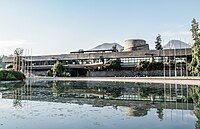
Cepal Building
.jpg)
The ECLAC building is located in the Vitacura commune and was inaugurated on August 29, 1966 by the President of Chile, Eduardo Frei Montalva, and the Secretary General of the United Nations, U Thant. The building is considered a landmark of modern Latin American architecture. Its design was in charge of the influential Chilean architect Emilio Duhart with the collaboration of Christian de Groote, Roberto Goycoolea and Oscar Santelices, inspired by the style of the prominent Swiss architect Le Corbusier.
Demographics
The Metropolitan Region has an area of around 15,403.2 km², and according to the 2017 population census it registered a total of 7,112,808 inhabitants, which gives an average density of 461.77 inhabitants per km². An average growth of 0.9 person per 100 inhabitants is estimated.
Since its foundation, on February 12, 1541, Santiago has had a sustained growth from the 150 people who arrived with Pedro de Valdivia to date, at first with a high growth rate, with 2.68% per year until the early years of the 17th century. Subsequently, this demographic growth stagnated at figures of less than 2%, until the end of the 19th century. From the last decades of the XIX century, Santiago began to grow rapidly, with a rate of more than 3% per year, reaching a maximum of 4.24 per year between the years 1952 and 1960. From the end of the 20th century, the growth rate decreases again to less than 2%. The population increase of Santiago, especially during the XX century, should not be attributed only to the natural growth of the population; It is also due to a very rapid increase in the rate of immigration from other parts of Chile and from abroad.
On the other hand, population growth is associated with a physical expansion of the city and changes in the density of space occupation. Thus, 50 years after its foundation, in 1591 Santiago occupied 218 ha, with a density of 6.8 inhab/ha. In 1700, the city had spread very little, but the density had increased to 66.6 inhab/ha. At the end of the 18th century, Santiago already occupied 400 ha and the density exceeded 100 inhab/ha. At the beginning of the XX century, the city already occupied almost 4000 ha, and the growth of satellite nuclei began, such as Puente Alto, San Bernardo to the south and Maipú to the west, which gradually merged with the city. In less than 50 years, around 1950, the urban area exceeded 13,000 hectares, and the population density increased in its central core. Urban growth continued at an accelerated rate during the following years, and in 1960 it already covered some 20,000 ha. In 1980 the figure was close to 45,000 ha and in 1990 it was close to 70,000 ha.

Alto Bridge commune, the most populous in the country.

Comuna de Maipú, the most populous of the Province of Santiago, and the second most populous of the country.

Church of Alhué, the least populated commune of the Metropolitan Region.
Commune of San Bernardo, Main Satellite Core of the City of Santiago.

Square of Talagante, capital of the province of the same name.


Basic indicators (historical series)
.jpg)
The historical series of basic indicators of the Santiago Metropolitan Region is presented below:
Transportation and communications
Airports
In the Metropolitan Region is the Arturo Merino Benítez International Airport, which is the most important in the country. We also find the El Bosque Air Base, and among the main private aerodromes for public use the following: Melipilla Aerodrome, Curacaví Aerodrome La Victoria de Chacabuco Aerodrome, Eulogio Sánchez ex Tobalaba Aerodrome, and the future Peldehue Aerodrome.
For the practice of ultralight flights or experimental aircraft and LSA, there are the Hacienda Lipangue Aerodrome and the Alberto Santos Dumont Aerodrome; For skydiving enthusiasts, there is the Los Cuatro Diablos Aerodrome, and for paragliding (gliding), there is the Vitacura Municipal Aerodrome, whose owner (Club de Planeadores de Vitacura) also manages the Chicureo Aerodrome.

Road network

The land communications of the Metropolitan Region are based on a network of well-developed roads and a network of secondary and tertiary roads, which lead to the different towns in this region and others. It has a total (as of December 2004) 2,555 km of public roads (concrete and asphalt). The main roads in the region, in the north-south direction, are:
- R5 Panamericana / Autopista Central
- In this province, the Chilean kilometric measure of the Pan American road is started, whose kilometer 0.0 is located at the intersection of the central Alameda Bernardo O'Higgins and the Central Autopista, and it extends with superior pavement quality and double and triple track, between the coast of Las Chilcas to the north and the tunnel Angostura to the south, covering 122 km in the region.
- Route 68 Santiago-Valparaíso
- Join Santiago with the cities of Valparaíso and Viña del Mar, and from here to the beaches of Veraneo in the Fifth Region. It also gives connection to the communes of Casablanca and Curacaví. It is prolonged by 115 kilometers, with superior pavement quality and double and triple track. It starts at the Alameda fork with Gladys Marin, in the Central Station commune.
- Autopista del Sol R78

Concessed, it connects the city of Santiago with Cartagena, and from there to the Central Coast (Llolleo, San Antonio, El Quisco, Algarrobo), in addition to connecting the populated centers of Melipilla, Talagante, El Monte, Padre Hurtado and Peñaflor. It extends for 110 km. It starts at the intersection of Isabel Riquelme with the Autopista Central, in the south of the commune of Santiago.
- Route G-21
That connects the city of Santiago with the winter resort of Farellones and Valle Nevado. It extends for 40 km. It is the continuation of Las Condes Avenue.
- Route G-25
That connects Santiago and the commune/city of Puente Alto with the Cajón del Maipo, up to the town of El Volcán. It extends for about 70 km, with superior pavement quality. It begins at the intersection of Avenida La Florida with Avenida Departamental, in northern Florida.
- Route 66
Better known as Camino de la Fruta, it links the port of San Antonio with the town of Pelequén, in the sixth region, extending for 70 km in the Metropolitan Region, up to the town of San Vicente from Tagua Tagua, about 7 km north of Lake Rapel.
- Route 70 / Avenida Américo Vespucio
Which corresponds to the ring road of the city of Santiago de Chile, with an extension of 60 km, with superior pavement quality and double and triple track. Currently, there are 2 state-of-the-art urban highways with electronic payment on its route.
Other roads of special importance are the urban highways of Santiago de Chile. At the end of 2004, the first concessioned roads in Santiago began to operate. The charge for the use of these roads is made through automatic collection by means of an electronic device called Televía or TAG that cars must carry to access and use these roads. A part of Route 5 and Route 70, which pass through Santiago, are examples of urban highways in the city.
Railroads

The railway is also a means of locomotion used for the daily transport of passengers; It is operated by the state EFE. It has a continuous line between the cities of Valparaíso, in the V Region of Valparaíso, and Puerto Montt, in the X Region of Los Lagos.
Metrotren commuter trains connect the extra-capital suburbs with Santiago. Another means of transport that can be mentioned is the Santiago Metro. With seven lines currently in operation, they transport an average of 2,800,000 people per day, thus becoming one of the main means of locomotion in the country. In one year the metro transports more than 360 million people. Both the Santiago Metro and the railway system are considered the most modern in Latin America.
Vehicle fleet
As of 2004, the Metropolitan Region had a fleet of 1,817,938 vehicles. It corresponds to 73.1% of the 2,824,570 existing vehicles in the country, which places it in first place in the national ranking.
For 2009, it is estimated that the number of vehicles in Chile reached 3,963,100 nationwide.
Gallery

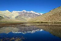
Landscape in the Angostura de Paine

Palacio de La Moneda
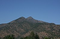
Cerro Challay, in Paine.

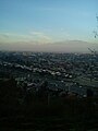
Santiago

Typical half-class Santiaguino neighborhood

Santiago de noche
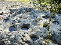
Curacaví tacit stones

Rural part of the Metropolitan Region
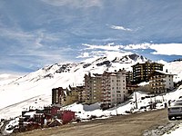
One of the ski resorts in the region

Plaza de Armas de Santiago

Avenida Apoquindo

Hill from the Comaico hill
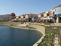
Laguna Piedra Roja

Yerba Loca

Jardines del Parque Quinta Normal

Handicrafts in Pomaire's greda

Barrio Lastarria
Cepal Building

Entel Tower, view towards the Andes Mountain Range.
Laguna Los Patos, San José de Maipo


Contenido relacionado
Algarve
Geography of Benin
Konosu (Saitama)