
San Fernando de Apure
San Fernando de Apure (also referred to only as San Fernando) is the capital of the municipality of San Fernando and of the State of Apure in the Llanos of Venezuela. Although it is a town, it is identified with the phrase "The city of hope!" It is the administrative headquarters of the state and has the headquarters of the most powerful military units in the area, its main economic activities being trade, financial activities and security. The town of San Fernando de Apure is the main financial settlement of the State, whose primary activity is livestock and agriculture. By the year 2020, the San Fernando metropolitan area has a population of 313,729 inhabitants.
Toponymy
It was founded in pre-republican times during the Spanish colony. Its name was a tribute to the then Infante Fernando de Borbón, a name that in the Catholic saints is associated with San Fernando Rey. Its connection with Apure was given by the homonymous river on whose bank it was established, and which currently gives its name to the state of which it is the capital. According to Juan Antonio Frago García, in Aragon in America, the town was founded by Fray Lorenzo de Zaragoza in 1690 as an "indigenous reduction and doctrine" called San Fernando de Apure, ordained by Fray Lorenzo de Magallón, of the Capuchins of Cumaná.
History
San Fernando was founded on February 28, 1788 by order of the Infantry Captain of the Royal Armies Fernando Miyares y González, military commander, politician and governor of the then newly formed Province of Barinas (1786), and executed by Senior Lieutenant Juan Antonio Rodríguez and Fray Buenaventura de Benaocaz, under the name of "Villa de San Fernando del Paso Real de Apure".
The foundation was witnessed by some 200 aborigines in a ceremony where Lieutenant Juan Antonio Rodríguez surveyed the land, with which the act describes that the property enjoys a good constellation, pure air, abundant farmland and livestock, wood for factories, firewood and running water. The Plaza Mayor (now Plaza Bolívar) was then demarcated and a cross was placed on the site where the church would be built, after all of which the Lieutenant exclaimed: «The Villa Real de San Fernando is founded! ». Later, in December 1783, given its strategic importance in the domination of Los Llanos, it was officially granted the title of Villa.
Between March 27 and 30, 1800, he received a visit from Alexander von Humboldt. And five years later (1815), Fray Joaquín María drew up the second plan of the villa together with a literal description of its limits and jurisdiction. Starting in the 30s of the XIX century, educational activity began to take shape in San Fernando, when in 1831 the Maestro Juan Castellanos founds the first private school for minors. Then the Second Category Federal College was created in 1875 and at the end of that century the León XIII Federal School was also founded.

The chronicles of the town record that on June 21, 1859, during the Federal War, the Federal Army set fire to a large part of the city, placing it on the brink of destruction. Between December 1871 and January 1872, the Battle of San Fernando de Apure took place.
So, by 1908, the streets of San Fernando started from a North-South line 100 meters from the east side of the cemetery (now known as the old cemetery) and were usually called: first, second, third, fourth and fifth, the last one reaching the extreme south. Between the first and the fifth the town was delimited. Today they are part of the central or historic center of the city with the names of Calle Comercio, Calle Bolívar, Calle Sucre, Calle Páez and Calle Muñoz respectively. At that time, San Fernando was a port on the banks of the Apure River. The main area of the port was about 400 meters long, which was extended a little further to the west when the Palace of the Barbaritos was built. Today the port only appears in historical records, and much of it is now mainland with urban planning, where it was once the domain of the Apure River.
At the beginning of the XX century, San Fernando enjoyed great commercial and industrial activity. Food factories (pasta, canned goods, sausages, preserves and others), candle factories, ice, heron feather distributors (since 1884), leather and alligator skins, among others, were developed in it. Trade maintained a strong relationship with Europe, the largest destination for exported products. This activity declined sharply as demand for exports decreased, as interest in navigation decreased due to the development of land trade with the development of the railway: there was the line of the Great Railway of Venezuela (Caracas to Puerto Cabello) that wanted to be completed with a branch to San Fernando de Apure (), and the development of road commerce with the Ford Tablitas (Ford model T, with wooden planks for cargo), which came to constitute a true revolution for its versatility and resistance.
In 1914, the chronicles record the arrival of the first automobile in San Fernando. It is an anecdotal fact. It was a Ford Model T vehicle owned by Don Jesús María Hernández M., purchased in Cagua by his son-in-law, General Waldino Arriaga.
Secondary education began in the city in 1931 with the creation of the Miranda school, which would later be transformed into the Lazo Martí school. Along the same lines, the Sagrada Familia school was also created in 1953. Around 1964 artistic training was consolidated with the foundation of the Juan Lovera School of Visual Arts.
In 1916, San Fernando experienced a large overflow of the Río Apure recorded as catastrophic by the press of the time. Consequently, the project for the construction of a diversion channel towards the Portuguesa River in the neighboring Guárico State was brought to the then National Congress (now the National Assembly). After approving it in 1917, in February of that year the authorization to manage the purchase of privately owned land for the construction of the diversion was published in the official gazette. On March 2, according to a publication in the official gazette of the Apure State, citizens Fabián and Juan Rafael Michelangeli, María de Domínguez, Fabián Michelangeli (son), Miguel Ángel and Gullermo Michelangeli, all owners of the land, together donate a space for 20,000 square meters, with the sole purpose of "saving the city of San Fernando from destruction and ruins". On June 12, 1917, the diversion channel for the Apure River was inaugurated. The canal is currently located on the north bank of the María Nieves Bridge.
Higher education studies began in 1976 with the creation of the Apure Nucleus of the Simón Rodríguez National Experimental University. The following year UNELLEZ was founded and in 1978 the local center of the National Open University opened. Currently, San Fernando maintains a wide educational activity at all levels, with innumerable primary schools, secondary schools and universities.
Government and Politics
The nucleus of San Fernando de Apure, includes the jurisdiction of the San Fernando municipality with 2 of its 4 parishes, namely: Urbana San Fernando and Urbana El Recreo. Venezuelan laws specify that the municipal government has 4 functions: the executive, the legislative, the comptroller, and planning. The executive function is handled by the mayor, who is in charge of municipal representation. The legislative function is handled by the municipal council, made up of seven councilors, in charge of deliberating new decrees and laws. The comptroller is in charge of investigating the government. Finally, planning is managed by the Public Planning Council, which presents municipal projects.
Demographics
The city of San Fernando, within its own administrative limits, registered a population of 215,847 inhabitants in 2020, which corresponds to only two of the four parishes of the San Fernando municipality that comprise the city, with the complete municipal data being 215 847 inhabitants. During the last decade of the XX century, San Fernando formed a metropolitan area extended over the Biruaca urban parish in the homonymous municipality and some areas of the south of the Camaguán municipality of the Guárico State. Thus, the urban parishes of the conglomerate registered a total of 281,794 inhabitants in 2020.
The metropolitan area of San Fernando is made up of three nuclei, namely: San Fernando de Apure, which covers the entire central area on both banks of the Apure River, the satellite population of Biruaca to the west, and the parish conglomerate to the east from El Recreo. According to the 2001 Venezuelan census, the urban area of San Fernando has experienced sustained population growth in the conurbation with Biruaca, the latter having a relative intercensal growth rate of 69.4% and San Fernando 36.1%.
Until the 2001 national census, the city was highly populated by young people and adolescents, who constituted more than 50% of the total population of the metropolitan area, while over 40% of the inhabitants were adults and less than 5% they were senior citizens. Such behavior has varied, according to the 2011 census that recorded just over 43% of the youth population, with an average decrease of 7 points in the age group. At the same time, the adult population reached 49.81%, which means an increase of close to 10 points, while the elderly only increased by a little more than 1 percentage point.
| Parish / Age group | 0-19 years | 20-39 years | 40 to 59 years | 60 and + years |
|---|---|---|---|---|
| Urban Parish San Fernando | 49.64 % | 30.22 % | 14.63 % | 5.51 % |
| Urban Parish El Recreo | 54.05 % | 28.34 % | 12.88 % | 4.72 % |
| Biruaca Urban Parish | 53.48 % | 28.64 % | 13.17 % | 4.71 % |
| Average | 52.39 % | 29.07 % | 13.56 % | 4.98 % |
| Municipality / Age group | 0-19 years | 20-39 years | 40 to 59 years | 60 and + years |
|---|---|---|---|---|
| Municipality San Fernando | 44.92 % | 32,00 % | 17.37 % | 5,71 % |
| Municipality Biruaca | 43.64 % | 32.68 % | 17.27 % | 6.41 % |
| Average | 44,28 % | 32.34 % | 17.32 % | 6.06 % |
- Satellite populations
San Fernando serves as the main urban center of several villages, hamlets and satellite towns in the northeast of Apure and the southwest of Guárico, whose inhabitants satisfy various needs related to services such as education, hospital, banking, commerce, terminal land and air transportation, entertainment, gastronomy, employment, government and others.
|
|
|
Physical geography
Location
The city was originally established in a meander of the Apure River and its greatest growth is maintained from East to West along the south bank, with some areas in the central area located on the north bank. Its soils are very sedimentary and humid. Its astronomical coordinates are 7°54′N 67°28′E / 7.900, 67.467 (UTM 873554 669033 19N)
| Northwest: Apure River and Camaguán in the Guárico State | North: Apure River and Camaguán in the Guárico State | Northeast: Rio Apure, Guayabal in the Guárico State |
| West: Biruaca |  | This: The Recreo and Arichuna |
| Southwest: El Negro, San Rafael de Atamaica and San Juan de Payara | South: Caramacate | Sureste: The Recreation |
Relief
The relief of San Fernando is completely flat, without hills, hills or mountains. Its surface is characteristic of the low western Llanos of Venezuela, at 47 m a.s.l. no. m. Due to its flatness, visibility over the horizon can reach up to 10 km. However, since the city has suffered many floods due to the rains and the overflow of the Apure River, some artificially built elevations of land can be found by engineering works for flood prevention.
Hydrography
San Fernando de Apure is bordered to the north by the Apure River, coinciding with the northern limit of the State of Apure with the State of Guárico. The city is characterized in its natural landscape by containing various streams and lagoons, such as Atamaiquita and Mangía, to name a few.
Parishes
San Fernando is the capital of the municipality of the same name, and its main jurisdiction is established within it, this being historically the center of formation and growth of the city. Venezuelan legislation establishes the municipal division into parishes, of which the San Fernando municipality comprises four and of these, the city strictly encompasses two: the San Fernando parish and the El Recreo parish. The other two parishes in the municipality (Peñalver parish and San Rafael de Atamaica parish) serve the development of the satellite populations of Arichuna and San Rafael de Atamaica, which do not conurbane with San Fernando and therefore are not considered part of the city.
On the other hand, given the population growth to the west, the population of Biruaca integrates the metropolitan area of San Fernando, with which the Biruaca urban parish of the homonymous municipality is part of the conglomerate. Similarly, some areas to the north of the Apure River in the neighboring Guárico State have extended the San Fernandina area under the jurisdiction of the Camaguán parish, a municipality of the same name.
Climate
San Fernando is recognized in Venezuela as a hot town because it is located in the center of the Venezuelan Llanos. Its climate is tropical savannah (dry summer). The average annual temperature is between min. 20.4 °C and max. 34.5 °C and the relative humidity of the air can reach up to 79% or more due to its location next to the Apure River, which at its narrowest point in the city covers up to 300 meters wide in its channel.
| Month | Ene. | Feb. | Mar. | Open up. | May. | Jun. | Jul. | Ago. | Sep. | Oct. | Nov. | Dec. | Annual |
|---|---|---|---|---|---|---|---|---|---|---|---|---|---|
| Average temperature (°C) | 34.3 | 34.2 | 35.2 | 34.8 | 32.5 | 30.6 | 30.0 | 30.3 | 33.0 | 34.0 | 33.9 | 34.5 | 33.1 |
| Average temperature (°C) | 27.6 | 28.4 | 29.4 | 29.6 | 27.7 | 26.5 | 26.1 | 26.4 | 27.2 | 28.1 | 28.1 | 28.1 | 27.8 |
| Temp. medium (°C) | 23.1 | 23.4 | 24.7 | 24.3 | 23.7 | 23.0 | 22.8 | 23.2 | 24.0 | 24.6 | 24.4 | 24.6 | 23.8 |
| Total precipitation (mm) | 1.1 | 3.5 | 6.2 | 71.9 | 167.3 | 242.9 | 276.1 | 255.3 | 172.4 | 98.5 | 44.2 | 9.9 | 1349.3 |
| [chuckles]required] | |||||||||||||
Transportation
San Fernando is accessed by 5 main roads (one to the north, two to the west, one to the south and one to the east). The first of these, the Los Llanos National Highway, which runs from La Encrucijada (Maracay Metropolitan Area in the Central Region of Venezuela) culminating precisely in San Fernando. It is the only land route outside of Apure State that has direct access to the city. By this almost all the regions of Venezuela are communicated. Additionally, three other arteries lead to San Fernando from within his State. The most important is the Avenida Intercomunal San Fernando - Biruaca and on the other hand the Avenida Perimetral Norte that connects the same to San Fernando and Biruaca, both to the west. Seen from its metropolitan area, San Fernando is accessed from the west by the San Fernando - Achaguas National Highway, which connects the latter population with Biruaca, and is in turn conurbated with San Fernando. These western arteries provide access to the Alto Apure and the Andes Region.
In addition to the two previous ones, San Fernando is accessed from the East through Avenida 5 de Julio, which connects with the San Fernando - Arichuna National Highway. On the other hand, to the south, the San Fernando metropolitan area connects with the town of San Juan de Payara, in the same Apure State, through the San Fernando - Puerto Páez National Highway, which connects with the city through biruaca. The internal road directs traffic essentially from east to west towards the center. The most recognized of the main roads is Paseo Libertador Avenue, which goes in a straight line with a boulevard from North to South. Three main avenues run from East to West, and two of them intersect with Paseo Libertador, namely: Avenida Carabobo and Avenida Caracas, as well as Avenida Perimetral Sur. A large chain crosses the entire city from east to west. It is the continuous junction of 5 de Julio (east), 1º de Mayo (center-east), Carabobo (center), Casa de Zinc (west), Los Centauros (west) and Intercomunal San Fernando - Biruaca (west) avenues.).
Urban public transport is made up of buses that cover different routes and in this way are colloquially called: the route. Each route is identified with a number, except for some exceptions where the milestones of the route are identified without any numbering.
The Maria Nieves Bridge
Its construction began in 1960. Bearing the name of a famous halter who swam across the width of the Apure River, alone with his horse to carry herds of cattle that would later be transferred to the center of the country.
The drawbridge system over the Apure River began construction in 2011, when Governor Ramón Carrizales presented the project that Chávez requested at the time. For this, the American company Arwick was hired, with extensive experience in such systems.
Rail transport
San Fernando is not served by any rail transportation system, however, the Venezuelan state has planned some interconnection with the city within the National Rail System project, where a railroad terminal station has been planned in the town, on the La Encrucijada - San Fernando section, with a distance of 279 km, in accordance with the 2030 Railway Development Plan of the State Railways Institute (IFE).
Also known as "Section San Juan de los Morros - Dos Caminos - Calabozo - San Fernando de Apure" by the IAFE, it has a flat length of 252.5 km with a modern, fast and economic intermodal transport system capable of mobilizing more than two million passengers a year and transporting more than 2 million tons of cargo per year. The San Fernando station, in addition to being used for passengers, is a collection station for cargo according to the project. Its completion was scheduled for 2012, however the schedule was not met.
Air transportation
The city is served by Las Flecheras Airport (SVSR/SFD). It has a single runway, 1,957 meters long and 49 meters wide, and because it is in an area with little air traffic, the terminal has little infrastructure. The airport does not have an Instrument Landing System (ILS) but it does have a non-directional radio beacon or beacon (NDB) and a VHF omnidirectional radio beacon with distance measuring equipment (VOR-DME), both acronym SFD, which They are part of the navigation aid system of Venezuela.
Fluvial transport
Large-scale fluvial access is not very common, however there is low traffic on the Apure River, which borders the city to the north, except in seasons of special competitions, when greater navigational activity can be appreciated. However, the Apure River is highly navigable (except for times of extreme drought) so it represents an important access by water. Even surrounding towns and villages navigate in outboard motor boats in a routine activity to transport people from villages and farms to the city and to sell agricultural products in the local market.
Public and private services
Supply
- Electricity
San Fernando is connected to the 230/115 kv Calabozo - San Fernando transmission line, of the national electrical system operated by the National Electric Corporation (CORPOELEC) through its subsidiary company, Compañía Anónima de Administración y Fomento Eléctrico, S.A. (CADAFE), which are owned by the Venezuelan State. The residential electrical power is 220/110 V.
- Water
Water supply and treatment is provided by the state-owned Los Llanos Hydrological Company (HIDROLLANOS). The main source of the resource is the Apure River itself. Running water is potable but not recommended for drinking, so it is common for the drinking water supply to be provided by private companies that sell bottled and sometimes mineralized drinking water. The sewage is discharged into the Apure River, but not before going through a purification process in smaller treatment plants located to the East and West of the city.
Media
Radio and television
The city has more than 30 local radio stations, mostly FM FM. Additionally, it has 4 local open-signal and/or subscription television channels, namely: ContacTV, Apure TV, Estrella TV and Esperanza TV.
Telecommunications Subscription television providers operate in San Fernando (cable, through the services of the Inter operator, and satellite through the DirecTV operator) and broadband Internet connections. The fixed telephony systems are operated by the two largest telephone exchanges in the country (Telefónica and CANTV), and cellular mobile telephony is operated by the main ones in Venezuela: Movistar de Telefónica, Movilnet and Digitel.
Education
San Fernando is the main educational center of Apure. Here is the majority of the universities with headquarters in the State. There are no local universities, but there are university institutes of technology. Among the main universities based in San Fernando are: Ezequiel Zamora National Experimental University of the Llanos, Simón Rodríguez National Experimental University, Bicentennial University of Aragua (UBA), National Open University (UNA), National Experimental University of the Armed Forces (UNEFA).
Other universities
- José María Vargas University.
- Universidad Pedagógica Experimental Libertador.
Health
The main hospital in San Fernando is the Dr. Pablo Acosta Ortiz General Hospital (HPAO), a public institution located on Avenida Caracas, between Av Paseo Libertador and Av Fuerzas Armadas. It serves as a free health center, maternity, imaging unit, and surgical unit, and no insurance is required for admission. Additionally, the hospital serves as an intensive care unit (ICU) for the states of Guárico, Amazonas, Bolívar, Barinas, Portuguesa and the southern border of Venezuela with Colombia. The Dr. Pablo Acosta Ortiz Hospital was inaugurated on December 17, 1930, after the renovations that were carried out at the until then called Hospital de La Caridad.
The city has several Comprehensive Diagnostic Centers (CDI) and Comprehensive Rehabilitation Rooms (SRI) from the national health program, which deconcentrate the population treated in the general hospital. The CDIs provide free X-ray, diagnostic ultrasound, endoscopy, electrocardiogram, Ultra Micro Analytical System (SUMA), clinical ophthalmology, emergency and pathological anatomy services.
Complementarily, the city's health system has several private hospitals (clinics) that offer care covered by health insurance policies for patients.
Culture
San Fernando is also an active cultural center. The region is recognized for being a source of inspiration for various compositions and artists of Venezuelan llanera music. In the same way, the joropo dance is very popular as typical and can be seen mostly in the periphery, although many events present it as a reinforcement of local identity, without being limited to it.
Additionally, each year various cultural manifestations take place, mostly of a religious nature, such as: the Calendas de San Fernando, the Locos de San Fernando, the Coromoteños from Apure, diablos from El Recreo and Paleros from San Martín. Other traditions have remained in the historical records, such as the dance of El Paloteo.
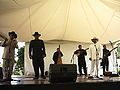
Plain music singers.

Cultural heritage

The Palace of the Barbaritos considered the most important and classic building in the city, located in front of Plaza Camejo. It was built by immigrant Italians, being used for residence and factory, at the beginning of the XX century. It was an important export center to Europe and the United States, also being looted several times for the immense merchandise stored there. Today, the Palace of Barbarito has been restored, being the seat of a museum where original mosaics can be observed.

The cathedral of San Fernando was planned by the German architect Robert Klein, and built by the engineer Manuel Pérez Marcano, in a period of 10 years. The works began in 1959, under the patronage of the San Fernando municipal council and the Apure state government. Once completed, it was consecrated on February 28, 1969, on the anniversary of the founding of the city, by Monsignor Felice Pirozzi..
In addition, the monument to San Fernando (Sanfernandote), the monument to the Flag (Composed of the Fuente de los Caimanes or Source of Abundance, the monument to Negro Primero and the national flag pole), the monument to to José Antonio Páez, Bolívar's house, Plaza Bolívar and its surroundings, where it is curious that 3 temples of 3 different religions are adjacent to each other on the same block. These are: The San Fernando Cathedral (Catholics), the Candor 27 Freemasonic Lodge (Freemasons) and an evangelical Protestant church. Finally, the Plaza del Alma Llanera stands out.
Parties
| Date | Name | Note |
|---|---|---|
| Mobile date | International Festival Voice of the Soul Plains | Fairs of San Fernando |
| 30 May | Calendas de San Fernando | Cultural heritage of the municipality of San Fernando in honor of San Fernando Rey |
| 28 December | Locos de San Fernando | Day of the innocent saints |
Sports
Because of its location next to the Apure River, San Fernando is the starting point for the nautical events of the “500 Extreme Miles of the Orinoco” and “Our rivers are navigable”, both competitions with a finish line in Ciudad Guayana. In the first, the boat tour takes 500 miles along the Apure, Orinoco, Caura and Caroní rivers. The competition usually has 4 categories. The total power is free, all with outboard and race motors. The vertical trim is usually free and from 18 feet in length, while the V-shaped or free hull. To participate in this competition, in addition to the requirements demanded by the laws that govern the INEA and its Regulations, all the vessels participating in the competition are required to have various navigation equipment in good operating condition. The second is organized by the Civil Association Our rivers are navigable, and proposes a route of approximately 2,000 km over the Apure, Cunaviche, Capanaparo, Arauca, Payara, Parguaza, Caura, Orinoco and Caroní rivers, among others.
On the other hand, the city participates in the Venezuelan National Basketball League (LNB) with the local team Centauros de Apure, occupying leading positions in the LNB and finishing first in the Western Division in 2010.
Meanwhile in football, San Fernando has a soccer team founded in 2009. It is Deportivo Apure FC, which previously played in the third division of Venezuelan soccer for the 2009/2010 season and was promoted the following season to the second division B of the FVF for the opening tournament. The club plays at the San Fernando Sports Center. In this same sense, San Fernando is the headquarters of the Huracanes de Apure club that has participated in the National Indoor Soccer League of Venezuela since 1997.
Additionally, the capital of Apurea is a bullfighting arena in its ring of bullfighting Vuelvan Caras, the scene of national and regional tournaments, located in the José Antonio Páez fairgrounds, to the west of the city.
Featured Characters
- Ignacio «indio» Figueredo, arpist and composer of plain music.
- Igor Barreto, poet and editor.
- Lucila Velásquez, writer and diplomat.
- Familia Cartri, Rosita(La Voz de Apure), Antonio(Farmacia Popular), José Luis(famous traumatologist)
- Trina Omaira Salerno Encinoza, amateur sportsman.
- Donato Muñoz, famous youtuber known as TheDonato.
- Diego Eugenio Chacon Arévalo, Lawyer, Mason, Engineer, politician and Military with the rank of General.
Sister cities
![]() San Juan de los Morros
San Juan de los Morros
![]() New Mexico Las Cruces
New Mexico Las Cruces
![]() Nienburg, Germany
Nienburg, Germany
![]() Jojutla, Mexico
Jojutla, Mexico
Contenido relacionado
Mojacar
Police inspection
Aija Province
Bratislava
Manama