
River meuse
The Meuse River (German: Maas; French: Meuse; Dutch: Maas) is an important European river on the slope of the North Sea, which originates in France and after flowing through Belgium and the Netherlands empties through the common delta of the Rhine- Meuse-Scheldt. It is 950 km longest—the 31st longest European river and 18th longest—and drains a basin of more than 36,000 km² —78th European Basin and 6th North Sea Basin—: 14,000 km² correspond to Belgium, 9000 km² to France and 8000 km² to the Netherlands, being the rest of Germany (4000 km²) and Luxembourg (500 km²). It has an average flow of 400 m³/s. Its basin is inhabited by nine million Europeans.
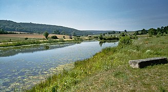
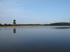
The Meuse rises in northeastern France at only 409 m above sea level, and flows first north, then northeast after crossing the Ardennes massif, and finally west. It empties through the Haringvliet, an inlet of the North Sea, after dividing into several branches now abandoned, leaving a wide delta between them.
Administratively, the river flows through the new French region of Grand Est —departments of Haute-Marne, Vosges, Meuse and Ardennes—, through the Belgian regions of Wallonia —provinces of Namur and Liège— and Flanders —province of Limburg— and by the Dutch provinces of North Brabant, Limburg, Gelderland, South Holland and Utrecht. The most important cities in its course are the French Commercy, Verdun, Mouzon, Sedan, Charleville-Mézières and Givet, the Belgian Dinant, Namur, Andenne, Huy, Seraing, Liège and Maaseik and the Dutch Maastricht, Roermond, Venlo and Rotterdam.
Its main tributaries are the rivers Semois (210 km), Sambre (190 km), Ourthe (165 km), Rur (164.5 km), Chiers (127 km), Niers (117 km) and Lesse (89km).
The river is navigable from the town of Saint-Mihiel for gabarit Freycinet gauges (250 tons), from Givet for péniches (barges of 1350 t) and from the autonomous port of Liège to Rotterdam, by ships of the Rhenish type (2,500 t) and barges (2 x 4,500 t). It is connected by various channels with the Rhine and Seine basins.
Historically, the Meuse was the western border of the Holy Roman Empire from its creation in the IX century until the annexation of most of Alsace and Lorraine by France after the Peace of Westphalia treaty, in 1648, and the annexation of the Principality of Liège, in 1792, also by France. Nostalgically, the river is still mentioned in the German anthem today.
The governments of the five countries in its basin — and also of the three regions of Belgium — signed an "International Agreement on the Meuse" in Charleville-Mézières on April 26, 1994 in order to settle all issues related to the river, including the question of the way in which the corresponding political authorities understand each other to preserve the interests they share. An International Meuse Commission was also established to put the agreement into practice. A new agreement was signed on December 3, 2002 in Ghent, which entered into force on December 1, 2006.
Etymology
The first written record that mentions the river names it in Latin Mosa. However, the river's name predates Roman times, dating back to at least the Celtic period. In fact, the name of the town of Mouzon means "Market on the Meuse" in Celtic (Moso-magus). The etymology of Meuse is unknown. On the Peutinger Table (from the IV century), the Mosa is not called Mosa, but Flumen Patabus.
The Dutch name Maas derives from Middle Dutch Mase, which comes from the presumed but unattested Old Dutch form *Masa, from Proto-Germanic *Masō. Only modern Dutch retains this Germanic form, however.
Despite the similarity, the Germanic name is not derived from the Latin name, judging by the change of the old o into an a, which is characteristic of the germanic languages. This would indicate that both the Latin and Germanic names probably derived from a Proto-Celtic source, which would have been *Mosā.
From the Latin Mosa comes the French adjective mosan and the Spanish mosano. Several place names derive from the name of the river: besides Mouzon also Moselle and Maastricht (in Latin Mosa Trajectum).
History
A commercial artery in the Middle Ages
The Meuse was an economic artery of the first order since ancient times, maintaining its influence in commercial exchanges forged during the Merovingian era, as evidenced by the diffusion of techniques and motifs in its basin well attested in archaeological excavations. It was also the backbone of the bishopric of Liège, which later became an episcopal principality (980-1795) in the second half of the Middle Ages. Thus, the authority of the prince-bishop extended over the faubourgs (or entire cities) linked by the river: Dinant, Namur, Andenne, Huy. In each of these cities, a bridge and a church dedicated to the Virgin perceived the right of way, feeding the episcopal treasury.
Marc Suttor considers that the traffic on the Meuse should be comparable to that of the Loire, Seine and Rhine, particularly wine, the main product transported on the great European rivers in the Middle Ages and the Renaissance, and that it would be a equal traffic in the XVI century to the production of Bordeaux wines. Taking advantage of this commercial axis, the Mosan goldsmiths (especially, the dinandería, that is, the work of brass) developed throughout the Middle Ages. The historical legend informs that the practice of dinandery pitted Bouvignes against Dinant: Philippe de Commynes (1447-ca. 1511) has recounted it well in the columns of him and the historian Jules Michelet (1798-1874) also picks it up.
Border River
From the end of the 13th century, the Meuse was one of the "four rivers" ("royaume des quatre rivières", referring to the Treaty of Verdun (843) that had set the limit between Western France and Lotharingia in the courses of the Scheldt, the Meuse, the Saone and the Rhone) that defined the border between the kingdom of France and the Holy Empire Roman Germanic. This limit, justified by the memory of the treaty, ran from the source of the river to the town of Mézières and ran through the middle of the principalities it encountered, including the county of Bar. (In 1301 Henry III of Bar received the western part (Barrois mouvant) as a French fief at the hands of King Philip IV.) This border was a reality, but above all an object of representation, stylizing the different limits (fiscal, judicial and feudal) of the kingdom. Riversiders in the Middle Ages were aware of the discrepancy between the official idea of a river boundary and the reality of complex borders. From 1390, in the royal surveys, the testimonies affirm that there were bronze terminals submerged in the river, without anyone having seen them. This myth shows the respect that surrounded this sacred boundary between France and the Empire.
The border remained stable until the annexation of most of Alsace and the Three Bishoprics of Metz, Toul and Verdun by King Henry II in 1552 and the subsequent occupation of the Duchy of Lorraine by the forces of King Louis XIII in 1633. By the Treaty of Westphalia (1648), the Meuse was no longer a de facto border, but remained a scholarly reference into the XVIII in France. Its lower course in present-day Belgium (Wallonia), part of the "industrial groove", was the first fully industrialized area in continental Europe.
In Germany, the Deutschlandlied ("Germany song"), which became the official German national anthem in 1922, alludes to it. The first stanza of Fallersleben's poem refers to the distribution of German-speaking peoples at the beginning of the XIX century and to the extent of the German Confederation at the time, withdrawn in 1945, which says that Germany extends:
(...) Von der Maas bis an die Memel
Von der Etsch bis an den BeltFrom the Mosa to the Niemen
From Adige to Little Belt
This memory of the Holy Roman Empire was also the denial of French claims on the Rhine frontier.
The sack of Dinant and Liège
The Duke of Burgundy Philip the Good took Dinant in 1466, burning and massacring its inhabitants by throwing them bundled two into the Meuse. Two years later, Liège suffered the same fate. Liège and Dinant were part of the Principality of Liège, while the city of Bouvignes-sur-Meuse was part of the County of Namur, already Burgundian. More than a dispute over bell towers, one must see political and economic reasons that far exceeded the Dinante microcosm: whoever controlled the river controlled the economy.
Industrial River

The Meuse was already industrial in the Middle Ages and some historians thus trace an industrial zone that would go from the city of Dinant to Liège. It will be even more so with the industrial revolution. The forges and furnaces of the Ardennes, which had been transforming iron from charcoal for centuries, would see their work shift from the small fast rivers that they used for their industry, to the larger rivers, such as the Sambre (which flows into the Meuse at Namur) and the Meuse itself. In the course of a second industrial revolution, which can be made to begin with the advent of Belgium, the second industrial power in the world is going to be built, from Charleroi to Liège, in the vertical of the English coal regions, of the French North and of Franco-German Lorraine. Only the Upper Meuse will escape the coal fever, supplanted by the Sambre which connected Charleroi with the markets of the North Sea. Little by little, the steel industry is acquiring pre-eminence over mining in Belgium, always following the basins of the middle Meuse and the Sambre. This steel industry, now in decline, continues to exist despite everything and was integrated into the Mittal-Arcelor agreement, but is suffering today from harsh international competition and the economic crisis of 2008.
The Nightmare of 1914

The Meuse has also been a tragic river crossed many times in the course of European invasions and rivalries. On August 23, 1914, several infantry units of the Imperial German Army—the 100th, 101st, 103rd, 108th, 178th, and 182nd regiments—attempted to cross the Meuse at Dinant, a city Belgian established on both sides of the river.
They were repulsed on the west bank of the Meuse by the French soldiers of General Franchet d'Espèrey (among whom was a then-lieutenant Charles de Gaulle), who recaptured the eastern quarters of Dinant, on the other side of the Meuse. During the successful French assault, the population fraternized with the soldiers of Franchet d'Espèrey and sang La Marseillaise several times.
After their withdrawal, the German army retook the city and shot civilians in retaliation for allegedly attacking German forces. As in other cities in Belgium or France, the Germans were convinced (wrongly) that they would have to face the franc-tireurs (in Spanish sharpshooters) (memories of the 1870 conflict, which became a disturbing hallucination). In Dinant, his "sincere false belief" turned the city into a Bosch enfer: several neighborhoods were completely destroyed by fire and there were 674 civilian casualties shot by German regiments, the largest massacre in August from 1914.
May 1940
In 1939, France declared war on Germany and prepared to repel an invasion. Within the framework of the French defensive plan, the Meuse played an important role since in a good part of its upper course (in France, from the confluence with the Chiers to Namur, in Belgium) the French Command hoped to stop the Germans in the square of the Dyle plan.
Downstream, the Belgians would defend the river especially at Fort Eben-Emael to protect Liège. This fort fell on May 11, 1940, the day after the German offensive, and the Belgians evacuated the fortified position of Liège and then Namur, leaving only the troops in the fortresses behind.
Upstream, surprising the French on May 12, 1940, a little further north of Dinant, at Houx, the first German infantry crossed the Meuse. The next day, Guderian's German troops also crossed the Meuse at Sedan causing the Sedan breach, as well as at Monthermé. His infantry also crossed at Givet and Profondeville, but failed at Nouzonville and Charleville-Mézières before the French evacuated their last positions on the Meuse on 15 May 1940; A large gap was left open on the Allied front from Namur to the western end of the Maginot Line, a gap which the French could not close for lack of sufficient reserves. German armored units passed and reached the English Channel near Abbeville on 20 May 1940, then taking the Allied armies in northern France and Belgium in the rear. The battle of France was already practically lost.
The European Meuse
An action program was launched for the period 1998-2003 under which in 2002 the Meuse Treaty was signed, also called the "Ghent Agreement", by which France, the Netherlands, Belgium and Luxembourg agreed to cooperate in the joint management of the river with the two states and the two regions of Belgium. The projects include the return of large salmonids to the basin and the gradual restoration of the free movement of fish (throughout the Benelux, while a European directive (Water Framework Directive, or DCE) demands the return good ecological status in 2015 (with exceptions to be justified).
Geography
The Meuse in France
The Meuse in the Haute-Marne department

The Meuse rises in France in the Bassigny, a small natural region located in the south of the Haute-Marne department (Gran Est region), and more precisely in Pouilly-en-Bassigny, a small town in the commune of Châtelet -sur-Meuse. Its place of origin is 409 meters and there is a milestone marking it. The Seine, the Marne and the Aube have their source not far from that of the Meuse, on the Langres plateau, a point where the slopes of the Atlantic, Mediterranean and North Sea meet. In this upper part, the Meuse first heads east for a short stretch, until it reaches the small town that gives it its name, Meuse (in the commune of Val-de-Meuse, from 1933 hab.), where after receiving several streams, it turns north. It then passes through small towns such as Levécourt (99 inhabitants in 2013), Doncourt-sur-Meuse (47 hab.), Hâcourt (34 hab.), Brainville-sur-Meuse (85 rooms), Bourmont (506 rooms) Saint-Thiébault (242 rooms< /span>), Gonaincourt, Goncourt (273 hab.) and Harréville-les-Chanteurs (289 hab..), before leaving the apartment.
The Meuse in the Vosges department
The Meuse enters the Vosges department where a particular geological phenomenon occurs near Bazoilles-sur-Meuse (604 hab.), the losses of the Meuseː the river seeps underground to reappear several kilometers further down the resurgence of the Meuse, near Neufchâteau (6602 rooms).
In Neufchâteau it also receives the first major tributary, the Mouzon River (27.9 km) on the right. Neufchâteau is the first city on the course of the Meuse, today a sub-prefecture, which was already a city of medieval importance where the differences between the duchy of Lorraine and the kingdom of France were usually settled. Then the Meuse leaves the clay plain to penetrate the front of the Meuse shores and enter a narrow limestone valley.
The Meuse continues its progress northward, washing the small towns of Frebécourt (303 inhab.) and Coussey (739 rooms), and then passes in front of the Bois Chenu Basilica. Follow Domrémy-la-Pucelle (126 rooms) —where Joan of Arc was born— and Maxey-sur-Meuse (244 hab.), where it meets the river Vair on the right (63.5 km). He then enters the Mosa apartment, to which he gives his name.
- The Mosa in the Vosgos department
The Mosa in Bazoilles-sur-Meuse
The Mosa in Frebécourt
The Mosa in Domrémy-la-Pucelle

The Mosa in Maxey-sur-Meuse


The Meuse in the Meuse department
The Meuse continues its slow flow through a narrow valley of limestone soil, receiving the waters of short tributaries. Stop by Brixey-aux-Chanoines (85 hab.), Sauvigny (245 hab.), Pagny-la-Blanche-Côte (247 hab.), Taillancourt (141 hab.), Champougny (80 rooms), Sepvigny (76 rooms), Vaucouleurs (2036 inhab.) and Rigny-la-Salle, where it meets the river Aroffe on the left ( 50.2km). It then continues through Ugny-sur-Meuse (103 hab.), Saint-Germain-sur-Meuse ( 271 rooms), Ourches-sur-Meuse (200 rooms), Pagny-sur-Meuse (1031 rooms) and Troussey (425 rooms).
The Meuse is then crossed by the Marne-Rhine Canal, a 314 km canal with 178 locks built between 1838 and 1853, linking the basins of the Seine and Rhine, the Marne (at Vitry-le-François) with the Rhine (at Strasbourg). This canal takes advantage of the topographical gap that opens to its left and that allows reaching the city of Toul, located about 12.5 km on the banks of the Moselle River (a tributary of the Rhine).
- The Mosa in the Mosa department

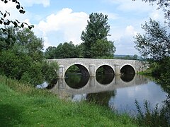
Bridge in Taillancourt

Bridge in Ugny-sur-Meuse

Viaducto en Saint-Germain-sur-Meuse

Canal de la Marne al Rhin en Pagny-sur-Meuse

The Mosa in Troussey


_Canal_de_la_Marne_au_Rhin.JPG)
_la_Meuse_avec_vue_du_village.JPG)
It is then followed by the Meuse through Sorcy-Saint-Martin (1068 inhabitants) and the sub-prefecture of Commercy (6220 inhab.). It then passes through Boncourt-sur-Meuse (320 hab.), Pont-sur-Meuse (139 hab..), Mécrin (232 rooms), Bislée (0 rooms) and Saint-Mihiel (4269 hab.).
On the right bank, at the exit of Saint-Mihiel, there is an outcrop of seven rocks, called the Ladies of the Meuse, in the form of coral reefs that formed during the Late Jurassic period, Oxfordian stage, then under a very hot climate when the sea covered the entire region.
Continue through Maizey (169 rooms), Rouvrois-sur-Meuse (178 rooms< /span>), Bannoncourt (163 hab.), Lacroix-sur-Meuse (704 hab.< /span>), Troyon (258 hab.), Tilly-sur-Meuse (286 hab.< /span>), Ambly-sur-Meuse (247 hab.), Villers-sur-Meuse ( 294 hab.), Les Monthairons (389 hab.), Dieue-sur-Meuse (1,393 pop.), Haudainville (948 pop.) and the sub-prefecture of Verdun ( 17,923 inhabitants).
Verdun is another city with a long history, seat of a bishopric since the IV century, place where the treaty of Verdun that divided the empire of Charlemagne into three parts, and since 1374 free imperial city of the Holy Roman Empire. The bishopric of Verdun —which together with Tull (Toul) and Metz formed the Three Bishoprics— was incorporated by France in 1552 (annexation recognized in 1648 by the Peace of Westphalia). Sadly, the city is also known for the Battle of Verdun, the longest battle (February–December 1916) and the second bloodiest (more than a quarter of a million dead) of the First World War.
- The Mosa to Verdun

The Mosa in Sorcy-Saint-Martin

The Mosa in Bannoncourt
The Mosa in Villers-sur-Meuse
The Mosa in Verdun
_la_Meuse.JPG)


.jpg)
After leaving Verdun behind, the Meuse turns somewhat to the NNW, reaching Sivry-sur-Meuse (397 hab.), Vilosnes-Haraumont (215 hab.) and Dun-sur-Meuse (698 hab.), where the river leaves the shores of the Meuse to reach the clayey plain of the Woëvre. Next, it meanders through a terrain with a very low slope.
At Stenay (pop. 2,743), the Meuse again enters a narrow valley and crosses a new front of hills, the northern end of the shores of the Moselle. It then runs opposite Martincourt-sur-Meuse (63 hab.), Inor (188 hab.) and Pouilly-sur-Meuse (199 hab.). For a short stretch of about 4 km its course marks the border between the departments of Meuse and Ardennes, where it then enters.

The Mosa Channeled in Vilosnes-Haraumont
The Mosa in Dun-sur-Meuse
The Mosa on Stenay, with the mouth of the harbor branch


The Meuse in the Ardennes department
The Meuse in the Ardennes department continues to meander in an ever narrowing valley. The river then runs through a grassy clay plain and again quite large. Baña Mouzon (2,202 hab.) whose center is on an island surrounded by an arm of the Meuse and continues by Villers-devant-Mouzon (91 hab.) and Remilly-Aillicourt (788 hab.) and receives in Bazeilles (2041 inhab.) to the river Chiers (130 km), which approaches it from the right. Bazeilles is one of the cities awarded the Legion of Honor (in 1900) for its heroic behavior in the Franco-Prussian War of 1870, later fictionalized by Emile Zola in La débâcle.
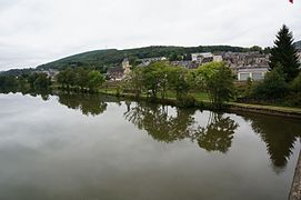
Then the Meuse reaches the city and sub-prefecture of Sedan (18,134 hab.), also famous for the eponymous battle in the aforementioned war of 1870 in the that Emperor Napoleon III himself was taken prisoner. It was a textile center, which began under the patronage of Cardinal Mazarin and maintained the city until the end of the XIX century. The historic center is located on a peninsula formed by a curve of the river Meuse and makes Sedan a town of art and history (since 2000) which preserves the castle of Sedan, one of the largest castles of medieval origin in Europe.
- In the French Ardennes to Sedán (I)

Mosa Canal in Mouzon

The Mosa in Bazeilles
The Mosa in Sedán

View of Sedán Castle


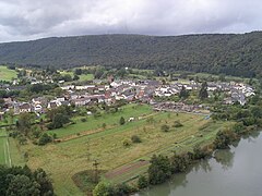
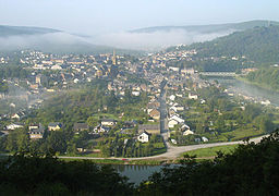
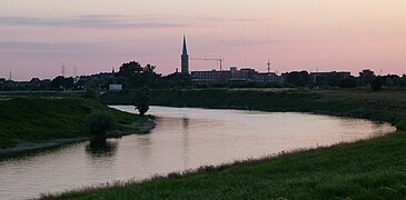
The river continues northward and encounters the foothills of the Ardennes massif and turns 180° south and shortly thereafter west along of the old mountain massif covered with forests. Soon it receives, from the left, the waters of the Bar (62 km) and soon those of the Vence river (32.7 km) in Charleville-Mézières (48,991 inhab.). The Meuse seems to waver in its course as it crosses the city: it forms three loops from west to east before turning north again and in one of them it receives from the left, and coming from the west, the river Sormonne (56.5km).
Mézières already had a fortification in Roman times and the medieval town defended itself against the imperial troops of Charles V: the siege of 1521 demonstrated the importance of the place for the defense of the kingdom. The city became a citadel enclosed in an important defense system that prevented its development. When Carlos de Gonzaga founded the new city of Charleville in 1606 as the capital of his principality of Arches, this allowed for expansion.
- In the French Ardennes, in Charleville-Mézières (II)

The Mosa in Charleville-Mézières

The pont_d'Arches in Charleville-Mézières

The Monte Olympe gateway, the first hanging bridge of the Ardennes


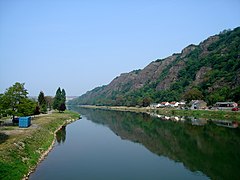
Next, the Meuse enters the regional natural park of the Ardennes, an area that protects the Ardennes massif that the river will cross through a very narrow valley whose slopes are densely forested. It is followed in this section by the Trans-Ardennes greenway and by the railway from Charleville to Givet. Here the river runs through black shale soils. Starting from Charleville-Mézières, the meanders are numerous until the exit of the Ardennes.
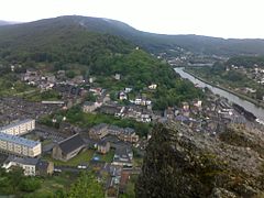
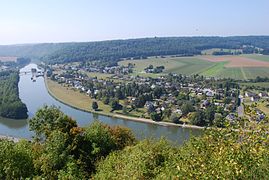
In the widening of these meanders, small towns have been built, very close, that the Meuse follows following a NW direction: Nouzonville (6,214 inhab.), Joigny-sur-Meuse (700 hab.), Bogny-sur-Meuse (5291 hab.) and Monthermé (2413 hab.), where it receives the Semois/Semoy river (210 km< /span>) along the right bank and where there are many high points (the highest offers views of 230 m) that allow you to contemplate the surroundings. The Meuse continues through Deville (1084 hab.), Laifour (481 hab.), Anchamps (226 rooms) and finally Revin (6783 rooms), built on three meanders. Near the city, two small reservoirs at different heights allow the operation of a pump-turbine power transfer station with a capacity of 1000 MW.
- In the French Ardennes (III)
The Mosa in front of the old Nouzonville gun factory (now a museum)
The Mosa in Joigny-sur-Meuse

The Mosa in Bogny-sur-Meuse

The Mosa in Monthermé
The Mosa in Deville


.JPG)

The Mosa in Laifour

Railway route between Laifour and Anchamps
The Mosa in Bogny-sur-Meuse

The Mosa in Revin
.JPG)
,_pont_du_chemin_de_fer_sur_la_Meuse.JPG)


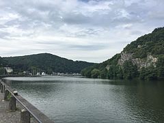
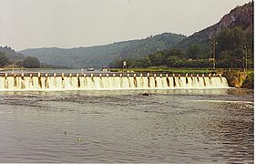
The Meuse turns to the NE passing Fumay (3,605 inhab.), the ancient slate city in the XIX. It begins a small geographical-administrative area, the Pointe de Givet, sometimes called the barrel or finger of Givet or even Pointe des Ardennes, which constitutes the extreme north of the department of Ardennes. This small territory about 25 km long and 10 km wide forms a band that It penetrates deep into the Belgian Ardennes, following the meanders of the Meuse.
Two national nature reserves have been delimited there: in 1991, Vireux-Molhain —with a protected area of 1.8 ha of an old outpost customs, which safeguards a schist outcrop from the Middle Devonian (from the Eifelian: ± 397 million years ago), exceptional for the quantity and fineness of its fossils, especially trilobites— and in 1999 the Givet point —from 354 ha, established for its geological, floristic and faunal interest, which offers a varied landscape made up of forests, scrublands, dry grasslands and spectacular rocky cliffs.
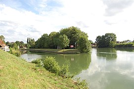
Follow the river through Haybes (1992 rooms), Fépin (244 rooms), Vireux-Molhain (1589 hab.) and Aubrives (866 hab.). In another of the meanders of the river, the Chooz nuclear power plant has been built, shortly before the small town of Chooz (757 inhabitants) that gives it its name. The plant, which employs some 700 people, was built in two phases: Chooz A, which started up in 1967 and stopped in 1991 and is currently in the process of being dismantled; and Chooz B, which comprises two units of 1450 MW each (Chooz B1 was commissioned in 1996 and Chooz B2 in 1997).
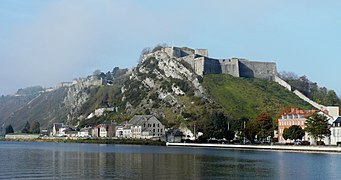
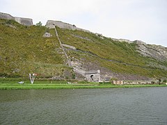
The Meuse then reaches Rancennes (721 hab.) and Givet (6618 hab.< /span>), the last French city before the Franco-Belgian border. In Givet is the Charlemont fort, an important fortress built by Charles V between 1555 and 1564 and which passed into French hands, together with the town, in execution of the Treaty of Rijswijk signed in 1697 by Louis XIV. Then the fortress was reformed by Vauban.
By leaving French territory, the Meuse has traveled 486 km following more or less an S-N direction.
- In French Ardennes (and IV)
The Mosa in Fumay

The Mosa in Haybes

Dam in Fépin
The Mosa in Vireux-Molhain

.JPG)


Chooz nuclear power station
The Mosa in Chooz
The Mosa in Givet
The door of France and the fortress of Charlemont, in Givet, seen from the green road.


The Meuse in Belgium
The Meuse in the province of Namur
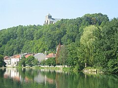
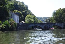
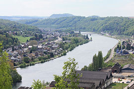
The Meuse, after having completed its crossing of the Ardennes, sensu stricto, enters Belgium through the province of Namur (Walloon region), near Heer-Agimont, at an altitude of 98m. In a short stretch the river separates two natural regions: the Fagne, on the left, and the Famenne, on the right. The Meuse passes through the small town of Hermeton-sur-Meuse (550 inhab.) — past which it receives the short Hermeton River (33 km), to the left—and then Hastière (5,708 inhab. in 2015).
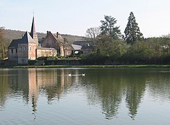
Then the Meuse enters the natural region of the Condroz, a limestone plateau where the river has carved its course between crags, leaving the western Condroz on the left and the Vrai Condroz (True Condroz) on the right.). It continues its slow course through Waulsort —home to Waulsort Abbey, founded in 946 by Otto I— and Anseremme (1000 inhab.), where it passes on the right to the river Lesse (89 km).
- The Mosa in the province of Namur before Dinant (Belgium valona)

Bridge in Heer-Agimont, about 200 m from the Franco-belga border

The Church of Saint Peter (1033-1035), in Hastière

The Mosa in Waulsort, with the Abbey of Waulsort in the first term

The Mosa and the Rochers de Freÿr (roquedos), and castle and gardens of Freÿr, between Waulsort and Anseremme
_over_the_Meuse_near_Heer-Agimont-9331.jpg)


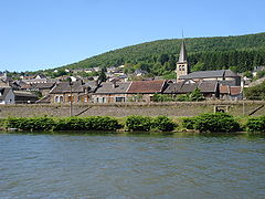
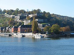
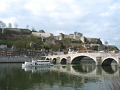
The Meuse then reaches the city of Dinant (13,912 inhabitants), a medieval town historically dependent on the Principality of Liège and located opposite its rival Namurian Bouvignes-sur-Meuse. Until the middle of the XI century, due to a geopolitical oddity common in the Middle Ages, Dinant was shared between the authority of the Count of Namur and the prince-bishop of Liège. Its position on the edge of the two enemy countries, each one on a bank of the Meuse, will seal its fate in the constant opposition between the German East and the Latin West. Closure of the Meuse, the city sees the conflict of the copper battery and the production of brass:
Bouvignes on the opposite shore actually has large deposits of derle, the white clay used by copper workers to cast their molds. That same brassware will bring an immense fortune to the city. These tensions reached their culmination in 1466, when Dinant was besieged by the armies of the Duke of Burgundy Felipe the Good. In just eight days the city falls, being given over to looting and slaughter. The surviving tinkers, for their part, were invited to join Namur in freely practicing their profession. This move dealt a fatal blow to the profession and to the medieval city.
The Meuse continues north through Houx (807 hab.), Anhée (7074 hab..) —where it receives from the right the short Molignée river (22 km)— and Yvoir (9339 inhabitants), located at the confluence on the right bank with the Bocq river (45 km). Then continue through Annevoie-Rouillon (691 hab.), Rivière, Godinne (1739 hab.), Profondeville (11,699 hab.).
- The Mosa in the province of Namur (Belgium valona)
Anseremme Bridge, shortly before arriving at Dinant

The Mosa in Dinant (city and school)

The Mosa in Dinant
The Mosa in Godinne
The Mosa in Profondeville

.JPG)

.JPG)
.jpg)

It continues through Boreuville, Pairelle, La Plante, on the outskirts of Namur (110,691 inhabitants) and immediately reaches the capital, where it receives the Sambre (190 km) on the left.
Namur is one of the most important cities of its course, current capital of the Walloon region and historical capital of the county of Namur (981-1795). The city began as a major trading settlement in Celtic times, straddling the E-W and N-S trade routes that crossed the Ardennes. The Romans settled after Julius Caesar defeated the Aduati tribe.
Namur already gained importance during the Middle Ages, when the Merovingians built a castle on the rocky spur overlooking the city at the confluence of the two rivers. In the X century, it became a county in its own right. The city developed somewhat unevenly, as the counts of Namur could only build on the north bank of the Meuse—the south bank was owned by the bishops of Liège and developed more slowly in the town of Jambes (now a suburb of Namur).
In 1262, Namur fell into the hands of the Count of Flanders, and was purchased by the Duke of Burgundy Philip the Good in 1421. After Namur became part of the Spanish Netherlands in the 1640s, its citadel was strengthened considerably. Louis XIV of France invaded the region in 1692, capturing the city and annexing it to France. Its renowned military engineer Vauban rebuilt the citadel. Then it goes through Dutch, Spanish, Austrian and finally Belgian hands.
Leaving Namur, the Meuse heads almost west, slightly NWO. The river will again be a natural boundary between two natural regions, to the north the Hesbaye plateau and to the south the Chondrusian Ardennes. In this section it passes through Sclayn (1,500 hab.) and Andenne (25,729 hab.), a city renowned for its ceramics, just before leaving the province.
- The Mosa in the province of Namur (Belgium valona)

The Mosa in Namur
The Mosa in Namur (the citadel in the center, to the left the Mosa and to the right the mouth of the Sambre)
The Mosa in Namur, the bridge of Jambes and the citadel
The Mosa in Sclayn from the natural reserve of Sclaigneaux

The Mosa in Andenne


.jpg)


The Meuse in the province of Liège
Already in the province of Liège, the Meuse crosses the old Walloon coal basin. It passes a major sugar refinery of the Raffinerie Tirlemontoise Group (RT Group), just at the entrance to the small town of Wanze (13,626 inhabitants.), where it receives the Mehaigne on its left bank (59 km). It then continues on to Huy (20,232 hab.), where it meets the Hoyoux River (28 km) on its right margin. In the Middle Ages, Huy was one of the most prosperous towns on the Meuse River with a strong economy based on metallurgy as well as wine, wood and sculpture manufacturing. As early as the X century, it changed its status from town to city and formed part of the principality-bishopric of Liège for more than eight centuries.. In the 13th and 14th centuries the economy developed thanks to the loom industry and the castle, which became a symbol of the city, was occasionally used in times of war. At the end of the XVII century the wars of Louis XIV caused repeated attacks on the city to the point that the frustrated inhabitants themselves dismantled in 1715 their own castle, which had caused them so much trouble. In 1818 the construction of a new fort began by the Dutch. This was a strategic defense position during the two world wars.
- The Mosa in the province of Liège (Belgium valona, I)
The Wanze Mosa, with the dull bridge Père Pir and the sugar refinery's goats to the bottom
Ruins of the château of Poilvache (Yvoir)
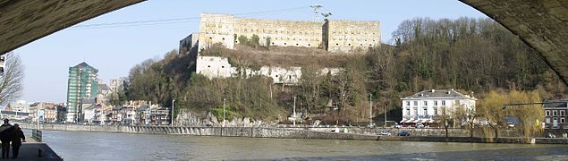
View of Huy's fort from the Batta district


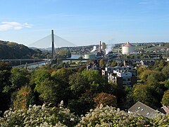
Leaving the city of Huy behind, the Meuse helps to cool the Tihange nuclear power plant, located on its right bank, commissioned in 1975 and which has three reactors that supply a power of 2985 MW. In an increasingly industrialized environment, it then continues through the town of Engis (5,811 hab.), Ramioul —home to the Préhistomuseum, an important museum of prehistory of Wallonia—and Seraing (61,237 inhab.). Seraing was a well-known place from the XI century, when Prince-Bishop Henry I of Verdun built a summer house in which he received his noble guests. In the Middle Ages, the people of Seraing obtained tax exemptions in exchange for a commitment to defend the city of Liège from invaders coming from the Meuse. In 1381, the first wooden bridge over the river was built. The village, which maintained its rural character until the end of the 18th century, began to change after the discovery of coal in Ougrée. The first steel mills were built in 1809 and Seraing became an industrial city that maintained its strength until the coal crisis (in the 1970s, when many mines closed) and the successive steel crises, when it experienced many social problems. Now it is trying to diversify with the creation of an industrial and scientific park, where the ArcelorMittal steel research center and many technological, aerospace, computer companies are located...
- The Mosa in the province of Liège (Belgium valona, II)

Tihange nuclear power plant cooling towers

Central Engis

Thermal center in Seraing
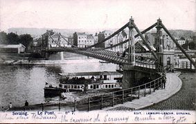
Bridge in Seraing (1902)


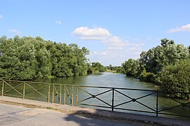
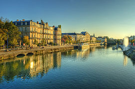
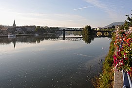
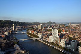
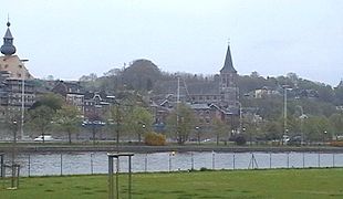
Finally, the Meuse reaches Liège, the provincial capital (196,970 inhabitants) and the most populous Walloon city. It is also the most populous city bathed by the river in its entire course, located at the confluence with the Ourthe River (165 km) which approaches it from the right and coming from the south. Liège is a city of great historical importance, capital and heart of the Principality of Liège, an ecclesiastical state of the Holy Roman Empire (980-1795) arising from the thriving bishopric of Liège. The Meuse crosses Liège in a general SW-NW direction, in a section of about 12 km that is fully canalized. In the old city, the floodplain of the river is still narrow (average width 1.3 km). The city is also crossed by the Ourthe and Vesdre, which come from the southeast, and by the Légia, from the west, a now underground river. The city has several canals: the Alberto canal, inaugurated in 1939, which allows reaching the Scheldt estuary leaving Monsin Island; the diversion that replaces several branches of the Meuse and the Ourthe to facilitate navigation and reduce flooding; and the Ourthe canal, a vestige of a canal project between the Meuse and the Moselle. Before, the Meuse and Ourthe divided into many arms that dotted the city, but they were gradually blinded and became important boulevards. The city has seen many floods, the most important being those of 1571, 1647, 1740, 1850 and 1926.
Liège has developed on both banks of the river and on the island of Outremeuse, a fluvial island surrounded by two arms of more than 3.5 km in length. The river is crossed by many bridges, mostly recently built viaducts that support modern infrastructure, since the old bridges were mostly dynamited in one of the two world wars. Leaving Liège, the Meuse divides again around Monsin Island, leaving a derivation to the left that feeds the aforementioned Alberto channel. In order to guarantee the water supply to the canal, the Monsin bridge and dam, a regulating dam with a hydroelectric power station, was built in 1928-1930 on the main course of the Meuse. To celebrate the inauguration of the canal, the Liège International Exposition (1939) was held, conditioning part of Monsin Island and the banks of the Meuse. Now that environment has been totally transformed with port and manufacturing facilities.
- The Mosa in Liège
The Mosa in Liège

Canal Alberto and entrance of the autonomous port of Liège

View of the International Exhibition of Liège (1939) from the cable car (1939)

Another view of the Exhibition area


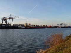
The Meuse soon reaches the small town of Herstal (39,242 inhabitants), now a suburb of Liège. There the river turns and flows north again. Liege's major autonomous port lies between the Meuse to the east and the Albert Canal to the west, with more than 26 km of docks. It is the most important river port on its course and one of the largest inland ports in Europe, with a total of goods transported in Wallonia in 2014 of around 40 million tons, mainly through the Meuse and the Sambre.
After passing through Vise (17,341 inhab.), the Meuse finally leaves the Walloon region at an altitude of 47m after traveling 128km. From Namur to Vise, the Meuse is used to produce electricity in six hydroelectric plants. Wallonia is the region with the largest basin of the Meuse, since it has 12,000 km², a third of its total area. The stretch of river between Liège and Maastricht is known as the Basse-Meuse region.
- The Mosa in the province of Liège (Belgium valona)

The Mosa to the exit of Liège (to the left the Mosa, to the right the derivation

Tired bridge in Herstal
The Mosa in Visé


The Meuse International Border


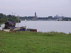
The Meuse enters a section that will be the international border: first, between the Belgian province of Liège and the Dutch province of Limburg, a short section of about 5.5 km where it bathes the small Dutch city of Eijsden (11,690 inhab. in 2007); then the Meuse makes a brief foray (less than 8 km) into the Netherlands, a short stretch passing through the city of Maastricht (121,010 pop. and where it meets the Geer River on the left (54 km).
Then the Meuse forms another long stretch of international border, this time between the Flemish province of Limburg and its Dutch namesake. It bathes in this stretch first the small Belgian towns of Smeermaas (a village in Lanaken, 25,793 inhab.) and Maasmechelen (37,406 pop.), and then the Dutch Elsloo (8,780 pop.) and Stein (11,075 inhab.), which has an important industrial river port on the Juliana channel. It then follows small Stokkem (3134 hab.) (Belgian), and Obbicht (2280 hab. ), Grevenbicht (2,500 pop.) and Roosteren (1,568 pop.) (Dutch), and then to Maaseik, also Belgian (24,865 inhabitants). About ten kilometers downstream it definitively leaves Belgian territory where it has covered a total of 183 km.
- Border Mosa

The Mosa in Eijsden
Maaseik

Bridge near Maasmechelen
Stein industrial port on the Juliana channel
.JPG)


The Meuse in the Netherlands

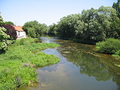
The Meuse continues its course to the north, slanting slightly to the east and closely following the Dutch-German border for a long stretch of about a hundred kilometres. In the first Dutch section, the Meuse passes in front of the towns of Maasbracht (13 614 inhabitants), Wessem (2,210 pop.), Beegden (1,800 pop.) and then on to Roermond ( 57,030 inhab.), located to the west, where it receives from the right bank, and coming from the south, from Germany, the river Rur (Rour or Roule) (100 miles). Roermond received town rights in 1231 and its center has been designated as a conservation area. Over the centuries, the city has played an important role as a commercial center, the principal city of the Duchy of Gelderland, and since 1559 has served as the seat of the Catholic Diocese of Roermond.

Then the Meuse continues through Beesel (13,354 hab.), Kessel (4,246 hab.< /span>), Belfeld (5,450 pop.), Tegelen (18,961 pop.) and runs through the city of Venlo (100,369 pop.). Venlo's history dates back to the Roman Empire and was already an important port. It received city rights in 1343 and became a member of the Hanseatic League in 1375. Due to its strategic importance, the city of Venlo has been besieged on several occasions, the most significant being in 1702, by Menno van Coehoorn, when Venlo was incorporated into the Lands of the Generalitat of the United Provinces and later became part of the Kingdom of the Netherlands.
The river continues its progress bathing the small towns of Arcen (2,479 inhabitants), Lottum ( 2020 inhab.) and Wanssum (1970 inhab.). To the right of the Meuse, between the river and the border, an area of approximately 4,500 hectares with dunes, was declared in 1996 a national park De Maasduinen.
- The Mosa in the Netherlands (I)

Maasbracht, the city near Julianakanaal and Mosa
The Mosa in Roermond, outstanding

Bridge in Venlo
The Mosa in Maasduinen National Park


Then it reaches Boxmeer (28,504 pop.), Beugen (1,762 pop.), Gennep (17,070 pop.) and Molenhoek (3,691 pop.). The Meuse then turns to head west, and after leaving behind the small town of Cuijk (24,641 inhab.) the Meuse al Waal channel leaves its course, a derivation to the right and in a northwesterly direction that connects with the Waal, one of the main branches of the Rhine, near the city of Nijmegen (168,292 inhab inhab.< /span>). The Waal flows more or less parallel to the west and the Lower Rhine runs further north. From the derivation of the canal, the Meuse becomes the border between the provinces of Gelderland (north) and North Brabant (south). Follow the river through Appeltern (835 hab.) —where the Appeltern Gardens have stood since 1988, a 22-hectare complex with 200 Dutch gardens designed by Ben van Ooijen and other designers, authors of gardening and landscaping books—, Grave (12,746 pop.), Ravenstein ( 8466 rooms), Alphen (1700 rooms), Lith (6656 rooms< /span>), Heerewaarden (1,460 hab.) —which has a small marina on an alluvial lagoon, the Lithse Ham recreation complex)— and Kerkdriel (< span style="white-space:nowrap">7,357 hab.) —which also has an alluvial lagoon with a marina.
- Mosa in the Netherlands (II)

The river in Boxmeer

Between Gennep and Oeffelt

John S. Thompson Bridge, near Grave

Grave, the marina with the church of Santa Isabel

Bridge near Ravenstein
_Zuidereiland,_Zicht_op_Maas_en_Haven_Boxmeer.jpg)


Then the Meuse passes north of Bolduque (or 's-Hertogenbosch or Bois-le-Duc) (107,870 pop.), which was one of the four main cities of the Duchy of Brabant (the others were Brussels, Louvain and Antwerp). It was founded in 1185 by Duke Henry I of Brabant, at the confluence of the Dommel and the Aa, which together form the Dieze. It was a place of pilgrimage, the largest Marian shrine in the Netherlands.
Follow Hedel (4871 rooms), Ammerzoden (3502 rooms), Aalburg (13,015 pop.) and Heusden (43,199 pop.), where the Meuse is divided between the Bergsche Maas —Bergen's Meuse, which receives all the water from the Meuse since its opening in 1904— and the Afgedamde Maas —barred or dammed Meuse, which was the previous course of the river. The name of the river will still change several times before flowing into the sea.
Here its course ceases to be a provincial border —which follows the old course— to enter momentarily (about 30 km) into North Brabant. It passes Waalwijk (46,495 pop.) and Raamsdonksveer-Keizersveer (12,345 pop.), where he receives little Donge from the left. From here, in a short stretch, it is called Amer, being the southern limit of the Nationaal Park De Biesbosch, a national park established in 1994 at the confluence with the Waal, which protects an area of about 90km2. In the small town of Lage Zwaluwe (4,209 hab.), where it meets the Nieuwe Merwede again, it becomes the Hollands Diep, again being the limit provincial with Gelderland.
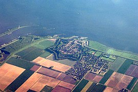
The Hollands Diep (about twenty kilometres) also receives part of its water through the Waal via the New Merwede. This arm arrives after having partly crossed the Biesbosch. In this section is Moerdijk (36,822 hab.) and then reaches Willemstad (2,329 hab.), a small historic town that received city rights in 1585 and still has its well-preserved fortifications. It lies at the end of the Hollands Diep, near where it divides into the Haringvliet and the Volkerak. Today the Meuse empties through the Haringvliet inlet, a stretch of about 32 km, which lies a considerable distance south of the Nieuwe Waterweg (New Channel), the main mouth of the Rhine into the North Sea., about thirty kilometers after passing Rotterdam to the south (Dutch Rotterdam).
- The Mosa in the Netherlands (III)
The small town of Veen (Aalburg) view from Aalst
Willemstad seen from the air, with clearly visible fortifications
.JPG)

Whenever the flow is low, the Haringvlietdam is closed. The waters then meet with the Old Meuse and the Nieuwe Waterweg.
Before the Delta plan was carried out, the island of Overflakkee separated the river into two inlets: to the north, the Haringvliet and to the south, the Volkerak, then the Krammer and Grevelingen. But today, with the construction of the Philipsdam, the waters of the Meuse no longer reach the Volkerak.
.png)


Several inlets that correspond to the former course of the Meuse still bear his name, even though when the Haringvlietdam is open, none of the water coming from the Meuse actually passes through them:
- Old Mosa (vieille Meuse, Oude Maas) who separates from the Waal to the east from his mouth in the Haringvliet. This arm is headed for the Nieuwe Waterweg.
- Mosa de Brielle (Meuse de Brielle, Brielse Maas).
- New Mosa (Nouvelle Meuse, Nieuwe Maas) crossing Rotterdam (Dutch). However the water flowing in the New Mosa comes to a large extent from the Rhine, so it should be called to Rotterdam a Renana city (Rijnstad) instead of a Mosana city (Maasstad).
The mouth of the Meuse forms with that of the Scheldt (Escaut/Schelde) and the Rhine a large delta, the Rhine-Meuse-Scheldt delta, partially dammed by the works of the Delta plan, before flowing into the North Sea at the end of a 950km course.
Abusively, the Meuse is often considered a confluent river with the Rhine and not a river that flows into the sea itself. In particular, it is not part of the great French rivers that are taught in primary school in France because only half of its total route runs through French soil and its basin is relatively narrow (for geological and physical reasons it does not receive a large tributary of the Rhine: the Moselle), so its flow is quite low. In contrast, in Belgium (where it has spread) and the Netherlands, it is considered an important river, serving as the main artery for the transport of goods and has shaped the history and geography of those countries.
Dams
- Dams and reservoirs in the Mosa
Waulsort (Belgium)

Dam in Andenne (Belgium)
Presa in Haybes
Presa in Fépin


Hydrology

The river follows its natural course in its upper part, subject to low water levels and significant floods and is only navigable in sections. Downstream, still in French territory, it is channeled, sometimes forming the northern branch of the East channel. After Saint-Mihiel its flow already allows the navigation of gabarit Freycinet vessels (250 tons with 1.80 m draft). From Givet, it is made navigable for péniches (barges) of 1350 tons. Past the autonomous port of Liège and up to Rotterdam, it admits ships of the Rhenish type (2500 tons) and barges and 2x4,500 tons.
The Ardennes Canal connects the Meuse with the Aisne and thus with the Seine. The Alberto canal, in turn, connects the Meuse (starting from Liège) with the Scheldt (up to Antwerp), passing through Bouchon de Lanaye. The failed Ourthe canal project also began in Liège and was initially supposed to reach the Rhine basin and save Luxembourg thanks to a Meuse-Moselle link.
The Meuse is traversed by many recreational boats. Its deep meanders in the crossing of the Ardennes massif are all popular tourist spots.
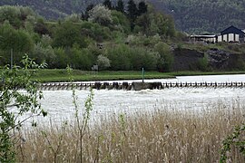
A major flood occurred in January and March 1910, exceeding that of 1886 at Nouzon.
Flow rate
- The flow of the Mosa in Domrémy-la-Pucelle, before the confluence with the Vair, is from 13,3 m3/s. The contribution of 5 m3/s from the Vair makes this flow to 18.5 m3/s, and the Mosa then becomes a medium-sized river. Its flow passes to 21,2 m3/s in Vaucouleurs, 24.2 m3/s In Commercy, 30.5 m3/s in Saint-Mihiel, 47.3 in Stenay, and more 80.0 m3/s in Sedán and 107 m3/s to the exit of Charleville-Mézières.
- The average flow observed in Heer (Hastière Commune), a little downstream of Givet, at the Franco-Blegian border, between 1995 and 2004 is from 163,2 m3/swith a maximum average 221.0 m3/s in 2001 and a minimum average 100.3 m3/s in 1996.
- The average flow in Namêche, a little downstream from Namur, observed during the same period 1995-2004, was from 210.8 m3/swith a maximum average 297,1 m3/s in 2001 and a minimum average 122.0 m3/s in 1996.
Flow on the Franco-Belgian border
The Meuse is not a very regular river. Its flow has been observed for 56 years (1953-2008) at the Chooz hydrological station (on Graviat Island, no. B7200010), a town in the Ardennes department upstream from the city of Givet, i.e. not far from the Franco-Belgian border. The station is at an altitude of 99 m and collects water from a basin with an area of 10 120 km2, but does not include the Houille, Alyse and other stream basins.
The modulus of the river in Chooz is 144 m³/s (not including, as already mentioned, the flows of the Houille, the Alyse, etc..).
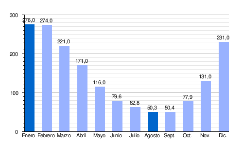
The Meuse presents well-marked seasonal fluctuations in flow. High water occurs in winter and early spring, and is characterized by mean monthly flows ranging from 225−277 m³/s, December through March inclusive (with a maximum in February). Beginning in April, the rate declines rapidly until the summer low, which occurs from June to October, reducing the average monthly flow to 51.4 m³. /s in August and 50.5 m³/s in September. But these monthly averages hide more pronounced fluctuations in short periods or between years.
| Average monthly flow of the Mosa at Chooz station (in m3/s; data calculated in the period 61 years, 1953-2013) |
 |
In dry season, the VCN3 (minimum consecutive volume of 3 days) can drop to 11 m³/s in the case of a five-year dry period, which can be considered severe for a thriving water course.
Floods can be extremely significant. The QIX 2 and QIX 5 are respectively 690 and 950 m³/s (QIX =maximum instantaneous amount). The QIX 10 is 1100 m³/s, the QIX 20 is 1300 m³/s, while QIX 50 climbs to 1500 m³/s. This means, for example, that every 50 years (on average), a flood of the order of 1500 m³/s is expected, which corresponds to the average flow of the Rhône in Valence after receiving the waters of the Isère.
The maximum instantaneous flow recorded at Chooz was 1610 m³/s on January 30, 1995, while the daily maximum value was 1560 m³/s on the same day. Comparing the first of these values on the QIX scale of the river, it is seen that this flood was well above the level defined by the fiftieth QIX 50, and therefore quite exceptional.
The Meuse is a rich river. Runoff in this quintessentially French part of its basin is 452 mm per year, which is significantly higher than the general average for France (320mm). The specific flow (or Qsp) reached 14.3 liters per second and per square kilometer of the basin.

Geomorphology and evolution of the channel
The crossing from the south to the north of the Ardennes massif along the course of the Meuse is a remarkable feature of this river. In general, the water currents start from a massif to reach the plain and then the sea.
The excavation of this valley is due to a particular chronology of geomorphological events in the region:
- During the Oligoceno, there was an opening of the renana pit accompanied by an elevation (overelevation) of its epaulements, the Black Forest and the Vosges Massif. From the Vosges a hydrographic system is organized: Mosa, Mosela, Meurthe; the Moselle had been for millions of years an tributary of the Mosa, which led to this river at the height of Pagny-sur-Meuse that has suffered a capture for the benefit of the Rhine.
- During the last millions of years, by the bark's composition, the Ardennes' massif was overtaken, where the Mosa was already passing. This slow elevation (with less than 1 mm per year), however, allowed the river to maintain its base level by excavating in the course of the years a deep valley in the massif of the Ardennes.
This explains how this river was able to maintain its slope when the surrounding terrain has taken a reverse slope. And it also explains the depth of the ravine that is the valley of the Meuse in the Ardennes.
According to some authors, this situation is unstable. the basin's hydrographic network should —in the distant future— be reorganized to the detriment of the Meuse. On the one hand, the lower part of its course in France will become a tributary of the Aisne, and through it the Seine, diverted south to the entrance of the Ardennes by the valley of the Bar. On the other hand, its upper course will it will become a tributary of the Moselle, and thus the Rhine, from the course at Neufchâteau. The riverbed has changed throughout recent history due to the low elevation of the floodplain. Man has often intervened.

The river flowed through the Oude Maasje and in 1273 the channel was diverted via the present Afgedamde Maas to the northwest, until the confluence with the Waal, this until 1904. Since the floods of Saint Elisabeth in 1421, the Waal and the Meuse met at Gorinchem to form the Merwede. The New Meuse has been clogged up and the artificial Nieuwe Waterweg [new canal] was inaugurated in 1872 so that Rotterdam could continue to be a seaport. The Heusden channel was dug in 1883 when the Afgedamde Maas began to fill with silt.
In order to fight against the floods, the Meuse was dammed in 1904, after Well, according to the plans of Cornelis Lely and was redirected to a new artificial arm, the Bergsche Maas, which then continues up the Amer towards the Hollands Diep. The Old Meuse is now one of the branches of the Rhine and no longer receives water from the Meuse, but still retains its name. Navigation is still possible between the Afgedamde Maas, now an almost dead arm, and the Rhine. The gatehouse: Kromme Nolkering can be lowered if necessary, while the Wilhelmine lock near Giessen ensures that the waters of the two rivers separate.
The mouth of the river until the 17th century, called the Meuse de Brielle, was finally dammed in 1950 and forms a dead arm, the Brielse Maas.
Today a small part of the river's water is diverted into the Dordtsche Kil and the rest enters the Haringvliet; from there they are diverted in an artificially controlled way, through the Haringvlietdam in the North Sea and on the Spui to reach the Vieille Meuse.
Distributors

The mean annual discharge rate of the Meuse has been relatively stable over the past several thousand years. A recent study estimates that the mean flow has increased by 10% since 2000 BC. The hydrologic distribution of the Meuse changed during the Middle Ages, when a great flood displaced its main course to the north, towards the Merwede River. Thereafter, various stretches of the original Merwede were named "Maas" (ie Meuse) instead and served as the main outlet for that river. Those branches are known today as Nieuwe Maas and Oude Maas. The resulting separation of the Rhine and Meuse rivers is considered to be the greatest achievement in Dutch hydraulic engineering before the completion of the Zuiderzee Works and the Delta plan works. By 1970, the Haringvlietdam had been completed. Since then the combined waters of the Rhine and Meuse have reached the North Sea, either at this site or, in times of lower Rhine discharges, at the Hook of Holland.
A 2008 study indicates that the difference between summer and winter flows has increased significantly in the last 100-200 years. Those studies predict that winter flooding of the Meuse may become a recurring problem in the next decades.
Culture
Mosan art
The Meuse, which crosses eastern Belgium from part to part, has given its name to the Mosan art that brings together a set of Carolingian-inspired productions, made mainly in the former diocese of Liège (400-1559), between the Holy Roman Empire and France from 900 to 1600, and which puts the history of Wallonia and the Principality of Liège into perspective, in a long cultural moment with architecture and the beautiful collegiate churches of Hastière, Nivelles, Saint Bartholomew of Liège, with the work of wood, ivory, metals (the baptismal fonts of Saint Bartholomew, the dinanderie [brass objects], for example).
Literary tributes
Charles Péguy put these verses in the mouth of Joan of Arc, born in Domrémy on the banks of the Meuse:
Adieu Meuse endormeuse et douce à mon enfance,
Qui demeures aux prés où tu coules tout bas.
Meuse adieu: j'ai déjà commencé ma partance
In des pays nouveaux où tu ne coules pas.Bye Mosa numb and sweet in my childhood,
that you remain in the meadows where you sink down.
Farewell Mosa: I have already begun my departure
In new countries where you don't go.
In his book Une certaine idée de la Wallonie (A Certain Idea of Wallonia), which he had to illustrate based on a painting by Henri Blès, Paul-Henry Gendebien describes the intellectual process of the great Mosan painter thinking of all the places in Europe where you can see his work:
L'Europe voit qu'un paysage du maître wallon - qui est mosan et qui ne peut qu'être mosan - est aussi le paysage par excellence, ce qui le hisse par le fait même au rang d'image de l'Univers.Europe sees that a landscape of the valon master—which is Mosano and which can only be Mosano—is also the landscape par excellence, which put it by the fact itself to the image range of the Universe.Une certaine idée de la WalloniePaul-Henry Gendebien
André Dhôtel is a Mosan who, from the French Meuse to the Belgian Meuse, has written this extraordinary novel in which Bayard is the heroTemplate:Refnec, Le Pays où l'on n'arrive jamais [ The country where you never arrive]. There is in this book, curiously, the ghost of the sea and of the great Flemish or Dutch towns, where the Meuse meets the sea between the cathedrals and the beffrois.
There are many links along the course of the Meuse, both French and Belgian. Rita Lejeune has drawn the map of the place names linked to the legend of Bayard, from the Langres plateau to Maastricht.
Jacques Brel evokes the Meuse in «Je suis un soir d'été» or in «Il neige sur Liège».
Dominique A cites the Meuse in his song "La pleureuse", emphasizing the dark side of the river compared to the blue of the Danube.
In plombeur de ces Dames
Ou en consolateur,
If you and trouves ton compte
J'inonderai ton cœur.
Et que le beau Danube
It becomes the Meuse
Et je suis ta pleureuse
Oui, je suis ta pleureuse
Pour toujours ta pleureuse.In the ladies' room
Or dildo,
If you find your account
I will flood your heart.
And that the beautiful Danube
It becomes the Mosa
And I'm your cryona
Yeah, I'm your cryona.
Forever your cry.«La pleureuse», Dominique A
Philippe De Riemaecker in La Mosane weaves a tender complicity between the river and his writings:
À cet endroit précis, la Meuse s’arrête quelques instants, le temps d’une respiration, perturbée qu’elle est par une écluse et bordée d'une imitation sauvage, que les hommes ont placés là, pour le plaisir des yeux et des enfants. Ce bout de terre apprivoisée s'étend sur une bonne distance et s’étendrait davantage s’il n’était arrêté par un alignement de bâtisses imposantes d’une architecture recherchée et particulière à cette région. Il y a de l’harmonie à ce paysage bon enfant dans lequel une marriage de bon goût a trouvé refuge. Au centre de ce paysage se découpe une maison dite « de Maître », gardée par une haie en fer forgé, vers laquelle plongent deux volées d’escaliers faites de pierres arrachées à la colline.At this precise point, the Mosa stops a few moments, the time of a breath, disturbed as it is by a lock and bordered by a wild imitation, which the men have placed there, by the pleasure of the eyes and the children. This piece of domesticated land spreads over a good distance and would extend even more if it was not stopped by an alignment of imposing buildings and a rebused and particular architecture of this region. There is harmony in this landscape good boy in which a good-looking bourgeoisie has found refuge. In the center of this landscape stands out a house called "Master", guarded by a fenced iron fence, towards which two sections of stairs made of stones torn to the hill.The Mosane, Philippe De Riemaecker
Military Tributes
The Meuse is mentioned in the chorus of the military song Verdun! On ne passe pas, written in 1916 by Eugene Joullot and Jack Cazol, on the occasion of the battle of Verdun.
Et Verdun, la victorieuse,
Pousse a cri que portent là-bas
The Meuse's bods,
Halte là! On ne passe pas!And Verdun, the victorious,
Throw a cry out there
The echoes of the edges of the Mosa
Stop right there! No way!
Cities and towns along the river
Many of the communities along the Meuse River are listed below; most have a historical significance or cultural tradition that links them to the river. Those with more than 200 inhabitants are listed below, from the source of the river to its end and the inhabitants correspond in France to the year 2013, in Belgium to 2015 and in the Netherlands to 2012.
Locations on the banks of the Mosa River |
|---|
|
Annex: Tributaries of the Meuse River
The river Meuse has many tributaries, generally short, the most important being those listed in the following table. The tributaries are arranged geographically, following the river from its source to its mouth.
| Ramal | Affluent name | Rio de Janeiro | Place of mouth | Length (km) | Cuenca (km2) | Caudal (m3/s) | Administrative entity(s) | Tram. | |||||
| - | D | Rio Mouzon | - | Neufchâteau | 63.3 | 415 | 4.76 | ||||||
| - | - | - | Rio Anger or Auger | Mouzon | - | 27.9 | 124 | 1,38 | |||||
| - | D | River Vair | - | Domrémy-la-Pucelle | 63.5 | 421 | 5.15 | Vosges | |||||
| I | - | Río Aroffe | - | Rigny-la-Salle | 50.2 | 265 | 0.825 | Meurthe-et-Moselle, Mosa, Vosgos | |||||
| - | D | Chiers River (Korn, Kor or Kuer) | - | Bazeilles | 127 | 2222 | 30.6 | Meurthe-et-Moselle, Ardennes Wallonia Aubange (LUX) | |||||
| - | - | - | Rio Loison | Chiers | - | 52.8 | 356,0 | 3,98 | Mosa | ||||
| - | - | - | Othain River | Chiers | - | 67 | 256,6 | 2.91 | Meurthe-et-Moselle, Mosa | ||||
| - | - | - | Rio Ton | Chiers | - | 32 | 318 | 5,05 | Mosa Wallonia | ||||
| - | - | - | Rio Crusnes | Chiers | - | 32.2 | 265,6 | 3,21 | Meurthe-et-Moselle, Mosa | ||||
| I | - | Bar | - | Vrigne-Meuse | 61.6 | 425 | 5.6 | Ardennes | |||||
| I | - | Rio Vence | - | Charleville-Mézières | 32.7 | 129.5 | 2.19 | Mosa | |||||
| I | - | Rio Sormonne | - | Charleville-Mézières | 56.5 | 411 | 6.36 | Mosa | |||||
| - | D | Rio Semois (Semoy en France) | - | Monthermé | 210 | 1350 | 35 | Ardennes Wallonia | |||||
| - | - | Houille River | - | Givet | 25 | 233.5 | 3,65 | ||||||
| - | - | Rio Hermeton | - | Hastière | 32 | 167. | 1.9 | Wallonia | |||||
| - | - | River Lesse | - | Anseremme | 89 | 1343 | 19 | ||||||
| - | - | - | River Lomme, Lhomme or L'Homme | Lesse | Eprave | 46 | 480 | 7.4 | Wallonia | ||||
| - | - | - | Wamme River | Lomme | Jemelle | 27 | 145 | Wallonia | |||||
| - | - | Río Bocq | - | Yvoir | 45 | 230 | 2.21 | Wallonia | |||||
| - | - | Rio Sambre | - | Namur | 190 | 2740 | 36 | Aisne, Nord Wallonia | |||||
| - | - | - | Rio Orneau | Sambre | Jemeppe-sur-Sambre | 25 | 203 | 1,8 | Wallonia | ||||
| - | - | - | Rio Eau d'Heure | Sambre | Charleroi | 47 | 344 | 3,8 | Wallonia | ||||
| - | - | - | Rio Helpe Majeure | Sambre | Noyelles-sur-Sambre | 69.1 | 329 | 3,86 | Wallonia | ||||
| - | - | - | Rio Helpe Mineure | Sambre | Maroilles | 51 | 275 | 3,76 | Wallonia | ||||
| - | - | Rio Mehaigne | - | Huy | 59 | 352 | 2.5 | ||||||
| - | - | Río Hoyoux | - | Huy | 28 | 239 | 2.0 | ||||||
| - | - | Rio Ourthe | - | Liege | 165 | 3624 | 55.2 | ||||||
| - | - | - | Río Vesdre | Ourthe | Chênée | 71 | 703 | 11.4 | Wallonia, Liège, North Rhine-Westphalia | ||||
| - | - | - | River Hoëgne or Hogne | Vesdre | Chênée | 30 | 215 | 6.3 | Wallonia | ||||
| - | - | - | Rio Amblève | Ourthe | Comblain-au-Pont | 93 | 1077 | 19.5 | Wallonia | ||||
| - | - | - | Río Lienne | Amblève | Stoumont | 29 | 149 | 2.9 | Wallonia | ||||
| - | - | - | Rio Salm (Belgique) | Amblève | Trois-Ponts | 34 | 202 | 3.2 | Wallonia | ||||
| - | - | - | Rio Warche | Amblève | Malmedy-Warche | 41 | 192 | 4,5 | Wallonia | ||||
| - | - | - | Rio Aisne (Belgium) | Ourthe | Bomal | 31 | 187 | Wallonia | |||||
| - | - | - | Rio Ourthe oriental | Ourthe | Houffalize | 329 | 5.7 | Wallonia | |||||
| - | - | - | River Ourthe West | Ourthe | Houffalize | 406 | 7.2 | Wallonia | |||||
| - | - | Berwinne River | - | Fourons | 25 | 118 | 1.32 | ||||||
| I | - | Rio Geer | - | Maastricht | 54 | 463 | 2.7 | Limburg and Limburg (Belgium), Maastricht | |||||
| - | - | Rio Gueule | - | Meerssen | 56 | 121 | 1.5 | Wallonie, Limbourg Dutch | |||||
| - | - | Geleenbeek River | - | Stevensweert | 39.5 | area | |||||||
| - | - | River Swalm | - | Swalmen | 45 | 277 | Limbourg néerlandais, North Rhine-Westphalia | ||||||
| - | D | Rio Rur (Rour o Roule) | - | Ruremonde | 164,5 | 2360 | 25 | Liège Province, North Rhine-Westphalia | |||||
| - | - | - | River Wurm | Rur | Heinsberg | 53 | 355.5 | 1.4 | North Rhine-Westphalia | ||||
| - | - | - | Inde | Rur | Juliers | 54 | 374,23 | Liège Province, North Rhine-Westphalia | |||||
| - | - | - | Río Urft | Rur | 46,37 | 372,5 | |||||||
| - | - | - | Río Olef | Urft | Rurberg | 28 | 196,0 | Liège Province, North Rhine-Westphalia | |||||
| - | - | Rio Niers | - | Gennep | 117 | 1348 | Limburg (Netherlands), North-Westphalia | ||||||
| - | - | Río Dieze | - | Bois-le-Duc | 120 (including the Dommel) | 2600 | 22 | ||||||
| - | - | - | Rio Aa (North Brabant) | Mosa | Bois-le-Duc | 90 | |||||||
| - | - | - | Dommel River | Mosa | Bois-le-Duc | 146 | North Brabant, Limburg | ||||||
| - | - | - | Esschestroom-Reusel | Dommel | Oisterwijk | 32 | North Brabant | ||||||
| - | - | - | River Beerze | Dommel | 45 | North Brabant | |||||||
- Grevelingen, Krammer, Volkerak
- Steenbergse Vliet (Steenbergen)
- Aa ou Molenbeek (Rosendael)
- Dintel (Dinteloord)
- Mark (Zevenbergen)
- Aa of Weerijs (Bréda)
- Mark (Zevenbergen)
- Steenbergse Vliet (Steenbergen)
Contenido relacionado
Machu Picchu base
Wadati-Benioff zone
Alcazar of San Juan
Andes mountains
Periglaciate