
Rhone
The Rhône (French: Rhône; Occitan: Ròse; Franco-Provençal: Rôno; in dialectal German, Rotten) It is one of the great rivers of Central Europe, the most important on the Mediterranean slope, which runs through Switzerland and France. With a length of 812 km —290 km in Switzerland and 522 km in France— is the 2nd European river on the Mediterranean slope, the 3rd in France and the 40th in Europe. It drains a large basin of 97,800 km², mostly in France.
The Rhône rises at an altitude of 2,209 m on the Rhône Glacier in the Swiss Lepontine Alps, at the eastern end of Valais. In its upper course it runs through a glacial valley between the Bernese Alps, to the north, and the Valesan Alps, to the south, until it empties into Lake Geneva. It crosses the lake and enters France, beginning its middle course, which runs in a general westerly direction over the western foothills of the Alps, toward Lyon, the largest city along its course, where it receives the Saone, its largest tributary. long. It then flows south, between the Alps and the Massif Central. At the height of Arles, the river divides into two large branches: the Grand Rhône to the east and the Petit Rhône to the west, between which the vast Camargue delta forms, before flowing into the Mediterranean Sea in the Gulf of de León (from French: Golfe du Lion).
In Switzerland, the river flows through three cantons and in France, it irrigates 3 regions and 21 departments. Many cities are found along its course: in Switzerland, Sierre (16 332 pop.), Sion (32,797 pop.), Martigny (17,215 pop..) and Geneva (191,557 inhab.); and in France, Lyon (496,343 hab.), Vienne (29,077 hab.), Valence (62,481 inhab.), Avignon (89,380 inhab.), Tarascon (13,540 inhab.), Beaucaire (15,860 inhab.), Arles (52,439 inhab.) and Port-Saint-Louis-du-Rhône (8,579 inhab.), the last one at its mouth. Some of these French cities —Vienne, Valence, Arles and Beaucaire— are towns of Art and History with an important historical-artistic heritage.
It is a very mighty river because it receives the waters of the Alps, on its left bank, and those of the French Massif Central and the Vosges, through the Saone, on the right. Its mean annual flow, measured at Beaucaire, is 1700 m³/s, which peaked on December 4, 2003 with 11,500 m³/s —a flood is considered when it exceeds 5,000 m³/s— of those extracted for consumption human an annual total of 2200 hm³. The strongest floods have been in 1840, 1856 and 2003 with 13,000 m³/s. The Rhône is the largest river in France and the second of the rivers that flow into the Mediterranean, after the Nile (without considering those that drain into the Black Sea, such as the Danube and the Don).
The river in its French course has been fully conditioned, both for the production of electrical energy and to prevent flooding in times of flooding, which has allowed safe navigation in a large part of its course, with important river ports —Lyon, Valence and Avignon—and even a cruise service from Arles to the city of Lyon. Navigation is completed with a large network of canals that connect with the Rhine basins (Rhône to Rhine canal), Seine, Loire and Garonne. The Rhône Valley produces a quarter of France's electricity – 7 nuclear power plants are located along the river – and the Rhône itself produces 20% of all hydroelectric power in the country.
Its main tributaries all arrive in the French section: on the right bank (west), coming from the Massif Central and the Cévennes mountains, Ain (190 km), Saône (480 km), Eyrieux (81 km), Ardèche (120 km), Cèze (128 km) and Gardon (127.3km); and from the left, coming from the Alps, river Arve (102 km), Isère (290 km), Drôme (110 km), Ouvèze (123 km) and Durance (323.8km).
Sometimes the Rhone is identified with the Eridanus, a river god from Greek mythology, son of Oceanus and Thetis.
Etymology
The origin and meaning of the name of this river are debated. According to the Celtic hypothesis, Rhodanus or Rodanus would come from Rhôdan, which means "to turn lively"; but the form of the name seems more Greek than Celtic, and Pliny the Elder in his Natural History reckons the Rhone to be named after Rhoda or Rhodanusia, an old colony of Rhodes formerly built at one of its mouths, near Aigues-Mortes.
In its southern part the river is called lou Rose in Occitan.
History
The Rhône is the only river that connects the Mediterranean with Northern Europe, and traces of occupation can be found in the valley and its banks since prehistoric times. In antiquity, tin, copper or furs were exchanged for their valley from the north in exchange for products from the East and the Mediterranean (ivory, spices, fabrics, etc.). Since the Rhoneans and Phoenicians, it was a main axis of circulation of people and goods and as such, it helped transmit Greek cultural influences to the western cultures of Hallstatt and later La Tène. Many Celtic tribes lived near the Rhône, such as seduni, sequani, segobriges, allobroges, segusiavos, helvetii, vocontii and arecomic volcas.
A structuring element in the organization of the territories, the Rhône also led men to work hard to tame it and especially to cross it. The Rhône was consolidated as an important communication route in the times of the Greeks and Romans. It was the main trade route from the Mediterranean to east-central Gaul, and with the Romans, it also became a route for commercial development, with wine, tableware and salt running through the valley in opposite directions, on the one hand, and on the other. weapons and fabrics of the other. The presence of the river allowed the development of cities such as Arles, Avignon or Vienne, which took advantage of their geographical advantages to cross it at the crossroads of the major land and sea communication axes. The river crossings also contributed significantly to the very history of the cities and territories.

In August 218 B.C. In BC, Hannibal crossed the Rhône with his army of 38,000 infantry, 8,000 cavalry and 37 war elephants with the aim of crossing the Alps. The most probable hypothesis is that his army crossed at the height of Caderousse where the Insulae Furianae were located according to uprising B due to the Orange Land Registry. The Roman army, commanded by Scipio, who was nearby on the left bank of the river, he tried to intercept them but failed to catch up, and for 4 days they followed the river at high speed to the mouth and rushed back to Italy so they could engage the enemy on their territory.
Navigation was always difficult, as the river had areas of strong currents, shallow water, flooding in spring and early summer when the ice melted, and drought in late summer. Until the 19th century, passengers traveled in coches d'eau (water cars) drawn by men or horses, or sailed. Many traveled with a painted cross covered with religious symbols as protection against the dangers of the journey.
For trade on the upper river, the Rhône barges (barques du Rhône) were used, sailing barges, 30 by 3.5 m, with a carrying capacity of 75 tons. Teams of up to 50 to 80 horses were used to tow convoys of five to seven vessels upstream. The goods were transferred in Arles to sailing barges, about 23 m, called allèges d'Arles to cover the final stretch towards the Mediterranean.
The first experimental steamship was built in Lyon by Jouffroy d'Abbans in 1783. Regular services did not start until 1829 and continued until 1952. Passenger steamships of 80−100 m long, they went up the river to 20 km/h and could make the downward journey from Lyon to Arles in one day. The loads were hauled in bateau-anguilles, boats measuring 157 by 6.35 m with paddle wheels amidships, and bateaux crabes, which had a huge & #39;claw', a 6.5m sprocket for propelling itself across the river bed in shallow water as a complement to the wheels of palettes. In the 20th century, powerful tugboats powered by diesel engines were introduced into the river, carrying as many as 1500 tons.
In 1933, the Compagnie Nationale du Rhône (CNR) was established to tame the river. Some progress was made in deepening the navigation channel and in the construction of side walls, but the Second World War brought a halt to the work. In 1942, following the collapse of Vichy France, Italian military forces occupied south-eastern France as far as the eastern bank of the Rhône, as part of the Italian Fascist regime's expansionist agenda.
In 1948, the government began construction of a series of lock barriers and canals to straighten the course and improve navigation and generate electricity, providing locks capable of lifting ships up to 23m.
Hydrography
Watershed


The Rhône Basin is located in two countries: Switzerland and France. With 97,800 km², about 17% of the area of metropolitan France, or more than twice the size of Switzerland.
This basin is contiguous with other basins in Europe, almost all of which are Atlantic: to the west it borders the Garonne basin and the Loire basin, and the watershed runs mainly through the Massif Central. The triple intersection point between the three areas (Rhône, Loire and Garonne) is located in the Lozère department, at the col de la Pierre Plantée, on the border between the communes of Laubert and Montbel. A monument was erected at that point in 2001 and in Meilly-sur-Rouvres (Burgundy), another monument symbolizes the union of three other basins (Rhône, Seine and Loire). In Burgundy, the Rhône basin is bordered to the north-west by the Seine basin and briefly by the narrow Meuse basin, at a short divide in the Vosges department.
Then the Rhône shares with the Rhine a long and winding divide that crosses the Vosges massif, the Belfort trench —a gap 20 km wide, so low that it allows passage to 345 m of the Rhône channel to the Rhine, which joins both basins—, the Jura massif, the Swiss plateau and the Alps. The Witenwasserenstock (a 3082m peak in the Lepontine Alps) contains the Rhône, Rhine and Po basins. The dividing line with the Po basin then follows the Swiss-Italian border and then the Franco-Italian border through the Alps, with the exception of the Gondo region (Po basin) and the Eau Noire valley, located in France, but whose waters discharge into the Swiss Valais. In France, it also adjoins other smaller coastal basins: that of the Var, on its left bank, and that of the Hérault, on the right.
In Switzerland, the Rhône basin is not contiguous, as it is made up of two separate areas. The main course of the Rhône and its direct tributaries flow south before joining Lake Geneva, however a part of the Doubs basin irrigates northwestern Switzerland. The Doubs joins the Saone River in Burgundy, which in turn joins the Rhône at Lyon. Thus, the waters of the Rhône basin meet downstream quite far from the outlet of Swiss territory. Similarly, the Arve, whose course and basin are mostly in France, joins the Rhône in the canton of Geneva.
Course
High Course


The Rhône rises from meltwater from the Rhône Glacier in the far eastern canton of Valais, Switzerland, where it is called Rotten, a name that it retains until Sierre, where it crosses the Röstigraben (the Franco-German linguistic border). The Rhone Glacier is located at the crossroads of two important massifs of the Alps: the Uranian Alps and the Valais Alps, and around it rise some peaks of more than 3000 m: the Dammastock (3630 m), the Galenstock (3586 m) or the Tieralplistock (3383 m). In 2007, the glacier tongue ended at an altitude of 2,250 m, not far from the access road to Furka Pass. From there, the Rhône flows in a south-westerly direction, passing immediately through the small mountain town of Gletsch (at 1757 m) and then into the valley of Shells. The Rhône Valley is a totally humanized valley that will be used as a communication route from here to Lake Leman, first by cantonal highway 19 and, from the town of Brig, by European route E-62, changing direction. banks both roads many times.

The valley first runs west for 30 km to Leuk, and then south-west for 50 km to Martigny. It is an inner valley of the Alps, parallel to the crest of the Bernese Alps to the north and the Valais Alps to the south. Many torrents and mountain streams flow from these two massifs that end up feeding the Rhône, still a torrent, and which in its first section receives small rivers and streams on the left bank such as the Agene (10 km), Milibach and Minna and, on the right, Minstigerbach and Wysswasser (8 km). In this valley, the Rhône passes through the capital, Münster-Geschinen (481 inhabitants in 2013), and then through a string of small mountain towns, Fiesch (935 hab.), Lax (287 hab.), Grengiols (464 hab.), Mörel-Filet (703 hab.), Bitsch (856 rooms), Naters (9496 rooms), and Brig (12,823 hab.), a small historic village located about 35 km from the source at the intersection of the Simplon route and from the Grimsel and Furka passes, which has an important border railway station at the northern portal of the Simplon tunnel, which links Switzerland with Italy. Shortly before reaching Brig, it receives the waters of the short Massa (6 km) that reaches it from the Aletsch glacier (the largest glacier in Europe). The valley that the river enters from here already bears his name, the Rhône Valley, a glacial valley in which the river is already a great mountain river. Between Brig and Martigny, the Rhône collects water mostly from the valleys of the Pennine Alps heading south, whose rivers originate from the great glaciers of the Monte Rosa, Dom and Grand Combin massifs.
The Rhône continues down the valley passing through Visp (7,377 hab.), Raron (1,900 hab. ), Steg (1558 rooms), Turtmann (1010 rooms, which has a small airfield), Agarn (804 pop.), Leuk (3724 pop.), Varen (625 hab.), Sierre (16,332 hab.), Saint-Léonard (2,213 hab.), and reaches the capital of the canton of Valais, Sion ( 32,797 hab.), a particularly well-preserved town of medieval origin that had three castles and a basilica. It then continues past the towns of Ardon (2964 hab.), Saillon (2363 hab.), Fully (8181 hab.) and reaches Martigny (17,215 hab. span>), in an elbow of the river at the crossroads of the highways of Gran San Bernardo and Simplon. Martigny is a small town of great historical importance that has some well-preserved Roman ruins and houses an important gallery, the Pierre Gianadda Foundation, of international influence.

At Martigny, where it receives the waters of the Dranse (14.3 km) on its left bank, the Rhône describes a sharp curve and veers north Going up towards Lake Geneva. Follow Dorénaz (834 hab.), Evionnaz (1202 hab.), Collonges (674 hab.) and passes through Saint-Maurice (4,516 hab.), located in a glacial closure that has long given this part of the Rhône Valley its strategic importance for the control of alpine passes. Here is the territorial Abbey of Saint Maurice, founded in 515, which is the oldest of the Western European abbeys to have maintained uninterrupted activity into the century XXI.
The river then marks the border between the cantons of Valais (left bank) and Vaud (right bank), separating the Valais Chablais and the Vaudois Chablais, passing through Bex (6,785 pop.) and Aigle (8,181 pop.) to end up emptying into Lake Geneva, in the eastern part of the lake, near Le Bouveret (1500 hab.).
In this upper course the Rhône crosses, or borders, the Binntal Valley Nature Park (Landschaftspark Binntal) and the Pfyn-Finges Nature Park (Naturpark Pfyn-Finges).
Lake Geneva
Lake Léman or Lake Geneva, located at an altitude of only 372 m, is the main lake in central Europe, with a length of about 70 km long, 14 km wide and with an area of 582.4 km² (25th in Europe). It is a fairly deep lake, with a maximum depth of 309.7 m (mean 154.4 m ).
For part of its length, Lake Geneva marks the border between France and Switzerland. On its left bank, the lake receives the Morge. This river forms the border between Switzerland (Valais) and France (Haute-Savoie) and empties into the lake at Saint-Gingolph, a town located on both sides of the border. Also on the left bank, it receives the waters of the Dranse between Thonon-les-Bains and Évian-les-Bains. On its right bank, the lake receives the Venoge and the Morges. The terms Haut-Lac (region of the Vaudoise Riviera and Swiss Chablais), Grand-Lac (Lausanne, Evian) and Petit-Lac (between Yvoire and Geneva) are used, although the lake is a single entity.

Intermediate course


The outfall of Lake Geneva is located in the west of the lake, in Geneva, where the lake level is maintained by the Seujet dam (the average discharge from the lake is 251 m³/s). In the same city, the Rhône receives the waters of the Arve river (102 km), which comes from the southeast from the Mont-Blanc massif. After a course of 290 km the Rhône leaves Switzerland and enters France at the southern foothills of the Jura massif, via the l'Écluse gorge.
In many of its sections, the river in France will be used as a departmental limit, starting from its entry into French territory to delimit the departments of Ain (north) and Haute-Savoie (south). Leaving behind the Fort de l'Ecluse, which military controlled access to the gorge, the river passes through Bellegarde-sur-Valserine (11,630 hab. in 2012), a small town located at the confluence with the Valserine, a short river (47.6 km) that comes from the north on the right bank.
The Rhône continues its advance passing in front of Saint-Germain-sur-Rhône (424 inhabitants) and after receiving the Les Usses river on the left (46.1 km), reaches the two Seyssels —two small towns separated by a bridge, the Ainesa (950 inhab. and the Upper Savoyard 2,295 inhab.)—, then receiving, also from the left, the river Fier (71.9 km), at whose confluence is the Motz-Seyssel velodrome. Leave behind the river the small towns of Anglefort (769 pop.) and Culoz (2,940 pop. span>), in a section where there is a large island of more than 8 km and then passes in front of Lavours (152 rooms) and Chanaz (505 rooms). Here the Rhône splits into two branches, leaving another wide river island in the middle, more than 10km in length. At the start of one of the arms, the eastern one, is the mouth of the Savières canal — a 4.5 km channel that connects to the nearby Bourget lake —, and then follow Yenne (2969 hab.); and in the other arm, the western one, the river passes through Cressin-Rochefort (375 hab.), Belley (8870 rooms) and Brens (1215 rooms), where the two arms meet again after a separate tour of almost 15km. The banks of the Rhône in this stretch are protected as the Lavours Marshes National Nature Reserve (Réserve naturelle nationale du marais de Lavours), an area of 473 hectares declared in 1984.
The Rhône continues passing through the small town of Murs-et-Gélignieux (248 inhabitants), where the construction of the dam was completed in 1981. Champagneux that has created a wide water plane of 25 ha. This reservoir has been conditioned for recreational tourism, especially with a river port with pontoons for mooring boats, restaurants and a camp, and has created a diversion channel of about 8 km, the Brégnier-Cordon canal, to prevent flooding and feed the Brégnier-Cordon hydroelectric power station (1985), located at the foot of the small town of Brégnier-Cordon (889 hab.). Between the diversion channel and the river, which runs for about 12.5 km before joining again, another large river island has formed on which is the Monte de Cordon, which is over 400 m in altitude. In this section, in the old course, the Rhône receives the Guiers river on its left hand side (50 km) and then its course becomes the departmental limit between Ain (north) and Isère (south).
The Rhône turns momentarily to the northwest, and after leaving behind a group of three natural river islands—the islands of Grand Brotteau, des Chevres, and de la Sauge—it shortly reaches the Creys-Malville nuclear power plant, a which came into operation in 1986 with a nominal installed capacity of 1240 MW. The river then passes in front of the small towns of Briord (919 hab.), Montalieu-Vercieu (3227 hab.), Sault-Brenaz (1029 hab.), Saint-Sorlin-en-Bugey (1,068 pop.) and Lagnieu (6,789 pop.), where the river turns west. Continue through Saint-Vulbas (1,011 hab.) and reach the Bugey nuclear power plant —which came online in 1972 with a nominal power of 3724 MW—, 30 km downstream of the former Creys-Malville power station.
The Rhône continues its advance towards the west, leaving behind the towns of Loyettes (3004 inhabitants) —where it receives the Bourbre on the left (72.2 km)— and Anthon (1017 hab.), where he approaches him from the right, arriving from the north, the first of the important tributaries, the river Ain (190 km). Leave the island of Méant behind and then arrive at Villette-d'Anthon (4,524 hab.), where the Golf is located in one of the abandoned meanders Lyons club. Right here, already in the metropolitan area of Lyon, the Rhône diversifies: to the north, the original course, the Vieux Rhôn; and to the south, the Jonage canal, an 18.85 km km diversification canal that came into service in 1897 created by a dam built in Villeurbanne that guaranteed navigation upstream and that feeds the Cusset hydroelectric power station —in service in 1899, with a fall of only 12 m and 63 MW. The old course briefly becomes the departmental limit between Ain (north) and Rhône (south), a department to which the river gives its name and where the river immediately enters.
The Jonage channel runs through Jons (1354 hab.), Jonage (5807 hab.) and Meyzieu (31,493 inhab.). It then widens out at the Grand-Large reservoir and continues through Décines-Charpieu (25,912 inhabitants), Vaulx-en-Velin (43,394 pop.) and Villeurbanne (146,282 pop.). And in the trunk of the Vieux Rhône are Thil (1030 hab.), Miribel (9128 hab.), Neyron (2,506 hab.), Rillieux-la-Pape (30,140 hab. ) and Caluire-et-Cuire (42,038 hab.), where both branches meet again, now in the metropolis of Lyon. Between both branches are the islands of Miribel-Jonage (28.49 km²) and La Pape (2.96 km²).
It immediately reaches Lyon (496,343 inhabitants), the largest city along its course, where it receives the Saone, its longest tributary. The Saone carries 400 m³/s and the Rhône itself 600 m³/s. The longest system in the Rhône basin is not the river of the same name either, but the Doubs, which has a length of about 950 km from its source to the Mediterranean (453 km from the source to the Saône, 167 km from Verdun-sur-le -Doubs to Lyon, and 330 km from Lyon to Port-Saint-Louis-du-Rhône).
Then it flows south, between the Alps and the Massif Central.

Low Course


Already on the outskirts of the metropolitan area, it reaches Givors (19,419 inhabitants), where after receiving the Gier (40.3 km) the course of the Rhône again marks the departmental boundary, this time between the Rhône department itself (west) and that of Isère (east). Follow Chasse-sur-Rhône (5,500 hab.), Loire-sur-Rhône (2,473 hab. ), Saint-Romain-en-Gal (1704 hab.) and Vienne (29 077 hab.), a small town located at the confluence with the short Gère (34.5 km), which comes from the left. From here the river is for a good stretch the eastern limit of the Parc natural regional du Pilat, a large park established in 1974.
He continues his progress south, reaching Saint-Cyr-sur-le-Rhône (1,244 hab.), Condrieu (3856 hab.) and Les Roches-de-Condrieu (1944 hab.), where, after receiving little Vernon, becomes the departmental limit between Loire (west) and Isère (east). After passing in front of Saint-Clair-du-Rhône ( hab.) and receiving the Varèze on the left (39.2 km) in Saint-Alban-du-Rhône (845 hab.), it reaches Saint-Maurice-l' Exil (5995 hab.) and then to Saint-Pierre-de-Bœuf (1683 hab.).
It continues as the departmental boundary, this time between Ardèche (west) and Isère (east), in a stretch that includes the large island of La Platière (6.02 km²), which was protected with the declaration in 1986 of the Ile de la Platière Nature Reserve. In one of the branches that border the island it reaches Serrières (1133 hab.), and in front, Sablons (2101 hab.), linked by a suspension bridge. At the end of the island, with both branches already reunited, it reaches Saint-Rambert-d'Albon (6056 inhabitants), where the follow changes the limit departmental, this time between Ardèche (west) and Drôme (east).
Reaches Andance (1150 rooms) and Andancette (1306 rooms), again two small towns facing each other and linked by a suspension bridge. It then receives Cance (41.3 km), on the right, and reaches Sarras (2,072 inhabitants.), Laveyron (1001 hab.), and Saint-Vallier (3990 hab. ), where he receives small Galaure (56.2 km) from the left.
Continue south passing the small towns of Ponsas (519 hab.), Serves-sur-Rhône (763 hab.), Gervans (565 hab.) and reaching after the confluence on the right with the Doux (70.1 km) in Saint-Jean-de-Muzols (2442 hab.), the city of Tournon-sur-Rhône (10,781 inhab.), which has two bridges connecting it to the Entrant town of Tain-l'Hermitage ( 5845 inhab.). Between Andance and Tournon it forms an epigenetic valley.
After passing through Mauves (1179 hab.) and Glun (694 hab.), reaches a new island, about 4 km long and 12.79 km², on which is La Roche-de-Glun (3161 inhab.), formed by the conditioning of the river. On the spurs are the small towns of Pont-de-l'Isère (3048 hab.) and Châteaubourg (222 rooms). At the end of the island, on the left, it receives another large tributary, the Isère River (290 km), the second by flow, which comes from the west.
Shortly the river reaches the important city of Valence (62,481 inhabitants), considered the gateway to the Midi. It continues through Soyons (2014), Portes-lès-Valence (9629 hab.), Saint-Georges-les-Bains (2090 hab.) and arrives at a new island about 5km long, at the end of which it receives from the right the short Eyrieux river (81 km).


It passes in front of La Voulte-sur-Rhône (5115 hab.) and Le Pouzin (2785 hab.), then receiving the Drôme River on the left bank (110 km). Continue through Saulce-sur-Rhône (1826 hab.), Les Tourettes (1076 hab.), Cruas (2872 hab.), La Coucourde (1008 hab.), In front of the Cruas-Meysse Nuclear Power Plant, which came online in 1983 with a nominal power of 3600 MW. It reaches Ancône (1356 hab.), where another island of about 5 km begins, on whose branches are Rochemaure (2286 hab.), Le Teil (8197 hab.) and Montélimar (35,704 hab.), at the confluence of the Jabron and Roubion rivers (66.6 km) and Châteauneuf-du-Rhône (2,503 hab.).
He soon arrives at Donzère (5,437 hab.), where the river branches off into a large island sandwiched between more than 20 km in length: on one side, the natural course of the Rhône; and on the other, the Donzère-Mondragon canal, an artificial 24 km canal that came into service in 1954 in order to improve river navigation, supply water cooling to the Tricastin nuclear power plant and feeding the Bollène hydroelectric power station, which has the largest lock in France, Saint-Pierre-de-Bollène (23 m). On the canal is first the nuclear power plant and then the towns of Bollène (14,131 hab.) —where it receives the river Lez from the left (73.6 km)—, and Mondragon (3727 hab.).

On the branch of the natural course are Bourg-Saint-Andéol (7203 hab.) and Saint-Marcel-d'Ardèche (2407 hab.), where the departmental boundary changes, passing for a short stretch to be between the Ardèche (west) and the Vaucluse (east). It then reaches Pont-Saint-Esprit (10,651 inhab.), where it meets the river Ardèche on the right (120 km), and where the departmental boundary changes again, becoming between Gard (west) and Vaucluse (east). Pierrelatte (12,952 inhabitants), Lapalud (3966 hab.) and Lamotte-du-Rhône (402 hab.).
The two branches meet again at Mornas (2,334 hab.), and then the Rhône advances through Saint-Étienne-des-Sorts (527 hab.) and Codolet (701 hab.), where it meets the river Cèze on the right (128km).
Follow Caderousse (2738 hab.), Montfaucon (1443 hab.), Roquemaure (5421 hab.), Châteauneuf-du-Pape (2179 hab.) and Sauveterre (1,731 inhab.). The river once again has several large islands — la Motte, la Barthelasse (7 km²) and des Papes, at the foot of Sorgues (18,473 hab.)— before reaching Villeneuve-lès-Avignon (12,232 hab.) and then Avignon (89,380 pop.), the historic city of the popes, located at the confluence with the Durance (323.8 km), the last of its large tributaries, which approaches it from the left.

Follow Aramon (3920 hab.), Vallabrègues (1368 hab.) and Comps (1,675 inhab.), where it receives the Gardon River (127.3 km), which arrives through the valley where the famous Roman aqueduct of the Pont du Gard is located. In Vallabrègues is the last of the river's dams, the Vallabrègues dam that feeds the hydroelectric power station and the Beaucaire 2 lock, and also has an EDF thermal power station with a chimney visible in the distance, with a height of more than 250 m, which is the tallest structure in the Languedoc-Roussillon region.
He immediately arrives at two opposing towns, Tarascón (13,540 inhabitants), on the left bank, and Beaucaire (15,860 inhab.), on the right, a village of Art and History. Located at a crossroads between Avignon, the Camargue and the Luberon, they have had a wooden bridge since the XIII century century, which in In 1674 it was replaced by another for barges and in 1829 by a suspension bridge. Beaucaire, founded in the s. VI a. C., was known by the Romans as Ugernum, a resting village on the famous Via Domitia that linked Italy and Spain (121 BC) and where the route diverged in the direction of Arles, Nîmes, Remoulins and Saint-Gilles. Since 1811, the canal from the Rhône to Sète starts at Beaucaire, along which there is a river port.
Rhone Delta


Shortly before reaching Fourques (2873 hab.), the Rhône divides into two: on the one hand the main course, which is called from from here, the Greater Rhone, and on the other a distributary, on the right, the Little Rhone, forming a deltaic area between them that is the Camargue.
The Grand Rhône immediately passes through Arles (52,439 inhab.), where the average annual flow is 1710 m³/s.
Up to Port-Saint-Louis-du-Rhône (8,579 inhabitants), at the mouth, in a stretch of almost 50 km, the The course of the Grand Rhône is the eastern limit of the Camargue Regional Nature Park and the Petit Rhône is the western one, in sections where there are no localities.
The river forms a typical triangular fluvial delta, although maintaining a main channel that exceeds 1.0 km in width, although the coastal ridge or arrow which extends from west to east comes to limit that width in half, on the coastline. The westernmost arm, that of the Petit Rhône, which has a width at its mouth of about 135 m. Draining into a tideless sea its arms have been moving from the west, generally during the historical period. Now dammed up, its delta is frozen except during exceptional floods, such as in 1993, 1994, and 2003.
Hydrology
The Rhône upstream of Lake Geneva

The flow of the river has been observed for 78 years (1935-2013) at Porte-du-Scex, at 377 m altitude and the mean annual flow or modulus observed during that period was 182 m³/s for a basin of about 3524 km², the 14.3% of the total catchment area of the river.
| Average monthly flow of the Rhone at Porte du Scex station, data and hydrological bases, OFEV (in m3/s. Data calculated in the period 78 years, 1935-2013) |
 |
The Rhône downstream of Léman
The hydraulic regime of the Rhône is characterized by autumnal maximums related to Mediterranean rains and spring maximums due to snowmelt. In winter it often presents sustained but less marked flows and the hydraulic regime is minimal in summer.
Long described as a "moody river" due to its powerful floods (more than 11,000 m³/s downstream), it is now It is customary to speak of a "tamed river" after the conditioning, in the French part, by the CNR. Upstream, on the Swiss side, it has undergone numerous modifications (on the French Wikipedia). The 1993-1994 and 2002-2003 floods showed that hydroelectric development only manages normal rates, but in no case prevents the formation of large floods similar to those of the century XIX.
The Rhône is characterized by the diversity of its catchment basin:
- Alpine contributions held between May and July (snow ice and glaciers);
- ocean winter contributions, with slow growth (Saône)
- Mediterranean and cevenol contributions with violent autumn growths and severe summer spices.
This results in a very complex hydrological regime, with great diversity in the formation of floods and their development. The following types of floods are distinguished:
- the oceanic growthin which the Saôna plays a preponderant role;
- the growing Mediterranean extensive (January 1994), with a strong contribution of the Mediterranean tributaries of the left margin (Durance, in particular);
- the cévenoles (September 2002) with a preponderant role of the Mediterranean tributaries of the right margin (Ardèche, Cèze, Gardon);
- the widespread growths (type 1856) that are the most harmful.
The mean interannual flow of the river observed at Beaucaire was 1690 m³/s (data calculated over 92 years, from 1920 to 2011, for a basin of 95,590 km² and 6 m altitude).
| Average monthly flow of the Rhone at Beaucaire station, data and hydrological bases, OFEV (in m3/s. Data calculated in the period 78 years, 1935-2013) |
 |
The Rhône is considered to be in flood when its rate is greater than 5000 m³/s. The recent record measured December 2003 with an initially announced rate of 13,000 m³/s at Beaucaire. The discharge was later revised to 11 500 m³/s ± 5%. See also data from the CNR and the Arles City Council.
The State services, for the evaluation of flood risk (development of Flood Risk Prevention Plans, IRPP), retain the greatest reference flood of the 1856 flood, estimated at 12 500 m³/s in Beaucaire, which would be slightly stronger than the 2003 flood.
The largest was probably the historic flood that occurred in November 1548, and even that of 580. The millennium flood, meanwhile, is estimated at more than 14 000 m³/s (between 14−16,000 m³/s, according to the authors, with a greater consensus for 14−14,500 m³/s). The Rhône is one of the five great French rivers with the highest flow.
Navigation

Before roads and railways were developed, the Rhône was an important inland trade and transportation route, connecting the cities of Arles, Avignon, Valence, Vienne, and Lyon with the Mediterranean ports of Fos, Marseille, and Sète. Traveling down the Rhône by barge took about three weeks. With a motorized boat, the trip now takes just three days. The Rhône is classified as a class V waterway from the mouth of the Saône to the sea. The Saône, which was also canalized, connects the Rhône ports with the cities of Villefranche-sur-Saône, Mâcon and Chalon-sur-Saône. Smaller vessels (up to ECMT Class I) can travel further north-west, north and north-east: via the Centre-Loire-Briare and the Canals de Loing to the Seine; across the canal from Marne to Saone (often recently called the "canal between Champagne and Bourgogne") to the Marne; via the Vosges Canal (formerly called the "Eastern Canal - South Branch") to the Moselle and via the Rhône-Rhine Canal to the Rhine.
The Rhône is infamous for its strong current when the river carries large amounts of water: the current can reach speeds of up to 10 km/h, over all in the section below the last Valabrègues lock and in some of the diversion channels. The ten river locks are operated daily from 5:00 a.m. to 5:00 p.m. m. until 9:00 p.m. m. The operation at night can be requested and is usually granted.
Fluvial tourism
Fluvial tourism has recreated the tradition of more than a thousand years that made the Rhône the link between Lyon and Avignon. The beginning was timid in 1994 with only three ship-hotels; In 2011, there is a fleet of twenty-one boats, six of them for a walk, which are anchored in the quays of the Oulle roads.
The ships of this flotilla offer a stopover of a minimum of one day to their clients. This makes it possible to visit the city of the popes and its immediate surroundings. Attendance, during the 2000s, has intensified with nearly 50,000 tourists arriving mostly from Northern Europe and North America. In addition, an electric river shuttle links Avignon with Villeneuve-lès-Avignon and, since 1987, a captaincy has managed all river traffic, passenger ships and ships docked in the port of Avignon.
- River cruisers

Cruises in the docks of Lyon.

The Viking Neptune in Tournon-sur-Rhône.
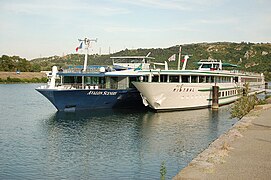
The Avalon Scenery and Mistral Viviers.
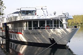
The Viking Burgundy at the Avignon dock.

A cruise to Arles.

_001.jpg)

_001.jpg)
_001.jpg)
Bridges and ferries on the Rhône
Old Bridges

The Constantine bridge in Arles was located on the Via Aurelia and continued towards Fourques by a second work that crossed the Petit Rhône. In 1762, the bed of the Petit Rhône was almost dry, exposing the foundations of this ancient work. Today, only the ruins of Trinquetaille remain, which are property of the State and the waterways of France. They are classified as a Historical Monument of France (1920) and on the UNESCO World Heritage List (1981).
After the passage of Maximiano Hercules, who was going to fight the bagaudas, the Gallic peasants revolted, and a first wooden bridge was built over the Rhône that linked Avignon with the right bank. It has been dated by dendrochronology in the year 290 after the excavations carried out under the bridge of Avignon resting on these Roman bases. The study of the piles raised above them have confirmed that they supported a wooden roof as in Arles.
The Roman bridge of Vienne was destroyed by a flood of the Rhône on February 11, 1407. Underwater excavations undertaken in 2011, not far from the Lattre de Tassigny bridge, allowed to find the remains of this building dating from the s. II d. C. These remains were already seen in 1938, and they were wooden piles as in Arles and Avignon.
Medieval Bridges

Legend says that Benoit Petit, known as Benedict of Avignon, a shepherd born in 1165 in Burzet, in the Vivarais, when he was 12 years old, received the divine order to go and build a bridge to Avignon. Construction began in 1177. The work was completed in 1185 and spanned the Rhône by 915 m. Originally it had 22 arches, of which only four remain, and only the pylons were made of stone and the top was then made of wood. The bridge was rebuilt in masonry between 1234 and 1237.
The possible involvement of Bénézet in the construction of the wooden Guillotière bridge is considered by historians such as Sylvain Gagnière and Élisabeth Magnetti, curator of the Musée du Petit Palais in Avignon, who explain: «Despite contrary opinions, it is not impossible historically that Benezet gave the impetus for the construction in agreement with brother Étienne». Empty reference (help) .
The wooden bridge may have collapsed under the crusaders of Philip the Fair and Richard the Lionheart in 1190, and had to be rebuilt in stone in 1244. While the bridge was under construction, on 28 February In June 1245 in the convent of Saint-Just in Lyon, the XIII Ecumenical Council was opened, presided over by Innocent IV. It was during this council that the brothers of the Work of the Bridge (Œuvre du Pont) of this city drafted a letter stating that Bénézet had been the founder of his first bridge.

The construction of a pass between Saint-Saturnin-du-Port et Lamotte was desired by Louis IX's brother, the Count of Poitiers and Toulouse, Alfonso de Poitiers. It was started in 1265 and finished in 1309. It is the oldest of all the bridges over the Rhône still in service. It has long been a mandatory crossing point on the river between Provence and Languedoc. It is made up of 26 arches, including 19 large and 7 small. Above each arch, there is an evacuation arcade identical to that of the Julien bridge, open for better evacuation of high water during floods.
According to Viollet-le-Duc, the main master builder was John Tensanges or de Thianges. Tradition tells that he, before the Benedictines of Saint-Saturnin-du-Port had first refused this construction after he had given in, inspired by the Holy Spirit, laid the first stone himself.
Ferries


The Rhône has always been a handicap for east-west trade, acting as a border between the left and right banks. During the Middle Ages, in the absence of a bridge, it was necessary to organize, regulate, control and price the river crossing in the most favorable place. It was there where the agglomerations developed, favoring accommodation and business. Ferries ensured their service from sunrise to sunset. Each pier was named after the port.
These leash or reaction ferries, to work, used the leash, a cable, stretched from one side of the river to the other, held high by bollards called ropes. the boat was connected by another cable, the trailon and a system of pulleys that could move on the leash allowed movement. The simple fact of tilting the ferry in the direction of the current allowed it to move perpendicular to it, and cross the river at the speed chosen by the intern or pontooner, using a large oar that allowed him to choose an angle between the leash and the current. A type of flat-bottomed boat was used that allowed the transport of pedestrians, gentlemen and wheeled vehicles.

Ampuis Trail Shuttle
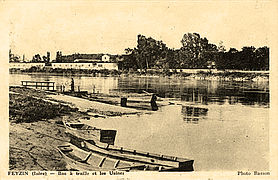
Feyzin Trailer

Saint-Pierre-de-Bœuf Trailer

Trailer ferry from Avignon up to the bridge of Saint-Bénézet


One of the oldest ferry whose history is known to us is the one that linksValence, episcopal villa, left bank under dependency of the Holy Roman Empire, with Saint-Péray in Vivarais, county of Crussol that, under the dependence of Toulouse when creating the ferry in 1160, will become a dependency of the kingdom of France in 1270, under the reign of Philip III the Atrevite.L'un des plus anciens bacs dont l'histoire nous est connue est celui qui reliait Valence, ville épiscopale, rive gauche sous la dépendance du Saint Empire Germanique, à Saint-Péray en Vivarais, comté de Crussol qui, sous la dépendance de Toulouse lors de la rovigneLa mémoire du RhôneGuy Dürrenmatt
In Avignon, between 1680, the date the Saint-Bénézet bridge was abandoned to enter the Languedoc, and 1819, the date the wooden bridge was put into service, this was the only scraper ferry connecting the two banks of the river. Despite the construction of the suspension bridge in Avignon, and after the Edouard Daladier bridge, the link with the island of Barthelasse continued to be made with a leash ferry until 1973. It was abandoned as a result of the work to improve the Rhône of the Compagnie Nationale du Rhône, the stronger arms having been diverted towards Villeneuve-lès-Avignon, there was no longer enough current to operate.
Two crossings over the Rhône with ferries continue to operate in the Camargue. These are the Barcarin ferry and the Sauvage ferry. The first crosses the Grand Rhône at Salin-de-Giraud. The crossing of 430 m is ensured by two amphidrome ferries, Barcarin 3 and Barcarin 4 (and the often-mentioned project of a bridge to replace the ferry is not yet considered). The second is in the Petit Rhône, near Saintes-Maries-de-la-Mer. On the Sauvage, the 230 m traversing is done with a paddle wheel assisted scraper ferry.
Barge bridges

Between Beaucaire and Tarascon, a wooden bridge was commissioned, probably in the 13th century. It was succeeded in 1674 by a barge bridge built in the shape of a bayonet. It remained in operation until 1829, when it was replaced by a suspension bridge, construction of which began in December 1826.
The boat bridge was transported upstream on the river, where it was used to connect Villeneuve-lès-Avignon and the island of Barthelasse.
Tresel bridge


Since 1791, the date of the union of Avignon with France, the problem arises from the relationship between the two banks of the Rhône. The solution of a wooden bridge called à chevalet (trestle) was adopted. The works began in 1806 and were finished in 1820.
This work was structured in several parts. The first crossed the Petit Rhône of Avignon right on the island of Barthelasse. This bridge is 7.40 7.40 m wide and 224.85 m long, it was divided into fifteen sections. A 226 m causeway was built on the island. The third part was crossing the great Rhône. For the length of 438.48m, the bridge had thirty spans. The rush of the river weakened him quickly. Several ridges were swept away in 1820 and 1821.
On the other hand, these trestles were barriers to navigation and the sailors of the Rhône wanted the construction of a suspension bridge. The city of Avignon opposed it, but in 1838 the project was approved. It was built in 1845, but only on the left bank. On the Gard side, the wooden bridge remained in service until the 1900s. It was only replaced in 1910 by a masonry bridge.
Suspension bridges
In France, the technology became known through British achievements reported in the press. An unsuccessful survey mission of the Ponts et Chaussées was carried out in 1821. The area had one of the most difficult rivers to cross at the time: the Rhône. The bridges were very few: three, including a broken one (the Avignon bridge) between Lyon and the estuary. In fact, the river was, and is, wide, very mighty and without notable decrease since it feeds on the melting ice. Without a "dry" season, it was impossible to build the bollards according to the proven method.
The Seguin Frères company (Annonay, Ardèche), directed by Marc Seguin, proposed an innovative project in 1822: the Tournon suspension bridge. The company quickly understood that a conventional suspension bridge was not possible in France due to the poor quality of the chains. He then tried to replace them with bundles of iron wire. That was the birth of the cable. After several tests and a refusal from Ponts et Chaussées, the project was finally accepted. To the innovation of the cables was added the use of hydraulic concrete for the foundations, reinforced concrete (25 years before the first patent) for the superstructures and stiffening reinforcement structures of the wooden board. The suspension bridge took its modern form.
- Some hanging bridges still in service

Pendant bridge in Bourg-Saint-Andéol (1830)

Fourques Bridge (1830), in the small Rhone
The "Pasarela Seguin" that unites Tournon-sur-Rhône and Tain-l'Hermitage (1849)

Bridge in La Voulte-sur-Rhône (1889)

Vernaison Pendant Bridge (1959)


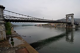
In a century and a half, there were nineteen works of this type that linked both banks of the river, some of which are still in service. They were the first Tournon bridge (1825), the Andance bridge (1827), the Beaucaire bridge (1829), the Vienne footbridge 1829, the Fourques bridge (1830), the Bourg- Saint-Andéol (1830), the Valence aux Granges bridge (1830), the Chasse bridge in Givors (1837), the Seyssel suspension bridge, the Teil bridge (1839), the Avignon (1845), the Collège footbridge in Lyon (1845), the first Saint-Clair suspension bridge in Lyon (1846), the Robinet bridge in Donzère, the M. Seguin footbridge in Tournon (1849), the Rochemaure bridge (1858), the La Voulte-sur-Rhône suspension bridge (1889), the new Sablons suspension bridge (1951) and the Vernaison suspension bridge inaugurated on October 17, 1959.
In addition to the bridges washed away by the decennial floods of the Rhône, such as the one in Vienne on October 4, 1840 or the connection between Condrieu and Roches-de-Condrieu in the 1930s, which was returned to service on July 11 of 1937, it was the Second World War that was fatal with 50 works destroyed. The one in Condrieu was dynamited on Thursday, June 20, 1940, by order of General Hartung, military governor of Lyon, and René Olry by a team of 4th engineering. This order, motivated by some military reason, despite the protests made by Pierre Marchand, mayor of Roches-de-Condrieu, who had invoked the armistice petition, signed four days later.
Flora
Course of the Rhône

Vegetation in the running waters and on the banks of the Genevan Rhône have been the subject of regular surveys in 1989, 2003 and 2010. The results showed that the river bed and its banks are home to 67 species, of which which 72% are hydrophytes (herbariums) and 28% helophytes (reed beds). Only 22 of the 67 species grow in significant numbers, and 18 species are threatened. Reed beds have increased by 28% in 7 years and herbaria 44% during the same period. For all aquatic vegetation in the Rhône, the increase was 88%.
If in Switzerland the study was carried out on 27 linear km of river and on an area of 23.6 ha, in France it concerned a larger area, since it was carried out in the whole of the Rhône-Mediterranean basin, which included the wide delta in the Saône, the tributaries of the Rhône valley and the Mediterranean coastal rivers. For the Rhône, it remains true that the evolution of its flora has been influenced by man, directly and indirectly. In the space of a century, the course of the river has gone from a "twisted geomorphological style to a succession of conditioned sections" (Empty reference (help) .). Currently, biologists, between Lyon and the Camargue, have identified 2,445 plant species, 395 hydrophytes (16.16%) and 2,050 helophyte plants (83.84%). If in an eco-political perspective the emphasis given to nature is gradually increasing, the future of the Rhône's natural environment remains uncertain. However, the initiatives of the State and associations make it possible to hope for the effective protection and restoration of these areas. Optimism that must be moderated in an extremely sensitive area, where the investment of the flora sometimes remains unexplained or inexplicable and where conflicts of competencies are still common.
Wildlife
Birds and small mammals

Man has been the main architect of qualitative and quantitative changes along the banks of the Rhône since the 19th century. Beginning in the 1950s, its development for navigation and hydroelectric power generation has renewed the ripisilva (riparian forest) in numerous ecological niches. Today, the river is made up of branch channels and the vieux Rhône with a reduced flow rate (from 1 to 10% of the average flow rate). The result is a modification of the fauna (small mammals and birds). Among the favorable areas for their reproduction or nesting are, in addition to the confluences of the main tributaries, the islands, islets, and sand and gravel banks that occasionally dot the bed of the Rhône. Particularly noteworthy are the Table Ronde island, the Beurre island (7 km²), the Platière island (6.02 km²), the confluence of the Rhône/Drome and the Ile de la Barthelasse offering varied aquatic environments.
The island of the Table Ronde [Round Table], south of Lyon, where the ripisilva is made up of willows, poplars, ash trees and elms, is home to the common night heron, the hawk, the beaver, which was reintroduced there again, and is home to two orchids, the Rhone epipactis and the beaver epipactis. South of Vienne, off Condrieu, the island of Beurre [butter] has been repopulated by beaver and otter, and is home to the common night heron and an orchid, the beaver epipactis.

South of Roussillon, towards Sablons, in the nature reserve on the island of La Platière several thousand migratory waterfowl make a stopover: ducks, teals, grebes and cormorants. It should be noted that the Rhône ripissilva acts as a corridor It facilitates the migration of many bird species. They penetrate from North / South and are followed twice a year by a considerable number of passerines such as the Common Chiffchaff, Papialbo Warbler, Pied Flycatcher or Chaffinch. At the confluence of the Drôme, the presence of otter, while several hundred great cormorants winter here.
The island of Barthelasse, the largest in the Rhône, is home to nesting birds: hawks, black kites, Montagu's harriers and common moorhens. The riverside forest is the privileged place for warblers, thrushes and herons. Different species coexist in the lônes such as the gray heron, the purple heron, the mallard, the jumping duck, the cormorant and the osprey. There are rabbits from Florida, introduced by hunters, and coypus or rodent otters, escaped from a farm. During the winter, the dead arms with stagnant waters are home to ducks, grebes, cormorants, gulls and larus. Mammals are also numerous: hedgehogs, moles, shrews, polecats, foxes, badgers, martens, weasels, squirrels, dormice, voles and beavers.
The beaver, which had all but disappeared by the end of the 19th century, was banned from hunting in 1906. Its last nucleus it was in the lower Rhône valley, between Arles and Pont-Saint-Esprit. The protected species gradually recolonizes the river and its tributaries. The only two limitations to its expansion are the absence of its favorite food, the leaves and bark of willows and cottonwoods, and a slope greater than 1% in the river. From Pont-Saint-Esprit, the beaver is now in large colonies at the confluence of the Rhône with the Galaure and begins to climb towards the Varèze.
Culture
Tench, pike, bleak, carp, European eel, pike perch, catfish, barbel and catfish are the most represented species in the Rhône.
In 2007, a series of prefectural orders prohibited all consumption of these fish in the departments of Rhône, Ain, Drôme, Ardèche, Vaucluse, Gard and Bouches-du-Rhône. From Lyon to the Mediterranean, the Rhône was polluted to the point that the environmental organization WWF described it in one of its reports as a "French Chernobyl". The river fish were all carriers of toxic products. The analysis revealed that they were PCBs (polychlorinated biphenyls or pyralenes), a carcinogenic product banned in France since 1987, classified among the most dangerous pollutants by the UN.
Samples from six species of fish have shown rates of up to 59 picograms/gram (pg/g), while the World Health Organization (WHO) has established an allowable concentration of 8 pg/g in fish destined for for human consumption. The most contaminated fish showed an amount 40 times higher than the acceptable daily dose. A new pollution? "Not really, but with the new European health standards, levels that were not previously considered worrisome now are."Empty reference (help) .
These analyzes were followed by a study carried out in Lyon on a panel of fifty-two fish consumers caught in the Rhône, which had shown that, when eaten at least once a week, all had levels of PCBs in the blood five times higher than the rates observed in a control group.
A new experience of the AFSSA (French Food Safety Agency, or Agence française de sécurité sanitaire des aliments), during the autumn of 2008, confirmed the results. The Regional Directorate for the Environment (DIREN, irection régionale de l'environnement) was commissioned to study the phenomenon and find ways to stop this contamination.
PCBs are very stable substances, and the ban on consumption could last for years. To determine the time, it was called the Cemagref. Because some species of fish became contaminated from sediments and the invertebrates that live in them, one of their missions was to predict levels of PCB contamination in fish based on rates observed in them. Within the framework of the "eel plan", Cemagef technicians also analyzed the reproduction rate. The toxicity of PCBs against fish fertility, and the effects on larval development were well demonstrated by in vitro studies. However, it seemed risky to make an allowance for in situ effects when laboratory reference concentration levels used were met or exceeded.
Especially the fishermen cast the bells on the fly. They found that after the ban on consumption, the Rhône was becoming a river of "extraordinary wealth of fish" (Empty reference (help) .). In recent years, carnivores had reappeared in good numbers. Pike, walleye and perch catches were frequent. South of Lyon, the river divides into bays from Vienne to Portes-lès-Valence via Condrieu. It is these conditionings that have allowed the conservation of species and their natural predators.
Another problem is the disappearance of sturgeon and alosa, which have become very rare and may be extinct, and with it, the alosa stew, a legendary Avignon dish. Until the middle of the XX century, this fish colonized the Rhône up the Savière canal to Lake Bourget. Since 1947, the construction of Donzère-Mondragon has caused the population of alosa to recede rapidly. Its catch fell from 53 tons between Arles and Pont-Saint-Esprit in 1927, to only 10 tons in 1950. Ten years later, some spawning was maintained between Beaucaire and Avignon. Starting in 1971, the construction of new dams on the Rhône further limited alosas so that seeing them in the area is now disturbingly rare.
Since the influence of the construction of dams on the river on fish populations has been demonstrated, Cemagref was commissioned to study their behavior in the Rhône in the face of its thermal and hydrological variations. This study was carried out during the summer of 2009 on the hot water discharges of the Bugey Nuclear Power Plant and the summer variations of the river flow in the behavior of the fish. The study was carried out with co-financing from EDF. Their goal is to "track ninety-five of eight different species of fish with acoustic transmitters." Empty reference (help) ..
The last sturgeon that was caught in the Rhône, off Villeneuve-lès-Avignon, was in 1933, by a skipper fisherman named Laugier. a river in which they proliferated in the Middle Ages. The Laboratory of Palaeogenetics and Molecular Evolution of Lyon (ENS-Lyon/CNRS/Lyon-I, INRA) has been able to identify that it was the Acipenser sturio that was fished in the Rhône through the DNA of specimens preserved in the museums of Nîmes and from Arles. The last European population of Acipenser sturio was in the Gironde Basin, and young sturgeons were collected there to be bred in captivity. Since 2007, 130,000 fingerlings have been released.
Territorial subdivisions crossed from the source to the mouth
In Switzerland
- I'm sorry.
- I'm sorry.
- Canton of Geneva: on the right bank of Lake Léman: Céligny, Versoix, Genthod, Bellevue, Pregny-Chambésy, Genève, on the left bank of Lake Léman: Hermance, Anières, Corsier, Collonge-Bellerive, Cologny later along the Ródano Vernier, Lancy, Onex, Bernex, Satign
In France
Auvergne-Rhône-Alpes Region
- Department of Alta Saboya: Vulbens, Seyssel
- Department of Saboya: Motz, Serrières-en-Chautagne, Ruffieux, Vions, Chanaz, Lucey, Yenne, La Balme, Saint-Genix-sur-Guiers.
- Ain Department: Bellegarde-sur-Valserine, Seyssel, Belley, Sault-Brénaz, Lagnieu, Loyettes
- Metrópoli de Lyon: Vaulx-en-Velin, Villeurbanne, Lyon, Givors
- Department of the Rhone: Condrieu
- Isère Department: Les Avenières, Villette-d'Anthon, Chasse-sur-Rhône, Vienne, Le Péage-de-Roussillon
- Loire Department: Saint-Michel-sur-Rhône, Chavanay, Saint-Pierre-de-Bœuf
- Drôme Department: Saint-Rambert-d'Albon, Saint-Vallier, Tain-l'Hermitage, Valence, Montélimar, Donzère, Pierrelatte
- Department of the Ardèche: Serrières, La Voulte-sur-Rhône, Le Pouzin, Le Teil, Tournon-sur-Rhône, Viviers, Bourg-Saint-Andéol
Occitania Region
- Gard Department: Pont-Saint-Esprit, Villeneuve-lès-Avignon, Aramon, Beaucaire, Fourques
Provence-Alpes-Côte d'Azur Region
- Vaucluse Department: Bollène, Orange, Sorgues, Avignon
- Department of the Bouches du Rhône: Arlés, Tarascón, Port-Saint-Louis-du-Rhône
Tributaries

The main tributaries of the Rhône are listed in the table below. The tributaries are ordered geographically, following the river from its source to the mouth, and the direction in which the tributaries flow, left-right, are also considered downstream.
| Ramal | Affluent name | Destroying | Length (km) | Cuenca (km2) | Caudal (m3/s) | Country through which it flows | |||||
| I | - | Río Arve | Rhodano | 102. | 2060 | 75 | France and Switzerland | ||||
| I | - | River Fier | Rhodano | 71.9 | 1380 | 41.2 | France | ||||
| - | - | - | Chéran River | River Fier | 53.7 | 350 | 7.8 | France | |||
| I | - | Rio Guiers | Rhodano | 50 | 575 | 16 | France | ||||
| I | - | Río Bourbre | Rhodano | 72.2 | 703 | 7.85 | France | ||||
| - | D | Rio Ain | Rhodano | 190 | 3630 | 123 | France | ||||
| - | - | - | Río Bienne | Rio Ain | 69 | 700 | 30 | France | |||
| - | - | - | Río Suran | Rio Ain | 77 | 349.5 | 6.71 | France | |||
| - | - | - | Rio Albarine | Rio Ain | 59.4 | 312 | 6.91 | France | |||
| - | D | Rio Saona | Rhodano | 480 | 29 950 | 473 | France | ||||
| - | - | - | Rio Côney | Rio Saona | 55 | 317 | 5,29 | France | |||
| - | - | - | Lanterne River | Rio Saona | 69 | 1020 | 22.1 | France | |||
| - | - | - | Río Salon | Rio Saona | 71.6 | 410 | 4.64 | France | |||
| - | - | - | Vingeanne | Rio Saona | 93 | 650 | 6.03 | France | |||
| - | - | - | Rio Ognon | Rio Saona | 215 | 2075 | 35 | France | |||
| - | - | - | Rio Rahin | Rio Ognon | 50.5 | 2.3 | France | ||||
| - | - | - | Rio Tille | Rio Saona | 83 | 1100 | 11,1 | France | |||
| - | - | - | Rio Ouche | Rio Saona | 95.4 | 860 | 8,49 | France | |||
| - | - | - | Doubs River | Rio Saona | 453 | 7710 | 176 | France and Switzerland | |||
| - | - | - | Allaine River | Doubs River | 65 | 1120 | 22.8 | France and Switzerland | |||
| - | - | - | Rio Loue | Doubs River | 126 | 1760 | 51.6 | France | |||
| - | - | - | Rio Dheune | Rio Saona | 66.7 | 1039 | 10 | France | |||
| - | - | - | Río Grosne | Rio Saona | 95.6 | 1000 | 6.79 | France | |||
| - | - | - | Rio Seille | Rio Saona | 110 | 2620 | 30.8 | France | |||
| - | - | - | Rio Brenne | Rio Seille | 54 | France | |||||
| - | - | - | Río Solnan | Rio Seille | 61.6 | 680 | 13 | France | |||
| - | - | - | River Sevron | Río Solnan | 54.6 | 195 | 3.16 | France | |||
| - | - | - | Río Vallière | Río Solnan | 50.8 | 250 | 5 | France | |||
| - | - | - | Rio Sâne Vive | Rio Seille | 46.8 | France | |||||
| - | - | - | Rio Sâne Morte | Rio Sâne Vive | 54.6 | France | |||||
| - | - | - | Río Chalaronne | Rio Saona | 52 | 175 | 1.01 | France | |||
| - | - | - | Río Reyssouze | Rio Saona | 75 | 470 | 1.41 | France | |||
| - | - | - | Río Veyle | Rio Saona | 66.9 | 670 | 6.81 | France | |||
| - | - | - | Río Azergues | Rio Saona | 61 | 820 | 7.5 | France | |||
| I | - | Rio Galaure | Rhodano | 56.2 | 232 | 2.18 | France | ||||
| I | - | Rio Doux | Rhodano | 70.2 | 637 | 7.5 | France | ||||
| I | - | Rio Isère | Rhodano | 290 | 11 800 | 360 | France | ||||
| - | - | - | Río Arc | Rio Isère | 127.5 | 2000 | 48.8 | France | |||
| - | - | - | Rio Drac | Rio Isère | 130.3 | 3550 | 99 | France | |||
| - | - | - | Río Romanche | Rio Drac | 78 | 1240 | 38.4 | France | |||
| - | D | Rio Eyrieux | Rhodano | 89 | 865 | 15.5 | France | ||||
| I | - | Drôme River | Rhodano | 110 | 1640 | 20 | France | ||||
| I | - | Rio Roubion | Rhodano | 66.6 | France | ||||||
| I | - | Río Ardèche | Rhodano | 120 | 2429 | 65 | France | ||||
| - | - | - | Río Chassezac | Río Ardèche | 84.6 | 560 | 15.3 | France | |||
| I | - | Rio Eygues | Rhodano | 114 | 473 | 6.22 | France | ||||
| - | D | Rio Cèze | Rhodano | 128 | 1359 | 22 | France | ||||
| I | - | Rio Lez (Ródano) | Rhodano | 73.6 | 445 | France | |||||
| - | D | Rio Ouvèze | Rhodano | 123 | 2200 | 25 | France | ||||
| I | - | Rio Duranza | Rhodano | 323.8 | 14 225 | 180 | France | ||||
| - | - | - | Rio Ubaye | Rio Duranza | 82.8 | 946 | 20.5 | France | |||
| - | - | - | Rio Guil | Rio Duranza | 51.6 | 630 | 17 | France | |||
| - | - | - | Buëch River | Rio Duranza | 85.1 | 1490 | 23 | France | |||
| - | - | - | Rio Bléone | Rio Duranza | 67.5 | 906 | France | ||||
| - | - | - | Rio Asse | Rio Duranza | 75.4 | 500 | 5 | France | |||
| - | - | - | Río Largue | Rio Duranza | 55.4 | France | |||||
| - | - | - | Rio Verdon | Rio Duranza | 175 | 2218 | 26.8 | France | |||
| - | - | - | Río Artuby | Rio Verdon | 53.8 | 250 | 1.37 | France | |||
| - | - | - | Calavon River | Rio Duranza | 88.3 | 1030 | 0.89 | France | |||
| - | D | Río Gardon | Rhodano | 127.4 | 2200 | 32.7 | France | ||||
| - | - | - | Río Gardon d'Alès | Río Gardon | 60.6 | France | |||||
Contenido relacionado
Ljubljana
Regional space
Lorca