
Mexico state
The State of Mexico, officially called the Free and Sovereign State of Mexico, is one of the thirty-one states that, together with Mexico City, make up Mexico. Its capital is Toluca de Lerdo and its most populous city is Ecatepec de Morelos. It is divided into one hundred and twenty-five municipalities.
It is located in the central south of the country, bordering Querétaro to the north, Hidalgo to the northeast, Tlaxcala to the east, Puebla to the southeast, Morelos and Mexico City to the south, Guerrero to the southwest, and Michoacán to the west. With 22,357 km², it is the seventh smallest entity — ahead of Hidalgo, Querétaro, Colima, Aguascalientes, Morelos and Tlaxcala.
With its 16,992,418 inhabitants in 2020, it is the most populous entity in the country, representing 13.5% of the national population. Around two thirds of its population is concentrated in the Metropolitan Zone of the Valley of Mexico. With 678.8 inhabitants/km² (inhabitants per square kilometer), the second most densely populated.
It was founded on March 2, 1824. It is one of the founding states of the federation. To distinguish its inhabitants from the citizens of the country, called Mexicans, its adjective is mexiquense. In the territory of the extinct Mexica Empire, are the origins of the state that maintained a political division of New Spain during the Spanish colonial period. Mexico City was chosen as the capital of the new nation after Independence; outside the state their territory was separated. Parts of the state were separated to form the states of Hidalgo, Guerrero, and Morelos years later. These territorial separations have given the state the size and shape it has; with the Valley of Toluca, to the west of Mexico City and a salient that extends to the north and east of this entity.
The State of Mexico contributes 9.8% of the national gross domestic product (GDP) and is one of the most industrialized states in Mexico and Latin America. It was the state with the highest number of people in poverty at the national level, in contrast, from 2012 to 2014. It faces a critical public safety situation, as it is the state in the country with the highest rate of violence with high-impact crimes, above the national average in 20 years and concentrate eight of the most insecure municipalities in the country. Among these criminal behaviors, feminicides stand out, and eleven of its municipalities present an active Gender Violence Alert, declared by the country's Ministry of the Interior since 2015.
Toponymy
The name of the State of Mexico derives from the Nahuatl term Mēxihco [me:ʃiʔko], which designated the capital of the Mexicas, Mexico-Tenochtitlan. According to Bernardino de Sahagún, the word means 'In the navel of the moon'. The hypothesis has been challenged because the Nahuatl morphology does not admit a derivation of the place name from the proposed words. place name should be interpreted as 'Place of Mexihtli', that is, of Huitzilopochtli, since Mexihtli was one of his alternative names.
During the viceregal era, Mexico was the name of one of the provinces of New Spain. When the Mexican Empire gained its independence, this province kept its name, since Mexico City was its capital. With the establishment of the federal system, the State of Mexico was forced to cede its capital to house the federal powers, but it continued to keep its name despite the fact that the city that is its origin is no longer part of its territory.
Commonly and to differentiate it from the country itself, the State of Mexico is known as Edomex (acronym for Estado from Mexicoico).
History
- History of the State of Mexico
Prehistory
The Tepexpan Man is an important find for Mexican and foreign anthropologists, since it is an important key to understanding what the Valley of Mexico was like almost 3000 years ago; In addition, it allows us to date the beginning of the settlement of the area occupied by Mexico City. Some scholars initially attributed an age of 11,000 years to him; others, 5,000, and some have even suggested 3,000 years. This individual was initially identified as male, but recent research identifies it as female, although this is a matter of debate.

The ground has been inhabited since about 35000 B.C. C. by primitive men who crossed the Bering Strait, coming from Asia. They were nomads, they hunted large animals such as mammoths and collected fruits, according to archaeological evidence found in this place. One of the most outstanding finds of primitive art in America was found in this municipality, and took the name Sacred Bone of Tequixquiac.
Pre-Hispanic period (post-classical period)

When the rule of the lordship or altépetl of Cuauhtitlán began at the end of the VIII century, it was about to be abandoned the city of Teotihuacan. When this center of power was depopulated, the social order of the regional tribes went from being a theocracy to a militaristic system, because society was no longer governed by faith but by the strongest. The area ended up under Toltec rule. In addition to being combative, the Toltecs (inhabitants of Tula) were skilled at manual tasks and artistic work. Other towns imitated them and also learned the Nahuatl language from them; for this reason, the Toltec culture became the model followed by the most refined societies of central Mexico.
Later on, Tula fell under the pressure of Chichimeca tribes, who took over this region, abandoned their nomadic life and founded cities; In addition, they learned the language, the ways of life, as well as the trades and arts of the Toltecs. The newcomers created important urban and religious centers, such as Tenayuca, Tetzcuco, Azcapotzalco, Chalco and Amaquemecan, among others. However, some towns maintained their language and their ancestral customs, as is the case of the Matlatzincas of the Toluca Valley and the border area with the Purépechas; the Ocuiltecos from the southwest (borders with the state of Morelos), the Mazahuas from the west (borders with the state of Michoacán), and the Otomi from the north and northeast (borders with the state of Hidalgo).

Afterwards, the area would come under the rule of the Aztec empire; Later, during the conquest, the Nahuatlacas founded the town of Tollocan (later Toluca) which later, in 1577, would be declared a city. The evangelizing missions that arrived in the state were made up of Franciscans, Dominicans, and Augustinians.
One of the political entities that made it up was the Chalca Confederation (Chalcayotl), made up of four señoríos, whose denomination was: Tlacohcalco-Chalco, Amaquemecan-Chalco, Tenanco Texopalco Tepopollan-Chalco and Chimalhuacan-Chalco.
Viceroyalty
After the conquest of the Mexica empire, the territory of the current State of Mexico was included within the Kingdom of Mexico, which in 1786 became the Intendancy of Mexico. Its most important cities and towns, inhabited by Spaniards, were administered by corregidores or mayors. The indigenous peoples were organized in republics, which had officers chosen by the heads of families, under the supervision of parish priests. Until the middle of the 18th century, these authorities directly administered the collective assets of the community funds.
When the Spanish conquered the Mexica Empire and began their explorations of the Americas, they created the Kingdom of Mexico, to facilitate the administration of the new territories, which was divided into five major provinces: Mexico (Mexico State, Tlaxcala, Puebla, Oaxaca and Morelia Valladolid or Michoacán). Later, the General Intendancy of the Army and Provinces of Mexico was created, with its capital in Mexico City.
It was also in the territory of what is now the State of Mexico where Sor Juana Inés de la Cruz (San Miguel Nepantla, 1648/1651-1695 in Mexico City) and José María Velasco (Temascalcingo, July 6, 1840- August 26, 1912, Villa de Guadalupe Hidalgo).
19th century
It is considered that it was during the second decade of the XIX century when the State of Mexico was created, from a legal act approved by article 7 of the Constitutive Act of the Federation. Said article was submitted to discussion by the deputy José Manuel Ramos Arizpe on December 20, 1823, the date on which it was approved that the provinces of Mexico and Michoacán be elevated to the category of states. Later, with the approval of the Law to Establish the Constituent Legislatures in the Provinces that have been declared States of the Mexican Federation, published in the State of Mexico on January 10, 1824 by Melchor Múzquiz, The first deputies to the Constituent Congress of the entity were elected, which then covered some 100,000 km².
With the promulgation of the Federal Constitution of the United Mexican States of 1824, the major provinces of Valladolid, Oaxaca, Puebla and the State of Mexico were established as states of the Federation; the territory of Tlaxcala was defined and the Federal District was created. By then, the State of Mexico still owned the territories of the current states of Morelos, Hidalgo and Guerrero.
In the 19th century, the State of Mexico was dismembered. With its territory, the state of Guerrero was founded on October 27, 1849, the state of Hidalgo on January 15, 1869, and the state of Morelos on April 17, 1869.
Due to the influence of the York Freemasons, in August 1827 the expulsion of the Spaniards was promoted throughout the state territory, which was unaware of what was agreed in the Plan of Iguala and the Treaties of Córdoba, adopting as recognition to Mexican citizenship and severely punishing the Spaniards, destroying their fortunes and separating them from all positions, forcing them to leave the state for being considered the richest Spaniards in the republic, expropriating their lands, their farms, their estates and fortunes, affecting the clergymen and throwing the Spaniards out of their houses; many were brutally murdered and others fled to the north or west of the country with their families. Finally, in 1822, the York Freemasons decided to re-establish in Toluca that there were many irregularities and victims of families descended from Spaniards, remaining in ruins, widows and orphans without being able to emigrate to Spain or leave the country. The continuity of the plans was revoked by the general congress, since the children and wives of the Spaniards accepted the conditions of Mexicanness asking for clemency in the face of the misery and misfortune to which they were subjected by the anti-Spanish campaigns of the state, on November 20 they were he returned to cede his properties, farms and haciendas but the properties of the clergy became the property of the State of Mexico.

The State of Mexico was involved in some of the major sociopolitical changes of the 19th century. During independence there were some brawls of no small importance in its territory, the battle of Monte de las Cruces stands out, in which Hidalgo defeated the royalist army commanded by Lieutenant Colonel Torcuato Trujillo. Consummated the independence, on February 1, 1824, the State of Mexico was declared free and sovereign, installing the First State Congress on March 2 the same year.
The first Political Constitution of the State of Mexico was promulgated in Texcoco, which at that time was the capital of the State, on February 14, 1827.
This first state Magna Carta had as its main characteristic being a liberal Constitution covering very important aspects of social benefit, such as the elimination of titles of nobility, avoiding hereditary jobs, promoting occupation and also prohibited the acquisition of real estate for the church.
That year, with Lorenzo Zavala as governor of the entity, the State Capital was moved to Tlalpan and in 1830, when Melchor Múzquiz was already governor, the powers of the state were established in the city of Toluca.
Later, during the first decades of independent life, the State of Mexico would suffer numerous secessions, since the current states of Hidalgo, Morelos and Guerrero would emerge from the original State of Mexico.
20th century
With the Revolution and the promulgation of the Political Constitution of the United Mexican States of February 5, 1917, a new Constitution of the State of Mexico was created, which established the existence of 16 judicial districts.
In turn, in 1941, at the disposal of the state governor Wenceslao Labra, a shield was created for the state. A call was launched for historians and artists from all over the country to compete in the preparation of a project for a state shield. On April 9 of the same year and by decree, the design elaborated by Pastor Velázquez was adopted as the coat of arms of the State of Mexico, which contains the insignia: "Homeland, Freedom, Work and Culture".
Geography
Most of the Mexican territory is located in the central part of the Neovolcanic Axis. It includes the valleys of Mexico, Toluca, part of the Puebla-Tlaxcala valley and a small portion of the Mezquital Valley in the north of the state that was formerly known as Teotlalpan, as well as the Sierra Nevada, Monte de las Cruces, Sierra de Monte Alto, Sierra de Tetzontlalpan to the north and Cumbres Occidentales in the border with Michoacán.
On this same plateau are located important elevations such as the Popocatépetl volcano (5500 m), the Iztaccíhuatl (5220 m a.s.l.), the Nevado de Toluca (4680 m a.s.l.) and the Tláloc hills (4120 m a.s.l.), Telapón (4060 m a.s.l.) and Jocotitlán (3910 m a.s.l.). The southern part of the Mexican territory is located within the Balsas depression, which it shares with the states of Guerrero, Michoacán, Puebla and Morelos.
Climate

The climate of the area, in general, is temperate sub-humid, with rains in summer and an average temperature between 10 and 16 °C (degrees Celsius), with rainfall between 500 and 1500 mm, except in the depression of the Balsas River, in Tierra Caliente, where it is warm sub-humid due to the low altitude, and on top of the volcanoes, which is polar due to the height.
The average annual temperature is 14.7 °C, the lowest temperatures occur in the months of January and February are around 3.0 °C. The average maximum temperature occurs in April and May is around 25 °C.
The rains occur during the summer in the months of June to September, the average rainfall in the state is 900 mm per year.
Hydrography
Hydrology: The State is included within three large basins, the Lerma, which occupies 27.3% of the state surface; Balsas 37.2% and Pánuco 35.5%.
The Lerma River is approximately 125 kilometers long. It is born in the municipality of Almoloya del Río and flows into the Pacific Ocean. It passes through the municipalities of: San Antonio la Isla, Tianguistenco, Texcalyacac, Santa Cruz Atizapán, Capulhuac, San Mateo Atenco, Metepec, Lerma, Toluca, Otzolotepec, Temoaya, Almoloya de Juárez, Ixtlahuaca, Jocotitlán, Atlacomulco and Temascalcingo. On its right bank it receives the waters of the Tianguistenco rivers, the Texcaltenango swamp, the Ocoyoacac, the Amealco, the Atarasquillo, the San Pedro, the Caparrosa, the Temoaya, the Solano, the springs of Jocotitlán and Sila; and to the left, the Verdiguel, the Calixtlahuaca, the Almoloya de Juárez, the Santa María del Monte and the Mineral del Oro.
.jpg)
The entire southern region of the state is part of the basin of the Balsas river, the Ocuilan or Chalma (with its tributaries Malinalco, Zumpahuacán, Zempoala and Zarcas) joins the Amacuzac already in the state of Morelos; the Tenango River passes underground through the caves of Cacahuamilpa, where it is known as Chontalcoatlan and reaches the state of Guerrero; the Malinaltenango flows into the Apetlahuacán; the Almoloya, the Sultepec and Ixtapan flow into the Balsas; while Temascaltepec and La Asunción do so in Cutzamala. The one from La Asunción receives the one from Valle de Bravo, the one from Amealco de Becerra and the one from Ixtapan del Oro.
The Pánuco river basin is linked to the Mexico basin and its original sources are the sub-basins of Lake Texcoco, which collects the waters of the Asunción, Remedios, Tlalmanalco or de la Compañía rivers, Río Frío, the Reyes and Panoaya; and that of Zumpango and Cuautitlán, which captures the streams of Zumpango, Coscomate, San Isidro, Aculco and Cuautitlán, which together with Taxhimay and Rosas feed the flow of the Tula - Moctezuma, which helps to outlet the sewage from Mexico City.
Apart from the spectacular lagoons of the Sun and the Moon in the Nevado de Toluca, in the state are those of the crater of Cerro Gordo; that of Atexcapan, in Valle de Bravo; San Simón, in Donato Guerra; the one between San Pedro and Concepción de los Baños; Tepetitlán, in San Felipe del Progreso; the four of Acutzilapan, at the foot of the Jocotitlán hill, in Atlacomulco; El Rodeo, near Xonacatlán; Xibojay and Santa Elena, in Chapa de Mota; that of Huapango, in Timilpan; that of Zumpango; and Lake Nabor Carrillo, in Texcoco.
There are also hot springs in Ixtapan de la Sal, Tonatico, Apaxco, San Pedro de los Baños, Valle de Bravo, Sultepec, Temascaltepec and Tejupilco.
Another important hydrological resource available to the state is the dams, the most important being: José Antonio Alzate, in Temoaya; Ignacio Ramírez, in Almoloya; Guadalupe, in Cuautitlán Izcalli and Nicolás Romero; Madín, in Atizapán de Zaragoza; Vicente Guerrero, in Tlatlaya; Tepetitlán, in San Felipe del Progreso; Valle de Bravo and Villa Victoria, in the municipalities of the same name; Huapango, in Timilpan; Ñadó, in Aculco, Brockman, in El Oro, J. Trinidad Fabela, in Atlacomulco; and Danho, in Jilotepec.
Natural areas and biodiversity
The state has several protected natural areas throughout its territory. The most important are: the national parks of El Desierto del Carmen, Bosencheve (shares an area with Michoacán), the Zempoala lagoons (shares an area with Morelos), Los Remedios Netzahualcóyotl, Nevado de Toluca, Zoquiapan and Anexas, El Sacromonte, Insurgente Miguel Hidalgo y Costilla (La Marquesa. Shares an area with the Federal District), Molino de las Flores, Iztaccìhuatl and Popocatépetl (shares an area with Morelos and Puebla) and the Monarch Butterfly Biosphere Reserve, which was recognized by UNESCO as Heritage Natural of Humanity (shares an area with Michoacán), which have various types of vegetation: pine forest, oyamel, oak, pine-oak and oak, rosetophilous desert scrub, crasicaule scrub and low deciduous forest.

Other areas, such as the Ciénagas de Lerma, the most important wetland in the state where some of the endemic species of Mexico are concentrated, such as the ahuehuete, as well as various genera of fish and amphibians threatened with extinction, are in the process of being declared protected areas, it has the status of flora and fauna protection area. The state government has proposed to the federal authorities that they declare the 3,000 hectares of Las Ciénagas as a protected area, and thus achieve its conservation. Another flora and fauna protection area is the Chichinautzin Biological Corridor (shares an area with Morelos and the Federal District).
In its varied landscapes, the flora varies: in the mountains there are dense forests of pine, oak, white cedar, oyamel and zacatonal. In the valley: grasses, vera dulce, nopal, damiana and ocotillo and in the Balsas depression, muskrats, weasels, badgers, tlacoyotes and skunks.
It also has a part of the Monarch butterfly (Danaus plexippus) biosphere to the west in the central zone. The reserve was created to protect the natural environment and habitat of the monarch butterfly, having a total area of 56,000 ha (it shares an area with Michoacán). The Government of the State of Mexico and the Federal Government are in the fight against environmental contamination and promote the care and reserve of this biosphere and other green areas of the State of Mexico.
Biodiversity in the State of Mexico is very varied since being in the center of the country, it has heterogeneous characteristics of climate, orography and hydrography that allow the development of multiple forms of life that are useful for human activities and essential for the maintenance of ecological balance, in this sense it is important to delve into the knowledge of this biodiversity to contextualize and value the role it plays in state development. Despite the fact that there are some zoos in the state, there are few spaces where you can observe, get to know and learn about the native fauna and flora of the state, a couple of places stand out in this sense: The Cosmovitral Botanical Garden in Toluca, that although it preserves flora from many places, emphasis is given to the Mexican flora and also the Living Museum of Los Bichos de Malinalco, located in that municipality (Malinalco) where the flora and fauna of the region is displayed in a playful and interesting way. region, especially in the south of the state, without a doubt they are places worth visiting.
| Flora and fauna of the State of Mexico | |||||||
 |  |  |  | _001.jpg) | |||
| Monarch Butterfly | Viper of cascabel | Coyote | Wild ducks | Teporingo | |||
 |  |  |  |  | |||
| Cat montés | Garza | Cenzontle | Tlacuache | Iguana | |||
 |  |  |  |  | |||
| Tuna | Oyamel | Erizo cactus | Ahuehuehuete | Agave | |||
Politics and government
The politics and government of the State of Mexico is made up of the executive power in charge of the governor, Alfredo del Mazo Maza, the legislative power in the Congress of the State of Mexico and the judicial power in the Judiciary of the State of Mexico.
Political division

The state is divided into 125 municipalities, grouped into 16 regions (I. Amecameca, II. Atlacomulco, III. Chimalhuacán, IV. Cuautitlán Izcalli, V. Ecatepec, VI. Ixtapan de la Sal, VII. Lerma, VIII. Naucalpan, IX. Nezahualcóyotl, X. Tejupilco, XI. Texcoco, XII. Tlalnepantla, XIII. Toluca, XIV. Tultitlán, XV. Valle de Bravo, XVI. Zumpango). Some of the most important municipalities are: Atizapán de Zaragoza, Coacalco de Berriozábal, Cuautitlán, Cuautitlán Izcalli, Ecatepec de Morelos, El Oro de Hidalgo, Huixquilucan, Ixtlahuaca, Metepec, Naucalpan de Juárez, Nezahualcóyotl, Nicolás Romero, Texcoco, Tlalnepantla de Baz, Toluca de Lerdo and Zumpango de Ocampo,
The largest municipality is Luvianos, with 703 km²; and the smallest, Papalotla, with only 3.53 km².
The ten most important cities in the state are: Coacalco de Berriozábal, Ciudad Nezahualcóyotl, Naucalpan de Juárez, Tlalnepantla de Baz, Chimalhuacán, Cuautitlán Izcalli, Ecatepec de Morelos, Atizapán de Zaragoza and Texcoco (all of these, belonging to the so-called Zona Metropolitana de Ciudad de México or ZMCM), and Toluca (the state capital).
In 2007, a program called "Bicentennial Cities" was created to give impetus to 6 municipalities and trigger their development, to create industry, housing and improve infrastructure and thus prevent them from continuing to be dormitory cities, the designated municipalities are: Almoloya de Juárez, Atlacomulco, Jilotepec, Huehuetoca, Tecámac and Zumpango.
The most important economic activities in the state are the automotive and textile industries. Considerable income is also obtained from tourism. The most relevant ancient activity was agriculture, but due to the growth of Mexico City and the large amount of urban population, this activity has been displaced by the manufacturing sector.
The capital is Toluca de Lerdo, seat of the entity's powers.
Regionalization
| N.o | Region | Regional head |
|---|---|---|
| I | Amecameca Region | Amecameca de Juárez |
| II | Region Atlacomulco | Atlacomulco de Fabela |
| III | Chimalhuacan Region | Chimalhuacán |
| IV | Region Cuautitlán Izcalli | Cuautitlán Izcalli |
| V | Region Ecatepec | San Cristóbal Ecatepec |
| VI | Region Ixtapan | Ixtapan de la Sal |
| VII | Lerma Region | Lerma de Villada |
| VIII | Naucalpan Region | Naucalpan de Juárez |
| IX | Nezahualcóyotl Region | Nezahualcóyotl City |
| X | Tejupilco Region | Tejupilco de Hidalgo |
| XI | Texcoco | Texcococo de Mora |
| XII | Tlalnepantla Region | Tlalnepantla de Baz |
| XIII | Toluca Region | Toluca de Lerdo |
| XIV | Tultitlán Region | Tultitlán de Mariano Escobedo |
| XV | Valle de Bravo Region | Valle de Bravo |
| XVI | Zumpango Region | Zumpango de Ocampo |
Dependencies
There are three types of state government dependencies: government secretariats, the auxiliary sector, and the autonomous sector.
The legislative power of the state is in charge of the H. Congress of the Free and Sovereign State of Mexico, made up of 75 deputies, 45 of them by representation by district (there are 45 state districts) and 30 by proportional representation. The LVI state legislature from 2006 to 2009 was made up as follows: the PRI was the first minority, with 22 deputies (2 proportional representation and 20 per district), the PAN and the PRD were tied as second minorities, each with 20 deputies; the PAN had 11 proportional representation and 9 by district; the PRD 16 seats per district and 4 for proportional representation. The minor forces, such as the PVEM (Green Ecologist Party of Mexico), the PT (Labor Party) and Convergence each had 6, 3 and 2 deputies, all by proportional representation.
In contrast, at the federal level, the State of Mexico belongs to the fifth circumscription, together with the states of Colima, Michoacán and Hidalgo. It has 40 electoral districts and 23 proportional representation seats, that is, 63 federal councils. In the election of the LX legislature (2006) the deputies were distributed as follows: 40 deputies by relative majority, 22 for the PRD, 6 for the PRI and 12 for the PAN; 23 deputies by proportional representation, 8 for the PRD, 4 for the PRI, 6 for the PAN, 2 for the PANAL (New Alliance Party), 1 for Alternativa, 1 for the PVEM and one independent deputy.
In addition, the state has three senatorial seats (won in 2006 by Yeidckol Polevnsky and Héctor Miguel Bautista López for the PRD and Ulises Ramírez Núñez for the PAN). During the 2012 federal elections, the coalition that obtained the most votes was the Coalition for the Good of All (PRD, PT and Convergence), with 2,262,614 votes, compared to 1,7766,443 for the PAN and 1,029,038 for the Alliance for Mexico (PRI and PVEM).
State Symbols
The coat of arms was recognized, along with the state anthem, until 1995, through decree 66, in which the legislature approved the Law on the Coat of Arms and the Anthem of the State of Mexico. The shield design is as follows: It is constituted by the motto Homeland, Liberty, Work and Culture
- Homeland
The national coat of arms at the head; below it, 18 bees representing the number of judicial districts in the state. In the upper quadrant on the left, a drawing of the Xinantécatl volcano, the pyramid of the sun and the original place name of Toluca.
- Freedom
In the upper right quadrant, two white crosses and a period cannon, symbolizing freedom and the battle of the Mount of Crosses.
- Labour and Culture
Below and in the center, on several stylized solar rays that, when hitting obliquely against the plain, become furrows of the plow, the book of knowledge is opened and, on it, a sickle, a gear, a pickaxe, a shovel and a flask. Under the book there are several magueyes, which symbolize the municipalities of the state. The entire set talks about "Work and Culture" (in fact, each year the state government awards the "Estado de México" medal to Mexicans distinguished in the arts, sciences, and other activities).
Sociopolitical situation

The State of Mexico has many strategic advantages due to its proximity to the capital. Especially due to the strong presence of investment and industrial and tourist development. However, there are multiple challenges caused by the overpopulation of 40 of its municipalities and that make up the urban sprawl and suburban area of Mexico City.
First, the quality of life for city dwellers can be too promising, or too precarious, especially for the thousands of people who arrive each year seeking accommodation in a new urban landscape with few employment opportunities for them. they (immigrants). In other words, there is a high degree of social and economic inequality (example: Naucalpan and Huixquilucan, among the richest municipalities in the country, and Chimalhuacán and Valle de Chalco, among the poorest). Besides, in many municipalities of the State of Mexico there are rural communities that do not have all the services, hindering the economic integration of those who live in them. That is why some municipalities have a marginal appearance compared to more urbanized communities.
Currently, the governments of Mexico and the capital have chosen to establish a dynamic of cooperation that has manifested itself in the joint execution of public works and security operations with the intention of requesting the federation to expand the Metropolitan Fund and the joint planning of other projects such as public transportation.
This new determination promoted by both governments is a first step to save the border area and promote the development of the entire ZMCM. This is how works have materialized with distributors and road bridges with high circulation, public transport and "deep drainage" very important issue for thousands of inhabitants of the Texcoco lake basin (the current Valley of Mexico was a natural lake artificially dried); Similar circumstances exist in the Chalco Valley with flood problems.
International relations
The State of Mexico has signed the following twinning agreements, with the following entities:
 State of Illinois, United States; signed on 2 May 1990.
 Gyeonggi Province, South Korea; signed on 13 May 1996.
 Province of Buenos Aires, Argentina; signed on 18 April 1997.
 Saitama Prefecture, Japan; signed on 5 June 1997.
 Oblast of Moscow, Russia signed on 11 October 1999.
 Canton Province, China; signed on 3 June 2002.
- State of New York, United States; signed on 12 February 2003.
- Chongqing, China; signed on 11 May 2004.
- State of Nevada, United States; signed on December 13, 2013.
- State of Utah, United States; signed on April 7, 2014.
- Province of Córdoba, Argentina; signed on September 29, 2014.
 Department of La Paz, Bolivia; signed on 22 October 2015.
 Xunta de Galicia, Spain; signed on May 3, 2018.
Economy
The Mexican economy contributed 9.1% to the national Gross Domestic Product in 2020, which positions it as the second economy in the country, only behind Mexico City. The state GDP is made up of 28% by industry manufacturing, machinery and equipment, electronics, automotive, textile and maquiladora; 22% by the services sector; 20% for trade, hotels and restaurants; and 15% for financial services and real estate activities.

Regarding primary activities, the State of Mexico stands out in the production of carnations, chrysanthemums, and roses, and is the largest producer of cut flowers in the entire country; which are also exported to countries such as Japan, the United States, Canada and the United Kingdom; Avocado, nopal, prickly pear, xoconostle, carrot, potato, chili, squash, beans, green tomato, pea, grain corn, barley, and wheat are also produced in this entity. In addition to being a state that, despite lacking a coastline (access to the sea), is positioned as the leading national aquaculture producer of trout and carp. The State of Mexico is the eighth largest milk producer nationwide, of which the largest milk production and its derivatives is destined for Mexico City and its Metropolitan Area.
The size of the Mexican economy places it on a par with other large Latin American economies. In the entity, 11% of the companies in all of Mexico operate: its large industrial parks and the great export force of its products and handicrafts (where, in addition, it occupies 3.er place of national production) confirm its position as a great industrial power in the country.
The State of Mexico has 42 industrial developments, 2,137 economic units that capture 129,457 people, and for presentation purposes, the municipalities where these developments operate have been arranged into four groups.
Of the 42 parks, cities and industrial corridors, 13 are located in the first group called the northeast of the Mexico City Metropolitan Area (ZMCM), where 841 economic units and 41,944 employed personnel are registered. It is followed in importance by the number of jobs, the group located to the northwest of the ZMCM, in which 38,678 people work in 786 economic units. In the center of the entity there are 12 industrial parks, where 33,190 employed people are employed in 464 economic units; and finally, in the group located in the north of the state, there are 4 industrial developments that report 15,645 jobs.
Economic activities
| Economic sector | Percentage of contribution to State GDP (2009) |
| Primary activities | 1.60 % |
| Secondary activities | 34.87 % |
| Mining | 0.43 % |
| Construction and electricity, water and gas | 7.55 % |
| Manufacturing industries | 26.89 % |
| Tertiary activities | 63.53 % |
| Trade, restaurants and hotels
(Commerce, temporary accommodation and food and beverage preparation services) | 20% |
| Transport and information in mass media
(Transports, mails and storage) | 6.95 % |
| Financial and real estate services
(Financial and insurance services, real estate services and rental of movable and intangible property) | 15.65 % |
| Educational and medical services
(Educational services, health and social assistance) | 9.50 % |
| Government activities | 4.38 % |
| Rest of services*
(Professional, scientific and technical services, corporate and business management, business support services and waste management and remediation services, cultural and sports recreation services, other recreational services and other services except government activities) | 6.92 % |
| Total | 100% |
| Source: | INEGI. Mexican National Accounts System. Gross Domestic Product by Federal Entity, 2005-2009. |
Poverty
The State of Mexico concentrated 9.46 million people in a situation of poverty, being 49.6% of its total population and 17% of the country's total, according to the National Council for the Evaluation of Social Development Policy (Coneval) Of this total, 1 206,000 are considered to be in extreme poverty, with an increase from 2012 to 2014 of 28% of people in this situation, being the state at the national level where the situation increased the most. The evaluation of the condition of poverty of the Coneval considers that almost half of the Mexican population lives with 10 MXN a day or less.
Tourism
Magic Towns
At the state level, the project Pueblos con Encanto del Bicentenario was created in 2005, which works as a support to trigger development in some municipalities with attractions and tourist vocation. To date, this name has been given to 17 municipalities that They are: Aculco, El Oro, Ixtapan de la Sal, Metepec, Teotihuacán, Tepotzotlán, Valle de Bravo and Villa del Carbón.
- Magic peoples in the State of Mexico

Pueblo de Aculco de Espinoza

Pueblo minero de El Oro
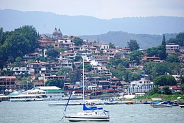
Embarcadero de Valle de Bravo

Panoramic view of Malinalco

Historical center of Metepec
![Centro histórico de Villa del Carbón[56]](https://upload.wikimedia.org/wikipedia/commons/thumb/d/db/Villa_del_Carb%C3%B3n_%2817%29.jpg/240px-Villa_del_Carb%C3%B3n_%2817%29.jpg)
Historical center of Villa del Carbón
![Pueblo de Tonatico[57]](https://upload.wikimedia.org/wikipedia/commons/thumb/a/a3/Shrine_Our_Lady_of_Tonatico%2C_Tonatico%2C_Mexico_state%2C_Mexico_.jpg/240px-Shrine_Our_Lady_of_Tonatico%2C_Tonatico%2C_Mexico_state%2C_Mexico_.jpg)
Pueblo de Tonatico


![Centro histórico de Villa del Carbón[56]](https://en.wikipedia.org/wiki/Archivo:Villa_del_Carb%C3%B3n_(17).jpg)
![Pueblo de Tonatico[57]](https://en.wikipedia.org/wiki/Archivo:Shrine_Our_Lady_of_Tonatico,_Tonatico,_Mexico_state,_Mexico_.jpg)
Project "Pueblos con Encanto"
At the state level, the project Pueblos con Encanto del Bicentenario was created in 2005, which works as a support to trigger development in some municipalities with attractions and tourist vocation. To date, this name has been given to some municipalities that are: Acolman, Amanalco, Amecameca, Ayapango, Otumba, Sultepec, Temascalcingo, Temascaltepec, Tlalmanalco, Tonatico and Zacualpan.
- Charming villages in the State of Mexico
People of Ayapango

Pueblo de Amecameca de Juárez
Otumba village

Historical center of Tlalmanalco
People of Sultepec


Archaeological zones
The State of Mexico has an important archaeological development, since it is one of the main states with the greatest cultural heritage, which can be accessed without any restrictions, since it is a Mexican heritage, in addition to serving as a good source tour; Some of the most important areas are:
Teotihuacán, 'The place where men become gods', is an archaeological zone located in the State of Mexico, in the municipalities of San Juan Teotihuacán and San Martín de las Pirámides, 48 km northeast of Mexico City. Its climate is semi-dry with an average annual temperature of 15 °C. This ancient ceremonial center is one of the most important in pre-Hispanic America due to its masterful urban layout, its architectural monumentality and the strong political and religious influence it exerted on other cities at the time; It is also one of the most visited and valued archaeological zones of the Mexican Republic.
Today some of the most impressive pre-Hispanic buildings in the world remain, such as the Pyramid of the Sun (the second largest in Mexico), the Pyramid of the Moon, the Temple of Quetzalcóatl, among others, all aligned around a large avenue of more than 2 km that has been called "The Street of the Dead" due to the large number of small pyramids that are in its path.
The archaeological zone of Teotenango is located on the Tetépetl hill, which is located to the west of the City of Tenango de Arista, at about 2700 m s. no. m. (meters above sea level); and it was the most important fortified city in the Valley of Toluca or Matalcingo, built by the Teotenancas and Matlatzincas in times prior to the Spanish conquest.
The archaeological site of Tlalpizáhuac was discovered in 1987, when urbanization works were being carried out on the surface of the property known as San José Chalco. By clearing the land, digging ditches for drainage, etc., different elements such as vessels, bones, walls and floors appeared. Given this evidence, the National Institute of Anthropology and History carried out an archaeological rescue whose results gave rise to establishing the importance of the site.
At the foot of the mountains, surrounded by lush forests, the town of Acambay preserves its cobbled streets and its wooden houses with tiles; in center field, stands a red brick tower with its clock. Nearby is the Acambay Regional Museum, where jewelry, tools and personal objects are exhibited that take us back to pre-Hispanic roots. Vestiges of the ancient settlers are found a few kilometers away, in the archaeological zone of Huamango.
The thousand-year-old lineage of Texcoco can be seen in the rich Acolhua heritage left by the ancient indigenous people. Emperor Nezahualcóyotl was born in these lands, whose palaces, temples and famous baths were preserved on the Cerro de Texcotzingo (or Tezcutzingo), which also still has traces of its aqueduct, which supplied this hill, which was also a botanical garden. The religious conquest left a legacy of magnificent colonial constructions, such as the Texcoco Cathedral.
In Tlalnepantla, four eras coexist in perfect harmony: pre-Hispanic, colonial, Porfirian and contemporary. The archaeological zones of Tenayuca and Santa Cecilia have a unique characteristic, since the "Aztec" style was found for the first time in their pyramids, which later would be used for the imposing Templo Mayor, which is located in the Historic Center of Mexico City..
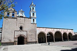
Its history goes back to the Matlatzincas who left their mark in the archaeological zone of Calixtlahuaca. In the historic center of the city you can appreciate the architecture of the imposing Cathedral with Roman reminiscences, the church of La Merced and the parish of Santa Veracruz. There are also the Botanical Garden and the well-known Cosmovitral, as well as numerous museums of Art, Painting, Watercolor, Prints and Popular Cultures, both in the Historic Center and in the Mexiquense Cultural Center.
- Archaeological zones in the State of Mexico

Archaeological zone of Teotihuacán

Archaeological zone of Teotenango

Monolytic Ruins of Malinalco

Archaeological zone of Calixtlahuaca

Archaeological zone of Santa Cecilia Acatitlán


Parks and protected natural areas
Estrella Biopark

Outdoor park located in Jilotepec, which has various activities in contact with nature and protected animals of the place, including a safari.
Zacango Zoo
This zoo has 159 ha, and is built on the Old Franciscan Estate from the XVI century, which later belonged to to the Counts of Santiago and Calimaya, it is considered one of the largest and most beautiful in Latin America. It is located in the municipality of Calimaya, 14 km from the city of Toluca, in a rural area far from civilization that is 15 minutes from the town of Metepec and 30 minutes from Toluca.
The Zacango zoo is one of the most biodiverse in terms of wild species, since it has more than 180 different species from all over the world, of which 80 are in danger of extinction.
It is very close to Nevado de Toluca, it was inaugurated and declared a Protected Natural Area on August 29, 1981 thanks to the efforts of the government of the State of Mexico, Conamp, Semarnat and Cepanaf.
Demographics
Population dynamics
The State of Mexico is the most populous federal entity in Mexico. According to data from the National Institute of Statistics and Geography (INEGI), in 2020 it had a total of 16,992,418 inhabitants.
The most populated municipalities of the entity as of 2020 are:
Migration
The State of Mexico is one of the entities in the country that receives the most migratory flows from rural areas to urban areas, but there is also migration from urban areas to rural areas, as in the case of the inhabitants who lived in Ciudad de Mexico and who have decided to change their permanent residence in the municipalities of the State of Mexico. The state has received numerous migratory flows of citizens from neighboring entities such as Guerrero, Hidalgo, Michoacán, Mexico City and Puebla; and from other states such as Veracruz, Oaxaca, Guanajuato and Jalisco.
Foreign Immigration
The State of Mexico is the seventh federal entity with the largest foreign population in the country. Its proximity to Mexico City allows numerous foreign communities to have settled in this entity. The majority of the foreign population residing in the state has settled in urban areas such as the Metropolitan Zone of the Valley of Mexico and the Metropolitan Zone of the Valley of Toluca.
Regarding foreign immigration to the State of Mexico, an increase in foreign citizens who have chosen the state territory as their place of permanent residence stands out. The State of Mexico has received innumerable communities from far away nations, for example, the Spanish, Italian and Portuguese communities had a notable presence in almost the entire state from colonial times to the present day. The Lebanese, Syrian, Chinese, German and Japanese communities have had a prominent presence, especially in the Toluca Valley and the Valley of Mexico Metropolitan Area. In more recent years, communities from Latin American countries such as Guatemala, Colombia, Venezuela, Honduras, El Salvador, Argentina and Cuba have been established in much of the state. There is also a presence of American and Canadian communities in towns such as Malinalco, Valle de Bravo and Valle de Toluca.
Ethnic groups
| Indigenous Peoples of the State of Mexico | |||
| Name | Pob. | % | |
| Mazahua | 95.411 | 42,91 | |
| Otomí | 83,522 | 36.11 | |
| Nahua | 45,972 | 2.04 | |
| Matlatzinca | 952 | 0.03 | |
| Tlahuica | 817 | 0.02 | |
| Other | 10.026 | 7.86 | |
| Source: INEGI | |||
The indigenous groups of the State of Mexico are the Mazahuas, Otomi, Nahuas, Matlatzincas and Tlahuilcas, who are considered natives of this territory, although in the last half of the 20th century and the beginning of the 21st century other groups have been incorporated indigenous people from other states of the republic. Of the total population of the state, 312,319 inhabitants speak an indigenous language, of which 150,741 are male and 161,578 are female.
There are indigenous communities from other states of the Republic that have settled mainly in the municipalities of the Metropolitan Area of Mexico City, and particularly in the eastern part of the state, Valle de Chalco Solidaridad being the municipality with the greatest diversity linguistic and ethnic groups throughout the country. There is a notable presence of other indigenous languages of the country that are not native to the State of Mexico; the most numerous of these are the Zapotecs, Mixtecs, Purépechas, Mazatecos and Tlapanecos, also Nahuas and Otomi from other Mexican states. To the west, the Mazahuas predominate, the most representative group and with the greatest identity. The municipality of El Oro considered a crossroads of indigenous languages. The center-south of the state highlights the presence of the Matlazinca, Tlahuilca, Nahua and Otomi communities, where Toluca is the city with the highest indigenous concentration in that region.
Religion
According to the 2005 General Population and Housing Census (INEGI), among the population aged 5 years and over residing in the state, the predominant religion is Catholic, with a percentage of 93.5%; the remaining 6.0% practice other cults, and 0.5% do not belong to any religion. Accordingly, Christianity is the dominant state religion, with the most common denominations being Catholicism, the Evangelical movement, Methodism, and Pentecostalism.

By number of believers, the Catholic Church is the religious association with the most adherents in the state. This is organized into 1 archdiocese: the Archdiocese of Tlalnepantla and 9 dioceses: the Diocese of Atlacomulco, the Diocese of Cuautitlán, the Diocese of Ecatepec, the Diocese of Nezahualcóyotl, the Diocese of Tenancingo, the Diocese of Teotihuacán, the Diocese of Texcoco, the Diocese of Toluca and the Diocese of Valle de Chalco.
On the other hand, the largest Jewish population in the country resides in the State of Mexico, where it has important communities, with a population of 21,000 believers, mostly Ashkenazi, although there is also a strong presence of crypto-Jews, who they were within Catholicism for obvious reasons and have preserved numerous Sephardic customs. The presence is strong in rural localities towards the states of Guerrero, Michoacán and Hidalgo. The largest Jewish population resides in the municipalities of Huixquilucan and Naucalpan de Juárez. There are notable communities also in Atizapán de Zaragoza, Metepec, Lerma, Tlalnepantla de Baz, Toluca, Atlacomulco and Texcoco.
Healers play a prominent role within the beliefs of the inhabitants, especially in indigenous communities and those furthest from urban centers. The beliefs attribute to them the ability to cure evil eyes, air, whooping cough, rabies, pain caused by work, fright, skin infections, among other conditions. The faith of most Mexicans has its roots in Mesoamerican beliefs and Catholic Christianity.
Education
Among the educational institutions, the Autonomous University of the State of Mexico (UAEMéx) in the state capital, Toluca, stands out. Of a public nature, it was founded in 1828 as the Literary Institute of the State of Mexico in Tlalpan (then the state capital). She was promoted to the Scientific and Literary Institute of Toluca (ICLA) in 1943, and to the Autonomous University of the State of Mexico (UAEM) in 1956.

At the upper secondary level, there is the prominent presence of Conalep with the schools Conalep Ing. Bernardo Quintana Arrioja and Conalep Cuautitlán n.º 108, both located in the municipality of Cuautitlán Izcalli.
It also has the presence of the National Technological Institute of Mexico, divided into at least 16 institutions, of which 14 are state-owned and 2 are federal, such as the Instituto Tecnológico de Toluca located in the Toluca Valley in the municipality of Metepec, as well as the Technological Institute of Tlalnepantla in the Valley of Mexico.
On the other hand, there is also the Chapingo Autonomous University (UACh), a public institution located in the municipality of Texcoco, in the eastern part of the state.
The state is home to some faculties of the highest house of studies in Mexico, the National Autonomous University of Mexico (UNAM); This is a public university, the largest in the country and in Latin America, as well as one of the 30 best-known on the planet. However, its main campus is not in the State, but is located south of the City of Mexico, and is known as Ciudad Universitaria (CU). In 2007, the site was declared a World Heritage Site by UNESCO.
In an analysis of the results produced by the INEGI in its 2010 census, it can be seen that the population assistance to receive their school education reaches its highest point between the ages of 6 and 12, with 96.7% of the total population of this age. Almost the entire population attends to receive their basic education. Upon receiving their secondary education, attendance at educational institutions drops by almost 9 percentage points and remains at 87.9% of the total population of this school age. This is the age where problems of various kinds arise where young people are exposed to situations that make them drop out of junior high school. In the upper average, the attendance percentage is 53.1%. The population receiving higher education is reduced to 22% of the population.
Culture and heritage
The State of Mexico preserves a great cultural baggage, derived from being part of the Valley of Mexico and, above all, from the peoples that have inhabited it throughout the country's history, as well as from the various historical moments that It has lived since pre-Hispanic times, going through the Colony, Independence and the Revolution.
Architecture
One of the states that stands out for its architecture is the State of Mexico, the tradition of tlaquitquis or alarifes was preserved with elegance from pre-Hispanic times to the present, the Spanish friars realized the finesse and quality of work among the indigenous people, a pre-Columbian heritage that they developed in their architecture, which is expressed in the carving of the stones and quarries of the colonial and modern buildings.
Sculpture

Among the greatest exponents are the clay figures of the Tlatilca culture, which stands out for the dynamism of form in the clay sculptures.
Another outstanding painter is Luis Nishizawa Flores, one of the great masters who managed to apply abstraction techniques to reality.
Literature
The state has also stood out in literature and poetry, among its main exponents are Nezahualcóyotl and Sor Juana Inés de la Cruz, two greats of universal literature in Mexico, both born in this entity and main icons of beauty in the letters. The scholar Ángel María Garibay was born in Toluca. The New Spanish scientist José Antonio Alzate, in Ozumba. There is a collection with several state books, available for download on the website of the Editorial Board of the State Public Administration, present in the following reference.
Painting
Among the greatest exponents of painting in the State of Mexico is José María Velasco Gómez, a Temascalcinguense who used to paint landscapes.
- Select paintings of the National Museum of the Virreinate

The castes.

Archangel in the domestic chapel.

Sister Maria Engracia Josefa.

Oil painting of the Virgin of Guadalupe.

Mark the Evangelist


.jpg)
In August 2022, a painting done by the inhabitants of the San Carlos Cantera neighborhood, in Ecatepec de Morelos, became popular. In it, it was possible to capture the face of "Doctor Simi", a famous character of Mexican popular culture, belonging to similar pharmacies created by Víctor González Torres. Later, a commemorative plaque was placed that made the name of this place official as the "Simi colonia". The idea of doing this work came from Víctor González Herrera (vice president of these pharmacies), which came to him after realizing that several houses were not painted due to the lack of economic resources of the residents of the area, supporting them by giving them paint to improve their homes.
Cultural Heritage of Humanity
The State of Mexico has numerous sites declared World Heritage Sites by UNESCO, these sites are the main tourist attraction visited by national and foreign tourists, These are: Teotihuacán Archaeological Zone, Arches of Padre Tembleque in the municipality de Nopaltepec (which are shared with the state of Hidalgo, in the municipality of Zempoala) and El Camino Real de Tierra de Adentro, which crosses the municipalities of Tlalnepantla, Cuautitlán, Cuautitlán Izcalli, Tepotzotlán, Coyotepec and Huehuetoca, towards Tepeji del River, later crosses through Jilotepec, Timilpan and Aculco.
The Federal government created the Pueblos Mágicos program, this designation has been granted in some Mexican municipalities, for the conservation of important sites declared Cultural Heritage of Humanity by Unesco.
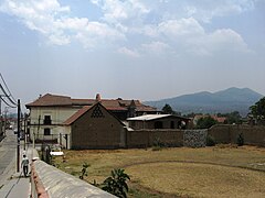
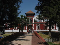
Tepotzotlán is a municipality that attracts many tourists for the National Museum of the Viceroyalty and its old baroque church dedicated to San Francisco Javier.
- Cultural heritage of humanity
Archaeological zone of Teotihuacán.

Father Tembleque aqueduct.

Ex-convention of Tepotzotlán.

Monarch Butterfly Sanctuary in Ixtapan del Oro.


Cultural Heritage of the State of Mexico
The government of the State of Mexico has declared numerous architectural and engineering monuments as part of its built state heritage, however, these monuments not only stand out for their architecture or aesthetics, but also for the historical events that occurred within said buildings.
- Monuments cultural heritage of the State of Mexico.

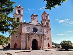
Cathedral of Texcoco.
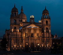
Metropolitan Cathedral of Toluca.

Cosmovitral and botanical garden of Toluca.

Ex-convention of the Divine Savior in Malinalco.
Ex-hacienda de Panoaya in Amecameca.

Palacio de Gobierno del Estado de México.


.JPG)


Gastronomy
As for food, it is traditional on a market day to find mixiotes, tlacoyos, mushroom quesadillas, tamales, turkey in green or pipián sauce, ground or letter cheese, cottage cheese, turkey in mexcalpique chile, samborojo tazarbo, acociles, escamoles, mosco (fruit liqueurs), lemons stuffed with coconut, milk candies, crystallized fruit, seed and peanut candy, alegrías and Tolucan garapiñas.
In the Valley of Toluca, important meat or sausages are made, a legacy of the Spaniards who settled in the region due to the raising of pigs, such as; the chorizos, the green and red sausages, the Serrano ham, the pork cheese or chompepe cheese, the bacon, the bishop and pork sausages. The State of Mexico shares a gastronomy with other bordering states, for example; the ximbó, the gualumbos and the ram barbecue that are also part of the gastronomy of the state of Hidalgo.
- Mexiquense gastronomy

Dog barbeque in Otumba.

Chorizos del Valle de Toluca.

The ximbó, gastronomy of Hueypoxtla.

Mushroom soup in Ocoyoacac.

Trucha in Tenango del Valle.

.JPG)


Crafts
The manufacture of rugs began in 1968 with the aim of creating jobs in what is now the municipality of Temoaya. The meeting was initially sponsored by the Bank of Mexico, and later the project was financed by the State of Mexico. This project was abandoned due to mismanagement, but the families here continued to make the rugs on their own. In 1999, a new organization, the Temoaya Hand-Knotted Rug Cooperative Society took over, but remained independent of the government. Although most of the rugs are made in a community called San Pedro Arriba (5 km from the headquarters), the cooperative's store, Centro Artesanal "Tapetes Mexicanos" is located in San Pedro Abajo.
While the techniques used are that of oriental rugs, the designs used are indigenous to Mexico. Most are Otomi, but designs from other cultures such as those of Chiapas, Nayarit, and Guanajuato are also used. Common themes include birds, flowers, geometric shapes, elements of nature, as well as magical and religious signs. About a hundred colors are used in forty-four basic designs that have 145 variants. The rugs are hand-knotted, mostly by women, using virgin wool, which is worn in the municipality from other places. Each square meter has around forty days to finish. The rugs are knotted on wooden frames that have been hung with heavy duty cotton rope to serve as the base. Many of these rugs come with certificates of authenticity and a number of serial numbers have been worked into the edge of the design.
Fireworks are another contribution of the handicrafts that are made in the state, municipalities such as Tultepec, Zumpango, Melchor Ocampo and Cuautitlán, stand out for the elaboration of colorful pyrotechnic castles and fireworks as an art that reached the center of the country through through the China Nao.
The manufacture of booty in the municipality of Villa del Carbón is another great contribution of state crafts, it has numerous workshops dedicated to the manufacture of booty in calfskin, calf, etc. considered the national capital of the charro booty.
- Mexiquen Crafts
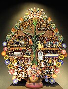
Tree of life, Metepec crafts.

Palm craftsmanship of Toluca

Preparation of carpets in Temoaya.

Preparation of bounces in Tenancingo.


Folklore
The State of Mexico is one of the federal entities that shares a rich intangible cultural heritage, its folkloric manifestations are diverse and colorful, both the indigenous peoples of the state and the mestizo peoples have contributed to the creation of their own cultural identity that makes its inhabitants proud.
Speaking of religion, in the State of Mexico is the picturesque Sanctuary of Chalma, a place where upon arrival, the villagers give you a warm welcome and immediately invite you to be part of their traditions, such as dancing with the flower crown
In some towns popular music is preserved in the form of breath bands, they are part of the music and choreography of various dances such as the dance of the chinelos, the dance of Moors and Christians, the contradanza de las varas and the dance of the arches
Los concheros, indigenous music performed with rattle, teponaxtle and huehuetl, as well as corridos and sonnets that stands out among songs and prayers in the Nahuatl and Spanish languages towards the old deities and towards the invocations of Christ of the Catholic Church that They are found in various regions of the state. The color of the costumes are a reminiscent contribution to the splendor of the old Mexica empire, it is made up of maxtlatl, plumage headband or copilli, friar or coyolli bones, huaraches or tecactli.
- Folklore mexiquense

Old Corpus Dance in Temascalcingo.

Dance of the Santiagueros in Zumpango.

Chinelos dance in Malinalco.

Contradanza de las Varas en Tequixquiac.

Danza de los Concheros en Amecameca.

Danza de los Arrieros en Ocoyoacac.


.JPG)
.JPG)


Media
.png)
The State of Mexico is one of the few federal entities that have its own television channel, XHPTP-TV channel 34, better known as Mexiquense TV, which was founded on September 26, 1984 by the then governor, Alfredo del Mazo González, and the President of Mexico, Miguel de la Madrid Hurtado.
Being a radio broadcaster, Mexiquense TV also has 6 radio stations; 91.7 FM Amecameca, 104.5 FM Valle de Bravo, 88.5 FM Zumpango, 1080 AM Tultitlán, 91.7 FM Metepec, 1600 AM Metepec.
Transportation
Airports
Felipe Angeles International Airport
.jpg)
The Felipe Ángeles International Airport, located in the town of Santa Lucía, within the municipality of Zumpango; It is the most important airport in the State of Mexico and was built within the metropolitan area of Mexico City to serve the inhabitants of the country's capital and the metropolitan region, it has a highway connection with the main roads of the entity and with roads to other states of the country such as Hidalgo, Tlaxcala, Puebla, Morelos, Guerrero, Querétaro and Veracruz.
Lic. Adolfo López Mateos International Airport
The Lic. Adolfo López Mateos International Airport, located within the municipality of Toluca; It is the second most important airport in the State of Mexico and was built within the metropolitan area of Valle de Toluca to serve the inhabitants of the Mexican capital and the inhabitants of the capital of the country, it has a highway connection with the main roads of the entity and with roads to other states of the country such as Hidalgo, Michoacán, Morelos, Guerrero and Querétaro.
Other airports
- Jorge Jiménez Cantú National Airport
- Aerodrome of Valle de Bravo
- Military Air Base No. 1 of Saint Lucia (Military Use)
Railroads
Suburban Train of the Valley of Mexico

The Suburban Train began operating on June 1, 2008; the first phase was Buenavista-Lechería. On January 5, 2009, the stretch to Cuautitlán was completed; the average travel time is 24 minutes. This project was carried out by the Spanish company CAF (Construcciones y Auxiliar de Ferrocarriles, S.A.). It is important to mention that this transport is ecological, since it is electric; something that is also notorious is the cleanliness and order in the facilities, and above all the importance they give to people with different abilities; It has elevators, for the comfort of these people; in the wagons there is an area for people in wheelchairs; Surveillance cameras are installed inside and outside the wagons to maintain the safety of users.
Mexico-Toluca Interurban Train
On July 7, 2014, construction work began on the Mexico-Toluca Interurban Train. This train will connect the Mexican municipality of Zinacantepec with the Álvaro Obregón mayor's office in Mexico City.
Bicentennial Viaduct
It is a project built with the purpose of making vehicular traffic more efficient, and with the purpose of being a commemorative work of the bicentennial of the independence of Mexico. The work was carried out during the government period of Enrique Peña Nieto and Marcelo Ebrard. It was concessioned to the Spanish company OHL, for which access to it has a cost of 1.43 pesos per kilometer.
The section of the peripheral that it covers goes from the Periférico Norte to Tepalcapa, State of Mexico, which is why it is 32 km long. Its construction began on September 1, 2008, and despite the scheduled date for its inauguration being August 2010, it was not until November of that year that the last section of this second floor was inaugurated.
Mexibus

The Mexibus is a mass transportation service through articulated buses of rapid transit (BRT), operated with a prepaid electronic card system. It is a system similar to the Metrobús previously implemented in Mexico City, and other BRT systems such as the Optibús in León, Guanajuato; the Guadalajara Macrobus, Jalisco; the TransMetro in Monterrey, Nuevo León, among others. It was proposed as a solution to the urban mobility of the municipalities of the Metropolitan Area of the Valley of Mexico, and those of the Toluca Metropolitan Area.
It has three lines in operation and one under construction:
- Line 1: extends from the Terminal Multimodal Azteca Bicentenario, in the municipality of Ecatepec, to Ojo de Agua, in Tecámac, with a length of 16 km. It has 24 stations, 3 modal transfer stations and the same number of terminals. Your stroke is for the Av. Central and National Avenue.
- Line 2: opened on January 12, 2015, its tour is from the Plaza las Américas Shopping Center, in Ecatepec, to the Quebrada, in Cuautitlán Izcalli. It has a length of 21.3 km, and has 42 stations. His stroke is through the avenues: May Day, Revolution and López Portillo. This line should have been listed in August 2010, but due to delays and poor planning and execution of the work, it was completed until January 2015 (even with some faults).
- Line 3: runs from the station of the Collective Transport System - Metro Pantitlán, in the Iztacalco City of Mexico City, to the municipality of Chimalhuacán, with a length of 14.5 km. It has 25 stations and 2 terminals. His stroke is through the avenues: from the Rock, Bordo de Xochiaca, Vicente Villada, Chimalhuacán and Río Churubusco.
- Line 4: at its first stage, its tour goes from Green Indians, at the Gustavo A. Madero mayor's office, to the Ecatepec Center of Abastos. In his second stage, he will go from Saint Thomas to Mexiquense University of the Bicentennial, in Los Heroes. In total, it will have a length of 24.4 km, and will have 31 stations. His stroke is by the Via Morelos and vialidad Mexiquense.
Public services
Security
The State of Mexico faces a critical situation of citizen security, as it is one of the most violent states in the country and the one with the most crimes per 100,000 inhabitants, being 93 (the national average is 41). During For several years since 2011, the state has been the largest in the country with crimes considered to have a high impact in the country, such as homicide, kidnapping, extortion, rape, injuries, and violent robbery. According to an INEGI survey, is the state with the highest perception of insecurity in Mexico among its inhabitants (90.7% of its population felt unsafe in 2014). The United States Department of State has prohibited travel to its citizens that is not strictly necessary to the municipalities of Coacalco, Ecatepec, Nezahualcóyotl, La Paz, Valle de Chalco Solidaridad, Chalco, Ixtapaluca, and Tlatlaya. The most common crimes in the state in 2014 were robbery in the street or on public transportation, threats, and extortion.
Femicides
Among the criminal behaviors with the highest incidence are femicides, crimes that have increased above the national average in 10 years. The murders of women in the state from 2006 to 2012 were counted by journalists in 1,997, almost 500 more than the 1,543 recorded in 20 years in Ciudad Juárez. For this reason, in 2015 the Ministry of the Interior declared a Gender Violence Alert in eleven municipalities of the entity.
Sports

The State of Mexico has been the birthplace of many Olympic athletes, among which Fernando Platas stands out as a diver and medalist who began to participate since Barcelona 1992.
Other notable athletes include Soraya Jiménez, who was born in Naucalpan. She started in basketball and, at the age of 14, began to practice bodybuilding and weights; she set records and, in 1997, she achieved the first world bronze medal in weightlifting in Mexican history, both women's and men's; and Belem Guerrero Méndez, a cyclist and Olympic medalist from Ciudad Nezahualcóyotl, who started in the sport at the age of 8 and won a silver medal at the 2004 Athens Olympics in the Women's Track Points race.
Basketball
The State of Mexico has a team in the National Professional Basketball League, the Giants of the State of Mexico.
Football
Deportivo Toluca is a Mexican soccer club that plays in the First Division of Mexico. Its current headquarters is the Nemesio Díez Stadium located in the city of Toluca, State of Mexico, Mexico. It was officially founded on February 12, 1917 by a board of trustees headed by Manuel Henkel and Román Ferrat Alday.
Despite being one of the oldest teams in Mexico with 103 years of history; The professional era for Toluca began in 1950, that is, 33 years after its foundation, becoming one of the founding teams of the Second Mexican Division. It is, along with Cruz Azul, Santos and Pumas, one of the clubs that since its creation and promotion have not relegated or disappeared from Mexican soccer.
Since its beginnings in the professional era, the team has kept playing its home games at the Nemesio Díez Stadium, known as "La Bombonera de Toluca", with a capacity of 21,091 fans. According to surveys carried out in 2007 and 2009 by Grupo Reforma, Récord and Consulta Mitofsky, Toluca is the fifth team with the most fans in Mexico and the team with the highest fan growth.
American Football
The State of Mexico has two teams in the Mexican Professional American Football League, the Naucalpan Raptors and the Toluca Bears.
Wrestling

The State of Mexico has a professional wrestling arena called Arena Mamá Lucha-S, located in the municipality of Cuautitlán Izcalli.
Personalities born in the state
Contenido relacionado
Trondheim
Saint John of Aznalfarache
Tehran