
Metropolitan area of the Valley of Mexico
The Metropolitan Zone of the Valley of Mexico (by its acronym, ZMVM) is the metropolitan area made up of Mexico City and 60 conurbated or agglomerated municipalities, one of them in the state of Hidalgo, the rest in the State of Mexico. According to the results of the census prepared by the National Institute of Statistics and Geography in 2020, this area had a population of around 22 million inhabitants, approximately 1 in 5 Mexicans (in Mexico City alone, there are 9,319,011 inhabitants). According to data from the United Nations Organization in 2012, it is the 7th largest metropolitan area in the world and the second largest in Latin America (7,954 square kilometers), only below the Binational Metropolitan Area of San Diego -Tijuana (12,496 square kilometers).[citation needed]
The metropolitan area concentrates the largest number of businesses and commercial activities in Mexico City, making it extremely important for the economic activity of both the city and the country.[citation required ]
Mexico City has been, for a good part of the history of independent Mexico, its main economic center. In the 19th century, the peripheral municipalities of the entity had an economy based on agriculture and the trade of the goods produced by this activity and other complementary manufactures. Both agricultural products and obrajes were consumer goods whose main point of trade was Mexico City. This, due to its nature of national capital, specialized in the provision of services associated with public administration. Some of its inhabitants were also agricultural workers, but almost all of them were concentrated in the service sectors and fledgling industry.[citation needed]

Definition of the metropolitan area
The term metropolitan area was coined and developed in the United States beginning in the 1920s and is most often used to refer to a “large” city whose boundaries extend beyond those of the political-administrative unit that originally contained it; in the case of Mexico, said unit is the municipality.[citation required]
Since the 1940s, given the growing conurbation around Mexico City, the definition and establishment of the limits had been proposed. Some of the proposals of that time would be the basis for the environmental pollution abatement programs of the 1980s. However, none of these definitions was universal and no commission had been created for the projects to be managed jointly. by the various entities and municipalities that made up the metropolitan area.[citation required]
On December 22, 2005, the government of Mexico City and the State of Mexico agreed to establish an official definition of the Valley of Mexico Metropolitan Area (ZMVM). According to this definition, the ZMVM is made up of the 16 demarcations of Mexico City (since 2017, called alcaldías), 59 municipalities of the State of Mexico and one (1) municipality of Hidalgo. It was also agreed that most urban plans would be administered by metropolitan commissions.[citation required]
Parts of the metropolitan area
The Metropolitan Zone of the Valley of Mexico is delimited by the 16 municipalities of Mexico City, with 9,209,944 inhabitants, 59 municipalities of the state of Mexico, with 12,437,287 inhabitants, and 1 municipality of the state of Hidalgo, with 168,302 inhabitants.
| Key INEGI | Municipality | Entity | Population (2000) | Population (2010) | Population (2015) | Population (2020) | Average annual growth rate 2000-2010 (%) | Surface (km2) | Average urban density (hab/ha) |
| 09002 | Azcapotzalco | Mexico City | 441 008 | 414 711 | 400 161 | 432 205 | -0.6 | 33.5 | 189.0 |
| 09003 | Coyoacán | Mexico City | 640 423 | 620 416 | 608 479 | 614 447 | -0.3 | 53.9 | 194.4 |
| 09004 | Cuajimalpa | Mexico City | 151 222 | 186 391 | 199 224 | 217 686 | 2.0 | 71.5 | 89.5 |
| 09005 | Gustavo A. Madero | Mexico City | 1 235 542 | 1 185 772 | 1 164 477 | 1 173 351 | -0.4 | 87.9 | 200.2 |
| 09006 | Iztacalco | Mexico City | 411 321 | 384 326 | 390 348 | 404 695 | -0.7 | 23.1 | 210.4 |
| 09007 | Iztapalapa | Mexico City | 1 773 343 | 1 815 786 | 1 827 868 | 1 835 486 | 0.2 | 113.2 | |
| 09008 | The Magdalena Contreras | Mexico City | 222 050 | 239 086 | 243 886 | 247 622 | 0.7 | 63.4 | 162.3 |
| 09009 | Milpa Alta | Mexico City | 96 773 | 130 582 | 137 927 | 152 685 | 2.9 | 298.2 | 47.3 |
| 09010 | Álvaro Obregón | Mexico City | 687 020 | 727 034 | 749 982 | 759 137 | 0.5 | 95.9 | 193.5 |
| 09011 | Tláhuac | Mexico City | 302 790 | 360 265 | 361 593 | 392 313 | 1.7 | 85.8 | 135.8 |
| 09012 | Tlalpan | Mexico City | 581 781 | 650 567 | 677 104 | 699 928 | 1.1 | 314.5 | 119.9 |
| 09013 | Xochimilco | Mexico City | 369 787 | 415 007 | 415 933 | 442 178 | 1.1 | 114.1 | 93.8 |
| 09014 | Benito Juárez | Mexico City | 360 478 | 385 439 | 417 416 | 434 153 | 0.7 | 26.7 | 157.1 |
| 09015 | Cuauhtémoc | Mexico City | 516 255 | 531 831 | 532 553 | 545 884 | 0.3 | 32.5 | 215.6 |
| 09016 | Miguel Hidalgo | Mexico City | 352 640 | 372 889 | 364 439 | 414 470 | 0.5 | 46.4 | 186.7 |
| 09017 | Venustiano Carranza | Mexico City | 462 806 | 430 978 | 427 263 | 443 704 | -0.7 | 33.9 | 209.5 |
| 13069 | Tizayuca | Hidalgo | 46 344 | 97 461 | 119 442 | 168 302 | 4.2 | 76.7 | 1555.1 |
| 15002 | Acolman | State of Mexico | 61 250 | 136 558 | 152 506 | 171 507 | 8.1 | 86.9 | 78.8 |
| 15009 | Amecameca | State of Mexico | 45 255 | 48 421 | 50 904 | 53 441 | 0.7 | 176.2 | 45.9 |
| 15010 | Apaxco | State of Mexico | 23 734 | 27 521 | 29 347 | 31 898 | 1.4 | 75.7 | 40.3 |
| 15011 | Atenco | State of Mexico | 34 435 | 56 243 | 62 392 | 75 489 | 4.9 | 87.7 | 52.1 |
| 15013 | Atizapán de Zaragoza | State of Mexico | 467 886 | 489 937 | 523 296 | 523 674 | 0.4 | 92.9 | 130.8 |
| 15015 | Atlautla | State of Mexico | 25 950 | 27 663 | 30 945 | 31 900 | 0.6 | 167.7 | 37.7 |
| 15016 | Axapusco | State of Mexico | 20 516 | 25 559 | 27 709 | 29 128 | 2.2 | 286.5 | 23.6 |
| 15017 | Ayapango | State of Mexico | 5947 | 8864 | 9863 | 10 053 | 3.9 | 50.7 | 29.0 |
| 15020 | Coacalco de Berriozábal | State of Mexico | 252 555 | 278 064 | 284 462 | 293 444 | 0.9 | 35.0 | 161.2 |
| 15022 | Cocotitlán | State of Mexico | 10 205 | 12 | 14 414 | 15 107 | 1.7 | 14.8 | 52.3 |
| 15023 | Coyotepec | State of Mexico | 35 358 | 39 030 | 41 810 | 40 885 | 1.0 | 39.9 | 48.6 |
| 15024 | Cuautitlán | State of Mexico | 75 836 | 140 059 | 149 550 | 178 847 | 6.1 | 40.8 | 125.0 |
| 15025 | Chalco | State of Mexico | 217 972 | 310 130 | 343 701 | 400 057 | 3.5 | 225.2 | 96.5 |
| 15028 | Chiautla | State of Mexico | 19 620 | 26 191 | 29 159 | 30 045 | 2.8 | 20.3 | 22.8 |
| 15029 | Boyloapan | State of Mexico | 77 579 | 176 053 | 206 107 | 200 750 | 8.4 | 42.2 | 150.4 |
| 15030 | Chiconcuac | State of Mexico | 17 972 | 22 819 | 25 543 | 27 692 | 2.3 | 6.8 | 51.4 |
| 15031 | Chimalhuacán | State of Mexico | 490 772 | 614 453 | 679 811 | 705 193 | 2.2 | 54.5 | 159.1 |
| 15033 | Ecatepec de Morelos | State of Mexico | 1 622 697 | 1 656 107 | 1 677 678 | 1 645 352 | 0.2 | 156.2 | 164.6 |
| 15034 | Ecatzingo | State of Mexico | 7916 | 9369 | 9414 | 10 827 | 1.6 | 53.2 | 11.2 |
| 15035 | Huehuetoca | State of Mexico | 38 458 | 100 023 | 128 486 | 163 244 | 9.7 | 119.8 | 76.8 |
| 15036 | Hueypoxtla | State of Mexico | 33 343 | 39 864 | 43 784 | 46 757 | 1.7 | 234.5 | 20.2 |
| 15037 | Huixquilucan | State of Mexico | 193 468 | 242 167 | 267 858 | 284 965 | 2.2 | 140.9 | 100.4 |
| 15038 | Isidro Fabela | State of Mexico | 8168 | 10 308 | 11 726 | 11 929 | 2.3 | 79.7 | 17.6 |
| 15039 | Ixtapaluca | State of Mexico | 297 570 | 467 361 | 495 563 | 542 211 | 4.5 | 324.0 | 142.4 |
| 15044 | Jaltenco | State of Mexico | 31 629 | 26 328 | 27 825 | 28 217 | -1.8 | 4.7 | 157.7 |
| 15046 | Jilotzingo | State of Mexico | 15 086 | 17 970 | 19 013 | 19 877 | 1.7 | 116.5 | 20.8 |
| 15050 | Juchitepec | State of Mexico | 18 968 | 23 497 | 25 436 | 27 116 | 2.1 | 132.5 | 72.7 |
| 15053 | Melchor Ocampo | State of Mexico | 37 716 | 50 240 | 57 152 | 61 220 | 2.8 | 14.0 | 65.9 |
| 15057 | Naucalpan de Juárez | State of Mexico | 858 711 | 833 779 | 844 219 | 834 434 | -0.3 | 157.9 | 192.8 |
| 15058 | Nezahualcóyotl | State of Mexico | 1 225 972 | 1 110 565 | 1 039 867 | 1 077 208 | -1.0 | 63.3 | 226.8 |
| 15059 | Nextlalpan | State of Mexico | 19 532 | 34 374 | 39 666 | 57 082 | 5.6 | 61.0 | 31.3 |
| 15060 | Nicolás Romero | State of Mexico | 269 546 | 366 602 | 410 118 | 430 601 | 3.0 | 232.6 | 86.5 |
| 15061 | Nopaltepec | State of Mexico | 7512 | 8895 | 8960 | 10 351 | 1.7 | 82.6 | 15.8 |
| 15065 | Otumba | State of Mexico | 35 274 | 36 331 | 143.42 | ||||
| 15068 | Ozumba | State of Mexico | 23 592 | 27 207 | 29 114 | 30 785 | 1.4 | 47.5 | 46.1 |
| 15069 | Papalotla | State of Mexico | 3469 | 4147 | 3963 | 4862 | 1.7 | 3.2 | 19.4 |
| 15070 | La Paz | State of Mexico | 212 694 | 253 845 | 293 725 | 304 088 | 1.7 | 36.6 | 134.7 |
| 15075 | San Martín de las Pirámides | State of Mexico | 19 694 | 24 851 | 26 960 | 29 182 | 2.3 | 69.9 | 43.0 |
| 15081 | Tecámac | State of Mexico | 172 813 | 364 579 | 446 008 | 547 503 | 7.5 | 156.9 | 98.2 |
| 15083 | Temamatla | State of Mexico | 8840 | 11 206 | 12 984 | 14 130 | 2.3 | 29.2 | 37.2 |
| 15084 | Topics | State of Mexico | 29 307 | 35 987 | 38 622 | 43 593 | 2.0 | 164.6 | 21.7 |
| 15089 | Tenango del Aire | State of Mexico | 8486 | 10 578 | 12 470 | 11 359 | 2.2 | 38.0 | 41.0 |
| 15091 | Teoloyucan | State of Mexico | 66 556 | 63 115 | 66 518 | 65 459 | -0.5 | 31.0 | 44.2 |
| 15092 | Teotihuacán | State of Mexico | 56 993 | 58 507 | 83.16 | ||||
| 15093 | Tepetlaoxtoc | State of Mexico | 22 729 | 27 944 | 30 680 | 32 564 | 2.0 | 178.5 | 15.5 |
| 15094 | Tepetlixpa | State of Mexico | 16 863 | 18 327 | 19 843 | 20 500 | 0.8 | 43.1 | 32.2 |
| 15095 | Tepotzotlán | State of Mexico | 62 280 | 88 559 | 94 198 | 103 696 | 3.5 | 207.1 | 55.4 |
| 15096 | Tequixquiac | State of Mexico | 28 067 | 33 907 | 36 902 | 39 489 | 1.8 | 122.5 | 18.7 |
| 15099 | Texcoco | State of Mexico | 204 102 | 235 151 | 240 749 | 277 562 | 1.4 | 428.1 | 45.9 |
| 15100 | Tezoyuca | State of Mexico | 18 852 | 35 199 | 41 333 | 47 044 | 6.2 | 16.5 | 37.0 |
| 15103 | Tlalmanalco | State of Mexico | 42 507 | 46 130 | 47 390 | 49 196 | 0.8 | 160.2 | 53.5 |
| 15104 | Tlalnepantla de Baz | State of Mexico | 721 415 | 664 225 | 700 734 | 672 202 | -0.8 | 80.4 | 155.4 |
| 15108 | Tultepec | State of Mexico | 93 277 | 91 808 | 150 182 | 157 645 | -0.2 | 15.6 | 84.7 |
| 15109 | Tultitlán | State of Mexico | 432 141 | 524 074 | 520 557 | 516 341 | 1.9 | 70.8 | 155.6 |
| 15112 | Villa del Carbón | State of Mexico | 37 993 | 44 881 | 47 151 | 51 498 | 1.6 | 303.4 | 21.6 |
| 15120 | Zumpango | State of Mexico | 99 774 | 159 647 | 199 069 | 280 455 | 4.7 | 223.6 | 45.0 |
| 15121 | Cuautitlán Izcalli | State of Mexico | 453 298 | 511 675 | 531 041 | 555 163 | 1.2 | 110.1 | 126.5 |
| 15122 | Valle de Chalco Solidaridad | State of Mexico | 323 461 | 357 645 | 396 157 | 391 731 | 1.0 | 46.6 | 158.7 |
| 15125 | Tonanitla | State of Mexico | No. | 10 216 | 9728 | 14 883 | No. | 17.1 | 8.698 |
Urban problems caused by future conurbation plans
Case of San Salvador Atenco
In 2001, the Mexican Federal Government tried to build the new Mexico City International Airport in this municipality, but the inhabitants prevented it through a civil resistance movement that forced the government to definitively suspend construction. This showed the dissatisfaction of the population about the offer made by the different levels of government.
On May 3, 2006, the state and municipal governments prevented a group of eight flower vendors from relocating to one of the main streets. The flower growers asked for the support of the Peoples' Front in Defense of the Land of the people of Atenco with a brutal repression. The next day the State Security Agency entered to take control of the situation and arrested 211 people.
Starting on February 17, 2009, the Freedom and Justice for Atenco Committee launched the National and International Campaign for Freedom and Justice for Atenco, a civil and peaceful initiative with the participation of various personalities from various fields: writers, artists, organizations civil and human rights as well as citizens.
Ejido Tequixquiac Case
The municipality of Tequixquiac does not have a Municipal Urban Development Plan, despite the fact that the law requires it because it has already exceeded 10,000 inhabitants. The cause is the speculation of the authorities of the government of the state of Mexico on Tequixquense soil promoted by former governor Arturo Montiel Rojas through the company Wilk SA. of CV. Despite what the law establishes, there were no public or citizen consultations to see what the positions and demands of the municipality's own inhabitants were, but rather it was a plan made in a private office with the interests of PRI militants who assured owning land within ejidal land to associate with developers of housing units, as happened with Huehuetoca or Zumpango de Ocampo, which were recently declared bicentennial cities.
Case of Ejido Santa María Apaxco
As background, the declaration of Ciudad Bicentenario in the municipality of Huehuetoca and the problems of real estate speculation in the ejido of the municipality of Tequixquiac that ex-governor Arturo Montiel Rojas promoted through the company Wilk SA in 2010 detonated a series of social and agrarian movements at the end of 2011, in Santa María Apaxco.
The same problem that occurred in the ejido of Santiago Tequixquiac was repeated in the ejido of the town of Santa María Apaxco on November 10, 2011, when the negotiation of an area called Cerro Colorado with the limits of the municipalities of Huehuetoca and Tequixquiac; the peasants rose up against the local authorities and the PRI offices to demand an explanation, of which they said that they preferred to donate that property for equipment rather than being forced to sell their properties.
Image Gallery

Paseo de la Reforma, main financial centre of the country, Cuauhtémoc City Hall.

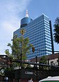
Edificio de la Bolsa Mexicana de Valores, alcaldía Cuauhtémoc.
The World Trade Center Mexico City is the International Exhibition and Convention Center, Benito Juárez City.

Las Torres de Satélite, in the municipality of Naucalpan de Juárez.
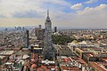
Historic Center of Mexico City in view of the Latin American Tower, Cuauhtémoc City.

Archaeological zone of Teotihuacán, in the municipality of Teotihuacán.


.jpg)

Contenido relacionado
Federated States of Micronesia
Cameroon Geography
National Park of the Atlantic Islands of Galicia