
Indus river
The Indus is an Asian river that runs through the Indian subcontinent, one of the longest on the continent, the most important in Pakistan and one of the main ones in India (and which also runs along its high course China). Originating on the Tibetan Plateau of western China in the Tibet Autonomous Region, the watercourse runs through the Ladakh district of Jammu and Kashmir and then enters Pakistan via Gilgit-Baltistan; It then continues from the north of the country in a southerly direction across the length of Pakistan, until it empties into the Arabian Sea near the port city of Karachi in Sindh.
The total length of the river is 3,180 km, making it the longest river in Pakistan. It drains a large basin of more than 1,165,000 km² and has an estimated annual flow of about 207 km³, making it the 21st largest in the world. Beginning in the highlands of the glaciated world, the river feeds the ecosystem of temperate forests, plains, and arid landscapes. Together with the rivers Jhelum, Chenab, Ravi, Sutlej, Beas and two tributaries from the Khaiber Pashtunjua and Afghanistan, the Indus forms the Indus Delta of Pakistan, mentioned in the Rig-veda (the most from India, mid-2nd millennium BCE) as Sapta Sindhu and in the Iranian text Zend Avesta as Hapta Hindu (both terms meaning 'seven rivers'). ').
The Indus provides key water resources for Pakistan's economy—especially the breadbasket of Punjab province, which accounts for most of the nation's agricultural output, and of Sindh. The watercourse also supports many heavy industries and forms the main supply of drinking water in Pakistan. The five rivers that give the Punjab its name are the Jhelum, Chenab, Ravi, Beas and Sutlej.
Before the 1947 division of ancient India into the modern states of India and Pakistan, the Indus was the region's second-largest river after the Ganges River in both cultural and commercial terms. Today the river also gives its name to the Pakistani province of Sindh.
The river has been a source of wonder during the classical period. King Darius I of Persia sent Scylax of Carianda to explore the Indus between 519 and 512 BC. C., descending it until reaching the sea. Called Hindós or Indós by the Greeks and then Indus by Latin authors, it was always known in the West by its Latinized name, which also gave its name to India (Bharat).
History

Paleolithic sites have been discovered in the Indus Valley at Pothohar, near Pakistan's capital Islamabad, with stone tools from the Soan culture. In the ancient region of Gandhara, also near Islamabad, evidence of caves inhabited dating back 15,000 years has been discovered in Mardan.
It also developed between 2300 and 1750 B.C. C. the culture of the valley of the Indus, a prehistoric culture that apparently did not get to know the culture of the Aryans and that knew several stages, from 7000 a. C. (see Tradition of the valley of the Indus).
The main cities of this civilization, Harappa and Mohenjo-daro, date back to around 3300 BCE. C., and represent some of the largest human settlements in the ancient world. The Indus Valley civilization stretched across Pakistan, reaching north from the Jhelum river east to Ropar in the upper Sutlej. Settlements along the coast stretched from Sutkagan Dor in Pakistan on the border of Iran to Kutch in Pakistan's far east. There is a site of this Indus culture at the Amu Darya in Shortughai in northern Afghanistan, and another at Alamgirpur on the Hindon River (a tributary of the Yamuna River, and thus the Ganges) which is only 28 km away. from New Delhi. To date, more than 1,052 cities and towns have been found, mainly in the general region of the Ghaggar-Hakra River and its tributaries. Among the settlements are what were the main urban centers of Harappa and Mohenjo-Daro, as well as Lothal, Dholavira, Ganeriwala and Rakhigarhi. Only 90 to 96 of the 800 best-known pieces of Indus Valley culture have been discovered in the Indus River and its tributaries. The Sutlej, now a tributary of the Indus, in Harappan times, sometimes emptied into the Ghaggar-Hakra, in whose basin more Harappan culture sites are found than along the Indus itself.
Most scholars believe that early Indo-Aryan Gandharan tomb culture settlements flourished in the Gandhara region beginning in 1700 BCE. C. to 600 B.C. C., when Mohenjo-Daro and Harappa had already been abandoned.
The first Europeans known to have reconnoitred this river were the Greco-Macedonian hosts of Alexander the Great who at the Indus virtually found the eastern limit of his empire as his forces withdrew along the southern course of the river to the end of the Asian campaign after the conquest of what is now Pakistan, uniting it with the Hellenic Empire. The name Indus is used in Megasthenes' book Indica for the mighty river crossed by Alexander, based on Nearchus' contemporary account. "Indus" is a Hellenic derivative of the Iranian Sindus, which in turn derives from Sindhu, the name of the Indus in the Rig-veda, since the river is considered, by Hindus, one of the seven sacred rivers of India. The Sanskrit term sindhu means generically 'river' or 'sea', probably from a root sidh meaning 'to drive away'. The term Sindhu appears 176 times in the Rig-veda, 95 times in the plural, most often used in the generic meaning. Already in the Rig-veda, especially in the later hymns, the meaning of the word is reduced when referring to the Indus river in particular, as for example, in the list of rivers in the Nadistuti sukta. This gave rise to the anomaly of a masculine gendered river: all other Rigvedic rivers are feminine, not just grammatically, being imagined as goddesses and compared to cows and mares giving milk and butter.
From the data provided by the Greek authors who began to mention the word India in reference to the entire Indian subcontinent, later the Latin authors would speak of a cisgangetic India (the India on this side of the Ganges) and of an India transgangetic (India on the other side of the Ganges).
In the past, the Persians and other Iranian-speaking peoples called this river Sindhu, extending that name to the inhabitants of the entire Indian subcontinent, with the name of Sindhustan ('country [of] Sindhu').
The Indus has formed a natural border between the Indian subcontinent and its border with the Iranian Plateau, a region that includes Pakistani Balochistan, Khaiber Pashtunkhua, as well as Afghanistan, Tajikistan, and Iran. It was crossed by the armies of Alexander the Great—his Macedonian forces withdrew along the southern course of the river at the end of the Asian campaign after conquering what is now Pakistan and joining it with the Hellenic Empire. The Indus plains have also been under the rule of the Persian Empire and the Kushan Empire. The Muslim armies of Mohamed ben Qasim, Mahmud of Ghazni, Mohammed of Ghor, Tamerlane and Babur also crossed the river to strike into the Punjab hinterlands and further south-east.
The word "India" derives from the Indus River. In antiquity, initially "India" referred to the region of Pakistan that is located along the east bank of the Indus River, but around the year 300 B.C. In BC, Greek writers such as Megasthenes applied the term to the easternmost subcontinent.
The traditional source of the river is Senge Khabab ('lion's mouth'), a perennial spring, not far from the sacred Mount Kailash, and is characterized by a long line of low Tibetan chortens. There are other nearby tributaries that can possibly form a longer watercourse than the Khabab Senge, but to this one, they are all dependent on melting snow. The Zanskar River, which empties into the Indus River in Ladakh, has a larger water volume than the Indus itself before that point.
That night in the shop [together with Senge Khabab] ask Sonmatering which of the Indo tributaries, which we crossed this morning, was the longest. All of them, he said, start at least one day on foot from here. The Bukhar starts near the village of Yagra. The Lamolasay fountain is in a holy place: there is a monastery there. The Dorjungla is a very long and difficult walk, three days perhaps, and there are many sharp rocks; but its water is clear and blue, hence the name of another tributary, Zom-chu, which Karma Lama translates as "blue water". The Rakmajang is born in a dark lake called the Black Sea.
One of the longest tributaries—and therefore a candidate to be the technical source of the river—is the Kla-chu, the river we crossed by a bridge yesterday. Also known as the Lungdep Chu, leads to the Indo from the southeast, and is born a day on the way from Darchen. But Sonamtering insists that the Dorjungla is the longest of the "three types of water" that fall in the Seng Tsanplo ['Leon Tribe' or Indo].Empires of the Indus: The Story of a RiverAlice Albinia (2008).
In the summer of 2010 the river overflowed at numerous points causing one of the biggest floods in Pakistan's history.
Geography
It originates in Tibet (China), at an altitude of 5500 ms. no. m., following its course through in a northwesterly direction, then through the Kashmir region and turning south to enter Pakistan and travel all the way. After passing through the city of Hyderabad, it flows into a delta bathing the shores of the port of Karachi, the first capital of Pakistan.
The total length of the river varies, according to sources, between 2,900 and 3,180 km. The average flow is 6,700 m³/s and it drains a wide basin of 1,081,700 km². At its mouth in the Oman Sea, the Indus forms an extensive and fertile delta, with an area of 7,770 km².
Description

Course in China
The Indus nominally begins very close to the eastern border of China's Tibet Autonomous Region, in the small town of Shiquanhe, at the confluence of the Sengge Zangbo and Gar rivers, which drain the Nganglong Kangri ranges and Gangdise Shan and run through one of the main valleys of the Himalayas. The Sengge (Tibetan: སེང་གེ་ཁ་འབབ།), also Shiquan or Shiquan He (in Chinese, 獅泉河), The most distant source with a length of 430 km, rises in the vicinity of the sacred Mana Sarovar Lake, at an altitude of 5,500 m and runs in a northwesterly direction. The Indus, as such, also flows northwest and immediately crosses the Chinese border and enters India.
Course in India


In India, where it is often called the Sind River, it flows through the state of Jammu and Kashmir, in the Ladakh region, just south of the Karakoram mountain range. After passing through the small towns of Nyoma (1,350 inhabitants) and Upshi (165 inhabitants). From here, the NH-21 road follows the river, which reaches an area where there are many monasteries, such as those of Stakna, Mashro, Thikse and Shey, and reaches Leh (27,513 inhabitants in 2001), the old capital of the kingdom of Ladakh. In the valley a new road accompanies the river, the NH-1D, and soon reaches Phey (pop. 331). It then receives the first of its important tributaries, the Zanskar River, from the left. It continues through the small villages of Nimu, Alchi and Tingmosgang and in this area the Indus borders to the north the great Hemit National Park, with 4,400 km², the largest Indian park, established in 1981. After maintaining the north-west direction, it leaves India and enters Pakistan.
Course in Pakistan


Shortly after entering Pakistan, in the Baltistan region, in the province of Gilgit-Baltistan, it receives from the left, coming from the south, the Suru river and then, from the right, the Shyok rivers (550 km) and al Shigar (62 km), at the confluence of which is the small town of Skardu (about 30,000 inhabitants in 2000), which has a small airport widely used by trekkers. It continues in a northwesterly direction and turns to the south, just when it receives, on the right, the Gilgit River (450 km). From here, the N-35 (which comes from the Gilgit valley), known as the Karakóram highway, which connects the Chinese city of Kashgar with the Pakistani capital, Islamabad (with a distance of 1,200 km), follows the valley. It borders the Nanga Parbat to the north, running between gigantic gorges, 4,500-5,200 m deep.
It passes through Chilas and soon you come to a place where construction began in October 2011 on the Diamer-Bhasha dam, which will have an installed capacity of 4,500 MW, located almost on the border with India. Then comes a short section, between Dudishaj and Sazin, where the river marks the border between Gilgit-Baltistan and Jaiber Pajtunjuá (Khyber Pakhtunkhwa).
Then it receives the small Kondia river, on the right, and reaches the towns of Dassu, Palas and Besha. The long tail of the Tarbela reservoir is then reached (with an area of 250 km² and a length of about 60-70 km), which also receives the waters of the Dor and Siran rivers. The dam, built between 1968 and 1974, contributes to flood control, irrigation, and hydroelectric generation (3,478 MW). Just after the dam the river leaves the mountains and enters the wide plains of the Punjab, between the important cities of Peshawar and Rawalpindi. It follows a small section in which its course is divided into many branches, intertwined and changing, with many small islands between them. From here and during a good stretch, the Indus will be the limit between the provinces of Pashtunjua Jáiber and that of Punjab, to the east. The Kabul River (700 km) joins it immediately, from the right, near the town of Attock (69,588 inhabitants in 1998).
It continues its path through the Punjab plains in a general southerly direction, receiving rivers on both banks, such as the Kohat Toi (right). It passes through the historic city of Makhad, then meets the Soan River (250 km), on the left, and reaches Mari. It continues downstream through Dera Ismail Khan (pop. 109,686, est. 2009) and receives the Gumal River on the right (400 km), and then on the left, a little before reaching the city of Mithankot. to the most important of its tributaries, the Panijnad River, a short river of only 71 km that carries the waters of the five Punjab rivers (it is formed by the confluence of two long rivers: the Chenab River (1,242 km) —with its subtributaries the Jhelam River (740 km) and the Ravi River (725 km)—and the Sutlej River (1,370 km)—with its subtributary the Beas River, 470 km). Beyond this confluence, the river was once called the Satnad River (Sat = seven, Nadi = river), as it carried at that time the waters of the Kabul, the Indus and the five rivers of the Punjab.
Then reach the Guddu Dam, built between 1957-62 for control of the Indus, right on the border with Sindh province. It continues through Rohri (224,362 inhabitants in 2002), Sanghar and reaches a new dam, the Sukkur Dam, built between 1923-32, for irrigation and flood control, near the homonymous city of Sukkur (493,438 inhabitants).. It then goes through Larkana (pop. 456,544) and very close to the ruins of Mohenjo-Daro. It continues through Sehwan (35,264 inhabitants), next to Lake Manchar, a reservoir built in the 1930s of between 350-520 km² fed by two canals derived from the Indus. It then reaches Jamshoro and the city of Hyderabad (pop. 1,578,367), the most populous city in its entire course. It passes near Lake Keenjhar and ends in a large delta to the east of Thatta.
The Indus Delta area is considered one of the most important ecological regions on the planet. In this river you can find a unique species of dolphin, the Indus river dolphin (Platanista minor), a species very similar to the one that inhabits the Ganges river. According to a census carried out in 2001, there were a total of 1,100 living specimens of this cetacean.
The Indus is one of the few rivers in the world that experience the bore phenomenon. The Indus system is largely fed by snows and glaciers from the Tibetan ranges of the Himalayas, Karakorum and Hindu Kush; from the waters of the Indian state of Jammu and Kashmir and the Northern Areas of Pakistan, respectively. The river's flow is also determined by the seasons of the year—decreasing greatly in winter and experiencing flooding of its banks in the monsoon months, from July to September. There is also evidence of constant changes in the river's course since prehistoric times—it veered west from its mouth at the Rann of Kutch and alongside the Banni grasslands after the 1816 earthquake.
Main tributaries
The main tributaries of the Indus, in a downstream direction, are the following:
- Zanskar river, on the left margin, the first affluent of importance;
- Shyok river (550 km), on the right bank;
- Shigar river (62 km), on the right bank, which flows into the city of Skardu;
- Gilgit river (450 km), on the right bank, with its tributaries the Ghizar and the Hunza;
- river Kabul (for the Greeks Cofen, 700 km), on the right margin, with its tributaries the Kunar (Choaspes) and the Swat (Suastos);
- Sohan or Soan river (250 km), on the left bank;
- Tochi river, on the left side;
- Gumal river (400 km), on the right margin, with its tributaries the Kundar and the Zhob;
- river Panijnad, on the left bank, a short river of only 71 km, formed by the confluence of two long rivers:
- Chenab river (Acesinesof 1,242 km), with its subfluents the river Jhelam (Hidaspes740 km) and the Ravi RiverHydrates725 km);
- river Sutlej (1,370 km), with its subfluent the river Beas (Hiphasis470 km).
Other less important tributaries are the Tanubal, Nagar, Astor, Balram, Dras, Ghizar and Kurram rivers.
Geology
The Indus feeds the Indus submarine fan, which is the second largest sedimentary body on Earth, with about 5 million km³ of material eroded from the mountains. Studies of sediments in the modern river indicate that the Karakorum Mountains of northern Pakistan are the most important source of material, with the Himalayas the next largest contribution, mostly via the great rivers of the Punjab (that is, the Jhelum, the Chenab, the Ravi, the Sutlej and the Beas). Analysis of sediments from the Oman Sea has shown that more than five million years ago, the Indus was not connected to the Punjab rivers which instead flowed east into the Ganges and were later captured. Pioneers showed that sand and silt from western Tibet had been reaching the Arabian Sea for 45 million years, which would imply the existence of an ancient Indus river at that time. The delta of this proto-Indus river was later found in the Katawaz basin, on the border between Afghanistan and Pakistan. The Indus, according to the ancient Rigveda, was the Saraswati flowing from the Himalayas through Pakistan to the Arabian Sea.
In the Nanga Parbat region, the massive amounts of erosion caused by the Indus, which followed the capture and diversion through this area, are thought to have washed lower and middle crustal rocks to the surface.
Natural life

Accounts of the Indus Valley from the time of Alexander's campaign indicate that there was healthy forest cover in the region, which has receded considerably. The Mughal Emperor Babur wrote in his memoirs (the Baburnama) that he found rhinos on its banks. Extensive deforestation and human interference with the ecology of the Shivalik Hills has led to a marked deterioration of vegetation and growing conditions. The Indus Valley regions are now arid with sparse vegetation. Agriculture is sustained in large part due to irrigation works.
The blind Indus river dolphin (Platanista gangetica minor) is a subspecies of dolphin found only in the river, although it also once appeared in its tributaries. The World Wide Fund for Nature says it is one of the most endangered cetaceans, with only about 1,000 specimens.
River palla fish (Hilsa) is a delicacy for people who live along the river. The fish population in the river is moderately high, with Sukkur, Thatta and Kotri being the main fishing centers, all in the lower reaches of Sindh. However, dams and irrigation have made fish farming an important economic activity. The great delta, located southeast of Karachi, has been recognized by conservationists as one of the most important ecological regions in the world. Here the river becomes swamps, streams and rivulets and meets the sea at shallow levels. Marine fish are found here in abundance, including pippins and shrimp.
Economy
The Indus is the major provider of water resources to the Punjab and Sindh plains, which form the backbone of Pakistan's agriculture and food production. The river is especially critical when rainfall is scarce in the lower Indus Valley. Irrigation canals were first built by the settlers of the Indus Valley Civilization and later by the engineers of the Kushan Empire and the Mughal Empire. Modern irrigation was introduced by the British East India Company in 1850, building new canals and repairing old ones. The British oversaw the construction of one of the most complex irrigation networks in the world. The Guddu Dam is 1350 m long, irrigating the districts of Sukkur, Jacobabad, Larkana and Kalat. The Sukkur Dam serves more than 20,000 km².
After Pakistan's independence, a water control treaty was signed between India and Pakistan in 1960, guaranteeing that Pakistan would receive water from the Indus River and its two western tributaries, the Jhelum and Chenab, with independence from upstream control of India. The Indus Basin Project mainly consisted of the construction of two main reservoirs, the Mangla Dam, built on the Jhelum River, and the Tarbela Dam, built on the Indus River, along with subsidiary dams. Pakistan Water and Power Development Authority' (Pakistan Water and Power Development Authority) undertook the construction of the Chashma-Jhelum link canal - linking the waters of the Indus and Jhelum -, expanding the supply of water to the Bahawalpur and Multan regions. Pakistan builds the Tarbela Dam, near Rawalpindi — 2,743 m long and 143 m high, with a reservoir length of about 80 km. The Kotri Dam near Hyderabad is 915 m long and offers an additional supply to Karachi. The Taunsa Dam, near Dera Ghazi Khan, produces 100,000 kilowatts of electricity. The great linkage of the tributaries with the Indus has helped to spread the water resources in the Peshawar valley, in the Khyber Pakhtunjuá. Extensive irrigation and dam projects form the basis for Pakistan's large productions of crops such as cotton, sugarcane, and wheat. The dams also generate electricity for heavy industry and urban centers.
Inhabitants
People in the regions crossed by the Indus are diverse in ethnicity, religion, national origins, and linguistics. On the northern course of the river, in the Indian state of Jammu and Kashmir, live the Buddhist people of Ladakh, with Tibetan values, and the Dards of the Indo-Aryan or Dardic family, who practice Buddhism and Islam. It then descends into Baltistan, in northern Pakistan, passing through Balti's main city, Skardu. As it continues through Pakistan, the Indus forms a distinctive border of ethnicity and cultures: on the west bank the population is largely Pashtun, Baluchi, and other Iranian-stock, with close cultural, economic, and ethnic ties to the east from Afghanistan and parts of Iran; the eastern shores are largely populated by Indo-Aryan peoples such as Punjabis and Sindhis. In the north of the Punjab and in Jaiber Pajtunjuá, ethnic Pashtun tribes coexist with Dardic peoples in the hills (Khowar, Kalash, Shina, etc.), Burushos (in the Hunza valley), and Punjabis. In the province of Sindh, the local populations form villages of Sindhi tradition. On the west bank of the river live the Baluchis and the Pashtun peoples of Balochistan.
Modern Problems

The Indus is a vital strategic resource for Pakistan's economy and society. After the independence of India and Pakistan in 1947, the use of the waters of the Indus and its five eastern tributaries became a major dispute between the two nations. The Sutlej Valley and Bari Doab irrigation canals were divided - with the canals running mostly in Pakistan and the head dams in India cutting off supplies to some parts of Pakistan. Concerns over India's construction of large dams on various Punjab rivers, which could undermine smooth supplies to Pakistan, as well as the possibility that India might divert the rivers at war time, caused political consternation in Pakistan. After holding diplomatic talks with the mediation of the World Bank, India and Pakistan signed the Indus Water Treaty in 1960. This treaty gave India control of the three easternmost rivers of the Punjab, the Sutlesh, the Beas, and the Ravi, while Pakistan gained control of the three western rivers, the Jhelum, the Chenab, and the Indus. India retained the right to use the western rivers except for irrigation projects. (See discussion of a recent dispute over a Chenab (not Indus) hydroelectric project, known as the Baglihar Project.)
Hindu pilgrimages to holy sites along the river have been a source of conflict with local Kashmiri people, who complain about encroachment on their traditional lands by Hindu nationalists from the deepest parts of India.
There are concerns that extensive deforestation, industrial pollution and global warming are affecting the vegetation and fauna of the Indus Delta, as well as agricultural production. There is also concern that the Indus may be changing its course to the west, although that progression has been going on for centuries. On numerous occasions, sediment clogging due to poor channel maintenance has affected agricultural production and vegetation. In addition, the extreme heat has caused the water to evaporate, leaving salt deposits that render the land useless for cultivation.
India has recently embarked on damming the river, in violation of the Indus Water Treaty, reducing the flow in Pakistan and causing Pakistan to take the matter to international arbitration tribunals. This has strained relations between the two countries.
Effects of climate change on the river
The Tibetan Plateau has the third largest reservoir of ice in the world. Qin Dahe, former head of the China Meteorological Administration, said the recent rapid pace of melting and rising temperatures would be good for agriculture and tourism in the short term, but issued a strong warning:
Temperatures are increasing four times faster than in other parts of China, and Tibetan glaciers are retreating at a higher rate than in any other part of the world... In the short term, this will make lakes expand and cause floods and mud alludes. In the long run, glaciers constitute vital elements of the Indo River. Once they disappear, water supplies in Pakistan will be in danger.
There are [sic] insufficient data to tell what will happen to the Indo — says David Grey, World Bank senior water advisor in South Asia. "But we all have very unpleasant fears that the flow of the Indo could be seriously, seriously affected by the melting of glaciers as a result of climate change — and reduced perhaps by 50% —. Now, what does that mean for a population living in a desert [where], without the river, there would be no life? I don't know the answer to that question," he says. But we have to be worried about that. Deeply, deeply concerned.
2010 floods

In July 2010, following abnormally heavy monsoon rains, the Indus River rose above its banks and began flooding nearby land. The rain continued for the next two months, devastating large areas of Pakistan. In Sindh, the Indus flooded near Sukkur on 8 August, inundating the village of Mor Khan Jatoi. In early August, the largest flood moved south along the Indus from the severely affected northern regions. western Punjab, where at least 570,000 hectares of farmland was destroyed; and the southern province of Sindh. As of September 2010, more than 2,000 people have been killed and more than a million homes have been destroyed since that the flood began.
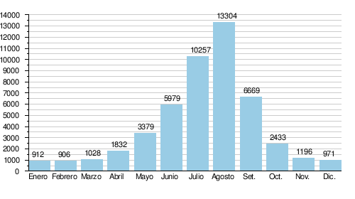
The monthly flows of the Indus at Sukkur
The flow of the Indus has been studied from 1937 to 1970 (34 years) at Sukkur, a Pakistani river port located about 200 km southwest (downstream) of the confluence with the Sutlej, its last major tributary. Sukkur area the river flow is at its maximum; in fact, further down, enough water is taken from the river for important irrigated extensions, so its flow gradually decreases. In addition, there are no longer any major tributaries to help feed its flow.
At Sukkur, the mean annual flow or modulus of the river observed during this period was 4,072 m³/s for a catchment area of about 90,000 km².
The sheet of water in this part of the basin, the largest by far from the point of view of flow (almost 100% of the total flow of the river) amounts to 143 millimeters per year.
Average monthly rate (in m3/s)
Hydrological Station: Sukkur(calculated for 34 years)
Contenido relacionado
Irati Jungle
Quetzaltenango
Cuellar Slabs