Iceland transport
Iceland's transportation includes the different communication systems that connect that island between Europe and America with the rest of the world, as well as the different communities within its national territory. As most of the population is concentrated in the southwest of the island, that area is home to a good part of the ports, airports and highways. Recently, the construction of tunnels has accelerated trade. Iceland does not have railway lines and its rivers are not navigable. Its main road is the Hringvegur, which surrounds the island.
Terrestrial
It has 12,691 km of roads, of which only 3,262 km are paved. The main road, Hringvegur, circles the island and links the main cities. Inland secondary roads connect to fjords and peninsulas.
There is no railway system, although there are three small railway lines. In 2008, 12 representatives of Alþingi, the local parliament, proposed to build a line between the capital Reykjavík and Keflavík airport and a light rail within the Capital Region.
There is an important system of tunnels, such as Hvalfjörður, the longest on the island, which connects the towns of Mosfellsbær and Akranes, in the Höfuðborgarsvæðið region.
Aerial
Iceland had 96 airports in 2013, but only 7 runways were paved. Of them, one measures more than 3,047 meters, three measure between 1,524 and 2,437 meters and another three measure between 914 and 1,523 meters.
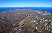
The most important airports are Keflavík, Reykjavik Airport and Akureyri.
Despite its geographic isolationism, low-fare airline Icelandair operates flights from Keflavík International Airport and Reykjavík Airport to North America and European cities such as London and Copenhagen. Other airlines are Air Atlanta Icelandic, Air Iceland, Bluebird Cargo, Eagle Air, Mýflug, Norlandair and WOW air.
Maritime
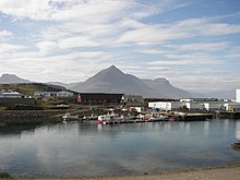
Its main port is the capital Reykjavik. Other port towns are Akureyri, Hornafjörður, Ísafjörður, Keflavík, Raufarhöfn, Seyðisfjörður, Straumsvík and Vestmannaeyjar.
Navigation along the island is reserved for the transport of goods. Increasingly, however, trucks are used. The island is connected to the rest of Europe through regular ferries.
Fluvial navigation is scarce since its rivers are not commercially navigable, among other reasons due to the marked changes in altitude in the terrain. Most of the water courses are born in the Highlands, several thousand meters high, and in a relatively short channel they go down to the ocean, which favors the formation of the famous waterfalls of the island. However, these represent a significant obstacle to terrestrial communications.
Contenido relacionado
Vietnamese geography
This
Geographic information system


