Honduran Geography
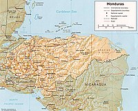
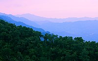
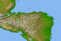
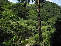
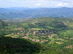
Honduras is a mountainous country, more so than the other Central American states, with an average of 1000 m s. no. m.. The Central American Cordillera divides the territory into three regions: The Eastern, Central and Western. Geomorphically, the Honduran territory is divided into three zones: Northern Coastal Plain, Southern Coastal Plain, and the Mountainous Region (composed of the northern, central, and southern mountain ranges).
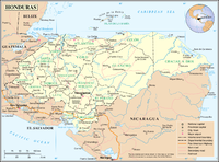
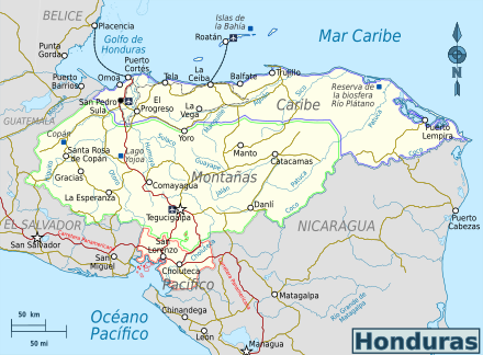
Honduras is limited to the north by the Atlantic, to the east by the same ocean and Nicaragua, to the south by Nicaragua, the Gulf of Fonseca and El Salvador, and to the west by Guatemala. The territorial extension of Honduras, including all its islands, is approximately 112,492 km².
The rivers of Honduras are grouped into two coastal slopes and the inland sub-slope of the Lempa River. The slope of the Caribbean and that of the Gulf of Fonseca. The Honduran rivers that flow into the Caribbean Sea are: Chamelecón, Ulúa, Aguán, Lean, Tinto or Negro, Patuca, Segovia among others. The Choluteca, Negro, Goascorán, and Nacaome rivers end up flowing into the Pacific Ocean. The sub-slope of the West or the Lempa River is fed by the Blanco, Gualcarque, and Torola rivers, among others, which join the Lempa River that crosses the border with El Salvador and finally flows into the Pacific. The rivers that flow into the Caribbean are the largest and mightiest in the country.
"The climate of Honduras is as varied as the configuration of its soil. The temperature is warm (Tropical Climate) on the Atlantic coast (AF) and a little less on the Pacific (As Climate); but in the interior, in its valleys and plateaus, there are delicious climates and cold temperatures with rain forest type microclimates. The N. and E. coasts of Honduras...a higher temperature than anywhere else...However, it decreases rapidly when penetrating inland."
Situation
The Republic of Honduras is located in the widest part of the Central American isthmus. It occupies the second place in territorial extension in Central America with a perimeter of 2,401 km and an extension of 112,492 km². This country is the most central of the Central American countries, extending between the republics of Guatemala, El Salvador and Nicaragua.
Honduras is geographically located between 15° 00' north latitude, 12° 59' north latitude, 83° 9' east longitude and 86° 30' west longitude. The longitude of Honduras is 676 km from the hill of Montecristo in the department of Ocotepeque to Cape Gracias a Dios; while the maximum width is 369 km from Punta Caxinas, in the department of Colón, to the old mouth of the Negro River, in the Gulf of Fonseca.
The border demarcation with El Salvador was established after the peace agreement signed in Lima, Peru in 1980 by both countries. Defined the limits after the agreements established by means of the ruling of the International Court of Justice in the Netherlands on September 11, 1992. Likewise, this same court ratified in 1960, the border demarcation with Nicaragua, which had been established in 1906 in the Award of Alfonso XIII, King of Spain.
On October 8, 2007, the International Court of Justice established the maritime border between the two countries at 15 degrees north latitude and 83 degrees west latitude, awarding Honduras sovereignty over the islands of Cayo Bobel, Cayo Port Royal, Cayo Savanna and South Key and Edinburgh Key remaining on the Nicaraguan side. While the limits with Guatemala were defined by the award of the Hughes court issued in Washington in 1933.
Limits
| Limits of Honduras | |||||||
|---|---|---|---|---|---|---|---|
| N.o | Country/litoral | km. | |||||
| 1 | 256 | ||||||
| 2 | 375 | ||||||
| 3 | 966 | ||||||
| 4 | Fonseca Golf Course | 133 | |||||
| 5 | Northern coastline | 671 | |||||
Honduras is bordered by three other Central American countries and two coastlines bathed by different seas. To the north, Honduran territory borders the Caribbean Sea, in the Atlantic Ocean, up to Cape Gracias a Dios, in a coastline of approximately 671 km. In the Atlantic, Honduras shares maritime boundaries with Belize, Cuba, Jamaica, Colombia, Grand Cayman, and Mexico.
To the west and northwest it is limited by Guatemala from the mouth of the Motagua River to the vertex of the angle formed by this line and the one that corresponds to the limits of Honduras with El Salvador, near the place known as Cerro de Montecristo, in a border extension of 256 km.
To the southwest, Honduras borders the Republic of El Salvador. With this republic, it has a land border 375 km long, near the Montecristo hill in the department of Ocotepeque, up to the mouth of the Goascorán river.
On the south side, Honduras borders the Gulf of Fonseca, in the Pacific Ocean, where it has an extension of 133 km of coastline, down to the lower part of the mouth of the Negro River. From this point to the confluence of the Guasaule river with the Negro river, the limit line follows an extension of the border with Nicaragua of 37 km.
From the aforementioned point of confluence, Honduran territory is limited, to the East and Southeast, by Nicaragua, up to the mouth of the Coco or Segovia River, in the Atlantic Ocean, in a border extension of approximately 829 km. In conclusion, the perimeter of the Honduran territory has been calculated at 2,401 km, as follows: north coast, 671 km; coastline of the Gulf of Fonseca, 133 km; border with Guatemala, 256 km; border with El Salvador, 375 km; and border with Nicaragua, 966 km.
Appearance and surface
"The territory of Honduras is very rugged, made up of high ranges of mountains, high plains, deep valleys in which there are extensive and fertile plains crossed by more or less mighty rivers and some navigable, all of which It contributes so that Honduras, in its soil and in its climate, is like a summary of all the plant and animal life of all the countries of the isthmus, of all climates, and consequently of all the productions, from those of the tropical zone to those of the temperate type zones."
Surface: Geomorphically, the Honduran territory is divided into three zones: Northern Coastal Plain, Southern Coastal Plain, and Mountainous Region. Although, due to its geomorphology, it is located in three Physiographic Regions: the Caribbean Coastal Region, the Central or Internal Tana Region and the La Raza Coastal Plain Region or Golfito de Fonseca.
The Northern Coastal Plain is approximately 670 km long and extends from the Guatemalan border to La Mosquitia, on the Nicaraguan border. This strip of land accounts for 16% of the Honduran territory and is the most productive agricultural area in the country. On the other hand, the Pacific Plains occupy only 2% of the Honduran territory.
"As indicated, the soil of the Republic of Honduras presents large accidents on its surface. From the common base of the mountain range...which extends from the South to the North, passing through the Center, lines of mountains depart in various directions that cross the entire territory in different directions."
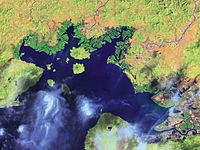
"The great chain of these mountains, seen from the Pacific, from which it is not more than 90 or 100 km, has the appearance of a natural wall, with a lower line of mountains, alternated with peaks of volcanoes of extraordinary regularity. In the far south they disappear to manifest themselves in the Fonseca bay in the form of islands of volcanic origin with high peaks and mountains."
"To the north there are several groups of mountains that cut the coast longitudinally, not allowing any interruption to be perceived from the sea that indicates the course of the rivers through the continuous chain of mountains that borders the coast, and which leads to it."
Orography
The mountainous region of Honduran territory that "includes the highlands of the interior, covers an area" of approximately 82%. This mountainous region is part of the great Central American Cordillera, which crosses the Honduran territory in a general direction from Northwest to Southeast. Its route is very irregular, interrupted by a wide valley.
The line of the Central American Cordillera, upon entering Honduras through the Guatemalan border, continues to the southeast while a spur of it takes a northeasterly direction to the Bay of Honduras. At the point of separation (to the southeast) it is called El Gallinero, Montaña del Merendón and La Grita.
"Due to its orography", the Honduran region of the Central American mountain range is made up of three mountain ranges: the North, the Central and the South."
Northern Sierra
The Sierra del Norte includes the Sierras del Espíritu Santo, Omoa and Nombre de Dios. This mountain range is interrupted by the great Sula Valley, which separates the Sierra de Omoa from the Sierra Nombre de Dios.
The Sierra del Norte in the direction of the Gulf of Honduras, between the departments of Copán and Santa Bárbara on the border with Guatemala, is called the Sierra del Espíritu Santo. Its main mountains are La Grita, Elencia, Las Dantas, La Casimira and Los Monos. Its highest point is Cerro Azul in Copán, at about 2,285 meters above sea level.
Already on the north coast of Honduras between the departments of Santa Bárbara and Cortés, this mountain range is called Sierra de Omoa with an elevation of 2,000 to 2,400 meters (about 8,000 feet). At the foot of this mountain, on the north side, runs the Motagua river, and on the south the Chamalecón, which runs separated from Santiago, parallel to it, by a line of hills that ends in the great valley of Sula, near the mouth of the Ulua river. The main mountains of this sierra are San Ildefonso and Omoa.
The Sierra Nombre de Dios, is located between the Departments of Yoro and Atlántida following its mountainous foothills to the Department of Colón where the mountains or peaks of Calentura (1235 masl) and Capiro with an altitude of 667 masl." "To the Sierra Nombre de Dios belong the mountains of Nombre de Dios, La Masica, Mico Blanco, El Tiburón and Cangrejal with the highest peak of the sierra: Pico Bonito with 2435 m s. no. m.. To the south of the city of La Ceiba, is the Salitrán Mountain that goes into the Atlantic coast.
Central Cordillera
The central region of Honduras is a predominantly mountainous area. "Its topography is dominated by medium-sized mountains, on average 1400 m. above sea level which creates a pleasant climate most of the year." In this area is the Central Cordillera in which the following mountain ranges are found: El Gallinero, Atima, Montecillos, Comayagua, Mico Quemado, Sulaco, Misoco, Agalta, Punta Piedra and La Esperanza.
"The Sierra del Gallinero extends from the Department of Copán, from the headwaters of the Gila River, between the municipalities of La Unión and Cabañas, crosses the Department of Copán and Santa Bárbara to the municipality of Concepción del Norte. Here sits the plateau of Santa Rosa where the city of Santa Rosa de Copán is located."
"The Sierra de Atima is located with a SW-NE orientation starting at Montaña Joconal to the north of the Municipality of Lepaera, Lempira, it crosses the entire Department of Santa Bárbara until it ends near Villanueva, Cortés.&# 3. 4; The Sierra de Montecillos extends from the department of Cortés, passes through Comayagua" until reaching the department of La Paz. "In the Sierra Montecillos are the mountains of Meámbar, Maroncho, and La Nieve. In these sierras, the maximum altitude reaches 2,744 m s. no. m. precisely in Pico Maroncho.""At the eastern base of the line of the Sierra de Montecillos, where the interruption of the mountain ranges is complete, is the plain of Comayagua."
Sierra de Comayagua: It is located in Comayagua and is separated to the north by the valley of Sulaco and to the south by Amarateca that separates from the mountain of Hierbabuena in Francisco Morazán to the south of the town of Talanga. In its extension on the north side are located the towns of Minas de Oro, Esquías and San Luis (Comayagua).
«Sierra de Mico Quemado is located to the west of the Department of Yoro, they are the mountains located to the eastern front of the city of El Progreso. It is delimited by the Ulúa or Sula River Valley to the west, by the Humuya River to the south, by the Olomán Valley drained by the Cuyamapa River to the east and by the Guaymas River, a tributary of the Toloa Lagoon, to the north.»
The Sierra de Sulaco is located to the east of the high mountains of Comayagua, past the river and valley of Sulaco, one reaches this group of high mountains, located almost in the center of Honduras and in the which originate from very important rivers, which run towards the Atlantic, such as the Aguán or Romano; and others of minor importance that go to the South. It is a short mountain range of about 60 km from East to West.""Among its main mountains is Pico Píjol whose peak is 2282 meters above sea level, forming part of the highest peaks in the country.&# 3. 4;
"Sierra de Misoco y Almendarez serves in part as the border line between the Departments of Francisco Morazán and Olancho, extending from NW to SE, a branch of the mountain range is located in the northern part of the Department of Francisco Morazán, Forming the group of the Mountains of La Flor, it is limited to the North by the Guayape River Valley and to the South by the Jalán River Valley. The mountains of El Chile belong to this Sierra, to the south of the Jalán River, communicating to the East with the mountains of Villa Santa and Azacualpa. Among the main mountains that make up this mountain range are Montaña La Flor, Misoco, Almendáres, Neblinas, La Lona, Jaboncillal, Maracunda, Carrizo, El Derrumbe and Conventos."
The "Sierra de Agalta stretches from southwest to northeast between the departments of Olancho and Colón. In this mountain range are the Boquerón Mountains, separated by the Telica River Valley and the San Pablo Mountains, between the Sico and Paulaya Rivers, also called the Tinto River.
In its southwestern part there are two foothills, one coming from the Macupina Mountain between the municipalities of La Unión and Esquipulas del Norte and the other from the Boquerón and La Cecilia Mountains on the side of the municipalities of Guayape and Salamá. In the Montaña Los Blancos is the La Muralla National Park. Forming the trunk of the Sierra de Agalta are the mountains of Fray Pedro, Aguacate, Zapotillo."
Sierra Punta Piedra: It is located between the Departments of Gracias a Dios and Colón, oriented from East to West. The main mountain of Punta Piedra was arched by an intrusive batholith that outcrops in a steep gorge of the Wampú River. The mountains of the Río Plátano are part of this mountain range.
Sierra de La Esperanza: It runs from SW to NE and serves in part as the dividing line between the Departments of Olancho-Yoro and between Olancho-Colón. Its foothills towards the NE are oriented towards Cabo Camarón, on the North coast. The mountains of Cerro Azul de Botaderos with 1433 m above sea level belong to this mountain range. no. m. and La Esperanza with 1075 m s. no. m.. Other mountains are Aguacatal, Jaguaca south of Sabá and Piedra Blanca and Paya south of Limón in Colón. The Sierra de la Esperanza continues parallel to the hydrographic basins of the Sico and Aguán Rivers, serving as a watershed for both basins. It ends near the coast at Cerro Sangrelaya with 1800 m a.s.l. no. m. south of Iriona.
Southern Mountain System
| Cordillera del Sur | |||
 | |||
| Sierra | Maximum height (mounts) | msnm | |
|---|---|---|---|
| Celaque | Pico Celaque | 2849 | |
| Merendon | Cerro El Pital | 2730 | |
| Puca or Opalaca | Ojuera Mountain | 2347 | |
| Lepaterique | Yerbabuena | 2243 | |
| Dipilto | Cerro Mogotón | 2107 | |
The Southern Cordillera crosses Honduras from the departments of Ocotepeque to Gracias a Dios. These mountain ranges are oriented from northeast to southwest, while in the western part the mountains have a north-northwest-south-southeast direction. The highest peaks in the country are found in this region. The mountains of Celaque, Dipilto, Lepaterique, Puca or Opalaca, the Merendón and the Sierra mountains are part of the Southern Cordillera.
The Sierra de Celaque is located between the departments of Ocotepeque, Copán and Lempira. It begins at the tops of Belén Gualcho (Ocotepeque), and follows a north orientation to San Pedro de Copán, where it turns to the southeast, continuing through the department of Lempira. In front of the city of Gracias is Pico Celaque on the homonymous mountain, considered "the roof of Honduras", due to its 2849 m.
The mountain of Azacualpa, located to the west of Erandique, is part of this mountain range; To the south of this mountain is the Pico Congolón, with 2134 m s. no. m.; in the southeastern part is the Coyocutena mountain. Also, the mountains of the sierra are part of this sierra are Montaña Peleo and Montaña Lempira, to the north of Santa Cruz, in Lempira.
The Dipilto mountain range is one of the longest in Honduras (400 km). It extends from the west of the department of Choluteca and crosses that of El Paraíso, where it marks the border with Nicaragua. Then it continues its course through the departments of Olancho and Gracias a Dios.
The Sierra de Lepaterique rises to the south of the Comayagua valley under the name of Yerba Buena, serving as a watershed along its entire trajectory for the Humuya, Nacaome, Goascorán and Choluteca rivers. It is divided into three branches: one heads south, another takes a southeast direction and the third heads north, until it is limited by the Choluteca valley in the municipality of San Juan de Flores. mountains of Pocoterique, Canta Gallo, Cebollal, Lepaterique, Upare and La Tigra, among others.
To the east of Celaque, the Puca or Opalaca mountain range begins its development, with crests that rise above 1600 meters high. The mountains of Portillo, Jacán, Joconal San Rafael, El Sirín, Aguailaca, Ojuera, Monte Verde, Chupuca and Pacaya, among others, belong to this mountain range. The Sierra de Puca serves as the border line between the departments of Lempira and Santa Bárbara. In the southeastern part, this mountain range is called Sierra de Opalaca. At its highest point (the Ojuera mountain) this mountain range reaches 2,347 meters above sea level. no. m..
From the northwest to the southeast and between the departments of Copán, Ocotepeque and Lempira, the Sierra del Merendón extends. The mountains of El Portillo and Cayaguanca belong to it, to the southeast of the city of Ocotepeque, with an elevation of 2305 m a.s.l. no. m.. Also the mountains of Santa Bárbara and La Canguacota, with 2409 m s. no. m.. The peak of this mountain range is Cerro el Pital, with the 2730 meters it reaches above sea level.
The Sierra mountains are located in the department of La Paz and in the extreme south of Intibucá. The mountain of Naguaterique is part of the sierra, with 2225 m s. no. m., located south of Santa Elena, and extends to the municipality of Colomoncagua, in Intibucá. Towards the center of the department of La Paz, are the mountains of Sabanetas, Sierra, Pacayal and Upa.
Hydrography
The Honduran hydrographic system is made up of nineteen river systems that originate in the national territory and flow into both oceans, the Pacific and the Atlantic. Thirteen of them flow into the Caribbean Sea, with lengths between 550 and 25 km. whose basins occupy 82.72% of the national territory; On the Pacific slope, through the Gulf of Fonseca, six systems flow, covering 17.28% of the country.
The watershed between both river slopes is formed by the Cordillera del Sur, made up of the Merendón, Celaque, Puca or Opalaca mountain ranges, the Yerbabuena mountain and the La Sierra mountain, among others.
The Honduran territory has some considerable lagoons on its northern coast, which are more like lagoons; In the center and south of the country there are very small lagoons, most of which dry up in the summer season.
Lakes
The Honduran territory only has one natural lake, however, there are considerable size lagoons on the north coast of the country. In the center and south of the territory there are small seasonal lagoons, that is, most of them dry up in summer.
Lake Yojoa is the only natural lake that Honduras has and is located between the departments of Cortés, Comayagua and Santa Bárbara, at an altitude of 650 m a.s.l. no. m.. It has a perimeter of 50 km, an area of approximately 90 km² and is located in an area of high rainfall, with an annual average of 3000 mm. The name of the lake originated from the Mayan words "Yoco-Ha", which means "water accumulated on the earth".
Feeds from underground streams from Santa Barbara Mountain and Azul Meambar; It has three drainages, one visible to the south by the Jaitique River and two underground ones, the Zacapa River and the Lindo River to the north, which appear from the Peña Blanca mountain. All its drains flow into the Ulúa River.
There are several artificial lakes in the country as a result of the construction of hydroelectric dams, among which stands out the Humuya river reservoir created after the completion of the Francisco Morazán hydroelectric dam in the place known as El Cajón, named after the which is also popularly called. At a distance of 17 km, are the Pulhapanzak Falls, a 43-meter-high waterfall on the Lindo River.
Gaps
| Some lagoons of Honduran territory | |||
| Name | Departmental location | ||
|---|---|---|---|
| Caratasca | Thank God | ||
| Laguna de Brus | Thank God | ||
| Ébano and Criba | Thank God | ||
| Guaymoreto | Columbus | ||
| The Micos | Atlantis | ||
| Alvarado | Cortes | ||
| Tinta | Atlantis | ||
| Ticamaya | Cortes | ||
| Jucutuma | Cortes | ||
| Toloa | Atlantis | ||
The lagoon of Caratasca is of considerable extension, varying in width. It is formed by a system of lagoons divided by natural channels. To the south and east of the lagoon are the lagoons of Warunta, Tansin and Tilbalaca, all of which are freshwater because they are fed by the Warunta, Mocorón or Ibantara rivers, and the Cauquira and Cohunta lagoons. To the west is the Tara lagoon, which flows into the sea through Tabacunta.
The great lagoon of Caratasca is located at the center of the lagoon complex, it has brackish waters and is separated from the sea by a narrow strip. It measures seventy-six kilometers long by fourteen kilometers wide. The Caratasca lagoon complex has two entrances to the sea: one to the west through Tabacunta and the other through the Caratasca bar, one kilometer wide and four meters deep.
The Brus Lagoon is located to the west of the Caratasca Lagoon, from which it is separated by the Patuca River. It is twenty-eight kilometers long and seven kilometers wide and is separated from the sea by the bar of the same name. To the south of the bar, there are two small islands. The Sigre rivers flow into the lagoon and, to the east, a branch of the Patuca river known as Tum Tum Crick.
The Ébano lagoon communicates with the small Criba lagoon to the west. These lagoons are connected to the sea by an entrance channel that measures five hundred meters and has a depth of one meter and forty centimeters in the dry season. In front of the Lagoon bar is the Macedonia key or islet. The length of the Ébano lagoon is twelve kilometers. The waters of the Tinto River reach the Criba Lagoon and are also fed by streams that come down from the Baltimore Mountain. In the Ébano lagoon there are six small islands.
Smaller lagoons
Laguna de Guaymoreto is located northeast of the city of Trujillo and communicates with the bay through a natural channel through which small boats can enter. Its greatest length is 9 km. Its name is derived from the word Guaymuras, the name by which the indigenous people knew Honduras during pre-Columbian times; It was declared a National Wildlife Refuge according to Executive Agreement No. 1118-92 since it reached number 30 on the list of wonders of Honduras.
The Laguna de Alvarado "is located in the northwest of Honduras in the department of Cortés, belonging to the municipality of Puerto Cortés. It is located at the coordinates 15°50'35'' north latitude; and 87°54'48'' west longitude. It has a permanent access channel with the Caribbean Sea, which is 894 meters long." "La Laguna de Alvarado has a mirror of water of 8.4 km²; and with an average depth of 4.5 meters and a maximum of 6 meters."
Laguna Quemada or Laguna de Los Micos has a water mirror of 41.71 km² with a basin area of 389.37 km² and 45.54 km² of fluctuating land. The average depth is 3.8 m and has a maximum depth of 16 m, the average temperature is 28°C. It is located to the west of the city of Tela in the department of Atlántida at the mouth of the San Alejo River. Its autochthonous name is Lagunu babunu, which in the Garífuna language means lagoon of the monkeys.
Other minor lagoons are: Laguna Tinta located between Punta Sal and Río Tinto, Laguna de Ticamaya located northeast of the city of San Pedro Sula, Laguna de Jucutuma, which is located near the city of La Lima, Cortés and the Toloa Lagoon located at the western end of the Department of Atlántida between the Los Micos Lagoon and the Ulúa River. It is 5 km long by 3 km wide and communicates by means of a canal with the Ulúa River.
Rivers of the Caribbean slope
Most of the Honduran rivers flow into the Caribbean Sea, they are the largest and mightiest in the country. These rivers "present stretches of youth, maturity and old age in their cycle of erosion." The most important rivers on the Caribbean slope are: El Chamelecón, Ulúa, Aguán, Lean, Tinto or Negro, Patuca, and Segovia.
The Coco, Wanks or Segovia is the last of the rivers on the north coast of Honduras and the second longest river in Central America (550 km) behind the Usumacinta of Guatemala and Mexico. This river is part of the dividing line between Honduras and Nicaragua; it is born in the mountain of La Botija in Choluteca; among its tributaries are the Poteca, the Rus Rus and the Bocay. When the Segovia flows into the Ocean, it does so through two main branches: the largest goes to Cape Gracias a Dios itself, where Honduran territory ends.
"The Chamalecón is a fairly long river (200 km); but it covers a comparatively narrow section of the country and owes to this its not being abundant. Its current is fast and full of bass. It rises on the eastern slope of the Gallinero mountain, in the Merendón mountain range, a few leagues northwest of Santa Rosa de Copán; it waters the departments of Copán, Santa Bárbara and Cortés and runs at the foot of the Omoa mountain, to the south, separated by a line of hills from the Santiago River, which continues parallel to it, ending in the valley of Sula and flowing into the Chamalecón east of the Alvarado lagoon."
"The Ulúa, is the widest river in Honduras and therefore the one that discharges the greatest flow of water into the Ocean, to the east of the Chamalecón, except perhaps the Segovia, after having traveled a great extension of territory, which comprises almost a third of it. It is formed by the meeting of the Blanco, Humuya," Otoro, Sulaco.
"El Tinto or Negro, born in the mountain of Fray Pedro in the Sierra de Agalta in its course is known as Sico. Close to the coast, it is divided into three arms: One ends at the Criba lagoon... and the other two arms go directly to the sea. Its total length is about 215 km. The bar of this river is bad and variable, and its draft varies, according to the seasons."
The Lean River rises northwest of the city of Yoro, in the mountains of Nombre de Dios; It has a length of 60 km. It covers an agricultural area of 883 km², and covers a basin of 1885 km². At its mouth it forms the Colorado bar in the department of Atlántida.
The Aguán or Romano, a mighty and widespread river that rises in the mountains of Sulaco, near Yorito, in the department of Yoro, and after traveling a total length of about 222 km, empties into the sea to the east of Trujillo and Punta Castilla. "At its mouth it divides into a multitude of arms, forming a wide delta; its valley is one of the largest and most fertile in the country."
The Motagua is born in the territory of Guatemala; it has a length of 486 km. Therefore, it is considered the longest river in Guatemala. It covers a basin of 2539 km². At the end of its journey it serves as a boundary between the republics of Guatemala and Honduras. After having run through the northern base of the Omoa mountain, it empties into the Gulf of Honduras.
The Patuca, which flows in the extreme northeast of Honduras, has its source at the junction of the Guayambre, Jalán, Guayape and Telica rivers, swelling it with many other tributaries, some of them important. After going through the departments of Olancho and Gracias a Dios, it flows into two branches, one going to the Brus lagoon and the other to the Caribbean Sea. This river has a maximum length of 500 km and covers a basin of 24,695 km².
Pacific Slope
The Goascorán river rises in the Comayagua valley and can be said to have its origin in the same places as the Humuya. While the Humuya runs north, the Goascorán heads directly south. "Which is why these two rivers that flow in the opposite direction completely cut the mountain range from sea to sea, opening a transversal valley." The Goascorán ends in the Gulf of Fonseca, running through a valley whose lower part and close to the coast is extremely fertile. The towns of San Antonio del Norte, Caridad, Saco. Aramecina and Goascorán lie on its banks, it is not navigable, it is 115 km long.
The Choluteca or Grande river is born in the mountains of Lepaterique and continues in an east and northeast direction until it passes through Tegucigalpa where the Guacerique and the Chimbo or Chiquito meet; from here it continues heading north, describing a semicircle to the east and south, it runs through the departments of Paraíso and Choluteca and ends at the Gulf of Fonseca, first passing through the head of the last of the named departments and through the town of Marcovia. It is 250 km long and covers a basin of 7,570 km².
The Negro River, which rises on the Caguasca hill, on the Nicaraguan border. It forms the boundary line between this Republic and that of Honduras, from its junction with the Guasaule River to its mouth in the Gulf of Fonseca. It is 85 km long, covers a basin of 1,690 km² and an agricultural area of 231 km².
The Nacaome; It is also born on the Lepaterique mountain, and flows into the Chismuyo bay in the Gulf of Fonseca. Its main tributaries are: Loma, Moramulca and Guacirope. It is 90 km long and its basin has a surface area of 2642 km². Other minor rivers are also part of the Honduran Pacific slope, such as: El Sumpul, Torola, Guarajambala and Agua Caliente.
The Lempa River has its sources in Honduran territory. Among its main tributaries are the Torola, Guarajambala, Mocal and Sumpul. "The trinational basin of the Lempa River has a total area of 17,790 km², of which 10,082 km² correspond to El Salvador, 5,251 km² to Honduras and 2,457 km² to Guatemala. The length of the main channel is 422 km, of which 360.2 km run within Salvadoran territory."
Islands
Islands of the Atlantic
Honduras has important islands in the oceans that bathe its coasts. In the Atlantic, it is found between 85° 48' and 87° 3' west longitude and 16° 7' and 16° 34' north latitude, the group of islands that make up the Honduran department of Islas de Bahía. This department is made up of the islands of Roatán, Guanaja, Utila, Barbereta, Elena, Morat and numerous islets and keys dependent on them.
In the past, these islands, even though geographically they have always formed part of Honduran territory, depended on the British Government. On July 11, 1852, the superintendent of Belize declared these islands a British colony, on behalf of the United Kingdom, with the name of Colony of the Bay Islands. However, the islands were returned to Honduras on April 21, 1861, after Great Britain and Honduras signed the Lennox Wike-Cruz Treaty. In this document it was stipulated that the British sovereign agreed to recognize the Bay Islands, Roatán, Guanaja, Helena, Utila, Barbereta and Morat, known as the Bay Islands, and located in the Bay of Honduras, as part of the Republic of Honduras.
These islands are a fundamental part of Honduran tourism. They receive about a third of the tourists that visit Honduras. In addition to the more than fifty thousand annual visitors attracted by diving and sport fishing, cruise ships today contribute some sixty thousand excursionists who disembark on the islands.
Roatán is the largest island in the Bay Islands archipelago; It is the most visited and developed of the archipelago. This island is located approximately forty miles from the Honduran coast, with a territorial extension of 155.9 km² and an estimated population of more than twenty thousand inhabitants, settled on an impressive coral reef that It is considered the second largest in the world, which is why it offers excellent conditions for diving and fishing. The island has a mountain range that runs along its entire length.
The island of Guanaja is the first Central American land reached by Christopher Columbus on his fourth and last voyage. He took possession of it in the name of the Crown of Spain, giving it the name of Isla de Pinos, because it is covered with these trees, and immediately discovered the other islands. Guanaja is the easternmost island of the insular group and is about nine miles long by five wide. It is quite elevated and as fertile and in good condition as that of Roatán, from which it is distant about fifteen miles.
The island of Utila is the westernmost of the group. It is located just thirty kilometers from the north coast of Honduras. It is 49.3 km² in area, 11 km long and 4 km at its widest point. The eastern end of the island is covered by a thin layer of basaltic volcanic rocks; it arose from several pyroclastic cones, including Pumpkin Hill at 74 m (243 ft), which forms the highest point on the island. At present this island enjoys a growing tourism mainly due to recreational diving.
The islands Elena, Morat and Barbareta, of which this is the largest and Elena the smallest, are very small; small islands to the south and east of Roatán, from which they are separated by narrow and deep channels, also being their madreporic origin. They are actually linked to the island of Roatan by coral reefs.
In the Atlantic, the islands of Cisne and the Cayos Cochinos also belong to Honduras. The first are two small islands, generally known by the English name of the Swan Islands. They are located in the northwestern part of the Caribbean Sea, about 250 km from the Honduran mainland, at 17º4' north latitude and 83º93' west longitude, at an altitude of three meters above sea level.
The archipelago is made up of three islands: Cisne Grande with 5.5 km²; Small Swan, with 2.5 km²; and El Cayo Pájaro Bobo (Booby Cay), with less than 0.01 km². On the other hand, the Cayos Cochinos are a group of islands that is formed by two small islands (15°58′18.99″N 86°28′31.34″W), Cayo Menor and Cayo Grande, and thirteen smaller keys of coral origin located thirty kilometers northeast of La Ceiba, on the north coast of Honduras.
Pacific Islands
"The islands of the Pacific are located in the archipelago of the Gulf of Fonseca, most of these islands are of volcanic origin and their formation dates from the Tertiary, that is, from the moment the aforementioned depression occurred gulf."
Tigre Island has an area of 23.7 km². It is located in the very center of the Gulf of Fonseca and to the south of the island of Zacate Grande. This island forms a perfect cone, which accuses its volcanic origin, being, although off, one of many of the series that exist in the Fonseca Bay; It rises to 783 meters above sea level, and has two mounds on either side, on its northern side, that give the island a truly remarkable symmetrical appearance. Despite the height indicated, the slope of the hill is gentle at some points and allows crops to be grown on it. On this island is "the quiet fishing village of Amapala", to the south and west the lava forms rock barriers to the waves, up to more than 5 meters high. To the North and East there are flat beaches, although they are not very extensive.
The island of Zacate Grande, is located to the Northeast of the island of Tigre and so close to it by its southern extremity that it is only separated from it by a narrow channel, it is the largest of the islands (54.3 km²). It is 9.5 km wide by 8 and a half wide. A series of peaks runs along its entire length, reaching approximately 656 meters from the south. To the north these elevations descend to the level of the extremely fertile lowlands.
The island gets its name from a grass that covers its mountains and which Hondurans call zacate and which is excellent pasture for cattle. In the rainy season there are several streams in the northern part of the island and even later. During the dry season running water is scarce; but it can be obtained easily and of good quality, digging into the lava layers, under which abundant flows flow. Zacate Grande is connected to the mainland by a highway.
Güegüensi, with about 7.5 km², is located to the East of the island of Zacate Grande, from which it is also only separated by a narrow channel. It has a single eminence of perfect regularity and the rest of its surface is flat, fertile and suitable for cultivation with little effort. It is mostly covered by mangrove-type vegetation. From northwest to southeast it measures 6 km, and from north to south 2.5 km.
Isla Exposición is in front of the town of Amapala and in the center of its bay. It has a wide beach to the north and the rest of the island is made up of a high hill that almost dies in the sea. The lack of water in it is almost complete, outside the rainy season and even in this it is little abundant. This island is 3 km long and 1.5 km wide, in total it has an extension of 2.5 km² and an elevation that reaches 170 meters above sea level. On the other hand, the island of Garrobo is located northwest of the island of Exposition. It has an area of 0.8 km²; It measures 1 km from north to south and 1.8 from east to west. Its highest elevation is 173 meters above sea level.
"The other Honduran islands in the Gulf of Fonseca are rather small islets, some of them very beautiful, such as the Isla de los Pájaros, so called because of the large number of them that nest there and exist continuously; but they are not important under any aspect that is considered, being in them the lack of water, in general, what is most opposed to its population.". Other islets include: Alamejas, Vaca, Tigritos, Caracolitos, Santa Elena, Conejo, Coyote, Violin, Ingleserra, Sirena, Garrobitos among others. "
Climate
Honduras is located in a tropical position 15 to 16 degrees north of the equator, it only has two seasons, which are well defined: the dry season and the rainy season. The rainy season begins in May extending to July with a pause during the month of August, this generally resumes in September until November when the dry season begins. This season extends until the month of April or May.
- The average high temperatures across the country is 32 °C (90 °F), and the average low temperatures is 20 °C (68 °F).
- The average annual temperatures in the interior of Honduras is 21 °C (70 °F).
- The average annual precipitation is 1000 mm (40 inches) in the mountains, and in the valleys of the north coast is 2500 mm (100 inches)
- The lowest areas in the coastal region have an annual average of 27 °C (80 °F) with high humidity levels.
In the coastal zone of the Atlantic, a rainy tropical climate generally occurs, with an average temperature of 27 °C, an average maximum of 30 °C and an average minimum of 20.7 °C. The rainy season begins in the month of June and generally lasts until the month of December. The annual rainfall average is 2643 mm. The northern zone that includes the departments of Cortés and Yoro receives an annual average rainfall of 1200 mm during almost 5 months of the year. The average humidity is 75%. The average annual temperature in this area is 26 °C with a maximum of 30 °C and a minimum of 21 °C.
The southern zone of Honduras has a tropical savannah climate. In this zone, a dry climate generally occurs for six months or more. During the rainy season, the southern zone accumulates an average of 1680 mm. The average temperature is 29.1 °C maximum of 35 °C minimum of 23.4 °C. The central zone that corresponds to the departments of Francisco Morazán, Comayagua and La Paz, has an average temperature of 22.4 °C, a maximum of 27.2 °C and a minimum of 17.4 °C. The average rainfall is approximately 1,000 mm during more than three months of the year.
| Climate of Tegucigalpa | |||||||||||||
|---|---|---|---|---|---|---|---|---|---|---|---|---|---|
| Month | Ene | Feb | Mar | Abr | May | Jun | Jul | Ago | Sep | Oct | Nov | Dic | Year |
| Average maximum temperature (°C) | 23.8 | 25.2 | 26.6 | 27.5 | 27.1 | 25.3 | 24.5 | 25.0 | 24.4 | 24.1 | 23.4 | 23.4 | 25.0 |
| Average minimum temperature (°C) | 11.5 | 12.9 | 14.0 | 15.4 | 16.2 | 16.2 | 15.8 | 15.8 | 15.8 | 15.4 | 14.0 | 13.1 | 14.6 |
| Precipitation (mm) | 3.2 | 4.9 | 6.9 | 25.9 | 117.2 | 249.5 | 180.6 | 181.6 | 235.2 | 131.0 | 42.6 | 7.6 | 98.8 |
Contenido relacionado
Peñahorcada Cherry
Delhi
Kazakhstan flag
