
Guipuzcoa
Guipúzcoa (officially and in Basque, Gipuzkoa) is a Spanish historical territory and one of the three provinces that make up the autonomous community of the Basque Country. Its capital and most populated city is San Sebastián. It is located at the eastern end of the Cantabrian Sea and borders the French department of the Atlantic Pyrenees to the northeast, Navarre to the south and southeast, Biscay to the west, Álava to the southwest, and the Bay of Biscay to the north.
Guipúzcoa is organized into 88 municipalities incorporated into seven regions. With an area of 1997 km², it is the smallest province in Spain. It is the twenty-first most populous province (720,592 inhabitants) and the fourth in population density (354.18 inhab/km²). More than half of the population lives in the San Sebastián metropolitan area.
The province is characterized by a low thermal amplitude and presents features typical of an oceanic climate with abundant rainfall. It is the Basque territory where Basque is most widely spoken, with 56% of Basque speakers in 2016.
Denominations
Gipuzkoa
It is the only official denomination approved for the historical territory by its General Assemblies. It is the denomination in Basque recommended by the Royal Academy of the Basque Language (Euskaltzaindia) and habitually used in official documents of Basque administrations. It is also used in some documents in Spanish. It is the denomination used in the Basque version of the Spanish Constitution in the repealing provision and in the Basque version of the Statute of Autonomy for the Basque Country.
The bill no. 122/000039 presented on July 2, 2004 by the Basque Parliamentary Group (Basque Nationalist Party) in the Congress of Deputies of the VIII legislature, which sought to establish Gipuzkoa as the sole official name, was withdrawn by that same party on May 9, 2006. In 2011, the budget agreement reached by the PSOE and the PNV in the Congress of Deputies included the current name change, through which the only official name of the territory Gipuzkoan is Gipuzkoa.
Guipuzcoa
Guipúzcoa is the spelling recommended by the Royal Spanish Academy, commonly used in documents written in Spanish. From 1833 to 2011 it was the official name of the province. In 2011, through the Official State Gazette, the only official name designated by the General Meetings of Guipúzcoa became effective, for which reason the only official name of the territory for all purposes is Gipuzkoa. It is the denomination used in the Spanish version of the Spanish Constitution in the repealing provision and in the Spanish version of the Statute of Autonomy for the Basque Country.
History
García Aznárez, first lord of Guipúzcoa (1025-1076)
The oldest mentions of the place name Guipúzcoa date from the XI century. The oldest known written document that mentions this place name dates from the year 1025. It is the donation document of the Monastery of San Salvador de Olazábal (monasterium quo dicitur ollazabal), together with its estates and terms, to the Monastery of San Juan de la Peña in the current province of Huesca. The donors are the senior Garsia Acenariz de Ipuscua and his wife Gayla or Gaila . It is believed that Guipúzcoa was at that time a feudal possession of the kingdom of Pamplona, headed by the aforementioned lord Garsia Acenariz or García Aznárez. The kingdom of Pamplona reached its maximum historical territorial extension at that time, covering from the County of Ribagorza in Alto Aragón to the Pisuerga river on the border between León and Castilla.
This donation document describes the limits of the municipality of the aforementioned Olazábal monastery, on whose site the current church of Altzo-azpi in the municipality of Alzo was built centuries later. The lands belonging to the Olazábal monastery covered a long and narrow strip of land that ran from the vicinity of the Gipuzkoan coast (the neighborhood of Elcano de Aya) to the Sierra de Aralar. It is assumed that this territory, centered on the Oria river valley, constituted the heart of the Ipuscua of the XI century governed by García Aznárez.
In addition to this first document, three other diplomas found in San Juan de la Peña mention García Azenáriz and his wife Doña Gaila, as well as other members of their family: his daughter Doña Belasquita and his son-in-law Sancho Fortuniones. A document from 1048 mentions Doña Gaila de Ippucha donating the Monastery of Santiago de Luquedeng (location unknown) to that of San Juan de la Peña. At that time, García Sánchez, the King of Nájera, was king of Pamplona.
In the second half of the XI century, a second lord of Guipúzcoa appears, Orbita Azenáriz, whose first written mention dates from a document from 1066, during the reign of Sancho Garcés IV of Pamplona.
First conquests of the kingdom of Castile (1076-1116)
In 1076 the kingdom of Pamplona suffered a convulsion with the murder of Sancho Garcés IV, the victim of an intrigue at the hands of his brothers. The nobles of Pamplona preferred to hand over the kingdom to one of their powerful neighbours, Aragon or Castilla y León, rather than allow the fratricidal infants to seize the kingdom or for the legitimate heir, Sancho of Pamplona, who was still a child of short age. The monarchs of León and Aragón also belonged to the Pamplona royal family, since they were grandsons of the great King Sancho el Mayor and therefore had a certain legitimacy to accede to the throne. Both candidates, with local support, tried to establish their candidacy by occupying part of the Pamplona territory militarily. Finally the two candidates reached an agreement and divided the kingdom into two parts. King Alfonso VI of León took control of the western half of the kingdom, which included a good part of La Rioja, Bureba and almost all of the current Basque Country, and went on to hold among his titles that of King of Nájera, while Sancho Ramírez de Aragón obtained recognition as King of Pamplona and the rest of the kingdom remained.

In the division of the kingdom in 1076, the easternmost part of the current province of Guipúzcoa, the region located between San Sebastián and the Bidasoa river, continued to be linked to the kingdom of Pamplona. This fact seems to be confirmed because King Pedro I of Aragon confirmed a few years later, in 1101, the old donation to the Leire monastery of the church of San Sebastián, which would prove his jurisdiction over this part of the territory at that time. Historically, this part of the province has always been most closely linked to Navarra, a territory for which it has been the natural outlet to the sea through the Bidasoa River and with which it shares the same Basque dialect and a common Basque ethnic past. It is possible to think that the Guipúzcoa of the XI century, the one that the Azenáriz had ruled as lords, did not yet include this part of the province.
On the other hand, most of the territory of present-day Guipúzcoa became part of the Castilian-Leonese political orbit for the first time in its history and became a border territory between Castilla and Pamplona. Orbita Azenáriz lost the lordship over Guipúzcoa as a result of this fact, since in 1080 he is mentioned in another document but no longer as senior of Guipúzcoa. In his place, King Alfonso VI handed over the government of Guipúzcoa to Lope Íñiguez, Lord of Vizcaya, who had been his main support in claiming the throne of Pamplona. Lope Íñiguez appears mentioned in a document from the monastery of San Millán de la Cogolla from 1081 under the title of count in Vizcaya, Álava and Guipúzcoa (comite Lope Ennecones in Bizkaia et Alava et Ipuzcoa). Later he is mentioned in a document from the monastery of Irache from 1088 as ....comes Lupus dominans Alaua et Bizcaya et Ipuzcoa and in another manuscript from San Millán from 1091 as Comes Lope dominante Bizcahiam et Ipuzcoam.
In 1109, knowing that he was close to death and without male heirs, Alfonso VI arranged the wedding of his heiress Urraca I with King Alfonso I of Aragon. Alfonso I became regent of Castile; However, the marriage between the King of Aragon and the Queen of León did not consolidate the union and peace between their kingdoms, since the spouses ended up in a few years facing each other in a civil war that lasted between 1111 and 1114. In the course of the confrontation, many territories and border squares that belonged to the kingdoms of his wife fell into the hands of Alfonso I. Among them was a good part of the territory that had fallen into Castilian-Leonese hands in the division of 1076.
Last belonging to the kingdom of Pamplona (1116-1200)
After the restoration of the Pamplona-Aragonese domain in the 1110s, Ladrón Íñiguez appeared as the new tenant of Guipúzcoa, who also appeared at the head of Vizcaya and Álava. In 1127 the Pact of Támara between Alfonso I of Aragon and Alfonso VII of Castile consolidated the Aragonese-Pamplona domain over Guipúzcoa, since the Castilians recognized the sovereignty of the kingdom of Pamplona over Guipúzcoa. In 1130 or 1131 a military expedition of Alfonso I to Bayonne took place. He was accompanied on this expedition by the father of the new lord of Guipúzcoa, Iñigo Vélaz, and his children. In 1134 the independence of the kingdom of Pamplona was restored under the reign of García Ramírez after separating again from Aragón on the death of Alfonso I, and Guipúzcoa remained as possession of Pamplona.
During the last years of Pamplona's rule, the foundation of the first town located in the Gipuzkoan territory took place. This is San Sebastián, which was founded by King Sancho el Sabio around 1180 to serve as the kingdom's maritime port.
.svg)
Finitive conquest of the kingdom of Castile (1200)
The Castilian kings, after conquering Guipúzcoa in 1200, promoted the work of urbanization and founding of towns that the people of Pamplona had begun a few years earlier with the founding of San Sebastián. Following the example of San Sebastián, the first impulse was focused on the foundation of villas on the coastal strip of the province. Castilla, like Navarra, needed seaports that served as a commercial outlet for its products, as a base for a naval fleet and for important economic industries such as fishing and whaling. In Guipúzcoa there were already population centers on the coast at that time; What the Castilian kings did was provide these pre-existing populations with privileges and rights that would promote their growth and strengthen those settlements. King Alfonso VIII of Castile founded, in less than a decade after the annexation, three fishing villages following the model of the jurisdiction of San Sebastián. The four Gipuzkoan fishing villages occupied the Gipuzkoan coast almost uniformly.
- Sourcerarabic (1203): at the easternmost end of the territory. Its function as a marine villa was a strategic location in a promontory that dominated Txingudi Bay, at the mouth of the Bidasoa River, which allowed it to control the borders with Navarre and Gascogne. That would make Fuenterrabía the main square par excellence of the province, together with San Sebastian.
- Guetaria (1209): on the central coast of Guipúzcoa, occupying the natural port formed by a sandy isthmus located between a firm land and an islet. Guetaria would become one of the most important villas in the province in the following centuries, one of its most outstanding ports and cradle of large seamen.
- Motric (1209): the western boundary with Vizcaya, occupying the natural port of a cove. It would also develop as an important port and cradle of large seafarers.
A few decades later this coastal urbanization would be completed with the foundation of a fourth villa by the grandson of Alfonso VIII, King Fernando III
- Zarauz (1237): Located near Guetaria, it was coming to occupy a coastal plain open to the sea. The villa seems to be oriented from its beginnings to the ballenera activity. The letter-pop appears to be a confirmation of previous privileges, so the foundation could have been produced earlier.
The second phase of urban expansion in Gipuzkoa occurred in the mid-XIII century, during the reign of Wise King Alfonso X. This time the foundations are made in two north-south axes that cross the province, the Oria river valley and the Deva river valley. Alfonso X founded five new villas and perhaps a sixth:
- Tolosa, Villafranca and Segura (1256): the first located in the middle course of the river Oria and the next two in the high course. The three locations are located in strategic situations. Tolosa and Villafranca are located at the entrance of lateral valleys that come from the border with Navarre. Safe at the feet of the mountain steps that communicate with Álava. These strategic locations allow to strengthen and protect the northern-south natural corridor formed by the Oria Valley, which unites the eastern coast of the province (San Sebastián, Fuenterrabía) with the interior of the kingdom. These localities are born with a clear defensive vocation, since this corridor is very close to the border of Navarre and was therefore exposed to raids of bandits coming from the neighboring kingdom. It is believed that Tolosa and Segura were new foundations and not supported in pre-existing populations. Villafranca was founded first under the name Ordicia and did not acquire its later name until 1268. In this case it could be a pre-existing population.
- Villanueva de Ariznoa and Mondragón (1260): they represent the equivalent of previous villas, but in the valley of Deva. This corridor links the western coast (Motrico, Guetaria) with the interior. It is also a conflicting area to be a border area with Vizcaya and therefore to be subject to the banditry raids of the neighboring manor. In this case the foundations were based on two pre-existing populations, Ariznoa and Arrasate, to which the king endowed with bulls, walled and changed his name. Villanueva de Ariznoa ended up being known as Vergara.
- Hernani (?): the date of its foundation is unknown, since its letter-population was lost along with its files in a fire. The oldest document that attests its status as a villa dates from 1374; this date is usually given as that of its "foundation", although it is known that the villa is older, not knowing how many years. Some suggest the hypothesis that the foundation of the village of Hernani dates back to more than a century before and enroll it in the foundations of Alfonso X. This is because of its location the natural extension of the Segura-Ordicia-Tolosa axis to San Sebastian, being the missing milestone in the series of defensive villas that protect the border with Navarre and the real road to San Sebastian and Fuenterrabía. Hernani is a population that already existed before the centuryXIII.
By King Sancho IV of Castile:
- Monreal (1294): the ancient population of Icíar was endowed with a promontory in front of the coast. A few years later (1343), at the request of the villagers, the transfer of the villa to a nearby location located at the mouth of the river Deva, better suited to take advantage of the coastal resources, leading to Montreal de Deva, the current Deva. Icíar remained a rural district dependent on Deva.
By King Ferdinand IV of Castile:
- Garmendia de Iraurgui (1310): its privileges are confirmed a year later as Salvatierra de Iraurgui, known since a few years later as Azpeitia.
By King Alfonso XI of Castile:
- Villanueva de Oiarso (1320): a villa is created in the mouth of the river Oyarzun (Oiarso). The foundation is carried out on the population of Orereta. The new villa originally extended its jurisdiction to the entire Oyarzun valley. It is currently known as Rentería.
- San Martín de Iraurgui (1324): it was merged in another location like Miranda de Iraurgi a few years later (1331), and known since the centuryXV like Azcoitia. The king established that the transit between Guetaria and Mondragon would pass through this town.
- Salinas de Léniz (1331): its origin is linked to the existence of a saline spring. The population linked to saline exploitation existed at least since the centuryXI. He was given the strength to boost his main economic activity. He was granted Mondragon's jurisdiction.
- Elgueta (1335): located on the border with Vizcaya. The Fueros de Vitoria and Mondragón were granted.
- Placencia de Soraluce (1343): the villazgo is awarded to the population of Soraluce, as an award for the important participation of the soralucets on the site of Algeciras (1342). This population then belonged to the Earth of Marquina.
- Villanueva de San Andrés (1346): at the request of the inhabitants of the Ego valley, in the natural passage between Guipúzcoa and Vizcaya. The new villa was granted the Fuero de Logroño. In the middle of the centuryXV the villa was already known only for its current name Éibar.
- Villamayor de Marquina (1346): at the request of the inhabitants of the parish of San Bartolomé de Olaso, who lived scattered in the Land of Marquina. Known from the mid-centuryXV like Elgóibar.
- Villagrana of Zumaya (1347): the king granted privilege to the hidalgos and Labradors of Seaz (in the territory of Aizarnazábal) to populate this villa, giving it the bull of San Sebastian. It was the last villa founded on the coast, located in the mouth of the Urola River. The place of foundation had a population settled around a monastery since at least the previous century.
By King Henry II of Castile:
- Belmonte de Usúrbil (1371): it was a colation dependent on San Sebastian that was endowed with that villa.
By King Juan I of Castile:
- Santa Cruz de Cestona (1383): was founded at the request of the inhabitants of the parish of Santa Maria de Aizarna, who asked the king to establish a villa as better defense against the abuses of bandits and the border location of the region with Navarre and Gascony. The king granted them the privileges of the neighboring village of Azpeitia. A new settlement was created which is the current town of Cestona. The native population, Aizarna, remained a rural district of Cestona.
- Villarreal de Urrechua (1383): the foundation was promoted by a group of 24 residents, who were welcomed to the Azpeitia era. The foundation ' s motives are to strengthen the Crown ' s power in an important node of communications against the bandits. Villagers under royal protection could better protect themselves from the bandits.
- By King John II of Castile:
- Oyarzun (1453): the villazgo is granted to several population centers of the Oyarzun valley, degajing them from the jurisdiction of Villanueva de Oiarso. This foundation is due to the plets of more than a century that maintained this population with the main core of Villanueva de Oiarso.
In 1845 the territory of the Señorío de Oñate, after the jurisdictional señoríos were abolished, was definitively incorporated into this province.
- Astigarraga (1382): during the bandit wars of the centuries XIV and XV The Murguía were part of the Oñacino side. In this turbulent period the lords of Murguía managed to establish a relationship of a certain dominion over the neighbors of Astigarraga. In 1382, being the lady of Murguía Navarra Martínez de Oñaz, granddaughter of Diego López de Salcedo, the neighbors of Astigarraga signed a contract with the lords of Murguía for which they had to provide the masters a series of services and pay a series of tributes in exchange for protection and a series of rights that were recognized by the latter.
Municipal history in Guipúzcoa
| Municipality | Name foundation | Current official name | Year | Queen | Category historical historical | Origin | Comments |
| San Sebastián | San Sebastián | Donostia / San Sebastián | towards 1180 | Sancho VI de Navarra | Villa, city (from 1662) | Founded in the territory of the Hernani Valley. | It was the first villa founded in the territory of the province of Guipúzcoa and the only villa that was founded when Guipúzcoa still belonged to the kingdom of Navarre. Its founder was the Navarre King Sancho VI, "the Sabio", and its original function was to serve as the seaport of Navarre. To this end King Sancho el Sabio granted him a jurisdiction based on the Fuero de Jaca and jurisdiction over a wide territory that covered from the river Oria to the river Bidasoa and from the coast to Arano (current Navarre). Its rings were subsequently confirmed by the Spanish kings, once the territory passed to its rule from 1200. From the original jurisdiction of San Sebastian many localities would be degated in the years and centuries to come until their extension is limited to the current limits. The name of the villa comes from an existing monastery in the place that at the time of the foundation of the villa would already have some century old and served as a religious center of the area. This monastery, in turn, was founded in the Hernani valley, one of the valleys in which the territory of the province was divided before the process of foundation of municipalities in the province began. San Sebastian has historically been the most important population in the province; in 1662 he obtained the title of city and already in the centuryXIX became the capital of the province. |
| Fuenterrabía | Fuenterrabía | Hondarribia | 1203 | Alfonso VIII | Villa | Segregada de la villa de San Sebastian | King Alfonso VIII granted a letter-population to this population on April 18, 1203 in Palencia. Fuenterrabía was the first villa founded by the Spanish kings in Guipúzcoa. Until then Undarribia It was a small hill on the banks of Chungudi Bay, at the mouth of the Bidasoa, which relied jurisdictionally on the village of San Sebastian since 1180. The king gave the population of his own jurisdiction by giving him the same as San Sebastian, his own council and his own garlic terms. Its term came to occupy the entire territory between the river Bidasoa and the port of Oiarso descoiling the eastern part of the jurisdiction that Sancho el Sabio had granted to San Sebastian in 1180. The port of Fuenterrabía is the first one to be found in the Guipuzcoan territory from east to west and occupies a strategic position at the mouth of the river Bidasoa, on the border with France and closing the departure of Navarre to the sea. In addition to its seaport status, Fuenterrabía has historically played an important role as one of the two main strong squares of the province, being the first line of defense of the kingdom on the border with France. |
| Motric | Motric | Mutriku | 1209 | Alfonso VIII | Villa | Royal foundation villa located in a coastal setting near the territorial boundary with Vizcaya. King Alfonso VIII to hisreturn of France wanted to improve and fortify its marines to dominate in the sea». Motrico, where there was already a prexistent population was erected in a closed and fenced villa and was granted the Fuero de San Sebastian by royal mercy. Its port is the last of the province to the west; it is not very large and the entrance was uncomfortable because of the currents and flows and refluxes of the sea, and because of its little limestone this port serves only for small boats. | |
| Guetaria | Guetaria | Getaria | 1209 | Alfonso VIII | Villa | Royal foundation villa located in the central part of the coast of Guipuzcoana. It was founded by King Alfonso VIII at the same time that Motric and for the same purpose, «fortify their marines to dominate in the sea». It is also probably a prexistent population that was erected in closed and fenced villa and was granted the Fuero de San Sebastian by royal mercy. The port is located between the island of San Antón and Mount Gárate, it has a large cove and with a lot of water background; it was safe port and to it could go ships of great tonnage. | |
| Zarauz | Zarauz | Zarauz | before 1237 | Fernando III | Villa | Real-founded villa located in the central part of the Guinean coast, within walking distance of Guetaria. Many details of its foundation are not known so it could be part of the foundations made by Alfonso VIII fortifying the Guinean coast. The oldest document that accredits his villazgo is a document of donation and confirmation of the Fuero de San Sebastian dating from 1237, during the reign of Fernando III. The document mentions Zarauz’s “concil”, so it seems that there is already a population group that is settled and endowed with institutions. Unlike the other coastal villas, Zarauz does not have a cove or a harbour of shelter, but its coast consists of a long beach of 3 kilometers long, so it has served only for small fishing boats. | |
| Tolosa | Tolosa | Tolosa | 1256 | Alfonso X | Villa | The village of Tolosa was founded by a privilege issued by King Alfonso X el Sabio on September 15, 1256 in Segovia. The new villa was placed in a strategic location in the middle valley of the river Oria, protecting the border with Navarre and the road that through the valley of the river Oria joined Castilla with Gascuña. The foundation of Tolosa probably occurred in 1256 at the same time as those of Segura and Ordicia, although it is the only one of the three that has been preserved documentary. The villagers of the village were granted the Fuero de Vitoria, but at the same time ordered that the pecheros who died in the realengo of the province should not be allowed to settle in the village grounds. By another privilege issued by the monarch in 1259, so that the villa could be better populated and fenced, he exempted the neighbors of Tolosa from the payment of the tribute called portazgo in all the kingdom, except in Toledo, Seville and Murcia. New privileges were extended in 1290 with tax exemption for the hidalgos and reduction for the farmers that were established in the villa. | |
| Sure. | Sure. | Sure. | 1256 | Alfonso X | Villa | The villa was probably founded in 1256 by King Alfonso X el Sabio, as a defensive bastion on the border with Navarre and as a stage of the land road that through the valley of the river Oria joined Castilla with Gascuña. The original of the letter-population was lost in a fire of the villa, but a confirmation of privileges of 1290 seems to confirm the existence of this original letter-population and is granted the Fuero de Vitoria. | |
| Mondragon | Montdragón | Arrasate / Mondragon | 1260 | Alfonso X | Villa | Segregated from the valley of Léniz | The villa was founded on May 15, 1260 by King Alfonso X el Sabio on the pre-existing population of Arrasate, located in the Léniz Valley. The king granted the new village the Fuero de Vitoria. After a fire in 1305 he was exempt from paying taxes for a period of 15 years, a privilege that was extended to him on successive occasions. |
| Villafranca de Ordizia | Ordicia / Villafranca | Ordizia | 1256?
/1268 | Alfonso X | Villa | It is believed that its foundation could take place in 1256, like that of Segura and under the old name of Ordicia that the population had, but there is no safe record of this fact. What is certain is the privilege granted on June 30, 1268 by King Alfonso X el Sabio in Seville who gave him the name of Villafranca and granted him the Fuero de Vitoria. | |
| Vergara | Villanueva de Ariznoa | Bergara | 1268 | Alfonso X | Villa | The villa was founded on June 30, 1268 for a privilege granted by King Alfonso X el Sabio in Seville. According to his mandate, this villa was settled in the place previously called Ariznoa, which was in the middle of the valley of the Deva River. The name of Villanueva was given to the villa. The Fuero de Vitoria was granted to its inhabitants. The same king, a few years later, in 1273 that the village might be better populated, exempted the hidalgos that inhabited it or settled in the same of all taxes. Later it was called Vergara, which is the name that has come to the present day. | |
| Deva | Monreal de Icíar / Monreal de Deva | Deba | 1294 / 1343 | Sancho IV/ Alfonso XI | Villa | Surge from the valley of Iciar (Ticiar) | Since 1027, when the Portuguese territory still belonged to the Kingdom of Pamplona, the existence of a Ticíar valley or Icíar which spread between the mouths of the rivers Deva and Urola, and from the coast to the massif of Izarraitz. The population inhabited dispersed in that valley and with the purpose of grouping and protecting it, in 1294 the foundation of the village of Monreal de Icíar was made around a sanctuary dedicated to the Virgin that existed in the place. The villa was originally located where the town of Icíar is currently located, although its jurisdiction extended to the entire geographical area of the old valley. The original core of the villa was a high location that dominated the coast, but was not practical for sea-related activities. Nearly half a century after the original foundation, in 1343, the inhabitants of Monreal requested King Alfonso XI to allow them to move the villa to the mouth of the Deva River, so that they could devote themselves more easily to the tasks related to fishing and trade. King Alfonso XI approved the transfer of the villa to the new location, maintaining its foundational privileges and previous rights, being the villa known from then on as Monreal de Deva. The current village of Deva is located in the location of the foundation of the centuryXIV. The original nucleus of the villa, currently known as Icíar (Itziar), would become a neighborhood dependent on the village of Deva and is still part of the municipality, although it has tried on several occasions to separate without success. The municipality of Deva is believed to correspond to great features with the extension of the first valley of Ticíar. |
| Azpeitia | Garmendia de Iraurgui / Salvatierra de Iraurgui | Azpeitia | 1310 / 1311 | Fernando IV | Villa | It was formed in the realm of the Iraurgui valley. | Founded in 1310 by King Fernando IV in the place of Garmendia, belonging to the valley of Iraurgui, where he ordered the erection of a population, to be inhabited by hidalgos and husbandmen. He granted to the inhabitants of the village of land that possessed the crown in Iraurgui so that they would till and use them. In 1311, one year later, the same monarch gave another privilege to foster the population of this village, to which he named Salvatierra, granted him the Fuero and privileges of Vitoria and also granted him the monastery of Soreasu, with all its belongings. This villa is known as Azpeitia since the centuryXV. |
| Rent | Villanueva de Oiarso | Errenteria | 1320 | Alfonso XI | Villa | Segregada de la villa de San Sebastian | Founded in 1320 by Alfonso XI at the request of the inhabitants of the valley of Oiarso (current municipalities of Oyarzun and Rentería). Their inhabitants resorted to the king, demonstrating the convenience of making a village village in the place and countryside of Orereta, which would close the best they could for their defense. For this purpose they requested license and also requested the conservation of the Fuero de San Sebastian. Alfonso XI agreed to all this and ordered that in the expressed place there be a village |
| Azcoitia | San Martín de Iraurgui / Miranda de Iraurgui | Azkoitia | 1324 /1331 | Alfonso XI | Villa | Founded in 1324 by a mercy of King Alfonso XI at the request of the inhabitants of the valley of Iraurgui, in the heart of the province. The new villa was endowed with the Mondragón era. The king established, among other privileges, that the route that joined Guetaria and Mondragón would necessarily pass through this new villa. A few years later, in 1331, the same king granted another privilege to the inhabitants of this villa by which he empowered them to establish themselves in an inheritance that they had purchased near the monastery of Santa Maria de Balda, in the place called Miranda de Iraurgui, which became the new name of the villa. This would be the definitive location of the villa, which already in the second half of the centuryXV It would become known as Azcoitia. | |
| Salinas de Léniz | Leniz salts | Leintz-Gatzaga | 1331 | Alfonso XI | Villa | Segregated from the valley of Léniz | It was founded by King Alfonso XI in 1331 in the highest part of the Léniz Valley. To this end, the inhabitants of several villages that existed in the valley were grouped and placed in a new location next to the salines that existed in the place. The foundation of this villa is linked to the exploitation of the saline spring that gives name to the population and to obtaining salt. |
| Elgueta | Elgueta | Elgeta | 1335 | Alfonso XI | Villa | The village of Elgueta was ordered to erect in the Maya Fields by King Alfonso XI to 13 September 1335. This was a landscape located almost on the same border with the Lord of Vizcaya in the passage that the Vizcaino Duranguesado communicated with the Gipuzka valley of Alto Deva. The main function of this foundation seems to be to keep the border with the neighboring dominion, whose lords María Díaz de Haro and Juan Núñez de Lara, although vassals of the king of Castile, were in those years confronted with this and in periodic rebellion. The king granted to the inhabitants of Elgueta the rings that had Vitoria and Mondragon. The hidalgos that populated the village were exempt from the payment of tributes to perpetuity, while the husbandmen were exempt for the first ten years. In 1338 the inhabitants of this village asked the king to point out the terms that belonged to the jurisdiction of the village and these were verified the following year by the main merino of the province. | |
| Pleasure of arms | Pleasure of Soraluce | Soraluze/Place of Arms | 1343 | Alfonso XI | Villa | Villa founded in the region or border territory with Vizcaya that was known as Marquina de Yuso. King Alfonso XI wanted the inhabitants of «Soraluce and field of Herlaibia» make this villa, closing it and towering it with its corresponding church, taking the name of Placencia de Soraluce. It granted the village the Fuero de Logroño and a municipal border covering the highest part of the Marquina de Yuso region in the middle valley of the Deva River. By the end of the centuryXIV this villa was already populated and with its own council and administration. Over the centuries, the villa would specialize in the metallurgy and manufacture of weapons, which earned it the name of Pleasure of Arms. | |
| Éibar | Villanueva de San Andrés de Heybar | Éibar | 1346 | Alfonso XI | Villa, city (since 1931) | It was founded at the request of the inhabitants of the border region with Vizcaya in the valley of the river Ego, which previously had several ferries and was known as Marquina de Suso.. King Alfonso XI granted him the Fuere of Logroño and ordered it to populate and wallow it to protect its inhabitants. In 1931 he was awarded the title of Muy Ajemplar Ciudad, having been the first locality of Spain that proclaimed the establishment of the republic. | |
| Elgóibar | Villamayor de Marquina | Elgoibar | 1346 | Alfonso XI | Villa | Founded only ten months after her neighbor Éibar and for similar reasons. In this case it was at the request of the inhabitants of the parish of San Bartolomé de Olaso, who lived scattered and experienced numerous evils following it. The foundation occurred at the
He was granted the Fuero de Logroño according to the Mondragons. | |
| Zumaya | Villagrana de Zumaya | Zumaia | 1347 | Alfonso XI | Villa | Founded also by Alfonso XI in 1347, at the request of the "hydalgos and Labradors who lived in the territory of Seaz". Thus, we can think that there was an important human contingent to populate the village at the time it was founded. The form of population prior to the grouping in the villa was a scattered population that no longer met the needs of those people. The port of the villa is located in the mouth of the Urola River, has a fairly dangerous bar and was frequented by small boats | |
| Useful | Belmonte de Usúrbil | Usurbil | 1371 | Henry II | Villa | Segregada de la villa de San Sebastian | The primitive population of Usurbil was very scattered in farms and long distances from each other. It constituted the parish or colation of San Salvador de Usurbil, within the territory assigned in 1180 to the village of San Sebastian. The inhabitants of this hill requested King Henry II to set up a fenced village, independent of the other towns. The king agreed to the petition and granted him to the new village of Belmonte de Usurbil in 1371, the franchises and liberties of the Fuero de San Sebastian. The medieval village of Belmonte de Usurbil is the current district of Kalezar de Usurbil, as the church of San Salvador was extramurus and centuries later constituted the nucleus of the current village of Usurbil (Elizalde district). |
| Orio | Villarreal de San Nicolás de Orio | Orio | 1379 | Juan I | Villa | Segregada de la villa de San Sebastian | From ancient times there was a population with a parish in Orio, whose patron saint was St. Nicholas. This parish was included within the territory assigned to the village of San Sebastian in 1180. Orio was established as an independent villa in 1379, Juan I was the one who granted the letter-pope and the Fuero of San Sebastian to this villa, at the request of the parishes of San Nicolás de Orio, denouncing it Villarreal of San Nicolás de Orio. The port is reduced to the sea arm that surrounds the villa and goes inside; the bar is dangerous, but once crossed it becomes safe and capable. This port had a marked commercial character at the time of the foundation of the villa. |
| Hernani | Hernani | Hernani | before 1380 | ? | Villa | Segregada de la villa de San Sebastian | Hernani was within the territory granted to San Sebastian in 1180, a villa that was in turn founded within the limits of the valle de Hernani. It is likely that the village of Hernani was the main population of this valley, prior to the foundation of San Sebastian and that it would not take long to erect itself in villa. Although it is possible to be a villa during the centuryXIII, we do not know the date of foundation of the village of Hernani and by whom the letter-population was given. The General Board of the province, which took place in Tolosa in 1491, requested the villas to present the letters-people and Hernani could not do so because he had lost his own, nor could he give the exact date of the concession. The oldest document that finds it as a villa dates back to 1380, when Hernani signed a concord with San Sebastian and it already appeared as a villa. |
| Cestona | Santa Cruz de Cestona | Zestoa | 1383 | Juan I | Villa | This villa was founded at the request of the children and good men of the parish of Santa Maria de Aizarna that asked the monarch to be able to found a villa in the territory of his colation where he could be protected and defended from the attacks they received from the knights and squire of neighboring regions. This request occurred in the context of the initial phases of the Band Wars. It also referred to the need to be able to defend the territory in case of a possible invasion from Gascuña or Navarra. The king granted to the new villa the ring of Azcoitia. Aizarna, which was the original core of the colation, became a neighborhood of the villa. | |
| Bozue-mayor | Bozue-mayor | - | 1617 | Philip III | Union | Union of Abalcizqueta, Alzo, Amézqueta and
Baliarráin. | Union formed by these four villas to afford joint representation in the Junats Generales. In 1660 Alzo separated to join the Aizpurua Union and was one with the remaining three and the same name. |
| Aizpurua | Aizpurua | - | 1625 | Philip IV | Union | Union of Joy, Icazteguieta and Orendáin. | Union formed by the villas of Joy of Oria, Icazteguieta and Orendáin to have joint representation in the General Boards. Originally formed for a period of 21 years, it was successively renovated and in 1660 the village of Alzo was added. |
| Escoriaza | Escoriaza | Eskoriatza | 1630 | Philip IV | Villa | Division of the Royal Valley of Léniz | Escoriaza was part of the Real Valley of Léniz along with other towns. |
| Bozue-mayor | Bozue-mayor | - | 1660 | Philip IV | Union | Union of Abalcizqueta, Amézqueta and Baliarrain. | Union formed by 3 of the 4 villas that formed the previous Union of Bozue-mayor. It continued to exist with this configuration until 1866. |
| Aizpurua | Aizpurua | - | 1660 | Philip IV | Union | Union of Joy, IcazteguietaOrendáin and Alzo. | Union formed by the three villas that originally formed the Union of Aizpurua, plus Alzo that was added in 1660. Originally formed for 20 years was successively renewed. In 1844 he was separated by Icazteguieta for two years. |
| Ainsu | Ainsu | - | 1742 | Felipe V | Union | Alquiza and Anoeta Union | Union formed by the Villas of Alquiza and Anoeta to afford common representation in the General Boards, to save the cost of their diets, the formation of the company of thirds in cases of war, and the appointment of the mayor of extracts in his turn. It was originally formed for a period of 20 years and was successively renewed until in 1815 Hernialde was added by changing his name to Ainsuberreluz. |
| Olavide | Olavide | - | 1805 | Carlos IV | Union | Union of Ibarra and Belaunza | |
| Ainsuberreluz | Ainsuberreluz | - | 1815 | Fernando VII | Union | Union of Alquiza, Anoeta and Hernialde. | Union formed by the villas of Alquiza, Anoeta and Hernialde that happened to the Ainsu Union, when the village of Hernialde was joined in 1815. It was formed without certain time and existed until the abolition of the foral regime in 1876. |
| Artamalastegui | Artamalastegui | - | 1825 | Fernando VII | Union | Union of Ceráin, Idiazábal and Mutiloa | It existed until the abolition of the foral regime in 1876. |
| Andatzabea | Andatzabea | - | 1826 | Fernando VII | Union | Union of Usúrbil and Orio. | Union formed by the villas of Cizúrquil, Orio and Usúrbil. It takes its name from Mount Andatza, at whose feet are the three towns. It existed until the abolition of the foral regime in 1876. |
| Aizpurua | Aizpurua | - | 1844 | Isabel II | Union | Union of Joy, Orendáin and Alzo. | Union formed by the villas of Joy, Orendáin and Alzo, which happened to that of the same name when Icazteguieta was separated. Two years later Icazteguieta re-integrated. |
| Aizarnazábal | Aizarnazábal | Aizarnazabal | 1845 | Isabel II | Council with Zumaya | Segregated from Zumaya | Following the enactment of the Municiapl Act of 1845. Until then Aizarnazábal had formed a council dependent on Zumaya. |
| Aizpurua | Aizpurua | - | 1846 | Isabel II | Union | Union of Joy, IcazteguietaOrendáin and Alzo. | Union formed by the villas of Alegría, Orendáin, Alzo and Icazteguieta that happened to that of the same name after reintegrating to the same Icazteguieta. It existed until the abolition of the foral regime in 1876. |
| Bozue-mayor | Bozue-mayor | - | 1866 | Isabel II | Union | Union of Abalcizqueta and Baliarrain | Union formed by the two remaining villas of the former Union of Bozue-mayor after being separated from it Amézqueta in 1866. It existed until the abolition of the foral regime in 1876. |
| Bidegoyan | Bidegoyan | Bidania-Goiatz | 1964 | Francisco
Franco | University | Fusion of Vidania and Goyaz. | Due to their closeness and lack of economic resources, the two municipalities requested to merge voluntarily. Although the merger was not endorsed by referendum during a dictatorship, none of the peoples had exercised the right to reverse the merger after democratic restoration. |
| Mendaro | Mendaro | Mendaro | 1983 | Juan Carlos I | - | Segregado de Motrico y Elgóibar. | After a democratic referendum. It was a core of
differentiated population and divided between two different municipal terms. |
| Lasarte-Oria | Lasarte-Oria | Lasarte-Oria | 1986 | Juan Carlos I | - | Segregated from Hernani, Urnieta and Andoáin. | After a democratic referendum. It was a distinct population nucleus and divided between three different municipal terms. |
| Alzaga | Altzaga | Altzaga | 1990 | Juan Carlos I | Villa | Segregated from Isasondo | It was a differentiated population centre, recovers the municipal autonomy lost in 1967. |
| Igueldo | Igeldo | Igeldo | 2013 | Juan Carlos I | - | Temporary segregated from San Sebastian. Cancelled secession. | Adopted by Foral Decree 46/2013 of 17 December 2013. This decree repealed the previous Foral Decree 6/2010 which rejected the request for segregation of Igueldo and constituted the new municipality. The process of constitution of the municipality of Igueldo was a complex process that came from the holding of several popular consultations in the 1990s, several changes in the existing fornal regulations, lawsuits in the courts and a long administrative process that closed in 2010 with the denial of the secession. The change of government in the Diputación de Guipúzcoa and the City Hall of San Sebastián in the 2011 municipal and foral elections led to a new climate favourable to segregation, as the abertzale Bildu coalition, which had always been favorable to the separation of Igueldo, had acceded to power. A new referendum was held in Igueldo in 2013 that was again favorable to the secession. The Government of the Deputation, pursuant to this result, cancelled the previous 2010 fora decree and approved the constitution of the new municipality. However, anti-segregation political forces maintained a majority in the General Boards and San Sebastian City Hall, and the decree was appealed to the courts by the latter. In February 2014, less than 3 months after becoming a municipality, the High Court of Justice of the Basque Country (TSJPV) temporarily suspended the segregation of Igueldo. The TSJPV declared it dissenting to Law and annulled by Judgment 11/2016, of 25 January 2016. The Supreme Court would subsequently ratify this judgement. |
| Ichaso | Itsaso | Itsaso | 2016 | Felipe VI | - | Temporary segregated from Ezquioga-Ichaso. Cancellation | Approved by Foral Decree 27/2016, following a favorable referendum in Ichaso and the requirements required by the Guipúzcoa 2/2003 Foral Regulation are met for the formation of municipalities. This rule allows municipalities that were annexed during the Franco regime to re-segregate; even without meeting the minimum population requirements and other conditions currently required for the constitution of municipalities. However, the general administration of the State did not admit the registration of Ichaso in the registry of local entities and filed a remedy. Following the first dismissal of this appeal by the High Court of Justice of the Basque Country, in second instance the Supreme Court annulled in July 2020 the segregation of Ichaso, which was forced to re-enter the municipality of Ezquioga-Ichaso. |
Geography
By extension, Guipúzcoa is the smallest of the fifty Spanish provinces.
Provincial boundary

Relief
Guipúzcoa has a very rugged orography as it is located at the junction of the Cantabrian Mountains to the west and the Pyrenees to the east. It is the second most mountainous province in Spain according to the unevenness of the terrain.
Hydrography
The rivers in Gipuzkoa are all short and have small hydrographic basins. However, its flows are relatively large and stable, due to the high rainfall rate and the persistence of rainfall in this area.
From east to west, the first river is the Bidasoa, which rises in Puerto Izpegui (Navarra) at an altitude of 710 m and enters Guipúzcoa through Endarlaza, traveling nine kilometers through the provincial territory serving as a natural border between Spain and France, first in a narrow valley and then widening into a coastal plain on which Irún and Fuenterrabía sit, finally flowing into the Cantabrian Sea next to Cabo Higuer.

The Oyarzun or Oarso is a small river 15 km long that rises in the Peñas de Aya, at an altitude of 680 m, crosses Rentería and empties into the Bay of Pasajes. It is a river with frequent floods that due to its slope (45.3 per thousand) carries numerous detrital sediments that are deposited in the bay.
The Urumea rises to the northeast of Leiza (Navarra) at an altitude of 710 m, has a 53 km channel and bathes Hernani where it receives the waters of its only tributary, the Añarbe river, to finally flow between the Ulía and Urgull mountains in San Sebastian.

The Oria River is the largest and longest of the Gipuzkoan rivers and rises in the Port of San Adrián, at an altitude of 660 m. At first it is considered to be formed by the three branches that pass through Idiazábal, Cegama and Zumárraga, and from here it continues with a single channel that reaches about 80 km in length where it collects the waters of its tributaries the Leizarán, Berástegui, Amézqueta rivers., Araxes, Amundarain, Agaunza and Ursuarán, bathing the municipalities of Beasáin, Ordicia, Legorreta, Alegría de Oria, Tolosa, Villabona, Andoáin, Lasarte-Oria and Usúrbil, flowing into the sea in Orio, forming a dangerous bar at its mouth.
The Urola River rises near Legazpia on the northern slope of the Aitzgorri at an altitude of 720 m, has the Urrestilla and Régil rivers as tributaries, and bathes Legazpia, Zumárraga, Villarreal de Urrechu, Azcoitia, Azpeitia, Cestona, Aizarnazábal and It flows into the sea at Zumaya.
The Deva River rises on Mount Eizmendi, in the Elgueta mountain range, at an altitude of 825 m. It has a 58 km long channel and has as tributaries the Ego, Aramayona and Aránzazu rivers; it crosses Salinas de Léniz, Arechavaleta, Escoriaza, Mondragón, Vergara, Placencia de las Armas, Elgóibar, Alzola and Mendaro, ending at Deva.
In addition, mention should be made of the rivers that come from the karstic or rocky areas existing in Arno, Lastur, Aizarna, Vidania, Aintzarga, Alotza, Iñurritza, Ubedí, Urbía, Escaraz, Guezaltza and Degüiza.
Climate

Determining factors of the Gipuzkoan climate are the location of the province between the Pyrenees and the Cantabrian Mountains and between the sea and the Ebro valley, a position from which results an oceanic climate with a Mediterranean nuance, characterized by its small annual thermal oscillation, with cool summers and moderate winters and abundant rains throughout the year but predominant in autumn and early winter. The average temperature is 8.1 °C in winter and 18.2 °C in summer.
The winds are very frequent, prevailing those from the north-northwest and south. Only 2% of the days are calm. The rains are abundant (50% of rainy days) due to the wind regime and the orography of the province, with precipitations that oscillate between 1200 and 1700 mm per year. square meter. Cloud cover is also high (only 10% of fully clear days), with an average of 1830 hours of sunshine per year (equivalent to 5 per day).
The climate is oceanic, with few thermal oscillations, and its annual temperature reaches an average of 14 °C, with abundant rainfall (1400 mm per year) and sometimes violent gales. The precipitations and the relief condition a hydrography defined by rivers of short length, although mighty and regular; the main ones are the Bidasoa, the Oyarzun, the Urumea, the Oria, the Urola and the Deva. Their agricultural utility, as a consequence of the rainfall, is minimal, although they have been the basis of an industry that has ended up contaminating its waters. The predominant vegetation, also conditioned by the climate, is the boreal forest, with deciduous species that alternate with meadows. Oak, ash, birch, pine, chestnut and eucalyptus trees cover the slopes of the mountains, where foxes, wild boars, squirrels and roe deer inhabit.
Demographics
The twenty most populated municipalities in Guipúzcoa are those indicated in the following table. Data obtained from the National Institute of Statistics in 2018, with the official name of the municipality indicated by the INE:
Guipúzcoa has 720,592 inhabitants (2018), it is the fourth Spanish province (after Madrid, Barcelona and Vizcaya) with the highest population density with 360.84 inhab/km².
Guipúzcoa has also been one of the regions thanks to which medieval Castile is repopulated, since people from these lands emigrated in the Middle Ages to Castilian lands where they settled; Thus, many of the people from Valladolid, Burgos, Toledo, Palencia, etc., have Gipuzkoan ancestors, although they do not have Basque surnames.
| Position | Municipality | Population |
|---|---|---|
| 1. a | San Sebastián | 186.665 |
| 2. a | Irún | 61.993 |
| 3. a | Rent | 39.355 |
| 4. a | Éibar | 27.406 |
| 5. a | Zarauz | 23.223 |
| 6. a | Mondragon | 22.019 |
| 7. a | Hernani | 20.222 |
| 8. a | Tolosa | 19.525 |
| 9. a | Lasarte-Oria | 18.253 |
| 10. a | Fuenterrabía | 17.018 |
| 11. a | Passage | 16.128 |
| 12. a | Azpeitia | 14.786 |
| 13. a | Andoáin | 14.618 |
| 14. a | Vergara | 14.596 |
| 15. a | Beassain | 13.881 |
| 16. a | Azcoitia | 11.609 |
| 17. a | Elgóibar | 11.582 |
| 18. a | Oñate | 11.335 |
| 19. a | Oyarzun | 10.276 |
| 20. a | Ordicia | 10.150 |
| Demographic evolution of Guipuzcoa, percentage compared to national total | |||||||||||||||||||
|---|---|---|---|---|---|---|---|---|---|---|---|---|---|---|---|---|---|---|---|
| 1857 | 1900 | 1910 | 1920 | 1930 | 1940 | 1950 | 1960 | ||||||||||||
| Population | 156 493 | 195 850 | 226 684 | 258 557 | 302 329 | 331 753 | 374 040 | 478 337 | |||||||||||
| Percentage | 1.01 % | 1.05 % | 1.13 % | 1.21 % | 1.28 % | 1.28 % | 1.33 % | 1.56 % | |||||||||||
| 1970 | 1981 | 1991 | 2001 | 2011 | 2021 | ||||||||||||||
| Population | 631 003 | 692 782 | 676 307 | 680 069 | 709 607 | 718 887 | |||||||||||||
| Percentage | 1.86% | 1.84% | 1.72% | 1.65% | 1.50% | 1.54% | |||||||||||||

Population by municipality (2018)
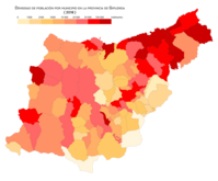
Population density by municipality (2018)

Population growth by municipality between 1998 and 2008

Population growth by municipality between 2008 and 2018


The province of Guipúzcoa is the 33rd in Spain in which there is a higher percentage of inhabitants concentrated in its capital (25.90%, compared to 31.96% for the whole of Spain).
Administration and politics
As a special province for constituting a historical territory within the Basque Country, Guipúzcoa has a regulatory chamber made up of 51 representatives (traditionally called in Guipúzcoa junteros) elected by direct universal suffrage called Juntas Generals of Guipúzcoa. The elections to the general councils are held every four years coinciding with the municipal elections and for them the territory of Gipuzkoa is grouped into four constituencies: Deba-Urola (14 junteros), Oria (9), Donostialdea (17) and Bidasoa-Oyarzun (eleven). The General Meetings are in charge of electing the general deputy, a one-person executive body, which together with the Council of Deputies elected by him forms the Provincial Council of Guipúzcoa as the provincial government body.
The Provincial Council is politically responsible before the Boards and directs the foral administration within the competence framework defined by the Law on Historical Territories, the Statute of Autonomy of the Basque Country and the Law on the Bases of Local Regime. Currently, the deputy general of Guipúzcoa Markel Olano (PNV), elected by the General Meetings after the 2015 elections by an absolute majority with the votes of the 18 junteros from his party and the 9 junteros from the PSE-EE.
Elections to the 2019 General Boards | ||||
| Political party | Scalls | |||
|---|---|---|---|---|
| Euzko Alderdi Jeltzalea-Nationalist Basque Party (EAJ-PNV) | 20 | |||
| Euskal Herria Bildu (EH Bildu) | 17 | |||
| Euskadi Socialist Party - Euskadiko Ezkerra (PSE-EE/PSOE) | 9 | |||
| Elkarrekin Podemos | 4 | |||
| Popular Party of the Basque Country (PP) | 1 | |||
Culture
The main tourist area of the territory is the coast (Basque Coast), where the municipalities of San Sebastián, Zarauz and Fuenterrabía stand out. In addition to its beaches, they have a large number of buildings of great cultural and historical interest. In the interior, towns such as Éibar, Beasáin, Villafranca de Ordizia, Oñate, Mondragón, Azpeitia and Tolosa stand out.
Gastronomy
Currently the Mugaritz restaurant is considered the fourth best in the world. It is located in a rural area of the municipality of Rentería.
Contenido relacionado
Map
Motezuma
Jijona