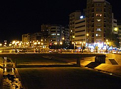
Guadalmedina
The Guadalmedina (from the Arabic وادي المدينة wādī al-Madīna, wādi l-madina, 'city river') is a coastal river in southern Spain that originates in the Pico de la Cruz, in the Sierra de Camarolos, at an altitude of 1,433 m above sea level. n. m. It has a length of 47 km to its mouth, in the heart of the city of Malaga. On its route, it passes through the Montes de Málaga natural park.
History and hydraulic works
In the XVI century, after the incorporation of Málaga to the Crown of Castile, deforestation of the river basin began. Guadalmedina to plow and cultivate its lands. The loss of the original forest leaves the slopes unprotected, beginning the erosive process triggered by torrential rainfall, typical of the Mediterranean climate. This phenomenon was accompanied by the increase in river floods in response to that rainfall (previously regulated by the forest) and floods, locally known as "riás" (floods) accompany with tragic persistence the history of the city until the beginning of the XX century.
Due to the great flood of September 23, 1907, the date on which the Guadalmedina River could not absorb an intense storm of water, King Alfonso XIII ordered works to prevent these floods. In 1908, the Málaga engineer Manuel Jiménez Lombardo would present the construction project for the Agujero reservoir to the Hydraulic Division of Southern Spain. The dam would retain the waters of the great autumnal avenues of the Guadalmedina, impounding them in an approximate quantity of 4.5 cubic hectometers, which would little by little be released through a tunnel that has a capacity of 360 m3 with drains of 60 m3/second. Currently, its gates and spillways are out of use, although still operational, as the Limonero dam is further downstream. Its surface occupies a space of 56 hectares. The dam is made of concrete, with the walls covered in ashlar, gravity type, straight in plan, 44 m high.
The Agujero dam, which was described in its day as the key to the Guadalmedina basin, although efficient in its limited function, could not be the last solution given to the problem of floods. Hydrological studies of the basin showed that it did not completely guarantee the safety of the city.
After decades of discussions and debates between supporters of solutions based exclusively on hydraulic works (road engineers) and supporters of hydrological-forest restoration (forest engineers), accompanied by the secular passivity of the Spanish public administration, we are facing the repopulation of the river basin, accompanied by the construction of haulage retention dikes. In 1919, José Almagro San Martín, Forestry Engineer of the 7th Forest Hydrological Division, completed the drafting of the Guadalmedina Basin Correction Project. Its execution will begin in 1929 with the arrival to the city of also a forestry engineer, José Martínez Falero. Almost 5,000 hectares of the left bank of the river were expropriated and repopulated, and 30 hydraulic masonry dams were built. Colonizing species such as the Aleppo pine or the stone pine were used, which effectively fulfilled the objective of protecting and restoring the soils of the basin, constituting today an adult forest mass sheltered from which some oak trees are being established.
Years later, in 1983 and 2.5 km downstream from El Agujero, the El Limonero Reservoir with a capacity of 25 cubic hectometers was built, leaving the old El Agujero reservoir unusable and, together with the aforementioned reforestation measures, They provide a solution to the serious floods that the capital of Malaga has historically faced.
From then until today, the only public initiative aimed at increasing the public forest area of the Guadalmedina basin was carried out by the city council in 2002, with the expropriation of almost 400 hectares of the right bank, which were reforested in collaboration with the Ministry of the Environment.
Communications
The furrow that the river leaves as it passes through the Montes de Málaga mountain range has for years been the crossing point of the road to Málaga from Antequera and Córdoba, the N-331 and then with the A-45 highway They run along the same route.
Curiosities
The Malaga musical group Tabletom dedicates one of their songs from the album 7000 kilos to the Guadalmedina River, with the collaboration of Marea's singer, Kutxi Romero.
On February 6, 2010, the riverbed was the place chosen by the Teodoro Reding Historical-Cultural Association to carry out the historical reenactment of the battle of Teatinos -February 5, 1810 - within the framework of the commemoration of the 200th anniversary of the defense of Malaga in 1810 against Napoleonic troops, with the participation of 300 historical reenactors from Poland, France and Spain, 5 real artillery pieces and 12 horses.
In 2014, scenes from the Spanish film Toro starring Mario Casas and Luis Tosár were filmed in Guadalmedina.
Image gallery
Contenido relacionado
Annex: Municipalities of the province of Córdoba (Spain)
Length (disambiguation)
Prince Edward Island


