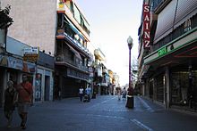
Getafe
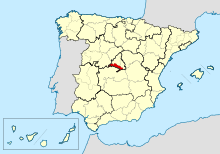
Getafe is a Spanish city and municipality located in the southern part of the Community of Madrid, and one of the most industrialized in the Madrid metropolitan area. The importance of the town is also due to the presence of one of the oldest military air bases in Spain; and the current presence of the Carlos III University of Madrid, whose rectory is in the city. In Getafe is the Cerro de los Ángeles, traditionally considered the geographical center of the Iberian Peninsula.
The proximity of Getafe to Madrid has fostered great industrial development throughout the XX century, increasing the population to the 185,180 inhabitants (INE 2020). Currently, thanks to its large industrial and service network, Getafe is a municipality with its own entity that has avoided becoming a commuter town, allowing a large proportion of its residents to work or study in the same locality. The increase in population has made it necessary to build numerous access roads, has expanded the supply of public services and has promoted the creation of new neighborhoods throughout the century XX.
The city is located 15 km south of central Madrid, in the southern part of the capital's metropolitan area, in a flat area of the Meseta Central belonging to the Manzanares river basin. It is divided into the following 11 neighborhoods: El Bercial, Las Margaritas, Sector III (which includes the Getafense part of El Arroyo Culebro), La Alhóndiga, Centro, San Isidro, Juan de la Cierva, Getafe Norte, Los Molinos, Buenavista and La district of Perales del Río, to which must be added the Air Base and five industrial estates.
Symbols
Shield
The official Getafe coat of arms was approved in 1967 and is described in heraldic language as follows:
Match shield. First, in the field of gules, a Latin cross, of gold, loaded with a panela, of gules, added of flames of the same color and highlighted by a crown of thorns of siple. Second, in the field of siple, sown with silver planes. Tied with the Royal Crown of Spain.
These weapons are of the type called allusive, referring on the one hand to the monument dedicated to the Sacred Heart of Jesus and on the other, to the military aerodrome, both located in the municipal area.
Flag
For its part, the flag is crimson in color with the official coat of arms in the center.
Toponymy
In the Middle Ages, several villages coexisted in the current municipality of Getafe, and one of the most important was Alarnes, located very close to the current urban center. In 1326, the inhabitants of these villages united in a town located along the royal road that linked Madrid with Toledo. This new town was called Xatafi. This name came from the Arabic word Jata, which means "something long". From this it was deduced that Xatafi referred to the long main street of the town, which was none other than the royal road. Therefore, Xetafe means “long street”. From there, the name evolved into Xetafi, Jetafee, Jetaphe, Jetafe, and finally Getafe.
History
Getafe's history can be divided into three clearly marked phases. In the first stage, which goes from prehistory to 1326, different civilizations and villages inhabited the municipality, although Getafe did not exist as a town. In the second, which begins in the XIV century and ends in the XX, Getafe was formed as a town and slowly developed with various constructions. In the third phase, which begins in the XX century, Getafe went from being an agricultural town to becoming a large industrial city, with a large increase in commercial and industrial activity, population, and urban area. These three phases are developed below.
Origins
The prehistoric remains found in the municipality of Getafe reveal the existence of a human settlement in this remote era. The human presence in Getafe dates back to the Lower Paleolithic (before 100,000 BC), on a terrace of the Manzanares River, where various stone tools (axes, flakes, arrowheads, scrapers and knives) have been found, belonging to to the Stone Age, and vessels and bracelets, all of them belonging to the Metal Age, and specifically to the end of the Bronze Age and the beginning of the Iron Age. Prehistorians, based on the large representation of domestic animals found in these Metal Age sites, affirm that the preferred activity of the inhabitants of the area was livestock. Meat, milk, cheese (cheese factories have appeared) and skins would be the main products obtained.
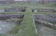
Century II to III d. C. the arrival of the Romans to the municipal area took place, building the Roman villa of La Torrecilla, located on the banks of the Manzanares. The Visigoths (VI- centuries) VII) left their mark with a necropolis near La Torrecilla.
In the 8th century century, the area where Getafe is currently located was invaded by Muslims and, in 1085, Alfonso VI conquered the villages then located in the current municipal area. In 1326, the inhabitants of Alarnes and other villages moved to the surroundings of the Madrid-Toledo royal road, creating a concentration of houses and thus getting Getafe born. To structure the new town, in that same century the primitive hermitage of La Magdalena was built, which would later be demolished. Other sources, based on historical documents, place the foundation of Getafe in the Muslim era, that is, between the VIII and XI.
Modern Age
In 1492 famine and plague devastated Getafe and in 1529 the Hospitalillo de San José was created. In 1549 Alonso de Covarrubias began to build the church of Nuestra Señora de la Magdalena (current cathedral) on the site of the old hermitage and in 1610 the hermitage of Nuestra Señora de los Ángeles was built on the Cerro de los Ángeles. In 1737 the school of the Pious Schools was founded in Getafe, La Inmaculada - PP. Piarists; and in 1763, under the reign of Carlos III, the new road to Aranjuez (whose last destination was Cádiz) was built, which passed through the foot of the slopes of Cerro de los Ángeles. Between 1808 and 1812 Napoleonic troops occupied Getafe and in 1851 the Madrid-Aranjuez railway section was inaugurated, passing through the municipality.
20th and 21st centuries
On December 22, 1897, public lighting was inaugurated in Getafe. In 1911 the air base was permanently established, and two years later, the Civil Aviation School was created. On May 30, 1919, Alfonso XIII inaugurated the first monument to the Sacred Heart on the hill of Los Angeles and in 1924 the company C.A.S.A. He installed his factory in the municipality. In that same year, at the air base, the first gyroplane flight was made, created by Juan de la Cierva.
Civil War
Franco troops took the city of Getafe on November 2, 1936, threatening to take over the capital of Spain.
The proximity of Getafe to Madrid provided strong industrial development at the beginning of the XX century, turning the municipality into a commuter town and causing rapid population growth from the 1950s. In 1956 the John Deere factory was installed in the municipality and a year later Siemens AC did the same. Starting in the 1970s, new neighborhoods such as San Isidro, El Bercial, Juan de la Cierva and Las Margaritas were created due to the sharp increase in population that the city was experiencing.
In 1961, the Isabel II canal supplied water to the municipality and in 1979 the first municipal democratic elections were held, after the Constitution of 1978. In 1988 work began on the Carlos III University. Between 1979 and 1988 the Sector III neighborhood was built, at the end of the 1990s the same was done with the Getafe Norte neighborhood and Arroyo Culebro. Currently, the El Bercial neighborhood has been expanded and two new neighborhoods have been created, Los Molinos and Buenavista. As of 2014, Getafe has the following neighborhoods, ordered by population density: Centro, Juan de la Cierva, Sector III, La Alhóndiga, Getafe Norte, El Bercial, Las Margaritas, Perales del Río, San Isidro, Buenavista, Los mills.
In April 2003, line 12 of the Madrid Metro was inaugurated, where Getafe has eight stations, thus linking the southern cities with the capital. In addition, two Madrid Cercanías train lines pass through Getafe (C-3 and C-4) with five stations in the city. In 2019, the government of the Community of Madrid announces a project to extend line 3 of the Madrid Metro to Getafe.
Administration and politics
Municipal government
Currently, the Spanish Socialist Workers Party and Podemos govern in coalition, being the mayoress of the municipality Sara Hernández Barroso, of the Spanish Socialist Workers Party, who has held the position since 2015. Hernández was also General Secretary of the PSOE of the Community of Madrid from 2015 to 2017. The most relevant political parties at the local level, in addition to the PSOE, are the Popular Party, whose current spokesperson is Manuel Ortiz Lázaro, and parties to the left of the PSOE such as Podemos, which is part of the Municipal Government with 3 departments: Feminisms and the 2030 Agenda; Youth, Health and Consumption; and Mobility and Citizen Participation. Getafe has traditionally been characterized by having a mostly working-class population; likewise, throughout its history, the most influential political parties have been those of the left wing: above all, the PSOE; although in some exception the PP has won.

In the 2015 municipal elections, the PP obtained 9 councilors (28.57% of the votes), becoming the political force with the most votes. However, the PSOE took over the mayoralty after an agreement between the left-wing parties, which together had an absolute majority. Getafe's municipal elections are held every four years, along with the regional elections. The next local government elections will be held in 2019.
The Getafe City Council is structured into different areas: finance, heritage and citizen security; of urbanism; public function, internal regime and culture; economic development, training and employment; social, citizen participation and drug addiction; of citizen action; and management of municipal cleaning and environmental companies and land and housing. The town hall holds ordinary plenary sessions every month, although extraordinary plenary sessions are frequently held, in order to debate issues and problems that affect the municipality.
Getafe is one of the most prominent cities in the workers' struggle due to the large number of people who worked in the local industry. The unions with the greatest impact in the municipality are Comisiones Obreras (CC.OO.), CSIT Unión Profesional and UGT. These formations have a branch in Getafe and have a large membership. Getafe is also part of what is known as the "red belt" of the Community of Madrid.
| Political party | 2019 | 2015 | 2011 | 2007 | 2003 | 1999 | 1995 | 1991 | 1987 | 1983 | 1979 | ||||||||||||||||||||||
|---|---|---|---|---|---|---|---|---|---|---|---|---|---|---|---|---|---|---|---|---|---|---|---|---|---|---|---|---|---|---|---|---|---|
| Votes | % | Councillors | Votes | % | Councillors | Votes | % | Councillors | Votes | % | Councillors | Votes | % | Councillors | Votes | % | Councillors | Votes | % | Councillors | Votes | % | Councillors | Votes | % | Councillors | Votes | % | Councillors | Votes | % | Councillors | |
| Spanish Socialist Workers Party (PSOE) | 31 602 | 26,14 | 11 | 23 868 | 27,30 | 8 | 26 711 | 32,64 | 9 | 35 271 | 45.11 | 13 | 40 025 | 47.35 | 13 | 39 185 | 52,93 | 15 | 31 483 | 38,78 | 11 | 29 479 | 50.55 | 15 | 29 640 | 48,21 | 14 | 35 494 | 62.42 | 19 | 16 960 | 35,18 | 10 |
| Popular Party (PP) | 14 514 | 16,14 | 5 | 24 985 | 28,57 | 9 | 34 652 | 42,35 | 12 | 29 016 | 37.11 | 11 | 29 048 | 34,36 | 10 | 22 381 | 30,23 | 9 | 25 721 | 31,68 | 9 | 11 854 | 20,33 | 6 | 8291 | 13,49 | 4 | 10 463 | 18,58 | 5 | 1388 | 2.88 | 0 |
| Citizens (Cs) | 14 140 | 15,72 | 4 | 7081 | 8.10 | 2 | - | - | - | - | - | - | - | - | - | - | - | - | - | - | - | - | - | - | - | - | - | - | - | - | - | - | - |
| We can- | 11 229 | 12,49 | 4 | - | - | - | - | - | - | - | - | - | - | - | - | - | - | - | - | - | - | - | - | - | - | - | - | - | - | - | - | - | - |
| Vox | 5834 | 6.49 | 2 | 0.67 | 585 | - | - | - | - | - | - | - | - | - | - | - | - | - | - | - | - | - | - | - | - | - | - | - | - | - | - | - | - |
| More Madrid Commitment to Getafe (MMCCG) | 4979 | 5,54 | 1 | - | - | - | - | - | - | - | - | - | - | - | - | - | - | - | - | - | - | - | - | - | - | - | - | - | - | - | - | - | - |
| United Left (IU)-Communist Party (PCE) | 2378 | 2.64 | - | 4993 | 5,70 | 1 | 11 487 | 14,04 | 4 | 9348 | 11,96 | 3 | 11 463 | 13,56 | 4 | 9307 | 12,57 | 3 | 21 434 | 26,40 | 7 | 11 682 | 20,03 | 6 | 10 415 | 16,94 | 5 | 7191 | 12,88 | 3 | 16 833 | 34,92 | 10 |
| Union Progreso and Democracy (UPyD) | 231 | 0.26 | - | 2622 | 3,00 | - | 5407 | 6.61 | 2 | - | - | - | - | - | - | - | - | - | - | - | - | - | - | - | - | - | - | - | - | - | - | - | - |
| Now Get afe | - | - | - | 20 647 | 23,61 | 7 | - | - | - | - | - | - | - | - | - | - | - | - | - | - | - | - | - | - | - | - | - | - | - | - | - | - | - |
| Democratic and Social Center (CDS)-Union of Democratic Center (UCD) | - | - | - | - | - | - | - | - | - | - | - | - | - | - | - | - | - | - | 908 | 1,12 | 0 | 2642 | 4.53 | 0 | 9565 | 15,56 | 4 | 1249 | 2.21 | 0 | 8664 | 17.97 | 5 |
Evolution of outstanding debt
| Graphic of evolution of the city council's living debt between 2008 and 2014 |
 |
Living city council debt in thousands of Euros according to data from the Ministry of Finance and Ad. Public. |
The concept of outstanding debt includes only debts with savings banks and banks related to financial credits, fixed-income securities and loans or credits transferred to third parties, excluding, therefore, commercial debt. The outstanding municipal debt per inhabitant in 2014 amounted to €218.37.
Territorial organization
Before the XX century, the city had only one neighborhood, which corresponds to the downtown neighborhood and La Alhóndiga. Perales del Río is also one of the oldest neighborhoods in the municipality, dating back to approximately the 17th century. Starting in the 1960s, the rapid increase in population forced the creation of new neighborhoods such as San Isidro in the south, Juan de la Cierva in the east, Las Margaritas in the north, and El Bercial in the west. In the 1980s, Sector III was built in the southwest, Perales del Río was expanded, and Getafe Norte was created in the following decade. Today, Getafe is divided into eleven neighborhoods and five industrial estates. They are listed below:
- Center.
- The central district is the most central and ancient of the municipality. It has a traditional and commercial atmosphere. It is the most populated of Getafe and has a large number of pedestrian streets. In it are the town hall, the cathedral, the Pías Schools (Colegio La Imaculada - PP. Escolapios) and the Hospitalillo de San José.
- The Bercial.
- The Bercial is a small neighborhood isolated from the urban hull and attached to an industrial estate in Leganés. It dates from the 1970s, and is currently expanding in a remarkable way, becoming one of the largest neighborhoods in the municipality and counting on a large commercial center of the signature of El Corte Inglés that has already been operating for several years. Several bridges have been made over the motorway of Toledo A-42 so it is already attached to the municipality by several streets.
- Getafe Norte.
- Built in the 1990s, it is the northernmost neighborhood in the city. In it, there is the football stadium Coliseum Alfonso Pérez. Much of this neighborhood is made up of chalets.
- Barrio de Juan de la Cierva.
- It is a central and commercial neighborhood that receives the name of the famous engineer. It dates from the 1970s and is now the second most populous in Getafe.
- The Alhóndiga.
- It is one of the oldest and worst aesthetically caring districts of Getafe. It is west of the Centre, next to the A-42 motorway and Getafe University Hospital. He has a football club originally from the neighborhood called Alhóndiga Sports Association.
- The Daisies.
- It is a small neighborhood located next to Carlos III University and student residences. It dates from the 1970s and has an important sportsman.
- San Isidro neighborhood.
- This neighborhood is located south of the Centre, has an important sports and large green areas. It dates from the 1970s.
- Sector III.
- Sector III is a single-family housing district. It is the largest in the municipality, and the third most populous; it was built in the 1980s and expanded with the Arroyo Culebro.
- The Molinos.
- Located between the district of Getafe Norte, the Los Angeles Polygon and the A4 and M-45 roads.
- Buenavista.
- Located in the Northwest area of the Sector III district, it is also close to the M-50 and the Alhóndiga Park.
- Perales del Rio.
- It's the furthest neighborhood in the urban area being really a paedia. It is located next to the River Manzanares in the eastern end of the municipality. Although it is one of the oldest neighborhoods in the municipality, it is currently expanding.
- Five Industrial Polygons.
- The five industrial polygons are divided by the peripheral areas of the city. In the eastern part of the city are Los Angeles, San Marcos and Los Olivos. In the southern part of the municipality is El Culebro, and next to the neighborhood of Las Margaritas is El Rosón. And today the largest polygon of all, Carpetania, is being carried out with large companies and multinationals that are moving to it.
Geography
Getafe is located in the southern part of the Community of Madrid, in Spain, in southwestern Europe, in the north of the Submeseta Sur (division of the Meseta Central), in the Manzanares river basin, and between the 610 and 640 meters of altitude. Its coordinates are 40º 18' No 3º 43' O. Getafe is traditionally considered to be the geographic center of the Iberian Peninsula, although according to the National Geographic Institute its exact location is difficult to determine, highly dependent on the methodology used, and some modern studies place it further west, in the province of Toledo.
The municipality of Getafe has an area of 78.74 km², a perimeter of 46.5 km and an elongated shape from west to east, with a maximum distance in this direction of 16 km, and 7 km from north to south. The easternmost part of the municipal area is within the Southeast regional park, encompassing the terraces of the Manzanares river, part of the Culebro stream and the Marañosa hills.
Distances
Getafe's central location on the Iberian Peninsula means that it is no more than 725.6 km from any provincial capital of mainland Spain. These are the distances to some cities, to the seas that bathe the Spanish coast and to the borders with Portugal and France:
|
|
Relief
The relief of the municipality of Getafe is quite flat, with an inclination of less than 5% to the east and with an average altitude of 631 meters above sea level. The minimum altitude is in the extreme east, in the Manzanares river, with 540 meters, and the maximum elevation is in the Buenavista hill, with 704 meters, located in the extreme west of the municipal term, bordering with Leganés. The most rugged area is that of the Marañosa hills, located in the southeast, whose maximum elevation is 698 meters. In the center of the municipal area is the Cerro de los Ángeles (670 meters). Getafe's soil erodes easily under the action of water, and to prevent this, Aleppo pine forests have been planted on the slopes of hills such as Los Ángeles and La Marañosa.
Hydrography
Through the easternmost part of the municipal area, 9.5 km of the Manzanares river pass, 16.5 km of the Culebro stream pass through the entire southern zone, and in the southeast, 2 km of the Filipinas ravine descend from the hills of the tangled There are two artificial canals that run on both sides of the Manzanares River and parallel to it, whose function is to irrigate the irrigated crops surrounding the river. 2 km east of Cerro de los Ángeles are the Perales lagoons, one of the few that remain in the area. The Culebro stream and the Filipinas ravine carry little or no flow in the summer season, while the Manzanares river carries water all year round. Therefore, the municipality of Getafe is within the Manzanares river basin, except for a small part in the southeast, which belongs to the Jarama river basin.
Limits
The municipality of Getafe borders the following municipalities: to the north with Villaverde and Villa de Vallecas (districts of Madrid), to the east with Rivas-Vaciamadrid, to the southeast with San Martín de la Vega, to the south with Pinto, to the southwest with Fuenlabrada, and to the west with Leganés.
Climate
Getafe's climate, like Madrid's, is a typical Mediterranean climate. According to the Köppen climate classification criteria, the climate of Getafe in the reference period 1981-2010 is classified as a BSk type climate (temperate semi-arid). reference: 1981-2010) is around 15 °C.
Winters are cold, with an average temperature in January of about 6 °C, average highs of between 10 and 11 °C, and lows of around 1 °C. Frosts are frequent in winter and occasional snowfalls (about 3 days of snow per year). On the contrary, the summers are hot, with averages in the warmest month (July) around 26 °C, average maximums around 33 °C and minimums around 17 °C. The daily thermal range is high (between 11 and 12 °C). The annual thermal amplitude is also high, standing at around 20 °C.
Annual precipitation does not reach 400 mm, with a marked minimum in summer (especially in July and August). The average humidity throughout the year is around 57%, with a wide oscillation between the cold seasons, which are much more humid, and the warm seasons, which are very dry.
The following shows the climatological values of the AEMET observatory located at the Getafe air base, at 620 m s. no. m., taking the years 1981-2010 as the reference period. Note that the extreme values are also taken in that period.
| Month | Ene. | Feb. | Mar. | Open up. | May. | Jun. | Jul. | Ago. | Sep. | Oct. | Nov. | Dec. | Annual |
|---|---|---|---|---|---|---|---|---|---|---|---|---|---|
| Temp. max. abs. (°C) | 20.8 | 22.6 | 26.4 | 30.7 | 35.4 | 40.6 | 41.6 | 40.6 | 40.0 | 30.6 | 25.2 | 19.2 | 41.6 |
| Average temperature (°C) | 10.5 | 12.7 | 16.8 | 18.6 | 23.0 | 29.3 | 33.2 | 32.5 | 27.5 | 20.6 | 14.5 | 10.7 | 20.8 |
| Average temperature (°C) | 5.9 | 7.5 | 10.8 | 12.7 | 16.8 | 22.4 | 25.9 | 25.4 | 21.1 | 15.3 | 9.8 | 6.5 | 15.0 |
| Temp. medium (°C) | 1.2 | 2.4 | 4.9 | 6.9 | 10.5 | 15.6 | 18.5 | 18.2 | 14.6 | 9.9 | 5.0 | 2.4 | 9.2 |
| Temp. min. abs. (°C) | -9.0 | -9.2 | -6.2 | -2.6 | -0.2 | 4.2 | 8.2 | 10.0 | 5.0 | -0.2 | -5.0 | -8.6 | -9.2 |
| Total precipitation (mm) | 29.5 | 31.6 | 23.6 | 38.3 | 39.3 | 19.3 | 9.4 | 9.4 | 22.1 | 50.1 | 48.0 | 44.8 | 365.4 |
| Precipitation days (≥ 1 mm) | 5.5 | 5.1 | 4.1 | 6.5 | 6.3 | 2.9 | 1.4 | 1.7 | 2.9 | 6.6 | 6.1 | 6.6 | 55.6 |
| Days of snow (≥) | 1.0 | 1.1 | 0.3 | 0.1 | 0.0 | 0.0 | 0.0 | 0.0 | 0.0 | 0.0 | 0.0 | 0.6 | 3.2 |
| Hours of sun | 149.7 | 171.6 | 222.0 | 236.8 | 279.1 | 325.6 | 367.9 | 338.9 | 255.5 | 202.0 | 151.6 | 123.8 | 2850.0 |
| Relative humidity (%) | 76 | 68 | 58 | 56 | 52 | 42 | 35 | 38 | 48 | 64 | 73 | 79 | 57 |
| Source: State Meteorology Agency | |||||||||||||
The following are some of the extreme values recorded at the Getafe airbase meteorological observatory taken from 1951 for temperature and precipitation and from 1961 for wind: the absolute maximum temperature of 41.6 °C recorded on July 24, 1995 and the absolute minimum temperature of -12 °C recorded on February 5, 1963, the maximum precipitation in one day of 64.6 mm recorded on September 28, 2012 and the maximum gust of wind of 126 km /h registered on December 30, 1981.
Flora and fauna
The autochthonous vegetation of Getafe is characteristic of the Mediterranean forest, made up of holm oaks and, to a lesser extent, cork oaks. As for the shrubby formations, the autochthonous species, but not abundant, are rockrose and broom. This autochthonous forest and undergrowth only occupies 16% of the surface of the municipal area, located in the hills of La Marañosa and in the eastern zone. On the banks of the Manzanares river and the Culebro stream we can find deciduous trees and reeds.
Most of the undeveloped land corresponds to cereal crops (mostly wheat), and to a lesser extent irrigated, with orchards in the Manzanares river plain. Some areas are reforested with pinyon and Aleppo pines, as is the case of Los Ángeles hill, Prado Acedinos, part of the Marañosa hills and part of the Sector III park. In the parks and streets of the city, the most abundant trees are the plantain or false chestnut, the three-pointed acacia, the elm and the stone pine. With less presence, you can find cedars, cypresses, Aleppo pines, plum trees, poplars, fir trees and palm trees.
Regarding the local fauna, it is worth noting the important population of certain small birds that live in the city itself, such as sparrows and pigeons. In the eastern part of the municipality you can find larger birds, rabbits, foxes, wild boars and weasels. In Perales del Río, the world's largest community of lesser kestrels lives, a bird of the falcon family.
Urbanism
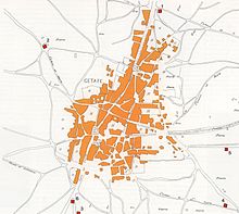
Getafe's urban space is organized almost longitudinally, from northeast to southwest. Thus, the elongated shape it has today is mainly due to the proximity of the air base, which prevents its growth towards the southeast. The most important streets in the city are Madrid and Toledo streets. These two roads, pedestrianized in their most central part, are today what the Madrid-Toledo royal road was in the Middle Ages. Getafe has other important streets and avenues that structure its neighborhoods, such as Avenida de España, Avenida de los Ángeles, Avenida de las Ciudades, Avenida de Juan Carlos I and Calle del Ferrocarril.
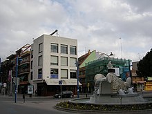
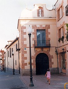
Buildings of the popular architecture of Getafe are characterized by having, generally, two floors, a sloping roof with tiles, several small balconies on the second floor and an exposed brick façade with a soft color, typical characteristics of Castilian architecture. These types of houses are found in the downtown neighborhood, but there are fewer and fewer of them, because when they are left uninhabited they are often demolished to build a new block of flats in their place. A special characteristic of Getafe's urbanism is that the average height of its buildings is five floors, or what is the same, about 17 meters. This peculiarity is due to the proximity of the air base, and makes Getafe a city of low buildings, something unusual in the cities in the south of Madrid. In this way, Getafe buildings that exceed eight floors are rare.
Despite the urban limits imposed by the air base and the limits of the municipal area, the city has a series of green spaces with a significant surface area. Two of the largest parks in the municipality are those of Sector III and La Alhóndiga, both joined together. These green areas have an artificial lake and river, two pine forests and numerous paths. They occupy an area similar to that of the downtown neighborhood and are located to the west of the urban center, separated from the east by the Toledo highway (A-42) and behind the Getafe University Hospital. Within the city there are a series of parks of various sizes and characteristics, which are Castilla-La Mancha, San Isidro, Escuelas Pías and El Casar. Outside the city there are two pine forests with picnic areas, fountains and kiosks, which are the Cerro de los Ángeles and the Prado Acedinos.
Several expansions of urban land are currently being carried out. One of them is in the El Bercial neighborhood and two have recently been awarded: Los Molinos and Cerro Buenavista. The expansion of El Bercial will quadruple the area of the neighborhood and will make the city grow to the northwest, joining El Bercial with the urban center. Likewise, the Los Olivos industrial estate is expanding to the east, and Perales del Río is growing to the west, keeping these two neighborhoods closer each time. In the southern area, next to the M-50 motorway, the Southern Technological Area is being built, an area in which exhibition halls and spaces for new industries will be created.
The Getafe city council has several projects to expand the city's urban land in order to enlarge neighborhoods. One of these projects, already underway, is the expansion of Sector III, in which houses will be built in the vicinity of the Buenavista hill deposit. Another project is the creation of the residential neighborhood of Los Molinos, located to the east of Getafe Norte and north of the Los Angeles industrial estate.
Monuments and places of interest
Getafe has a series of monuments and places of interest that represent a true reflection of its history. The most famous and visited place in Getafe is the Cerro de los Ángeles, but there are other important places such as the Cathedral of Nuestra Señora de La Magdalena, the Hospitalillo de San José and the Padres Escolapios school in this municipality.
- Cerro de los Angeles: elevation located in the area of industrial polygons. Its fame is that traditionally it was considered the geographical center of the Iberian peninsula, although according to the National Geographic Institute the exact location of the same is difficult to determine, very dependent on the methodology used, and some modern studies place it more west, in the province of Toledo. At its top are the hermitage of Our Lady of Angels and the monument to the Sacred Heartas well as a convent of Carmelitas Descalzas. The hill, almost always visible from Getafe, rises over the buildings making a backdrop.
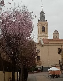
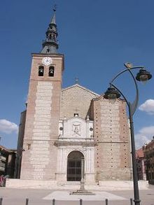
- Magdalena Cathedral: Getafe Cathedral is home to the obispado of the southern part of the Community of Madrid. This Renaissance temple dates from the century XVIIIIt has a Mudejar tower and a Baroque altarpiece. In 1958 it is declared a Historic Art Monument and is the headquarters of the Diocese of Getafe.
- Hospitalillo de San José: an old hospital built in 1529 to improve the precarious health of the getafenses of that time. It maintains a very Spanish style with its central porticodo courtyard and small chapel.
- Colegio La Inmaculada-Paris Escolapios: a school built in 1609 located in the center of the city. Within the school enclosure there is a sportsman and a park.
- Ricardo de la Vega Library: former prison built in 1617. From the mid-century XX. became a library. It has a sober style and rectangular plant.
- Church of the Righteous Saints and Pastor: temple dating from the century XVI, located in Perales del Río. In 2004, it was rebuilt due to the unfortunate state it had previously presented.
- Convent of the Sacred Heart of Jesus and Saint Joseph of La Aldehuela: monastery of Carmelites Descalzas located on the site of La Aldehuela de Perales del Río.
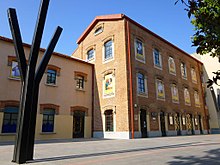
- Some of the faculties of the Carlos III University of Madrid are located in buildings that operated as military barracks in the early century XX..
Tourism
Tourism is underdeveloped in the city. The city's hotel rooms are numerous and are often in great demand, since tourists visiting Madrid and the center of Spain find in Getafe a varied range of hotels very close to the capital.
Demographics
The population of Getafe, estimated at 185,180 inhabitants in 2020 according to the INE, is unevenly distributed in the different neighborhoods that make it up: Sector III, San Isidro, Perales del Río, Las Margaritas, La Alhóndiga, Juan de La Cierva, North Getafe, El Bercial and Centro.
| Getafe demographic evolution figure between 1842 and 2020 |
 |
Population of law according to population censuses of the INE.Population according to the 2017 municipal register.Between 1842 and 1857, the term of the municipality grows because it incorporates Perales del Río. |
The neighborhood with the most homes is the Center, with 12,574; followed by Juan de la Cierva, with 12,072. While Perales del Río, with 1,815, and El Bercial, with 1,820, are the least; although the latter will see their number increase considerably with the scheduled urban developments. The most populated neighborhoods are Juan de la Cierva, Centro and Sector III, with 32,925, 32,160 and 24,217 inhabitants respectively. 30,000 people between the ages of 20 and 40 live in the municipality, and 24 people aged 100 or over (of which 21 are women and 3 are men); In aggregate terms, women predominate over men, being these 79,514 and men, 78,849.
The foreign population increases year after year in Getafe, and currently stands at around 9% of the total. The immigrants who arrive in the city come mainly from Latin America, Eastern Europe and Western Europe. The constant annual growth rate is between 0.01 and 3.00 %, the birth rate is between 0.01 and 8 ‰, the death rate between 4 and 8 ‰, and the vegetative growth of the period from 1996 to 2002 is between 5 and 10 ‰. The youth rate is 13%, the aging rate 12%, and the average age of the inhabitants is less than 22 years. As for religion, more than 85% of the inhabitants consider themselves Catholic, but close to 20% of them are practitioners who go weekly to a Catholic temple.
The population of Getafe experienced strong growth throughout the second half of the XX century. Throughout the Middle Ages and up to 1900, the population hovered between 2,500 and 6,000 inhabitants. In 1950 the population was 12,254, in 1970 it was 69,424, in 1977 it was 124,601, and in 1988 it was 136,162. The data show the very strong population increase that occurred from 1960 to the present. Today, the city's population is growing continuously and moderately, at an average rate of 1,700 people per year. However, 2006 was the first year since the 17th century that the population decreased, specifically 2043 people compared to the previous year. Getafe is currently a clear example of a dormitory city in that nearly half of its population works in Madrid.
Getafe is ranked 35th in the order of most populated cities in Spain, behind San Sebastián and ahead of Burgos. In the Community of Madrid it is the sixth most populous city, behind Leganés and ahead of Alcorcón. The name of Getafe is getafense or getafeño, although the first form is the most used. The zip codes of the city are: 28901 - 28902 - 28903 - 28904 - 28905 - 28906 - 28907 - 28909.
The municipality, which has an area of 78.38 km², has 178,288 inhabitants and a density of 2,274.66 inhabitants/km² according to the municipal register for 2017 of the INE.
Population by nuclei
Breakdown of the population according to the Continuous Register by INE Population Unit.
| Nucles | Inhabitants (2020) | Male | Women |
|---|---|---|---|
| The Aldehuela and the Torrecilla | 51 | 19 | 32 |
| Cerro de los Angeles | 55 | 25 | 30 |
| Getafe | 156586 | 76159 | 80427 |
| Perales del Río (La Burela, Casas del Cura y Caserío de Perales) | 9532 | 4717 | 4815 |
| Acedin | 0 | 0 | 0 |
| The Atalayuela | 0 | 0 | 0 |
| The Bercial | 18928 | 9466 | 9462 |
| Cañada del Molino | 0 | 0 | 0 |
| The Plains (Adaro) | 28 | 17 | 11 |
Economy
Getafe's economy began as primarily agricultural: the primary sector was the most important for much of its history. At the beginning of the XX century, the first factories appeared in the municipality, but it was not until the second half of that century that the industry began to gain prominence. In the 1960s this was already the main sector of the local economy.
Today the Getafense economy is largely industrial, since the city has five industrial estates. After Madrid, Getafe is the most industrialized city in the Community of Madrid, having numerous industries such as John Deere, Siemens or Construcciones Aeronáuticas SA, among many others. The city has five industrial estates distributed in the peripheral areas. Regarding the type of industrial activity, the Getafense industry is divided as follows: 34% is metallurgy, 20% food, 14% wood and furniture, and 6% textiles and leather; other industries such as paper and graphic arts or construction occupy smaller percentages. As for mining, there are some quarries in the eastern part of the municipality that are intensively exploited.
The service sector began to emerge at the end of the 1990s with the creation of new shopping and leisure centers, and new offices installed in the urban center. Currently this sector is constantly growing. On Saturday mornings there is a street market in the parking lot of the Cercanías de Las Margaritas station.
The weight of agriculture in the local economy is already very low, although the eastern part of the municipality preserves good areas of rainfed and irrigated crops. The predominant crop is wheat, and there are small extensions of olive trees, vines and orchards. Livestock, less and less present, is still preserved in the vicinity of Cerro Buenavista and, above all, in the pastures near the Manzanares River. The wines made in Getafe receive the Denomination of Origin of Wines of Madrid and are part of the Arganda Subzone, which covers the entire southeast of the Community of Madrid.
Services
This city has grown a lot in recent decades, inducing a similar increase in the number of endowments and equipment. Some of these are the following:
- The faculties of Humanities, Legal Sciences, and the Rectorate of the Carlos III University of Madrid. The facilities are in the neighborhood of Las Margaritas.
- The student residence Fernando de los Ríos, located 500 metres from the university in the same barium.
- The Getafe University Hospital, famous for its burned unit. It is next to the A-42 motorway, at km 12 and is one of the largest in the South of Madrid.
- The Getafe Air Base, famous for being one of the first in Spain. It is located to the southeast of the urban center and its use is almost exclusively military, although it is also used by the SA Aircraft Construction Factory.
- The Teatro Federico García Lorca, a great cultural center located in the center district. It was built in the 1990s and currently houses a large number of cultural events.
- The Coliseum Alfonso Pérez, stadium of the Getafe Club of Football. It is in Getafe Norte, opened in 1998 and has a capacity of 17 000 people.
- The Getafe Professional Music Conservatory, located in Sector III. It is the only public conservatory in the southern part of Madrid.
- The train line of Cercanías C-4 at its pass through the centre of Getafe has been buried since 2001 to avoid divisions and noises (although vibrations have not been avoided to adjacent buildings) and thus create a park on its old route.
- The cemetery of Nuestra Señora de la Soledad, located south of the air base, is the main cemetery of the city and was opened in 1974. Previous to this, was the old cemetery, which remained unused with the construction of the new one.
- Next to Perales del Río there is a depuradora that treats the waters of the Manzanares river at its passage through the municipal district of Getafe, as well as the depuradora of the Culebro stream, located south of Getafe.
- The bullring, built in 2004 and located next to the fairground. It hosts cumshots at local parties.
- Seven sportsmen and three municipal swimming pools.
- Fifteen Catholic temples, eleven civic centres and five municipal libraries.
- It is from the few municipalities of the Community of Madrid, except Madrid itself, which has a cathedral; it is the Cathedral of the Magdalena.
Health
Getafe has a good health service, both public and private. In the city there are eleven public health centers spread over the neighborhoods of Juan de la Cierva, Las Margaritas, La Alhóndiga, Getafe Norte, Sector III, El Bercial and Perales del Río. The Getafe University Hospital, inaugurated in April 1991, is the main health center for the population. This hospital, located next to the neighborhood of La Alhóndiga, is famous throughout Spain for its burn unit. Next to the Prado Acedinos, 5 km south of the urban center, is the Apanid, a residence for people with Down syndrome. This center is unique in the entire southern area of the Community of Madrid.
Diocese
The Diocese of Getafe is one of the newest in Spain. It was erected canonically by Pope John Paul II on July 23, 1991, the same day the new diocese of Alcalá de Henares was created. Both were dismembered from the Archdiocese of Madrid-Alcalá, of which they are suffragan dioceses. The creation of these two new dioceses was due to the great demographic growth of the Archdiocese of Madrid which, at the beginning of the 1990s, already reached five million inhabitants, of whom around 90% are considered Catholics.
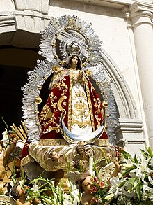
The diocesan territory of Getafe covers the entire southern area of the Community of Madrid, occupying an area of 2,295 km², with a population of 1,122,601 inhabitants, distributed in 115 parishes. Getafe's cathedral is the church of La Magdalena, consecrated as a cathedral on July 23, 1995. The patron saint of the diocese is Our Lady of the Angels, whose devotion is linked, according to tradition, to her sanctuary on the hill of Los Angeles, next to the road that goes from Madrid to the south of the peninsula. The diocese has the Nuestra Señora de los Apóstoles Diocesan Seminary, which is located on the Los Angeles hill, on the South highway, at kilometer 13.
The first bishop of Getafe was D. Francisco José Pérez y Fernández-Golfín, who was appointed to his position on July 23, 1991 and died on February 24, 2004. The current bishop is Ginés García Beltrán, and as auxiliary bishop officiated, until June 2021, José Rico Pavés.
Education
Getafe's public educational offer includes six infant education schools (up to 5 years), 23 infant and primary education schools (up to 12 years) and fourteen secondary education institutes. One of them, the Laguna de Joatzel Institute, is carrying out a bilingual teaching project to which other institutes will join later. The concerted schools are not very numerous, highlighting the Colegio La Inmaculada - PP. Escolapios (first religious school in Getafe), center of the Pious Schools (PP. Escolapios) with concerted Infant, Primary and Secondary Education, with Bachelor and F.P. private; Divina Pastora (MM. Calasancias), San José (Santo Domingo Foundation) and Jesús Nazareno School, all of religious education. The Los Ángeles School located in the Prado Acedinos with education from 1 year to 2nd year of Baccalaureate and with a sports center that will soon be inaugurated and the Aristos European School, bilingual, atheist and private whose educational offer goes from nursery schools to Baccalaureate, and which It has a sports club and indoor pool. In the city there are also several first and second cycle vocational training centers and an adult education center dependent on the Community of Madrid, the C.E.P.A. House of Culture.
Lastly, the rectorate of the Carlos III University is based in Getafe along with three of its faculties of humanities and legal sciences. Next to the university is the Fernando de los Ríos student residence. The percentage of people over 16 years of age with a university degree is 14% and the illiteracy rate is 12%.[citation required]
- National University of Distance Education
Getafe has a UNED University Classroom, integrated into the Madrid Sur Associated Center of UNED. The presence of the UNED in Getafe dates back to the 1984-85 academic year. The facilities are located in the IES Alarnes. The Madrid South Center has more than 8,000 students, with around 1,000 enrolled in the Aula de Getafe.
The facilities have 6 classrooms with capacity for 35 students, a multipurpose room for 80 people, a study room, an office for administrative tasks and cafeteria service.
In Getafe the degrees are taught (offered in 2015-2016): University access for over 25 and 45 years old, Political Science, Legal Sciences of Public Administrations, Law, Sociology, Senior Program for over 50 years, Languages: German B1 and English B1.
Transportation
Getafe has means of transport typical of a big city, such as highways and highways, taxi ranks, buses, trains and has line 12 of the Madrid metro (Metrosur).
Roads
Four motorways and dual carriageways pass through Getafe, two radial (A-42 and A-4), and two bypass to Madrid (M-45 and M-50). Another two-lane highway connects Getafe with Leganés, and two provincial highways connect Perales del Río. They are listed below:
- Autopists
- M-45, Madrid's ring road. 4 km from this motorway are within the municipal border, crossing it from west to east. The road makes the north limit of the neighborhoods El Bercial and Getafe Norte.
- M-50, Madrid's ring road. By Getafe, 13.6 km from this road pass through the municipality of west to east. The motorway makes the southern limit of Sector III, of the northern limit of the industrial estate El Culebro and crosses Perales del Río.
- Motorways
- A-4, the Southern motorway, called N-IV before. By Getafe, there are 7,25 km of this road and the municipal border runs from north to south. The road separates industrial polygons from Los Angeles and San Marcos, with the Olivos polygon and the Los Angeles hill.
- A-42, motorway from Toledo, first called N-401. The municipality runs 6.13 km from this road and crosses the municipality from north to south. The motorway separates the neighborhoods of El Bercial and Sector III from the urban center. To avoid this division, the city council has made a project to bury this motorway at its pace in Getafe.
- Other roads
- M-406, road with two lanes per sense. Go through Alcorcón, Leganés and Getafe. This way, when entering Getafe, becomes Leganese Street.
- M-301, road departing from Villaverde, passes through Perales del Río and ends in San Martín de la Vega.
- Los Angeles hill road to Perales del Rio. It is a continuation of the M-406 and communicates the center of Getafe with Perales del Río. Known as the Road.
Public transport
- Airport
- The Getafe Air Base is exclusively military use. The nearest commercial airport is Madrid-Barajas Airport, which is 26 km from the centre of Getafe and which is reached by the M-45 and M-40 motorways.
- Bus
- The city has seven urban lines (Avanza Interurbanos), eight lines that connect with Madrid, five that communicate with the municipalities of Pinto, Valdemoro, Leganés, Alcorcón, Parla, Serranillos, Casarubuelos and Griñón, and two night lines that connect with Madrid. The following are:
| Line | Heads |
|---|---|
| 1 | Getafe Sector III (FF.CC/Ceminium) - Ambulatory |
| 2 | Arroyo Culebro (Sector III) - Ambulatory |
| 3 | Getafe Circular |
| 4 | Industrial Polígono Los Angeles - Hospital - Perales del Río |
| 5 | Buenavista - Getafe Sector III (FF.CC.) |
| 6 | Hospital - San Isidro |
| Pi1 | Getafe Central - Pol. Ind. Los Angeles - Pol. Ind. of the Olives |
| Pi2 | Getafe Central - Pol. Ind. San Marcos - Pol. Ind. El Lomo - Parque Empresarial La Carpetania |
| Line | Tour | |
|---|---|---|
| 411 | Madrid (Legazpi) - Perales del Río | |
| 428 | Getafe (Hospital) - Pinto - Valdemoro (Hospital) | |
| 441 | Madrid (Plaza Elíptica) - Getafe (Sector III) (by University) | |
| 442 | Madrid (Elliptical Square) - Getafe (Juan de la Cierva) | |
| 443 | Madrid (Plaza Elíptica) - Getafe (Las Margaritas) | |
| 444 | Madrid (Plaza Elíptica) - Getafe (Sector III) (per Hospital) | |
| 446 | Madrid (Elliptical Square) - Getafe (El Bercial) | |
| 447 | Madrid (Legazpi) - Getafe (Hospital) (by polygons) | |
| 448 | Madrid (Legazpi) - Getafe (Hospital) (by Villaverde) | |
| 450 | Getafe - Leganes - Alcorcon | |
| 455 | Getafe - Pinto | |
| 462 | Getafe - Parla | |
| 488 | Leganes (San Nicasio) - Getafe (The Spaniards) | |
| Nocturnos | ||
| N801 | Madrid (Atocha) - Getafe | |
| N805 | Madrid (Atocha) - Getafe | |
- Train
- By Getafe they pass two train lines from Cercanías Madrid that cross the municipality from north to south. These two lines are: C-3 (stations: The Casar and Getafe Industrial) and C-4 (stations: The Margaritas-Universidad, Getafe Centro and Getafe Sector 3). There are a total of five stations, two of them with exchanger with the Madrid Metro.
- Metro
- Since April 2003, Getafe has eight stations on line 12 of the Madrid Metro Network. These stations are: El Bercial, Los Espartales, El Casar, Juan de la Cierva, Getafe Central, Alonso de Mendoza, Conservatorio y Arroyo Culebro. The government of the Community of Madrid has a project to expand the line 3 of Metro of Madrid to get it to Perales del Río via the station of El Casar. In 2019, the government of the Community of Madrid announced the project to expand the line 3 of Metro from Madrid to Getafe.
Culture
Culture in Getafe is represented in institutions such as the Carlos III University, whose rectory and three faculties of humanities and legal sciences are located in Getafe. This university has a choir and an orchestra that have been awarded and recognized on numerous occasions throughout the Spanish territory. The Getafe Professional Music Conservatory, which was inaugurated in 2000, turns out to be the public conservatory for the entire southern area of the community. The Federico García Lorca Auditorium Theater, one of the largest and most important in the southern area of Madrid, was inaugurated at the end of the 1990s and hosts a multitude of plays and concerts. In addition, eight civic centers and a series of municipal libraries are distributed throughout the different neighborhoods of Getafe. Next to the Sector III library is the José Hierro Poetry Center, a place of creation and study where you can hold consultations, meetings and training activities, whose objective is to collect documents and create a literary heritage. In this center there is a great legacy of the poet José Hierro, historical magazines, a photo library and a video library. In 2005 it was planned to build the Getafe Aviation Museum, with a design commissioned to the architect Norman Foster, a project that, however, was abandoned.
Independent cultural activity is very present in Getafe. There is a large number of musicians and bands of all styles and disciplines. A good part of the cultural acts in the open air are carried out based on an abusive use of decibels as a claim instrument, so that they are heard at a much greater distance from where the public for whom they are supposedly intended is located, and they are located next to homes instead of more appropriate places such as parks, theaters, schools or sports centers. It is these shows that are detrimental in terms of noise, both for those who come voluntarily and for those who cannot choose, although this is the norm in this century and what the municipalities in the area promote.
When talking about culture in Getafe, we must talk about Cultura Inquieta, a music and arts platform that, with roots and headquarters in Getafe, carries out its activity throughout the year on different Spanish stages, publishes its magazine international art Inquieta Magazine, reports daily on what is happening in the world in the field of art, photography, eroticism or music through its website and social networks and culminates its annual activity with the Festival Cultura Inquieta, a multidisciplinary meeting that takes place throughout the entire month of July in Getafe.
Nearly 40% of the inhabitants of Getafe come from autonomous communities other than Madrid. Some of these groups have created the Regional Houses, meeting places where activities and cultural events are held. Some of these Regional Houses are those of Extremadura, Castilla-La Mancha, Murcia and Andalusia.
Parties
The Getafe Patron Saint Festivities are celebrated forty days after Easter Sunday, which means that each year they are celebrated on a different date between the middle and end of May and the beginning of June. The festivities officially begin on Saturday, but unofficially the starting signal is given by a pilgrimage that takes place nine days before, on Ascension Day, in which the patron saint, the Virgen de los Ángeles, is lowered from the hill of Los Angeles. Upon arrival in town, the mayor symbolically gives the virgin the baton of command of the city and then concludes the pilgrimage in the Getafe cathedral. That day it is a tradition to drink lemonade in places like the Plaza del Ayuntamiento.
The beginning of the festivities occurs, as already indicated, nine days after the descent of the Virgin. The "Saturday of the festivities", as it is popularly known, starts with a proclamation in the Plaza de la Constitución followed by a mascletá in Calle Jardines. During these days, a fair is set up in the fairgrounds, the booths of the political parties are placed on Calle Ferrocarril, next to the Getafe Central train station and numerous cultural activities are held, some concerts and several bullfights.. The presence of a falla known as La Chamà during these festivities is noteworthy, an event that has been held since 1992, being the only fallas festivity in the Community of Madrid. A week after the start of the festivities, there is a parade that passes through the center of the city in which candies are thrown. The Getafe Patron Saint Festivities conclude eight days after the proclamation with the climb up the hill of Los Ángeles of the virgin who leaves the town until the following year.
During Christmas days various cultural activities take place, such as special Christmas concerts, the setting up of a large Murcian nativity scene in the interior patio of the Hospitalillo de San José and the procession of the Three Wise Men on January 5th. It is also a tradition to celebrate Carnival with parades of costumes, and cultural events. During Holy Week there are between two and four religious processions that leave from various churches and travel through the streets of the city.
Media
The municipality has several local newspapers with print and digital editions, such as Getafe Capital, which has its biweekly paper newspaper with free distribution and a website. Since December 2009, Al cabo de… La Calle, a medium also present on the Internet, has been distributed biweekly. Likewise, in February 2013, Más Getafe was born, a newspaper created by a group of journalists that emphasizes culture and social issues and is published weekly every Wednesday in kiosks and points of sale. Also with website and active management of social networks. The Madrid town also has other prominent media such as El Buzón, one of the most followed, which also has its digital edition, or El Iceberg, also with renewed daily content on the Internet. Others, like local media veteran Acción Getafense, have disappeared. Living in Getafe, Getafe Ahora or Getafe al Día and Mercado also disappeared. The City Council also publishes a municipal bulletin.
The local radio station Radio Getafe disappeared, absorbed by Cadena COPE (101.8 FM). The city also has a community radio station, Radio Ritmo (99.9 FM), which is a member of the Community Media Network. In the 1990s, the city had a television station called Tele Getafe. There are other digital-only media such as Capital del Sur, Getafe Digital or Getafe Hoy. Cope Madrid Sur (89.7 FM) carries out weekly programs with the intervention of politicians from all parties with representation in the municipality, in which it also updates daily the news from the south of the CAM. The station SER Madrid Sur (94.4 FM) also provides coverage to the town as well as to the rest of the southern part of the Community of Madrid.
Gastronomy
The typical cuisine of Getafe is very similar, if not the same, to that of Madrid. The climate, the products of the field and the history have shaped this varied gastronomy. The most representative dishes are the Madrid stew, Madrid-style tripe, chickpea stew, potato omelette, Madrid-style sea bream, red cabbage and silly and ready donuts, among others. As for the wines, those of the Community of Madrid stand out, among which the most famous are those of San Martín de Valdeiglesias, Arganda del Rey and Navalcarnero. Both in the large shopping centers and in the central streets of Getafe we can find a wide range of restaurants.
Shopping and entertainment
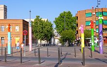
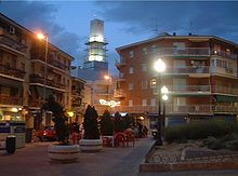
Getafe is a city for shopping and leisure; It has many shops located in the urban center and several large shopping and leisure centers in more peripheral areas. In the center of Getafe, the area with the most shops and businesses is the axis of Calle Toledo and Calle Madrid, which crosses the municipality from North to South. Much of this boulevard is pedestrianized, making shopping on foot more convenient. Another very commercial downtown area is Avenida de Juan de la Cierva.
As we move away from the center, we find the Getafe 3 shopping center, located in the Sector III neighbourhood, and it has an Alcampo, several restaurants and a large number of clothing stores and footwear. In the Getafe Norte neighborhood, there is the Bulevar, which has a Carrefour, several restaurants, and clothing stores. The largest shopping and leisure center in Getafe is Nassica, located in the South Technological Area, which is reached by the M-50, 5 km from the city centre. The center has computer and furniture stores, a Factory , 25 restaurants, a bowling alley, recreational games, a permanent market and 20 cinemas. In the neighborhood of El Bercial is the newest shopping center in the city, which is called El Bercial. It houses an El Corte Inglés, a Hipercor and two cafeteria-restaurants. The area with the most nightlife is the Barrio Centro, where most of the city's tapas bars and nightclubs are located.
Despite its proximity to Madrid, the municipality has two good pine forests that have tables, picnic areas, barbecues, soccer fields, and playgrounds. These facilities are prepared to spend a day in contact with nature. One of them is the Prado Acedinos, located to the south of the urban area, which is reached by exit 16 of the A-42 motorway. The other is the Cerro de los Ángeles, which is reached by the A-4 motorway.
Sports
As in the rest of Spain, soccer is very popular in Getafe. The city's professional soccer club is Getafe Club de Fútbol SAD, founded in 1983. On June 19, 2004, the team was promoted to the First Division of the Spanish league, where it played until 2016. It has been in two runner-up in the Copa del Rey soccer (2007 and 2008) and gained international fame with his performance in the UEFA Cup in the 2007/08 season, where he was on the verge of reaching the semifinals.
One of the most successful athletes in the city is the soccer player Alfonso Pérez Muñoz, who was Olympic champion in Barcelona in 1992. Today, the local stadium bears his name in his honor.
Its soccer teams also include A.D. Alhóndiga with its current women's team in the women's second division and which is a benchmark team in the entire southern area of Madrid.
Every June, at local festivities, the day of the bicycle is celebrated, a day in which tens of thousands of Getafenses take their bicycles out to the streets to make a route through the city non-competitive purposes. Another important sporting event is the Villa de Getafe Half Marathon, which is held every January and has a large influx of athletes.
It also has a wheelchair basketball team (CID Casa Murcia Getafe BSR) that has played in the Division of Honor, the highest national category, since 2008. It has won the silver medal in 2 editions of the Copa del Rey (2012 and 2014) 1 League runner-up (2011/2012) 1 European Club Championship (WB Cup) in 2016. Players have come from his ranks who have represented Spain in Paralympics (London 2012 and Rio 2016) and the European and World Wheelchair Basketball Championships, both in senior teams (male and female) and under 22.
Among the outstanding handball teams, there is Getasur Handball, which has men's and women's teams and competes in the 2007-2008 season in the 1st National category. And on the other, the Getafe Handball Club, which also has men's and women's teams, of which their senior categories compete in the 2007-2008 season in 2nd National.
The city has seven sports centers distributed in the different neighborhoods, but the largest and most important are those of San Isidro and Las Margaritas. Getafe also has a skate park that is located behind the Sector III Conservatory, three municipal swimming pools, which are the one in Sector III, the one in Getafe Norte and the one in Perales del Río. The Coliseum Alfonso Pérez football stadium also stands out, with a capacity for 17,050 spectators. On the occasion of the promotion to the first division of the local soccer team, a sports city has been built next to the Getafe Norte municipal swimming pool.
Getafe's aeronautical tradition is reflected in the Ultralight Club, which has been Spanish champion numerous times, European champion in 2004 and World champion in 2009.
Twin cities
The city of Getafe actively participates in the town twinning initiative promoted, among other institutions, by the European Union.
- Carabanchel (Madrid). This twinning protocol was signed on 21 May 1980.
- Jetafe (Philippines). This twinning protocol was signed on 16 November 1990.
- The daira de Djrafia, or Ejdairia, belonging to the wilaya of Smara, in the Saharawi refugee camps of Tinduf. This twinning protocol was signed on 11 June 1991 and ratified in March 2002.
- Guanabacoa (Cuba). This twinning protocol was signed on 16 November 1996.
Notable people
Contenido relacionado
1964
XVII century
Morelia inquisition
