
Geography of Türkiye
Turkey (local name, Turkiye Cumhuriyeti) is a state located in southeastern Europe and southwest Asia (that portion of Turkey west of the Bosporus is geographically part of Europe), which borders the Black Sea, between Bulgaria and Georgia, and borders the Aegean Sea and the Mediterranean, between Greece and Syria. Politically European Turkey (Rumelia) borders Greece and Bulgaria. Asiatic Turkey limits in the Caucasus, with Georgia, Armenia, Azerbaijan; to the east with Iran, and to the south with Iraq and Syria.
Physical geography
Relief

Different regions can be distinguished in Türkiye. First, at the western end of the country is European Turkey or Eastern Thrace, around Istanbul. It represents approximately 3% of the territory. Basically it is a steppe and arid plateau that has some heights. To the east and northeast, it has the Istranca massif (in Turkish, Yıldız Dağları or Istranca) on the border with Bulgaria; its highest point is Mahya Dağı (1031 m) in Türkiye. This massif ends up reaching the coast, which is thus high and abrupt. In the southwestern part is the Tekir Dag, which overlooks the Sea of Marmara. These Ganos hills end up forming the Gallipoli peninsula, between the Gulf of Saros and the Dardanelles.
On the other side of the Bosporus channel lies the rest of Turkey, Asiatic Turkey. Also here the basic structure is a plateau with an average altitude of 900 m altitude. It is made up of deposits that are the remains of an ancient sea from which the salty Lake Tuz remains. In the central area of Anatolia, in places like Konya, Kayseri, as well as in the western part of the country, there are hot springs. This central area is rather flat, with sunken areas such as the Tuz Gölü basin. The relief in eastern Anatolia is mountainous, reaching in the Mysia region up to 2000 m, as seen in the Ulu Dag.
Around it, there are several mountain ranges. To the east, the Anatolian plateau rises to the Armenian mountains, 1,500-1,800 meters high. Here there are sedimentary ridges (clay and volcanic remains as well as deeply depressed valleys that make communications difficult.
Two ridges come from here: the Pontic Alps or Pontic Mountains to the north rise to more than 3,000 meters (Kackar, 3,937 m) that hinder access to the sea from the interior plateaus; and the Taurus or Taurus mountains to the south, which in turn has two branches, the western Taurus and the central Taurus. Within this central Taurus there are several massifs: Bolkar, Taurus, Ala (where the highest peak, Ala Dagh, 3734 m, is located) and Hinzir. In the Armenian zone there is a high plateau where the basin of Lake Van is. It is an area with volcanic and seismic activity.
Then there are several mountain ranges parallel to Taurus that are called Antitaurus. And they end up joining the Armenian system, where Mount Agri or Ararat is located, 5166 m high, already on the border with Armenia. It is the highest point in the country.
Rivers, lakes and coasts
Rivers

Turkey's rivers—generally unnavigable as they run so fast—can be divided into several groups depending on where they flow.
- Black Sea:
- Black Sea Anatolia:
- Kizil Irmak ("Red Trio," 1150 km the longest river in the country, also known as the river Halys;
- Sakarya River, the third in length of Turkey with 824 kmalso known as Sangarius;
- Yeşilırmak ("Green River", the classic IrisOf 418 km), Yağlıdere, Aksu Deresi in the province of Giresun, the Batlama River in Giresun, the Bartın River (classic Parthenius) and Çoruh river (classic Campesis).
- European green of the Black Sea:
- Mutludere (also known as Rezovo) that flows from Turkey to Bulgaria, with 112 km;
- Veleka that flows to Bulgaria and then to the Black Sea, with 147 km length, 25 km Turkey;
- Mar de Marmara:
- * Biga Çayı that in classic times was known as the Gránico, and Simav çayı also called Susurluk çayıthat in classic times was known as Makestos.
- Aegean Sea:
- European aegean:
- Ergene river, affluent of the Maritza, which borders Greece. The main European Aegean is the Meriç (Maritsa or Evros) which is in the European section of Turkey and has its source in Bulgaria; it has a course of 480 km long.
- anatolia:
- Bakırçay (classic Caicus or Astraeus);
- Büjük Menderes (classic Meandro)548 km);
- Cayster River or Küçük Menderes (Küçük Menderes)114 km);
- Gediz (hermus classic). (401 km);
- Karamenders River (classic Escamandro);
- Mediterranean Sea:
- Aksu (classic Kestros);
- Manavgat River;
- River Köprüçay (classic Eurymedon);
- Göksu 260 km);
- Limonlu Çayı (also known as Lamos, Cilicia);
- Müftü River (also called Tyrutes);
- Tarsus River (also called Berdan; classic Cidno);
- Seyhan (classic Sarus);
- Ceyhan (classic Pyramus or Leucosyrus) 509 km);
- Rio Payas;
- Rio Deli Çay;
- Rio So (classic Orantes);
- Caspian Sea:
- Araks River, whose course marks the border with Armenia;
- Kura river. The Araks and the Kura unite shortly before the Caspian Sea;
- Persian Gulf (Indian):
- sources of the Tigris and Euphrates rivers, with its affluent Murat, flowing from eastern Turkey.
Lakes
Lakes abound in Türkiye. The most important is Lake Van, on the border with Armenia which has an area of 3766 km² and has 1720 m altitude. Other notable lakes are: Tuz, Beyşehir, Egridir, Aksehir and Sugla.


| Name in Spanish | Name in Turkish | Surface (km2) | Deep | Location (districts or provinces) |
|---|---|---|---|---|
| Lake Van | Van Gölü | 3,755 km2 | 451 m | Van, Bitlis |
| Lake Tuz | Tuz Gölü | 1,500 km2 | 2 m | Aksaray, Ankara, Konya |
| Lake Beyşehir | Beyşehir Gölü | 656 km2 | 10 m | Beyşehir, Seydişehir at Konya, Isparta |
| Lake Eğirdir | Eğirdir Gölü | 482 km2 | Isparta | |
| Lago İznik | İznik Gölü | 308 km2 | İznik in Bursa, Yalova | |
| Lake Burdur | Burdur Gölü | 200 km2 | Burdur, Isparta | |
| Lake Manyas | Manyas Gölü | 166 km2 | Balıkesir | |
| Lake Acıgöl | Acıgöl | 153 km2 | Denizli, Afyonkarahisar | |
| Lake Uluabat | Uluabat Gölü | 134 km2 | 1-2 m | Bursa |
| Lake Çıldır | Çıldır Gölü | 115 km2 | Ardahan, Kars |
| Swamp or reservoir | Surface (km2) | Deep | Location |
|---|---|---|---|
| Atatürk Baraj Gölü | 817 km2 | Şanlıurfa, Adıyaman | |
| Keban Baraj Gölü | 675 km2 | Elazığ, Tunceli, Erzincan | |
| Karakaya Baraj Gölü | 298 km2 | Malatya, Elazığ, Diyarbakır | |
| Hirfanlı Baraj Gölü | 263 km2 | Ankara, Kırşehir | |
| Altınkaya Baraj Gölü | 118 km2 | Samsun |
Coasts
Turkey has a coastline of more than 6,400 kilometers in length and faces several seas. To the north, the Black Sea coastline whose most prominent feature is Cape Ince. To the west is the Aegean coastline, characterized by being very indented and the abundance of islands and islets. To the south is the Mediterranean coast, in which the gulfs of Antalya and Alexandretta are found as main features. Turkey is in a strategic position, dominating the Straits of the Bosphorus, the Sea of Marmara and the Dardanelles that connect the Aegean Sea with the Black Sea.
Climate
The climate is temperate, although the various regions of Türkiye have different climates. The coastal areas of Turkey bordering the Mediterranean Sea and the Aegean Sea have a temperate Mediterranean climate, with hot, dry summers and wet, cold winters. The annual precipitation is in this area between 580 and 1300 mm. The coastal areas of Turkey bordering the Black Sea have a temperate oceanic climate, with hot, humid summers and cold, wet winters. The annual precipitation is in this area between 1000 and 2500 mm.

Ordu

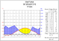
Samsun
Van


In the mountainous areas near the sea, the temperatures are milder. In the west, winter temperatures average a minimum of 1 °C. Summers are hot and dry, with temperatures above 30°C.
Inland, on the Anatolian plateau, the climate is harsher, more continental. The mountains near the western coast prevent the influence of the Mediterranean from advancing inland, giving the regions far from the coast a continental climate with well-differentiated seasons. In the basins of the interior of the country they are more extreme, with cold in winter and heat in summer, presenting especially rigorous winters. The eastern mountains can record temperatures as low as -30 or -40 °C.
It tends to rain more in the northern zone, the Black Sea coast, thus in Rize it falls 2545 mm per year; It is the only region of the country in which it rains throughout the year, with an annual average of 2,500 mm at the eastern end of this coastline, which is the maximum rainfall in the country. The average annual rainfall in the western zone is 400 mm. On the Aegean and Mediterranean coasts, annual rainfall varies between 580 and 1,300 mm, depending on the location. In general terms, rainfall decreases in an easterly direction. In the interior massif there is more aridity, so that in places like Ankara, for example, rainfall is 417 mm and usually occurs in winter and spring. The most arid regions are Konya Ovasi and Malatya Ovasi, where annual rainfall is frequently less than 300 mm. May is generally the rainiest month and July and August the driest. The low temperature makes it usually snow. The eastern mountains can have snow covering them up to one hundred and twenty days a year.
The climate of the Antitaurus mountain region in eastern Turkey can be inhospitable. Summers tend to be hot and extremely arid. Winters are icy cold with frequent and heavy snowfall. Towns can be isolated for several days during winter storms. Spring and autumn are generally mild, but in both seasons, sudden heat waves and cold snaps are frequent.
| Region | Average temperature | Maximum recorded temperature | Minimum recorded temperature | Average humidity. | Total anticipation | ||||
| Marmara Region | 13.5°C | 56.3°F | 44.6°C | 112.3°F | -27.8°C | -18,0°F | 71.2 % | 564,3mm | 563,88mm |
| Aegean Region | 15.4°C | 59.7°F | 48.5°C | 119.3°F | -45.6°C | -50.1°F | 60.9 % | 706,0mm | 706,12mm |
| Mediterranean Region | 16.4°C | 61.5°F | 45.6°C | 114.1°F | -33.5°C | -28,3°F | 63.9 % | 706,0mm | 706,12in. |
| Black Sea Region | 12.3°C | 54.1°F | 44.2°C | 111.6°F | -32.8°C | -27,0°F | 70.9 % | 828.5mm | 828.04mm |
| Region of Central Anatolia | 10.6°C | 51.1°F | 41.8°C | 107.2°F | -36.2°C | -33.2°F | 62.6 % | 392.0mm | 391.16mm |
| Region of Eastern Anatolia | 9.7°C | 49.5°F | 44.4°C | 111.9°F | -45.6°C | -50,1°F | 60.9 % | 569.0mm | 568.96mm |
| Region of South-Eastern Anatolia | 16.5°C | 61.7°F | 48.4°C | 119.1°F | -24,3°C | -11.7°F | 53.4 % | 584,5mm | 585.20mm |
| Climate of Turkey by region | |||||||||
Environment

Most of Türkiye is divided into various ecosystems. Temperate hardwood forest predominates in the north and east. In the south and in the west the forest is Mediterranean; in the west the pine forest and the scrub dominate and then, as you move towards the south, you will find palm trees and banana trees. Other biomes are also present: the temperate coniferous forest in the northern mountains (coniferous and chestnut) and the prairie in the central, eastern and southeastern areas. The interior landscape of the Anatolian plateau is steppe.
According to WWF, the territory of Turkey is divided into fourteen different ecoregions:
- Tempered hardwood forest:
- Forest of the Ponto Euxino and Colquide on the Black Sea Coast
- Balkan Mixed Forest in much of European Turkey
- Caucasus mixed forest in the northeast of the country
- Central Anatolia deciduous forest in the centre
- Eastern Anatolia deciduous forest in the centre-east
- Sterling forest of the Zagros mountains in the southeast
- Coniferous temperate forest:
- Northern Anatolia Forest in the Northern Mountains
- Mediterranean forest:
- Sclerophile and mixed forest of the Aegean and western Turkey on the west coast
- Mixed forest of Anatolia in the center-west of the country
- Southern Anatolia Mountain Forest in the South Mountains
- Eastern Mediterranean Forest on the South Coast
- Prairie:
- Central Anatolia steppe in the center of the country
- East Anatolia mountain range in the east
- Middle East steppe in the southeast, on the border with Syria
The following two World Heritage Sites declared by Unesco stand out in their natural heritage, both of a mixed type: the national park of Göreme and cave sites of Cappadocia (1985), and Hierapolis-Pamukkale (1988). Since 2005, it has a biosphere reserve, Camili. 179,898 hectares are protected as wetlands of international importance under the Ramsar Convention, a total of 13 Ramsar sites, among which Lake Uluabat stands out. Finally, it has 17 national parks, including Uludag.
Turkey's natural hazards are very severe earthquakes, mostly in northern Turkey, along a fault line that runs from the Sea of Marmara to Lake Van. On August 17, 1999, a magnitude 7.4 earthquake struck northwestern Turkey, killing more than 17,000 and injuring 44,000.
Environmental concerns include contamination of waste water from chemicals and detergents; air pollution, particularly in urban areas; deforestation; Concerns about oil spills due to increased transport traffic on the Bosphorus.

Biodiversity
Turkey encompasses three bigeographic regions, Anatolia, the Mediterranean and the Black Sea region, along with transition zones. In this small continent there are forests, steppes, wetlands, mountains, marine and coastal ecosystems and combinations of all of them. Its biodiversity is among the highest in the temperate zone. It is considered that there are about 19,000 species of invertebrates, of which 4,000 subspecies are endemic. 1,500 species of vertebrates have been identified, of which about 100 are endemic, including 70 species of fish. Turkey is located on one of the two most important migration routes in the world, and has important nesting areas, hence the 14 Ramsar sites.
Human Geography

The population of Turkey was estimated at 76,805,524 as of July 2009. They are mostly 70-75% Turks, but there are also 18% Kurds and other minorities, 7-12% (2008 est.) Most of the population is Muslim 99.8% (mostly Sunni), other 0.2% (mainly Christians and Jews). The official language is Turkish, although Kurdish and other minority languages are also spoken.
The cities with over one million inhabitants are: firstly, Istanbul with 12,829,960 inhabitants according to an estimate for the year 2009; then there is the seat of government, Ankara (the Ancyra of Antiquity) with 4,306,105 inhabitants. Then there are Izmir (İzmir), Bursa, Adana and Gaziantep. Geographically, according to the Political-Administrative Organization of Turkey, this country is divided into seven regions: Aegean Region, Black Sea Region, Central Anatolia Region, Eastern Anatolia Region, Marmara Region, Mediterranean Region, and Turkey Region. Southeast Anatolia, which are subdivided into eighty-one provinces, each administered by a governor appointed by the central government.
Economic geography
Turkey's natural resources are: antimony, coal, chromium, mercury, copper, sulfur, iron ore, arable land, hydroelectricity. Livestock is focused on sheep, goats and cattle. In agriculture, the cultivation of cereals and nuts stands out.
Land use
- Cultivated land: 32%
- Permanent Harvests: 4%
- Permanent pastries: 16 %
- Forests and vegetation: 26 %
- Rest: 22 % (1993)
- Irrigated land: 36,740 km2 (1993)
Turkey protected areas
The IUCN recognizes only 18 protected areas in Turkey, 1,709 km² of the country's 782,239 km², or 0.22%, of which only 799 km², 0.1%, and 270 km² are effectively managed of marine areas, 0.11% of the 255,926 km², and well managed only 128 km², 0.05%. Of these areas, 2 are UNESCO biosphere reserves, 2 are World Heritage Sites and 14 are Ramsar sites. However, a more flexible methodology applied by the government greatly expands the protected areas, reaching 7.2 % of the territory, about 56,300 km², and include 40 national parks, 31 nature conservation areas, 107 natural monuments, 184 natural parks, 81 wildlife protection areas, 58 protected forests, 239 genetic conservation areas, 373 seed banks, 15 special protected areas, 1,273 natural sites, 14 Ramsar sites and 1 biosphere reserve.