Geography of Tonga

Tonga is an archipelago located south of Samoa. Its 169 islands, of which 96 are inhabited, are divided into three main groups: Vava'u, Ha'apai and Tongatapu, which form a north-south line 800 kilometers long. Tongatapu, the largest island and home to the capital Nuku'alofa, covers 257 km². Geologically, the islands of Tonga are of two types: most have a limestone base that originated from uplifted coral formations; the others consist of limestone on a base of volcanic origin.
The climate is basically subtropical with a warm period (December to April), during which the temperature rises above 32 °C, and a cooler period (May to November), in which the Temperatures do not usually exceed 27°C. The temperature rises from 23°C to 27°C, and annual rainfall varies from 170 to 297 centimeters if traveling from Tongatapu in the south to the northern islands closer to the equator. The average daily humidity is 80%.
Geology
The Tonga archipelago is located on the border of the Pacific and Australian plates, to the west of the deep trenches that are located in its territorial waters, and represents an accumulation of territory of volcanic, coral and reef origin. The The oldest specimen of rock in the country was found on the island of 'Eua, and dates back to the Eocene period. Therefore, this tells us that since then the island was always above the level of the sea. On the contrary, before this it remained submerged for a long time. The exact time of Tonga's existence is unknown. It is likely that this archipelago is more than five million years old, dating back to the Pliocene epoch. It can also be assumed that some islands arose at the end of the Miocene, or in the Neogene itself.


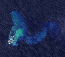
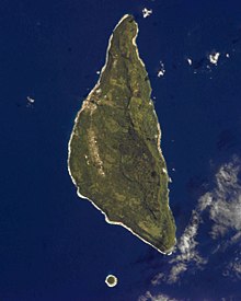
The islands of volcanic origin are 'Ata, Ha'apai and Kao. These islands form a volcanic arc that extends from the south - starting from the island of 'Ata - to the southeast, north and northwest. In more recent times, various active geological processes occurred within this arc that led to the formation of some new islands, however, only one of them has not sunk.
The island of Vava'u has intense volcanic activity and its soil is only composed of calcareous stones, in addition to being surrounded by reefs. The island of Ha'apai also has intense volcanic activity and low relief, and like Vava'u it has calcareous stones. The islands of Tongatapu and 'Eua are of calcareous origin. The former is characterized by a flat relief, since its highest hills do not exceed 30 m s. n. m. The coral base of the island is covered by a layer of volcanic ash three meters deep.
Over the last hundred years, more than thirty-five volcanic eruptions have been recorded in the country. One of the largest volcanoes in Tonga, with 515 m s. n. m. and 5 km wide, it is located on the island of Tofua. The last eruption recorded by this volcano occurred on March 18, 2009. The highest volcano in the country, whose summit is at 1030 m s. n. m., is located on the island of Kao.
The islands of Tonga contain large deposits of minerals, especially Tongatapu and Vava'u. In 2008, large deposits of zinc, copper, silver and gold were found in its territorial waters.
Floors
The soil in much of the islands is characterized by its fertility, except in the areas that have the newest volcanoes. These were formed mainly from the fall of andesitic volcanic ash that rested on a coral and calcareous platform. These soils have certain physical properties: they are friable, well structured, with good drainage and moderate water retention capacity. Soil types vary from acidic to alkaline, with high calcium and magnesium content, high cation exchange capacity and base saturation.
The soils of Tongatapu Island are very fertile, suitable for agriculture and livestock, in some coastal areas they are sensitive to salinity. The soils of the island of 'Eua are more productive, except for some areas in the south of the island, which have a coral rock surface. In Ha'apai, there are groups of islands predominantly of coral origin. A serious problem is soil erosion, which significantly reduces its fertility.
Climate
Tonga's climate is tropical, influenced by the trade winds of Southeast Asia. The rainfall regime is largely related to the South Pacific convergence zone. There are two distinct seasons: the rainy season and the dry season. The first, also known as the cyclone season, runs from November to April, and the second runs from May to October. The rainiest months of the year are January, February and March, each registering up to 250 mm of rain.
The average temperature varies between 26 to 23 °C. During the rainy months – November to April – the temperature generally ranges from 25 to 26 °C, while in the coldest and driest months – May to October – it ranges between 21 and 24 °C. The temperature difference on the islands in the north it is generally less pronounced than in the southern islands. The maximum temperature recorded in the country was 35 °C, in Vava'u, on February 11, 1979. Meanwhile, the lowest temperature was 8.7 °C, recorded on September 8, 1994 in Fotuha'a. The predominant winds are from the east towards the south, which blow from May onwards.
| Month | Ene. | Feb. | Mar. | Open up. | May. | Jun. | Jul. | Ago. | Sep. | Oct. | Nov. | Dec. | Annual |
|---|---|---|---|---|---|---|---|---|---|---|---|---|---|
| Temp. max. abs. (°C) | 32 | 32 | 31 | 30 | 30 | 28 | 28 | 28 | 28 | 29 | 30 | 31 | 32 |
| Average temperature (°C) | 28 | 29 | 28 | 27 | 26 | 25 | 25 | 24 | 25 | 25 | 27 | 27 | 26.3 |
| Average temperature (°C) | 25 | 25 | 25 | 24 | 23 | 21 | 21 | 21 | 21 | 22 | 23 | 23 | 22.8 |
| Temp. medium (°C) | 22 | 22 | 22 | 21 | 20 | 18 | 17 | 18 | 17 | 19 | 20 | 20 | 19.7 |
| Temp. min. abs. (°C) | 16 | 17 | 15 | 15 | 13 | 11 | 10 | 11 | 11 | 12 | 13 | 16 | 10 |
| Rains (mm) | 130 | 190 | 210 | 120 | 130 | 100 | 100 | 130 | 110 | 90 | 100 | 120 | 1530 |
| Days of rain (≥ 1 mm) | 11 | 13 | 14 | 12 | 12 | 10 | 10 | 12 | 10 | 10 | 10 | 10 | 134 |
| Relative humidity (%) | 77 | 78 | 79 | 76 | 78 | 77 | 75 | 75 | 74 | 74 | 73 | 75 | 75.9 |
| Source: Weatherbase | |||||||||||||
Hydrography

The archipelago has a limited number of permanent sources of fresh water. Although water is retained in the soil due to its porosity, residents often use rainwater collected in concrete-roofed tanks or small wells, allowing them to have access to some drinking water. Most of the lagoons, lakes and streams are located on the volcanic islands. Vaipūua is the largest lake in Tonga and is located on the island of Vava'u. However, the most important sources of fresh water are found in Niuafo'ou, Nomuka and Niuatoputapu.
Flora and fauna

In general, the islands of Tonga are covered with lowland rainforests. Because in the past several sections of the tropical forest were granted for agricultural use, a part of this territory is covered by secondary vegetation dominated by grasslands and sorghum and millet meadows. Coastal zones and areas of volcanic craters are dominated by herbaceous plants. In the archipelago there are two national parks—one in 'Eua and another in Vava'u—and six nature reserves.
There are 770 species of vascular plants recorded in Tonga, including seventy species of ferns (three of which are endemic), three types of gymnosperms (of which one, Podocarpus pallidus, is endemic) and 698 species of angiosperms, nine endemic. Species diversity varies from island to island; For example, on the island of Tongatapu there are about 340 species of plants, while on Vava'u there are 107 species.
The country's native fauna is extremely poor and consists mainly of introduced species. In the archipelago there are twelve species of reptiles (one of them endemic) and two species of bats, the only mammals native to the islands. In the coastal region you can find sea turtles, mollusks and various fish. There are still a large number of birds, 73 species recorded, of which two are endemic: Pachycephala jacquinoti, which lives in Vava'u, and Megapodius pritchardii, inhabitant of Niuafoou. As a consequence of human occupation of other Tongan islands, outside of Tongatapu and Vava'u, at least 23 species of birds became extinct.
Geographical data
Coordinates: 20°00′S 175°00′W / -20,000, -175,000

Area:
total:
748 km²
land:
718 km²
water:
30 km²
Border length: 0km
Length of coasts: 419 km
Marine accidents:
continental platform:
200m deep
exclusive economic zone:
200 nm (370.4 km)
marine territory:
12 minutes (22.2 km)
Climate: tropical; altered by trade winds; warm season (December to May), cool season (May to December)
Land: Most islands have a limestone base that originated from uplifted coral formations; the rest consist of limestone on a base of volcanic origin
Land elevations:
lowest point:
Pacific Ocean 0 m
highest point:
unnamed place in Kao with 1,033 m
Natural resources: fish, fertile ground
Land use:
arable land:
24%
permanent cultivation:
43%
permanent pastures:
6%
forest and jungle:
eleven%
others:
16% (1993 est.)
Irrigated lands: N/A km²
Natural hazards: cyclones (from October to April); earthquakes and volcanic activity in Fonuafo'ou (Falcón Island) and Late'iki (Metis Island)
Tonga Protected Areas


There are 50 protected areas in Tonga, covering 96.5 km² of land area, 12.6% of the country, and 390 km² of marine area, 0.06% of the country's 668,055 km². Of these, 3 are national parks, 1 is a marine reserve, 1 is a nature reserve, 1 is a sanctuary, 11 are reserves, 3 are conservation areas, 14 are community conservation areas, 6 are special management areas, 6 They are multiple use conservation areas and 1 is unclassified.
National parks
- Eua National Park, 4.51 km2, 21°24′06′S 174°54′27′′W. It's Tonga's only national forest park. It is on the east coast of the volcanic and mountainous island of 'Eua. It forms a strip of about 800 m between the coast and a series of cliffs full of caves.
- Mounga Talau National Park, 5 ha, on the top of Mount Talau, of 131 m, on the island of Vava'u, next to the Port of Refuge. The Vava'u group is an archipelago north of Tonga with the typical sandy beaches, lagoons, coconut trees, pandanas palm trees and banana plantations.
- Tofua Island National Park, 54 km2. The island of Tofua is an active volcano that rises to 507 m above sea level. The island has 8 km of diameter and in the crater there is a lake at only 20 m of altitude. There are smokers north of the island. Here came the riot HMS Bounty in 1789.
Contenido relacionado
King's Cross Station
The town of the river
Paterna de rivera