Geography of the Democratic Republic of the Congo
The Democratic Republic of the Congo is located in the center of Africa. It is, together with Sudan and Algeria, one of the three largest countries in Africa, exceeding two million square kilometers.
Limits
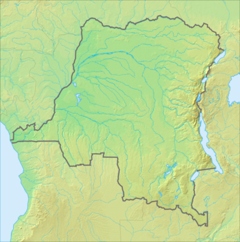
The Democratic Republic of the Congo is bordered to the north by the Central African Republic, to the northeast by Sudan, to the east by Uganda, Rwanda, Burundi and Tanzania, to the south by Zambia and Angola and to the west by the Republic of the Congo and the Atlantic Ocean. To the north, on the northern coastal border, the Democratic Republic of Congo also borders Angola, and more specifically with the Cabinda enclave.
Borders
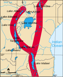
The border with the Republic of the Congo is made up of the Congo River practically in its entirety, although, in the border region between Matadi and the ocean, it is entirely land. The border with the state of Impfondo, in the Republic of the Congo, is established by the Ubangui River, which also serves as the border with the Central African Republic, as does its tributary the Bomu River. The Ubangui River is in turn a tributary of the Congo River. On the border with Uganda are two important lakes, Lake Albert and Lake Eduardo. On the border with Rwanda, between Bukavu and Goma, is the beautiful Lake Kivu. Further south, along part of the border with Burundi, and along the entire border with Tanzania, is Lake Tanganyika. This lake extends from the city of Uvira to the south. These lakes make up, together with Lake Victoria, where one of the branches of the Nile is born, what is known as the region of the great lakes of Africa, which experts suspect that, as happened with the Mozambique channel, that opened up and caused the separation of Madagascar, within a few years the lakes will join to form an opening that separates the east from the continent (Mozambique, Tanzania, Rwanda, Burundi, Kenya...).
Relief
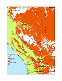
The relief of the DRC is characterized by a central depression drained by the Congo River and its tributaries. This immense basin has an average altitude of 400 m, and the lowest point, at 340 m, is in the region of the Tumba and Mai-Ndombe lakes. It is surrounded by a series of staggered plateaus of different heights and large mountains in its easternmost part. To the west, at its lowest point, it meets the Sierra de Mayombé, a low-lying mountain range that runs along the coast from the Angolan border to Lambarené in Gabon. This eroded range of sandstone and limestone, which actually looks like a plateau with an average height of 600-700 m, culminates in Mount Fongouti, at 930 m. The Congo River crosses the mountains through a narrow pass, with some thirty waterfalls and rapids, and crosses a coastal plain formed by the Congo estuary and the alluvial lands of the river, which form a passage about 40 km long until its mouth. in sea.
Border relief
If we follow clockwise, starting at the mouth of the Congo River, moving northeast along the DRC border, we first find the border marked by the river itself with the Republic of the Congo, followed next by one of its tributaries to the north, the Ubangui River, which will mark the border with the Central African Republic (at an altitude of 360 m) until leaving it in the hands of one of its tributaries, the Bomu River. This last basin rises progressively to the Congo-Nile watershed, which marks the border with South Sudan to the northeast, at about 720 m in Ezo, and now descends to the south following the border with Uganda.
Eastern border, South Sudan, Uganda, Rwanda, Burundi, Tanzania
South Sudan is separated from the DRC by the Ironstone Plateau, a broad plateau of 800-1000 m and lateritic soils that culminates at 1,700 m, and is easily traversed along what is believed to have been the expansion route of the bantu
Continuing to the south, on the border with Uganda and in the same watershed, are the Blue Mountains, to the west of Lake Albert, which culminate in Mount Aburo, 2,445 m high and in whose western part is the Ituri forest.
To the west of Lake Albert begins the Albertine Rift, a western branch of the Great Rift Valley that will mark the border from the Democratic Republic of the Congo to Zambia. The Rift begins with the Ruwenzori mountains, a large chain of mountains with the highest peaks in the country, including Mount Stanley or Margarita, at 5,109 m, and Mount Emin, at 4,798 m, where there are even glaciers. To the east of this great massif is the national park of the Ruwenzori Mountains, the mountains of the Moon, with peaks that border 5000 m in Uganda.
Continuing south, on the border between Uganda and Rwanda, are the Virunga Mountains, made up of eight volcanoes culminating in Mount Karisimbi, 4,507m. There are two still active volcanoes, Mount Nyiragongo, 3,470 m (eruption 2002), and Mount Nyamuragira, 3,058 m (eruption 2014), both in the DRC. The entire region is sparsely populated due to earthquakes, volcanoes, the jungle, very dense and rainy in this part, and wars. To the south of the Nyiragongo volcano is the city of Goma. From here, the border passes into the eastern part of the mountains, crossing Lake Kivu from north to south facing Rwanda to Bukavu and then following the valley of the Ruzizi river, facing Burundi, and the hinterland of Lake Tanganyika, facing Tanzania., until reaching Zambia, in the extreme south, where it turns to the west.
To the west of the region between Lakes Kivu and Lake Tanganyika lie the Itombwe Mountains, an extension of the Ruwenzori Mountains where the two branches of the Rift, eastern and western, merge. The highest peak is Mount Mohi, at 3,475 m. Following the western edge of the Ruzizi River and Lake Tanganyika, which is 770 m above sea level, are the Mitumba Mountains, where Mount Kahuzi stands out, at 3,308 m, and Mount Biéga, at 2,790 m, extinct volcanoes. The western slope, for its part, where the Itombwe forest or jungle is located, gently descends towards the Congo basin. Here the Lualaba River is born, which will later be the Congo River. The southern half of the mountain range does not exceed 1900 m. Its continuity facing the lake are the Muganja Mountains, which reach 2,000 m, and the Marungu Mountains, which reach a maximum height of 2,400 m.
Southern border, Zambia, Angola
Upon reaching Zambia, at the southern part of Lake Tanganyika, the border turns sharply west to Lake Moero, 990 m, separated from the Congo Basin by the remnants of the broad North Katanga Plateau: The Kundelungu Mountains, which have altitudes between 1,200 and 1,700 m, above the lake, and further north and west, the Kibara Mountains, which culminate at 1,850 m, separated from the Mitumba Mountains, to the east, by the Lufira River. Two parks are found in this region: Upemba National Park, in the Kibara Mountains to the north, and Kundelungu National Park, bordered on the south by the Luapula River, which joins Lake Moero with Lake Bangweulu, following the border of the DRC with Zambia. Lake Moero empties to the north into the Luvua River, which skirts the Kundelungu Mountains and the Kibara Mountains to join the Lualaba River, which will become the Congo River after the Boyoma Falls.
To the west of Lake Moero, in Upper Katanga Province, which extends southward into Zambia, is the Katanga Plateau, averaging 1,200 m in altitude, a region rich in copper and uranium. The city of Sakania, in the far south, next to the border copper mines, is 1,278 m high. The city of Kambove, north-west of Katanga, with copper and cobalt mines, is located at 1,450 m elevation. On this plateau, the Lufira River is born, which will later become the Lualaba. The mountains continue west outlining the Zambian border and descend into the Angolan border outlined by the Kasai River, which flows south to north in Lualaba province from Angola. The border with Angola is marked by the channels of several rivers that flow from south to north, the Kwango River, in the center, the Cuilo or Kwilu River, in the center-east, and the Kasai River, to the east, separated by various mountain ranges that form the northern border of Angola and the southern border of the DRC. West of the Kwango River, the border runs straight west to the coast.
Geology
Geologically, the DRC is very old, billions of years old in most of the rocks. The country encompasses the Congo craton, a stable section of the ancient continental crust, deformed and influenced by various mountain systems due to various orogeny, sedimentation, volcanism and recent geological effects caused by the Great Rift Fault in the east. This tectonically complicated past has created vast deposits of gold, diamonds, coltan, and other valuable minerals.
Archaic soils of the Congo Craton occur in the Kasai region, as part of the Angolan Shield, in the western Congo Basin, and as granite and greenstone belt in neighboring Central African Republic, Uganda, and South Sudan.
At Kasai, the metamorphic substrate of the Angolan shield appears at 4 degrees south latitude with migmatite and gneiss rocks from the Phanerozoic 541 million years old. The oldest rocks in the DRC (and Angola) are the granodioritic gneisses of the Lunda Kasai Paleoarctic shield, in Upper Luanyi, which contain pegmatites metamorphosed to amphibolite of metamorphic facies 3.4 billion years old.
The western Congo belt was formed during the pan-African orogeny that formed the Chaillu Mountains between Gabon and the Republic of the Congo, with various types of granite, 2.7 billion years old.
The Congo or Kasai craton occupies the entire central part of the country. The rock only emerges to the northeast and east, where gneiss and granite are common as part of the greenrock belt, which are basalts and metamorphosed sedimentary rocks in which green color occurs, such as chlorite, amphibolite, and other amphiboles, among 2,600 and 2,800 million years. In the easternmost part is the Tanzania craton. In this eastern part are the coltan reserves shared with Rwanda and Burundi.
In the southeast, the Luphilian arc or belt separates the Congo craton from the Kalahari craton to the south. The Lufilian belt, which stretches between Angola, Katanga province, southeast DRC and northwestern Zambia, for 800 km, was formed during the pan-African orogeny and is of great importance for its copper and cobalt deposits.. The Katanga and Zambia copper belt within the Lufilian arc contains more than half of the world's cobalt reserves and 12% of the copper reserves, some 4.8 million tons of cobalt, of which 3.1 million are in the DRC.
The central basin of the Congo, for its part, is covered with river sediments during the Lower Cretaceous and Upper Jurassic, forming the Kamina, Lualaba and Kwanga series, the latter from the Upper Cretaceous.
After a long period of calm, volcanism began in the upper Cenozoic in the western branch of the East African Rift, at the same time as eruptions began in the Kenyan Rift. The oldest basalts in the Virunga Mountains are 14 million years old.
The Wembo-Nyama ring structure at Omeonga is a circular-shaped depression 30 km in diameter that could be an impact crater caused by a meteorite.
Hydrography
The Congo River
The Congo River determines the entire geography of the country, as it forms an arc that runs through it completely, between the mountains of the African Rift and the Atlantic Ocean. It has a length of 4,700 km, the second in Africa, after the Nile, a basin of 3.8 million km² and a flow of 50,000 m³/sec, the second in the world after the Amazon. Due to its position astride the terrestrial equator and the almost homogeneous distribution of its tributaries on both sides of it, it becomes one of the great rivers with the most regular flow in the world. This can range from 1 to 3, while that of the Amazon varies from 1 to 200. The Congo River has considerable economic importance, as a means of communication, with a network with its tributaries of 14,166 navigable km, and as a potential source of electricity., although it is still little used.
Given the size of the territory, it is very diverse. First of all, it must be said that the Democratic Republic of the Congo has a small outlet to the sea, although it does not have important ports in it. The country's main port is located at Matadi, on the Congo River. This river is navigable in its final stretch, although boats cannot go up it to Kinshasa, the capital, since between it and Matadi there are some insurmountable waterfalls for boats, the Livingstone Falls. The Congo River serves, together with a tributary of it, as the border with the Republic of the Congo and with the Central African Republic. In addition, in its final stretch it serves as the border with Angola. Kinshasa, the country's capital, is also its largest city with more than two million inhabitants. It is located on the banks of the Congo River, just opposite the capital of the Republic of the Congo, Brazzaville. The capital, therefore, is located in the west of the country.
The Congo rises south of Katanga, in the town of Musofi, at an altitude of 1,435 m and bears the name of Luabala up to Kisangani. It flows into the sea through a wide estuary and its flow is so great that its waters can be recognized up to 45 km in the middle of the ocean.
Lakes and reservoirs
There are numerous lakes in the Democratic Republic of the Congo and little information about their characteristics. Most have tectonic origin. This is the case of the Tanganyika, Eduardo, Upemba and Moero lakes, which occupy the bottom of tectonic trenches. Lake Alberto is outside the norm, since it already existed in the lower Miocene, and the others have developed in the Quaternary. Lake Moero appears to be in a branch of the East African Rift.
The shape of the lakes is the one that corresponds to their tectonic origin, elongated shape in a depression surrounded by escarpments, slightly indented shores, absence of islands, great depth. The exception is Lake Upemba, an example of a swamp basin whose depth ranges from 0.50 to 3.25 m.
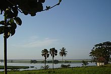
Beyond the tectonic lakes lie another series of basin lakes, including Mai-Ndombe Lake, Tumba Lake, Fwa Lake, and others. They are considered the remnant of a larger lake, which would have occupied part of the basin for a short period in the history of the Congo River. They are shallow, 4 or 5 m, and their shores are swampy.
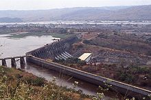
On the other hand, a process of creating important reservoirs is underway. Of particular note are the Inga dams in the Bajo Congo province, near the city of Matadi. Inga I entered service in 1972, with 352 MW, Inga II entered service in 1982, with 1,424 MW. The Inga III and Inga IV projects are underway, the first two are operating at 20 percent of their capacity.
Climate
One-third of the Democratic Republic of Congo lies north of Earth's equator (5.o N) and two-thirds south (13.o S). The climate is hot and humid in the river basin and cool and dry in the southern highlands, with a cool, alpine zone in the Ruwenzori Mountains. The average rainfall for the whole country is 1,070 mm.
Although, in general, the entire country enjoys high temperatures, it has a great variety of climates and landscapes, determined by the influence of the Atlantic Ocean, to the west, and by the trade winds of the Indian Ocean, the convection of the equatorial zone and the mountains to the east.
Around the equator, the temperature does not normally drop below 20.oC. In the periphery, on the other hand, the nights are cold. In the northeast and southeast, plateau and mountain regions, altitude significantly modifies the climate. The temperature averages 25.oC in the Congo Basin, 26.oC on the coast, 18.oC to 20.oC at a height of 1500 m, 16.orC at 17.oC at 2,000m, 11.oC at 3,000 m and 6.oC at 4,000 m.
The rains, constant at the equator (in Kisangani an average of 1,890 mm falls on 141 days a year, with maximums in March-May and October-November, as the sun passes), are distributed progressively according to two seasons as the we walk away to both sides. To the north, the rainy season lasts from March to the end of October; the dry season lasts from November to early March (in Gemena the fall is 1,650 mm in 136 days with a drier dry period in December and January) South of the equator, the rhythm of the seasons is exactly the opposite (in Kinshasa the fall is 1,387 mm in 106 days with a dry period between May and September). In the eastern highlands, the two dry seasons last less than a month, in January and July (in Goma, 1,265 mm falls in 190 days). In the south and southeast of Katanga, the rainy season begins in mid-October and lasts until mid-May (in Lubumbashi, 1,240 mm falls in 124 days with a very dry season between May and September). In northern Katanga and southern Kasai, the rains begin in early October and end in late April, with a short dry season in January (in Kalemie, 1,090 mm falls, with a very dry period between June and September). The three dominant climates are equatorial, tropical, and montane.
In the driest part of the coast, the Benguela current prevents the formation of clouds and favors the creation of low clouds. In Banana, 780 mm fall in 58 days with a very dry season between May and October.
The forest covers 67% of the territory; Of the estimated 155 million hectares, 99 million are humid forest. Deforestation, relatively moderate, is extensive around Kinshasa and other large cities. Agriculture depends on the existence of forests and the fight against climate change involves their conservation.
In recent years, some degradation of the forest in the Democratic Republic of the Congo has been observed due to decreased rainfall and rising temperatures. On the other hand, the influence of the Congo forest on the climate of the region and, probably, of the whole world is undoubted.
Population dispersal
The Democratic Republic of the Congo is characterized by the dispersion of its population, because despite exceeding two million square kilometers it only has around fifty million inhabitants.
Vegetation
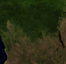
In the north of the country, in the region between the Congo River and the Central African Republic, is the second largest jungle in the world, which reaches its maximum impenetrability in the vicinity of Mbandaka, especially near the national park of the Salonga (north and south), and of the city of Kiri. Another important city in the north of the Democratic Republic of the Congo is Kisangani, the largest of all those in the north of the country.
WWF divides the territory of the DR Congo into sixteen ecoregions:
- Mosaic of jungle and savannah in the north of the Congo.
- East Sudanese savanna, northeast.
- Atlantic equatorial coastal jungle, at the west end.
- Mangrove Central Africa, in the mouths of the Congo River.
- North-Eastern Congo Basin Jungle, north-east of the Congo Basin.
- Banana Jungle of the Western Congo, on the western shore of the Congo.
- East Congo swamp forest on the eastern shore of the Congo.
- Selva de tierras baja del Congo central, en el centro de la Cuenca del Congo.
- Mosaic of jungle and savannah of the western Congo.
- Mosaic of jungle and savannah of southern Congo, in the south of the Congo basin.
- Mounted jungle of the Albertina fault and paraamo of the Ruwenzori and Virunga mountains in the eastern mountains.
- Mosaic of jungle and savannah of Lake Victoria Basin on the border with Uganda.
- Treeed savannah of miombo from Angola, in the southwest.
- Treeed savannah of central Zambeze miombo, southeast.
- Matorral de Itigi and Sumbu, in a small enclave next to Lake Tanganica, on the border with Zambia.
- Zambeze's flooded mountain range, in a small area of the southeast, on the border with Zambia.
Mining areas
In the center of the country are the cities of Kananga and Mbuji Mayi, which are important mining centers (especially the first one).
All of the inland regions described so far, those that extend from Kinshasa east through the center and north of the country, lie in the well-known Congo Depression, and therefore at low altitude. The highest regions of the country will be described below.
Protected areas of the Democratic Republic of the Congo
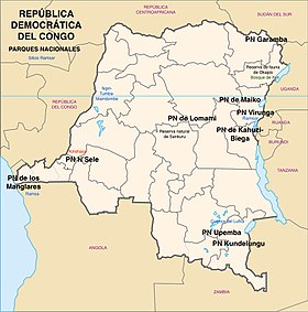
In the DRC there is a protected area under some concept of about 324,290 km², about 14% of the territory, 2,344,858 km². Among these protected areas there are 10 national parks, 10 hunting areas, 10 nature reserves, 2 wildlife reserves, 1 community forest, 1 primate nature reserve, 3 biosphere reserves, 1 comprehensive nature reserve, 1 scientific reserve and 2 protected areas. not named. Among them there are 3 UNESCO biosphere reserves, 5 World Heritage Sites and 4 Ramsar sites.
- Virunga National Park, 7,800 km2, World Heritage Site
- Salonga National Park, 36,000 km2, World Heritage Site
- Mangrove National Park, 768 km2, Ramsar site
- Maiko National Park, 10,885 km2
- Lomami National Park, 8,879 km2
- Kundelungu National Park, 7,600 km2
- Kahuzi-Biega National Park, 6,000 km2, World Heritage
- Garamba National Park, 4.920 km2, World Heritage Site
- Upemba National Park, 13,674 km2
- N'Sele National Park, 34,38 km2
The Okapi Wildlife Reserve is the fifth World Heritage Site. It covers 14,000 km², is located in the northeast of the country, occupies a fifth of the Ituri forest and is affected by the violence of the Mai-Mai militias, which is why it is considered a threatened area.
Ethnic groups of the DRC
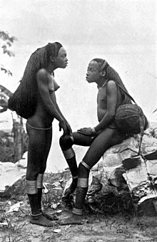
More than 200 different ethnic groups have been identified in the DRC, most of which belong to the Bantu people, which is made up of more than 400 ethnic groups scattered throughout central Africa, from Cameroon and Somalia in the north to the south of the continent. In addition, more than 200 different languages are spoken. The most important Bantu groups are the Kongo; the Luba, and the Mongo, of which there are supposed to be more than 10 million in each case. The population census in the DRC is very limited and the number of members of each ethnic group is made according to estimates with a very wide margin.
Major ethnic groups
- Bantu..............................................
- Kongo. More than 10 million, concentrated in the southwest of Pool Malebo and west of the Kwango River in the Democratic Republic of the Congo; in Punta Negra, in the Republic of the Congo, and north of Luanda, in Angola.
- Luba. More than 10 million. They live in the provinces of Katanga, Kasai and Maniema, central and southern DRC.
- Hemba. About 90,000. They live south of Kasai and north-east of Zambia.
- Lulua. About 9.5 million, settled in the Lulua River valley in the province of West Kasai. Related to the Chokwe and the songye.
- Mongo. More than 10 million. They speak the Mongo language, a Bantu language. Most are Christians. They live in the north of the country around the Kasai and Sankuru rivers, south of the Congo River. They include numerous ethnic groups, including bokote, ekonda or konda, bolia, sengele, ntomba, ndengese, songomeno, mbole, bongandu, buoyela, nkutu and tetela-kusu. They cultivate bananas, cassava and collect wild products, hunt and fish.
- Konda, about 2.7 million.
- Chokwe or kioko About 1.13 million. Shared between DRC, Angola and Zambia amount to about 2.95 million.
- Lingala. Nearly 4 million in the DRC, although there are about 15 million native speakers of the lingala language concentrated in Kinshasa, Brazzaville and northern DRC, and about 70 million members of the lingala language group.
- Azande. About 1.8 million. Most Christians, with 30% evangelicals. They speak the Zande language. Delivered by the north-east of the DRC, South Sudan and the Central African Republic. They live in adobe houses with the straw roof, with a patio and a garden where they can cultivate pineapples, mangoes, oranges, bananas and sugar cane, as well as corn, rice, sesame, cassava and boniatos.
- Alur. About $1.15 million, nilotics. In north-west Uganda and north-east of the DRC.
- Lega or shabunda rega. About 1.1 million. They live in eastern Congo, in the most humid areas.
- Lendu or baledha. About 1.4 million. They live east of the DRC, northwest of Lake Alberto, in the Ituri region, in the Eastern Province. They speak the Lendu language, a Swedish language.
- Songye. More than 2 million, in the Eastern Province, in the Lualaba River valley, although censuses are very variable.
- Mangbetu or amangbetu. About 1.6 million. They live in the Eastern Province. They speak the Mangbetu language, a South Asian language.
- Mbaka. About 1.7 million, although the 1999 census was around 300,000. They live in the northwest.
- Ngbandi. About 400,000. Mobutu Sese Seko belonged to this group. It's a South Asian town.
- Logo. Over 400,000. In the northeast, in the province of Alto Uele.
- Lugbara. Over 500,000. In the western Nile region, north-west Uganda and DRC, in the Eastern Province. They speak the Lugbara language.
- Pygmy peoples of the DRC. There may be some 600,000 pygmies in the DRC forests.
- Mbuti or bambuti. From 30,000 to 40,000. Forests of the northeast of the DRC, in the Ituri forest. Hunters-gatherers.
- Twa. The Twis are a people who live in various countries, mixed with the banana agricultural populations, in Congo, Uganda, Angola, Namibia, Zambia and Botswana.
- Baka. They live mainly in Cameroon, Central African Republic and Gabon.
Contenido relacionado
Aegean Sea
Saitama Prefecture
Cabezabellosa de la Calzada
