
Garonne River
The Garonne River (French: Garonne; Occitan: Garonne; Catalan: Garonne) is one of the great rivers of Western Europe, one of the most important on the Atlantic slope. It was born in Spain and runs mainly through France. With a length of 568.9 km —with 47 km in Spain and 521.9 km in France without counting the estuary, according to the Sandre— it is the 3rd river on the French Atlantic slope, the 5th in the country and the 34th.º of Europe. It drains a large basin of 55,846 km² —the 52nd European— and with more than 55,000 km² drained in France, the 4th largest in the country.
It was born in the central Pyrenees, in the Arán Valley, province of Lérida, Spain. Already close to the sea, in the vicinity of Bordeaux (Gironde) France, the Garonne meets the Dordogne, forming between them the Gironde estuary, which is about 65 kilometers long and flows into the Bay of Biscay (Atlantic).
In France, the river flows through two regions —Occitania and New Aquitaine— and 4 departments —Haut-Garonne, Lot-et-Garonne, Tarn-et-Garonne and Gironde —, giving names to three of them. It passes through two major regional capitals—Toulouse (Haute-Garonne)(466,297 inhab.), the capital of Occitania, and Bordeaux (Gironde) in France. (239,157 inhab.), capital New Aquitaine—, in addition to bathing other important cities (downstream): Montréjeau (2872 hab.), Saint-Gaudens (11,255 hab.), Muret (24,975 hab.), and Blagnac (23,416 hab.), in the Haute-Garonne, France; Verdun-sur-Garonne (4,660 inhab.), Castelsarrasin (13,765 inhab.), in Tarn and Garonne, France; Agen (34,126 pop.), Tonneins (8,973 pop.), Marmande (17,748 inhab.), in the Lot-et-Garonne, France; and La Réole (4,091 hab.) and Langon (7,396 hab.), in the Gironde, France.
In Spain it runs through the Valle de Arán, in the province of Lérida. It crosses the towns of Salardu, Arties, Vielha, capital of the region, Bossost and Lés.
It is a very mighty river because it receives the waters of the Pyrenees and then, on its right bank, those of the French Massif Central, mainly through the Lot and the Tarn. It has ten tributaries over 100 km long—Lot (485 km), Tarn (380 km), Baïse (188 km), Gers (175 km), Ariège (163 km), Save (148 km), Gimone (136 km), Dropt (132 km), Arrats (131 km) and Louge (100 km)—, plus eight other tributaries of that length —Aveyron (291 km) and Agout (194 km), tributaries of the Tarn; Viaur (168 km), a tributary of the Aveyron; Truyère (167 km) and Célé (104 km), tributaries of the Lot; Hers-Vif (135 km), a tributary of the Ariège; Osse (120 km), a tributary of the Gélise and sub-tributary of the Baïse; and Dadou (116 km), a tributary of the Agout.
The river in its French course has been almost totally conditioned, both for irrigation and the production of electrical energy as well as to avoid flooding in times of flooding, which has allowed safe navigation in a large part of its course, with important river ports —Bordeaux, Agen or Toulouse— and even a river cruise service. The Garonne plays a very important role in inland navigation as it allows ocean-going ships to reach the port of Bordeaux and thanks to a side channel of the Garonne —opened in 1856 with 193 km long—, the barges go upstream to Toulouse and, through the Canal du Midi, reach Sète and the Mediterranean coast. The tide is felt as far as Casseuil, 12 km upstream of Langon.
From the Pyrenees to Bordeaux (Gironde) France, the river has been conditioned for the production of hydroelectric power (there are 37 power plants) and more recently, two nuclear power plants have been built in its lower course, one in the estuary, in Blayais (1976) and another in Golfech (1991).
Its average annual flow, measured at Mas-d'Agenais, is 631 m³/s (more than the Seine at its mouth), which reached its maximum on March 5, 1930 at 5700 m³/s. The Garonne is the 4th largest river in France and the second of the European rivers that flow directly into the Atlantic coast, after the Loire (without considering those that flow into the North, Baltic and White seas). It has well marked seasonal fluctuations, but not excessive. The high waters correspond to winter and spring and the dry season goes from July to October, both inclusive, with a decrease in the average monthly flow to 190 m³/s in August, a flow that is still considerable. However, the fluctuations in the flow are more important depending on the year, or those observed during short periods. The strongest floods have been those of 1835, 1855 and 1875. On June 18, 2013, the Garona overflowed due to heavy rains and snowmelt, affecting a large part of the populations of the Aran Valley, causing losses of more than 20 million euros.
The Garonne is one of the few rivers in the world that has a tidal wave (tidal bore or mascaret). Surfers can ride the tidal wave to the town of Cambes, almost (100km) from the Atlantic Ocean coast. The Dordogne also has this phenomenon.
Origin of name
The name "Garona" comes from Garumna, which apparently contains the Aquitanian word -unn, onna, &# 39;source, river' and which is found in the name of several western European rivers such as Seine or Saone. In Latin sources it appears as Garunna (Garuna) (Julius Caesar, for example, collects it as Garumna).
Another hypothesis suggests that «Garona» would come from the proto-Basque gar and ona. 'Gar' refers to 'water' (as in garbi or garoa) and ona means 'good'. This hypothesis is reinforced by the place where it has traditionally been marked as the source of the river: La Bonaigua.[citation required]
Geography
The course of the Garonne

The Garona can be considered divided into several parts, which in the downstream direction are the following:
- a mountain tour towards S-N, from its formation in the Spanish Central Pyrenees;
- a piedemonte route of direction O-E, along the central pirenaica chain;
- a first tour of SO-NE direction plain, to the confluence with the Ariège and the city of Toulouse;
- a second tour of SE-NO direction plain to the city of Bordeaux;
- the mouth from the city of Bordeaux and the confluence with the Dordogne to the Gulf of Gascogne.
The triple point between the three dividing lines of the Garonne, Loire and Rhône basins is located in the Lozère department, at a "summit" from Mount Planas (44°33′12″N 03°43′23″E / 44.55333, 3.72306, elevation: 1271 m) in the commune of Allenc very close to the border with that of Belvezet, northwest of the "Carrefour de la Pierre Plantée" with a nearby menhir.
Birth and course in Spain
Traditionally, the peak located in the Pla de Beret known as the Uelh deth Garona has been accepted as the source of the river, but in view of the cartographic data (National Topographic Map, series 1: 25,000) it seems more appropriate to consider the Saboredo cirque and the Ratera lakes, where the Ruda river is born at 2580 m a.s.l., as the authentic source. no. m., to arrive after 12 km of travel to the Pont deth Ressèc (confluence with the Aiguamog and drainage of the Uelh deth Garona). The riparian forest of the upper course of the river in Spain is protected under the name of Ribera del Garona.
Lately, the opinion has become popular that the Garona rises at the foot of the Aneto peak, in the Forau de Aigualluts sinkhole where the meltwater filters to rise again to the surface through the Uelhs deth Joeu , in Lin's Artiga. The route of the Joeu from Aigualluts to Artiga de Lin is a curious karstic phenomenon discovered in 1931 by the French geologist Norbert Casteret, who, pouring 60 kg of fluorescein into the Aigualluts chasm, verified that the colored water reappeared in the aforementioned Uelhs deth Joeu (Artiga de Lin, Aran Valley), at a distance of almost 4 km in a straight line.
However, available cartographic information shows that:
- The height of the Aigualluts basin (2000 m. n. m.) is lower than that of Saboredo (2500 m. n. m.). In addition, the Joèu confluence point with the main valley is also much lower (800 m) than the Ruda (1500 m. n. m.).
- The Aigualluts-Las Bordas route is 11.5 kmwhile that of Saboredo-Pont deth Ressèc is 12 km.
- The average annual flow from the Joèu River (Aigualluts drain) to the main channel is (2,16 m3/s, while at the point of confluence, the Garona already carries 17,17 m3/s.
The data referring to the Ruda-Garona are practically identical if applied to the Aiguamog river, although the point of confluence of said river with the main valley is somewhat lower than that of Ruda-Garona. Thus, if the criteria for the height of the first permanent flow, its course, and the average flow provided are met, the Saboredo cirque and the Ratera pass are the birthplace of the Garonne.

Until entering French territory, after the Puente del Rey, the Garonne receives the main contributions of the Aiguamòg (I), Unhola (D), Valarties (I) Nere (I), Varradós (D), the aforementioned Joèu (I) and Torán (D), and passing through the main towns of the Aran Valley, such as Arties (476 inhabitants), Viella ( ="white-space:nowrap">5459 hab.), Bosost (1123 hab.), Lés (958 hab.) and Las Bordas (250 hab.).
- El Garona in Spain

Circus of Saboredo, one of the proposed places of birth of the Garonne, specifically the Ruda-Garona.

Forau d'Aigualluts, another of the alleged sources of the Garona

El Garona in Arties

View of the Garonne crossing Bosost
The Garona entering Lés


Course in France
Mountains and foothills

The river runs north, entering France at the Pont du Rei (in the commune of Fos, Haute-Garonne department) with a drained area to that point of only 521.9 km. The river will be accompanied on the right bank by the N-125 road and less than 1.5 km from the border there is a dam with a small reservoir, shortly before reaching Fos (with 247 inhabitants in 2014), where the river turns NW. It continues shortly through the small towns of Argut-Dessous (27 hab.), Arlos (97 hab. ) and Saint-Béat (393 hab.), a small town considered a «key to France» (clef de France) in which marble quarries have been exploited since Roman times, a white marble used especially in the reign of Louis XIV.
In Chaum (188 inhabitants) it receives, on the left bank, the first of its important tributaries, the Pique (from 32.9 km), descending from the Luchon massifs. From here, on the left bank, the river will be accompanied by another road, the D-825. It then passes the Garonne in this mountainous section through the small towns of Esténos (185 inhabitants) and Fronsac ( 202 hab.), where the ruins of a castle of the Counts of Cominges are preserved. Then its course marks, for a stretch of just over 15 km and intermittently, the departmental boundary between Haute-Garonne (E) and Hautes-Pyrénées (W). In this section the valley gradually changes to a landscape of gently wooded hills, passing through Galié (89 hab.), Bertren (210 rooms), Luscan (60 rooms), Loures-Barousse (611 rooms), Labroquère (328 rooms) and Valcabrère (146 hab.) —where the Saint-Just de Valcabrère basilica is preserved— on the outskirts of Saint-Bertrand-de-Comminges (237 hab.). The Garonne passes less than a kilometer, on the right, from the historic capital of the medieval county of Cominges, strategically located towards the Spanish ports and already populated since Roman times and at the crossroads with the Chemin du Piedmont, the Jacobean route that bordered the extreme north of the Pyrenees. In today's small town, a rich heritage is still preserved that attests to its past importance, such as the Cathedral of Our Lady.
- The Garona in its mountainous course

Plan d'Arem Dam, before Fos

The river crossing the town of Fos

The Garonne crossing Saint-Béat

El Garona at the limit of Valcabrère and Labroquère

View of the historic Saint-Bertrand-de-Comminges at the exit of the Pyrenean valley descending from the Garonne

The Cathedral of Our Lady, one kilometer from the Garonne


.JPG)


After passing through Seilhan (202 rooms) and Jaunac (137 rooms) —less than 1 km from the Gargas caves— the Garonne leaves the Pyrenees and immediately receives, in Gourdan-Polignan (1,223 inhabitants), the Neste (from 73km), who approaches him from the left. You immediately arrive at Montréjeau (2872 hab.), the first major town on its upper reaches. Located at an altitude of 468 m, this old bastide founded in 1272 under the reign of Felipe III, offers a superb panorama of the Pyrenean chain. Near the town is the château de Valmirande, a mansion from the XIX century classified in 1992 as a historical monument.
The Garonne changes direction to head northeast, in a winding route through the foothills, with abundant but short meanders, which runs through the central part of a wide valley (fluvial plain) that also takes advantage of several infrastructures: the A -64 to get to Toulouse and the D-817 (to Martres-Tolosan); and the SNCF branch from Tarbes to Toulouse, the route of which will follow the river from Gourdan-Polignan, changing banks several times. After passing the Garonne through the small towns of Huos (486 hab.), Ausson (561 hab.), Pointis-de-Rivière (851 hab.) —where a small dam allows water to be diverted through a side channel, the Camon channel—, Clarac (616 hab.), Bordes-de-Rivière (491 hab.) and Valentine (885 hab.), both very close to the south to the city of Saint-Gaudens (11 255 inhabitants), which was the economic capital of Comminge. A paper mill, Fiber Excellence Saint-Gaudens, was installed here in 1959, completely renovated in 1992. Another small dam has been built on the river to feed another channel that allows avoiding a rapids area.
The Garonne then continues its advance passing through Miramont-de-Comminges (776 inhabitants) and Estancarbon (616 inhabitants), to then receive, on the right bank, the river Ger (37.2 km). The river heads northeast and after passing through Lestelle-de-Saint-Martory (448 hab.) it reaches Saint-Martory (944 hab.), where a new diversion through a small dam allows water to be diverted to the Saint-Martory canal. The canal is a 71.2 km long irrigation canal built in 1866 and also intended as a navigation channel, although the inauguration of the railway made it unnecessary.
- The Garonne on the piedemonte before the Small Pyrenees
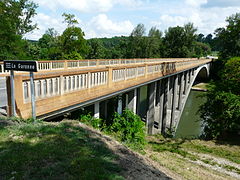
Gourdan Bridge in Gourdan-Polignan, a 19th-century bridge registered as a Historic Monument

Château de Valmirande, near Montréjeau

Bridge in Miramont-de-Comminges
Bridge in Saint-Martory

Church of Saint-Martory

.JPG)


.JPG)
Shortly the Garonne begins the short crossing of the Little Pyrenees, the western part of the Pre-Pyrenees, west of the Volp valley, and reaches Mancioux (442 inhab.) —where it receives the Noue river on the left (44.2 km)—, Roquefort-sur-Garonne (796 inhabitants) —where it receives on the right bank to Salat (78 km), descending from Saint-Girons— and Boussens (1122 hab.), where the Garonne carves a gorge to leave behind the last foothills of the Petit Pyrenees and soon reach Martres-Tolosane (2,288 hab.). Once again, another small dam makes it possible to divert water for a new lateral channel. The river continues its slow progress passing through Mauran (206 hab.), Cazères (4871 hab.)—another former bastide where another dam feeds another side canal—Gensac-sur-Garonne (401 hab.) and Saint-Julien-sur-Garonne (537 hab.), home to “Le Village Gaulois - L'Archéosite”, a small park on the banks of the river that recreates life in a small village gala.
- The Garonne in the plain before Toulouse

Derivation of water from the Saint-Martory canal
The channel of Saint-Martory in Boussens

The Garonne in Boussens
Bridge in Saint-Julien-sur-Garonne

The Garonne between Saint-Julien-sur-Garonne (izqda) and Rieux-Volvestre


Continue through Salles-sur-Garonne (554 hab.) —with another dam and a side canal where there is even a sailing club— and Carbonne (5377 hab.), where it receives the Arize river on the right (83.8 km). Between the two, on the other side of the river, a couple of kilometers away, the medieval city of Rieux-Volvestre overlooks the Arize with its old cathedral, a reflection of better times. Pass quickly by the small towns of Marquefave (997 hab.), Capens (997 hab.), Noé (2863 hab.), Mauzac (1228 hab.), Le Fauga (1960 inhab.) and finally the city of Muret (24,975 inhab.), at the confluence, on the left, with the Louge River (100.1 km). On September 12, 1213, the battle of Muret was held in the place, which made Muret enter history, a battle of the Albigensian crusade that changed the horizons on both sides of the Pyrenean border and saw the fate of the Occitans tilt. King Pedro II of Aragon, who had arrived to reinforce the local Occitan forces, died in Muret and this defeat of the Occitan-Aragonese troops heralded the annexation of Languedoc to the crown of France and the end of the Cathars.
The Garonne continues through Roques (4402 hab.), Roquettes (4182 hab.), Pinsaguel (2793 hab.) and Portet-sur-Garonne (9609 hab.), already in the suburbs of Toulouse, where it receives from the right one of its main Pyrenean tributaries, the one with the largest flow, the Ariège river (163.5 km). An area of the confluence of 579.07 ha has been protected since June 4, 2015 when it was declared the Garonne-Ariège Confluence Regional Nature Reserve ( Confluence Garonne-Ariège Regional Nature Reserve).
- The Garonne before Toulouse

Crossing Cazères

The Garonne in Salles-sur-Garonne

Jumelage Bridge in Carbonne
The river in Capens

Aerial view of the river in Mauzac

The river in Roques

Confluence of the Garonne (izqda.) and the Ariège (dcha.)


The crossing of Toulouse


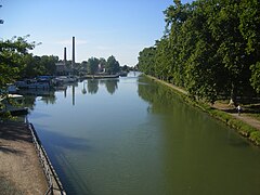
The Garonne reaches Toulouse from the south, with a wide channel between 100−200 m. It leaves in its course two large islands that have been urbanized: the Ramier islands (Empalot and Gran Ramier, where the Stadium is). There are many bridges that connect these islands and both sides of the city, beginning with the A-620 viaducts, the Poudrerie footbridge, the Croix de Pierre bridge (1966), the Saint-Michel bridge (1844, 1890, 1962), the New Bridge (1632), the Saint-Pierre Bridge (1852, 1931, 1987), the Catalans Bridge (1908) and the viaducts of the A-620 and A-621 and finally, the bridge from Blagnac, in the north of the city.
Between the Saint-Pierre bridge and the bridge of the Catalans, the Garonne is diverted, on the right bank, to feed the Brienne canal, which connects, a little more than 200 m and in Touluose itself, with the Port de l'Embouchure, which since 1681 has been connected to the Midi canal. In this interchange are the mouths ennobled by the Ponts-Jumeaux. With this connection, barges can go up the Garonne and, through the Canal du Midi, reach Sète and the Mediterranean coast.
The quays and banks of the Garonne were refurbished in the 18th century. The Henri Martin quays and the Tounis quays, built in brick, were built to contain the floods and allow you to walk along the river and discover the old bridges of Toulouse. Rightly considered the oldest bridge in the city, the Neuf Bridge, with a length of 220 m, is not only a masterpiece but also the first bridge that was able to withstand the many floods of the Garonne. A little further down the Garonne is the Bazacle, a crossable ford around which early Toulouse was founded. There is now a dam there to maintain a sufficient level of water in the Garonne during the summer months.
The river passes close to many historic buildings and spaces, such as the Meadow of Filters (where water was filtered for human consumption) and Le Château d'eau (a brick tower with a water reservoir), the School of Fine Arts, the former Hôtel-Dieu Saint-Jacques, the Hôpital de La Grave (a former hospice for plague patients), the Viguerie footbridge, the Basilique de la Dorada, Les Abbatoirs (museum of modern and contemporary art in the Raymond VI gardens.) or the Espace EDF Bazacle.
- Bridges in Toulouse

St Pierre Bridge

Bridge of the Catalans from the Raymond VI garden

New bridge

Saint-Michel Bridge

Bridge of Blagnac


From Toulouse to Bordeaux
The Garonne leaves Toulouse in an almost northerly direction, and after meeting the short River Touch (74.5 km) on the left, passes shortly through the city de Blagnac (23,416 hab.), today a suburb of Toulouse. Blagnac, where the Toulouse-Blagnac airport is located, is the headquarters of Airbus, and one of the main poles of the world aviation industry. The origin dates back to the Sud-Aviation factory facility that developed the Caravelle (1958), the Puma (1969) and the Concorde (1969). Now, in addition to Airbus and Avions de Transport Régional, there is an Air France Industries maintenance center and the aeronautical museum space, Aeroscopia (opened in 2015).
Then follows the Garonne through Beauzelle (6111 hab.) —with the Base de sports et loisirs des Quinze sols—, Gagnac-sur-Garonne (2933 hab.) and Seilh (3109 hab.), located at the confluence with the short Aussonnelle River (42.4 km), which approaches the Garonne from the left. Continue through Merville (5112 hab.) and Ondes (701 hab.) and, after meet the small river Hers-Mort (89.3 km) on the right, it passes in front of Grenade ( 8557 inhab.). Granade is an old bastide founded in 1290 that is the main administrative and economic pole of the Toulouse-Montauban axis and just outside this city, the Garonne receives the Save river from the left (148.4 km), just as you enter the Tarn-et-Garonne department.
- The Garonne after Toulouse
Lakes des Quinze Sols, in Blagnac, some old graves today place of recreation and recreation

Quick in Beauzelle
The Garonne from the walkway between Seilh and Gagnac-sur-Garonne

Save in Grenade-sur-Garonne, almost in confluence with the Garonne
.jpg)
.jpg)
.jpg)

In the Tarn-et-Garonne department
The Garonne continues its advance in a NW direction passing through Verdun-sur-Garonne (4660 inhabitants), Mas-Grenier (1366 hab.), and Bourret (849 hab.), very close to Montech (6158 hab.), on the banks of the Garonne canal, appreciated for its marina and its unique water slope (a curious water lift inaugurated in 1974 that drives a sheet of water on which the boat slides). The important city of Montauban is less than 10 km to the west, and can be accessed by navigating from the Garonne canal itself.
- The Garonne in Tarn and Garona

Pendant bridge in Verdun-sur-Garonne

Pendant bridge in Bourret

The Garonne in Bourret
Montech, on the banks of the Garona Canal

The two locomotives that make the Montech water slope work


The Garonne is then followed by Cordes-Tolosannes (348 hab.) —home to the Belleperche abbey, established in 1130/1140—, Castelferrus (483 hab.), Saint-Aignan (415 hab.) and Castelsarrasin (13,765 inhab.), where it meets the short Gimone River on the left (135.7 km). After passing through Saint-Nicolas-de-la-Grave (2,192 inhabitants), it then meets the River Tarn on the right (380.2 km), its second largest tributary, which has just passed through the town of Moissac (about (3 km, with 12,408 inhab.), coming from the Massif Central. right.
- The Garonne in Tarn and Garona

Belleperche Abbey in Cordes-Tolosannes

Recreation port Jacques-Yves Cousteau, in the Garona canal, opened in 1997 in the center of Castelsarrasin

The Garonne Side Channel in Moissac

Confluence of the Tarn and the Garonne, shortly before arriving at Boudou

The Garonne in Boudou
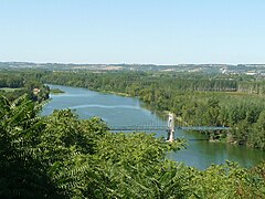
The river in Auvillar, with the hanging bridge

The hanging bridge of Auvillar

Golfech Nuclear Power Plant

The river in Lamagistère


The Garonne turns more and more to the northwest, passing through the small towns of Boudou (719 inhabitants), Malause (1122 hab.) —where the Golfech channel that feeds Valence d'Agen starts (5194 hab.)—, Auvillar (935 rooms), Espalais (400 rooms) and Saint -Loup (509 hab.) —where it receives, from the left, the river Arrats(131 km— and Donzac (1023 hab.) Then it arrives at the Golfech nuclear power plant, near the town of Golfech (954 inhab.), a plant that came into service in 1991 with an installed capacity of 2,620 MW. It immediately receives, on the right, the short Barguelonne river (61.1 km and continues through Lamagistère (1,125 inhabitants) to shortly enter the Lot-et-Garonne department.

In the Lot-et-Garonne department
The Garonne soon reaches the small towns of Saint-Nicolas-de-la-Balerme (392 inhabitants) —where it receives the river Auroue from the left (62.4 km) marking the departmental boundary—, Saint-Jean-de-Thurac (525 hab.) and Sauveterre-Saint-Denis (443 hab.). After receiving the river Séoune on the right (64.9 km) and the river Gers on the left ( 175.4 km at Layrac (3520 hab.), it reaches Boé (5552 hab..), very close to Agen-La Garenne airport and soon reaching the city of Agen (34,126 inhabitants). An important town since the Middle Ages, for three centuries a border town between English and French territories, which changed hands up to eleven times.In the following centuries, Agen benefited from the rise of the Garonne as a trade route, surpassing the road network poorly maintained, increasing agricultural production and food industries, as well as the export of wine, flour and plum production.It has a reputed Musée des beaux-arts d'Agen.In 1981the "Nature Reserve" has been established shad spawning area» (Réserve Naturelle de Frayère d'Alose) which protects 47.8 ha) and 2.31 km) of the course of the Garonne. On the Agen crossing, the Garonne is crossed by the Agen bridge-canal, a 539 m bridge that allows the side channel of the Garonne to change banks of the river. Opened in 1849 and listed as a historical monument since 2003, it was an important engineering work in its day, the largest canal-bridge in France until the end of the century XIX with the opening of the Briare bridge-canal in 1896.
- The Garona in Agen

Agen seen from the canal
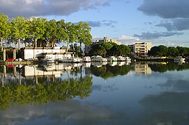
Marina de Agen

The bridge-channel of Agen
The bridge-channel of Agen


Follow the Garonne then through Colayrac-Saint-Cirq (2902 hab.), Saint-Hilaire-de-Lusignan (1479 rooms), Clermont-Dessous (831 rooms), Saint-Laurent (518 hab.) and Feugarolles, where it meets the Auvignon river on the left (55.7 km). It then goes through Port-Sainte-Marie (1924 hab.), Thouars-sur-Garonne (211 hab..), Saint-Léger (157 hab.) —where it meets the Baïse river on the left (187.7 km)— and Aiguillon (4,324 inhab.), at the confluence to the right of the Lot River (485km). The Lot is the main tributary of the Garonne and contributes almost a quarter of its flow, collected in the Massif Central; it is the second longest tributary of France (after the Marne river).
Then continues the Garonne via Nicole (268 rooms) Monheurt (204 rooms) and the city of Tonneins (8973 hab.), after which it receives the Tolzac river on the right (47.8km). Follow Le Mas-d'Agenais (1481 rooms), Taillebourg (78 rooms), Fourques-sur-Garonne (1287 hab.), Saint-Pardoux-du-Breuil (609 inhab.) and the small town of Marmande (17,748 inhab.), after which it receives the Avance River on the left (56.4 km) in Gaujac (262 hab.).
The Garonne continues its slow flow, reaching the small towns of Couthures-sur-Garonne (356 inhabitants), Sainte-Bazeille (3143 rooms), Meilhan-sur-Garonne (1347 rooms) and Jusix (122 hab.), just before leaving the Lot-et-Garonne.
- The Garonne after Agen

Tonneins seen from the bridge

Bridge over the Garonne and the Side Channel in Le Mas-d'Agenais

The Garonne Channel at Fourques-sur-Garonne

Marmande Pendant Bridge

Couthures-sur-Garonne

Canal en Meilhan-sur-Garonne

_-_panoramio.jpg)


In the Gironde department
Enters the Gironde department, where it continues through Bourdelles (103 hab.), La Réole (4091 hab.), Floudès (84 hab.), Gironde-sur-Dropt (1,230 inhabitants) —where it receives the Dropt river from the right, also Drot (132.4 km)— and Casseuil (396 hab.), where the tide is already making itself felt. (The characteristic oscillations can also be observed in La Réole, 5 km upstream (when the flow is low enough.)
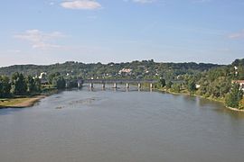
The Garonne continues through Barie (289 hab.), Caudrot (1182 hab.), Castets-en-Dorthe (1,169 hab.) —where it connects, on the left, with the side canal of the Garonne—, Saint-Pierre-d& #39;Aurillac (1351 hab.), Saint-Macaire (2089 hab.) and Langon (7396 pop.). In Langon the effects of large tides can be clearly observed and it was the limit of navigation for large barges before the Garonne lateral channel was inaugurated. The history of the city is inseparable from that of Bazas, fifteen kilometers to the south, an important military and religious center from antiquity to the 18th century, which had Langon as a port on the Garonne, competing in time with Bordeaux. Taking advantage of its location in a bend in the river at the confluence, on the left, with Brion Creek (12.9 km), Langon became the Middle Ages in an important in a market town on the road between Bordeaux and Agen.
The Garonne continues, bathing many small towns built on its banks, Preignac (? hab.), Barsac (2054 inhab.) —where it meets the Ciron river on the left (96.9 km—, Loupiac (1151 rooms), Cadillac (2743 rooms), Béguey (1168 rooms), Podensac (3115 rooms), Rions (1576 rooms.), Virelade (1030 hab.), Arbanats (1142 hab.), Paillet (1224 hab.), Portets (2615 hab.), Langoiran (2259 hab.), Beautiran (? hab.), Baurech (799 hab.), Cambes (1,361 hab.) and Isle-Saint-Georges (537 inhab.). On the outskirts of Bordeaux, the Garonne bathes Quinsac (2,145 hab.), Cadaujac (5,845 hab. ), Camblanes-et-Meynac (2801 hab.), Villenave d'Ornon (31,027 pop.) and Latresne (3,352 pop.). Then, after passing the small island of Ancines and passing under the François-Mitterrand Bridge (1993), in the southern part of the Bordeaux ring road supporting the E5/E70 motorway, the Garonne reaches Bègles (26,437 hab.), now a suburb of Bordeaux where a modern incinerator has been built right on the riverbank.
- The Garona in Gironde

The Garonne in La Réole

Pendant bridge in La Réole

Confluence of Drot and the Garonne
The river in Barie

The Garonne and the end of the Garonne channel, in Castets-en-Dorthe

Bridge in Castets-en-Dorthe

The Garonne in Langon

Modern incinerator in Bègles


The Garonne in Bordeaux
Bordeaux (1,196,122 inhab.) Pass by the Port of the Moon, the miroir d'Eau, the Quai des Chartrons, the National Museum of Customs,
- Bridges in Bordeaux
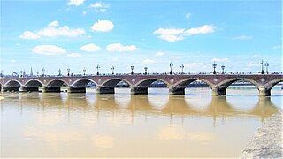
Stone bridge (Burdeos), 1822

Eiffel Gateway (1860) and Saint-Jean Bridge (1965)

Aquitaine Bridge (1967)
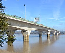
François-Mitterrand Bridge (1993)

Jacques-Chaban-Delmas Bridge (2012)


From Bordeaux to the estuary


Leaving Bordeaux, the Garonne still has a short stretch of about 20 km to the confluence with the Dordogne where the river is around half a kilometer wide. After passing under the Aquitaine bridge, which supports the northern ring road of the A630, the Garonne leaves Bordeaux to the north, in a rather degraded area of port facilities: it passes in front of the Bordeaux-Lac Activity Sector (left) and the Area Industrial of the Autonomous Port of Bordeaux (right). After passing through Saint-Louis de Montferrand, it finally reaches the confluence with the Dordogne, which approaches it from the right, a place where the Ambes port complex has been built, opposite the small town of Macau.
In Bordeaux the river is very wide and is subject to the influence of the tides. When the tide is rising, a mascaret is formed that goes up the river. · The salty ocean water reaches Bordeaux in the dry season, when the swell can be seen upstream of Cadillac in periods of high tides.
Hydrography

The flow of the Garonne depends, in its upper course, upstream of Toulouse, on snowfall and snowmelt, and in its lower part, it has a supply of rainwater due to its main tributaries.
- the channel of Saint-Martory to with water in Saint-Martory, takes 10 m3/s to the river,
- the side canal of the Garonne with the water in Toulouse by the canal of Brienne.
The SANDRE («Service d'administration nationale des données et référentiels sur l'eau») assigns the river Garonne the identification number 0 --- 00000 and the generic code O --- 0000.
Floods of the Garonne


In Toulouse, the Garonne has suffered numerous floods, especially since its left bank has traditionally been inhabited. There are records of important floods in 1177, in 1220, in 1258, in 1430, in 1523, in 1536 and in 1589, in 1608, in 1658, in 1673, in 1675, in 1709, in 1712, in 1727, in 1750, in 1772, in 1788, in 1804 and in 1810, in 1827 and in 1835, in 1855 and in 1856.
In Toulouse, in 1827, the Garonne reached four meters above the ordinary level, filling the arches of the Pont de Piedra and the Pont Nuevo. In 1835, the Garonne rose to 5.35 m above low water level and passed through all four bridge panes. In 1772, the Garonne reached 8.50 m.
- Grown from the Garonne in 1835: 7.50 m in Toulouse Pont-Neuf
- Grown from the Garonne in 1855: 7,25 m in Toulouse Pont-Neuf
- Grown from the Garonne in 1875: 9,70 m in Toulouse Pont-Neuf (or 8,32 m d'après vigicrue).
- Grown from the Garonne in 1879: 4,87 m in Toulouse Pont-Neuf
- Grown from the Garonne in 1890: 3.30 m in Toulouse Pont-Neuf
- Grown from the Garonne in 1900: 4,00 m in Toulouse Pont-Neuf
- Grown from the Garonne in 1905: 4,24 m in Toulouse Pont-Neuf
- Grown from 1927 in Aquitaine, particularly important after the confluence of the Garonne with the Lot (still growing as reference), insignificant upstream.
- Grown from the Garonne in 1952: 4.57 m in Toulouse Pont-Neuf
- Grown from the Garonne in 1977: 4,31 m in Toulouse Pont-Neuf
- Growing of the Garonne in 2000: 4,38 m in Toulouse Pont-Neuf
- Growing Garonne in 2004: 3,52 m in Toulouse Pont-Neuf
In 1777, the Garonne suffered an extraordinary flood to the point that the priest of Bourdelles bothered to transcribe the event, at the end of the acts of the year, in the parish register of baptisms, marriages and deaths:
It is for the memory that on May 17 of this present year that the river of Garona being overwhelmed for three different times by denying and totally losing the gathering of the parish of Bourdelles that forced the inhabitants to cut the hay Bleds and that they collected no more than four celemines minus two spits of wheat, nine of Spanish wheat, and all of the wine.Soit pour mémoire que le dix sept May de cette présente année que la Rivière de Garonne étant débordée pendant trois diverses fois a noyé et perdu totalement la Récolte de la parroisse de Bourdelles qui obligea les habitants a faucher les Bleds foins, et qu'il ne branchesser
Hydrology: flows
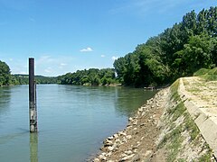
The Garonne at Mas-d'Agenais
The flow of the river has been observed for 76 years (1913-1988) in Mas-d'Agenais, a town in the Lot-et-Garonne department located a dozen kilometers upstream from the town of Marmande. The approximate area of the basin at that point is about 52,000 km², which corresponds to 95% of the total area drained by the river (about 55,000 km². The mean annual flow or modulus of the river at Mas-d' Agenais is 631 m³/s (more than the Seine at its mouth, which is about 540 m³ /s).
The Garonne presents seasonal fluctuations that are well marked, but not excessive. High waters correspond to winter and spring, and are characterized by mean monthly flows ranging from 832 m³/s to 1030 m³/s, from December to May inclusive (with a slight peak in February). From the end of May, the rate gradually decreases leading to the low waters of summer. These occur from July to October, inclusive, and are accompanied by a decrease in the average monthly flow to 190 m³/s in August, a flow that continues being considerable. However, the fluctuations in the flow are more important depending on the year, or observed during short periods.
| Average monthly rate of the Garonne at the Mas-d'Agenais station (in m3/s. Data calculated in the period 76 years, 1913-1988) |
 |
Dry water or low waters
In the dry season, VCN3 can drop to 77 m³/s, in the event of a five-year dry period, which is not severe at all. Thus, the rate of the Garonne, in times of drought, remains much better than those of the Seine or the Loire.
Floods
In addition, the flooding of the river can be very important, aggravated by the large size of its basin. The QIX 2 and QIX 5 are respectively 3500 and 4400 m³/s. The QIX 10 is 5000 m³/s, and the QIX 20 is 5500 m³/s. As for the QIX 50, it is equivalent to no less than 6300 m³/s, almost the mean flow or Danube modulus at the end of its run. Therefore the possibility of large floods is a constant threat.
The maximum daily flow recorded at Mas-d'Agenais was 5700 m³/s on March 5, 1930, during the historic flood of 1930. When comparing this value to the QIX scale noted above, it appears that this flood was slightly larger than the twenty-year flood calculated by the QIX 20 (a twenty-year flood has, each year, a probability of 1/ 20 to happen).
It can also be noted that estimates of the inundation of the Garonne in 1875, where at least 10,000 m³/s would have passed downstream of the confluence with the Tarn.
Sheet of water and specific flow rate
Although much of the basin's plains have little rainfall, to the point of requiring irrigation works, the Garonne is a mighty river, powerfully fed by the heavy rains in the high peaks of the Central Pyrenees and from a much of the Massif Central. The sheet of water beyond its basins amounts to 384 millimeters per year, which is significantly higher than the general average for France in all basins (320 millimeters per year). The specific flow velocity (or Qsp) reached 12.1 liters per second and per square kilometer of basin.
Hydrology: the dry season (July-October)


The generally low flows in summer and autumn, the so-called dry season, coincide with significant extractions. To limit the risks for the Garonne and avoid conflicts between uses, recharge is ensured from reservoirs in the Pyrenees. The uses that extract water from the river are (average data taken from the Plan de Gestión d'Étiage du 1er juillet au 31 octobre):
- drinking water: regulate all year round, the quantities of drinking water, in the water supply, are close to 60 hm3. One third is consumed and the remaining two thirds are returned to the environment. However, the effluents of treatment plants have an even more important impact when the water level is low.
- Industry: industrial extractions (nuclear, hydroelectricity, paperwork...) are regular throughout the year, represent in the stiaje 108 hm3. This water is restored to a large extent, and net consumption represents just 7% of the extractions, but can cause instant flow variations harmful to the ecosystem and other activities.
- Agriculture: irrigation represents 40% of the extractions in the stiaje, but 80% of the consumption, as little of the irrigation water is returned to the medium. However, in the biological cycle of plants from May to September, the first needs are met by natural hydrology and precipitation. The possible impact of the pumping for agriculture only begins in mid-July and in early September begins to disappear. If it is still low compared to natural flows in wet years, it can be decisive in dry years (minimum of 93 hm3 and maximum 188 hm3). Waters below the basin, net agricultural extraction (not compensated, with a weight therefore in the natural resource) can reach, at the top of the irrigation season (between 25 July and 5 August), 20−25 hm3; the target of stiage is of a flow of 110 m3/s.
- Water transfers: they represent even 212 hm3. Three channels derive the water during the four months of stretching: the canal of Garonne and the channel of Saint-Martory (including retreats in the Garonne, without compensation, weighing on the natural resources when it is exhausted) and the channel of the Neste (in which the derivation in Neste Aure is compensated to 50% by the altitude lakes of Néouvielle).
- Stiage flow: multi-year stiage flow agreements already mobilize, and since 1993, more 50 hm3) of resources up to Toulouse (from 30−70 hm3 are mobilized depending on the year. In this action, the average volume mobilized is 25 hm3 (minimum) 12 hm3 maximum 46 hm3) since there are wet summers, dry summers and autumnal rains more or less late.
Navigation
Once an important axis of navigation and freight transport, the Garonne River is now navigable even for the largest ships (cargo ships, containers...) in its estuary, up to the Pont de Piedra in Bordeaux, and for large barges as far as Langon. River traffic then takes the Garonne Canal, which is dedicated almost exclusively to river tourism.
The navigability of the Garonne has been stable since ancient times for a good stretch.
The transport of large barges has resumed to Langon thanks to the aeronautical construction and especially the A380 aircraft in the Toulouse workshops.
The Ville de Bordeaux is one of the three ships built to transport parts of the A380 to Pauillac (Gironde) which are then transferred to one of the two barges, the Breuil and the Brion, going up the Garonne to Langon. The main components that comprise the devices in the Airbus range are produced in factories spread across Europe, but the assembly lines are located on the site of Toulouse-Blagnac Airport in France or at Hamburg-Finkenwerder Airport in Germany. These movements between the different production and assembly sites were carried out in large trucks or by air, thanks to the Beluga, an Airbus A300-600ST whose fuselage was specially modified to receive large parts. However, with the dimensions of the A380, the use of that aircraft became impossible and therefore Airbus implemented a combined air, sea and land transport system, using ships, barges and trucks.
Old Practices
Bridges

Throughout its history, many bridges were built across the Garonne to cross it, built above all in the cities of Bordeaux and Toulouse. Among the old bridges, the Montaudran bridge and the Velours bridge stand out. In 1789, the bridge downstream of Montréjeau was still made of wood.
In 1860 the southern railway company built the railway to connect Toulouse with Tarbes (before reaching Bayonne) and needed to erect six bridges over the Garonne: two bridges at Empalot, two at places known as Fourqs and Appas and two more at Valentine and at Montréjeau.
Floating
Floating or madera — transporting logs by floating — was already used to build the main beams of Montauban cathedral from wood felled in the Aure valley. Floating disappeared with the construction of the railway line (now replaced by a bus service) between Luchon and Montréjeau.
The Garona was also used to float firewood for heating and construction, which came from the Aran Valley, in Spain, to Cazère or even Toulouse itself. The floating was done in the context of free trade, although later they were subject to privileges, a matter of local differences until their disappearance. Thus, some 500-600 men cut 8,000 logs of wood a year for the Toulouse region. The stops were made in the ports of Bosost, Lés (today in Spain), Saint-Béat and Fos. On the other hand, Julien Sacaze supposes that Lugdunum Convenarum —today Saint-Bertrand-de-Comminges— would have already been an ancient port river in Roman times.
Thus, in the Haute-Garonne, in 1878, the Garonne was navigable for a stretch of about 190 km.
Ports and docks
In 1847, Toulouse had quays and three ports on the Garonne.
Tolls
The history of tolls on the Garonne River and its tributaries in the Middle Ages has been studied by Professor C. Higounet, noting that there were about thirty between Bordeaux and Toulouse.
Migratory fish
The Garonne and its estuary are still home to eight species of diadromous migratory fish: great shad, false shad, eel, European sturgeon, lamprey, sea lamprey, Atlantic salmon, and sea trout. The river constitutes the main axis of the migration of these highly migratory fish, which joins the Atlantic with the Pyrenees. The Gironde estuary, a true transition medium, plays a key role in the physiological adaptation of these fish from a marine environment to a river environment, and vice versa. The Garonne is a breeding ground and the gravel pits on its bed house the eggs. It is also a nutritious medium.

Little by little, the impact of human activities began to damage these fragile populations. The intensive extraction of aggregates, the contamination of the water and especially the dams altered the ecosystems, often making the spawning grounds inaccessible or simply destroyed.
Until the 1970s and 1980s, the public powers did not extend the salmon rescue plans to all migratory species, imposing the construction of dam breaching devices, preventing fry and limiting fishing, giving a future to the return of species emblematic in the Garonne regions.
- The European sturgeon is on the red list of threatened species of the International Union for Conservation of Nature (IUCN). The La Gironde-Garona-Dordoña system is home to the latest developments.
- The eel, long considered harmful, is currently the subject of attention. Emergency measures are needed at the national and local levels to protect the species.
- The great saddle: the Garonne and Dordogne have for a long time hosted the largest sábalo population in Europe. Today, this kind of sardine family has experienced a worrying decline. A safeguard plan for the species was implemented in 2008.
- Lamprea marina, fished in the lower part of the Garonne, with reed or in nasas. Cuisine «à la bordelaise», encebollada, for its conserving marketing. It's the most abundant migratory species.
- The Atlantic salmon, disappeared in the 1970s, gradually repopulates the Garonne basin, thanks to the restoration plan.
Tourist activities
- Canoa-kayak
- Rafting
- Hidrospeed
- Sport fishing and without death
- Swimming
- Go.
- Aviron (sport)
- Motorcycle and skiing
- River navigation

Croisière sur la Garonne à Bordeaux.

Cabane de pêche au filet carré (carrelet) sur pilotis.
.JPG)

In literature

La Garonne is, «à la carte, one of the most important figures in the work of Pierre Gamarra. (...) The Loire had its poet and novelist with Maurice Genevoix, the Durance had its own with Giono, the Garonne, with Pierre Gamarra has its troubadour."
Annexes
Tributaries of the Garonne River
The Garona River has many tributaries, the most important being those listed in the following table. The tributaries are arranged geographically, following the river from its source to its mouth.
| Ramal | Affluent name | Rio desagua | Destroying | Length (km) | Cuenca (km2) | Caudal (m3/s) | Department(s) | Tram. | |||||
|---|---|---|---|---|---|---|---|---|---|---|---|---|---|
| I | - | Rio Neste | Garona | Montréjeau | 73 | 870 | 19.4 | Alto Garona, High Pyrenees | Mountain | Alto Garona | |||
| - | D | Rio Ger | Garona | Pointis-Inard | 37.2 | 200 | 5 | Alto Garona | Piedemonte | ||||
| I | - | Rio Noue | Garona | Mancioux | 44.2 | 127 | 0.99 | Alto Garona | |||||
| - | D | Río Salat | Garona | Roquefort-sur-Garonne | 78 | 1570 | 42.5 | Alto Garona and Ariège | |||||
| - | D | Río Arize | Garona | Carbonne | 83.8 | 528 | 5,31 | Alto Garona and Ariège | First stretch | ||||
| I | - | Rio Louge | Garona | Muret | 100.1 | 486 | 6.14 | Alto Garona | |||||
| - | D | Río Ariège | Garona | mouth | 163.5 | 4120 | 76.4 | Oriental Pyrenees, Ariège and Alto Garona | |||||
| - | - | - | Río Lèze | Ariège | Clermont-le-Fort and Labarthe-sur-Lèze | 70.3 | 351 | 2.01 | Ariège | ||||
| - | - | - | River Hers-Vif or Grand Hers | Ariège | Cintegabelle | 134.9 | 1350 | 15.7 | Ariège, Aude, Alto Garona | ||||
| I | - | Rio Touch | Garona | Blagnac and Toulouse | 74,5 | 508 | 3,85 | Alto Garona | 2.o stretch plain | ||||
| I | - | Rio Aussonnelle | Garona | Seilh | 42.4 | 192 | 0.79 | Alto Garona | |||||
| - | D | River Hers-Mort | Garona | Grenade and Ondes | 89.3 | 768 | cautious | ||||||
| - | - | - | Rio Girou | Hers-Mort | Saint-Sauveur | lon | area | cautious | Alto Garona | ||||
| I | - | Rio Save | Garona | Grenade | 148.4 | 1152 | cautious | ||||||
| - | - | - | Gesse River | Save | Cadeillan and Espaon | lon | area | cautious | |||||
| I | - | Rio Gimone | Garona | Castelferrus | 135.7 | 840 | cautious | Tarn and Garona | |||||
| - | D | Rio Tarn | Garona | Boudou and Saint-Nicolas-de-la-Grave | 380.2 | 15 700 | cautious | ||||||
| - | - | - | River Lemboulas | Tarn | Moissac | lon | area | cautious | |||||
| - | - | - | River Aveyron | Tarn | Montastruc and Villemade | lon | area | cautious | |||||
| - | - | - | Río Vère | Aveyron | Bruniquel | lon | area | cautious | |||||
| - | - | - | Rio Cérou | Aveyron | Milhars | lon | area | cautious | |||||
| - | - | - | Río Viaur | Aveyron | Laguépie | 166 | 1530 | 15.2 | Aveyron, Tarn, Tarn and Garona | ||||
| - | - | - | Rio Céor | Viaur | Saint-Just-sur-Viaur] | 340 | 4.6 | ||||||
| - | - | - | Rio Tescou | Tarn | Montauban | lon | area | cautious | |||||
| - | - | - | Río Agout | Tarn | Coufouleux and Saint-Sulpice | lon | area | cautious | |||||
| - | - | - | Rio Diceu | Agout | Ambres y Giroussens | lon | area | cautious | |||||
| - | - | - | Rio Sor | Agout | Sémalens | lon | area | cautious | |||||
| - | - | - | Río Thoré | Agout | Castres and Navès | lon | area | cautious | |||||
| - | - | - | Río Arn | Thoré | Mazamet | lon | area | cautious | |||||
| - | - | - | Rio Gijou | Agout | Lacrouzette and Vabre | lon | area | cautious | |||||
| - | - | - | Rio Rance | Tarn | Curvalle and La Bastide-Solages | lon | area | cautious | |||||
| - | - | - | Río Dourdou de Camarès | Tarn | Broquiès and Saint-Izaire | lon | area | cautious | |||||
| - | - | - | Rio Dourbie | Tarn | Millau | lon | area | cautious | |||||
| I | - | Río Arrats | Garona | Saint-Loup | 131 | 950 | cautious | ||||||
| - | D | Río Barguelonne | Garona | Lamagistère and Valence | 61.1 | 552 | cautious | ||||||
| I | - | Rio Auroue | Garona | Saint-Nicolas-de-la-Balerme and Saint-Sixte | 62.4 | 200 | cautious | Lot and Garona | Lot and Garona | ||||
| - | D | River Séoune | Garona | Boé and Lafox | 64.9 | 463 | cautious | ||||||
| I | - | Rio Gers | Garona | Layrac | 175.4 | 1227 | cautious | Lot and Garona | |||||
| I | - | Auvignon River | Garona | Feugarolles | 55.7 | 303 | cautious | Lot and Garona | |||||
| I | - | River Baïse | Garona | Saint-Léger | 187,7 | 2910 | cautious | Lot and Garona | |||||
| - | - | - | Rio Gélise | Baïse | Lavardac | lon | area | cautious | |||||
| - | - | - | Río Osse | Gélise | Andiran and Nérac | lon | area | cautious | |||||
| - | - | - | Rio Auzoue | Gélise | Mézin | lon | area | cautious | |||||
| - | - | - | Río Petite Baïse | Baïse | L'Isle-de-Noé | lon | area | cautious | |||||
| - | D | Rio Lot | Garona | Aiguillon | 485 | 11 254 | 155 | Lozère, Aveyron, Cantal, Lot and Lot and Garona | |||||
| - | - | - | Río Lède | Lot | Casseneuil | lon | area | cautious | |||||
| - | - | - | Rio Célé | Lot | Bouziès and Tour-de-Faure | lon | area | cautious | |||||
| - | - | - | Rio Dourdou de Conques | Lot | Grand-Vabre | 83.8 | 550 | 7.47 | Aveyron | ||||
| - | - | - | Rio Truyère | Lot | Entraygues-sur-Truyère | 170 | 3300 | 69.5 | Lozère, Cantal and Aveyron | ||||
| - | - | - | Rio Goul | Truyère | Saint-Hippolyte | 52 | area | cautious | |||||
| - | - | - | Rio Bès | Truyère | (retained by barge of Grandval, Faverolles and Fridefont) | 66.7 | area | cautious | |||||
| - | - | - | Colagne River | Lot | Le Monastier-Pin-Moriès y Saint-Bonnet-de-Chirac | lon | area | cautious | Lot and Garona | ||||
| - | D | River Tolzac | Garona | Tonneins | 47.8 | 255 | 1.33 | Lot and Garona | |||||
| I | - | Rio Avance | Garona | Gaujac | 56.4 | Lot and Garona | |||||||
| - | D | Rio Dropt | Garona | Caudrot and Casseuil | 132.4 | 1350 | 6.03 | Dordogne, Lot-et-Garonne and Gironde | Gironde | ||||
| I | - | Río Ciron | Garona | Barsac | 96.9 | 1500 | cautious | ||||||
- Garonne (Estuaire de la Gironde: Ambès et Bayon-sur-Gironde)
Villages along the Garonne River
The main towns along the Garonne River are listed below; most have a historical significance or cultural tradition that links them to the river. They are listed from the source of the river to its end and the inhabitants all correspond to the year 2014. Towns with more than 2,000 inhabitants are highlighted in bold and those with more than 20,000 inhabitants are in small capitals.
Locations on the banks of the Garona River |
|---|
|
References
- This work contains a translation derived from Wikipedia's "Garonne" in French, published by its editors under the GNU Free Documentation License and the Creative Commons Attribution-ShareAlike 3.0 Unported License.
Contenido relacionado
The Aridane Plains
Bulnes orange tree
Territorial Organization of Cuba