
Estad Hidalgo
Hidalgo, officially the Free and Sovereign State of Hidalgo, is one of the thirty-one states that, together with Mexico City, make up Mexico. The capital and most populated city is Pachuca de Soto. It is divided into eighty-four municipalities.
It is located in the eastern region of the country, bordering San Luis Potosí and Veracruz to the north, Puebla to the east, Tlaxcala and the state of Mexico to the south, and Querétaro to the west. With 20,821.4 km², representing 1.1% of the surface of Mexico, it is the sixth smallest state (before Querétaro, Colima, Aguascalientes, Morelos and Tlaxcala, the least extensive. It is located between the coordinates: north, 21° 23' 55''; south, 19° 35' 52'' of north latitude; east, 97° 59' 06''; west, 99° 51' 34'' west longitude.
According to the latest available census (INEGI, 2020) the state has a total population of 3,082,841; that is, 2.3% of the total for the country. Of these inhabitants, 1,601,462 are women, and 1,481,379 are men. The indigenous peoples with the greatest presence within the state are the Otomi, Nahuas, and Tepehuas. The information The most recent one places Hidalgo with a State Human Development Index of 0.761 High (2019). Hidalgo's Gross Domestic Product was 271,360 million pesos; and contributes 1.6% to the national GDP.
The oldest archaeological record found in Hidalgo is an ax, found in Huapalcalco. Numerous indigenous groups inhabited the current territory of Hidalgo, mainly the Toltecs, who founded Tulancingo and Tula. In the 14th century the Mexicas settled and due to the proximity of this region with respect to the great Tenochtitlán, the Spanish conquest soon reached Hidalgo soil.
During New Spain, the silver mines of Mineral del Monte and Pachuca were discovered in 1552. During the Independence of Mexico, the first insurgent uprising was produced by Julián Villagrán in Huichapan; In 1821, during the consummation, the insurgent generals Nicolás Bravo and Guadalupe Victoria arrived in Tulancingo.
On January 16, 1869, the Congress of the Union issued the Decree of Erection of the State of Hidalgo, by President Benito Juárez, designating the city of Pachuca as the capital of the state, to which was added the name “de Soto” in recognition of Manuel Fernando Soto, originally from the city of Tulancingo and who is considered the most important promoter in the creation of the state.
The Porfiriato was a period of stability and great economic progress in the Hidalgo territory, especially in the development of public works for the sanitation of cities such as Tula, Tulancingo and Pachuca. But also with severe social inequalities which triggered the Mexican Revolution, nonconforming peasants from the Mezquital Valley and the Apan Valley participated in this conflict.
During the Mexican Revolution, political instability did not allow the exercise of government by any of Hidalgo's three powers (Executive, Legislative and Judicial), during this period a series of governors paraded; all provisional and from different revolutionary currents: villistas, convencionistas, carrancistas. In 1917 with the inauguration of Nicolás Flores the three powers of government were established, historically this fact is considered as the resumption of the constitutional regime in the state of Hidalgo.
Toponymy

The official name of the state is the Free and Sovereign State of Hidalgo, but it is commonly known as the state of Hidalgo or simply as Hidalgo. The name was designated on January 16, 1869, when the Congress of the Union of Mexico issued the Decree of erection of the state of Hidalgo. The name Hidalgo was assigned to it in honor of the considered father of the country and initiator of the Independence of Mexico: Miguel Hidalgo y Costilla. Its officially accepted abbreviation is Hgo.; and its inhabitants are given the adjective hidalguenses.
Symbols
Shield

The shield designed by Diego Rivera and devised by José Vasconcelos in 1922 is recognized as official; and adopted on December 14, 1979, by the official decree published in the Official Gazette of the State of Hidalgo on January 24, 1980. The description according to the Decree of the shield for the state of Hidalgo, is as follows:
As exterior ornaments, two cross flags, the one on the right side, in blue, containing to the center the image of the Virgin of Guadalupe incarnated and with a golden glow that symbolizes the birth of Independence, since with a banner of this nature, Father Hidalgo began the insurgent movement. On the sinister side, you will find the National Flag with its colors and official symbols.The shield consists of two horizontal fields. At the top, blue, a winding mountain, downtown. This represents the Hindu serranium, as well as the ridge of its mines. In the same upper field, on the right side, a bronze bell sloping from a tree, symbol of the Dolores, whose call was proclaimed independence. In the sinister, a frigid cap of gules, adorned with three branches of laurel, both symbols of freedom and victory, obtained in 1821.
In the lower field, on equality, a war box, to the center, symbol of the country's three major social movements: Independence, Reform and Revolution. At the right hand, center and sinister, three hour in the field, which symbolize the mine mouths, representing with it the main economic activity of the state, which is mining.Shield Decree for the State of Hidalgo
Anthem
The official anthem is officially called "Canto de paz, de unión y de esperanza", it consists of three stanzas and a chorus. It was written by Genaro Guzmán Mayer; and the musical composition was in charge of Roberto Oropeza Licona.
In 1968, on the occasion of the Centennial of the establishment of the state of Hidalgo, a contest was called for the creation of a hymn for the entity. On December 7, 1968, the qualifying jury awarded first place to the hymn "Canto de peace, union and hope", signed by Guzmán Mayer with the pseudonym Prometeo Encadenado. The jury was made up of Juan Castañeda, deputy director of the Hidalguense Institute of Fine Arts; and by professors Raúl Osorio, Salvador Salgado and Raúl Guerrero Guerrero.
The hymn has two different versions, one delivered to the qualifying jury under the pseudonym Prometeo Encadenado, along with twenty-five other compositions by different poets. And another modified in parts, attributed to Guzmán Mayer, which was distributed on February 5 of 1969 and sung by elementary school students at the commemorative ceremony of the promulgation of the Political Constitution of the United Mexican States, with music by Roberto Oropeza Licona.
History
Pre-Hispanic period


Vestiges of prehistory in Hidalgo have been found in the regions of Tepeapulco, Tulancingo, Actopan and Huichapan; Its antiquity ranges between 14,000 and 2,500 B.C. C. It is in Huapalcalco in the municipality of Tulancingo, where the oldest remains of human vestiges in Hidalgo territory have been found. The first to found colonies in these territories were Olmec groups, who took advantage of the jade banks and serpentine. During the Preclassic Period, the exploitation of obsidian took on relief, as in the deposits of the Sierra de las Navajas. The first evidence of social stratification in Hidalgo has been found in La Loma in the municipality of Tepeji del Ocampo River.
During the Classic Period, the Teotihuacans extended their territory to the towns located in Hidalgo, particularly Chingú, located between Atitalaquia and Tlaxcoapan, Pahñú in Tecozautla, Xihuingo in Tepeapulco, Zazacuala in Santiago Tulantepec de Lugo Guerrero and Huapalcalco in Tulancingo de Bravo. Xihuingo is where one of the commercial exchange routes that went from the Mesa del Centro to the east passed. In the Epiclassic Period, the xajay culture, which developed from approximately 450 to 950 AD. C., with five major sites in Hidalgo: Zethé, Pahñú, Zidada, El Cerrito and Taxangú. the mythical Cerro Coatepec, place where Huitzilopochtli was born.
The Huasteca culture settled in the north and northeast of Hidalgo. The Huasteca Hidalguense area was formerly known as Cuextlán, although it was also known as Tonacatlalpan, "the mainland of livelihoods", or Xochitlalpan, "the place of flowers on the mainland". Some archaeological remains are found in the municipalities of Chapulhuacán, La Mission, Huejutla de Reyes, Yahualica, Jaltocán, and Tepehuacán de Guerrero.
In the Postclassic Period, the Toltecs began their pilgrimage from a site they called Huehuetlapallan; They arrived at Xochicoatlán and Molango, at the beginning of the 7th century to disperse to different places; a group towards Huejutla and the most numerous towards Tulancingo, from there to return to the west and reach Tula de Allende. strategic position allowed it to control products such as turquoise, from northern Mesoamerica.
The exact date on which the Otomi arrived in the Mezquital Valley is not known, some authors affirm that during the hegemony of Tula the Otomi played an important role in society. After the collapse of Tula, the Otomi and Nahuas they dispersed until they occupied large areas of the Basin of Mexico. Nopala. The Señorío de Xaltocan also prevailed, which dominated most of the towns located to the south of the Hidalgo territory.
Around 1168, the Mexica tribe migrated from Aztlán to central Mexico. On his journey he passed through different places in the state of Hidalgo, through Tollan-Xicocotitlan (Tula de Allende), where he stayed for two decades; He immediately arrived at Atlitlalacyan (Atitalaquia) and settled there for a decade. He then moved to Tlemaco (San Gerónimo Tlamaco) and Atotonilli (Atotonilco de Tula), and spent five years in each place; Finally, the Mexicas founded their city that was called Tenochtitlán. Years later, the Mexicas and their allies dominated the peoples settled in the current Hidalgo territory, only two lordships were not subdued: the Lordship of Metztitlán and the Lordship of Tutotepec.
In the year 1395, the king of Azcapotzalco, Tezozómoc, destroyed Xaltocan. For this reason, large numbers of Otomi migrated to Metztitlán and Tutotepec; after the fall of Xaltocan, the king of Metztitlán was henceforth recognized as the heir of Xólotl. In this way, the independence of the Lordship of Metztitlán was consolidated. During the warlike incursions of Ahuízotl, the Lordship of Tutotepec was surrounded and separated from Metztitlán, since apparently before this they constituted a single entity. Around the year 1400, the Otomi of Tutotepec came into contact with the Tepehuas. It is also known that the Pame population transited through the northwest of Hidalgo territory.

Conquest of Mexico

With the fall of Tenochtitlán, the territory of the current state of Hidalgo, which was then subjugated by the Mexicas, came to be controlled by the Spanish authority. Faced with this oppression, the lordships of Metztitlán and Tutotepec rebelled to recover their independence.
In 1522 Hernan Cortés sent Tlaxcalan warriors, under the command of one of his Spanish captains, to conquer the Señorío de Metztitlán. Due to the presence of Francisco de Garay's expedition that caused great disorders and violence in the Huasteca Region, in October 1522 Hernán Cortés left for the Huasteca, reaching the north of Veracruz. Towards the end of the same year and after 25 days of bloody combat, Cortés managed to break the resistance and returned to Mexico. In 1523 after his return from the Huasteca, Cortés went to Tutotepec, ordered the ruler to be hanged and severely punished this manor.
In 1528 Francisco Téllez nicknamed "El Tuerto", and twenty-five Spanish conquerors invaded Pachuca and killed its chief Ixcóatl. He prepared his people, but Téllez, mocked the enemy's movements and let him pass by. Then, the Spanish entered the unprotected population and attacked the women and children who had remained in it. Itzcóatl, retreated to defend his town, but his army was annihilated and the city burned down.
Viceroyalty of New Spain


Among the first Spaniards to arrive in Pachuca were Francisco Téllez and Gonzalo Rodríguez, who built the first houses. By 1529-1530, the population had already been laid out, since it had streets, a jail, and a square. The first deposits of Silver in the territory began to be exploited from 1534 in El Cardonal. The Viceroyalty of New Spain was officially created on March 8, 1535.
In the year 1537, the Mezquital Valley was populated with sheep, while the Apan plains began to raise pigs. In the 16th century, haciendas appeared mainly in the southern plains. Their extensive territories were They were formed by donations from the viceroy, negotiations, in addition to the dispossession of the indigenous peoples of the communal lands. In 1552 other mining deposits were found in Mineral del Monte, Mineral del Chico and Zimapán. The discovery of the mines in Pachuca was made on April 25, 1552 by Alonso Rodríguez de Salgado. In 1554 Bartolomé de Medina arrived at the mines of Pachuca, dedicated himself entirely to testing the separation of silver and would successfully discover the Beneficio de patio.
Despite the advances of colonization in other parts of New Spain, in the Sierra Gorda inhabited by the Jonaces, Pame and Ximpeces, this region remained uncontrolled. After several battles, control of the area was achieved Different missions were built, some by the College of Franciscans of Pachuca. In 1677 the Indians of Ixmiquilpan revolted, and assassinated the Governor of the place because he forced them to work in the mines of Pachuca. In 1700 a strong flood was recorded in the Jacal Mine in the Pachuca mining district.
In the 18th century, Pedro Romero de Terreros revived the mineral from Mineral del Monte, finding new and rich veins that gave Pachuca an extraordinary boom. In 1766 Pedro Romero de Terreros tried to suppress the party and the wages and double the workloads. On July 28, the miners of the Vizcaína vein presented, before the royal officials of the Real Caja de Pachuca, a petition document whose first and greatest demand was the full restitution of these payments.
On August 15, 1766, they went on strike, in which after freeing the prisoners in Pachuca, where they killed the mayor of Pachuca, José Ramón de Coca; while Romero de Terreros saves his life by managing to flee to his haciendas in Huasca de Ocampo.The barreteros calmed down when the priest José Rodríguez Díaz ordered the "Santísimo" to come out on a pilgrimage through the mines, to appease the tumult.
Around 1780, the indigenous people of several towns near Zempoala protested because the Royal Treasury wanted to charge them the tax on pulque. On May 15, 1803, Alexander von Humboldt arrived in Pachuca and visited the Mineral del Monte mines. the basaltic Prisms of Santa María Regla in Huasca de Ocampo, on May 21 he leaves for Atotonilco el Grande. On May 22 he spends the night in the town of Baños de Atotonilco near Villa de Magdalena and the Madre de Dios Bridge. During May 23 and 24, he would tour the Actopan area, to later leave on May 25 for Mexico City. In 1807 in Tulancingo, the Spanish authority imprisoned the indigenous governor and his officials because they refused to pay a extra tax to repair the church.
Independence of Mexico

The first armed independence uprising in the region was led by Miguel Sánchez and Julián Villagrán in the Huichapan area, who assaulted royalist convoys on the road from Mexico to Querétaro. Villagrán and his son José María, persecuted by the royalists, operated in the region from 1810 to 1813, the year in which they were captured and shot.
The insurgents attacked Pachuca on October 5, 1810 and, again on April 23, 1812, under the command of Miguel Serrano, Vicente Beristáin and Pedro Espinosa. From this battle, 310 silver bars were taken as booty, a part It was sent to Ignacio López Rayón, another was delivered to José María Morelos on October 14, 1813. On May 10, 1813, the royalist commander Domingo Claverino, who had been joined by the forces of Rafael Casasola, entered Pachuca and reestablished the normality in the work of the mines.
On May 24, 1812, José Francisco Osorno began the attack on Tulancingo, which resisted for six days until the arrival of Domingo Claverino, causing the insurgents to flee. Finally, in Huejutla, various indigenous groups led by Rafael revolted Vizuet and Pedro Franco. In the mountains, the so-called "Molangueros" arose, groups of rebels that operated from Molango to Huejutla, whose main action was to blend in with the market vendors in order to propagate the ideas of independence.
On February 25, 1814, there was another confrontation in Tulancingo. On November 27, 1814, Osorno's forces attacked the Apan square, but they were unable to overcome the royalist resistance, so they withdrew to return again on December 4, with the same result. By the end of 1816 and the beginning of 1817 the territory of the state of Hidalgo was practically in the hands of the royalists.
Servando Teresa de Mier was imprisoned on June 13, 1817 in Soto la Marina, from where he was taken to Mexico City, where he crossed through Huejutla, Zacualtipán, Tulancingo, and Pachuca. On April 29, 1821 Nicolás Bravo advanced towards Tulancingo, occupied by the Spanish commander Manuel de la Concha; who decided to leave the city, Bravo went in search of him and met Guadalupe Victoria. De la Concha was caught in San Cristóbal Ecatepec, after this event Bravo and Victoria returned to Tizayuca, where they spent the night and the next day on June 9 they went to Pachuca, where they entered proclaiming the Plan of Iguala. Here Bravo and Victoria separated; the first returned to Tulancingo, and the second continued to San Juan del Río to meet Agustín de Iturbide.
Early years of independent Mexico

After the independence ended, the First Mexican Empire was formed, in 1823 Pedro Espinosa, ruler of Pachuca, adhered to the Casa Mata Plan and declared himself in favor of the First Federal Republic of Mexico. On his departure from Mexico, Agustín de Iturbide remained in Tulancingo from April 3 to 20, 1823, escorted by the forces of General Nicolás Bravo. In 1828 ideological differences confronted Nicolás Bravo and Guadalupe Victoria. Bravo became strong in Tulancingo and between April 6 and 7 January was attacked by Vicente Guerrero.
During the United States-Mexican War in May 1847, 200 American prisoners were transferred to Huejutla. On June 10, the US forces advanced on Huejutla to free the prisoners. The Military Commander, General Francisco Garay, went out to meet troops from Huejutla, Molango and Zacualtipán defeating them. On December 29, 1847, the second regiment of Kentucky volunteers entered Pachuca with about 600 men, commanded by Colonel William T. Withers, who established his headquarters in the Convent of San Francisco, without finding any type of opposition. Celedonio Dómeco de Jarauta, who at the beginning of the invasion by Veracruz, raised a small guerrilla, took part in the defense of Mexico City and later withdrew to Tulancingo, Joseph Lane is ordered to go after on February 17, 1848, who on the 19th of the same month had retired to Zacualtipán. On February 25, the troops arrived and took the town after a heroic defense.
The Ayutla Revolution was an insurgent movement in the year 1854. In 1856, on the first days of February, Manuel Andrade spoke in Tulancingo, and on the same days Ignacio Solís spoke in Pachuca, after having written for three days before a letter to Ignacio Comonfort in which he protested his adhesion. On October 20, 1856 Colonel José Ignacio Gutiérrez entered Pachuca at the head of 200 men, he withdrew after having provided some resources. In 1857 José Ignacio Gutiérrez sent by Gral. Tomás Mejía to operate in what is now the state of Hidalgo, and seizes Tulancingo by surprise and later Pachuca.
On February 18, 1856, liberals from Jacala led by Gabriel Mayorga drafted the so-called Act of Jacala with which they supported freedom of worship, equality before the law, and separation of Church and State. During the War of Reform on April 23, 1860, the liberal Colonel Campos defeated the reactionary garrison of Pachuca and took its chief, Colonel Aguilar, prisoner. On May 26, 1860 Antonio Carbajal entered Pachuca and carried out the secularization of the friars of the Colegio de San Francisco, On September 5, 1860 General Pedro Ampudia occupies Pachuca and carries out a second secularization of the friars of the Colegio de San Francisco who had met again. The last battle of this conflict developed in Pachuca and Mineral del Monte, where the conservatives; Félix María Zuloaga and Leonardo Márquez were defeated by the liberal Santiago Tapia and Colonel Porfirio Díaz on October 20, 1861.
Due to the French intervention in Mexico, when Emperor Maximilian I took possession of the crown of Mexico, President Benito Juárez had to transfer the capital of the republic to different regions; During this journey on May 31, 1863 heading to the north of the country, his first stop occurred in the town of Tepeji del Río. On August 1, the Republican forces of León Ugalde were defeated in Huejutla by Colonel Torres, and on August 2 On August 12, the Mexican troops from Huejutla and Molango defeated a French column commanded by Colonel Tours in Cuatapa. On June 12, 1865, the Republicans Martínez and Escamilla attacked Huejutla and the imperialist forces who had to leave the town. Maximiliano de Habsburgo visited Pachuca de Soto, Mineral del Monte and Huasca de Ocampo from August 26 to September 2, 1865. On November 12, 1865, the imperialist forces of Lamadrid occupied Huejutla, which had been in the hands of the Republicans commanded by León Ugalde. On December 23, the Republican leader León Ugalde was defeated by the imperialist troops commanded by Castillo and Alzati.
On May 21, 1866, forty men under the command of the Republican Antonio Reyes seized Huejutla, defeating the imperialists commanded by Silverio Ramírez. The troops of the Belgian Legion arrived in Tula de Allende on September 24, 1866. Here Colonel Alfred Baron Van der Smissen, received information that the Republican general Joaquín Martínez had seized Ixmiquilpan, the Belgian commander decided to address the population that same night, his idea was to attack at dawn and take the enemy by surprise. The Battle of Ixmiquilpan occurs on September 25, 1865 between 350 soldiers of the Belgian legion and Juarista forces, ending the battle with the victory of the latter. Back in Tula, Smissen receives the order to leave for Tulancingo Arriving on November 13, 1866, in Tulancingo on December 19, 1866 they received the news that on December 6 an imperial decree dissolved the foreign troops in the service of Maximilian.
Erection of the state of Hidalgo
.jpg)

Concluded the Second Mexican Empire and restored the Republic, on July 15, 1867, the deputies: Manuel Fernando Soto, Antonino Tagle, Manuel T. Andrade, Cipriano Robert, Protasio Tagle, Gabriel Mancera, José Luis Revilla and Justino Fernández Mondoño began the process of creating the new state. The municipalities that wanted to be part of the new entity, expressed to the Congress of the Union, between July 2 and August 19, 1867, their resistance to continue as part of the state of Mexico.
On March 17, 1868, in a session of the Congress of the Union, it was approved to create the state of Hidalgo with the districts of Actopan, Apan, Huejutla, Huichapan, Huascazaloya, Ixmiquilpan, Tula, Pachuca, Tulancingo, Zacualtipán and Zimapán. On January 16, 1869, the Decree of Erection of the State of Hidalgo was issued by President Benito Juárez. On January 21, 1869, Juan Crisóstomo Doria González was appointed as provisional governor of Hidalgo.
The Tuxtepec Revolution was an armed movement in Mexico based on the Plan of Tuxtepec, which began when the constitutional president Sebastián Lerdo de Tejada announced his candidacy for re-election, in January 1876 General Porfirio Díaz took up arms. On June 16, 1876, Pachuca was attacked by Porfirian troops under the command of Colonels Sóstenes Vega, Tito Flores, Rafael Rubio and Juan Fuentes; the defense was made by the political chief and by the governor, who were forced to withdraw; and on June 23 enough federal troops arrived in Pachuca under the orders of General Alonso.
On November 20, 1876, the Congress of the State of Hidalgo disregarded Sebastián Lerdo de Tejada and Justino Fernández Mondoño as President of Mexico and Governor of Hidalgo respectively, recognizing the Tuxtepec Rebellion; leaving Joaquín Claro Tapia as interim governor. On November 25, the revolutionary forces of Rafael Cravioto enter Pachuca victorious, who is appointed as governor.
Porfiriato
.jpg)
The period during which General Porfirio Díaz ruled the country from 1876 to May 1911 is called the Porfiriato. It was a period of stability and great economic progress in the country, but also with severe social inequalities. In the state of Hidalgo the government was managed during most of the Porfiriato by the Cravioto Family.
In 1876 Rafael Cravioto was elected governor for the period 1877-1881; his brother Simón Cravioto, held the position from 1881 to 1885; and his brother Francisco Cravioto followed him from 1885 to 1889, when Rafael returned for the periods 1889-1893 and 1893-1897. On April 2, 1894, the journalist Emilio Ordóñez disappeared from the Pachuca prison, where he remained for having been accused of having murdered Manuel Escamilla along with his brother Francisco. One of the rumors of the disappearance was that Ordóñez had been assassinated by orders of the governor and then cremated.
Rafael Cravioto was re-elected again for the years 1897-1901, his government only lasted from April 1897 to November of the same year. His resignation was due to having fallen out with Porfirio Díaz, after the mysterious death of the journalist Emilio Ordóñez, the alleged allocation to the Cravioto Family of the Mineral del Chico forests, and the imposition of officials without presidential approval. When Rafael Cravioto resigned, Pedro L. Rodríguez was appointed interim governor, to later govern constitutionally from April 1, 1901 to May 16, 1911, being re-elected twice (1905 and 1909).
Gabriel Mancera founded the Hidalgo and Northeast Railway in 1881. The Porfiriato marked a significant development of public works for the sanitation of cities. In 1901, the first movie theater in Pachuca was installed, and on October 1, 1902, the first automobile arrived in that city. In 1908, one of the first flights in the country took place in the Venta Prieta plains in Pachuca, where the engineer aeronautical Juan Guillermo Villasana tested one of his first models.
After the discontent of the Porfiriato, the Liberal Club of Tulancingo arose; the Manuel Doblado Club in Huasca; the Liberal Patriotic Corporation in Atotonilco el Grande; the Zacualtipán Private Patriotic Board; the Ignacio Ramírez Club in Calnali; the Liberal Patriotic Club in Tezontepec; the Ignacio Zaragoza Liberal Club in Zimapán and the Ignacio Ramírez Liberal Society in Tula.
On January 16, 1910, the Benito Juárez Anti-reelection Club was founded in Pachuca. Invited by this political party, Francisco I. Madero visited Pachuca on May 29, 1910. On November 13, 1910, seven days before After the outbreak of the revolution, Ramón Rosales was surprised and apprehended in Mexico City, confiscating his weapons and money. His companion Jesús Silva Espinoza, who had promised to raise 25 municipalities in arms, was persecuted and arrested on November 29, 1910..
Mexican Revolution

In Hidalgo the first revolutionary events would take place in Huejutla, in January 1911 led by Francisco de P. Mariel. The Maderista general Gabriel Hernández advanced from the Sierra Norte de Puebla and on May 15, 1911 entered the Tulancingo; and the next day he entered Pachuca.
Nonconforming peasants from the Mezquital Valley followed the example of Francisco Villa and Emiliano Zapata, they left the crops to join the armed movement that, in this region, was led by Villista Roberto Martínez y Martínez. In the Huasteca, Hidalgo, Francisco de P Mariel was joined by the brothers Amado and Antonio Azuara and Daniel Cerecedo Estrada. In the Sierra Gorda, Nicolás Flores led the fight. In Pachuca, Jesús Silva and Ramón M. Rosales participated actively.
Governor Pedro L. Rodríguez resigned and on May 21, 1911, Joaquín González was appointed governor, who would resign on June 21, appointing Emilio Asiain in his place to appoint Jesús Silva Espinoza months later. On July 7, Governor Silva and various companions traveled by railway from Pachuca to Tula, to receive Francisco I. Madero at the Tula station. On July 23, 1912, President Madero made a working tour in the State of Hidalgo, he laid the first stone for the La Libertad dam in Huichapan; on July 28 he visited Pachuca, and he visited Tulancingo on July 24.
Jesús Silva Espinoza, who on November 4 would hand over the governorship to Ramón Rosales, who on October 16, 1912 resigned to launch his official candidacy, leaving Miguel Lara as his substitute. the period that would cover from April 1, 1913 to March 31, 1917, Ramón M. Rosales triumphs; Government instability did not allow his term to end.After taking power, Victoriano Huerta sent Agustín Sanginés to the state of Hidalgo, and he temporarily occupies the governorship on different occasions.
On August 4, 1914, Agustín Sanginés resigned as interim governor and left Pachuca; the legislature appoints Froylán Jiménez. That same day, the constitutionalist troops of Nicolás Flores Rubio enter, who assumes command as governor and military commander. On November 29, 1914, the villistas commanded by Medina Veytia arrive in Pachuca, and the carrancistas commanded by Flores and others, leave the city taking different directions.
Álvaro Obregón camped in Irolo, Tepeapulco on January 23, 1915 while fighting the Zapatistas. In the first months of 1915 two significant events occurred, the first with the entry of General Villista Roberto Martínez y Martínez, on January 24 after engaging in combat with the forces of General Salazar in the vicinity of Mineral del Monte; and the second, the arrival of General Martínez y Martínez, on February 9.

In 1915, the governors of the different factions followed one another quickly in Hidalgo: Manuel Medina Veytia (Villista), Daniel Cerecedo Estrada and Vicente Salazar (conventionists), Roberto Martínez y Martínez (Villista), Fortunato Maycotte and Alfredo Machuca (Carrancistas). Many other people held office for only a few weeks or a few days, until Nicolás Flores returned in August 1915. He governed supported by Carrancista triumphs until 1917, the year in which the Constitution was promulgated. Politics of the United Mexican States.
On November 30, 1919, General Álvaro Obregón arrived in Pachuca in his propaganda for President of Mexico, the same day he went to Mineral del Monte. On November 11, 1923, Adolfo de la Huerta visited Pachuca. During the Delahuertista rebellion, on January 2, 1924 the forces of General Marcial Cavazos take Pachuca and on January 10, 1924, again the forces of Marcial Cavazos penetrate the city, with the forces commanded by Generals Nicolás Flores and Otilio Villegas defending the city.
Contemporary period


- 1930-1970
From 1929 to 1933, Governor Bartolomé Vargas Lugo began construction of the Pachuca-Huejutla highway, and 130 schools were built with the cooperation of peasants in different parts of Hidalgo. From 1933 to 1937, Governor Ernesto Viveros The Hidalgo State Public Library and the Hidalgo State Judicial Police were created.
From 1938 to 1941, Governor Javier Rojo Gómez expanded the sections of the Actopan-Mixquiahuala highway, Xochicoatlán-Molango, the Pachuca-Tulancingo junction. The markets of Zacualtipán, Cuautepec, Tepatepec, and the Huejutla trail were built From 1941 to 1945, Governor José Lugo Guerrero worked on the Pachuca-Huejutla, Actopan-Tula and Tulancingo-Tenango de Doria highways. He introduced drinking water to Ixmiquilpan and built the Endhó dam on the Tula River.
During the period of Governor Vicente Aguirre from 1945 to 1951; the autonomy of the Scientific and Literary Institute was decreed. During the period of Governor Quintín Rueda Villagrán from 1951 to 1957; Most of the infrastructure construction was concentrated in Pachuca, and the industrial complex was also built in Ciudad Sahagún. From 1957 to 1963, Governor Alfonso Corona del Rosal advanced the highways to Metepec and Mineral del Chico.
In the years from 1963 to 1969 during the period of Governor Carlos Ramírez Guerrero, the markets of Actopan and Ixmiquilpan and the Red Cross building in Pachuca were built. In the years 1969-1975 during the period of Governor Manuel Sánchez Vite, construction of the Pachuca-Mexico and Pachuca-Ciudad Sahagún highways began.
- 1970 to 2000

On April 1, 1975, Otoniel Miranda Andrade took office as governor, a few days after his government began, the situation in the state became complicated, various protests against him were condensed and he was accused of repression. The Senate of Mexico who, after allegedly verifying the accusations, decreed the disappearance of powers in the state, being dismissed as governor. On April 29, Raúl Lozano Ramírez was appointed governor and called for new elections.
When Jorge Rojo Lugo was governor, from 1975 to 1981, in Pachuca, the Vicente Segura bullring, the bus station and the supply center were built. Guillermo Rossell de la Lama was governor from 1981- 1987, marked the urban development in many localities; in Pachuca and Tulancingo mainly; and the municipal palaces of Huautla, Tizayuca, Tula, and Atotonilco el Grande were built.
Adolfo Lugo Verduzco was governor from 1987 to 1993. The exit boulevard to Actopan was built in Pachuca, and a latrine campaign was undertaken and the rescue of the urban image of Huichapan. Jesús Murillo Karam holds the position Governor from 1993 to 1998; during that period, the Hidalguense Institute of Higher and Higher Education (IHEMSYS) was created and four technological universities were built. Humberto A. Lugo Gil was appointed as interim governor, occupying the position from October 1998 to March 1999, upon requesting license to separate from his position Jesús Murillo Karam.
- Years 2000 to 2020


From 1999 to 2005 Manuel Ángel Núñez Soto held the post of governor. The Luis Villarreal Rural Normal School in the town of El Mexe in the municipality of Francisco I. Madero was occupied on January 5, 2000 by its students in response to the closure of the school. On February 19, around 6:30 a.m. m., about 800 policemen entered to recover the campus, where students and local residents captured a group of policemen and took them to the main square of Tepatepec, where they threatened to lynch them in retaliation. Around 11 a.m.:00 p.m. m., an order was given to release the detained students, who were sent by bus to Tepatepec, where the policemen were released.
On July 4, 2010, state elections were held where Francisco Olvera Ruiz was elected governor; he would hold office from April 1, 2011 to September 4, 2016. From 2009 to 2012, organized crime has marked its presence in the state; in response to the war against drug trafficking in Mexico. In January 2017, there were protests, road blockades and looting due to the increase in the price of gasoline, mainly in the Mezquital Valley area.
In 2017, the earthquake of September 19 in Mexico was felt in the entity, there were no personal injuries. However, cracks and fissures were reported in Pachuca, Mineral de la Reforma, Tulancingo, Mixquiahuala and Tizayuca. On September 21 December 2018 workers, retirees and pensioners of the National Union of Education Workers in Hidalgo blocked different highways of the entity demanding the payment of a bond, which they found delayed. At least 22 blockades and marches were carried out in state territory.
On January 18, 2019, there was a leak and later an explosion in the Tuxpan-Tula gasoline pipeline in the municipality of Tlahuelilpan. The explosion left an initial death toll of 73; later, the number rose to 137 due to the severity of the burns of the injured. COVID-19 in the state of Hidalgo. On March 19, 2020, the first two cases of COVID-19 were confirmed in the state, detected in the municipalities of Pachuca and Mineral de la Reforma. On March 27, it was reported the first death in Pachuca de Soto.
On September 7, 2021, the Tula River overflowed its banks, causing flooding in the municipalities of Tula de Allende, Ixmiquilpan, Tlahuelilpan, Alfajayucan, Mixquiahuala de Juárez, Chilcuautla, Tepeji del Río de Ocampo, Tezontepec de Aldama, Tasquillo and Tlaxcoapan.
Geography
Location and extension
The state of Hidalgo is located in the central-eastern region of Mexico, between the coordinates: to the north, 21° 23’ 55’’; south, 19° 35’ 52’’ north latitude; east, 97° 59’ 06’’; to the west, 99° 51' 34'' west longitude. It is bordered on the north by the states of San Luis Potosí and Veracruz, on the east by the state from Puebla, to the south with the states of Tlaxcala and México and to the west with the state of Querétaro. According to INEGI, it has an area of 20,821.4 km², and represents 1.06% of the country's area.
The largest municipality is Zimapán with an area of 872.5 km² representing 4.19% of the state area; and the smallest municipality is Tlahuelilpan with an area of 31.5 km² representing 0.2% of the state area.
Geographic Regions

In Hidalgo, from north to south, there are three clear regions: the first is the Northern Gulf Coastal Plain, and the lowest; the second is composed of the Sierra Madre Oriental, with medium altitude, and the third is the Neovolcanic Axis, with the highest altitude in the state. Because of this, the state is commonly divided into ten geographic regions, which have no political character -administrative, but social and cultural; These are: the Pulque Plateau (Llanos de Apan); the Mining Region; the Basin of Mexico (Tizayuca Valley); the Hidalgo Huasteca; the High Sierra; the Low Sierra; the Sierra de Tenango (Sierra Otomí-Tepehua); the Sierra Gorda; the Tulancingo Valley; and the Mezquital Valley.
The number of regions that make up the state of Hidalgo depends on the author consulted. Sometimes the Sierra Alta, the Sierra Baja, the Sierra de Tenango, and the Sierra Gorda; They are placed in a single region called the Sierra Hidalguense. And the Valley of Tulancingo, the Mining Region, the Pulque Plateau, the Basin of Mexico; They are placed in a single region called the Altiplano Hidalguense.
The Huasteca of Hidalgo, is located to the north of the state territory, but some sources extend it to the south, to the municipalities of Molango de Escamilla, Metztitlán and Zacualtipán de Ángeles. Even annexing the Sierra de Tenango, and parts of the municipality of Huasca de Ocampo.
The Sierra de Tenango, is confused with the slopes that go down to the Huasteca region; some geographical maps name it as part of the Sierra Norte de Puebla and others as part of the Sierra de Huayacocotla. Even the municipality of Acaxochitlán it is named as part of the Totonacapan region.
Relief

The territory occupied by the state of Hidalgo is of vast geological complexity, due to its geographical position it is located between three physiographic provinces: Sierra Madre Oriental, Neovolcanic Axis and the Northern Gulf Coastal Plain. In the northeastern part of the state, the Northern Gulf Coastal Plain occupies a small portion that represents 1.33% of the state territory. The Coastal Plain together with the flattest and lowest part of the Sierra Madre Oriental make up the so-called Sierra Huasteca or Sierra Huejutla. a low and flat ground, where the lowest altitude of Hidalgo is found, with 100 m s. no. m., in the municipality of Huejutla de Reyes.
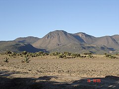
The Sierra Madre Oriental occupies 45.21 % of the surface, with average elevations of 2000 m a.s.l. no. m. The mountain range crosses the territory through the center, in a southeast-northwest direction; forming three main spurs of mountain ranges. All of these ramifications take different local names. The first foothill is located where the Zimapán and Jacala mountain ranges meet, which give way to the Sierra Gorda. In this area there are also ravines or canyons formed by the Moctezuma River, such as those of Infiernillo or San Vicente-Mármoles.
The second spur begins in Tulancingo and joins the central nucleus in the Agua Fría hill in Eloxochitlán; here the Sierra de Zacualtipán is located, as well as the ravines of Amajac, Metztitlán, Almolón, Metzquititlán and Tolantongo. Passing to the east of the territory, the Sierra de Tenango is located, some geographical maps name it as part of the Sierra Norte de Puebla. The third spur is located in the central part, where the Sierra Madre Oriental and the Neovolcanic Axis meet. intercept; It is here where the Sierras de Navajas, Pachuca, Actopan and Juárez meet.
The Neovolcanic Axis occupies 53.46% of the state territory, covering the southern part of the entity. It is made up of the highest peaks of the entity, with heights above 3000 m s. no. m.; as well as by various valleys and highlands, delimited by various mountains. The Tulancingo Valley is located to the southeast of the territory, it extends from the Sierra Norte de Puebla, heading northwest to southeast to the Sierra de las Navajas; having as its border the calderas of Tulancingo and Acoculco, which separate it from the Valley of Apan. The Apan Valley is formed by a set of plains and highlands to the south of the territory. These are delimited by the Navajas, Pitos and Tepozan mountain ranges.
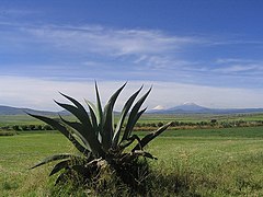
To the southeast of the territory is the Sierra de Tepozán where the Tepozán volcano and Cerro la Peñuela are located; La Peñuela in the municipality of Almoloya is the highest elevation in the state with 3380 m s. no. m. At the center of the Apan Valley are the Chichicuautla and Apan mountain ranges, which separate the alluvial plains of the area. The Sierra de los Pitos serves as the border of the Apan Valley from the Pachuca-Tizayuca Valley. The Sierra de Tezontlalpan is located in the southern center of the territory, and serves as the border between the Pachuca-Tizayuca Valley and the Mezquital Valley area.
To the southwest is the Mezquital Valley, which is made up of the Actopan, Ajacuba, Alfajayucan, Ixmiquilpan, Tasquillo, and Tula valleys; which are limited by mountains of volcanic origin and basaltic spills such as the Serranías de Xinthé, San Miguel de la Cal and El Mexe-Chicavasco. The extreme western area is made up of plateaus, geological faults and volcanic domes. There is also the Huichapan Caldera, a large depression whose approximately subcircular structure is 8.5 km in diameter, it was formed by the eruption of several ignimbrite flows approximately 4.2 Ma ago. Being on the limit of the Neovolcanic Axis and the Sierra Madre Oriental, it gives it particular geological and tectonic characteristics, which is why in the region there are faults, causing seismic activity. In the municipalities of San Salvador, Tasquillo, Progreso de Obregón, Actopan and Ixmiquilpan this type of phenomenon has occurred.
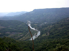
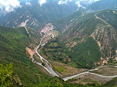
- Relieve of the state of Hidalgo.

Sierra huasteca located north of the territory.

Sierra de Zimapán located to the west of the territory.

Sierra de Tenango located east of the territory.

Sierra de las Navajas located in the center of the territory.

Sierra de Pachuca in the Minera region.

Barranca de Metztitlán located to the east center of the territory.
Plains of Apan located south east of the territory.
Actopan Valley located in the center of the territory.

Plains of Tula located south west of the territory.
Pachuca-Tizayuca Valley located in the southern center of the territory.

Tulancingo Valley located southeast of the territory.
Sierra de Chichicuautla located southeast of the territory.

.jpg)


.jpg)


.jpg)


Hydrography

The state of Hidalgo is almost entirely within the Pánuco hydrological region with an area of 94.95% of the state territory. This hydrological region is completely located in the Moctezuma river basin. Only a small extension from the eastern portion it is part of the Tuxpan-Nautla hydrological region, sheltering the Sierra de Tenango and the eastern end, in the vicinity of the state of Puebla. The basins of this hydrological region are: Tecolutla river, Cazones river and Tuxpan river; with a total of only 5.05% of the state territory.
Among the main water currents, the Tula, Amajac and Metztitlán rivers stand out. The Tula river has as main tributaries the Tepeji, Rosas, Tlautla, Salto, Salado, Chicavasco and Alfajayucan rivers; The Tula River, when joining the San Juan River, takes the name of the Moctezuma River, which serves as the border with Querétaro, later penetrating San Luis Potosí to form the Pánuco River. The Metztitlán River originates on the border with Puebla with runoff from Cerro Tlachaloya. On its way it first receives the name of the Tulancingo River, then the Venados River and finally the Metztitlán River, whose influx gives rise to the Metztitlán Lagoon.
The Amajac River rises in the Sierra de Pachuca, and serves as the boundary between Atotonilco el Grande and Actopan. With the name of the San Juan River, it passes through the districts of Jacala de Ledezma and Molango de Escamilla, receives the waters of the Metztitlán lagoon and joins the Moctezuma river outside the limits of the entity. With 317 km in length, it is the main water current of the entity. The most important dams are: Zimapán dam where the rivers converge San Juan and Tula; Requena and Endhó, on the Tula river; El Tejocotal, where the Huitzilin and Rincón rivers discharge their waters, and Omiltémetl, fed by the San Marcos river; El Cedral, in Mineral del Chico; and San Antonio in Huasca de Ocampo.
In reference to groundwater, CONAGUA has delimited twenty-one aquifers in the state: Zimapán, Orizatlán, Atotonilco-Jaltocán, Xochitlán–Huejutla, Atlapexco-Candelaria, Calabozo, Huichapan-Tecozautla, El Astillero, Chapantongo-Alfajayucan, Valle del Mezquital, Ajacuba, Ixmiquilpan, Actopan-Santiago de Anaya, Metiztitlán, Huasca-Zoquital, Tepeji del Río, Valle de Tulancingo, Acaxochitlán, Tecocomulco, Apan and Amajac. Also in part of Hidalgo's territory are the Álamo-Tuxpan aquifers belonging to the state of Veracruz, and the Cuautitlán-Pachuca belonging to the state of Mexico. Of these only two are overexploited, the Huichapan-Tecozautla and Valle de Tulancingo aquifers; as well as the Cuautitlán-Pachuca between the states of Hidalgo and Mexico.
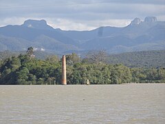
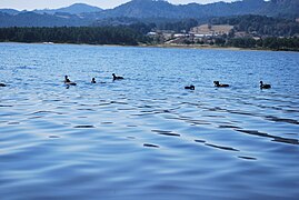
The main lagoons in the state are Tecocomulco between the municipalities of Tepeapulco, Apan and Cuautepec de Hinojosa; Metztitlán between the municipalities of Eloxochitlán and Metztitlán; and Atezca in the municipality of Molango de Escamilla. The Tecocomulco lagoon is the The largest body of water in the entity. In the state, the caves of Xoxafi in Santiago de Anaya, Tolantongo in Cardonal, Texcatete in Zacualtipán de Ángeles, Texcapa in Tepehuacán de Guerrero and Mecapala, Tecamachal and Villacastla in Molango de Escamilla stand out. The basaltic prisms of Santa María Regla are a basalt rock formation over which a small waterfall falls, they are the result of lava cooling several million years ago.
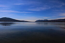
- Hydrography of the state of Hidalgo.

Río Tula in Mixquiahuala de Juárez.
Calabozo River in Huautla.
Metztitlán River in Metztitlán.
Laguna de Tecocomulco in Tepeapulco, Apan and Cuautepec de Hinojosa.

Metztitlán Lagoon in Eloxochitlán and Metztitlán.

Laguna de Atezca in Molango de Escamilla.

Presa Fernando Hiriart in Zimapán and Tecozautla.
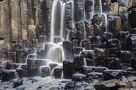
Baltic prisms in Huasca de Ocampo.

Tolantongo River in Cardonal.
Presa San Antonio Rule in Huasca de Ocampo.

Presa El Cedral en Mineral del Chico.
Presa El Tejocotal in the municipality of Acaxochitlán.


.jpg)


.jpg)
.jpg)

Climate

A(w)
ACf
ACm
ACw
BS1(h')
BS1h
BS1k
BSh
C(f)
C(m)
C(w)
C(E)(w)
Hidalgo has an average annual temperature of 16 °C. In January, the coldest month, the average minimum temperature is 4 °C; and the maximum occurs in April and May, which on average is 27 °C. In Hidalgo the warm climate has registered temperatures of up to 44 °C during April and May, in the Huasteca area. And in the Sierra area, minimum temperatures of -5 °C during the day and up to -10 °C at night, in the months of December and January. Between April and May 2017, in Huejutla, a record high of temperatures up to 50 °C. On January 24, 1906, it was recorded down to -15 °C, in Pachuca.
The rains occur in summer, from June to September, the average rainfall in the state is 800 mm per year. Hidalgo has regions with rainfall of 2800 mm per year, which contrasts with the dryness of some areas, where scarcely 250 mm are recorded. Due to its geographical characteristics, snowfall is very infrequent, however, in the mountainous areas snowfall, sleet, and frost have been recorded. In the state of Hidalgo there are forty-four municipalities considered vulnerable to the cold.
In the state territory, the tropical climate [A] occupies 23.03%. In general terms, the tropical sublimates are: the warm humid with rains all year round [Af] with 0.20%; the warm subhumid with summer rains [A(w)] with 0.84%; the humid semi-warm with rains all year round [ACf] with 13.31%; the humid semi-warm with abundant rains in summer [ACm] with 2.92%; and the semi-warm sub-humid with summer rains [ACw] with 5.76%. These are found mainly in the Huasteca Hidalguense.
The dry climate [B] occupies 38.57% of the state territory. In general terms, the dry subclimates are: the very warm and warm semi-dry [BS1(h')] with 0.17%; the semi-dry semi-warm [BS1h] with 4.92%; the temperate semi-dry [BS1k] with 29.65%; and the dry semi-warm [BSh] with 3.83%. Found mainly in the Mezquital Valley.
The temperate climate [C] occupies 38.40% of the state territory. In general terms, the temperate subclimates are: humid temperate with rains all year round [C(f)] with 3.35%; the humid temperate with abundant rains in summer [C(m)] with 2.70 %; the temperate sub-humid with summer rains [C(w)] with 31.42%; and the subhumid semicold with summer rains [C(E)(w)] with 0.93%. Found mainly in the areas of the Sierra Madre Oriental and Neovolcanic Axis that are located in Hidalgo.
| Average annual climate parameters of Hidalgo (1951-2010). | ||||||
|---|---|---|---|---|---|---|
| Key Station | Municipality | Altitude (msnm) | Temperature (C°) | Precipitation (mm) | ||
| Minimum (average) | Media | Maximum (average) | ||||
| 00013011 | Huejutla de Reyes | 150.0 | 17.3 | 23.7 | 30.1 | 1469.7 |
| 00013038 | Tlanchinol | 1365.0 | 13.4 | 17.6 | 21.8 | 2416.2 |
| 00013034 | Tenango de Doria | 1666.0 | 11.6 | 17.0 | 22.5 | 1733.7 |
| 00013074 | Ixmiquilpan | 1700.0 | 8.8 | 17.7 | 26.6 | 342.4 |
| 00013050 | Zacualtipán de Angeles | 1980.0 | 8.5 | 13.6 | 18.8 | 1287.3 |
| 00013056 | Pachuca de Soto | 2368.0 | 6.6 | 14.0 | 21.4 | 411.9 |
| 00013115 | Mineral of the Mount | 2812.0 | 7.5 | 13.0 | 18.5 | 870.7 |
| Source: National Meteorological Service. | ||||||
Ecology and environment
Flora and fauna

The State of Hidalgo is zoned into five Forest Management Units (UMAFOR): UMAFOR 1301. Sierra and Huasteca, UMAFOR 1302. Zacualtipán-Molango, UMAFOR 1303. Pachuca-Tulancingo, UMAFOR 1304. Valle del Mezquital, and UMAFOR 1305 Jacala-Tlahuiltepa. The existing flora is half a million hectares of desert-type scrub, pines, and mountain oaks. It also has jungle vegetation with 50 hectares with trees over 25 m tall.
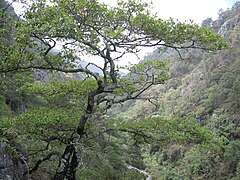
The vegetation that can be found in the Hidalgo mountains is represented by fir, pine, oak, oyamel and juniper; there is also copal, mahogany, rosewood, ebony, framboyán, mesquite, coffee, nopal, agave, lechuguilla and damiana. In the Tulancingo valley there are tejocote, pear, quince and apple fruit trees. In the Minera region Cactus, mesquite, maguey and nopal grow, among other plants. In the plains of Apan and the Basin of Mexico there are nopales, yucca, mesquite and pirul. The vegetation of the Mezquital Valley is made up of huizache, ahuehuete, walnut, biznaga, pirul, cardón, garambullo and other dry climate plants.
Among the most abundant fauna in the area, the following birds, mammals, and reptiles stand out: herons, parrots, hummingbirds, thrushes, owls, vultures, wild cats, coyotes, skunks, rabbits, hares, lizards, and rattlesnakes. Towards the center and throughout the northern and eastern part of the state there are white-tailed deer, ounces and jaguars. In the Sierra de la Huasteca the typical fauna is made up of opossums, porcupines, ocelots, badgers, quail and turkeys. The existence of an arid soil and the scant rains that occur in the Mezquital Valley, favors the presence of coralillos, lizards, chameleons, spiders, centipedes, scorpions, crickets, grasshoppers, ants and pinacates.
- Flora and fauna of the state of Hidalgo.
Encino (QuercusIn Zimapan.

Mexican Haya (Mexican)Mexican Fagus) in Zacualtipán de Angeles.

Biznaga (Echinocactus grusonii) in Metztitlán.

Nopal Serrano (Nopal Serrano)Opuntia stenopetalaIn Tula de Allende.

MagueyAmerican bird) in the Mezquital Valley.

Grey fox (Urocyon cinereoargenteus).
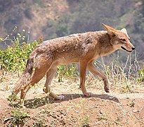
CoyoteCanis latrans).
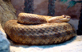
Cascabel of Queretaro (Crotalus aquilus).

Red Chipe (red Chipe)Cardellina rubra).


Protected natural areas


The state of Hidalgo has fifty-eight protected natural areas under federal, state and municipal jurisdiction; which cover 156,950.68 hectares, which represent 7.54% of the total territorial extension. The protected natural areas of federal jurisdiction correspond to three National Parks, a Biosphere Reserve and a Natural Resources Protection Area, the latter is shared with the state of Puebla. In total, the protected natural areas under federal jurisdiction cover 131,522.57 hectares. For their part, there are three state parks, four state reserves, and a biological corridor, with 14,088.89 ha; in addition to forty-five municipal areas of competence with 11,339.22 ha.
In addition, the state of Hidalgo has three sites decreed within the Ramsar Agreement: Laguna de Tecocomulco, Laguna de Metztitlán and the Necaxa River, the latter shared with the state of Puebla. Also on May 5, 2017, the UNESCO designated the Comarca Minera Geopark within the Global Geoparks Network.
It should be noted that the Ramsar sites and the Geopark do not necessarily represent a protected area; Of the Ramsar sites, only Metztitlán and Necaxa belong to a protected area, although only a fraction of the surface of the protected area corresponds to the Ramsar site. The area designated to the Comarca Minera Geopark corresponds to the total number of municipalities it includes, but only thirty-one geosites correspond to a core area; Within these geosites are protected areas of federal, state and municipal jurisdiction, and even historical monuments declared by the INAH.
| Main protected natural areas and areas decreed in the state of Hidalgo. | ||||
|---|---|---|---|---|
| Natural area | Date of appointment | Surface (ha) | Municipalities | Category |
| Metztitlán Barranca | 27 November 2000 | 96 042.90 | Acatlán, Atotonilco el Grande, Eloxochitlán, Huasca de Ocampo, Metepec, Metztitlán, San Agustín Metzquititlán and Zacualtipán de Angeles | Biosphere Reserve |
| Necaxa River | 2 February 2008 | 1541.4 | Acaxochitlán | Ramsar site |
| Laguna de Tecocomulco | 27 November 2003 | 1769 | Apan, Cuautepec de Hinojosa y Tepeapulco | Ramsar site |
| Laguna de Metztitlán | 2 February 2004 | 2937.2 | Eloxochitlán and Metztitlán | Ramsar site |
| Necaxa River | 9 September 2002 | 9491.15 | Acaxochitlán, Cuautepec de Hinojosa y Tulancingo de Bravo | Natural Resources Protection Area |
| Tula | 27 May 1981 | 99.50 | Allende Tula | National park |
| The boy | 6 July 1982 | 2739.02 | Mineral del Chico y Pachuca de Soto | National park |
| The Marbles | 8 September 1936 | 23 150 | Ledezma cod, Nicolás Flores, Pacula and Zimapán | National park |
| Geoparking Comarca Minera | 5 May 2017 | 184 800 | Atotonilco el Grande, Epazoyucan, Huasca de Ocampo, Mineral del Chico, Mineral del Monte, Omitlán de Juárez, Pachuca de Soto, Mineral de la Reforma and Singuilucan | Geopark |
| Source: National Commission of Protected Natural Areas. | ||||
Pollution

Water pollution is very high due to the densely populated and highly industrialized areas through which the rivers pass. The Tula river basin is the most affected as it receives wastewater from the Metropolitan Area of the Valley of Mexico, of which almost 60% is raw wastewater and the remaining 40% is rainwater. The main rivers that are contaminated are: Tula, Tepeji, Salado, El Salto and Alfajayucan.
Forest pests represent a phytosanitary problem that is basically concentrated in temperate pine and oyamel forests, mainly due to the lack of management of these forest areas. There is the presence of coniferous bark beetle affecting stone pine forests in the Mezquital Valley region. It is estimated that only 9.46% of the total area of forest vocation is under technical management of some kind.
The exploitation of the mining estates of Pachuca de Soto and Mineral del Monte generated during 500 years more than eighty million tons of sludge known as tailings. The presence of heavy metals reflects the possible infiltration into the aquifers, causing their contamination and generating in some areas the drag of particles by means of the wind.
The emissions of the state of Hidalgo are, where the percentage contribution is from mobile sources with 55%, followed by area sources with 20% of emissions, fixed sources with 17% and natural sources (biogenic emissions) with 8%. The industrial sector is the main source of sulfur dioxide (SO2) generation, contributing 99% of the emissions. The transport sector contributes 90% % of carbon monoxide emissions. As for nitrogen oxides, they are mainly emitted by the transport sector with 49% followed by the industrial sector with 42%.
According to the State Emissions Inventory, the total greenhouse gas (GHG) emissions of the state of Hidalgo were calculated using the ICCP 1996 methodology, resulting in a total emissions of 32,783.38 Gg of CO2eq and a capture of 1,134.20 Gg of CO2, for which a net emission of 31,373.05 Gg CO2eq is estimated. The CO2 emitted by the burning of fuels in the energy category is the the most outstanding emission of all GHGs. The source with the highest emission is the Tula thermoelectric plant. The energy category is also responsible for the largest SO2 emissions, mainly due to the burning of fuel oil by many industries. The industrial processes category ranks second. Partly due to the high SO emissions COVDM and also by CO2, mainly due to the manufacture of cement, lime and manganese ore. The waste category ranks third, especially due to the emission of methane.
There are ten municipalities in Hidalgo with environmental pollution problems: Pachuca de Soto, Mineral de la Reforma, Tizayuca, Tulancingo de Bravo, Tula de Allende, Tepeji del Río de Ocampo, Ixmiquilpan, Zimapán and Huejutla de Reyes.
Politics
Government
.jpg)
.jpg)
The city of Pachuca de Soto is the seat of the legislative, executive and judicial powers, therefore it is the capital of the state.
The executive power is represented by the constitutional Governor of the state of Hidalgo, who lasts in office for six years and can never be re-elected. The election of the governor is direct, secret, uninominal and by simple majority throughout the territory of the state. state. The first governor in office was Juan Crisóstomo Doria, who was in office from January 27 to May 27, 1869. The current governor in office is Julio Menchaca Salazar; whose period began on September 5, 2022, and will end on September 5, 2028.
The legislative power is deposited in a body called the Congress of the Free and Sovereign State of Hidalgo. The Congress is made up of 18 Deputies elected by direct vote and 12 Deputies elected by proportional representation. The I Legislature of the Congress of Hidalgo was formed from May 16, 1869 to February 28, 1870. The current legislature called the LXV Legislature of the Hidalgo Congress entered into office, for the period from September 5, 2021 to September 4, 2024.
The judiciary is made up of the following bodies: a) Jurisdictional: the Superior Court of Justice and Common Law Courts; the Court of Administrative Justice; the Labor Court; and officials and assistants in the administration of justice. b) Administrative: A Judicial Council. c) Non-Jurisdictional: The State Center for Alternative Justice, with technical autonomy and administratively linked to the Council of the Judiciary.
The Superior Court of Justice will be made up of at least fourteen Magistrates, approved by the Congress of the state of Hidalgo. The Court of Administrative Justice of the State of Hidalgo is a legal control body, with full autonomy to dictate their resolutions and power to enforce them. There are sixty-nine courts of First Instance of the Superior Court of Justice of the State of Hidalgo: fourteen in criminal matters, eight mixed, two in commercial matters, three in family matters, four in court, fifteen civil and family courts, one specialized in justice for adolescents, five execution courts and seventeen accusatory criminal courts.
In addition to a State Center for Alternative Justice created on April 23, 2007, mediation and conciliation processes are carried out here, where a neutral and impartial third party serves as a communication bridge between the interested parties. Account with five regional offices located in the judicial districts of Tulancingo de Bravo, Tula de Allende Huejutla de Reyes, Tenango de Doria and Ixmiquilpan.
Political-administrative division
Municipalities
- Municipal Division

The history of the territorial division originates in the period of Spanish domination, which in turn finds its antecedent in the population concentrations of pre-Hispanic Mexico. In order to reward the Spaniards who participated in the conquest, the established a system of distribution of benefits that was called encomienda. The parcel was the object of criticism, as well as successive regulations that regulated and limited its existence. It fell into decline after the New Laws of 1542, although it subsisted for some time in some regions.
Within the territorial organization in Hidalgo, the minor Provinces of Metztitlan, Pánuco, Texcoco, and Jiotepec correspond to it within the framework of the Greater Province of Mexico. Hidalgo was divided into nine Mayor's Offices: Zimapán, Huichapan, Ixmiquilpan, Tula, Actopan, Pachuca, Zempoala, Metztitlán and Yahualica, and five corregimientos that were those of Tepeapulco, Atitalaquia, Tulancingo, Mixquiahuala and Huejutla.
This division did not constitute the basis of the regional administration. The structure of the indigenous towns was used, so in each town or manor a "Cabildo de Indios" was adapted, the Indian cacique became in a governor and the figure of an indigenous judge or mayor was created. The bases of this organization were the "heads" and the "subjects". The "Head" it was the place of residence of the indigenous governor and his council, and the & # 34; Subject & # 34; to the populations that were remote, but were linked to it. Among the Indian towns are Zimapán, Actopan, Huichapan, Tula, Tulancingo, Pachuca, and Zempoala.
The first Mexican Constitution of 1824, from which the first states divided into municipalities governed by a city council were erected. This category was respected in the Constitution of 1857. During the French intervention in Mexico to organize the Mexican army on June 7, 1862, the president of Mexico Benito Juárez decreed the division of the state of Mexico into three military districts, the second formed by the territories that make up the state of Hidalgo, for which Actopan was designated as the capital.
The lack of infrastructure to house the authorities of that locality forced the headquarters to change to Pachuca. The structure of the Military Districts operated until March 3, 1865, the date on which Emperor Maximilian of Habsburg decreed a new territorial organization, fifty departments were established, two of them comprised the state of Hidalgo, those of Tula and Tulancingo.
After the Second Mexican Empire ended and the Republic was restored, after the establishment of the state in 1869, it was included in the districts of Actopan, Apan, Huejutla, Huichapan, Pachuca, Tula, Tulancingo, Ixmiquilpan, Zacualtipán and Zimapán. It is the Political Constitution of the United Mexican States of 1917, which grants the municipality full legal freedom. On January 8, 1970, the municipality of Progreso de Obregón was erected, the last municipality to be created.
In the history of the state, two municipalities have been suppressed. On August 8, 1865, Achiotepec was consigned as a municipality, suppressed on May 4, 1902, joining Tulancingo de Bravo. On May 13, 1924, the municipality of Santa María Nativitas was erected, suppressed on March 9, 1925, joining Tenango of Doria.
- Municipal Government
The municipal presidents of Hidalgo for the period 2020-2024 were elected by popular vote in the state elections held on October 18, 2020. They will begin their term on December 15, 2020 and by law will conclude their term on September 2024.
Administrative regions
At the state level it is divided into different administrative Regions. The current regionalization was published on December 25, 2017 in the Official Gazette of the State of Hidalgo. The regionalization is defined by the grouping of municipalities into three levels: I. Macroregional level; II. Operative Level; and III. Microregional level.
| .svg) Macroregions of the state of Hidalgo. | ||||||||||||||||||||||||||||
| .svg) Operative Regions of the State of Hidalgo. | ||||||||||||||||||||||||||||||||||||||||||||
| .svg) Microregions of the state of Hidalgo. | ||||||||||||||||||||||||||||||||||||||||||||||||||||||||||||||||
Districts
- Electoral districts
In the state of Hidalgo there are seven federal electoral districts. The current district was approved on March 15, 2017 by the National Electoral Institute. The federal electoral districts of Hidalgo are: District 1 Huejutla, District 2 Ixmiquilpan, District 3 Actopan, District 4 Tulancingo, District 5 Tula, District 6 Pachuca, and District 7 Tepeapulco.
In the state of Hidalgo there are eighteen local electoral districts, approved on September 3, 2015 by the General Council of the National Electoral Institute (INE). The local electoral districts of Hidalgo are: District 1 Zimapán, District 2 Zacualtipán, District 3 Orizatlán, District 4 Huejutla, District 5 Ixmiquilpan, District 6 Huichapan, District 7 Mixquiahuala, District 8 Actopan, District 9 Metepec, District 10 Apan, District 11 Tulancingo, District 12 Pachuca East, District 13 Pachuca West, District 14 Tula, District 15 Tepeji, District 16 Tizayuca, District 17 Villas del Álamo, District 18 Tepeapulco.
| .svg) Federal electoral districts of the state of Hidalgo. | ||||||||||||||||||||||||||||||
| .svg) Local elections districts of the state of Hidalgo. | ||||||||||||||||||||||||||||||||||||||||||||||||||||
- Judicial districts
The state of Hidalgo is divided into seventeen judicial districts: District 1 Actopan, District 2 Apan, District 3 Atotonilco el Grande, District 4 Huejutla de Reyes, District 5 Huichapan, District 6 Ixmiquilpan, District 7 Jacala de Ledezma, District 8 Metztitlán, District 9 Molango de Escamilla, District 10 Mixquiahula de Juárez, District 11 Pachuca de Soto, District 12 Tenango de Doria, District 13 Tizayuca, District 14 Tula de Allende, District 15 Tulancingo de Bravo, District 16 Zacualtipán, and District 17 Zimapán.
With the purpose of the proper functioning of the jurisdictional bodies, solely for administrative purposes, the judicial districts integrate five judicial circuits: First circuit Pachuca de Soto, Second circuit Tulancingo de Bravo, Third circuit Tula de Allende, Fourth circuit Ixmiquilpan, and the Fifth Huejutla de Reyes circuit.
| .svg) Districts of the state of Hidalgo. | ||||||||||||||||||||||||||||||||||||||||||||||||||||
Political-electoral participation
.jpg)
The first elections held in the state of Hidalgo were held on May 2, 1869, resulting in the victory for governor Antonio Tagle. The Hidalgo State Electoral Institute is the body in charge of carrying out and organizing state electoral processes, it was Created on November 9, 1995. It is a public citizen body, permanent and independent in its decisions and autonomous in its operation.
In the 2018 state and federal elections, 1,758 basic polling stations were installed, 1,781 contiguous, 19 special, and 229 extraordinary. Soto. According to the National Electoral Institute as of March 23, 2018, the state of Hidalgo has an electoral roll of 2,141,492 people and a nominal list of 2,121,965.
In the federal district 1 Huejutla, 290 basic polling stations were installed, 196 contiguous polling stations, two special and three extraordinary. In the federal district 2 Ixmiquilpan, 371 basic polling stations were installed, 200 contiguous, two special, and 26 extraordinary. Federal District 3 Actopan installed 295 basic polling stations, 248 contiguous polling stations, three special polling stations and 17 extraordinary ones.
In the federal district 4 Tulancingo, 190 basic polling stations, 278 contiguous, two special polling stations and 35 extraordinary polling stations were installed. In federal district 6 Pachuca, 185 basic, 320 contiguous, four special and 52 extraordinary polling stations were installed. In Tepeapulco federal district 7, 214 basic, 229 contiguous, three special and 43 extraordinary polling stations were installed.
International relations
The state of Hidalgo has a twinning relationship with the province of Henan, in the People's Republic of China; signed in Zhengzhou, on September 26, 2006; with a validity of 5 years (Agreement). On June 18, 2012 in Pachuca, government officials received a Chinese delegation led by the vice governor of Henan province, Xu Jichao, and signed the renewal of the Twinning agreement between Hidalgo and Henan.
Demographics
Population dynamics
| Population dynamics of the state of Hidalgo. | |
|---|---|
| Measured | Value |
| Population | 3 082 841 hab. |
| Density | 148.1 hab/km2 |
| Growth rate | 1.5 |
| Nativity | 16.91 |
| Fecundity | 2.2 |
| Mortality | 6.33. |
| Infant mortality | 10.89 |
| Life expectancy | 75.11 years. |
| Source: INEGI-CONAPO (2020). | |
According to the results of the 2020 Population and Housing Census of INEGI, the state of Hidalgo has a total population of 3,082,841; which represents 2.4% of the population of Mexico. With a demographic growth rate of 1.5; the population distribution is: 57% urban and 43% rural; and it has a population density of 148.1 inhabitants/km².
Of these inhabitants, 1,601,461 (51.9%) are women, and 1,481,379 (48.1%) are men; With a ratio of 92 men for every 100 women. The population under 17 years of age represents 31.1 % of the total; 18.6% are between 18 and 29 years old; 37.7% are between 30 and 59 years old; and 12.4% are 60 years of age and older. Half of the population is 30 years of age or younger.
For 2020, the projected birth rate is 16.91 live births per 1,000 inhabitants. The total fertility rate in the state of Hidalgo is 2.2 per number of live births per 1,000 women. In Hidalgo, the rate gross mortality was 6.33 per number of deaths per 1,000 people; and infant mortality is the demographic indicator that indicates the number of deaths of children in a population of every 1,000 registered live births, during the first year of their life in Hidalgo during 2020 is 10.89.
Regarding the demographic evolution when the state of Hidalgo was erected, a total of 404,207 inhabitants were registered for that year; in the First Population Census in 1895, 558,769 Hidalguenses were counted; doubling for the year 1970 when the figure of 1,193,845 was reached, exceeding one million inhabitants; and by 2010 the number of residents doubled again to 2,665,018 exceeding two million people. In 2015 it had 2,858,359 inhabitants and by 2020 3,082,841 exceeding three million inhabitants.
| Graphic of demographic evolution of the state of Hidalgo between 1869 and 2020 |
 |
| Source: INEGI |
Most populated locations
The term locality in the geographic scope of Mexico, refers to the lowest of the three levels of subnational division recognized by the government entity in charge by law of the definition of the national geostatistical framework, the National Institute of Statistics and Geography (INEGI).). The locality, according to the custom or the laws of each state, can have titles such as city, town, town, ranchería, congregation or even ejido; its population and political or economic conditions can be enormously variable, and it can even be completely depopulated.
According to the Municipal Organic Law of the state of Hidalgo, a city is considered to be those with more than 25,000 inhabitants; town, more than 10,000 inhabitants; villa, more than 5000 inhabitants; community, more than 500 inhabitants; and rancheria, those with less than 500 inhabitants. As of the year 2020, the state of Hidalgo has 4,690 localities; of which 4,514 are rural and 176 urban. The most populated locality is the state capital, the city of Pachuca de Soto with 297,848 inhabitants; while the least populated locality registered only one person, there are 101 localities with these characteristics in Hidalgo.
Most populated municipalities
The most populated municipality is the municipality of Pachuca de Soto with 314,331 inhabitants, which represents 10.20% of the state population, while the municipality of Eloxochitlán is the least populated with 2,593 inhabitants, 0.08% of the state population.
Metropolitan areas

For the state of Hidalgo there are three metropolitan zones, based on the criteria established by the Technical Group to delimit the metropolitan zones of the country, being the ZM of Pachuca, ZM Tulancingo and the ZM of Tula. The municipality of Tizayuca is considered within the metropolitan municipalities of the Metropolitan Zone of the Valley of Mexico.
The metropolitan area of Pachuca is made up of the municipalities of Pachuca de Soto, Mineral del Monte, Mineral de la Reforma, San Agustín Tlaxiaca, Epazoyucan, Zapotlán de Juárez and Zempoala. Being Pachuca de Soto and Mineral de la Reforma the central municipalities.
The Tulancingo metropolitan area is made up of the municipalities of Tulancingo de Bravo, Cuautepec de Hinojosa and Santiago Tulantepec de Lugo Guerrero, these three being central municipalities. The Tula metropolitan area is made up of the municipalities of Tula de Allende, Atitalaquia, Atotonilco de Tula, Tlahuelilpan and Tlaxcoapan, with Tula de Allende being the central municipality.
Ethnicity
_2.JPG)
In the state of Hidalgo there is an indigenous population of 606,045 people. The most significant indigenous peoples are the Nahua and Otomi people; The Tepehua group is also found to a lesser extent. The indigenous population is located in three well-defined regions: the Mezquital Valley, inhabited by the Otomi; the second is the Huasteca, inhabited mainly by the Nahuas; and the third region is located in the eastern strip that borders Puebla and Veracruz, which is known as Otomi-Tepehua or Sierra de Tenango, the population is mostly Otomi and a Tepehua minority.
The municipalities where more than 90% of the population identifies as indigenous are: Jaltocán, Xochiatipan, Yahualica, Cardonal, Huazalingo, Nicolás Flores and Huautla. In contrast, the municipalities where less than 10% of the population identifies as indigenous are: Tlanalapa, Almoloya, Cuautepec de Hinojosa, Pisaflores and Singuilucan.
In the state of Hidalgo, 48,693 people self-identify as Afro-Mexican or Afro-descendant, 1.58% of the total population of the state of Hidalgo. Of which 23,585 are men and 25,108 are women. The The municipality with the largest Afro-Mexican or Afro-descendant population is Pachuca de Soto with 6,204 people; It is followed by the municipalities of Mineral de la Reforma with 4,251 people, Tizayuca with 3,618 people, Tulancingo de Bravo with 2,835 people, and Huejutla de Reyes with 2,240 people.
Indigenous languages
| Indigenous languages in the state of Hidalgo. | |
|---|---|
| Name | Percentage |
| Nahuatl | 64.9 |
| Otomí | 33.5 |
| Tepehua | 0.4 |
| Totonaco | 0.2 |
| Zapoteco | 0.2 |
| Mixteco | 0.1 |
| Maya | 0.1 |
| Huasteco | 0.1 |
| Mazahua | 0.1 |
| Other languages | 1.1 |
| Source: INEGI (2020). | |

By 2020, the state of Hidalgo has 362,629 people speaking an indigenous language, 12.31% of the population. Of which 175,833 are men and 186,796 women. Of the speakers of an indigenous language, some 331,650 people, 91.5% of the total, also speak Spanish; while 28,497 people, 8.5%, only their mother tongue.
The municipalities with the largest number of speakers are Huejutla de Reyes with 64,555 people, Ixmiquilpan with 34,500, San Felipe Orizatlán with 20,451, Yahualica with 18,557, and Tlanchinol with 16,061. an indigenous language are Xochiatipan with 85.57%, Yahualica with 75.21%, Huazalingo with 74.19%, Jaltocán with 75.48%, and Atlapexco with 67.31%.
In the state of Hidalgo, up to 48 indigenous languages are spoken; the majority are Nahuatl, Otomi and Tepehua. Speakers of the Nahuatl language are mainly concentrated in sixteen of these municipalities, fourteen of which form a conglomerate in the northeast of the state in the Huasteca and Sierra Alta regions. The municipalities of Huejutla de Reyes and San Felipe Orizatlán are the ones that stand out for their number of speakers. In the area, the variant of Nahuatl from the Hidalgo Huasteca stands out.
The Otomí language can be grouped in the regions of the Sierra Baja, Sierra Gorda and Valle del Mezquital, where a block of twelve municipalities is formed; although it is also found in the Sierra de Tenango (Otomí-Tepehua area). Ixmiquilpan is the municipality with the largest number of speakers of this language. The variants of Otomí from Valle del Mezquital and Otomí from Tenango stand out. of the Tepehua language are mainly concentrated in the municipality of Huehuetla, which is located in the Otomí-Tepehua zone, in the extreme east of Hidalgo; with the Tepehua variant of Huehuetla.
The languages that continue with a smaller presence, with a concentration of the population that speaks them is a few hundred, are the languages Mixtec, Zapotec, Totonac, Mazahua, Maya, Huastec, Chinantec, Tlapanec, Tseltal, and Purépecha. In a much smaller presence, with a concentration of population that speaks them less than 100 people in some cases even less than 10 people are the Ch'ol, Tzotsil, Popoloca, Amuzgo, Triqui, Mam, Cuicateco, Zoque, Huave, Huichol, Tarahumara, Cora, Mayo, Yaqui, Matlatzinca, Tojolabal, Chontal de Oaxaca, Chontal de Tabasco, Chocho, Chatino, and Tlahuica. Many of these are presumed to be immigrant populations in the state of Hidalgo.
Housing

By 2020 there are 1,197,729 private homes, of which 857,174 are inhabited, 229,124 are uninhabited, and 111,431 are for temporary use. The number of occupants per inhabited private home is 3.6 on average. The municipalities with the highest number of inhabited private homes are: Pachuca de Soto (93,242), Mineral de la Reforma (63,885), Tizayuca (47,529) and Tulancingo de Bravo (45,953).
In Hidalgo by 2020, 64.3% of the homes have a cement or firm floor, 32.7% a wooden, mosaic or other coating floor and 2.9% a dirt floor. Regarding the availability of services and equipment, 99.0% have electricity service, 97.3% bathroom or toilet service, 94.9% have drainage, 66.9% have piped water, 29.1% only piped water in the patio or field, the 76.3% have a water tank, and 22.6% have a cistern or cistern.
As for housing by goods and technologies, 82.8% have a refrigerator, 60.1% have a washing machine, and 34.7% have a microwave oven. In terms of information and communication media, 30.5% have computer, 24.6% have a fixed telephone line, 85.1% with a cell phone, 38.8% with Internet, 44.2% with pay television service, 11.2% have paid Internet movie, music or video service, and 7.5% have a video game console. In terms of means of transportation, 44.3% of the homes have a car or truck, 22.5% a bicycle, and 10.1% a motorcycle or scooter.
Poverty and social marginalization

According to the measurements in 2008, 55.2% of the population was in poverty, for 2010 it decreased to 54.8%, for 2012 it decreased to 52.8% and for 2014 the percentage increased again to 54.3%. For 2016 50.6%, and by 2018, 43.8% of the entity's population lived in poverty.
The municipalities with the highest percentage of population in extreme poverty were: Xochiatipan, Yahualica, Huehuetla, Tepehuacán de Guerrero and San Felipe Orizatlán. The municipalities with the lowest percentage of their population in extreme poverty were: Mineral de la Reforma, Pachuca de Grove, Tizayuca, Atotonilco de Tula and Tepeapulco.
The five municipalities with the highest degree of marginalization in the state are: Huehuetla, Yahualica and Xochiatipan. The five municipalities with the lowest degree of marginalization in the state are: Pachuca de Soto, Mineral de la Reforma, Tepeapulco, Tizayuca and Atitalaquia.
Religion
| Religions in the state of Hidalgo. | |
|---|---|
| Religious group | Believers |
| Catholic | 2 475 984 |
| Protestant / Evangelical Christian | 301 786 |
| Judaico | 981 |
| Islamic | 182 |
| Ethnic roots | 479 |
| Afro | 1091 |
| Spiritualist | 2647 |
| Other religions | 1405 |
| No religious (believing) | 150 061 |
| No religion | 141 682 |
| Source: INEGI (2020). | |


According to the results presented by the INEGI 2020 Population and Housing Census, the main religion is the Catholic Church with 80.3% of the population; Protestants, Christians and Evangelicals represent 9.8% of the population; 4.9% of the population declare themselves without religious affiliation, but a believer; 4.6% declare themselves without religion, atheist or agnostic; and 0.2% correspond to Judaic, Islamic, Ethnic roots, Afro roots, Spiritualist and others.
The Catholic Church is the most practiced, the work of evangelization in the state of Hidalgo began when the Franciscans arrived in the region of Tepeapulco in 1528 and later in Tula in 1930. The Augustinians settled in Atotonilco el Grande and Metztitlán in 1536. Secular priests worked in a narrow strip of territory that stretched from Tizayuca, Tetepango, Pachuca, Mineral del Monte, Mineral del Chico, and Yahualica. Dominicans did not settle in the state of Hidalgo during the 16th century. In 1743 it was ordered that the religious convents pass to the Secular Clergy, from that year, little by little, the parishes were passed to the administration of the Secular Clergy. On May 22, 1864, the Diocese of Tulancingo and on November 25, 2006, the Archdiocese of Tulancingo was created. This archdiocese has Tula and Huejutla as suffragan dioceses.
Judaism arrived in Pachuca in the 16th century, through the crypto-Jews, Manuel de Lucena and Beatriz Enríquez, of Portuguese origin; who founded an inn or inn on the outskirts of the city. According to the Museum of The Jewish People Online Beit Hatfutsot site, between the 1920s the first Jewish congregation in the city was created. On June 14, 2011, the religious group called Comunidad Israelita Mexicana El Neguev was registered to become a religious association.
From the second decade of the 19th century, due to the presence of numerous mining managers and technicians of Cornish and English origin, in Pachuca and Mineral del Monte, various branches of Protestantism arrived, among them Lutheranism, Calvinism, Anglicanism and Methodist. In 1840 they established the first English-speaking Protestant congregation, and in 1850 the first Protestant pastor, the Reverend Henry Davis, arrived in Pachuca, who officiated in English at Finca San Lunes.
The Church of Jesus Christ of Latter Day Saints arrived in the state of Hidalgo in 1880 in Nopala de Villagrán, when Desideria Quintanar de Yáñez became the 22nd person (first woman) in Mexico to convert to Mormonism, she was baptized with his son José María and his daughter Carmen, likewise, the wife of José María. On July 5, 1881 in the town of San Marcos in the municipality of Tula de Allende, Jesús Sánchez was baptized with other people. Jesús Sánchez introduced the Monroy family to Mormonism, this family would create a branch of this religion in this town around 1913. During the Mexican Revolution on July 17, 1915, Rafael Monroy president of the small branch of San Marcos, and Vicente Morales, his first adviser, were seized by a group of revolutionaries and executed. The Church of Jesus Christ of Latter-day Saints has a nine-stake presence in the state of Hidalgo.
Healers and shamans still predominate in the conception of the inhabitants, especially in the most remote communities, nestled in the middle of the mountains. Popular beliefs refer to curing evil eyes, air, whooping cough, rabies, pain caused by work, fright, skin infections, etc. Santa Muerte has been venerated in the state of Hidalgo since 1965, in the state this cult takes place mainly in the towns of Pachuca and Tepatepec.
In the most extreme cases, conflicts between religions have been generated in the state. Problems include: the imposition of fines and punishments, the denial or suspension of public services (drinking water, drainage, education, government programs), the confiscation of property and the threat of expulsion from the community; all of them as sanctions for refusing to comply with community uses and customs related to religious aspects. The main municipalities where this type of aspect occurs are: Huejutla, Huazalingo, San Felipe Orizatlán, Huautla, Tlanchinol and Ixmiquilpan.
Culture
Architecture

Religious architecture
In the territory of the state of Hidalgo, the Franciscan Order and the Order of San Agustín evangelized mainly; the convent buildings and the churches and chapels, built by both religious orders, are located in a large portion of the Hidalgo territory, either the Sierra Alta, the Valle del Mezquital, the Huasteca and the plains of Apan. There are notable differences between those built by the Augustinians and Franciscans. The Augustinians are richer and more elaborate, both in their architectural programs and in the complex sets of paintings mural; the Franciscan establishments, for their part, are more modest. The religious architecture of the 16th century contains high towers with bell towers, buttresses, vaults, an atrium, the atrial cross, the chapels, the open chapel, the church, the cloister, the the portico, the sacristy and the garden. The construction of temples and convents during the period was fundamentally in charge of the friars, aided by European artisans and indigenous workers.
The Franciscans arrived in Tepeapulco and then Tulancingo in 1528 and two years later in Tula (1530). Franciscan foundations included Zempoala (1540); Tepeji del Rio (1558); Apan (1559); Alfajayucan (1559); Atotonilco de Tula (1560); Tlahuelilpan (1560); Tepetitlan (1561); Huichapan (1577); Tecozautla (1587). The Augustinians settled in Atotonilco el Grande and Metztitlán in 1536. From there they spread and reached Xochicoatlán (1538); Epazoyucan (1540); Singuilucan (1540); Mixquiahuala (1539); Huejutla (1545); Molango (1546); Actopan (1550); Ixmiquilpan (1550); Villa de Tezontepec (1554); Acatlan (1557); Chichicaxtla (1557); Tutotepec (1560); Chapulhuacan (1560); Chapantongo (1566); Ajacuba (1569); Tlanchinol (1569); Zacualtipan (1572); and the Lolotla (1563).
During the 17th and 18th centuries, interesting samples of New Spanish Baroque were also developed, including the Sanctuary of the Lord of Mapethé in the town of Mapethé in the municipality of Cardonal and the Convent of San Francisco in Pachuca de Soto. For At the end of the 18th century, neoclassical architecture began to be used; Several temples have modified their original structure, such as the Cathedral of Tulancingo.
- Religious architecture in the state of Hidalgo.
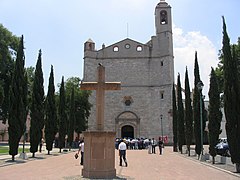
Cathedral of San Jose in Tula.

Cathedral of Christ the King, in Huejutla.

Temple and ex-convention of San Francisco, in Tepeapulco.

Temple and ex-convention of All Saints, in Zempoala.
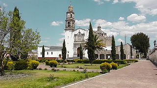
Temple and ex-convention of the Assumption, in Apan.

Temple and ex-convention of the Holy Kings in Metztitlán.
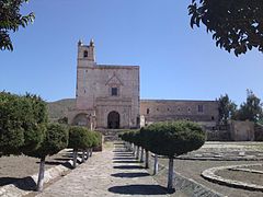
Temple and ex-convention of St. Andrew the Apostle in Epazoyucan.

Temple and ex-convention of St. Michael the Archangel in Acatlán.

Temple and ex-convention of St. Nicholas of Tolentino, in Actopan.

Temple and ex-convention of St. Michael the Archangel in Ixmiquilpan.
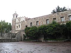
San Francisco Temple and Exconvento in Pachuca.

Temple and ex-convention of Our Lady of Loreto, in Molango.

.jpg)


Civil architecture

During the Viceroyalty of New Spain, Hernán Cortés built a house in Tepeapulco; the House of Hernán Cortés, had a tower, a fort, battlements to equip oneself and other luxuries of that type; it occupied an entire block, today it is divided among five families. Also during this period, the Tercena de Metztitlán was built, one of the few civil buildings from the 16th century to gather a council that remains standing in Mexico; It consists of two adjoining vaulted rooms, open to the outside through semicircular arches.
In the construction of aqueducts, the Tepeapulco aqueduct and water box stand out; the aqueducts of Actopan and Epazoyucan, which served the Augustinian convents of those towns; also noteworthy are the bridges that cross rivers and streams, such as the one called La Otra Banda, at the entrance to the Progreso neighborhood, in Ixmiquilpan.
The haciendas were built during the 16th and 20th centuries; some were built to benefit the metals that were extracted from the mines, and others for the production of livestock and pulque. Many of them belonged to aristocratic families of the viceregal or Porfirian society. There are twenty-five haciendas between the municipalities of Apan and Almoloya, these are: Chimalpa, Alcantarillas, Acopinalco, Horno, Mala hierba, the Tetlapayac dam, Tezoyo, Espejel, Ocotepec, Zotoluca, Aviles, Buena Vista, Cocinillas, La vente, San Isidro, Huehuechocan, Coatlaco, Ánimas, Santa Bárbara, Ixtilmaco, El Rincón, Tepepatlaxco.
Among the best known mill farms are those built by Pedro Romero de Terreros in the municipality of Huasca de Ocampo: Santa María Regla, San Miguel Regla, and San Antonio Regla. In 1915 San Antonio Regla was completely flooded by the dam of the same name and only part of the chimney and a small tower protruding from the water can be seen.
By the 19th century, the strong French influence that accompanied the Porfirian period was felt in the entity and proof of this are the various municipal palaces that were built mainly in neoclassical style. The monumental clocks built during this period are the from Tecozautla (1905) and Huejutla (1908). The main building of this type is the Monumental Clock of Pachuca, it was inaugurated on September 15, 1910, in the middle of a great popular festival; built to commemorate the Centennial of the Independence of Mexico.
Of Art Deco architecture in the state, is the Municipal Palace of Mixquiahuala; and of Art Nouveau architecture, is the old Exquitlán hacienda. During the contemporary period, different monumental clocks were built such as those of Pachuquilla, Acaxochitlán, Santiago Tulantepec, Cuautepec, Metzquititlán and Jacala. The historic center of Pachuca de Soto also stands out, with an approximate area of 12 km². It has sloping streets and narrow alleys; It is in this area where the old mining buildings are located, of which about 500 are valued in the city's historical catalog, for their restoration and preservation.
- Civil architecture in the state of Hidalgo.
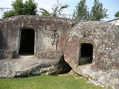
Stone house in Zacualtipán de Angeles.

Monumental clock and main square in Acaxochitlán.

Monumental clock and main square in Pachuca de Soto.

The Metztitlán Tercena.
Hacienda de Exquitlán in Tulancingo de Bravo.

Monumental watch in Huejutla.

English Pantheon in Mineral del Monte.

Chimalpa Hacienda in Apan.

Hacienda de San Miguel Rule in Huasca de Ocampo.

Hacienda de Santa Maria Rule in Huasca de Ocampo.
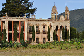
San Diego Tlalayote Hacienda in Apan.

Hacienda Ocotepec in Apan.


.jpg)


.jpg)

.jpg)
Sculpture

.jpg)
From the pre-Hispanic period, the sculptures representing different representations of gods stand out, as well as the ceramics of this period. In Yahualica the "Falo de Yahualica" a sculpture that is associated with the cult of the Phallus, measures 156 centimeters high by 30 centimeters wide. There are also the Atlantes of Tula, divided into four segments, the sculptures average 4.60 m in height. It is believed which are representations of Toltec warriors, dressed in a feathered headdress, a butterfly pectoral (or "átlatl", hence the name "Atlanteans"), darts, a flint knife and a curved weapon. Another is the Chac Mool, Toltec sculpture of great importance.
During the period of the Viceroyalty of New Spain, the high-relief and bas-relief works used mainly on the façades of churches and convents stand out, those of Metztitlán, Epazoyucan, Ixmiquilpan, Atotonilco el Grande and Actopan stand out. The altarpiece is the architectural, pictorial and sculptural structure that is located behind the altar in Catholic churches of the Latin rite. Interesting altarpieces have been produced in Hidalgo, such as: Apan, Mapethé, Huichapan and the Iglesia del Carmen in Ixmiquilpan.
By the end of the 19th century and the beginning of the 20th century, the strong French influence that accompanied Porfiriato made itself felt in the entity; The different monuments stand out, some monuments dedicated to Benito Juárez, erected on the occasion of the centenary of his birth. In the 20th century, the Cristo Rey de Pachuca sculpture stands out, 33 m high; Angeles, is the so-called Mining Corridor; which is a series of monuments, sculptures, and old mining equipment, placed to highlight the region's mining past.
The Diana the Huntress Fountain in Ixmiquilpan, was donated to the town in 1970 by Alfonso Corona del Rosal, when a replica of the Diana the Huntress fountain was built, placing the replica in Mexico City and the original in Ixmiquilpan. The sculpture was made by Juan Fernando Olaguíbel and is 22 m high in Art Deco style. In Mineral del Monte is the Monument to the Anonymous Miner, and the Monument to the First Strike in America.
In the 21st century, the monuments to commemorate the Bicentennial of Mexico stand out, such as the Monument to the Victory of the Wind, 19 m high; and the Rotunda de los Hidalguenses Ilustres. In 2014, five monumental sculptures were installed in Pachuca that were built by Enrique Carbajal that have "air" as their theme., Héctor Vázquez, José Antonio Cano Hernández, Ana Teresa Fierro, José Luis Vera, Carmen Parra Velasco, Mario Patiño and Benjamín León Estrada.
Painting


In the state of Hidalgo there are fifty-eight sites with cave paintings, distributed in more than thirty municipalities. The main ones are Huichapan, Tecozautla, Alfajayucan, Metztitlán, Tepeapulco, Ajacuba, Actopan, Agua Blanca de Iturbide, El Arenal, Atotonilco de Tula, Cardonal, Cuautepec de Hinojosa, Chapantongo, Epazoyucan, Huasca de Ocampo, Juárez Hidalgo, Metepec, San Agustín Metzquititlán, Progreso de Obregón, San Salvador, Santiago de Anaya, Ixmiquilpan, Tepeji del Río de Ocampo, Tepetitlán, Tezontepec de Aldama, Tlahuiltepa, Tulancingo de Bravo, Zacualtipán de Ángeles and Zimapán. The petroglyphs are located in the municipalities of Acatlán, Huazalingo, Metztitlán, Mixquiahuala, Tepeapulco, Tepeji del Río de Ocampo, Tula de Allende and Tulancingo de Bravo.
In New Spain, the murals or frescoes that can be found in several of the convent enclosures stand out, such as in the open chapels, in the nave, in the cloister, in the sacristy, and in the refectory. convents of Actopan, Ixmiquilpan, Atotonilco el Grande, Epazoyucan and Metztitlán; as well as the Iglesia de la Purísima Concepción in Santa María Xoxoteco. At the beginning of the XIX century, during his trip through Alexander von Humboldt, in the state of Hidalgo, would draw and study the basaltic prisms of Santa María Regla and the Órganos de Actopan known as Los Frailes. During the 19th century, different places in Hidalgo would be visited and drawn by different painters and academics such as Johann Moritz Rugendas, François Mathurin Adalbert and Eugenio Landesio.
During the 20th century, the works of Mexican muralism stand out, Roberto Cueva del Río made three murals, the first in Ixmiquilpan, made in the Mezquital Valley Indigenous Heritage building in 1955; the second is in Pachuca de Soto located in the Center for the Arts of Hidalgo carried out in 1957; and the third is in Ciudad Sahagún located in the Fray Bernardino de Sahagún elementary school, carried out in 1958. In Pachuca de Soto there are the murals made by José Hernández Delgadillo in the 1980s in Plaza Juárez, called "Contradicciones y lucha en Hidalgo" and "For democracy, work and national sovereignty". In Tula de Allende is the mural "Tula Eterna" located in the downtown open-air theater, made by Juan Pablo Patiño Cornejo made between 1994 and 1997.
.jpg)
In the 21st century different works were carried out continuing with the mural, and incorporating the graffiti technique. On March 13, 2005, a pictorial slab designed by Byron Gálvez entitled "Homage to the Woman of the World"; whose dimensions are 80 m wide by 400 m long, it is divided into sixteen modules that contain two thousand and eighty figures made with approximately seven million mosaics of twelve different sizes and forty-five different ones, all of them in color. On August 31, 2015, it was inaugurated in Colonia Palmitas, the Macromural of Pachuca; one of the ideas was to capture the nickname of Pachuca "La Bella Airosa", and yes, in the distance the colors are seen as waves of air.
In Colonia Morelos (El Nueve), in the municipality of Mixquiahuala de Juárez, 160 murals by 140 artists from 22 countries have been made, the cultural project that began in 2014. Among the visual artists from the state are: José Hernández Delgadillo, José Emmanuel Garcá Sánchez, Yessica Adriana Ruiz Morales, José Emilio Pacheco Vega, Celia Guadalupe Rasgado Marroquín, Liliana Herrera Hernández, and Bernardo Santiago Ángeles.
Literature

Among the literature, the codices made in pre-Hispanic Mexico and during New Spain stand out; such as the Huichapan Codex, the “Fundo del pueblo de Acaxochitlán”, the Mizquiahuala Tribute Codex, the Anales de Tula, the Nicolás Flores Codex.
During the 19th and 20th centuries, among the main writers are: Efrén Rebolledo, poet, among his most important works are "Japanese Rhymes", "El Desencanto de la Dulce Inea" and "Libro de Loco Amor"; Genaro Guzmán Mayer, writer and playwright, his most representative works are: Metallic Voice, Deni Thani, Pachuca verbal urn and the book Ixmiquilpan dedicated to the Mezquital Valley; Ricardo Garibay that includes the novel, essay, poetry, chronicle, theater and I count; The novel The House That Burns at Night (1971) stands out; Gabriel Vargas cartoonist created "La Familia Burrón", which had a weekly circulation of more than 500,000 copies.
Among the main writers are: Jesús Becerril Martínez, Enrique Olmos de Ita, Fernando Rivera Flores, Rafael Tiburcio García, Jair Cortés, Rogelio Perusquía, Julio Romano Obregón, Alfonso Valencia, Javier Said Estrella García, Ignacio Rodríguez Galván, Daniel Olivares Viniegra, Ignacio Trejo Fuentes, Daniel Fragoso Torres, Raúl Macin Andrade, Nancy Ávila Márquez, Agustín Cadena, Diego Castillo Quintero, Adela Calva Reyes, José Lorenzo Cossío, José Luis Herrera Arciniega, Gonzalo Martré, Luis Ponce, Elisa Vargaslugo Rangel, Margarita Michelena and Yuri Herrera.
The most important library in the state is the Ricardo Garibay Central State Library, inaugurated on May 18, 2007 and occupies a space of 4560 m², and can simultaneously serve up to 700 users. The library has a collection of more of 65,000 volumes, distributed over the two floors of the modern and comfortable building, and divided into nine collections: General, Children's, Didactic, Silent, Braille, Multimedia, Newspapers and Hidalgo Collection.
Music

.JPG)
The Symphonic Band of the State of Hidalgo created in 1901, and its first director was Candelario Rivas. The symphonic band has adapted popular music with different aspects: jazz, tango, national and foreign folklore. It is performed annually a season of concerts by the UAEH symphony orchestra, created in 1997; that plays in the Aula Magna Alfonso Cravioto with a capacity for 740 people. On January 16, 2014, the activities of the Children's and Youth Symphony Orchestra of Tlaxcoapan begin, this project benefits boys and girls from the south-west region of the Valley of the Mezquital.
Regional music is represented by the so-called huapango, a musical genre also known as "Son Huasteco" from the Huasteca Region. There are two types of huapango: the traditional and the modern. The traditional huapango is interpreted using three instruments: jarana, violin, fifth huapanguera or guitar. The modern Hupango or Huapango slow, is the result between the son huasteco, and the commercial ranchera song. Two of the main composers of huapango, Nicandro Castillo and Valeriano Trejo, originate from Hidalgo.
Within Otomí music, through music, it manifests cultural elements that refer to the traditions and tastes of the Otomi people. These elements have been taken up, or have been created based on collective concerns. In the Valle del Due to the high number of migrants in Mezquita, the “grupera” music has led to the marginalization of traditional dance and music in the festivities, there are even groups of “cumbia hñahñu”. The music of the hñähñu people is used to accompany the ritual of songs and dances, it also has the function of recreation, you can listen to mischievous, loving, pastoral, animal and lullaby versions.
Among the musicians from the state of Hidalgo are: Consuelo Gándara Romero (Soprano); Josefina Estefanía Blancas García (Pianist); Leonardo Bejarano (Flutist); Clara Lozano Garcia (Pianist); Gladys Habib Nicholas (Soprano); David Peña Cruz (Percussionist); Carlos Galvan (Tenor); Jesus Yusuf Isa Cuevas (Musician); Nimbe Salgado (Soprano); María Teresa Rodríguez (Pianist); Abundio Martínez (Composer); Miguel Ángel Asiain Díaz (Guitarist); Martha Zeller (Singer); Demetrio Vite (Composer); Alejandro Chehín (Pianist); Maximino Calva Pérez (Musician); Mauricio Hernández Monterrubio (Musician); Paula Hernández del Castillo (concert player); Alejandro Moreno Ramos (concert player); Alberto González García (Musician); Leonardo Martín Candelaria González (Musician); José Luis Roma (Composer and Singer); and Raúl Roma (Composer and Singer).
Dance


The Ballet Folclórico del Estado de Hidalgo, was founded in 1976. Among the traditional dances of the state of Hidalgo, there are many in which the dancers are disguised or masked with different elements. The groups of dancers are accompanied by a music group, the instruments vary according to the area: in the Huasteca and the Sierra they use jarana, violin and guitarrón in the Valley a small guitar similar to the mandolin.
In the Huasteca region, the dance of the Indian women is performed, also called “Macehualichpocamihtotlan”; that is danced on December 12 in honor of the Virgin of Guadalupe; the group is made up of only women. The dance of the mecos is danced during the carnival; the dancers paint their bodies with tepetate, and use a headdress and loincloth. The Texoloc indigenous women's dance is danced in honor of the Virgen de la Concepción, in Texoloc, Xochiatipan municipality. The dance is also danced in the Huasteca of the Matlachines, the dance of the negritos, the dance of Montesón, the dance of Chicomexochitl, the dance of Xochitines and the dance of the Huehuentines, as well as the dance of Huapango.
In the Xantolo different dances are performed, most of them only performed by men such as: the dance of Cuanegros, the men interpret the “old women” and the “old men”; the dance of the tecomates, where the six dancers They wear white blanket shirts and pants; the cabbage dance, the costumed wear very old and battered clothes, cover their faces with a cloth mask, some men dressed as women.
The state of Hidalgo shares traditions and customs with neighboring regions, it is common to use some traditions that often come from Veracruz, or from the Sierra Norte de Puebla, such as the Dance of Quetzales, the Rite of the Flyers and the dance of the Acatlaxquis; these are mainly performed in the Sierra de Tenango. The dance of the bows is danced in the Sierra Alta and Baja, mainly in Metzquititlán and in Los Reyes, municipality of Acaxochitlán. Due to its steps, music and costumes, it is a mockery of the Spanish dances of the colonial era. There is also the dance of the flower of the municipality of Tenango de Doria.
The dances in the Mezquital Valley are of recent creation, in this area the "Ixtle Dance" stands out, which describes the spinning and weaving of the ixtle. The music is made up of seven songs in the Otomi language, it is made up of fourteen evolutions and eight steps, 12 women and 12 men participate. The dance was created in 1965, whose author was Pedro Pioquinto Secundino Miranda, originally from the municipality of Ixmiquilpan. Also from the Mezquital Valley is the dance of the shepherdesses, where a group of girls dance in honor of the Virgin Mary; San Sebastián Mártir is represented by a young man tied to a tree, the dancers dance around him pretending to throw their arrows at him.
Among the dance performers from the state of Hidalgo are: Álvaro Serrano Gutiérrez (Choreographer); Renato Alvarez (Interpreter); Enrique Cruz del Castillo (Choreographer); Javier Santo (Interpreter) and Alejandra Castañeda (Interpreter).
Parties

The calendar is full of festivities, which are the product of the heritage of indigenous and Spanish miscegenation. This begins with the celebration of Candelaria; going through the carnivals to later celebrate Easter, arriving at the Day of the Dead. At the end of the year the Virgin of Guadalupe, the Posadas and Christmas are celebrated; which closes the cycle of religious festivals.
Throughout the year there are festivities paying homage to the patron saint of each locality with religious services, mechanical games, and sporting and cultural events. In the celebrations, the fireworks stand out, mainly the Castillos, and the Cohetones. Also in the state all the commemorations of Mexico are celebrated, such as the Anniversary of the Independence of Mexico (September 15 and 16) and the Mexican Revolution (November 20).
Candelaria Day is celebrated on February 2; a tradition in Mexico is to dress the figures each year for the presentation that takes place in the church, and eat tamales that day. On the occasion of the approach of Lent, several municipalities celebrate carnival; in Hidalgo they take place in dates far removed from those established by the Church, during the dates after Ash Wednesday and before Easter. Huehuetla, Huejutla de Reyes, Jacala de Ledezma, Jaltocán, Metepec, Metztitlán, Mixquiahuala de Juárez, Molango de Escamilla, San Agustín Metzquititlán, San Bartolo Tutotepec, San Felipe Orizatlán, Santiago de Anaya, Tecozautla, Tepeapulco, Tenango de Doria, Tulancingo de Bravo, Tlahuelilpan, and Zacualtipán de Ángeles.
During Holy Week, the representations of Acatlán, Actopan, Apan, Atitalaquia, Huasca de Ocampo, Huichapan, Metztitlán, Metzquititlán, Mineral del Chico, Omitlán, Pacula, Pachuca, Pachuquilla, Progreso, Molango, Santiago Tulantepec, Tlaxcoapan Tepeji del Rio, Tianguistengo, Tolcayuca, Tulancingo, Tula and Zacualtipán. The Festival of the Cruz de Mayo, held on May 3, this festival dedicated to the raising of the cross takes place mainly in construction sites.
The Day of the Dead is present in various regions such as the Mezquital Valley, Huasteca, Sierra Alta, Sierra de Tenango and Sierra Baja. Among the Otomi of the Mezquital Valley, the offering is made up of a dirt floor, two side walls of reeds and a central one made up of maguey leaves. The Tepehua group, which shares space with the Otomi group in the Sierra de Tenango, begin their celebrations on October 18; on this day, food is offered to the deceased in a violent way, as they are spirits prone to cause illnesses. The Tepehua celebration is known locally as Santoro, a linguistic expression intended to indicate sanctorum. The Xantolo festival that takes place within the Huasteca region. The Xantolo (a word introduced into Nahuatl by the deformation of the Latin phrase festiumominum sanctorum, which means feast of all saints), During these days, the Miss Cempasúchil pageant is celebrated , a traditional event that year after year is part of the Xantolo festivities.
During the month of December, the so-called December Holidays are held, during which the apparitions of Our Lady of Guadalupe are celebrated (December 12), the Posadas (December 16 to 24,), Christmas Eve (December 24), Christmas (December 25), April Fool's Day (December 28), New Year's Eve (December 31), New Year (January 1) and Three Kings Day with the departure of the Rosca de Reyes (January 6). These are also colloquially known as the Guadalupe Reyes Marathon. In the month of December, the lighting of the Christmas tree is carried out in the cities of Pachuca de Soto, Atotonilco el Grande, Tulancingo, Apan, Tizayuca, Jacala, Zimapán, Tula de Allende, Huichapan, Ixmiquilpan, Actopan, Zacualtipán and Huejutla de Reyes. In the first days of January the Three Kings parade takes place in the cities of Pachuca de Soto, Tulancingo, Apan, Huejutla de Reyes, Actopan, Ixmiquilpan, Zimapán, Tula de Allende and Tizayuc a.
- Hidalgo State Party.

Feast of the Lord of Wonders in El Arenal.

Festivities in honor of the Virgin of Tetepango.

Carnival at Calnali.

Carnival in Tamoyón Primero.

Carnival in Jaltocán.

Dolores Altar in Actopan.

Viacrucis in Tlaxcoapan.
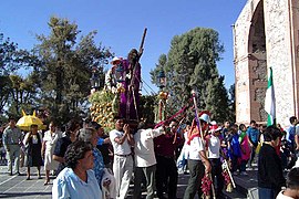
Viacrucis in Atitalaquia.
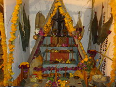
Otomi dead Altar in Tula de Allende.
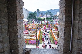
Xantolo in Huejutla.

Christmas tree and ice rink in Pachuca.

Horseback Riding in Actopan.


.jpg)

_07.jpg)


Exhibitions

The Fruit Fair is held in Tecozautla in July; The exhibition of regional fruits and various products derived from the processing of fruits such as preserves, wines, jams and cider stands out. The Acatlán Fair takes place in Acatlán in September, in the center of the town with an exhibition and sale of dairy products; At the same time, the Festivity in honor of San Miguel Arcángel takes place. The so-called Maguey and Barley Fair is held in Apan with a sample of maguey fiber articles, pulque outlets and some food and drinks made from barley. The Christmas Eve Fair in Huejutla de Reyes takes place between December and January.
In Omitlán de Juárez, the Apple Festival is held between June and July; there is an exhibition of the best apples harvested by farmers in the region, and the Queen of the Apple is chosen. The Ears Fair is held in Tlaxcoapan; on the last Saturday of April there is a nocturnal procession with sawdust carpets painted with ears of wheat. In Tula de Allende, during March, the Fiesta de San José is held, and it is also known as the Tula Annual Fair. In Tulancingo de Bravo, the Expo Feria Tulancingo is celebrated; at the same time the Feast of Our Lady of the Angels is held. During the days that this fair lasts, a commercial, livestock, agricultural, industrial and craft exhibition is installed, as well as such as sporting and cultural events.
In Actopan the so-called Barbecue Fair is held, which takes place in the month of July with different cultural activities; where the barbecue contest stands out. In Santiago de Anaya since 1975, the Gastronomic Showcase has been held; a week before Easter. In this exotic dishes of animals and plants that are part of the fauna and flora of the state, such as the opossum, coyote, fox, armadillo, opossum, lizard, and viper; this varies according to whether the animator is threatened or not.
Hidalgo Fair

In Pachuca de Soto, the San Francisco Fair is held, which is the most important festival in the state of Hidalgo. It had its origin in the 16th century, with the liturgical celebrations carried out by the Franciscan friars, in honor of Saint Francis of Assisi, to which the civil and ecclesiastical authorities were invited, both from the city and from the surrounding towns.
For this event, two separate fairs are held: the San Francisco Traditional Fair, which is held in Hidalgo Park and in the San Francisco Convent, and whose main day is October 4. And the San Francisco International Fair, which takes place in its special facilities. Among the program of the fair, the following stand out: charreadas, bullfights, craft, gastronomic, industrial and livestock shows, sporting and cultural events, as well as mechanical games and popular dances; It is held annually in the month of October.
Crafts
.jpg)

In Hidalgo, clay pots, pots, casseroles, griddles, pots, tableware, etc. are made; these mainly in the regions of Valle del Mezquital, Comarca Minera, Valle de Tulancingo, Sierra Baja and Sierra Gorda. Blankets, sarapes, girdles, shawls, quexquémitl, rugs, sacks, etc. are made from the wool; in the regions of Valle del Mezquital, Sierra de Tenango, Valle de Tulancingo, Huasteca, Sierra Gorda and Sierra Baja. Cotton dresses, shawls, shirts, belts, bags, quexquémtl, tablecloths, napkins, sacks, backpacks are made; in the Valle del Mezquital, Sierra de Tenango and Huasteca regions.
In the Sierra de las Navajas, due to its rich veins of obsidian stone in shades of black, green, gold, jade or red, arrowheads, knives and axes have been produced for war, but also kitchen utensils and decoration. In basketry, baskets, baskets, aviaries, flutes are made from willow and/or reed rods; this in the Mezquital Valley region.
In pottery, the one made in the town of Chililico in the municipality of Huejutla de Reyes stands out; In this town it is a practice that has been maintained since pre-Hispanic times, with few changes, which is why it is the most important pottery community in the state. The clay that is used is orange, although there are other shades such as dye in shades of black, brown, white and red. The decoration is distinguished because on the ocher tone of the clay, flowers are added and painted birds.
In the Mezquital Valley, the work of the ixtle stands out, mainly in the municipalities of Santiago de Anaya and Ixmiquilpan. It is used to make ayates, bags, purses, carvers for personal hygiene, belts, tablecloths and folders. With the ixtle, bows, sacks and even special garments such as the costumes of the queens in municipal fairs are also made.
In the Sierra de Tenango, embroideries called tenangos are made where they represent the flora and fauna of the region; mainly in the municipality of Tenango de Doria and to a lesser extent in the municipalities of San Bartolo Tutotepec and Huehuetla. In its elaboration, the design is first drawn on the fabric with a pencil, and then they begin to embroider, often mixing colors and other doing the embroidery in a single color.
The production of bells stands out in the municipality of Zacualtipán de Ángeles, mainly the towns of Tlahuelompa and Tizapan.
Typical costume


In Hidalgo, three regions are characterized by their clothing: the Huasteca, the Sierra de Tenango, and the Mezquital Valley. It covers part of the shoulders in which brightly colored flowers are drawn that is combined with a white or colored skirt, without any decoration, which reaches halfway down the leg, most walk barefoot.
The women's clothing from the Sierra de Tenango consists of a blanket blouse with embroidered ornaments in green or red thread, which cover the shoulder and part of the small sleeve; skirt of black, blue or brown color, which is entangled at the waist and cinched with a sash of regular width, woven on the pre-Hispanic waist loom.
In the Mezquital Valley inhabited by Otomí groups, it determines the use of traditional clothing made primarily of blanket. The blouse has a fine embroidery called "pepenado" that is made with black, red, blue and green thread, which covers the shoulders, part of the sleeves, the chest and the back, with drawings that represent the Nahui Ollin. The mid-calf skirt sometimes has an embroidered trim at its lower end. They also usually use the quexquémitl put on the shirt or tied to the head, although it is a widely used garment, it is the thin ayate, made with fiber from the heart of the maguey, and due to the roughness of the soil, leather sandals are used.
Gastronomy


The paste is a dish of Cornish origin that is consumed in the Mining Region; It is a kind of empanada whose base is wheat flour, with a filling that results from a combination with beef, potato, parsley, and pepper. When Mexicanizing this product, chili was added to the original recipe.
In the Mezquital Valley, barbecue is prepared, a dish where lamb or goat meat is wrapped in maguey stalks and cooked in a stone oven in a hole underground; chicken, rabbit or mutton, cooked in the same way as barbecue; the xagis (tender beans with pork and pasilla chili); and the mixiotes, which is a dish of various types of meat (chicken, sheep, turkey, etc.) wrapped in the cuticle of the maguey stalk.
Likewise, tunas come from the Mezquital Valley, with which fresh waters or desserts are made; xoconostles in syrup or jam, which are also used to flavor chicken broth with vegetables or certain moles. Different types of insects are also consumed, such as some edible beetles, escamoles (eggs and larvae of the ant), meocuilines and chinicuiles (maguey worms), xotlinilli or jumiles (mountain bugs) and the chagüis or xamoes (bugs of the mesquite).
From the Tulancingo Valley, the tulancingueñas stand out, consisting of a corn tortilla with yellow cheese and ham bathed in green sauce with onion and cream. Turkeys are another dish consisting of a bolillo with black beans, fried enchiladas with butter and boiled egg inside, the traditional ones are boiled egg and chicken; currently many more ingredients have been adopted, such as roast beef, sausage, milanesa, turkey and ham.
From the Huasteca region come the shala tamales (ground sesame seeds with spices, stewed with beans), and mole with pork. The zacahuil made by Martajada corn dough base, and stuffed with large pieces of meat. Among the state drinks, pulque, curados and mead stand out; these drinks are consumed mainly in the Mezquital Valley and the Llanos de Apan. Another drink is the carnavalito made with tequila, orange juice, cinnamon and sugar.
Cultural heritage
._01.jpg)

The Congress of the State of Hidalgo, in use of the powers conferred on it by the Political Constitution of the State of Hidalgo, has made different declarations of cultural heritage in Hidalgo, among the declarations are: the Gastronomy of Hidalgo (2009), the Fiesta de Toros (2012), the Huapango (2014), the Wind Bands (2014), the Charrería (2014), the Xantolo (2015).
The United Nations Educational, Scientific, and Cultural Organization (UNESCO) has various programs, lists, and conventions that in turn disseminate and seek to protect tangible or intangible cultural heritage. Within the Regional Memory Program of the World in Latin America and the Caribbean is the Hugo Brehme Photographic Collection located in the National Photo Library in Pachuca; within the Memory of the World Program Mexico is the Parish Archive of Tolcayuca.
The Barranca de Metztitlán Biosphere Reserve is part of the Unesco Program on Man and the Biosphere; and the Comarca Minera Geopark is part of the Global Geoparks Network Program. Within the Representative List of the World Heritage Site declared in Mexico, in the state of Hidalgo are the Camino Real de Tierra Adentro and the hydraulic system of the Padre Tembleque aqueduct.
Of the sixty sites declared as part of the Camino Real de Tierra Adentro, two are in the municipality of Tepeji del Río de Ocampo: the “Antiguo convento de San Francisco en Tepeji del Río y puente” and the “Section of the Camino between the bridge of La Colmena and the old Hacienda de La Cañada"; a third site, the "Puente de Atongo" which is located on the border between Hidalgo and the state of Mexico.
The first site is the Temple and ex-convent of San Francisco de Asís in Tepeji del Río, a Franciscan convent in the 16th century. The second site is a section of the royal road that crosses the towns of Santiago Tlautla and Cañada de Madero, measures approximately 3.5 km; In it, it is possible to recognize the original route of the path, it is characterized by the traditional bola stone paving, and some masonry walls that flank it. It has three bridges: "La Colmena", "Tlautla" and "La Cañada".; in addition to the Parish of Santiago Apóstol and the farm of La Cañada that are on the way.
The Padre Tembleque Aqueduct is a hydraulic system made up of water springs, massive stone walls, columns, water boxes, drinking troughs, cisterns, apantles, ceramic pipes and aqueduct bridges. It was erected between 1554 and 1571, to carry water from the springs of Cerro Tecajete to the towns of Zempoala, Hidalgo and Otumba, Mexico; It has a route of 48.22 km, if you count the geographical features that had to be avoided and the branch that bifurcates the route to Zempoala.
The main arcade is the one located in Santiago Tepeyahualco, in the area known as the Papalote river ravine; it reaches an elevation of 39.65 meters, consists of 68 arches and is 904 meters long. The section of the aqueduct located in the vicinity of the old Hacienda de Tecajete, comprises 54 arches, 26 within this estate, their length is 363 meters and its average height is 7.34 meters.
Public services
Health

For 2020 in Hidalgo, the total life expectancy at birth is 75.11 years, women have an expectation of 77.82 years and men 72.33 years. The main causes of death were heart disease, diabetes mellitus and malignant tumors.
By 2020, 69.7% are affiliated with some health service, 30.1% are not affiliated and 0.2% are not specific. Of the total number of affiliated people, 34.6% are affiliated with the Mexican Social Security Institute (IMSS)); 10.3% to the Institute of Security and Social Services for State Workers (ISSSTE); 0.5% to the State ISSSTE; 1.6% to PEMEX, Defense or Navy health units; 51.0% to the Institute of Health for Well-being (INSABI); 1.1% the IMSS-Well-being; 1.2% to a private institution; and 1.0% to another institution.
There is an infrastructure of 972 medical units, made up of 28 hospitals and 944 outpatient units. To care for users without rights, the Health Services have 16 hospitals and 536 outpatient units; IMSS-Prospera has 4 hospitals and 227 outpatient units; 1 Children's Hospital DIF Hidalgo.
For the attention of entitled users, there are 57 medical units, of which 20 are from the IMSS in its ordinary regime; 35 from ISSSTE and 2 from PEMEX. The Mexican Red Cross Hidalgo Delegation has 18 medical units for its use; in terms of rehabilitation care, there is 1 Hidalgo Comprehensive Rehabilitation Center in the state, 6 Centers Regional Comprehensive Rehabilitation Units and 57 Basic Rehabilitation Units.
Education
For 2020 in Hidalgo, the average level of schooling for the population aged 15 and over is 9.4, which means a little more than completed secondary school. The municipalities with the highest average level of schooling are Mineral de la Reforma with 11.7, and Pachuca de Soto with 11.5; The equivalent to having the second grade of upper secondary education. The municipalities with the lowest average level of schooling are La Misión with 6.2, and Xochiatipan with 6.3; The equivalent to having a little more than primary school completed.
The illiteracy rate in the state of Hidalgo is 6.6 percent. With an illiterate population of 151,311 people. By 2020, the percentage of the population from 3 to 5 years old that attends school is 63.9%, the percentage from 6 to 14 years is 96.2%, the percentage from 15 to 24 years is 49.1%.
| Education in the state of Hidalgo. | ||||||
|---|---|---|---|---|---|---|
| School level | Students | Teachers | Schools | |||
| Men | Women | Total | ||||
| Initial | Total | 7968 | 7756 | 15 724 | 1362 | 150 |
| Basic education | ||||||
| Preschool | 52 112 | 51 267 | 103 379 | 6035 | 3098 | |
| Primary | 174 454 | 169 080 | 343 534 | 16 529 | 3181 | |
| Secondary | 86 864 | 85 004 | 171 868 | 10 403 | 1347 | |
| Total | 313 430 | 305 351 | 618 781 | 32 967 | 7626 | |
| Higher secondary education | ||||||
| General Baccalaureate | 39 716 | 43 745 | 83 461 | 4959 | 457 | |
| Technical baccalaureate | 29 262 | 29 982 | 59 244 | 2361 | 98 | |
| Professional technician | 234 | 425 | 659 | 65 | 8 | |
| Total | 69 212 | 74 152 | 143 364 | 7385 | 563 | |
| Higher education | ||||||
| Pedagogical | 1260 | 2910 | 4170 | 292 | 7 | |
| Senior University | 9152 | 8857 | 18 009 | 1052 | 13 | |
| Technological | 18 039 | 13 340 | 31 379 | 1688 | 14 | |
| University | 25 215 | 36 107 | 61 322 | 6225 | 114 | |
| Total | 53 666 | 61 214 | 114 880 | 9257 | 148 | |
| Adult education | Total | 36 056 | 54 326 | 90 382 | 2422 | 112 |
| Total | 481 745 | 504 420 | 986 165 | 54 104 | 8717 | |
| Source: SEP. Statistics of the education system in Hidalgo. School cycle 2020-2021. | ||||||
Higher secondary education

In the upper secondary level dependent on the federal government are the Industrial and Services Technological Baccalaureate Center (CBTIS), the Center for Technological, Industrial and Services Studies (CETIS), the Center for Technological Studies in Continental Waters (CETAC), the Center for High School Studies (CEB), and the Center for Agricultural Technology High School (CBTA); dependent on the state government are the National College of Technical Professional Education of the State of Hidalgo (CONALEPH), the High School of the State of Hidalgo (Community Telebachillerato), the College of Scientific and Technological Studies of the State of Hidalgo (CECyTEH) and the College of Bachelors of the State of Hidalgo (COBAEH).
The CBTIS has twelve schools, distributed in twelve municipalities. The CETIS has three schools, distributed in three municipalities. CETAC has a campus in Tezontepec de Aldama. The CEB has two campuses located in Huhuetla and Pachuca. The CBTA has six schools in six different municipalities. The CONALEPH has six schools, distributed in six municipalities. The Hidalgo State High School (Community Telebachillerato) has one hundred and thirty-five schools.
The CECyTEH was created in 1991 during the administration of Governor Adolfo Lugo Verduzco; on May 19, 1992, the LIV Legislature of the Congress of Hidalgo, sanctioned the creation of the CECyTE Hidalgo through Decree No. 229, with which It is officially created; and it is published in the official gazette on July 6, 1992. The CECyTEH has 41 schools located in thirty-eight municipalities. The COBAEH is created on September 28, 1984, by Decree number 16 issued by the LII Legislature of the Congress of Hidalgo, and formally began its operations on September 28, 1987. The COBAEH is made up of 53 schools and 79 of the Distance Higher Middle Education Center (CEMSaD); located in sixty-eight municipalities.
There is also the Center for Scientific and Technological Studies (CECyT) of the National Polytechnic Institute (IPN), and the dependent and incorporated preparatory schools of the Autonomous University of the State of Hidalgo (UAEH). The CECyT No. 16 Hidalgo of the IPN, began activities on August 20, 2012. The UAEH has thirteen dependent high schools, distributed in eleven municipalities; and eighteen incorporated high schools. Preparatory School Number 1 (UAEH), is the upper middle level institution, oldest that has provided its services uninterruptedly in Hidalgo; inaugurated on March 3, 1869, and began activities on March 8, 1869.
Higher Education

The Autonomous University of the State of Hidalgo (UAEH) is the oldest and most important public institution of higher education in the state of Hidalgo. It was founded on March 3, 1869, under the name of Literary Institute and School of Arts and Crafts; on February 24, 1961, the decree creating the UAEH was promulgated; and on March 3, 1961, the establishment ceremony is held and the UAEH is erected. The UAEH has an approximate average of 50,000 students per academic year. The six institutes into which the UAEH is divided and where they are located They are the ICBI, in Mineral de la Reforma; the ICSHu, in Pachuca de Soto; ICSA and ICEA in San Agustín Tlaxiaca; the ICAp in Tulancingo de Bravo; and the IDA in Mineral del Monte. It also has the Higher Schools of Actopan, Apan, Atotonilco de Tula, Ciudad Sahagún, Huejutla de Reyes, Tepeji del Río, Tizayuca, Tlahuelilpan, and Zimapán.
The Technological Institute of Pachuca (ITP) is a public institution of higher education located in Pachuca de Soto, it was founded on March 18, 1938, as the Instituto Politécnico de Hidalgo, until on September 4, 1970, when the construction of the Regional Technological Institute No.20 was authorized and on September 21, 1971 it began its activities, becoming the current ITP. The Technological Institute of Pachuca has with an average enrollment of 4,500 students per academic year. The ITP has an Academic Unit in the municipality of Jacala de Ledezma.
On August 11, 2014, the City of Knowledge and Culture of Hidalgo was officially inaugurated, a complex for education, development, technology and research; in whose project an area of 178 ha is established in the municipal limits of Pachuca and San Agustín Tlaxiaca. Within this complex is the Interdisciplinary Professional Unit of Engineering Campus Hidalgo (UPIIH) of the National Polytechnic Institute. The National Pedagogical University has with a general headquarters in Pachuca de Soto and regional offices located in Huejutla de Reyes, Tulancingo de Bravo, Ixmiquilpan, Tula de Allende, Tenango de Doria and Jacala de Ledezma.
Other public institutions are the Polytechnic Universities of Tulancingo, Pachuca, Francisco I. Madero, Huejutla, Metropolitana de Hidalgo, and Tula Energy. The Technological Universities of Tula-Tepeji, Tulancingo, Huasteca Hidalguense, Valle del Mezquital, Sierra Hidalguense, Minera de Zimapán, Mineral de la Reforma, and Metropolitana del Valle de México. In addition to the Technological Institutes of Atitalaquia, Huejutla, Huichapan, Occidente and Oriente. Among the private centers that impart studies to At the higher level, the following stand out: the Hidalguense Center for Higher Studies (CENHIES), the University of Football and Sports Sciences, the La Salle University, Campus Pachuca (ULSA) and the Technological Institute of Higher Studies of Monterrey, Campus Hidalgo (ITESM).
There is also the Benito Juárez García University for Well-being (UBBJ), with eight campuses in the municipalities of Ajacuba, Chilcuautla, Francisco I. Madero, Huasca de Ocampo, Jacala, San Felipe Orizatlán, Tlanchinol and Yahualica. It also has five normal schools, the Sierra Hidalguense, Valle del Mezquital, Las Huastecas, Superior Pública del Estado de Hidalgo and the Benito Juárez Regional Normal Education Center. There is also the Luis Villarreal Rural Normal School of El Mexe, closed in 2008 and reopened in 2021. The Intercultural University of the State of Hidalgo (UICEH) located in Tenango de Doria was created by decree on October 1, 2012.
Security
The municipalities with the highest crime rate; They are Pachuca de Soto, Tulancingo de Bravo, Tula de Allende, Ixmiquilpan, Tizayuca, Mixquiahuala de Juárez, Actopan, Huejutla de Reyes, Tepeapulco and Mineral de la Reforma, in which 70% of the crimes reported in the entity are generated.
The State Telecommunications Network is made up of the Control, Command, Communications and Computing Center (C4) Pachuca; the C4 Tula Subcenter, the C4 Tulancingo Subcenter and fourteen booths (twelve radio repeaters and two for microwave links). The network offers radio communication coverage corresponding to 84% of the state territory. There are three Urban Video Surveillance Systems installed in the cities of Pachuca, Tula and Tulancingo, each one has an Administration and Monitoring Center.
The Hidalgo prison system includes twelve Social Readaptation Centers (CERESO) and five district, as well as a Detention Center for Adolescents. According to the 2015 Mexico Peace Index (IPM), Pachuca ranks fifth in the safest cities in Mexico and is the second safest city in Hidalgo, after Tulancingo.
Drinking water and sanitation

In the state, 94.1% of the population has a drinking water service, and 89.4% has a sewerage service. The volume of water supplied in the state and the volume of disinfected water is 4321 l/s and 4155 l/s respectively with a disinfection percentage achieved of 96.2%.
Coverage for the urban population is 73% and 36% in rural areas. The demand for water for agricultural use represents more than 90.0%, the demand for urban use is 5% of the total demand, the use in the industrial and mining sector represents only 2.0% of the total demand, the electrical industry also requires 2.0% of the total demand.
There are four irrigation districts in the state of Hidalgo. Districts 003 (Tula) and 100 (Alfajayucan) in the Mezquital Valley represent 97.5% of the total irrigated area, far below is district 028 (Tulancingo), which represents only 1.5% of the irrigated area. Groundwater is difficult to exploit in mountainous areas. Hidalgo is located within the "Río Pánuco" hydrological region, with the exception of a small extension to the east that belongs to the " Tuxpan-Nautla", where hydraulic use is minimal.
The state of Hidalgo has twenty-five municipal water treatment plants with an installed capacity of 449 l/s and a potable flow of 414 l/s; it also has fifty-one municipal wastewater treatment plants with an installed capacity of 24,122 l/s and a drinkable flow of 657 l/s with a coverage of 26.5%. sanitation capacity will be 35,000 cubic meters per second, 23,000 l/s on average and an additional 12,000 l/s in the rainy season.
Waste management

Hidalgo, produced 737,000 tons of waste in 2011, approximately 1.5% of the national generation. Concentrating mainly in Actopan, Huejutla de Reyes, Ixmiquilpan, Mineral de la Reforma, Pachuca de Soto, Tizayuca and Tulancingo de Bravo. In the state of Hidalgo, a per capita generation of 0.806 kg.hab/day is estimated, Pachuca de Soto contributes the highest percentage, 15.01%, in contrast to Zacualtipán de Ángeles with 2.05%. Waste such as paper, paper, cardboard, plastic and synthetic fibers.
In almost all of the 84 municipalities that make up the entity, there is a lack of adequate systems for the management and final disposal of Solid Urban Waste (SRU). There are other sites, known as controlled landfills, which account for a total of 49, in which it is estimated that 6.6 % is available; Likewise, as an integral management action in the management of MSW, it is estimated that 2.0% is recycled. In contrast, among the irregular options to dispose of MSW generated daily, it is estimated that 50.0% corresponds to dumps in the sky open and 21.0% is subject to burning.
In the state of Hidalgo there are six sanitary landfills in Pachuca de Soto, Apan, Santiago Tulantepec de Lugo Guerrero, Tula de Allende and Chapantongo. There are also 14 municipal sanitary landfills located in Chilcuautla, Cuautepec de Hinojosa, Francisco I. Madero, Huasca de Ocampo, Tecozautla, San Agustín Metzquititlán, Tasquillo, Tlanalapa, Villa de Tezontepec, Zempoala, Huichapan, Metztitlán, Pisaflores and Tepeji del Río de Ocampo.
On May 14, 2013, an urban solid waste separation plant was inaugurated with infrastructure to process 400 tons per day, with garbage from the city and its surroundings. The plant is located in the community of San Juan Tilcuautla, in the municipality of San Agustín Tlaxiaca.
Infrastructure
Roads and highways

The Highway Network consists of 11,830 kilometers and is made up as follows: 931.8 kilometers (7.87% of the total) correspond to the Federal Highway network; 2,528 kilometers (21.37% of the total) correspond to the of State Feeder Highways while 8,370 (70.76% of the total) kilometers correspond to the Network of Rural Roads and Gaps. The Arco Norte highway is 223 kilometers long, with deviations to the cities of Tula de Allende and Pachuca de Soto this is a highway that connects the center of the country without having to cross through Mexico City.
The main routes that cross the state are: federal highways, Federal Highway 85 Mexico-Laredo; Federal Highway 105, the short road to Tampico that touches Mineral del Monte, Omitlán de Juárez, Atotonilco el Grande, Zacualtipán de Ángeles, Molango de Escamilla and Huejutla de Reyes; Federal Highway 130 towards Túxpam through Tulancingo and Acaxochitlán, with a deviation at Ocote (km 14) towards Tepeapulco.
Rail network

The railway network that complements the communications system has 865 kilometers, of which 708 km correspond to trunk lines and branches. 90% are more than 50 years old and are in disuse.
In the state, the railway infrastructure only exists in the southern region, between Tula de Allende and Huichapan as support for the cement industry, connecting with the city of Pachuca de Soto, Tezontepec, Tulancingo, Ciudad Sahagún and Apan, among other towns, who have communication with the cargo rail network of the state of Mexico and Tlaxcala.
Transportation

The main bus terminals in the state are: Pachuca, Tulancingo, Tula, Actopan, Huejutla. The majority of the state is located in the Sierra Madre Oriental, which means that it has a very high degree of isolated communities, difficult to access and very limited in its communications. On August 16, 2015, the Tuzobús was put into operation, in the metropolitan area of Pachuca.
The state operates three airports, the Pachuca airport, and two short-range aerodromes, located in Molango (Autlán mining company) and Tizayuca (private), these runways are coordinated by the Pachuca airport. The most important airport It is the one in Pachuca de Soto, officially called Ingeniero Juan Guillermo Villasana National Airport, named in honor of Juan Guillermo Villasana. It has an asphalt surface runway 2,200 m long, 26 m wide and has an area of 36 ha, the runway points to heading 033°/213°, while the indicative numbers at the ends of the line are 03 and 21.
Media

The government agency Radio y Televisión de Hidalgo, created in 1982, is located in the city of Pachuca de Soto. This agency is in charge of the public television station, Canal 3 Hidalgo, created on November 24, 1982; and eleven radio stations located in: Pachuca, Tula, Actopan, Ixmiquilpan, Huichapan, Jacala, Tlanchinol, San Bartolo Tutotepec, Huejutla and Tepeapulco.
There is a radio station La Voz del Pueblo Hñahñu (XHCARH) in Cardonal, belonging to the National Commission for the Development of Indigenous Peoples (CDI); transmission tests began on July 16, 1998, and was officially inaugurated on January 12, 1999. It broadcasts in the Otomi, Nahuatl and Spanish languages, and covers a large part of Hidalgo and the states of Querétaro, Veracruz, San Luis Potosí and the state of Mexico. The Autonomous University of The State of Hidalgo has five radio stations located in Pachuca de Soto, Actopan, Huejutla, San Bartolo Tutotepec and Zimapán.
El Sol de Hidalgo is a local newspaper, founded on June 27, 1949; daily with an average circulation of 27,727 copies. El Sol de Tulancingo, founded on April 13, 1978, with a circulation of 6946 copies, daily. Both newspapers are members of the Mexican Editorial Organization.
Milenio Hidalgo is another important newspaper in the city founded on March 30, 2004; daily with an average circulation of 8,929 copies. Other newspapers that publish in the state are: Unomásuno Hidalgo; Synthesis, The Hidalgo Newspaper; Hidalgo's Clock; Today's Chronicle in Hidalgo; Approval; El Independiente de Hidalgo and Ruta Newspaper.
The Tulancingo Telecommunications Earth Station is made up of two complexes, which are the Tulancingo Teleport and the Tulancingo Data Center. These facilities are owned by Telecomunicaciones de México. It has three antennas, Tulancingo 1, Tulancingo 2 and Tulancingo 3. The first two are 40 meters high, with a 32-meter diameter disk. Tulancingo 1 dates from 1968, it is used to have data transmission to the United States, Europe, Africa and Latin America and occasional television; Tulancingo 2 was installed in 1980; the Tulancingo 3 antenna is smaller, its disk has a diameter of 13 meters, and is used to transmit occasional television to the NewSky 806 satellite. The antennas are in operation with the IS-IVAF-1 satellite and the Morelos II satellite.
Regarding telecommunications, the state maintains national and international communication through the services provided by the Federal Microwave Network and the satellite system. Today the network is broader and almost the entire state has coverage with the system of microwave stations, there is also a wide network of radio and television with its repeaters, particularly in Huichapan, Ixmiquilpan, Pachuca, Tlanchinol, Tula and Tulancingo.
Energy
.jpg)
In terms of energy generation, the state is self-sufficient, since it has electricity generating plants in different municipalities, the state generates 9.4% of the country's electrical energy with 2900 megawatts (MW). The Fernando Hiriart Dam Balderrama, located in the channel that joins the Tula and Moctezuma rivers in Zimapán, was put into operation on September 27, 1996. The curtain has a height of 203 meters from the slope to the crown and has a hydroelectric power station capable of generating 292 megawatts of electric power.
Regarding the oil industry, there is the Miguel Hidalgo refinery in Tula de Allende, its facilities occupy a total area of 749 hectares; it was the first refinery planned in an integral way with high-capacity hydrocarbon process plants. Its construction was carried out in several stages, the first stage was inaugurated on March 18, 1976.
This refinery is considered one of the most important in the country due to its installed capacity, and the portion of the market it controls, since it processes 24.0% of the total crude oil that is refined in Mexico. The average production volume of refined was 127,821,900 barrels; of these, 40.1% corresponded to gasoline; 28.5% to fuel oils; 19.3% to diesel; 6.3% to kerosene and the rest to liquefied gas, industrial fuel and asphalt. In addition, the Tula-Salamanca, Tula-Toluca, Ref. Tula-Azcapotzalco, Tula-Pachuca, Cab Poza Rica-Ref. Tula; the Poza Rica-Ref. Salamanca, New Teapa-Salamanca, New Teapa-Tula; and the Tula-Villa de Reyes, Tuxpan-Tula gas pipelines.
The “Francisco Pérez Ríos” thermoelectric power plant in Tula de Allende is made up of five 300 MW (megawatt) electric power generating units and operates mainly with fuel oil; it generates 3% of the electricity produced nationwide. On July 11, 2019, the Guajiro Photovoltaic Power Plant was inaugurated, executed by the Atlas Renewable Energy brand; located in the municipality of Nopala de Villagrán. The plant is equipped with more than 370,000 solar panels distributed over 410 hectares, with a production of 300 GWh annually.
Economy
| GDP Hidalgo. Percentage participation. | ||
|---|---|---|
| Economic sector | Percentage | |
| Primary activities | 3.65 | |
| Agriculture, breeding and exploitation of animals, forestry, fishing and hunting | 3.65 | |
| Secondary activities | 31.04 | |
| Mining | 0.84 | |
| Generation, transmission and distribution of electricity, supply of water and gas by ducts to the final consumer | 2.70 | |
| Construction | 7.43 | |
| Manufacturing industries | 20.07 | |
| Tertiary activities | 65.32 | |
| Trade | 19.2 | |
| Temporary accommodation and food and beverage preparation services | 1.59 | |
| Transportation, mails and storage | 10.13 | |
| Information in mass media | 0.75 | |
| Financial and insurance services | 2.91 | |
| Real estate and rental services | 14.26 | |
| Professional, scientific and technological services | 0.50 | |
| Educational services | 5.63 | |
| Health and social assistance services | 2.19 | |
| Government activities | 4.24 | |
| Rest of services | 5.22 | |
| Source: INEGI (2019). | ||
Economic indicators
In 2015 Hidalgo had a State Human Development Index of 0.723; for 2019 it registers an HDI of 0.760. Hidalgo's Gross Domestic Product amounts to 271,360 million pesos in constant prices in 2016, and the GDP per capita was 88,023 pesos. For the year 2015, Mineral de la Reforma is the municipality with the highest human development in Hidalgo, with an HDI of 0.835; In contrast, the municipality with the lowest performance in the entity is Xochiatipan, whose HDI is 0.586.
Sectors of economic activity
Primary Activities
Agriculture and Forestry

The agricultural area planted in 2013 was 576,907 hectares, of which 146,428 ha were irrigated (25.4%) and 430,479 ha were rainfed (74.6%). Of the seventy-six crops planted In the state, the main ones in terms of planted area were: corn (44.0%); barley (19.0%); alfalfa (8.0%); bean (6.0%); fodder oats (5.0%); cherry coffee (4.0%) and pastures (4.0%) that together make up 91.0% of the total area.
The production volume of 7,557,117 tons, in turn, produced 5,732,467 tons in irrigation (75.9%) and 1,824,650 tons in rainfed (24.1%). Being the main crops in terms of production: alfalfa (58.0%), pastures (12.0%), corn (9.0%), fodder oats (7.0%), maguey (6.0%), and barley (2.0%) that add up to 93.0% of the state's production. The production value amounted to 8,015,293,000 pesos, in irrigation 4,018,827,000 pesos (50.1%) was obtained and in rainfed 3,996,466,000 pesos (49.9%).
In terms of agriculture, despite being a semi-desert area, the Mezquital Valley is nicknamed "El Granero de Hidalgo", due to its large production; the 61% of the population of the Mezquital Valley live from agriculture.
In Hidalgo there is a wooded area of forests with a cold temperate climate where timber species such as pine, oyamel, white cedar and oak are used, the former belonging to the group of conifers, and the latter to the arborio group of broad-leaved ones. The state's forest area is 817,640 ha, of which 454,486 are forest, 252,036 in arid zones, and 13,184 from other formations. Forestry activity contributed just under 1.0% of state GDP.
Livestock and fishing

The volume of livestock production during 2013 was 545,000 tons of which 109,732 tons were carcass meat, highlighting sheep production. The value of livestock production amounted to 8,015 million pesos. Its The main products are classified into three categories: carcass meat with a participation of 20.6%, milk 78.0% and other products 1.4%.
In turn, those that stood out the most were bovine milk with 78.0%, poultry meat 10.8%, bovine meat 5.9%, pork meat 2.2% and sheep meat 1.4% which together represent 98.2% of state livestock production.
Hidalgo has a long sheep farming tradition concentrated in the regions of Apan, Tulancingo, Tizayuca, Actopan and Ixmiquilpan. It has seven slaughterhouses and nineteen slaughterhouses, which cover twenty-eight municipalities in the state, with fifty and six municipalities without a registered establishment.
Aquaculture production in the state has become relevant in recent years, the consolidation of the trout and tilapia production chains; during the 2013 cycle there was a production volume of eight thousand tons with a production value of 193.5 million pesos. The volume of fishing production in Hidalgo is 8000 tons, occupying the 2nd national place in the fish production of landlocked states. The main species are: carp with 55.6% participation in production, crappie 39.1% and trout 3.7% representing 98.4% of state production.
Secondary Activities
Manufacturing industry

Regarding the transformation of agricultural and livestock products, there are 3,518 establishments dedicated to this area, the municipalities with the largest number are Pachuca, Ixmiquilpan, Actopan, and Tula, which together represent 29.8% of the total.
Manufacturing industries are the most important sector in Hidalgo, these industries contribute 28.84% of Hidalgo's GDP. In the area of productive infrastructure, the state has thirteen industrial and/or technological parks operating, located in Pachuca de Soto, Mineral de la Reforma, Tula de Allende, Tizayuca, Huejutla de Reyes, Atitalaquia and Ciudad Sahagún.
The textile and clothing sector is one of the most important sectors for Hidalgo. The municipalities with the highest levels of production of inputs and textile finishes, textile products and clothing are Tepeji del Río de Ocampo, Tizayuca, Tlaxcoapan, Zapotlán de Juárez, Tlanalapa, Tepeapulco, Pachuca de Soto, Mineral de la Reforma, Progreso de Obregón, Actopan, Cuautepec de Hinojosa and Tulancingo de Bravo.
Mining

Mining is one of the oldest activities, with a long tradition in the state. Mining in the state of Hidalgo represents 1.06% of state GDP. About 75.4% of the value of mining production corresponds to non-metallic minerals, highlighting gravel, sand and limestone.
Approximately forty-five mines are operated in the state; the municipalities of Tula de Allende, Francisco I. Madero and Zimapán, are producers of limestone deposits, they also produce stone aggregates such as gravel, sand and seal for roads, they produce raw materials for the production of lime and cement. In Huichapan, Tecozautla and Chapantongo, there are quarry deposits for the construction industry. In Zimapán there are deposits of calcium carbonate. In the municipalities of Agua Blanca de Iturbide and Metepec have kaolin deposits, an input in the production of the cement industry. Tepehuacán de Guerrero has one of the largest manganese veins.
Tertiary activities
Trade

Commerce in the state has had a stable behavior in recent years; being the second sector with the highest contribution to the state GDP. Hidalgo has seven supply centers, 60 markets and 211 flea markets. 54.0% of the municipalities do not have a public market and the inhabitants of these municipalities get their supplies through street markets that are installed at least once a week.
By commercial branches, the most important for the personnel it occupies, is that of retail food products, this includes groceries, butcher shops, poultry shops and others. In second place, we have pharmacies, haberdasheries, shoe stores and clothing stores among others.
In third place, according to its importance, is the wholesale food trade, where we find distributors of fruits, eggs, groceries, beverages and others. The trade is concentrated in the main urban centers such as Pachuca de Grove, Tulancingo de Bravo, Actopan, Ixmiquilpan, Tepeji del Río, Apan, Huejutla de Reyes and Tula de Allende.
Tourism

The state of Hidalgo, of the national tourist offer, represents 1.6%. Hidalgo has an offer of natural and historical destinations, and benefits from its geographical proximity to the state of Mexico and Mexico City.
One of the main destinations are the spas located in the Mezquital Valley. These are located within three spa corridors, the first located in the area from Ajacuba to Tula, the second in the area from Ixmiquilpan to Tasquillo and the third from Huichapan to Tecozautla. In these, thermal waters, natural landscapes are combined, with different events such as musicals and others; In addition, the Mezquital Valley also presents competitive advantages in terms of gastronomy, culture and climate.
Another of the main destinations is the Mountain Corridor, which is visited for its ecological appeal, where you can practice sports such as rappelling, mountaineering, canoeing, sport fishing and paragliding, made up of the municipalities of Huasca de Ocampo, Mineral del Monte, Mineral del Chico, Omitlán de Juárez and Atotonilco el Grande. The Corredor de las haciendas also stands out. municipalities of Zempoala, Tepeapulco and Apan.
The Magical Towns tourism program is developed by the Ministry of Tourism (Sectur), in conjunction with various government agencies, and recognizes those who inhabit these cities and the work they have developed to protect and preserve their cultural wealth. Localities that have this designation are Huasca de Ocampo declared on October 5, 2001, the first site to be called "Magic Town" in Mexico; Mineral del Monte declared on August 28, 2004; Mineral del Chico declared on August 30 March 2011; Huichapan declared on October 6, 2012; Tecozautla declared on September 26, 2015; Zimapán declared on October 11, 2018; and Zempoala declared on December 1, 2020.
The Secretary of Tourism of the State of Hidalgo awards the distinction of Towns with Flavor in Hidalgo, which recognizes the places of the entity with a gastronomy rich in tradition. The towns designated as part of the tourist program are Zempoala, Tulancingo, Acaxochitlán, Omitlán, Calnali, Huejutla and Actopan, declared in 2017.
- Tourism in the state of Hidalgo.

Boy Mineral, Magic Village.

Mineral del Monte, Magic village.

Huasca de Ocampo, Pueblo magical.

Tecozautla, Magic Village.

Huichapan, Magic Village.

Zimapán, Magic Village.
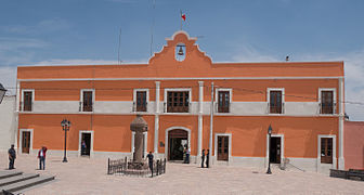
Zempoala, Magic Village.
Balneario Tephé in the town of El Tephé, Ixmiquilpan.

Balneario Te-Pathé in the town of El Tephé, Ixmiquilpan.

The Truchas Forest in Huasca de Ocampo.

Xoxafi ecological park in Santiago de Anaya.
.jpg)


.jpg)

Sports

The most practiced sport is soccer, the Club de Fútbol Pachuca that plays in the First Division of Mexico, founded by English miners from Cornwall who called it "Pachuca Athletic Club", which is considered as the first official soccer club in Mexico. It also has different soccer teams in the second division and third division; as well as numerous amateur soccer leagues, both in conventional soccer and in indoor and fast.
American football began to be practiced in the state during 1970, in 1990 the Hidalgo State Arena American Football Organization (OFAAEH) was created. There are some disciplines that are also practiced in the amateur or professional field such as baseball, volleyball, cycling, fronton, karate, judo, chess, table tennis, swimming, abseiling, bullfighting, wrestling, boxing, and gymnastics.
Golf was introduced between 1822 and 1825 with the entry of British companies and by the mid-19th century, golf was already being played in Pachuca. Despite not having any confirming documents, it is known that in 1898, a member of the board of directors of the Scottish club of Saint Andrews, visited a golf course in Pachuca. In 1924 the Pachuca Country Club was founded in the city.
In the early years of New Spain, the authorities forbade the indigenous people from practicing horsemanship. One of the first known authorizations was granted by Viceroy Diego Fernández de Córdova. authorization for twenty-two Indians to ride horses, and thus be able to care for and graze the cattle belonging to the Hacienda de Santa Lucía, a subsidiary of the Hacienda de San Javier in the district of Pachuca; This occurred on November 16, 1619, after which he passed to the plains of Apan where the Charrería took place.
Sports centers


The Hidalgo Stadium is the most important stadium in the state, it was inaugurated on February 14, 1993, the complex is also called "El Huracán", and has an approximate capacity of 30,000 people. This was one of the stadiums that hosted the XIV U-17 Soccer World Cup in Mexico 2011, which was held from June 18 to July 10, 2011.
The Vicente Segura bullring is the most important bullring in the state, located in the city of Pachuca de Soto, it has a capacity for 10,000 attendees. Other of the main stadiums in Hidalgo are: Estadio Revolución Mexicana (soccer), Alfonso Corona del Rosal Stadium (baseball), "Carlos Martínez Balmori" (basketball) and the 10 de Diciembre Stadium (soccer).
The Hidalgo State High Performance Center is based in Pachuca, it is equipped with a semi-Olympic pool; tartan track; batting box; field for shot put, discus and javelin; a dojo for the practice of judo, where there is also the weight equipment; a tennis court; multipurpose gym with 600 m² and an Olympic village with capacity for 80 people. Within this complex is the Bicentennial Velodrome with a 250 m circuit, 40-degree cambers and a 12.5 straight line, and grandstands for 800 people; since 2015, the property is not used.
The Pachuca Golf Club, is made up of nine holes, it has a course of 3589 yards per round; that is, 7,178 yards to complete the 18 holes. It also has two par 3 holes (the shortest), five par 4 holes, and two par 5 holes (the longest). The city of Pachuca de Soto has a charro canvas officially named "Lienzo Cuna de la Charrería" which has hosted the "National Charro Congress and Championship" in 1946, 1980, 1985, 2000, 2010, 2017 and 2020. The Moisés Solana Autodrome, inaugurated in 1988 and named after the renowned Mexican pilot Moisés Solana; It is 1,750 m long by 12 m wide.