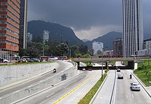
Eldorado Avenue (Bogotá)
The Avenida Eldorado, also called Calle 26 Avenida Calle 26 or Avenida Jorge Eliecer Gaitán, is an important road in Bogotá, Colombia. Its construction began in 1952 to connect the center of Bogotá, to the east, with El Dorado International Airport, to the west. It constitutes, together with the Autopista Norte, one of the most modern avenues in Bogotá. Some of the office buildings of large public and private institutions in Colombia are located there. The roads are separated by planted green areas and gardens, adorned with large sculptures, also housing a section of Bogotá's cycle paths. In its western sector it is the widest avenue in Bogotá.
History
In 1946 it was proposed to extend Calle 26 to 42 meters wide from Caracas Avenue to the University City, so that it would tie there with the Avenue of the Americas.
The current avenue was built between 1952 and 1958, at the same time as the construction of the El Dorado International Airport, which was put into service in 1959, to replace the old Techo Aerodrome, which was located on one side of the roundabout. of Banderas, at the end of the Avenue of the Americas.
Layout
It begins in the foothills of Cerro de Monserrate, on Carrera Tercera in the Germania neighborhood and gradually descends towards the west, crossing the center of Bogotá.

It is the widest in Bogotá, with four wide roads, two with three fast lanes and the remaining two with two lanes for slow traffic and a shoulder along most of its length. In the Ciudad Salitre sector, the avenue has two additional lanes for local traffic.

From Carrera 4, the avenue has a sunk canal design below the ground level until Carrera 16. At Carrera 7 it passes behind the National Library and next to the Colpatria Tower, above the south sidewalk. On the opposite sidewalk (north) are the Parque de la Independencia, 50 meters to the west the church of San Diego (between Carreras 7 and 10) and, between Carreras Décima and 13, the Hotel Tequendama. The Torres Atrio project rises on Caracas Avenue, which will have the tallest building in the country. From there to the west, the avenue is called Calle 26.


Its course towards the west continues in front of the Central Cemetery (on the south side), until it crosses the Avenida de las Américas and the North-Quito-South trunk road at the District Administrative Center (CAD).
Then it passes through the campus of the National University of Colombia, and at the height of Carrera 50 by the United States Embassy to the south and the National Administrative Center (CAN) to the north, in front of which the Cemsa is located.
To the west of its intersection with Avenida 68 are the buildings of Banco Davivienda, the Bogotá Chamber of Commerce, the newspaper El Tiempo, the GHL Hotel Capital and the Marriott Bogotá hotel, among others.
Then there is an area of commercial headquarters of important companies, the industrial sector of Fontibón on the south side, the Monument to Queen Isabel and Christopher Columbus, created in 1906 by Césare Sighinolfi and the El Dorado airport, where the avenue ends..
Public transportation
TransMilenio 26th Street Trunk
In 2012, the works that had begun in 2009 were completed and Line K of the TransMilenio mass transportation system was inaugurated on this avenue. This begins in the center of the city, at the Las Aguas station, and continues west to Portal Eldorado on Cali Avenue. From there the trunk continues through feeder services to the airport.
Contenido relacionado
Province of Heredia
Lubumbashi
General Mosconi (Salta)
Arakawa River
Hestur