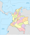
Departments of Colombia
The 1991 Constitution establishes Colombia as a unitary and decentralized republic that is divided administratively and politically into 33 divisions: 32 departments, which are governed from their respective capital cities, and one capital district, Bogotá. Departments form cultural and economic areas within geographic regions. In Colombia, resources go from the nation to the department and from the latter to the municipality; with the exception of Bogotá, which, as the capital district, receives directly from the nation (through the royalty law).
Sovereignty falls on the Nation as a unit and, in turn, Colombia has an administrative decentralization through which part of the administration of the State is distributed among the 32 departments and the municipalities.
History
The origin of the Colombian departments can be found in the political-administrative division of New Granada (today Colombia and Panama), which was organized into provinces that more or less corresponded territorially to the current departments. With the 1858 constitution, the nation's political system changed to that of a federal republic, its name became the United States of Colombia, and the provinces were replaced by nine sovereign states (Antioquia, Bolívar, Boyacá, Cauca, Cundinamarca, Magdalena, Panama, Santander and Tolima).
The centralist constitution of 1886 changed the name of the country definitively to the Republic of Colombia and converted the sovereign states into departments. With the reforms of 1905 and 1910, the guidelines were given to split the territories of the different departments and form new entities (departments, municipalities and police stations). With the new constitution of 1991, the existing municipalities and police stations were promoted to departments.
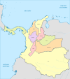
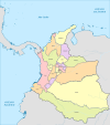
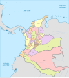
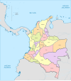
| Evolution of the subdivision in departments of Colombia | |||||
| 1824 | 1886 | 1905 | 1908 | 1912 | 1916 |
| 1928 | 1942 | 1958 | 1966 | 1990 | Actual |
Administrative regime
| Political map of Colombia showing division by departments |
Departments
It should be noted that, in Colombia, the legislative power is centralized, since the country is a unitary (not federal) republic; that is, only the Congress of the Republic can legislate, while the executive power does have representatives in the Departments, Municipalities and/or Districts. It is mistakenly believed that the Departmental Assemblies and the Municipal Councils are legislative bodies, but these two public corporations are organs of the executive power and their acts, called administrative acts, although they constitute orders, are not laws. Therefore, there is no legislative or judicial power emanating from a territorial entity: be it a department, municipality or district. The legislative and judicial power emanates totally from the Nation and only the executive power of the National order also emanates from the Nation.
Thus, in the territorial entity at the departmental level it can be perfectly affirmed that the executive power is in charge of a governor, elected by popular vote since 1992, and who exercises for a period of 4 years beginning in 2004. The governor appoints a cabinet made up of his secretaries.
- The legislature is represented in a public corporation called the Departmental Assembly, which is responsible for giving political control to the governor. He is a schoolteacher who issues administrative acts called 'orders', the Constitution sets him specific competences for matters to be regulated in the department. Its members are called deputies.
- As for the judiciary it is represented by the Courts of the Judicial District (of the ordinary and administrative jurisdiction) but this is not decentralization as it happens with the territorial entities, but it is a matter of deconcentration of the Nation. Generally a judicial district fits the territory of a department, but there are exceptions. As the legislative branch is unique, it is also the judiciary, but this is not concentrated in the country, so these courts belong to the Nation and not to the department. Misma confusion can occur with the judicial circuits and municipalities that belong equally to the nation and are not dependent on any municipality.
The departmental Assemblies or their members are elected by popular vote for the same term as the governor. The Assembly has between 11 and 31 deputies according to the population of the department.
Two or more departments can be associated into planning administrative regions.
The departments are subdivided into municipalities, whose administration is in charge of a mayor and a municipal council elected by popular vote for a term equal to that of the departmental dignitaries. Some departments with a large number of municipalities have chosen to recognize the existence of provinces or subregions, these being a group of municipalities with cultural, geographical or historical affinities, where a major urban center is located as the capital and from there local institutions operate with jurisdiction over the other municipalities. These groups, however, lack legal recognition.
Regions of Administrative Planning (RAP)
Colombia is a unitary and decentralized republic, the latter according to what is established in article 306 of the current Constitution of 1991, two or more departments may be constituted in administrative and planning regions, with legal status, autonomy and own patrimony, to develop economically and socially the territory.
Currently the following administrative planning regions are constituted:
- RAP Caribbean (created in 2017 and formed by the departments of the Atlantic, Bolivar, Cesar, Córdoba, La Guajira, Magdalena and Sucre)
- RAP Aje Cafetero (created in 2018 and made up of Caldas, Quindío and Risaralda; Tolima joined in 2020)
- RAP (E) Central (created in 2015 and formed by Boyacá, Cundinamarca, Meta, Tolima and the Capital District; Huila joined in 2019)
- RAP Pacific (created in 2016 and made up of Cauca, Chocó, Nariño and Valle del Cauca)
- RAP Amazonia (created in 2019 and made up of Amazonas, Caquetá, Guaviare, Guainía, Putumayo and Vaupés)
- RAP Gran Santander (created in 2021 and made up of Santander and Norte de Santander)
- Water and Mountain RAP (created in 2021 and made up of Antioquia and Caldas)
Bogota
Decree 1421 by which the special regime for the Capital District of Bogotá is issued states that «in accordance with the provisions of article 322 of the political constitution, the city of Bogotá, capital of the Republic and the department of Cundinamarca, is organized as a capital district.
According to the decree, «the administrative powers that the Constitution and the laws confer to the departments are understood to be granted to the Capital District, in what is compatible with the special regime of the latter. The provisions of the Assembly and the Governor's Office of Cundinamarca do not apply in the territory of the District", which makes Bogotá a territorial entity of the first order in Colombia.
The government and administration of Bogotá are in charge of:
- The District Council (Legislative).
- The Mayor (Executive Power).
- The High Court of Bogotá (judiciary).
Bogotá is further divided into localities which are controlled by:
- Local Boards.
- Mayors and other local authorities.
List of Colombian departments
| Department | Municipalities | Capital | Surface (km2) | Population (hab) | Density (hab/km2) | IDH | Date of creation | Date of erection |
|---|---|---|---|---|---|---|---|---|
| 2 | Leticia | 109 665 | 82 068 | 0.75 | 0.768 | 1928 | 1991 | |
| 125 | Medellín | 63 612 | 6 887 306 | 108.27 | 0.849 | 1856 | 1886 | |
| 7 | Arauca | 23 818 | 304 978 | 12,80 | 0,804 | 1911 | 1991 | |
| 23 | Barranquilla | 388 | 2 804 025 | 827.63 | 0.835 | 1905 | 1905 | |
| 1 | Bogotá | 1 139 | 8 906 342 | 7 819.44 | 0.904 | 1538 | 1954 | |
| 45 | Cartagena | 25 978 | 236 603 | 86.10 | 0,823 | 1857 | 1886 | |
| 123 | Tunja | 23 189 | 1 259 601 | 54,32 | 0.842 | 1857 | 1886 | |
| 27 | Manizales | 7 888 | 1 036 455 | 131.40 | 0.828 | 1905 | 1905 | |
| 16 | Florence | 88(+34) 965 | 419 275 | 4.71 | 0.752 | 1909 | 1991 | |
| 19 | Yopal | 44 640 | 442 068 | 9,90 | 0.867 | 1973 | 1991 | |
| 41 | Popayán | 29 308 | 1 516 018 | 51.73 | 0,782 | 1857 | 1886 | |
| 25 | Valledupar | 22 905 | 1 341 697 | 58.58 | 0.810 | 1967 | 1967 | |
| 31 | Quibdó | 46 530 | 553 519 | 11,90 | 0.731 | 1906 | 1947 | |
| 30 | Montería | 25 020 | 1 856 496 | 74,20 | 0.798 | 1952 | 1952 | |
| 116 | Bogotá | 23 071 | 2 473 634 | 107,22 | 0.837 | 1857 | 1886 | |
| 2 | Intimate | 72 238 | 52 061 | 0.72 | 0.768 | 1963 | 1991 | |
| 4 | San José del Guaviare | 53 460 | 90 357 | 1.69 | 0.768 | 1977 | 1991 | |
| 37 | Neiva | 19 890 | 1 140 932 | 57.36 | 0.807 | 1905 | 1905 | |
| 15 | Riohacha | 20 848 | 1 002 394 | 48,08 | 0.691 | 1898 | 1964 | |
| 30 | Santa Marta | 23 188 | 1 463 427 | 63.11 | 0.785 | 1857 | 1886 | |
| 29 | Villavicencio | 85 635 | 1 080 706 | 12,62 | 0,822 | 1905 | 1967 | |
| 64 | Pasto | 33 268 | 1 629 181 | 48,97 | 0.773 | 1904 | 1904 | |
| 40 | Cúcuta | 21 658 | 1 651 278 | 76.24 | 0.799 | 1910 | 1910 | |
| 13 | Mocoa | 24 885 | 369 064 | 14.83 | 0.759 | 1905 | 1991 | |
| 12 | Armenia | 1 845 | 569 569 | 308,71 | 0,832 | 1966 | 1966 | |
| 14 | Pereira | 4 140 | 977 829 | 236,19 | 0.839 | 1966 | 1966 | |
| 2 | San Andrés | 44 | 65 228 | 1 482.45 | 0.834 | 1912 | 1991 | |
| 87 | Bucaramanga | 30 537 | 2 324 090 | 76.11 | 0.879 | 1857 | 1886 | |
| 26 | Sincere | 10 917 | 972 350 | 89.07 | 0.775 | 1966 | 1966 | |
| 47 | Ibago | 23 562 | 1 346 935 | 57.17 | 0,804 | 1861 | 1886 | |
| 42 | Cali | 22 140 | 4 589 278 | 207,28 | 0.861 | 1910 | 1910 | |
| 3 | Mitu | 54 135 | 48 932 | 0.90 | 0.768 | 1910 | 1991 | |
| 4 | Puerto Carreño | 100 242 | 115 778 | 1,15 | 0.768 | 1913 | 1991 | |
| Colombia | 1 103 | Bogotá | 1 141 748 | 51 609 474 | 45,20 | 0.840 | 1810 | -... |
Statistics
- Largest department: Amazons in the south of the country, with 109 665 km2.
- Smallest apartments: San Andrés and Providencia with 52.5 km2 and Quindío with 1 845 km2.
- Department with the largest number of municipalities: Antioquia, with 125.
- Entity with fewer municipalities: San Andrés and Providencia, with 1 respectively.
- Average number of municipalities per department: 33.
- First most populous entity: Capital District with 715 778 inhabitants. Following Antioquia, with 5 281 409 inhabitants.
- Less populated department: Guainía in the southwest of the country, with 43 446 inhabitants.
- Departments with lower population density: Vichada (0.5 Hab/km2), Guainía (0.6 Hab/km2), and Amazonas (0.7 Hab/km2).
- Departments with greater density: San Andrés and Providencia (1410 ha/km2), Atlantic (766 ha/km2) and Cundinamarca (391 ha/km2)
At an urban level, Cundinamarca has the highest population density. Additionally, they present high densities: Antioquia, Risaralda and Bolívar in their urban areas ranging from 11,366 to 10,571 inhabitants/km².
At the level of rural areas or «rest», the departments with the highest density are: San Andrés and Providencia with 476 inhabitants/km²; Risaralda with 52 inhab./km² and Caldas with 41 inhab./km².
Fonts
Notes
Contenido relacionado
Seventh Crusade
Periglaciate
Frederic Joliot-Curie

