
Buenos Aires
Buenos Aires, in the text of the Constitution: City of Buenos Aires or Autonomous City of Buenos Aires (CABA), also called Federal Capital, for being the seat of the national government, is the capital and most populous city of the Argentine Republic. This metropolis is an autonomous city that constitutes one of the 24 districts, or "first-order jurisdictions" that make up the country. It has its own executive, legislative and judicial powers. It is located in the central-eastern region of the country, on the southern shore of the Río de la Plata, in the Pampas region. The City of Buenos Aires was ceded in 1880 by the Province of Buenos Aires to be the federal capital of the country; As of 2020, it is considered the "main capital", along with 24 alternate capitals. Under the 1994 constitutional reform, it enjoys an autonomous regime.
Its urban fabric resembles a fan that limits to the south, west and north with the neighboring province of Buenos Aires and to the east with the Río de la Plata. Officially the city is divided into 15 communes that group 48 neighborhoods. From 1880 to the present it is also called Federal Capital, although since 1996 it has not officially appeared with that name either in its own Constitution or in the National Constitution.
The population of the city is 3,075,646 inhabitants and that of the Greater Buenos Aires Agglomerate (made up of the Autonomous City of Buenos Aires itself together with certain parties-municipalities of the neighboring Province of Buenos Aires) is 17,541 141 inhabitants, the latter being the second agglomeration in Latin America, the second in South America and one of the 20 largest cities in the world.
Buenos Aires is a cosmopolitan city and an important tourist destination. Its complex infrastructure makes it one of the most important metropolises in the Americas and it is an alpha-category global city, given its influences in commerce, finance, fashion, art, gastronomy, education, entertainment and mainly in its marked culture. According to a quality of life study (2019) by Mercer Human Resource Consulting, the city is in position 91 worldwide and second in America America after Montevideo. Its per capita income is one of the highest in the region. It is considered one of the 25 most influential cities in the world.
Its urban profile is markedly eclectic. Spanish colonial, art deco, art nouveau, neo-Gothic, Italianate, Bourbon French and French academic styles are mixed. Due to the latter, added to its building development and marked European influence in its architecture in certain areas, it is known in the world by the nickname "The Paris of America".
Toponymy

In the so-called first foundation, Pedro de Mendoza called the place Real de Nuestra Señora Santa María del Buen Ayre, to fulfill the promise he made to the Patroness of Navigators, who was in the Cofradía de los Mareantes de Triana and of which he was a member. Indeed, "Buen Ayre", the hispanicization of the name of the Virgin of Bonaria, that is, of the Virgin of Candelaria, to whom the Mercedarian fathers had built a sanctuary for sailors in Cagliari, Sardinia, and who was also venerated by the sailors of Cádiz, Spain. Mendoza. However, he did not found a city, but a settlement (real in the terminology of the time), close to a Querandí village, which was not considered as such by the Europeans, who supplied them with food for two weeks. Subsequent hostilities prevented the founding of a population in accordance with Castilian laws, therefore the founding of the city of Buenos Aires dates back to Juan de Garay in 1580, who called it City of the Trinity, official name, but almost never used, of the city until 1996.
The reason for the name does not appear in any documentation; It has been speculated because the Trinidad is the closest religious festivity or because of the day in which the colonizers arrived at the site, the port, for its part, kept the name by which it was already known at the time, with the form of Puerto de Santa María de los Buenos Ayres. Until 1996 there was no official provision to change its name; However, the ignorance of the facts and the memory of the tragic expedition of Pedro de Mendoza made the use of the name of Buenos Aires for the city general.
For many years the name was attributed to Sancho del Campo, from whom Ruy Díaz de Guzmán in his work La Argentina manuscrita collected the phrase: «What good airs are those of this soil! », which he pronounced when he went down. However, in 1892, Eduardo Madero, after carrying out exhaustive investigations in the Spanish archives, would end up concluding that the name was closely related to the devotion of the Sevillian sailors to Our Lady of Buenos Aires. The author Pastor S. Obligado attributed the homage to the Virgen del Buen Aire to Leonardo Gribeo, squire of Mendoza.
In Argentina they usually refer to it with different names. The name Federal Capital was one of the most used —especially to differentiate it from the homonymous province—, alluding to the status of independent district that it acquired with the federalization law promulgated by Julio Argentino Roca. Many times the expression "City of Buenos Aires" is also used, or simply "Buenos Aires", although the latter is confused with the neighboring province, of which it was its capital until 1880, the year it was federalized.
"City of Buenos Aires" and "Autonomous City of Buenos Aires" are the two denominations officially given to it by the Constitution of the city sanctioned in 1996. For this reason, the abbreviation 'CABA' is also often used.; to mention it. Informally it is usually called Baires, short for the original form, common within the city but little used in the interior of the country.
In a figurative way it has numerous names, such as the Paris of the South, for its architectural beauty and its cultural character; or the Goliath's Head, according to an essay by Ezequiel Martínez Estrada, alluding to its size and disproportionate influence over the rest of the country; or la Reina del Plata, as Manuel Jovés and Manuel Romero call her in a famous tango, taking a metaphor that Esteban Echeverría had already used in his poem Avellaneda;
Geography


Location
The city of Buenos Aires is located in South America, 34° 36' south latitude and 58° 26' west longitude, on the margin of the Rio de la Plata.
In front of its coasts is already in Uruguay, Colonia del Sacramento, and further away, Montevideo, the capital of that country, 220 km (25 min by plane or 2 h 30 by boat). 1065 km (1 h 50 aeroplanes) is Asunción, the capital of Paraguay; 1139 km (2 h aeroplanes), Santiago, the capital of Chile; and a little further, 1719 km (3 h aeroplanes), is São Paulo (Brazil), the other great metropolis of South America.Limits


The Rio de la Plata (to the east and north) and the Río Matanza-Riachuelo (to the south) are the natural limits of the Autonomous City of Buenos Aires. The rest of the perimeter is surrounded by the external collector of Avenida General Paz, which is a 24 km extension highway that surrounds the city from north to west until it is in the south with the Río Matanza-Riachuelo. It should be remembered that by the East the boundary is the waters of the aforementioned river, except the enclosures of the buildings of the Port of Buenos Aires, which are under the administration of the National State. These buildings are scattered, towards the East of the City in an imaginary line that are found by: Avenida Presidente Ramón S. Castillo, Corbeta Uruguay and Avenida Antártida Argentina and Avenida Lanchas to the Rio de la Plata; then retake the limit on the line that forms the Avenida España, Avenida Rawson de Dellepiane and the Autopista Dr. Arturo Balbín, coming to the Riachuelo. This line described demarcates a boundary by the East, between the jurisdiction of CABA and a space under the jurisdiction of the National State, which is formed by the aforementioned buildings of the Port of Buenos Aires (not to confuse with Puerto Madero).
There is a small stretch of no more than 2 km, between Avenida Intendente Cantilo and Río de la Plata, where the limit with the Province of Buenos Aires is partly the imaginary line of the extension of the Av. General Paz and another stretch the Raggio stream; this sector corresponds to the limit between the Park of the Children and the Paseo de la Costa. This is because the highway called Avenida General Paz does not end on the river coast but on Av. Intendent Cantilo. This avenue quickly links the city with the rest of the Buenos Aires, a strip of high concentration of inhabitants and strong commercial and industrial activity.
In addition, there is in Comuna 4 a meander of the Riachuelo, called Meandro de Brian, where the limit with the Province of Buenos Aires becomes the projection of the pending rectification of the channel, so that in the area where the river borders to the meander, both banks (including the meander itself) are part of the City of Buenos Aires.
Except its eastern boundary with the river of La Plata, all the other limits indicated in the city separate its jurisdiction from those corresponding to the province of Buenos Aires.
| Northwest: San Martín | North: Vicente López and Rio de la Plata | Northeast: Rio de la Plata |
| West: Three of February |  | This: Rio de la Plata |
| Southwest: The Matanza | South: Lomas de Zamora | Sureste: Lanús and Avellaneda |
Hydrography
The region was formerly dotted with lagoons and crossed by streams, some of which were filled and others piped. Among the important streams are the Terceros (from the South or from Granados, from the Middle or from Matorras and from the North or from Manso), Maldonado, Vega, Medrano, Cildáñez and White. In 1908 many streams were channeled and rectified, since the floods caused damage to the city's infrastructure. They were channeled but remained in the open sky, and several bridges were built to cross them. Finally, in 1919, its closed channeling was arranged, but the works only began in 1927, finishing some in 1938 and others, such as Maldonado, in 1954.
Relief
The city is almost entirely located in the geologically pampeana region, only the eastern areas – where Puerto Madero is located, the Ecological Reserve of Buenos Aires, the Aeroparque, the Sports City of Boca Juniors, among other areas – are artificially emerged by filling the coasts of the Rio de La Plata.
The original boundary of the coast with the river was given by a series of rods (including the Barrancas of Belgrano) arising from the variations of the sea level (and the estuary of the Silver) thousands of years ago. Such an old limit corresponds to approximately the following avenues: Paseo Colón, Leandro N. Alem, and the Libertador. The marginal jungle that remains on many coasts of the Paraná River north and south of Buenos Aires, does not exist anymore.
The basins of the streams were characterized by the existence of areas more depressed than others, known as "valles de inundación". Thus, the territory had mild undulations interrupted by the south, in the face of the vast flood valley corresponding to the Riachuelo, much of the flooded areas received until the beginning of the century.XX. the denomination Bañados de Pereyra. The highest area of the autonomous city is located in the neighborhood of Villa Devoto.
The existence of a series of fairly abrupt coastal cliffs is explained by the variations of the sea level (and the Silver estuary) thousands of years ago. Despite the fact that most of the porteña area is part of the Pampeana region, believe that the territory was before the very plain urbanization, the series of streams involved the existence of areas more depressed than others, those lower areas are known as "valles de inundación". Thus, the territory had mild undulations interrupted by the south, in front of the wide flood valley corresponding to the Riachuelo, the flood valley of the Riachuelo was a swamp zone (e.g.: The Pilyra Beads, dried up throughout the centuryXX.).
The highest area of the autonomous city is located in the neighborhood of Villa Devoto located in the west of the city. The highest point is the corner of Av. Francisco Beiró and Chivilcoy, located in the neighborhood, near the border with Monte Castro. It should be considered that Monte Castro receives his name as a "monte" not because there is an orographic accident, but by the other sense that the word "monte" has in Argentina: that of a wooded area. In fact, this highest area of the city, before 1880, was naturally populated by trees.
The famous neighborhood of La Boca is an area that is easily flooded by the Rio de la Plata, given its low altitude, to avoid its flooding during the undiscovered (very ventous and rainfalls in the southeast) artificial systems have been used.Seismicity
Buenos Aires would, in appearance, be located in such a region within the territory of the Argentine Republic. The region responds to the "fallen of Punta del Este", with low seismicity. Only slight seismic movements can be perceived in the upper floors of the central buildings, and whose origins are usually seismic movements whose epicenter is located in the west of the republic.
Given the very well-known period (5 centuries after 1500), it is only known that on June 5, 1888 the Rio de la Plata earthquake of 1888 occurred at 3.20 UTC-3, with a magnitude in the Richter scale of 5.5; its epicenter was at 30 km deep in the center of that river. No minimum anti-sysmic measures were taken. It affected all the towns of the Rio de la Plata coast, especially the cities of Buenos Aires and Montevideo, producing slight damage.
It should also be noted the earthquake that occurred on November 30, 2018, at 10:27 in the morning, with epicenter 32 km south of the city and 25 km deep, with magnitude of 3,8 on the Richter scale.Climate
.PNG)
The country is located in the southern hemisphere, the seasons in Argentina are reversed compared to the northern hemisphere. The southern summer in Buenos Aires is hot and sunny despite possible thunderstorms and temperatures range between 19°C and 30°C. The southern winter is temperate and humid with temperatures between 7°C and 16°C. The climate of the city of Buenos Aires is temperate pampas. According to the Köppen climate classification, Buenos Aires has a humid subtropical climate (Cfa). Considering the period 1981-2010, normally used to designate climatic averages, the average annual temperature is 17.9 °C and the average annual precipitation is 1236.3 mm. The highest temperature recorded in Buenos Aires was 43.3 °C on January 29, 1957 and the lowest was -5.4 °C, recorded on July 9, 1918. Throughout the 20th century, as has happened in most of the world's large cities due to urbanization, city temperatures have increased slightly due to heat island (urban development), currently being between 1 and 8 °C higher than that of nearby less urbanized regions, such as Greater Buenos Aires. The proximity to the Río de la Plata is also an influential factor. Rainfall has also increased since 1973, as it already happened in the previous humid hemicycle: 1870 to 1920.
| Month | Ene. | Feb. | Mar. | Open up. | May. | Jun. | Jul. | Ago. | Sep. | Oct. | Nov. | Dec. | Annual |
|---|---|---|---|---|---|---|---|---|---|---|---|---|---|
| Temp. max. abs. (°C) | 43.3 | 38.7 | 37.9 | 36.0 | 31.6 | 28.5 | 30.2 | 34.4 | 35.3 | 36.3 | 36.8 | 40.5 | 43.3 |
| Average temperature (°C) | 30.1 | 28.6 | 26.8 | 22.9 | 19.3 | 16.0 | 15.4 | 17.7 | 19.3 | 22.6 | 25.6 | 28.5 | 22.7 |
| Average temperature (°C) | 24.9 | 23.6 | 21.9 | 17.9 | 14.5 | 11.7 | 11.0 | 12.8 | 14.6 | 17.8 | 20.7 | 23.3 | 17.9 |
| Temp. medium (°C) | 20.1 | 19.3 | 17.7 | 13.8 | 10.7 | 8.0 | 7.4 | 8.8 | 10.3 | 13.3 | 15.9 | 18.4 | 13.6 |
| Temp. min. abs. (°C) | 5.9 | 4.2 | 2.8 | −2.3 | −4.0 | −5.3 | −5.4 | −4.0 | −2.4 | −2.0 | 1.6 | 3.7 | −5.4 |
| Total precipitation (mm) | 138.8 | 127.1 | 140.1 | 119.0 | 92.3 | 58.8 | 60.6 | 64.2 | 72.0 | 127.2 | 117.3 | 118.9 | 1236.3 |
| Precipitation days (≥ 1 mm) | 9 | 8 | 9 | 9 | 7 | 7 | 7 | 7 | 7 | 10 | 10 | 9 | 99 |
| Hours of sun | 279.0 | 240.8 | 229.0 | 220.0 | 173.6 | 132.0 | 142.6 | 173.6 | 189.0 | 227.0 | 252.0 | 266.6 | 2525.2 |
| Relative humidity (%) | 64 | 68 | 72 | 76 | 77 | 79 | 79 | 74 | 70 | 70 | 65 | 63 | 71.4 |
| Source: National Meteorological Service | |||||||||||||
Although cloudy days are more frequent in winter, when it rains the most is in summer, a time when storms develop, sometimes very intense, so that enormous amounts of water fall in a short time. In winter, weak but continuous drizzles are more common. In any case, it cannot be said that there is a seasonality of rains. Summers are warm, with a January average of 24.9 °C. The high humidity can sometimes make the weather stifling. The annual average relative humidity is 71.4%.
Winters are cool, with an average maximum temperature in July of 15 °C and minimum temperatures that, on exceptional occasions, can drop below 0 °C (with frost in suburban areas). Winter, at its time, it is quite irregular or variable, since temperate days are also observed, and even exceptionally warm during that season, which makes it milder and shorter in terms of its duration.
Fogs can occur variably throughout the year, although they are not very frequent.
As for the heliophany (duration of sunshine) it is between moderate and considerable, with approximately 2,400 to 2,500 hours of sunshine per year out of a total of approximately 4,300 possible.
Regarding the atmospheric conditions, an average of 124 clear or cloudless days, 92 days with cloudy skies and 101 rainy days, and the rest mixed, are recorded per year.
- Winds
The city of Buenos Aires is influenced by two types of zonal winds: the pampero and the southeast. The first comes from the southwest, it usually starts with a short storm that quickly gives way to much colder and drier air. Although it can occur at any time of the year, it occurs with greater intensity in summer; it is expected when it cools down after hot days. The southeast occurs mainly between April and October. It consists of a strong wind from the southeast, cool and very humid, which lasts several days and is often accompanied by rainfall of varying intensity. The continuous wind makes the waters of the Río de la Plata rise, sometimes causing flooding in the lower areas of the city, such as the La Boca neighborhood.
- Nevadas

Snowfalls in the city are not frequent. The last significant snowfall occurred on July 9, 2007. It began in the form of sleet and ended up covering a large part of the city and the suburbs with snow. In suburban areas it became much thicker. It happened as a result of a great polar wind that spread throughout the territory of Argentina.
Since systematic climate records have been obtained, in the year 1870, another considerable snowfall is also known in 1918. Sleet phenomena have occurred repeatedly, mainly in the suburban area.
History

Exploration
On January 15, 1526, Diego García de Moguer, set sail from La Coruña, as captain general of the navy, in command of an expedition of three ships, financed by merchants, to search for the spice route, following the defeat of Elcano, passing through the Strait of Magellan. On the way, in February 1528, he stopped to explore the area of the Río de la Plata, for which he is credited with discovering it.
On August 24, 1534, he traveled, in a second expedition, in the caravel Concepción towards the territory of the Río de la Plata, passing through the island of Santiago de Cabo Verde, then to Brazil, where the Plata estuary of the Uruguay and Paraná rivers ascended, becoming one of the first neighbors of the original settlement of Santa María del Buen Aire.
1536: First foundation of Buenos Aires
On February 2, 1536 (or February 3 according to other historians), the Spanish Pedro de Mendoza established a settlement he named Puerto de Nuestra Señora del Buen Ayre on a region inhabited by indigenous pampas known as querandis. After famines and conflicts with the Querandíes, the position was finally abandoned and destroyed by the Spanish themselves at the end of June 1541.

June 11, 1580: Second foundation of Buenos Aires

The second foundation of Buenos Aires was organized in Asunción, by the Castilian advance of Basque or Burgos origin Juan de Garay. In January 1580 Garay recruited around 300 people in Asunción who would constitute the initial population of Buenos Aires. Most of them, about two hundred people, were Guarani families. They were joined by 65 people registered as neighbors, many of them accompanied by their wives and children. Of the 65 residents registered as such, one was a woman, Ana Díaz, herself Guarani on her mother's side (single women or widows over the age of 25 had the right to be considered "neighbors").. Of the total contingent, only ten were born in Spain. Asunción provided cattle, plants, fodder, and wood for the new settlement.
At the end of February 18 soldiers went out by land herding troops of horses and cows. In mid-March, the bulk of the contingent set sail, sailing down the Paraguay/Paraná River. The majority traveled in canoes manned by the Guarani. The rest embarked on the caravel "San Cristóbal de Buena Ventura", built in Paraguay -which was then to continue its journey to Spain- and two brigantines. After landing in Santa Fe, previously founded and where Garay had his family, the trip resumed at the end of May. On the 29th of this month, the squadron anchored in the Riachuelo in the place where the destroyed Mendoza fort had been. It was considered inadequate for the population and a better location was sought. At last the place was located, according to the chronicles, half a league to the north, in a high place.
There, on Saturday, June 11, 1580, technically the foundation of the city took place, which was given the name City of the Trinity , in Puerto de Santa María de los Buenos Aires - since until then neither the town of the Querandíes destroyed by the lansquenettes nor the fort and port of Pedro de Mendoza represented a city according to the Spanish concept and norms of the time.
According to the ordinances and laws of the Indies, the ceremony began in the morning in the future Plaza Mayor, today Plaza de Mayo, when Garay had a cross planted on the site intended for the church. Immediately the first Cabildo was constituted and the Roll of justice was erected in the center of the Plaza. Finally, Garay took possession of the territory, seizing his sword, cutting a few blades of grass with it and shooting thrusts according to the ceremonial. With these rites, the city of Buenos Aires was founded
.jpg)


Originally Buenos Aires, a name that replaced in practice that of City of Trinidad, was the seat of a government subordinated to the Viceroyalty of Peru. For about two centuries the inhabitants, later designated as porteños, suffered many hardships: far from any important commercial center, they lacked the necessary elements to maintain the European lifestyle and were unable to manufacture them in the city. The Crown, for its part, privileged the ports on the Pacific, for their rich cargoes, and therefore relegated Buenos Aires to the background, since it only received two registered ships per year, and there were decades in which it did not none arrived. This led the inhabitants (barely 500 in 1602) to seek to circumvent the law and live off contraband, which came mainly from Brazil. This contraband was paid for with the only source of wealth that existed until the beginning of the century XVII, which consisted of the sale of leather obtained from the slaughter of herds (dairies) of bovines without owners who roamed the fields. Meat, tallow, antlers and such were eaten locally with leftovers thrown away.
From about 1660 it is one of the first descriptions of the city of Buenos Aires, by the traveler Acarete du Biscay, contained in the Relation of a trip to the Río de la Plata and from there by land to Peru with observations on the inhabitants, whether Indian or Spanish, the cities, the commerce, the fertility and the riches of this part of America.
In 1680 the Portuguese, recently independent from Spain, arrived with an expedition to Colonia del Sacramento, on the opposite coast of the Río de La Plata, intending to settle in that sparsely populated territory but dependent on the Castilian monarch. The governor of Buenos Aires, José de Garro, after sending them an ultimatum ordering their withdrawal, which was rejected, gathered the inhabitants who totaled some three thousand men with contingents from other cities in the governorate, including Guarani from the Missions, and successfully attacked the usurpers. This resounding victory was widely celebrated in Buenos Aires and made it more prestigious within the Hispanic Monarchy.
From the 18th century, the African slave trade boomed in the city, whose main businessmen were British. Many of these slaves settled in the city to perform domestic tasks in the homes of the most important families. This led to the city having a 25% population of African origin out of its total inhabitants.
The leather industry was progressing, and towards the middle of the 18th century there was an important local production. On the other hand, given that in Buenos Aires one could only prosper from what one had, social value was not given by last names or closeness to the aristocracy, but by success achieved on one's own merit. Unlike other neighboring cities, aristocratic or caste prejudices outweighed fortune.
In 1776, the city was designated the capital of the newly created Viceroyalty of the Río de la Plata. The main causes of this decision were due to: the need to stop the Portuguese and British advance in the region, the attempt to end smuggling, and its strategic location on the Atlantic route. Thus began a period of great prosperity, since the city was benefited by the Spanish Crown with a more open, flexible and liberal type of trade, given by the Free Trade Regulations. Buenos Aires could introduce merchandise from any region, and connect with other ports, without asking permission from the royal authorities; In this way, he cut off his political and commercial dependence on Lima. The city experienced exponential progress between 1780 and 1800, also receiving strong immigration, mainly from Spaniards, and to a lesser extent from French and Italians; and it was populated by merchants and the first ranchers.
Foreign invasions and process of independence from Spain
From its creation until 1807 the city suffered several invasions. In 1582, an English corsair [citation needed] attempted a landing on Martín García Island but was repulsed. In 1587 the Englishman Thomas Cavendish tried to seize the city, without success. In 1658 the third attempt was made, ordered by Louis XIV, King of France, but the Camp Master, Don Pedro de Baigorri Ruiz, then Governor of Buenos Aires, managed to successfully defend the port. The fourth attempt was made by the adventurer Mr. de Pintis, but the neighborhood rejected him. In 1699 there was the fifth invasion by a band of Danish pirates who were quickly expelled. During the government of Bruno Mauricio de Zabala, the Frenchman Étienne Moreau landed on the eastern coast of the Río de La Plata, where the Spanish troops rejected and killed him.
In the framework of the Anglo-Spanish War (1804-1809) —eleventh Anglo-Spanish War—, in 1806, Great Britain had taken an interest in the riches of the region and Spain was allied with France, an enemy of that empire. On June 27, the English major general William Carr Beresford seized Buenos Aires, almost without resistance, since there was no strong and organized army. He took over the government, but was defeated on August 12, 1806 by an army from Montevideo commanded by the Frenchman Santiago de Liniers. In 1807 a second English expedition under the command of John Whitelocke took the stronghold of Montevideo and remained in this enclave for several months. On July 5, 1807, Whitelocke attempted to occupy Buenos Aires, but its inhabitants and the urban militias, now organized and—once again with the help of Liniers—defeated the English. The resistance of the people and their active participation in the defense and reconquest increased the power and popularity of the criollo leaders, while increasing the influence and fervor of the independence groups. Buenos Aires gained in military power (mainly made up of Creoles) and moral prestige. At the same time, the insufficiency of the metropolis in terms of sending troops that could defend its colonies, now eagerly desired by other emerging powers, became evident. All this, and the arrival of liberal ideas and fundamentally the occupation of Spain by the Napoleonic army, allowed the creation of emancipatory movements, which unleashed the May Revolution in 1810 and the creation of the first national government.
As a consequence of this, the power of the Spanish was deposed in favor of the Creoles. The city, of about 40,000 inhabitants, became an important consumer port of manufactured products that came mainly from Great Britain and the dismemberment of the Viceroyalty of the Río de la Plata took place. Buenos Aires initially became the hegemonic center, but it had to prevail over the provincial oligarchies, which had their own economic projects.
Until the end of the 19th century

.jpg)

.jpg)


The government that succeeded the viceroy, the Primera Junta, considered that it had all the powers of the viceroy. The governments that succeeded him understood the same: the Big Board, the First and Second Triumvirate, and the Directorates. The First Meeting also tried to designate the governors-intendants, send armies and collect customs duties. This made the rest of the viceroyalty feel that the revolution had only replaced the central power of the viceroy with that of Buenos Aires, without gaining any advantage.
In 1815 the provinces rebelled against the central government when Carlos María de Alvear was appointed as Supreme Director. He was deposed three months later, which forced him to instill a new reason for fervor for the Revolution. Thus arose the need to declare, in the Tucumán Congress of 1816, what was already a fact: the independence of the viceroyalty with respect to Spain. That congress then moved to Buenos Aires, and drew up the Constitution of 1819, which did not work and was rejected by the federalists. The following year the federal forces defeated the Directory and the province of Buenos Aires was created, its first governor being Manuel de Sarratea who signed the Treaty of Pilar with the victors. After a period of instability, Martín Rodríguez was appointed governor and his ministers, among whom Bernardino Rivadavia stood out, began a period of order and reforms: the National Registry was created, the Vaccine Administration and the General Archive of Buenos Aires were founded, and the Mercantile Exchange was inaugurated. In the cultural aspect, the inauguration of the University of Buenos Aires stood out and the Society of Physical and Mathematical Sciences was created.
At the end of 1824 a congress met to draw up a national constitution but a few months later the War in Brazil broke out, forcing the urgent formation of an army, and it was thought that a National Executive Branch would also have to be formed to unify military command.
So, without even beginning to discuss a constitution that would give the position a legal framework, on February 6, 1826, the law of the presidency was sanctioned, creating a Permanent National Executive Power, with the title of «President of the United Provinces of the Río de la Plata". Rivadavia was appointed as the first president in February 1826, which was not well received in the provinces.
Rivadavia presented to that congress a capitalization project for Buenos Aires, the city and a large part of the surrounding countryside proclaiming itself the capital of the State. Buenos Aires federalism opposed it, in defense of the institutions of the provinces guaranteed by the fundamental law, especially the port and customs, the main source of resources for the province. However, the law was sanctioned in 1826. The governor of the province of Buenos Aires, Las Heras, resigned from his position by decree of the Executive Power. The Junta de Representantes was dissolved, and the army of the province, public lands, customs and all provincial properties. The landowners, alarmed by the consequences that capitalization could have, stopped supporting Rivadavia, and he was left politically isolated. Three months later the Constitution of 1826 was approved but the provinces rejected it.
Meanwhile, in 1825, the liberating expedition of Juan Antonio Lavalleja and his Treinta y Tres Orientales disembarked in the Banda Oriental and, after laying siege to Montevideo, they gathered a congress that declared that the Eastern Province was reincorporated into the United Provinces of the Silver river. The National Congress accepted the reinstatement but Rivadavia then decided to get rid of the war with Brazil since a naval blockade imposed by it affected trade, the basis of state revenue collection. Despite the resounding victory over Brazil, a dishonorable treaty was signed that recognized the Empire's sovereignty over the Banda Oriental and promised to pay the enemy compensation. Although in the face of criticism, Rivadavia rejected the agreement, he also suffered the political cost of the pact, which was to be one of the reasons for his subsequent resignation.
During the so-called «Rivadavia era» science and culture prospered significantly. His reformist impulse gave intellectual life a dynamic unknown until then, creating a propitious climate that bore fruit in various fields through the personal work of many individuals.
The centralist measures increased the enmity of the provinces with his government and the war with Brazil exhausted resources. Rivadavia had to resign and went into exile in England. Thus, the presidential regime ended and again each province was governed by its own institutions, entrusting Buenos Aires with the management of Foreign Relations. Most of the protagonists committed to the fallen regime emigrated, impoverishing the intellectual work of a Europeanizing tendency, mainly in Buenos Aires.
Then a period of questioning was opened to the assumptions that until then had founded Buenos Aires relations with the rest of the country. In 1829, Juan Manuel de Rosas came to power after defeating the Unitary Party. In 1831 he defeated the unitary army and left the government in 1832 to return in 1835, securing the sum of public power, heading a coalition made up of most of the city's traditionalist and federal elite. Rivadavians and Unitarians were forced to emigrate.
The 1836 census carried out in the city at the request of Rosas indicated that there were 62,000 inhabitants. In 1852 there were already 85,000 in 350 built blocks.
Rosas sanctioned a Customs Law that protected the production of the provinces, but notably increased the income of Buenos Aires. At this time the city bravely faced the French Blockade and the Anglo-French Blockade.
When Urquiza defeated Rosas in the battle of Caseros, the latter went into exile in England, and thus in Buenos Aires the center of political power remained in the hands of the Liberals and Unitarians. Vicente López y Planes was appointed provisional governor of the province of Buenos Aires and by the Agreement of San Nicolás the customs of the city was nationalized, and its income managed by Urquiza, when he was appointed Director of the Nation.
But the Buenos Aires Legislature, thanks to the plea of Bartolomé Mitre, rejected the agreement, which led to the resignation of Governor López. Urquiza tried to assume the leadership of Buenos Aires, but the porteños, after the revolution of September 1852, retook control of the city.
In this way, although the State of Buenos Aires did not declare itself free, it separated itself from the rest of the thirteen provinces that made up the Argentine Confederation.
After Caseros, the city opened up to immigration. Thousands of Europeans, especially from Italy and Spain, changed the face of the city and its idiosyncrasies. Constructions of all kinds were carried out, including the first railway in Argentina, which linked the city with the town of Flores, which at that time was in the province. Palaces and houses were built or decorated in the Italian style, replacing the "colonial style".
The foundation in 1854 of the Municipality allowed ordering the city. But the lack of hygiene was a big problem and it was only after [[Yellow fever in Buenos Aires|the yellow fever epidemic of 1871 that literally decimated the population that the problem of running water was improved and the living conditions of the population, which in some places lived overcrowded and in 1875 the large green space of Parque Tres de Febrero was created.
During the long process that led to the creation of the Argentine National State, Buenos Aires was chosen as the place of residence of the National Government, although it lacked administrative authority over the city, which was part of the province of Buenos Aires.
The need of the national government to federalize it, added to the movement of troops ordered by the governor of the province, Carlos Tejedor, produced in 1880 a series of confrontations that would end with the defeat of the province of Buenos Aires and the federalization of the city. Subsequently, the province ceded the Flores and Belgrano districts, which were annexed to the territory of the Federal Capital, receiving financial compensation in exchange.
In 1882 the National Congress created the figures of the Mayor and the Deliberative Council of the city. The mayor was not elected by popular vote, but was appointed by the President of the Nation in agreement with the Senate. The first to exercise the new position was Torcuato de Alvear, appointed in 1883 by Julio A. Roca. On the other hand, the Deliberative Council was voted for by the inhabitants.
In addition, the city became cosmopolitan, unlike the rest of the country, and developed financial and cultural potential. The Nation did everything possible to enlarge and beautify the city that now belonged to it. From 337,617 inhabitants in 1880, the city had a figure of 649,000 in 1895, of which only 320,000 were natives.
To the present day
Towards the end of the 19th century and the beginning of the 20th century, the city underwent an important transformation; The economic prosperity that the country was going through added to the preparations for the I Centennial that would be celebrated in 1910 allowed the urban infrastructure to develop. Public services were improved and in 1913 it had the first subway in Latin America. In terms of urban planning, styles, tall buildings and the urban layout were modified. Plans were discussed and formulated to make the metropolis the symbol of a new and progressive nation.
Increased commercial traffic required the construction of a new port in the city. Eduardo Madero had presented several projects for its construction in 1861 and 1869, but it was in 1882 when his project was accepted thanks to his uncle Francisco Madero, Vice President of the Nation during the first presidency of Julio Argentino Roca.. The port was inaugurated in 1884, but the north dock and dock 4 were only inaugurated in 1897. This port had many deficiencies; Therefore, in 1908 the National Congress established the construction of the New Port, which was provisionally inaugurated in 1919, made up of open docks and located to the north of Córdoba Avenue.
But not everything was prosperous in the city of Buenos Aires. The Centennial celebrations took place under a state of siege, declared as a result of the general strike that took place the previous year after the bloody repression in Plaza Lorea of an anarchist demonstration, which left 8 dead and more than 100 injured, and which would later take place known as the "Red Week". In January 1919, 700 workers were killed and nearly 4,000 injured after a conflict unleashed as a result of a strike in the metallurgical workshops Pedro Vasena e Hijos, an event that would be remembered as the “Tragic Week”..
From 1895 to 1914, due to the arrival of large immigration flows, the city grew with one of the largest annual rates in the world and in 1914 it was the twelfth largest city in the world with 1,575,000 inhabitants, and it also grew culturally and commercially.
This immigration caused changes in the physiognomy of the city. The construction of conventillos, precarious houses that were rented to newcomers, who had to live in a situation of overcrowding and lack of hygiene, was frequent. The first emergency slums also began to form, which, although they developed from the 1930s, had existed since the end of the 19th century.
During the late 19th century and early 20th century there was a great development of the tram system. The first tram line was inaugurated on July 14, 1863. By the 1920s, the network had 875 km of lines, 3,000 vehicles and 12,000 employees. The system continued to operate until February 19, 1963, after which the city was left without trams until the PreMetro was inaugurated on August 27, 1987, except for a historic service that operates in the Caballito neighborhood in Los Angeles. holidays and weekends since 1980 —the "Buenos Aires Historic Tramway"— provided by the Friends of the Tramway Association.
In 1936 the Obelisk was built and the following year the first stretch of Avenida 9 de Julio was inaugurated, the extension of which would be extended several times in the following decades.
In 1941, after 4 years of work, Avenida General Paz was inaugurated. Since then, it has served as the border with the province of Buenos Aires, although said limits had been set by law in 1887.
During the governments of the Revolution of 1943 and the mandates of Juan Domingo Perón, as a result of a strong process of internal migration, the city increased its population both within its administrative limits and in the districts of the province of Buenos Aires adjacent to it, which led to the formation of the megacity known as Greater Buenos Aires.
In 1955 the city suffered the bombardment of the Plaza de Mayo by a group of soldiers and civilians opposed to the government of President Juan Domingo Perón with the intention of overthrowing it. In the event, 308 people died and more than 700 were injured.
Around 1976 (at the height of the military dictatorship), with a view to a constantly expanding fleet of vehicles, the Urban Highway Plan was devised, firmly executed by Mayor Cacciatore, which contemplated a network of toll highways. Construction began in 1978, and the 25 de Mayo and Perito Moreno highways were finally inaugurated on December 6, 1980. A significant amount of land was expropriated, in many cases forcibly, and with deep discomfort and rejection from a large part of the affected residents. Many of them were moved to neighborhoods built by state housing projects. Other works were started and later abandoned, and said lands were illegally occupied.
On March 17, 1992 at 2:45 p.m., a car bomb exploded against the Israeli Embassy building, causing 29 deaths, but it would not be the only one, since the event would be repeated on July 18, 1994 at 9:53 a.m., this time against the AMIA headquarters, causing 85 deaths and more than 300 injuries.
After the Reform of the Argentine Constitution of 1994, the city was able to count on its own Constitution and an autonomous government directly elected. Fernando de la Rúa in the first head of Government. De la Rúa would resign from his position in 1999 to assume the Presidency of the Nation, his term being completed by the vice chief Enrique Olivera.

During the following years the city continued with its cultural and infrastructure development. New works began to expand the subway line; at the same time that different museums, theaters and cultural centers were inaugurated and refurbished.
In December 2001, the city witnessed some of the cacerolazos and marches that called for the resignation of the Minister of Economy, Domingo Cavallo, and the President of the Nation, Fernando de la Rúa. The police repression ordered by the National Government caused several deaths both in the vicinity of the Casa Rosada and in those of the Palace of Congress. The conflict ended with the resignation of the President, and gave rise to one of the worst institutional crises that the Argentine Republic suffered.
In 2003 the Civil Union was promulgated, both for homosexual and heterosexual couples, becoming the first city in Latin America to make said unions official.
In 2004 the city suffered one of its greatest tragedies when at a rock recital on December 30 a fire broke out in the República Cromañón dance venue when flares were thrown inside by the attendees causing a fire that left 193 dead and 1,432 injured. This fact led to an investigation into a political trial to determine the political responsibility of the head of government Aníbal Ibarra; after which, the Legislature decided to suspend him and then dismiss him, being definitively replaced by Vice-Head of Government Jorge Telerman on March 7, 2006. In the criminal trial initiated later, it was found that Aníbal Ibarra was not guilty and it was dismissed, a ruling that was later finalized.
In 2007 the elections for head of government and legislators took place. On December 10, 2007 Mauricio Macri took office as head of Government, after winning the formula composed by him and Gabriela Michetti, in the second round of the elections held in June of the same year, to the Daniel Filmus-Carlos Heller binomial with 60.96% of the votes. This formula had also triumphed in the previous round by obtaining 45.62%, with a difference of more than 20% compared to its main competitors. On the same date, Aníbal Ibarra also assumes the position of legislator in the Buenos Aires Legislature, after having won in the legislative elections.
In 2010, the central events of the Bicentennial of Argentina were held in the city, during which the reopening of the Teatro Colón was also celebrated, after the restoration work carried out as a result of its deterioration.

Capital relocation project
In 1868 President Bartolomé Miter vetoed Law 252, which intended to move the capital to the city of Rosario. Domingo Sarmiento also vetoed two laws that intended to move it to the same destination: Law 294 in 1869 and Law 620 in 1873. In 1870, he also vetoed Law 462, which intended to transfer it to Villa María.
On May 3, 1972, during the de facto presidency of General Alejandro Agustín Lanusse, decree-law 19610 was issued, which declared the need to move the nation's capital away from the city of Buenos Aires.
On May 27, 1987, during the presidency of Raúl Alfonsín, the National Congress sanctioned Law 23512 in which the urban centers erected and to be erected in the future in the area of the cities of Viedma, Carmen de Patagones and Guardia Miter (Federal District of Viedma-Carmen de Patagones), together with a large territory of fields in the area of the Lower Valley of the Negro River, ceded by the Legislatures of the provinces of Buenos Aires and Black river. This project, which is known as the Patagonia Project, had the objective of not only decentralizing the city of Buenos Aires, but also populating and developing the Patagonian region. To comply with the project, on July 21, 1987, through decree 1156, the Entity for the Construction of the New State Capital-Company (ENTECAP) was created. When Carlos Saúl Menem assumed the presidency, in 1989, he decided to dissolve ENTECAP.
With the project to transfer the capital, a debate was opened on the eventuality of the city returning to the jurisdiction of the province of Buenos Aires, which was resolved with article 6 of Law 23512, which establishes the provincialization of the city once the federal authorities were based in their new headquarters and that a Constituent Convention should be convened to organize their institutions. of November 1991) and by that of Río Negro (on July 14, 1994) on May 21, 2014 Law 23512 was repealed with the sanction of the Argentine Legal Digest (Law No. 26939), which is the body ordered of the Argentine national norms in force, since it is not included in its normative body. In this way, the transfer project of the federal capital came to a legal end.
Discussion about their legal status
The Argentine constitutional reform of 1994 granted the city of Buenos Aires a new legal status by providing that "The City of Buenos Aires shall have an autonomous government regime, with its own powers of legislation and jurisdiction, and its chief of government will be directly elected by the people of the city" (art. 129). Before 1994, the city of Buenos Aires was a municipality that had the extraordinary power to have its own representation in the chambers of senators and representatives of the National Congress, but it did not have the power to elect the municipal mayor, whose choice fell on the President of the Nation.
After 1994, the city's citizens elected a charter convention that proceeded to approve an "organizing statute" (art. 129, CN), called "constitution" by the convention, which also adopted as the official name of the city, that of "Autonomous City of Buenos Aires".
Since then there has been no agreement among specialists on the legal status of the city of Buenos Aires. The central discussion centers around the dichotomies autonomy-autarky and municipality-state. The following is a summary of the main positions on the status or legal nature of the city of Buenos Aires as of 1994:
- Self-Government. For Claudio Kiper Buenos Aires it is not a "autonomous city", nor a "self-governing state", but a city with "self-governing government", that is to say a self-governed city. Kiper contends that the use of the word "self-governance" used by the National Constitution, and not "self-governance" or "self-governance", expresses the will of the constituents to limit autonomy to the government, establishing for the legislative and jurisdictional powers (judicial) a more accompanied criterion of "self-faculties" defined by the regulatory law dictated by the National Congress. For Kiper the status of autonomous state in Argentina, it only corresponds to the provinces. For this reason, according to Kiper, the City of Buenos Aires has no power to have its own civil justice, because the concept of "self-governance" does not include the notion of its own judicial power, but only that of "facultades proper to jurisdiction".
- City-stated on the way to full autonomy. For Antonio María Hernández it is a "city-state" on its way to the "full autonomy", which in 2017 had not yet reached it, because many institutional areas are still in charge of the federal state and are paid for by the entire population of the country.
- City-state status lower than a province. For Juan Octavio Gauna is also a "city-state", with a legal status superior to a municipality, but lower than a province.
- Municipality with a broad degree of autarchy. For Rodolfo Barra is a "municipality", whose nature as all the municipalities is conferred by urban neighbourhood relations. As a municipality, it has no autonomy but autarchy, which the 1994 constitutional reform granted to a large extent.
- Federated municipality. Pedro Frías is also a municipality, but unlike the other Argentine municipalities, it integrates the Argentine federation with the provinces.
- Autonomous City with a wide functional competence. For Miguel Marienhoff, in the Argentine constitutional regime only the provinces have autonomy, because their power is original. Public persons whose power is derived from other power have no autonomy but autarchy. For that reason, for Marienhoff, Buenos Aires is not an autonomous city, but it is an autonomous city with a wide functional competence.
- Person of public law not originated in the will of its inhabitants. For Alberto Spota the personería of the city of Buenos Aires is more like autarchy than autonomy. The reason for this is that it was not installed by the will of its inhabitants, but by a reforming convention of the Constitution, which could in the future extinguish that status and return to the previous or other status that is decided.
- Urban province. For Ricardo Ottonello is a "urban province".
- Federated constitutional city. Horacio Rosatti argues that this is a "federated constitutional city". This doctrine was recently adopted by the Supreme Court of Justice of the Nation in the cars "City of Buenos Aires c/ Pcia. de Córdoba s/ Fiscal execution", judgment of April 4, 2019. In this precedent it was resolved that "...the art. 129 of the National Constitution was incorporated in the constitutional reform of 1994 recognizing to the city of Buenos Aires the status of a federated constitutional city (...) giving it autonomy of legislation and jurisdiction and thus includes it in the federal dialogue".
- Autonomy limited by its role as federal capital. For Jorge Francisco Cholvis it is a "federated constitutional city" (conf. Horacio Rosatti), not equipped to the provinces, with a "limited autonomy" due to its double role of local government and federal capital. For this reason, Cholvis argues that the Port of Buenos Aires should not be transferred to the Autonomous City of Buenos Aires, as its domain and jurisdiction corresponds to the federal state.
- It's not a province. The Supreme Court of Justice of the Nation has held that the City of Buenos Aires after 1994 was not a province. (conf., CSJN, “Cincunegui v. Government of the City of Buenos Aires”, of 18.11.99; CSJN, “Fisco Nacional-Administración Federal de Ingresos Públicos-Dirección General Impositiva”, of 16.5.2000 -“El Derecho”, Special Constitutional Law Series of August 25, 2000-; CSJN, “Rodríguez, Héctor and Others v. J.A.S. of the weekly 6255, of 18.7.2000, among others. In more recent failures, such as "City of Buenos Aires c/ Pcia. de Córdoba s/ Fiscal Execution" (Fallos 342-533) and "Nisman" (Fallos 339-1342), held that the City of Buenos Aires "is city, for its demographic characteristics. It is a constitutional city, because it is the only one expressly designated by its name and with specific attributes of public law in the National Constitution, unlike the other cities that are generically referred to in dealing with the municipalities of province. And it is a federated constitutional city, because it directly integrates the Argentine federal system together with the remaining political subjects that make up it, both those of «necessary existence" or "inexorable", whose identification and regulation - or the forecast of its regulation - works in the Basic Law itself (the National State, the provinces, the municipalities of province and the autonomous city of Buenos Aires), such as those of "existence possible" or "eventuals", those whose existence depends on the will of the inexorable subjects (as in the case of the regions).
Population and urban planning
Demographics
| Historical population | ||
|---|---|---|
| Year | Pob. | ±% |
| 1779 | 24 205 | - |
| 1810 | 44 800 | +85.1% |
| 1869 | 177 797 | +296.9% |
| 1895 | 663 854 | +273.4% |
| 1914 | 1 575 814 | +137.4% |
| 1947 | 2 981 043 | +89.2% |
| 1960 | 2 966 634 | −0.5% |
| 1970 | 2 972 453 | +0.2% |
| 1980 | 2 922 829 | −1.7% |
| 1991 | 2 965 403 | +1.5% |
| 2001 | 2 776 138 | −6.4% |
| 2010 | 2 890 151 | +4.1% |
| 2020 | 3 075 646 | +6.4% |

In the last national census carried out in October 2010 by INDEC, the city of Buenos Aires had 2,890,151 inhabitants, of which 54.0% were women and 46.0% were men. Likewise, the city has a significant demographic density that amounts to 14,307.68 inhabitants/km². At the beginning of the 21st century, due to the aging (due to low fertility of the middle class strata) of the native population of Buenos Aires, emigration abroad and demographic substitution largely caused by economic crises, 40% of Buenos Aires It was not born in the city or in the districts of Greater Buenos Aires, but it is a population that migrated from the northern Argentine provinces and other countries (it is estimated that 381,778 of its inhabitants were born abroad). According to the General Directorate of Statistics and Censuses (belonging to the Government of CABA), in 2008 the global fertility rate was 1.94 children per woman (below the generational replacement level of 2, 1 children per woman).
| Graphics of demographic evolution in Buenos Aires between 1779 and 2020 |
 |
Source of National Censuses of INDEC |
For more than 60 years, the population of the city of Buenos Aires has stagnated at approximately 2.9 million inhabitants, with slight intercensal variations. In 2001, the city gave up the 2nd place that it historically occupied among the most populous jurisdictions in the country, due to the demographic growth of the provinces of Córdoba and Santa Fe.
Architecture and urbanism
.JPG)

The city of Buenos Aires evolved from various immigration currents belonging to different cultures and, consequently, have created a remarkable eclecticism that is evident in its architecture in which expressions ranging from cold French academicism or art can be found. deco, up to the cheerful art nouveau; from the modern neo-Gothic, passing through the Bourbon French, to the modern skyscraper made of glass or concrete. Or very peculiar styles, such as the colorful Italian neighborhood of La Boca, as well as buildings from the colonial or neocolonial era.
The city is on a good geographical support: its territory is extensive and flat and rarely suffers complications from extreme temperatures, winds, snowfall (three per century), or earthquakes (low seismicity). It has a very good source of fresh water such as the Río de La Plata.
The layout of the city is very regular. The historical and financial center of the city has perfectly square blocks, extended from north to south and from east to west, just as its founder Garay established them. This layout of perpendicular streets (the so-called "checkerboard") extended to a large extent towards the rest of the city. Buenos Aires has 2113 streets (between avenues, streets and passages).
During the so-called Rivadavian period (1821-1828), architects, engineers and technicians from Great Britain, Italy and France arrived at these beaches, bringing architecture that reflected what was happening in their countries of origin. There was undoubtedly in the Buenos Aires leadership a desire for change, for cultural rupture, with a manifest anti-Hispanic character. In 1880 alterations to the urban plan appeared. In Buenos Aires, in 1894, Avenida de Mayo planned an axis that was described as Parisian. Around 1920, the opening of the two diagonal avenues from the Plaza de Mayo began, completing with the previous avenue the patte d'oie scheme that referred to the French urban layouts of the 17th century. The squares were landscaped with designs also taken from the Gallic repertoire, incorporating fountains, luminaries and monuments to the great men of the country consecrated in accordance with the teachings of what was called official history. In the capital and inland cities, parks of European design were created, importing plant species that were often exotic.
The metropolis is fertile in areas of urban and architectural quality. It has insufficient public squares among which the parks stand out: Parque Tres de Febrero or (Bosques de Palermo), Almirante Brown and those of the former Costanera Sur (Andrés Borthagaray and Manuel Ludueña). Buenos Aires has a total of 640 squares and small squares. And the lack of parks and squares is 2,400 hectares.


One characteristic is the diversity of trees and the colors of their flowers. To a large extent, this is a consequence of the work of Carlos Thays, a French landscape designer, creator, among other things, of the Buenos Aires Botanical Garden, who planted trees such as tipas, jacarandas and lapachos, following the criteria of geometric and picturesque variants. that France had adopted since the 17th century for green spaces.
Another outstanding feature is the crowning on domes, towers and mansards that the buildings have. In principle, they were the result of the European influence on Buenos Aires architecture, especially due to the work carried out by French, Italian and German architects, who designed the buildings between the end of the 19th century and the beginning of the 20th century, as a replacement for colonial architecture. At first it was a symbolic architectural element. But later they were chosen as a symbol of the sumptuousness of the Argentine bourgeoisie that held national power. Perhaps their main characteristic is their variety: there are half oranges, pineapples, onions and many others.
However, the amount of public green spaces is insufficient, it does not meet the minimum standards of the World Health Organization (WHO).
Neighborhoods

The oldest derive from the old parishes established in the 19th century. Starting at the end of the 19th century, a new generation of neighborhoods arose, no longer determined by parishes but with different origins. Although there is talk of 100 Buenos Aires neighborhoods, this expression originates from a popular song and not from the actual number of neighborhoods. Each neighborhood has its own history and population characteristics that give it unique colour, style and customs; and they are a reflection of the cultural variety that underlies the city. Many of these territorial units are centuries old, others have officially disappeared and there are others that were recently determined. This is the case of Parque Chas, whose limits were established on January 25, 2006 when Law 1907 was published in the Official Gazette.
However, there has always been a large number of unofficial names for some areas of the city, such as Barrio Parque and Abasto.
The northeastern neighborhoods are the ones with the highest purchasing power, with exclusive shops and several upper-class residential areas such as Recoleta, Retiro, Palermo, Belgrano, Núñez, Las Cañitas, Colegiales as well as Puerto Madero, to the east of the city. With the exception of the Barracas neighborhood, where a middle and upper-middle class population is emerging thanks to the real estate boom, the southern zone is the one with the lowest socio-economic indicators in the city.
The decentralization system of government by communes, resumed the inter-neighborhood limits, since there is a commune for each neighboring neighborhood or neighborhoods. The city is officially divided into 48 neighborhoods or territorial units.
Urban issues

The shantytowns of Buenos Aires, similar to the Brazilian favelas, the Uruguayan cantegriles, the Colombian slums, the neighborhoods in Venezuela or the Chilean shanty towns. A settlement is a group of a minimum of eight families grouped or contiguous, where more than half of the population does not have a land title, nor does it have regular access to at least two of the basic services. Since the 19th century, fueled both by the rural exodus and by a large number of European immigrants. Their growth was enhanced during the international crisis of 1930 and the crisis of 2001, the latter having caused an increase in income inequality.
26% of household heads are foreigners and 13% come from other provinces, but 61% were born and raised in Buenos Aires. The current situation of the villas is varied: some sources indicate that some continue to grow, while several other villas have been partially or totally urbanized in recent years, and some others are the subject of future urbanization plans and campaigns, such as Villa 20 in Lugano and Villa 31.
Insufficient subway network
The metro network —including the subways— in Buenos Aires was the first in the southern hemisphere, being inaugurated in 1910. Due to vested interests in favor of private bus companies or urban buses, After more than a century, it only has 61 kilometers of tracks, compared to 294 kilometers for Madrid, 226 kilometers for Mexico City, 140 kilometers for Santiago de Chile, 80 kilometers for São Paulo and 70 kilometers for the from Caracas.
Public green spaces
There is no established international standard on the quantity and quality of green space that a city should have. The values range from a minimum of 9 square meters of green space per inhabitant, mentioned in some papers carried out by researchers from the World Health Organization (WHO), up to 20 square meters and even 40 square meters., proposed by experts from developed countries. There is also no consensus on what should be understood as "green space", varying from surfaces of a quarter of a hectare to surfaces of 5 hectares. Finally, the works on urban green spaces give maximum importance to the distance that each inhabitant lives from a green space, considering in some papers a maximum of 300 meters as reasonable. Finally, it has recommended calculating the green spaces per person taking into account the number of people who enters the city daily.
The city of Buenos Aires has not published official data after 2018, when it reported that it had 6.09 square meters per inhabitant, considering six categories as public green spaces: parks, squares, small squares, flowerbeds and gardens. The total number of green spaces fluctuates with little variation for the period 2006-2020 at around 1,800 hectares.
The deficit of public green space in the city is 2,400 hectares according to Dr. Sonia Berjman, and the current trend indicates that the amount of public green space per inhabitant in the city will continue to decrease because the total occupancy factor (FOT) allows indiscriminate construction, because the government's plan is to double the population of the city of Buenos Aires.
In addition, green spaces are unevenly distributed in the city, for example, neighborhoods like Almagro are in a worse situation than neighborhoods like Palermo. Large cities in the world such as New York and London have, respectively, 29 and 27 square meters of public green space per inhabitant.
According to a study published by the IDB, Buenos Aires is among the cities that offer the worst quality of life in terms of public green space per inhabitant. Offering just 2.69 square meters of public green space per inhabitant in 2001 against 11.58 square meters of public green space offered by São Paulo.
Between parks and squares, the amount of green space in the city averaged 4.54 meters per inhabitant in 2007, however by 2014 this proportion barely reached 3.9 m² for each porteño, of which 1.17 m² are provided by the Costanera Sur Ecological Reserve.
In Caballito, for its part, the amount of green space per inhabitant does not reach 1.5 square meters.
Area of green spaces per inhabitant (ha/thousand inhabitants) by commune. Buenos aires city. Years 2006/2013.
| Administrative unit | 2006 | 2007 | 2008 | 2009 | 2010 | 2011 | 2012 | 2013 |
|---|---|---|---|---|---|---|---|---|
| Total | 0.60 | 0.60 | 0.61 | 0.61 | ... | 0.63 | 0.62 | 0.59 |
| Commune 1 | 2.44 | 2.45 | 2.46 | 2.35 | ... | 2.33 | 2.33 | 2,30 |
| Commune 2 | 0.26 | 0.26 | 0.27 | 0.27 | ... | 0.28 | 0.29 | 0.38 |
| Commune 3 | 0.04 | 0.04 | 0.04 | 0.04 | ... | 0.04 | 0.04 | 0.04 |
| Commune 4 | 0.36 | 0.36 | 0.43 | 0.43 | ... | 0.39 | 0.38 | 0.37 |
| Commune 5 | 0.01 | 0.01 | 0.02 | 0.02 | ... | 0.02 | 0.02 | 0.02 |
| Commune 6 | 0.15 | 0.15 | 0.15 | 0.15 | ... | 0.14 | 0.15 | 0.15 |
| Commune 7 | 0.18 | 0.18 | 0.19 | 0.19 | ... | 0.18 | 0.18 | 0.18 |
| Commune 8 | 2.22 | 2.24 | 2.19 | 2,17 | ... | 2.29 | 2.31 | 1.49 |
| Commune 9 | 0.64 | 0.65 | 0.65 | 0.66 | ... | 0.68 | 0.68 | 0.68 |
| Commune 10 | 0.12 | 0.13 | 0.13 | 0.13 | ... | 0.13 | 0.13 | 0.13 |
| Commune 11 | 0.31 | 0.31 | 32 | 32 | ... | 0.31 | 32 | 32 |
| Commune 12 | 0.83 | 0.83 | 0.83 | 0.83 | ... | 0.80 | 0.81 | 0.81 |
| Commune 13 | 0.49 | 0.49 | 0.48 | 0.48 | ... | 0.65 | 0.55 | 0.50 |
| Commune 14 | 0.84 | 0.84 | 0.82 | 0.83 | ... | 0.97 | 0.98 | 1.14 |
| Commune 15 | 0.15 | 0.15 | 0.16 | 0.16 | ... | 0.13 | 0.13 | 0.13 |
According to official data, only 3 communes (1, 8 and 14) meet the minimum established by the WHO of 10 square meters of green space per inhabitant. Communes 3 and 5, which include neighborhoods such as Boedo, Almagro, San Cristóbal and Balvanera, have practically no green spaces. Communes 2, 4, 6, 7, 10, 11 and 15 are also in a very critical situation.
This lack of green spaces affects the health of the population. 56% of children and adolescents in the city do not do enough physical activity and an important reason, for 28.5%, is that their club or square is far from their home.
According to official data, 80% of public green spaces correspond to parks, squares and small squares (dry squares are also counted). The remaining 20% is made up of flowerbeds, gardens, playgrounds, sports centers, gardens located on Avenida General Paz and various spaces maintained by the General Directorate of Green Spaces. With which, the usable green space (squares and parks added), would barely reach 4.48 square meters per inhabitant.
Regarding the urban trees, there are 425,000 trees. In order for there to be no less than 1 tree for every 3 inhabitants, as in other cities, the city government should plant an additional 575,000 trees, given that the city has about of 3 million inhabitants.
Recognizing the problem of the lack of green spaces, the city government launched the Green Buenos Aires Plan which proposes the following: "with the Green Buenos Aires Plan we will be adding by the year 2034, more than 1,000,000 square meters of new public green spaces to Buenos Aires". This means that by the year 2034, if the built-up area does not change and always according to official data, the city will have 6.23 square meters of green space per inhabitant, well below the 10 square meters per inhabitant suggested by the WHO.
With the drafting of a new urban code, the government of Horacio Rodríguez Larreta proposes to double the current population of the city. With this proposal, the city will go from 3 million people to 6 million. The environmental impact of this measure will be strong, the green area will drop from the current 5.9 square meters per inhabitant to 2.95 square meters, moving further away from the minimum of 10 square meters of green per inhabitant recommended by the World Organization for Health.
Contaminated watercourses
The city of Buenos Aires borders one of the most polluted rivers on the planet, the Riachuelo. It also borders the Río de la Plata, which is heavily polluted. According to AYSA, sewage waste is dumped 2.5 km from the coast after being treated. In the past, on hot days, the porteños had more green spaces per inhabitant and also had the option of cooling off in the river. The pollution of the river was lowering the quality of life in the city from Buenos Aires.
Pedestrian Priority

This plan was implemented based on a comprehensive urban plan to renovate the streets of the downtown area, called “Pedestrian Priority”, with the general objective of optimizing public space, which included: traffic and transportation regulation —restricting the use of the avenues for vehicular circulation and the use of the streets for pedestrian circulation—, the increase in bicycle paths, the ordering of advertising in shops, the renovation of facades of historic buildings, the placement of underground containers to improve the cleaning of the streets, the renovation of the luminaires by LED technology, the leveling of the sidewalks with the road, the placement of bars in drains and the installation of bollards to discourage the use of automobiles.
It was carried out through Plans and Programs by the Undersecretariat of Urban Planning, Architecture and Infrastructure Projects, under the responsibility of the Ministry of Urban Development, together with the city administration; from 2009 to 2015.

Government and administration
Local government


The executive power of the Autonomous City of Buenos Aires, called the Government of the Autonomous City of Buenos Aires (GCABA or GCBA) or Head of Government of the Autonomous City of Buenos Aires, is exercised by a head of government elected by the popular vote in double round, whose term in office is four years and with the possibility of consecutive re-election for only one more period.
In the past, with the exception of short intervals in which the municipal authorities were under the jurisdiction of the national government, or had some autonomy, it was the Government of the Province of Buenos Aires that controlled the city. As it became dependent on the Nation in 1880, the highest authority of Buenos Aires became a mayor appointed by the president of the Nation, who had a Deliberating Council chosen by popular vote. However, after the 1994 Argentine constitutional reform, it was agreed to give Buenos Aires the status of an autonomous city, and its head of government has been elected, since 1996, by its inhabitants, every four years, together with a deputy head of the Legislature of the City of Buenos Aires composed of 60 members. Each deputee lasts four years in office, and the legislature is renewed for half every two years by means of the non- cumulative direct vote based on the Law or the D'Hondt System. Article 62 of the Constitution states that the suffrage is free, equal, secret, universal, obligatory and non cumulative. Resident aliens enjoy this right, with the corresponding obligations, on an equal basis that Argentine citizens registered in this district, in the terms established by law. In 2015, we tried to incorporate the Single Electronic Ballot System, in order to "guarantee better security in the development of the elections".
The Head of Government may appoint his ministers and secretaries under the aforementioned Constitution of the City of Buenos Aires. This constitution also envisages the figure of a coordinating minister, the Chief of Staff, who has institutionally the role of enforcing the decrees and the administration of the Budget sanctioned by the Legislature. In the area of the judiciary, according to Law 24588, the city ' s justice has jurisdiction only in matters of criminality, neighbourhood, contravention and faults, administrative and local taxation. It is composed of the High Court of Justice, the Council of the Magistracy, the Public Prosecutor ' s Office and the various courts of the city. However, its organization in terms of legislative and judicial autonomy is less - in legal terms - than that of any of the provinces that make up the Argentine Republic. Justice in matters of common law in the city is governed by the Judiciary of the Nation.
Since 2007, the city has embarked on a new decentralization scheme, with the creation of new communes, to be managed by elected committees of seven members each. Each of them has its own heritage and budget. The following year, the Metropolitan Police of Buenos Aires was created, officially starting on 5 February 2010.National Government
Buenos Aires is the seat of the Government of Argentina, located around the Casa Rosada. Many of the authorities that make up the national government reside in the city. The Congress of the Argentine Nation was inaugurated in 1906, and is one of the largest in America. In the Argentine congress there are 3 senators and 25 deputies who hold office on behalf of the city, elected through legislative elections.


Infrastructures
Health
| Statistics | |||
|---|---|---|---|
| Primary care | |||
| Health Centres | 44 | ||
| CMB | 38 | ||
| Heads doctors | 286 | ||
| Header dentists | 57 | ||
| Infant mortality | |||
| Year | TMI | Prenatal | Postnatal |
| 1990 | 16,0 | 10.7 | 5.3 |
| 1991 | 13.6 | 8.5 | 5.1 |
| 1992 | 14,4 | 10.2 | 4.2 |
| 1993 | 15.4 | 10.4 | 5,0 |
| 1994 | 14.0 | 9.6 | 4.4 |
| 1995 | 12.5 | 8.3 | 4.2 |
| 1996 | 14,3 | 9.6 | 4.7 |
| 1997 | 11,8 | 8.1 | 3.7 |
| 1998 | 12.6 | 8.7 | 4.0 |
| 1999 | 10.3 | 7.1 | 3.2 |
| 2000 | 9.0 | 5.9 | 3.1 |
| 2001 | 9,1 | 6.2 | 2.9 |
| 2002 | 9.9 | 6.3 | 3.6 |
| 2003 | 10.1 | 6.4 | 3.7 |
| 2004 | 8.5 | 5.7 | 2.8 |
| 2005 | 7.8 | 5.2 | 2.6 |
| 2006 | 7.9 | 4.9 | 3.0 |
| 2007 | 7.9 | 5,0 | 2.9 |
The city's public health system provides coverage to 21.9% of the population, based on a survey carried out by the Buenos Aires government. The city of Buenos Aires has 34 hospital establishments with completely free care, which They work within the state health system. 90% of the consultations carried out in the public health system are carried out in one of these establishments. Of the consultations carried out in hospitals, 55.6% correspond to the population residing in the city, while 41.2% corresponds to residents of the province of Buenos Aires and 3.2% to residents of other towns.
This primary care system is made up of Health Centers, Neighborhood Medical Centers and Primary Care Physicians. The Health Centers are integrated, among others, by general practitioners, paediatricians, psychologists and social workers, since their function is not only care, but also the execution of different prevention programs. The Neighborhood Medical Centers (CMB) fulfill the same function of prevention and care, but this care and delivery of free medicines is aimed at sectors considered "at risk". Primary Care Physicians is another decentralized system, where hospital doctors provide care and free medication delivery in their private offices.
Among the Buenos Aires hospitals, we can highlight the general ones, such as the Hospital Fernández or the Hospital Argerich; pediatric ones such as the Elizalde Hospital and those specialized in various pathologies, such as the Marie Curie Oncology Hospital.

The city also has a large number of clinics and private offices, where the Italian Hospital (place where many of the organ transplants are performed in Argentina), the Suizo Argentina Clinic and Maternity Hospital, the Hospital University of the Favaloro Foundation, the CEMIC (Center for Medical Education and Clinical Research "Norberto Quirno") and the FLENI (Foundation for the Fight against Childhood Neurological Diseases), among others.
The metropolis has had low birth rates in recent decades compared to other jurisdictions in the country. In 2008, 45,820 births were registered, giving a crude birth rate of 15.1‰. There were 32,074 deaths, with a high crude mortality rate of 10.5‰ (product of an aging population structure). As a result, a very low vegetative growth of 4.6 ‰ (0.46 %) is glimpsed, similar to that observed in European countries.
- Infant mortality
Infant mortality is an indicator that indirectly reflects the socioeconomic conditions of a society, and above all its impact on the most vulnerable sectors. In the period 1990-2007, the infant mortality rate suffered a drop of 51%. While in 1990 the rate was 16 per thousand, in 2007 it was reduced to 7.9 per thousand. But there is a very large gap in the city between the south and the north: while in some communes to the west and north of the city (Comunas 10, 11 and 12) the rate is much lower than the city average (4.6, 4.0 and 5.9, respectively), in the communes of the southern zone (3, 4, 5, 8 and 9) the rate is much higher (8.9, 9.9, 8.5, 10.0 and 8.7, respectively). The indicator in 2008 it was 7.7‰, according to the National Ministry of Health.

Security
The Minister of Justice and Security of the City of Buenos Aires is the coordinator of the area.
The City Police and the Comprehensive Public Security System
Since January 1, 2017, Buenos Aires has been under the jurisdiction of the City Police, which has personnel transferred from the Federal Police, which previously operated, in addition to personnel from the former Metropolitan Police, as established by Law 5688 of the Comprehensive Public Security System, sanctioned on November 17, 2016.

The city has a Comprehensive Public Security System, with an Urban Monitoring Center with the capacity to monitor 24 hours a day the cameras installed in 14 parks and squares in Buenos Aires, in the streets surrounding the Government Headquarters and the Legislature, the Technological District, the surroundings of Plaza de Mayo and the Plaza Naciones Unidas, in the vicinity of the Faculty of Law. In addition, the presence in the streets of agents of the City Police, City Firefighters, agents traffic, prevention, park rangers and emergency personnel; which gives a total, as of June 12, 2017, of 36,137 troops, against the 32,987 that there were in 2016. It also has a digital ring made up of license plate readers, which record the entry and exit of vehicles automotive.
To a greater extent after the great crisis of 2001, crime grew notably in the city and did not drop again, despite the economic growth of the following years, according to the government's own statistics. A public opinion study carried out by the University of Belgrano in 2012 reveals that 79% of the inhabitants of the city believed that "currently insecurity is high", a feeling that increased 37 points since 2006. 80% of those surveyed in said study maintained that insecurity in the city grew in 2012 compared to the previous year, resulting in consequences that have affected its quality of life.
Transportation
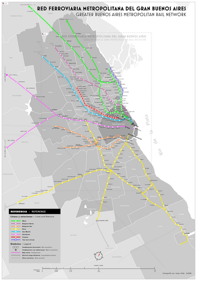
Railroad network map

The complexity of the City of Buenos Aires requires an equally complex and extensive transportation and access system to the city. The city not only needs a transport system for those who live in it, but also for the inhabitants of the agglomeration who move to the city mainly for work reasons.
Since 2009, the SUBE began to be progressively implemented, a prepaid system that allows you to pay for trips on buses, subways, and trains with a single card.
Ground transportation
Buses and the Metrobús system: The most widely used means of transport is the bus, which with more than 135 lines in service not only connects different parts of the city but also reaches different parties of the neighboring province of Buenos Aires.

Since May 31, 2011, the Metrobús has been operating, a system of stops and lanes exclusively for buses, which began on Avenida Juan B. Justo, with 21 stops along 12.5 kilometers between the neighborhoods of Palermo and Liniers. On July 24, 2013, a new corridor was opened on the route of Avenida 9 de Julio and, three weeks later, another branch was inaugurated that connects the Plaza Constitución Station with the La Noria Bridge. Subsequently, a new corridor was inaugurated in June 2015, on Avenida Cabildo (Capital side) and Avenida Maipú (Province side). In April 2016, the exclusive lane on Avenida San Martín was enabled, connecting the neighborhoods of La Paternal and Devoted Villa. New corridors are currently under construction: on Alem Avenue and Paseo Colón Avenue (Metrobús del Bajo), on National Route 3 (Metrobús la Matanza) and on Provincial Route 8 (Metrobús 3 de Febrero).
Trains: The other mass means used to access the city is the rail network, which has a clear hub in Buenos Aires. Some of these lines have a connection to the subway, which allows a relatively fluid transfer from the Buenos Aires suburbs to different areas of the city. Trains are also used by locals as a means of fast travel within the city.

Subway: The Buenos Aires Subway has six lines in operation (A, B, C, D, E, and H), totaling about 56.7 km of length. tunnels for commercial service and 90 stations. The extension of line A to the intersection of Avenida Rivadavia with Nazca and San Pedrito avenues in the Flores neighborhood and Line B from the De los Incas - Parque Chas station to the Villa Urquiza neighborhood were inaugurated in 2013. Line E, in 2019 was extended to Retiro.

The construction of another three lines is planned: F, G and I, with which the lines in operation would reach nine. Line A —inaugurated in 1913— is also a tourist attraction, for having been the first line of subways in the southern hemisphere, Latin America and the Spanish-speaking world, in addition to preserving fourteen stations inaugurated between 1913 and 1914 in a practically original state.
Tram: Although the tram was very important in the past, it is currently only a tourist attraction located in the Caballito neighborhood.
Premetro: The Premetro is a train system that runs through the streets of the southern part of the city. It was inaugurated in 1987 as a way to continue the service of line E at the end of it in a SW direction.
.jpg)
Light Rail: At one time, the city of Buenos Aires had a light rail system called Tranvía del Este that began operating in 2007 in the Puerto Madero neighborhood, and was suspended in 2012. The Tren de la Costa, located in the Argentine province of Buenos Aires, is a tourist light rail, inaugurated in 1995 that runs 15.5 km through elegant residential neighborhoods parallel to the Río de la Plata, between the Avenida stations Maipú, located in the town of Olivos y Delta, in Tigre.

In its journey of 11 stations, it passes through the municipalities of Vicente López, San Isidro, San Fernando and Tigre.
Remís: Remis is a transportation system that, unlike taxis, can only be contacted by phone and has a fixed rate.
Taxi: Taxis circulate continuously throughout the city and in a few minutes you can get a free one 24 hours a day. A gesture with the hand is enough to make it stop and be able to make the desired trip. Taxi drivers are the ones who know the city the most, which makes the trip safe and fast. The taxi has 2 rates, one that is applied from 6:00 a.m. to 10:00 p.m. and the rest, the so-called 2 or night rate, which has a 20% surcharge. You must always pay the amount indicated by the clock and in pesos, adding the cost of the toll in case there was one during the trip. The taxi driver can legally apply a surcharge for each bag, suitcase or package and also the return, if traveling outside the city, to the Federal Capital if the passenger does not return.

Combis, charters and others: The vans or charters also have two of their own terminals: the Obelisco Terminal and the Puerto Madero Terminal, so that the vans that go to and from the Greater Buenos Aires do not obstruct traffic in the lower area of Buenos Aires, on Avenida 9 de Julio and the Metrobús. Combis are used by people who work in the city and live in the province.
Bike lanes and Ciclovías: Buenos Aires ranks fourteenth out of 122 urban centers as one of the friendliest cities in the world for getting around by bike, according to a report by the Copenhagenize Index Bicycle-Friendly Cities. In recent years, the construction of bicycle lanes has been carried out in the most important arteries of the city and the Ecobici shared bicycle system that works automatically.
Buenos Aires also has a network of 269 kilometers of integrated and protected cycle paths, encouraging the use of bicycles as a means of transport, as well as a free bicycle rental system.
Bus Terminals: In interurban passenger transport, the Retiro Bus Terminal stands out, from which pulman services leave for the interior of the country and neighboring countries, and the bus stop Liners micros. In March 2017, the third long-distance bus terminal was inaugurated in the Villa Soldati neighborhood, called Terminal Dellepiane, to serve the metropolitan area.
Highways: The city has four highway accesses, in addition to the large number of existing accesses, whether they are bridges or avenues that cross Avenida General Paz. The highway accesses are the Buenos Aires - La Plata Highway, the Ricchieri Highway, the West Access and the North Access.
According to a study by the CNRT, the railway is the fastest way to get from the suburbs to the city center, followed closely by the private car or taxi, and in third place, the bus, with the exception of the southern zone, where traveling by car is somewhat faster than traveling by train. According to this same study, the train is the cheapest means of transport, followed by the bus, and lastly, the car. And he concludes that the railway, although it is usually faster and cheaper than the car, the problems of punctuality in the schedules and quality of the trip, mean that despite the higher cost and even probable delays, many people choose to travel to the capital in auto.

Fluvial transport
The port of Buenos Aires is the largest in the country, and was traditionally the main maritime entrance to Argentina. It currently handles 70% of Argentine imports and concentrates approximately 40% of the country's total foreign trade.

The metropolitan area of Buenos Aires also has the Domingo Faustino Sarmiento international river station, located in the town of Tigre, from which taxi boats, collective boats and tourist catamarans depart for trips to the numerous islands of the Paraná delta, towards Carmelo, towards Nueva Palmira and towards Colonia (all located in the Eastern Republic of Uruguay); Likewise, from said fluvial terminal it is possible to arrive at Puerto Madero, in the City of Buenos Aires.
Air transportation
The city and Greater Buenos Aires have three commercial airports, five military and two private. The two commercial ones are the Ministro Pistarini International Airport, in the Ezeiza district, 35 kilometers from the city, and the Jorge Newbery Airport in the Palermo neighborhood. In addition, Buenos Aires has the only low-cost airport in Latin America, which is dedicated to the operations of the low-cost airline Flybondi: it is El Palomar Airport, located in the Buenos Aires suburbs. This airport also has military purposes. From Ezeiza airport there are flights to all of South America, North America, Europe, Africa, Oceania and Asia. Domestic flights depart mainly from Aeroparque Jorge Newbery and, to a lesser extent, it provides international services to Paraguay, Bolivia, Chile, Brazil and Uruguay. The IATA airport codes are EZE (international airport), AEP (Jorge Newbery airport) and EPA (El Palomar).
Public services


The running water and sewage service was administered from 1993 to 2006 by the company Aguas Argentinas, in March 2006 its concession was terminated. To replace it, the national State created the state company Aguas y Saneamiento Argentinos (AYSA). The service is supplied by two water treatment plants, the General San Martín plant and the General Belgrano plant. The General San Martín Water Treatment Plant, inaugurated in 1913, is located in the Palermo neighborhood, with an area of 28.5 ha and with a production of 3,100,000 m³ of water per day. The General Belgrano Water Treatment Plant is located in the province of Buenos Aires, in the town of Bernal. It was inaugurated in 1978 and has an area of 36 ha and a production of 1,700,000 m³ per day.
The natural gas service has been supplied by MetroGAS since December 1992. During 2006, a total of 4,398,286,000 m³ of gas were distributed, being 1,031,385,000 m³ for residential users, 339,704,000 m³ for Compressed Natural Gas, 169,264,000 m³ for commercial users, 173,411,000 m³ for industries, 2 629 972 000 m³ for power plants and 55 007 000 m³ for official entities.
Electrical service is provided by two companies: Edesur and Edenor. Edenor's coverage area is delimited by: Dock "D", street with no name, trace of the future Coastal Highway, extension of Pueyrredón Avenue, Córdoba Avenue, San Martín Railroad tracks, General San Martín Avenue, Zamudio, Tinogasta, Avenida General San Martín, Avenida General Paz and the Río de La Plata; while Edesur is in charge of the service in the rest of the city. According to provisional values for 2004, the city generated 14,783,018 MWh, while it only consumed 9,689,504. The main electricity production plant is the Costanera thermal power plant, located in the southern part of the port area, with an installed capacity of 2,304 MW.
The fixed telephone service is provided by Telecom Argentina and Telefónica de Argentina. These companies have been in charge of providing the service since ENTel was privatized in 1990. By the year 2006, 1,604,750 telephone lines were in service, while that by 2005 there were 9 491 787 subscribers to mobile telephony. In addition, in 2006 there were 1,068,859 residential Internet accesses and 77,948 organizational accesses. Regarding the cable television service, in 2006 there were 2 752 323 subscribers to the same.
The waste collection service is organized into six collection zones, in which the service is provided by a different company. In Zone 1 (which includes the old CGP 1, 2S, 2N and 3) the service is provided by the company Cliba, in Zone 2 (which includes the old CGP 13, 14O and 14E) it is provided by the company AESA, in Zone 3 (which includes the old CGP 4, 5 and 6) the service is provided by the company URBASUR, in Zone 4 (which includes the old CGP 7 and 10) the service is provided by the company Níttida, in Zone 5 (which includes the old CGP 8 and 9) is provided by the Urban Hygiene Entity and in Zone 6 (which includes the old CGP 11 and 12) it is provided by the company INTEGRA. In turn, since 2008 the Ministry of Environment and Public Space carries out the formalization of urban recuperators in order to carry out the recovery of recyclable materials in dignified, hygienic and safe working conditions. Currently, more than 2,100 collectors are already working without minors, with uniforms, credentials, resources, and logistics provided by the city government, within the framework of the Zero Waste Law (No. 1854) and 992 (urban collectors)..
Its inhabitants have high access to public services: 99.9% have network water, the same number have network electricity, 92.8% have network gas, 99.6 % with public lighting, 99.3% with waste collection and 89.7% of homes have telephones. These figures decrease for the population residing in villas, although all of its inhabitants receive running water (including the public tap), 99.5% have electricity, 93.1% public lighting, 87.8% % trash and only 1.3% regular gas.
Deployment of the Armed Forces
| Units | Abbreviation | Location |
|---|---|---|
| Army General Staff | GEGE | Libertador Building (Monserrat) |
| JEMGE Secretariat | SAJEMGE | Libertador Building (Monserrat) |
| Evaluating Army Contracts Commission | CECE | San Telmo |
| Army Inspector General | IGE | Libertador Building (Monserrat) |
| General Directorate of Plans, Programmes and Budget | DGPPP | Libertador Building (Monserrat) |
| General Directorate of Administration and Finance | DGAF | Libertador Building (Monserrat) |
| General Directorate of Legal Affairs | DGAJ | Libertador Building (Monserrat) |
| EMGE Accounting and Finance Directorate | DCF | Libertador Building (Monserrat) |
| SUBJEMGE Coordination Secretariat | SC SUBJEMGE | Libertador Building (Monserrat) |
| GEGE headquarters | Cu Gral EMGE | Libertador Building (Monserrat) |
| General Directorate of Communications and Information | DGCI | Libertador Building (Monserrat) |
| General Directorate of Staff and Welfare | DGPB | Libertador Building (Monserrat) |
| General Directorate of Health | DGS | Patricios Park |
| General Directorate of Intelligence | DG Icia | Libertador Building (Monserrat) |
| Management of Engineers and Infrastructure | DGII | Libertador Building (Monserrat) |
| General Directorate of Research and Development | DGID | Libertador Building (Monserrat) |
| General Directorate of Organization and Doctrine | DGOD | Libertador Building (Monserrat) |
| Remonta and Veterinary Management | DRV | Palermo |
| General Directorate of Material | DGM | Palermo |
| Army Historical Affairs Directorate | DAHE | San Telmo |
| Directorate of Pre-University Education of the Army | DEP | Palermo |
| General Annex San Martín | n/d | Palermo |
| Directorate of Distance Education and Self Learning | DEADIA | Palermo |
| Language School of the Argentine Army | Ec Languages | Palermo |
| Army Computer School | Ec Infor | Palermo |
| Argentine Army Distance Education System | SEADEA | Palermo |
| University Institute of the Army | I | San Telmo |
| "Mayor Francisco Romero" Army Faculty | FE | Palermo |
| Superior War School « Lieutenant General Luis María Campos» | ESG | Palermo |
| Army Engineering Faculty "General of Division Manuel Nicolás Savio" | FIE | Palermo |
| Infantry Regiment 1 «Patricians» | RI 1 | Palermo |
| Granaderos Regiment to Caballo « General San Martín» | RGC | Palermo |
| Military Detachment «House of Government» | Dest Mil Casa de Gobierno | Casa Rosada |
| Regional Medical Board Buenos Aires | JMR Buenos Aires | Patricios Park |
| Communications Battalion 602 | B Com 602 | Palermo |
| Hospital Militar Central «Cirujano Mayor Dr. Cosme Argerich»-Hospital General 601 | H Grl 601-HMC | Palermo |
| Hospital Militar Campo de Mayo «Cirujano Primero Dr. Juan Madera»-Hospital General 602 | H Grl 602-HMCM | Palermo |
Education
| Statistics | |||
|---|---|---|---|
| Educational institutions | |||
| Level of education | Total | State | Private |
| Initial level | 683 | 204 | 479 |
| Primary level | 890 | 454 | 436 |
| Middle | 484 | 145 | 339 |
| Tertiary or higher non-university level | 261 | 51 | 210 |
| Students enrolled | |||
| Level of education | Total | State | Private |
| Initial level | 101 358 | 45 961 | 55 397 |
| Primary level | 263 719 | 149 549 | 114 170 |
| Middle | 195 294 | 104 011 | 91 283 |
| Tertiary or higher non-university level | 96 200 | 34 567 | 61 633 |

The City of Buenos Aires has the lowest illiteracy rate in the Argentine Republic, being 0.45% among those over 10 years of age.
According to a survey carried out by the General Directorate of Statistics and Censuses in 2006, the schooling rate by level is 96.5% for the initial level (5 years) and 98.6% for the primary level (6 to 12 years) and 87.0% for the intermediate level (13 to 17 years). In addition, the number of students enrolled continues to increase, reaching 656,571 students in 2,318 establishments during 2006.
In 2013, there was a greater enrollment in public elementary schools, reversing 10 years of setback in the city and becoming the only district in the country to achieve a drop in the loss of enrollment compared to private institutes, however enrollment at the public high school still continued to drop that year.
Buenos Aires has a large number of educational establishments. Except in the case of primary schools where there are more state establishments, the number of private establishments is greater. However, the number of students enrolled in privately run educational establishments is slightly less than that registered in state institutions.
The city also receives students who live in the province of Buenos Aires, during 2005 the percentage of students residing in that province who attended state schools was 4.5% at the initial level, 11.8% at the primary level, 19.5% at the secondary level.
Primary and secondary education

Initial education corresponds to the period between 45 days and 5 years. The Kindergartens are responsible for the education of minors between 45 days and 2 or 3 years, depending on the establishment. The so-called Infant Schools cover the entire period, between 45 days and 5 years.
Primary education covers from 6 to 12 years of age of the minor, and is compulsory throughout the Argentine Republic. A second language is taught in all of them, in those of official management only from the 4th grade (English in the single-day institutions; and English, French or Italian in the full-time ones), although there are 22 multilingual establishments in the city, where In addition to Spanish, English, French, German, Portuguese or Italian are taught.
Secondary education is intended for minors between 13 and 18 years of age, can reach 19 years in some modalities, and is organized into a basic cycle that includes the first 3 years, and a specialization cycle that includes the remaining period (up to 19 only in technical schools). Unlike many provinces, the City of Buenos Aires maintained its technical schools, and through Law 898 it was established that the average level of education is mandatory. Some schools are dependent on the University of Buenos Aires, such as the Instituto Libre Secondary Education, the Carlos Pellegrini Higher School of Commerce and the National College of Buenos Aires; While others are dependent on the Government of the City of Buenos Aires, such as the Otto Krause Technical School and the Raggio Technical School.
Higher Education

The city is home to some of the most important universities in the country, including the different modalities of tertiary education. Buenos Aires is a city with great weight at the regional level in terms of higher education. The British consultancy Top Universities in a 2013 study considered the city as the best city for students in Latin America. In the 2014 academic year the city had a university population of around half a million students, about one in three nationwide, of which 68.4% of students attended public universities.
With its 308,748 students, the University of Buenos Aires (UBA), which is public, is the largest face-to-face education university in all of Latin America. It was founded on August 12]], 1821 and is divided into two fields —Ciudad Universitaria and Centro Universitario Regional Paternal— that group several of its academic entities, with a total of thirteen faculties. The first year of all the careers is made up of the Common Basic Cycle (CBC), which must be approved to enter the corresponding faculty. The University also has eight regional university centers, fifteen museums and five assistance units. Each of these members of the University of Buenos Aires has its own admission procedures and its own awards for the studies they teach. For several years now, the University of Buenos Aires has been classified according to different and prestigious international rankings as the best Latin American and Spanish-speaking university, integrating the select elite club of the best 100 universities in the world.
In the city there are also other higher education institutions outside the University of Buenos Aires, including the Caece University, the University of Palermo, the Argentine Catholic University, the Manuel Belgrano National Nautical School, the University of Salvador, the University of Belgrano, the Technological Institute of Buenos Aires, the Argentine Business University, the Torcuato Di Tella University, which are private. There are also the main headquarters of the National Technological University, National University of Tres de Febrero, and there are some headquarters of the National University of General San Martín (Argentina) that are public like the UBA. There are some tertiary schools dependent on the city such as the Instituto Superior del Profesorado "Dr. Joaquín V. González", as well as institutes dedicated to art such as the National University of the Arts or the Superior School of Fine Arts.
Religions
Freedom of worship
As in the whole country, the freedom of worship of the Buenos Aires citizen is guaranteed by Article 14 of the national constitution, although the State recognizes a pre-eminent character to the Catholic Church, which has a differentiated legal status with respect to that of the rest of the churches and denominations.
Main followers
.jpg)
According to the survey provided by CONICET regarding the religious situation according to the different Argentine regions in 2008, Buenos Aires, being part of the Greater Buenos Aires and Federal Capital region, although it is the most indifferent region towards religion with 18.0%, Catholics are 69.1% of the population. While it is the fourth area of evangelicals with 9.1%. Due to its immigration past and different current immigration currents, it is where the maximum of minority religions are concentrated with 2.3%.


Most of the porteños declare themselves to be Catholics. The Archbishop of Buenos Aires, currently Cardinal Mario Aurelio Poli, is the Primate of the Catholic Church in Argentina. The previous Archbishop of Buenos Aires was Jorge Mario Bergoglio who, since March 13, 2013, is the current Pope Francis. Jorge Mario Bergoglio is the first Jesuit pope, the first from the southern hemisphere and the first non-European since the Syrian Gregory III ―died in [[741―.
Despite its long Catholic tradition, Argentina has only two recognized saints: the martyr Héctor Valdivielso Sáez (1910-1934) and the diocesan priest José Gabriel Brochero (1840-1914), the former born in Buenos Aires.
There is also a significant number of evangelical or Protestant temples in the city that represent 9.1% of the population.
Judaism is the second most practiced religion in the city after Christianity. The Jewish population in Argentina is the largest in Latin America, the third largest on the continent, and the seventh largest in the world outside of Israel. As of 2006, a population of around 184,500 Jews was estimated according to some estimates, others based on a report by the JOINT (or JDC: Jewish Joint Distribution Committee) based on a sample of 30,000 households., estimated (in 2005) 233,000 Jews in and around Buenos Aires, based on the definition of a Jew according to Israel's Law of Return.
Other major religions include Jehovah's Witnesses and Mormons, while another large part of the population considers itself atheist or agnostic.
Likewise, the city has the presence of some mosques, being the King Fahd Islamic Cultural Center, located in the Palermo neighborhood, the largest mosque in Argentina and Latin America.
Economy
.jpg)
In 2008, the Gross Geographic Product (GDP) of the City of Buenos Aires was approximately 460,455 million Argentine pesos (ARS), which results in $80,400 (Argentine peso) per capita. The income, approximately US$ 24,900 (US dollar) per capita, was much higher than the national rate for that year and ranks the city with the second highest per capita income in Latin America in nominal terms, after Mexico City. This, due to the relatively devalued exchange rate of the Argentine peso, presents important distortions, since, taking purchasing power into account, Buenos Aires has the highest per capita product in the Latin American region. Real GDP grew by 11.4% in 2006 compared to 2005.
The main economic sector of Buenos Aires is the Services sector, which represents 78% of its GDP in constant terms, much higher than the 56% nationally. The most important branches are real estate, IT, professional services, business and rental services, and financial intermediation services.
One of the most dynamic sectors was construction, since the number of building permits increased by 44%, with communes 6, 8 and 11 showing the highest growth with 164%, 132% and 130% respectively. The influence of the sector in the PBG reached 7.48 billion pesos in 2006.
Regarding financial services, Buenos Aires generates 70% of the added value of the Nation. It concentrates 53% of bank deposits and 60% of loans to the non-financial private sector, amounting to 90,446 and 53,567 million pesos, respectively. In addition, 90% of the country's financial institutions have their headquarters in this city.
The manufacturing industry represents 20.2% of GDP. The sector suffered an increase of 10% compared to the previous year, and the items that registered the greatest increase in activity are medicines, chemical products and clothing, which exceeded 14%. The headings of "Food, beverages and tobacco", "Medicines for human use" and "Paper and printing" concentrate 60% of the income of the sector.


In recent years, the city has become a tourist hub, especially due to the drop in costs that the devaluation of the peso produced for foreign visitors. Between 2002 and 2004 the number of hotel establishments increased by 10.7%, while the rate of occupied rooms had a significant increase of 42.9%.
In the city there is an important development of the sector of computer services. Approximately 70% of the software generating companies are installed in the City of Buenos Aires, which at the national level export more than 940 million dollars. The Port of Buenos Aires is the largest in the country and manages 9 7 million tons of goods every year.
Tourism

.jpg)
Argentina is among the most visited countries in South America and in turn, Buenos Aires has 5.5 million visits per year. Buenos Aires is a populous city and is among the 20 preferred destinations in the world.
.jpg)
The most important tourist places are located in the historic center of the city, a sector formed practically by the neighborhoods of Monserrat and San Telmo. The city began to be built around the Plaza Mayor (today Plaza de Mayo), and the administrative institutions of the Colony were installed in the area. To the east of the Plaza you can see the Casa Rosada, the current headquarters of the Executive Power of Argentina, where the Fort used to be. To the north of the Plaza is the Metropolitan Cathedral, which occupies the same place since colonial times, and the Banco de la Nación Argentina building, whose plot was originally owned by Juan de Garay. Another important colonial institution was the Cabildo, located to the west, which has not been preserved in its original form since part of its structure was demolished to open up Avenida de Mayo and the Julio A. Roca diagonal.
To the south you can see the building of the old National Congress, where the National Academy of History currently operates. And finally, to the northwest you can see the City Government Headquarters, advancing towards Avenida de Mayo.

Avenida de Mayo is considered the Civic Axis, since it joins the Casa Rosada with the Palace of Congress, headquarters of the Executive Power and the Legislative Power, respectively. Along this avenue you can see some buildings of great cultural, architectural and historical interest: the Casa de la Cultura, the Palacio Barolo and the Café Tortoni, among others. Under this avenue runs Line A of the Buenos Aires subway which, when it was inaugurated in 1913, became the first in Latin America.
When you reach the end of the artery, you can see a set of squares, decorated with various monuments and sculptures, including a signed copy of The Thinker by Rodin. In the vicinity of these squares are the Palace of Congress and the Confitería El Molino building.
In the Old Town you can also visit the Manzana de las Luces. There are several buildings with great historical value, such as the San Ignacio Church and the headquarters of the National College of Buenos Aires. On the block you can see the hidden tunnels that ran through the city during colonial times and you can also visit the building where the Deliberative Council functioned from 1894 to 1931.
In the San Telmo area you can visit Plaza Dorrego, where every Sunday the famous Antiques Fair takes place. In addition, several antique shops and a Jesuit complex made up of the church of Nuestra Señora de Bethlem, the Parish of San Pedro Telmo and the "Antonio Ballve" Penitentiary Museum are located nearby. In the area there are also the National Historical Museum and the Lezama Park, where several sculptures and monuments were housed.
In the Recoleta neighborhood there are a large number of tourist sites and many that also have great cultural value. There you can find the main headquarters of the National Museum of Fine Arts, the National Library, the generic floralis, among others.


Women's Bridge at night.
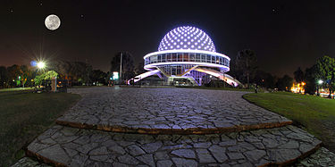
The Planetarium Galileo Galilei.

MALBA's interior.
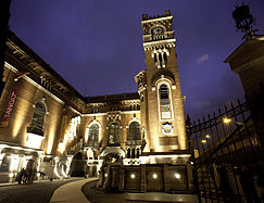
Usina del Arte, a cultural center and shows.

Foyer of the Usina of Art during the night.

Fortabat Art Collection.


Culture
The culture of the city of Buenos Aires shares many features with the culture of the Rio de la Plata area. Not only do Idiomatic features are shared (since in the region the same dialect is used, the Spanish rioplatense), but it shares the diverse roots that formed the culture of the region. Diversity is given by the large number of immigrants who arrived in the region during the nineteenth and twentieth centuries, which made Buenos Aires a cultural crucible.
Buenos Aires is one of the main cultural metropolises in the West. Cultural development is appreciated in the many museums, theatres and libraries that can be found in the city. It also stands out for its publishing industry and for having its own cultural identity, reflected in manifestations such as steak, lunfardo, tango, matt and carnivals. It also has an important tourist offer and numerous places to visit.Museums and Libraries
The City government manages ten museums that cover different themes: from the plastic arts Eduardo Sívori Museum of Plastic Arts to History, the Cornelio de Saavedra Historical Museum of Buenos Aires, and the Pablo Ducrós Hicken Cinema Museum. There are also many museums dependent on the National Government such as the Casa Rosada Museum, the National Museum of Fine Arts, the National Museum of Decorative Art, the Argentine Museum of Natural Sciences or foundations such as the Museum of Latin American Art of Buenos Aires. The city has 26 public libraries that have 317,583 copies. In addition, there are many libraries dependent on the different Powers of the Nation, as well as the different universities that are located in the Capital.


Publishing industry

The metropolis is also distinguished as the largest publishing center in the country, since the most important publishers reside there, and it is also the city where the newspapers and magazines with the largest circulation are published. For example, Clarín is the newspaper with the largest circulation in Argentina, and is also one of the most widely distributed in the Spanish-speaking world, with an average circulation of 300,837 daily copies in June 2010. The second with the largest circulation (average of 160,000 copies from Monday to Saturday and 250,000 on Sundays) is La Nación, which is one of the oldest on the planet, its first issue was published on January 4, 1870.
The publishing industry in Buenos Aires is one of the most competitive in the region. According to the World Cities Culture Forum, Buenos Aires is the city in the world with the most bookstores per capita. Old books, first editions and publications in different languages can be regularly obtained in different places, especially in the shops located on Avenida de Mayo and on Corrientes Avenue, between Callao and 9 de Julio.
Every year in April, the Buenos Aires International Book Fair is held, one of the five most important fairs in the world, along with those of Frankfurt, São Paulo, Guadalajara, London and Book Expo America. It is aimed at the general public, as well as the literary community as a whole.
Bars and theaters

Buenos Aires has one of the largest concentrations of theaters in the world, ranking fourth among the cities with the largest number of theaters, and some sources even place it as the city with the most theaters in the world. The city It also has the largest theater industry in Latin America.
The Teatro Colón is one of the most important in the world due to its size and history, and one of the five best theaters for opera due to its acoustics.

Avenida Corrientes, in whose traditional cafes and bars tango evolved in the early and mid-20th century, is the artery where some of the most important theaters are located. In this sense, the City of Buenos Aires has a very diverse offer, and many of the most important theaters depend directly on the City Government: the Teatro Colón, the Teatro General San Martín, the Teatro Presidente Alvear, the Teatro Regio, the Sarmiento Theater and the Ribera Theater, among others. There is also an important activity in the Cervantes National Theater, the Gran Rex Theater, the Recoleta Cultural Center, the General San Martín Cultural Center, the Maipo Theater, the Coliseo Theater, the Lola Membrives Theater, among others and the large number of independent theaters that are distributed by the neighborhoods of Villa Crespo, Almagro and Abasto. The city has more than 300 theaters.
The city has a select group of about 70 bars known as Notable Bars that are characterized by having been protagonists of an important part of the city's history, they receive aid from the Government of The city of Buenos Aires. Some were even declared Cultural Heritage of the City of Buenos Aires. They are found mainly in the old neighborhoods of the City, San Nicolás, San Telmo or La Boca. To this is added the location of notable old bars but whose history interests those who come looking for a historical focus on their visit to the Reina del Plata. Such is the case of two cafés that were linked to one of the most important episodes of Argentine literature, the social and literary dialectic between the Florida Group, so called because they met at the Richmond Confectionery in the central Florida street, and published in the offices of the nearby magazine Martín Fierro, with members such as Jorge Luis Borges, Victoria Ocampo, Leopoldo Marechal, artists such as Antonio Berni, vs. the Boedo Group, so called because they published in Editorial Claridad and met at Café El Japonés on Avenida Boedo in the current neighborhood of the same name, leaving said literary confrontation and the establishments that sheltered them in the history of the city. Another of the notable bars in the city is the renowned London City café. London City is today one of the emblematic corners of Buenos Aires, due to its permanence over time, for being linked to the living history of its people, for having contributed to relevant cultural and historical events and for its preserved architectural design. It was here in London where the still unknown Julio Cortázar wrote, and also set, a large part of his first novel Los premios, published in 1960.
Music

Buenos Aires is known internationally for being the cradle of tango, being the Argentine singer Carlos Gardel its greatest exponent. But we must not forget orchestras such as those led by Aníbal Troilo, Mariano Mores and Osvaldo Pugliese, or lyricists such as Enrique Santos Discépolo and Homero Manzi. In the mid-20th century, new singers such as Julio Sosa, Edmundo Rivero and Roberto Goyeneche emerged, as well as new trends, whose greatest exponent was Astor Piazzolla.
From the end of the 1960s, as in many urban centers of the country, National Rock arose, and in the 80s and 90s, Argentine punk rock; in fact Argentina was the third country in the world to create a rock of its own identity. The city has also been influenced by Colombian cumbia, the quartet and, at the end of the 20th century, cumbia villera, which emerged in the poorest areas of the city and Greater Buenos Aires. Today, the new fashion genre that was born in Buenos Aires and is exported in Europe is digital cumbia, a mixture of the ternary rhythm of cumbia with electronic influences.
Galileo Galilei Planetarium

The Planetarium Galileo Galilei is located at the intersection of Avenida General Sarmiento and Belisario Roldán, in Parque Tres de Febrero, in the Palermo neighborhood of Buenos Aires, Argentina. His first function was June 13, 1967, and he received various reforms and updates being the most important ones in 2011 and 2017. It was built to promulgate the dissemination of astronomical science through educational shows for students and the general public. Three metallic meteorites, which were found in Argentinian territory, are on display in their explanade of access.
Its dome is 20 meters in diameter and on it 8900 fixed stars, constellations and nebulae can be reproduced.Traditions

A cultural manifestation typical of the city is the use of lunfardo, a jargon that developed and spread from the mid-19th century in the poor areas of the City of Buenos Aires. It has language contributions from Italy, France, Spain and Portugal, as well as from the local black and Creole population and even indigenous people. The lunfardo was immortalized in the lyrics of popular music, particularly in those of tango.
Another cultural manifestation typical of the porteño is fileteado, decorative and popular art, born in the first decades of the XX century. It usually appears in contexts related to tango, design and advertising. Flowers, scrolls, acanthus leaves, Argentine ribbons, are combined with popular characters through very bright colors and through contrast the idea of volume is given. The texts are also part of the composition of the filleting, with phrases coined by popular wisdom. In 2006, the Buenos Aires legislature declared fileteado as Cultural Heritage of the City of Buenos Aires from the enactment of the 1941 law.
An important tradition is that of the Carnival Celebrations. There are 103 murgas in Buenos Aires, bringing together more than 10,000 people. Annually, more than 800,000 people usually gather to enjoy the music, dance and singing offered by these comparsas in the large number of corsos that take place in the Buenos Aires neighborhoods.
Fashion
In Buenos Aires, since 2001, the most important fashion event in Argentina, the Buenos Aires Fashion Week, has been held twice a year in order to show the latest trends for the spring-summer and autumn-winter collections. BAF Week is attended by international but above all national designers, so it is a good opportunity to offer an overview of the local fashion industry. The call is made in La Rural. The city also hosts Argentina Fashion Week and the Buenos Aires Moda event, which have been held for 34 and 46 editions respectively.
The city also has the Metropolitan Design Center, a public institution belonging to the Government of the City of Buenos Aires located in the Barracas neighborhood in the place of the old Fish Market. The property has 3,000 m² for carrying out samples related to the design. Events such as Casa FOA and Buenos Aires Runway have taken place at its facilities. It is also worth highlighting the spaces dedicated exclusively to the teaching of training courses related to design.
Gastronomy

The gastronomy of the city of Buenos Aires is characterized by two large European contributions: Italian and Spanish, it is just as varied as the rest of the culture, including red meats, fish, pastas and empanadas, which are originating from the northwest of Argentina. Among the meats are roasted, roasted or empty, usually accompanied by chorizos, mollejas, chinchulines and morcillas. In addition to these popular cuts, you can try the chorizo bife, the loin bife or the bife eye, more noble. The most consumed fish are merluza, corvina, tonguedo, besugo and pejerrey. The influence of the Italian Mediterranean diet, very diffused by migratory flows from that country in the early twentieth century, is reflected in pastas such as noodles, ñoquis, canelones, lasagnas and ravioles, and in desserts, especially ice cream and tiramisú Beyond all of these there is one that failed to mention El Mate a set of dry yuyos placed inside a container with a metal base.
Buenos Aires is characterized by a huge range of bars and restaurants. The city has a privileged group of 60 bars with great history and renowned within the city. The city also has a large number of international food restaurants such as Italian, Chinese, Spanish, Japanese, Korean, etc.Media
Open television
The main broadcast television stations are América TV (channel 2), Televisión Pública (channel 7), El Nueve (channel 9), Telefe (channel 11), El Trece (channel 13), Net TV (channel 27.2), Channel 21 and Channel 26. Historically, these stations have broadcast on analogue terrestrial television since they began broadcasting, although they are also available on open digital television (TDA).
Radio stations
The city of Buenos Aires has numerous radio stations, both AM and FM. As in the rest of the world, FM is more listened to. Among the 15 most listened to are 10 that broadcast on FM: La 100, Pop Radio, Rock & Pop, FM Metro, Los 40, Radio Disney, FM Aspen, Mega, Vale, Radio One 103.7, Vorterix Rock; and 5 in AM: Radio 10, Radio Miter, Continental, La Red and Radio Nacional, not to mention Radio América and Del Plata, which are also among the most important.
Newspapers
The two with the largest circulation are La Nación and El Clarín. They also have national circulation: Crónica, Popular, La Prensa, Página/12, Perfil. With a financial orientation, Buenos Aires Económico, El Cronista and Ámbito Financiero are published.
Sports
Football
The most popular sport in Buenos Aires, as in the whole country, is soccer, and many of the teams with the longest history in the Argentine Primera División are located in the city, which is the one with the highest concentration of soccer clubs in the world (with 21 institutions). On the other hand, 18 of them have their own stadium, an aspect in which it is only comparable with London and Montevideo, which followed the English model that proclaims that each team owns its field, unlike what happens in continental Europe., where there is usually a single large stage, usually communally owned, which is shared by the city teams.
Buenos Aires is home to several of the most important soccer clubs in the country:
- First Division: Argentinos Juniors, Barracas Central, Boca Juniors, Hurricane, River Plate, San Lorenzo and Vélez Sarsfield.
- First National B: All Boys, Atlanta, Belgrano Advocates, Riestra Sports, West Railway and New Chicago and Sacachispas.
- First B: Communications.
- First C: Spanish Sports, Excursionists, and General Lamadrid.
- First D: Paraguayan sports, Sportivo Barracas and Yupanqui.
Some institutions have moved their stadiums, and even their headquarters, to the Buenos Aires suburbs or to the interior of the province of Buenos Aires, but they maintain ties with the city, where their building nuclei and a number of partners and supporters remain. They are:
- First Division: Platense
- First National B: Almagro, Chacarita Juniors, Students and San Telmo
- First B: Colleges, Armenian Sports and Phoenix
- First C: Atlas, Liniers, Sportivo Italiano
- First D: Lugano
In terms of sports, Boca Juniors, River Plate and Vélez Sarsfield are the three clubs from Buenos Aires that have been world champions.
Other disciplines
The city also has numerous entities that participate in the different categories of the AFA Futsal Championship, among them the most important of the discipline in the country, the multi-champions Pinocho and Boca Juniors (futsal).
There are institutions that have infrastructure for the practice of sports such as basketball (whose top national competition is the National Basketball League), or tennis (where the Buenos Aires Lawn Tennis Club is the venue for the only ATP tournament played in the country, the Buenos Aires Tournament). There are also other stadiums for practicing sports such as Luna Park (in which boxing matches stand out) and the new multipurpose Parque Roca stadium, inaugurated in 2006, used for Davis Cup series.
In the Núñez neighborhood is the National Center for High Performance Sports (CeNARD), a state complex that houses athletes from all over the country and allows the practice of a large number of sports. It has soccer fields, hockey, handball, rugby, tennis, volleyball, skate courts, swimming pools, among other sports, gyms, taekwondo, judo, weightlifting, and two athletics tracks.
Events


.jpg)
The city of Buenos Aires was the venue for several international competitions: two stadiums, River Plate and Vélez Sársfield, hosted the 1978 Soccer World Cup, and on several occasions the Copa América of the same sport. In addition to soccer, the city hosted two world championships in basketball (1950 and 1990), one in men's volleyball (2002) and another in polo (1987).
As for multi-sport events, it hosted the first Pan American Games played between February 25 and March 9, 1951, and later lost the election to host the 1956 Olympic Games by just one vote; It was also among the top 5 venues for the 2004 Olympic Games. In 2006, it hosted the eighth edition of the South American Games, organized by the South American Sports Organization (ODESUR). The city was chosen in 2013 as the host city for the 2018 Summer Youth Olympic Games.
As for motor racing, at the Oscar and Juan Gálvez Autodrome the Argentine Formula 1 Grand Prix was held twenty times and the Argentine Motorcycle Grand Prix ten times. On four occasions (2009, 2010, 2011 and 2015) the city was the starting and finishing point of the Dakar Rally.

_football_River_Plate.jpg)
Sports Equipment
| Equipment | Sport | Current category | Barrio | Stadium |
|---|---|---|---|---|
| All Boys | Football | First National B | Monte Castro | Falkland Islands |
| Argentinos Juniors | Football | First Division | Villa Mitre | Diego Armando Maradona |
| Atlanta | Football | First National B | Villa Crespo | Don León Kolbowsky |
| Central Barracas | Football | First Division | Barracas | Claudio Tapia |
| Boca Juniors | Football | First Division | La Boca | Alberto J. Armando |
| Communications | Football | First B | Agronomy | Alfredo Ramos |
| Advocates of Belgrano | Football | First National B | Núñez | Juan Pasquele |
| Deportivo Español | Football | First C | Avellaneda Park | New Spain |
| Paraguayan sports | Football | First D | Barracas | He doesn't own |
| Deportivo Riestra | Football | First National B | Villa Soldati | Guillermo Laza |
| Excursionists | Football | First C | Belgrano | Excursionists |
| Railway West | Football | First National B | Caballito | Architect Etcheverri |
| General Lamadrid | Football | First C | Villa Devoto | Enrique Sexto |
| Hurricane | Football | First Division | Patricios Park | Tomás Adolfo Ducó |
| New Chicago | Football | First National B | Killers | New Chicago |
| River Plate | Football | First Division | Núñez | Antonio Vespucio Liberti |
| Sacachispas | Football | First National B | Villa Soldati | Beto Larrosa |
| San Lorenzo | Football | First Division | Boedo | Pedro Bidegain |
| Sportivo Barracas | Football | First D | Barracas | He doesn't own |
| Vélez Sarsfield | Football | First Division | Liniers | José Amalfitani |
| Yupanqui | Football | First D | Villa Lugano | He doesn't own |
| Boca Juniors | Basketball | National Basketball League | La Boca | Luis Conde |
| Railway West | Basketball | National Basketball League | Caballito | Hector Etchart |
| Sanitary works | Basketball | National Basketball League | Núñez | Sanitary works |
| San Lorenzo | Basketball | National Basketball League | Boedo | Polideportivo Roberto Pando |
| River Plate | Vóley | Argentina Volleyball League | Núñez | Microestadio River Plate |
| Predecessor: - | Pan American City 1951 | Successor: |
| Predecessor: | South American City 2006 | Successor: |
| Predecessor: | Olympic Youth City 2018 | Successor: |
International relations
Headquarters of international organizations
- Secretariat of the Antarctic Treaty
International airports connected to Ezeiza airport
| City | Airport |
|---|---|
| Viru Viru International Airport | |
| São Paulo-Guarulhos International Airport | |
| Galeão International Airport | |
| International Airport President Juscelino Kubitschek | |
| International Airport of Curitiba | |
| International Airport Luís Eduardo Magalhães | |
| International Airport Salgado Filho | |
| International Airport Tancredo Neves | |
| Hercilio Luz International Airport | |
| International Airport of Recife | |
| Carrasco International Airport | |
| International Airport of Laguna del Sauce | |
| Silvio Pettirossi International Airport | |
| Arturo Merino Benítez International Airport | |
| Jorge Chávez International Airport | |
| El Dorado International Airport | |
| International Airport of Maiquetía Simón Bolívar | |
| International Airport of Tocumen | |
| Benito Juárez International Airport | |
| Cancun International Airport | |
| International Airport of Punta Cana | |
| José Martí International Airport | |
| John F. Kennedy International Airport | |
| International Airport Freedom of Newark | |
| Miami International Airport | |
| Los Angeles International Airport | |
| George Bush Intercontinental Airport | |
| Dallas-Fort Worth International Airport | |
| Hartsfield-Jackson International Airport | |
| Orlando International Airport | |
| Toronto Pearson International Airport | |
| Paris-Charles de Gaulle Airport | |
| Rome-Fiumicino Airport | |
| Madrid-Barajas Airport | |
| Barcelona-El Prat Airport | |
| Amsterdam-Schiphol Airport | |
| Frankfurt am Main Airport | |
| London-Heathrow Airport | |
| London-Gatwick Airport | |
| Zurich International Airport | |
| Dubai International Airport | |
| Hamad International Airport | |
| Auckland International Airport | |
| Atatürk International Airport | |
| Bole International Airport |
Twinnings
The city of Buenos Aires has had, throughout its history, various twinning and cooperation agreements with cities from various continents, as well as some regions or autonomous communities. Sister cities with Buenos Aires:
 Cadiz, Spain (1975),
 Caracas, Venezuela (1982)
 Medellin, Colombia.
- Barcelona, Spain (1985; 1990)
- Bilbao, Spain (1992)
- Almeria, Spain (2008)
 Bangkok, Thailand (2006)
- Ceuta, Spain
- Guadix, Spain (1987).
- Madrid, Spain (1975).
- Salamanca, Spain (2006).
- Santa Cruz de La Palma, Spain
- Oviedo, Spain (1982).
- Santiago de Compostela, Spain
- Seville, Spain (1976).
- Vigo, Spain (1992).
 Tarija, Bolivia.
 Belgrade, Serbia (1990).
 San José, Costa Rica
 London, United Kingdom
 Berlin, Germany (1994)
 Athens, Greece (1992).
 Guadalajara, Mexico (1996).
 Warsaw, Poland (2004).
- Bogotá, Colombia (1986).
- Barranquilla, Colombia
 New York, United States.
 Brasilia, Brazil (1986; 1997).
- Porto Alegre, Brazil (1995).
- Rio de Janeiro, Brazil (1996).
- São Paulo, Brazil (1999).
- La Paz, Bolivia (2003)
 Havana, Cuba
 Cape Town, South Africa
 Damascus, Syria (1989).
 Cairo, Egypt (1992).
 Yerevan, Armenia (2000).
 Genoa, Italy (1991).
- Lucca, Italy (2003).
- Cagliari, Italy
- Bergamo, Italy
- Milan, Italy (1998).
- Naples, Italy (1990).
- Rome, Italy (1987).
- Ferrara, Italy (2004).
 Lima, Peru (1983).
- Cuzco, Peru (1986).
- Aguas Calientes, Peru.
 Jerusalem, Israel
- Tel Aviv, Israel (1958).
 Kiev, Ukraine (1993).
 Lisbon, Portugal (1992).
 Managua, Nicaragua
- Miami, United States (1978).
 Asunción, Paraguay (2002)
 Montevideo, Uruguay (1975).
 Moscow, Russia (1990).
 Osaka, Japan (1990).
- Tokyo, Japan (2018).
 Ottawa, Canada (1998).
 Toulouse, France (1990).
- Paris, France (1999).
 Reikiavik, Iceland.
 Beijing, China (1991; 1993).
 Prague, Czech Republic (1992).
 Quito, Ecuador
 Rotterdam, Netherlands (1990).
 Santiago de Chile, Chile (1992).
 Santo Domingo, Dominican Republic (1991).
 Seoul, South Korea (1992).
 Zagreb, Croatia (1998).
- Mexico City, Mexico (1997).
 Tegucigalpa, Honduras (2000)
 Corrientes, Argentina (2009).
- Cuernavaca, Mexico (2012).
- Palermo, Italy (2014)
- Colonia del Sacramento,Uruguay (2018)
 Mixco,Guatemala (2019)
Regions, states and autonomous communities (sub-state entities) twinned with the City of Buenos Aires:
|
|
|
|
Contenido relacionado
Peter's projection
Korea
Commodore Amiga 500