Black Sea
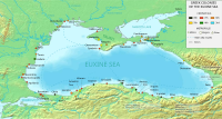
The Black Sea (Latin Pontus Euxinus) is a sea located between eastern Europe and western Asia. It is found enclosed between the Balkans, the Pontic steppe, the Crimea, the Caucasus and the Anatolian peninsula. The Bosphorus Strait connects it with the small Sea of Marmara, and the Dardanelles Strait connects the former sea with the Aegean Sea, which is a division of the Mediterranean Sea. It is also connected to the Azov Sea, located to the northeast, by the Kerch Strait. The Black Sea forms an elliptical depression sloping from east to west, and has an area of 436,400 km² (not including the Azov Sea), a maximum depth of 2,212 m, and a volume of 547,000 km³. The countries riparians of the Black Sea are, starting from the south and clockwise, Turkey, Bulgaria, Romania, Ukraine, Russia (Krasnodar Krai, Rostov Oblast, and Crimea), and Georgia.
It is bounded by the Pontic Mountains to the south and the Caucasus Mountains to the east, and has a broad plateau to the northeast. Its greatest length from east to west is 1,175 km. Among the important cities on its coasts are: Batumi, Burgas, Constanta, Giresun, Hopa, Istanbul, Kerch, Mangalia, Năvodari, Novorossiysk, Odesa, Ordu, Poti, Rize, Sinope, Samsun, Sevastopol, Sochi, Sozopol, Sukhumi, Trabzon, Varna, Yalta and Zonguldak.
There is a net outflow of water of 300 km³ per year through the Bosphorus and the Dardanelles Strait into the Aegean Sea, while water from the Mediterranean flows into the Black Sea as part of a round-trip path of exchange hydrological. The flow coming out of the Black Sea is colder and less saline, and the flow coming in from the Mediterranean is warmer and saline, so this flow is the result of density changes caused by different salinities, giving gave rise to a large amount of anoxic water 150 m below the surface, which have the ability to break down sunken iron ships but not wooden ships. The Black Sea also receives water from the great Eurasian river system by the north of the sea The rivers that provide the most water are the Danube, the Dniester, the Dnieper and the Don.
The water levels of this sea have varied significantly throughout history. Due to these variations of the water level in the basin, the current limits of this sea have sometimes been dry geological terraces. When certain high water levels occur, it is possible that the sea connects with other nearby waters to stabilize. It is through one of these busiest connecting routes, the Turkish Strait, that this sea connects with the world's oceans. When this hydrological link is not present, the Black Sea becomes an endorheic basin that operates independently of the global ocean system, as is the case with the Caspian Sea. The Turkish Strait connects the Black Sea with the Aegean, spanning the Bosphorus, the Sea of Marmara, and the Dardanelles Strait.
Extension
The International Hydrographic Organization defines the limits of the Black Sea as follows:
- To the southwest: The border to the northeast of the sea of Marmara. A line that unites Cape Rumili (Rumeli Feneri) with Corporal Anatoli (Anadolo Feneri) (41°13'N).
- In the Strait of Kerch: A line that unites the Takil Cape (Mys Takyland Cape Panaghia (Mys Panagiya) (45°02'N).
Populations
Name
Modern names
Modern names for this sea are equivalent to the name "Black Sea", including those given in countries that are washed by this sea:
- Abkhaz: Amshyn Eikwa (Aмшын Еия)а)
- Adyghe: Xi Shutse (HOOTS ш1уц1э), Axin (Aхын)
- Bulgarian: Cherno more (CHEERING)
- Georgian: Shavi zghva ()))。
- Laz: Ucha zuğa or simply Zuğa
- Romanian: Marea Neagră
- Russian: Chornoye morye (Чёрное морe)
- Turkish: Karadeniz
- Ukrainian: Chorne more (CHEERING)
These names were not fully established until the 12th century, but there are indications that they may be considerably older. In Greece, the historical name Ponto Euxinus (Eύξεινος Πόντος, Eúxeinos Póntos), meaning "Hospitable/Welcoming Sea", is still widely used.
Historical names
In the work Geography (1.2.10) Strabo says that in ancient times, the Black Sea was often called "The Sea" (ὁ πόντος, ho pontos). Greco-Roman tradition has long referred to the Black Sea as the Hospitaller Sea (Εὔξεινος Πόντος, Eúxeinos Póntos), which replaced an earlier name, the Inhospitable Sea (Πόντος Ἄξεινος, Póntos Áxeinos), first cited by Pindar (c. 475 BC). Strabo (7.3.6) believes that the Black Sea was called "Inhospitable" before the Greek colonization because it was difficult to navigate and because its coasts were inhabited by savage tribes. The name was changed to "Hospitalario" after the Greek Milesians colonized the southern coast, Pontus, making it part of the Greek civilization.
It is also possible that the epithet Áxeinos comes etymologically from the Scythian word axšaina, which means "dark"; so the designation of the Black Sea could come from antiquity.
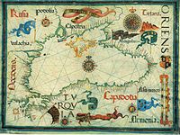
A 1570 map of Asia titled Asiae nova descriptio, from Abraham Ortelius's Theatrum orbis terrarum, calls it mar Maggior (Greater Sea). English-language writers of the 18th century used the name Euxine Sea to refer to the Black Sea. Edward Gibbon, for example, called the sea this way in his work The History of the Decline and Fall of the Roman Empire. During the Ottoman imperial period, the Black Sea was also called Bahr -e Siyah or Karadeniz, meaning "Black Sea" in the Ottoman Turkish language.
Geology and bathymetry
The geologic origins of the basin can be traced back to two earlier relicts that were created from an Albian volcanic arc that was subsumed by the Paleo-Tethys and Tethys oceans, but the timing of these events remains a matter of debate..
Since its inception, the pressure environment of the tectonic plates caused the subsidence of the basin, which was interspersed with phases in which it extended as a result of large-scale volcanic activity and numerous orogenies, which they caused the uplift of the Caucasus ridge, the Pontic Mountains, the Balkans and the southern Crimean peninsula.
The ongoing collision between the Eurasian and African plates and the westward drag of the Anatolian plate, which produces the North and East Anatolian Faults, have dictated the current tectonic regime, which it has major subsidence in the Black Sea basin and significant volcanic activity in the Anatolian region. It is these geological mechanisms that have caused, over time, periodic isolation of the Black Sea from the rest of the world. global ocean system.
The modern basin is divided into two sub-basins by a depression that begins to extend south of the Crimean peninsula. It is, first of all, a large submarine terrace (equivalent to a continental platform) whose widest part is 190 km long from the coast to the unevenness. The uneven slope has an inclination between 1:10 and 1:1000. The southern edge runs through northern Turkey and the eastern edge runs along the Georgian coastline, although in these places it is characterized as a narrow shelf that is rarely more than 20 km long, with a slope of 1:40, with large submarine canyons and extensive channels. In the center of the Black Sea is the Euxine abyssal plain, which has a maximum depth of 2,212 m at a point south of the city of Yalta on the Crimean peninsula.
The Black Sea coastline is often referred to as the Pontic Littoral or the Pontic Zone. To the north is the "Chernozem belt", which runs from eastern Croatia (Slavonia), along along the Danube (northern Serbia, the Bulgarian Danube Plain and southern Romania via the Wallachian Plain) to northeast Ukraine and through the Black Lands region and south into Russia into Siberia.
Hydrology
The Black Sea is a marginal sea and the largest body of water in a meromictic basin in the world. Deep waters do not mix with surface waters that receive oxygen from the atmosphere. As a result of this, approximately 90% of the deeper water in the Black Sea is anoxic. Patterns of water circulation in the Black Sea are controlled primarily by basin topography and inflow by waterways, which It ends in a stratified and vertical structure. Because of this extreme stratification, it is classified as a "salt wedge" estuary.
The Black Sea only experiences one water exchange with the Mediterranean, so all inflows and outflows are in the Bosphorus Strait and the Dardanelles Strait. The inward flow from the Mediterranean has a higher salinity and density than the outward flow, creating the classic estuarine circulation. This means that the inward flow of the denser Mediterranean water occurs at the bottom of the basin while the outflow of Black Sea surface water into the Sea of Marmara occurs near the surface. Surface water is a product of the balance of rivers, so this makes the Black Sea a positive sea. The network of introduction of new water in the Mediterranean means that the volume of water leaving the Black Sea is double that which enters it. Evaporation is approximately equal to precipitation, being around 300 km³ per year.
Due to the narrowness and lack of depth of the Bosphorus and the Dardanelles Strait (their respective depths are only 33 and 70 meters), the velocities of the incoming and outgoing currents are high and with little verticality. This causes turbulent mixing of the two layers. The surface water leaves the Black Sea with a salinity of 17 (practical salinity scale) and takes in water from the Mediterranean with a salinity of 34. The inflow from the Mediterranean, which has a salinity of 38.5, it experiences a decrease in its salinity to approximately 34.
The main surface circulation is cyclical, with the waters around the perimeter of the Black Sea flowing up the slope of the basin in a gyre known as the "edge current". The edge current has a maximum speed of about 50-100 cm/s. In addition to this, there are two smaller cyclic courses that are in the eastern and western sectors of the basin. The "gyros" East and West are well-organized systems in winter but dissipate into a series of interconnected eddies in summer and fall. Mesoscale activity in the peripheral flow becomes more pronounced during these warmer seasons and is subject to interannual variability.
Outside the edge current, there are numerous quasi-permanent eddies that form as a result of upwelling in the coastal shelf environment and wind mechanisms. The interannual duration of these phenomena is controlled by the fluvial and atmospheric variations of each season. During spring, the Batumi eddy forms in the southeast corner of the sea.
Below the surface waters (50-100 meters) there is a halocline that stops at the cold intermediate layer (CFI). This layer is made up of the cold and salty surface waters, which are the result of atmospheric cold and the decrease in the arrival of river water during the winter months. This layer is mixed with winter water from the surface. The base of the IFC is marked by a main pycnocline of about 100-200 meters and the disparity in their density is the main mechanism for the isolation of the deep water.
Below the pycnocline is the deep water mass, where salinity increases to 22.3 and temperatures reach 8.9 °C. The hydrochemical environment changes from oxygenated to anoxic. Weak geothermal heat and long residence time create a "thick" in the background.
Hydrochemistry
Organic matter, including anthropogenic artifacts such as ship hulls, is well preserved. During periods of high surface production, ephemeral algae blooms form rich organic layers known as sapropel. Scientists have documented an annual phytoplankton bloom, which can be seen in NASA photographs of the region. As a result of this feature, the Black Sea has gained interest in marine archeology and excellently preserved wrecks have been discovered., such as the Byzantine wreck Sinop D, located in the anoxide layer off the coast of Sinop, in Turkey.
Reenactments have shown the release of clouds of hydrogen sulfide in the event of an asteroid impact in the Black Sea, which could pose a threat to the health or life of people living on the sea shores Black.
Isolated instances of flashovers have been reported in the Black Sea during storms, possibly caused by the luminous ignition of flammable gas seeping from the depths of the lake.
Ecology
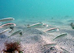
The Black Sea supports an active and dynamic marine ecosystem, dominated by species adapted to brackish and nutrient-rich conditions. As in all marine food webs, the Black Sea has a range of trophic groups, with autotrophic algae, including diatoms and dinoflagellates, acting as primary producers. The Eurasian and Central European river drainage system introduces large volumes of sediments and dissolved nutrients into the Black Sea, but the distribution of these nutrients is controlled by the decrease in physiochemical stratification, which develops physiographically in a variable way depending on the season.
During winter, strong winds benefit convective cycling and nutrient upwelling, while summer temperatures create a warm, highly stratified surface mixed layer. The length of the day and the intensity of the insolation also control the extent of the photic zone.
Productivity below the surface is limited by nutrient availability. The anoxic bottom waters act as a sink for nitrates, which are reduced to ammonia. The benthic zone also plays an important role in nutrient cycling. Chemical-synthetic organisms and anoxic geochemical pathways recycle nutrients, which can be lifted into the photic zone, increasing its productivity.
Phytoplankton
The main groups of phytoplankton present in the Black Sea are dinoflagellates, diatoms, coccolithophores, and cyanobacteria. Generally, the annual cycle of phytoplankton development produces a predominance of dinoflagellates and diatoms in spring, followed by a mixed community of the different types developed in smaller numbers that occurs under the seasonal thermocline of the summer months, and followed by a production intense surface phytoplankton growth in autumn. This pattern of productivity is enhanced by a bloom of emiliania huxleyi during the spring and summer months.
- Dinoflagellate
The annual distribution of dinoflagellates is defined by an extended blooming period below surface waters during spring and summer. In November, subsurface plankton production is combined with surface production, due to the vertical mixing of water masses with nutrients such as nitrites. The most frequently upwelling dinoflagellate species is gymnodinium . It is estimated that the diversity of dinoflagellates in the Black Sea can range from 193 to 267 species. This number of species is relatively low compared to the Mediterranean, which is attributable to the conditions of brackishness, the transparency of the low waters and the presence of anoxic waters at the bottom. It is also possible that the low winter temperatures of the Black Sea, below 4 °C, prevent the establishment of thermophilic species. The relatively high amount of organic matter in the surface waters of the Black Sea favors the development of heterotrophic species (organisms that use organic carbon to grow) or mixotrophic dinoflagellates (capable of taking advantage of different trophic pathways) in relation to autotrophs. Despite its unique hydrographic setting, there are no endemic Black Sea species of dinoflagellates.
- Diatomes
The Black Sea is populated by many species of marine diatoms, which normally coexist in colonies of unicellular, non-motile, auto/heterotrophic algae. The life cycle of many diatoms can be described as one of "blooming and disappearing" and the Black Sea is no exception, with diatom blooms on the surface throughout the year, especially in March.
In simple terms, the rapid growth phase of the diatom population is caused by the arrival of terrestrial silicon sediments, and when the silicon supply is depleted, the diatoms begin to sink and fall outside the photic zone., where they crust. In addition, there are other factors, such as predation by zooplankton and the regeneration of the production of ammonium derivatives, which also play a role in the annual cycle of diatoms. Above all, in the blooms of proboscia alata and pseudosolenia calcar-avis during summer.
- Cocolitróficos
Coccolitrophs are a type of mobile, autotrophic phytoplankton that produce CaCO3 plates, known as coccoliths, as part of their life cycle. In the Black Sea, the main growth period for coccolitrophs occurs when most of the dinoflagellates have grown. In May, the dinoflagellates have already moved below the seasonal thermocline, towards the deep waters, where more nutrients are available. This allows the coccolitrophs to utilize the nutrients from the upper waters, and by the end of May, with favorable temperature and light conditions, they grow to their largest level. The species with the greatest upwelling is emiliania huxleyi, which is also responsible for the release of dimethyl sulfide into the atmosphere. Although coccolitrophic diversity is low in the Black Sea, and although recent sediments contain mostly E. huxleyi and braarudosphaera bigelowii, Holocene sediments have also shown contents of the species helicopondosphaera and discolithina.
- Cianobacterials
Cyanobacteria are from the group of picoplanktonic bacteria (plankton ranging in size from 0.2 to 2.0 microns), which obtain their energy through photosynthesis, and are present in all of the world's oceans. They exhibit a range of morphologies, including filamentous colonies and biofilms. In the Black Sea there are several species present, such as synechococcus, which can be found throughout the photic zone, although the concentration decreases with increasing depth. Among the other factors that influence the distribution of nutrients are predation and salinity.
Endemic Animal Species
- Zebra mussel
The Black Sea and Caspian Sea are part of the native environment of the zebra mussel. The mussel has been accidentally introduced throughout the world and has become an invasive species wherever it has been introduced.
- Common tent
The common carp has its native environment in the Black Sea, the Caspian Sea and the Aral Sea. Like the zebra mussel, it is an invasive species when introduced into other habitats.
- Round cap
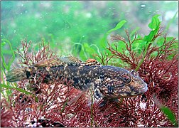
The round goby is another native fish also found in the Caspian Sea. Like the zebra mussel and common carp, it becomes an invasive species when it is introduced into other environments, such as the Great Lakes.
Ecological effects of pollution
Since the 1960s, the large growth of industry around the Black Sea and the construction of a larger reservoir have significantly increased the annual variation of N:P:Si (Redfield ratio) in the basin. In coastal areas, the biological effects of these changes have increased the frequency of bloomings of monospecific phytoplankton, leaving a blooming frequency of diatoms that has increased by a factor of 2.5 and a blooming of non-diatom species that has increased. with a factor of 6. Non-diatom species, such as the primnesiophytes emiliania huxleyi (cococolitroph) and chromulina, and the euglenophytes eutreptia lanowii, are able to compete with diatom species because of the limited availability of silicon, a necessary constituent of diatom frustules. As a consequence of these blooms, macrophyte populations are starved of light and anoxia causes mass mortality in marine animals.
The decline of macrophytes was accompanied by overfishing during the 1970s, while the ctenophore mnemiopsis reduced the biomass of copepods and other zooplankton species in the late 1980s. an outsider species, mnemiopsis leidyi, was able to establish itself in the basin, growing from a few specimens to a biomass of one billion tons. Black Sea also had consequences in its hydrochemistry, as in calcium, producing the influence of coccolitrophs on salinity and pH, although this has not yet been quantified. In the central Black Sea waters, silicon levels also decreased significantly, due to a decreased advection-associated flux of silicon across isopycnic surfaces. This phenomenon demonstrates the potential for localized nutrient disturbance throughout the Black Sea Basin.
Pollution reduction and regulatory efforts have allowed a partial recovery of the Black Sea ecosystem during the 1990s, and the European Union monitoring exercise, EROS 21, revealed declining N and P (from the N:P:Si ratio) compared to the peak measured in 1989. Recently, scientists have noted signs of ecological recovery, due in part to the construction of new sewage treatment plants in Slovakia, Hungary, Romania and Bulgaria, in collaboration with the members of the European Union. Populations of mnemiopsis leidyi have been controlled with the arrival of other species from outside that feed on them.
Climate
Short-term climatic variations in the Black Sea are significantly influenced by the behavior of the North Atlantic Oscillation, which is the set of climatic mechanisms that result from the interaction between the North Atlantic and the air masses of the mid-latitudes. Although the exact mechanisms causing the North Atlantic Oscillation are unclear, it is believed that weather conditions established in Western Europe by heat and precipitation flow into Central Europe and Eurasia, regulating the formation of cyclonic winds, which They are, to a large extent, responsible for the regional rainfall that goes to that area and influence the temperature of the surface of the Mediterranean.
The relative strength of these systems also limits the amount of cold air that reaches the northern regions during the winter. Other influencing factors include topography, with depressions and storm systems coming from the Mediterranean and channeling through the lowlands around the Bosphorus. The Pontic Mountains and the Caucasus Mountains act as guides for these weather waves, limiting the speed and track of cyclones passing through the region.
Historical Geology
Connection with the Mediterranean during the Holocene
The Black Sea is connected to the world ocean by two straits, the Dardanelles and the Bosphorus. In the ice age the sea level was 100 meters below where it is now.
There is evidence that the water level in the Black Sea was considerably lower at some point after the ice age. For example, archaeologists have found shells of freshwater species and man-made structures 100 meters below the sea off the coast of Turkey. This is why the Black Sea is believed to have been a landlocked freshwater lake (at least on its surface) during the last ice age and some time after.
Following the last ice age, the water level in the Black Sea and the Aegean Sea rose independently until they were high enough to exchange water. The exact timing of this process is still under debate. One possibility is that the Black Sea filled up first and the excess water flowed over the Bosphorus into the Mediterranean. There are also catastrophic scenarios, such as the "Black Sea deluge theory" by William Ryan, Walter Pitman and Petko Dimitrov.
Flood Hypothesis
The Black Sea Flood is a hypothetical natural catastrophe that raised the level of the Black Sea, around 5,600 BC. C., because the waters of the Mediterranean found an abyss in the Bosphorus Strait. This hypothesis was made known when the newspaper The New York Times published it in December 1996. A short time before it had been published in a scientific journal. Although it is accepted that the sequence of events that is narrated happened, there is debate about how sudden it was, the date and the magnitude of the events. This theory highlights that the prehistoric description of this event would be included in the myths of the universal flood.
History
Many common routes from the ancient world passed through the Black Sea: to the Balkans, to the steppes of northern Eurasia, to the Caucasus and Central Asia, to Asia Minor and Mesopotamia, and to Greece from the southwest.
The oldest gold processors were in Varna. Furthermore, the Black Sea was supposedly navigated by the Argonauts. The land east of the Black Sea, Colchis (now Georgia) was the eastern end of the world known to the Greeks.
The steppes north of the Black Sea may be the homeland (Urheimat) of the first speakers of the Proto-Indo-European language, from which the Indo-European languages are descended. This theory has been held by the disciples of Marija Gimbutas. Others move the birthplace of that language further east, to the Caspian Sea or Anatolia. There are many port enclaves whose history dates back to the times when the pyramids were built in Egypt.
The Black Sea became a "lake" of the Ottoman navy for three centuries, since Genoa lost the Crimean peninsula in 1479, after which the only Western merchant ships crossing its waters were those of the Republic of Ragusa, which was a rival to the Republic of Venice. This restriction was gradually changed by the Russian navy from 1783 until the relaxation of export controls in 1789 by the French Revolution.
The Black Sea was a theater of naval operations in World War I and a couple of naval battles on the Eastern Front of World War II took place there.
Archaeology
Ancient routes in the region are being studied by scientists. The region was covered by Hittites, Carians, Thracians, Greeks, Persians, Cimmerians, Scythians, Romans, Byzantines, Goths, Huns, Avars, Bulgars, Slavs, Varangians, Crusaders, Venetians, Genoese, Lithuanians, Poles, Georgians, Tatars, Turks and russians.
Perhaps the most promising areas for underwater archeology are submerged prehistoric settlements on the continental shelf and ancient shipwrecks in the anoxic zone, which are expected to be well preserved due to the lack of oxygen. This concentration of historical powers, combined with the preservation capacity of the anoxic waters of the Black Sea, has increased the interest of marine archaeologists who have begun to discover a large number of ancient ships and well-preserved organic remains.
In October 2018, experts from the Black Sea Maritime Archaeological Project located the oldest ship in the world to date. The discovery occurred during the observation of an area of 2000 square kilometers.
Modern uses
Commercial and civil uses
According to NATO, the Black Sea is a strategic corridor for smuggling networks to move legal and illegal goods, including drugs, radioactive materials and counterfeit products that can be used to finance terrorism.
Navigation
Ports and ferry piers
According to a 2013 study by the International Transport Workers' Federation there are at least 30 operating merchant ports on the Black Sea (including at least 12 in Ukraine).
Merchant ships and traffic
According to a 2013 study by the International Transport Workers' Federation, there are around 2,400 commercial vessels operating in the Black Sea.
Fishing
Anchovies: The Turkish commercial fleet catches 300,000 tonnes per year on average. Fishing takes place mainly in winter, although most of the stock is caught between November and December.
Exploration for hydrocarbons
Since the 1980s, the Soviet Union began offshore drilling for oil in the western part of this sea (near the coast of Ukraine). Independent Ukraine continued and intensified these efforts within its 'exclusive economic zone', inviting the major international oil companies to explore. The discovery of massive new oil wells in the area stimulated a flow of foreign investment. It also sparked a short-term peaceful territorial dispute with Romania that was settled in 2011, when an international court redefined the exclusive economic zone between the two countries.
Hotels and spas
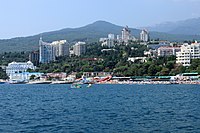
In the years after the end of the Cold War, the popularity of the Black Sea as a tourist destination grew. Black Sea resort tourism has become one of the booming industries in the region.
Modern Military Use
International and military use of the Straits
The Montreux convention of 1936 provided free passage for civilian ships in international waters of the Black Sea and the Mediterranean. However, only one country (Turkey) has complete control over the strait that connects both seas. The 1982 amendments to the Montreux convention allow Turkey to close the strait at its discretion in both wartime and peacetime.
The 1936 Montreux Convention regulates the passage of ships between the Mediterranean and Black Seas and the presence of military vessels belonging to landlocked states in the waters of the Black Sea.
Contenido relacionado
Phyllostachys
Geography of Mexico
Mapping


