
Barranquilla
Barranquilla, officially Special, Industrial and Port District of Barranquilla, is the capital of the department of Atlántico, Colombia. It is located on the western bank of the Magdalena River, 7.5 km from its mouth in the Caribbean Sea. In 1993 it was constitutionally organized into a special, industrial and port district. It is the main economic center of the Caribbean region of Colombia, among the economic activities commerce and industry stand out.
The establishment of the city dates from the third decade of the XVII century, when the sectors surrounding the Magdalena River began to populate around grants granted by the Spanish Crown. During the time of Independence, Barranquilla was distinguished by the support of its inhabitants for the independence cause, which earned it the erection of a town in 1813. In the second half of the century XIX acquired strategic and economic importance when steam navigation began on the Magdalena River, which allowed it to become the main export center of the country until the first half of the century XX.
From the late XIX century until the 1930s, Barranquilla was the main point of entry into Colombia for thousands of immigrants and advances such as aviation, commercial radio and telephony, as well as various sports.
Since the late 19th century, it became an important city serving as a refuge for large waves of immigrants from Spain, Germany, Italy, France and the Middle East, which allowed it to become, at the beginning of the XX century, a city culturally diverse and modern.
The population of Barranquilla is 1,274,250 people, which makes it the fourth most populous city in the country behind Bogotá, Medellín and Cali. The city is the nucleus of the Barranquilla Metropolitan Area, which is also made up of the municipalities of Soledad, Malambo, Galapa and Puerto Colombia. The conglomerate is home to 2,199,507 inhabitants, and also ranks fourth among the country's conurbations. As the departmental capital, Barranquilla is the seat of the Atlántico Governor's Office, of the Departmental Assembly and of the Superior Court of the Atlantic, the highest judicial body of the department.
Barranquilla is the cradle of eminent figures of the artistic and cultural life of Colombia, including writers, poets, painters, musicians, historians, filmmakers, journalists and broadcasters.
Barranquilla is home to one of the most important folkloric and cultural festivities in Colombia, the Barranquilla Carnival, declared Cultural Heritage of the Nation by the Colombian Congress in 2001 and Oral and Intangible Heritage of Humanity by Unesco in 2003. The city was designated the American Capital of Culture in 2013, host of the 2018 Central American and Caribbean Games and host of the 2027 Pan American Games.
Toponymy
The name of Barranquilla refers to the ravines that existed in the sector adjacent to the western bank of the Magdalena River, where the city began to be formed. During the Colony, the name ravine was common in riverside populations (Barrancabermeja, Barranca Nueva, Barranca Vieja). The diminutive is an alteration probably of Aragonese origin. During the Colony, the place was successively known as Sitio de los Indios de Camacho, Camach or Camacho (by the Camash indigenous people, inhabitants of the region upon the arrival of the Spanish), Sabanitas de Camacho, site of Barrancas de San Nicolás (for San Nicolás de Tolentino, patron saint of Nicolás de Barros and de la Guerra, founder of the San Nicolás hacienda that gave rise to the development of the area), Barrancas de Camacho.
Nicknames

- La Arenosa: named after the president of the Republic of New Granada Tomás Cipriano de Mosquera during his stay in the city in 1849.
- Portico Dorado de la República: in 1921, President Marco Fidel Suárez calls Barranquilla to inaugurate the building of the Customs Administration in recognition of its economic importance since the end of the centuryXIXof being the pioneer city in commercial aviation in Latin America (see Scadta), and that the city was the point of introducing new advances to the country such as the telephone, as well as several sports and immigrant currents.
- Gold Gate of Colombia: in 1946, at the opening of the V Central American and Caribbean Games, President Mariano Ospina Pérez made one of the most widely used appeals to refer to Barranquilla.
- Curramba, the Bella: reverse or alpine pronunciation of the syllables of the abbreviation Barranq. (q-rran-ba) used to abbreviate the name of the city in the telegrams read by journalist Juan Eugenio Cañavera at the Nueva Granada station in Bogotá in the mid-centuryXX.. The appendix "the beautiful" was assigned to him by also journalist Barranquillero Roger Araújo as a counterbalance to the pejorative dye he had Curramba At first. De Curramba derives the popular or hypocorstic “currambero”.
- City of the Open Arms: so called by the thinker Agustín Nieto Caballero.
- Faro de América: named by Enrique Ancízar, president of the Colombian Society of Agriculture.
Symbols

- Flag. Barranquilla adopted the flag of Cartagena, made up of three concentric rectangles, red the exterior, yellow the central and green the interior, in whose center is located an eight-point white star.
- Shield. It was pointed out in the decree by which Manuel Rodríguez Torices, President Governor of the Sovereign State of Cartagena de Indias, granted the title of villa to Barranquilla as a prize for the participation of the patriots of the Barranquilleros in the defense of the independentist Cartagena against the realistic Santa Marta in 1813.
 Barranquilla Shield
 - Hymn. The music and lyrics of the Barranquilla anthem were chosen by a contest called by the Society of Public Improvements, and officially adopted as anthem of the city by the Municipal Council in lobby open on October 19, 1942. The letter is authored by the poet Amira de la Rosa (concurso de 1942) and the music of Simon Urbina (concurso de 1928).

- Other symbols
- Flower: Cayenne.
- Tree: purple oak, which in the city blooms during the first quarter of the year.
- Typical dish: plain rice.
History
Colonial Period
The first mention of the territory that Barranquilla occupies dates from 1533, and was written by Gonzalo Fernández de Oviedo y Valdés. In it, he describes the journey of Pedro de Heredia, founder of Cartagena, just weeks before founding said city, who affirmed that this point was a berth for Indian canoes from the Santa Marta Governorate, who had two canoes full of dried shrimp that They brought merchandise, and went to the Magdalena River to trade with said merchandise, salt and other things.
However, the site of the Camash Indians (Spanishized Camacho or Camach) is known as the first permanent human settlement on the site of present-day Barranquilla. In 1549, the oidor of the Royal Audience of Santo Domingo, Miguel Díez de Armendáriz, gave Camacho a commendation to the cavalry captain Domingo de Santa Cruz, awarded by the Spanish Crown for his performance as a soldier. This parcel disappeared in 1559, when it was in the hands of Ana Ximénez, widow of Santa Cruz, who had received it after the death of her husband. Said lady was the victim of an outrage by the second encomendero of Galapa, Pedro de Barros, who arbitrarily seized the entire entrusted population of Camacho that was able to work and took it to his encomienda.

On June 28, 1625, Juan Casetas de Bayarte obtained a grant of four caballerias three quarters of a league from Camacho. Between 1627 and 1637, Nicolás de Barros y de la Guerra, great-grandson of Pedro de Barros, second encomendero of Galapa, founded the San Nicolás de Tolentino hacienda on the banks of the La Tablaza stream. According to historian Domingo Malabet Castañeda, the original area of the property was 24.78 square kilometers, but Pedro Vásquez Buezo sold him 16.52 more square kilometers, reaching 41.30 square kilometers. On this hacienda, Nicolás de Barros found himself in need of allowing his free subsidiaries to build their homes within its limits, in such a way that they could carry out their work in the fields and help support their families. In addition, after the death of Nicolás de Barros, the hacienda began to house another type of inhabitants, people who, for reasons of health, age, or for maintaining a godfather relationship with the owner of the hacienda, were allowed to live in said stay. There were also indigenous people from Malambo and Galapa. By 1681, the hacienda was considered a site, that is, a town, and with its surrounding areas it was known as Barrancas de San Nicolás. In 1720, the colonial government established the Sitio de Libres de las Barrancas de San Nicolás in charge of a local mayor. Before 1700, the territory corresponding to Barranquilla had been the Aguerra captaincy of the Tierradentro Party. In 1747 it was constituted as a parish and in 1772 it was erected as a corregimiento of the same party, with a legal judge.
The thesis on the origin of Barranquilla, which stated that Barranquilla had been founded by cattle ranchers from Galapa who left their lands following the herds that sought to quench their thirst in the waters of the Magdalena River, promoted by the publication of the historical compendium of the historian Domingo Malabet in the newspaper El Promotor in 1876, and reproduced by Imprenta El Siglo in 1911, whose livelihood is oral tradition, was scientifically reassessed by the work of the geographer and historian José Agustín Blanco The North of Tierradentro and the origins of Barranquilla (1987).
Independence period

At the time of Independence, the inhabitants of Barranquilla sided with the Creole independence movement. In 1812, General Pierre Labatut attacked and defeated the royalists who were in Sitioviejo and Sitionuevo. On April 7, 1813, a date that was later institutionalized as the day of Barranquilla, the president-governor of the Free and Independent State of Cartagena de Indias, Manuel Rodríguez Torices, granted the population the title of villa with corregidor letrado (mayor ordinary) and municipality (town hall), capital of the department of Barlovento or Tierradentro, in recognition of the courage and patriotism of the people for their support in the defense of the independence movement of Cartagena de Indias in its fight against the royalist Santa Marta. In 1815, Joaquín Vallejo, a wealthy foreign merchant, supported a battalion for three months with his own capital. When the Spanish forces under the command of Colonel Valentín Capmany approached Barranquilla, its inhabitants put up resistance but were defeated. On April 25, 1815, the town was attacked and taken over by royalist troops, who also killed Joaquín Vallejo's battalion. Barranquilla was the center of the military operations of the Republicans from 1820 to 1821. On October 10, 1821, the last Spanish redoubt of Cartagena de Indias was expelled, at that time the capital of the Sovereign State of Bolívar, to which Barranquilla belonged. That same year, the then town had its first mayor, Agustín Del Valle, who fulfilled his duties in his own residence, which was converted into an army barracks in 1879. By the Constitution of Cúcuta, between 1821 and 1857 it had the category of canton. On July 24, 1823, the naval battle of Lake Maracaibo took place, with which the Spanish were definitively deposed from the Gran Colombian territory.
Republican period

19th century
Since in the geographic space of Barranquilla there are no mining or natural wealth, during the Colony the area was not attractive for the Spaniards to justify a permanent presence. Its importance would come in the second half of the XIX century, promoted by the commodatum delivery of steam navigation on the Magdalena River to the German businessman Juan Bernardo Elbers by Simón Bolívar in 1823, at the beginning of Gran Colombia, a route opened on November 10, 1825. Barranquilla thus began an intense commercial exchange with the main cities and towns in the interior of the country, as well as with international markets, and became the main coffee exporting port.
Initiating the new nation of the Republic of New Granada, in 1831 two revolutions were forged in Barranquilla. One, led by Captain Policarpo Martínez and Antonio Pantoja, Lorenzo Hernández, Crispín Luque, Esteban Márquez and Santos de la Hoz against the dictatorship of General Rafael Urdaneta; and the one led by General Ignacio Luque, who had won the first.
In the 1940s, Barranquilla was the second largest city in the country and one of the most modern in the Caribbean and South America.
In 1840, merchants and transporters from Barranquilla tried to form an independent province with the name of Cibeles, made up of the cantons of Barlovento, and they proclaimed Colonel Ramón Antigüedad chief. The main objective was to obtain authorization for the population of Sabanilla as an import port, an activity that was carried out only through Cartagena and Santa Marta. This revolution was quickly put down by troops from Cartagena. In 1845, the city was one of the nine cantons that made up the province of Cartagena.

On February 23, 1849, President Tomás Cipriano de Mosquera sanctioned Law 1 of July 1842, which enabled Sabanilla Bay as a port for export trade and a customs office was installed there in the current Salgar Castle, condition for the commissioning of Sabanilla. Communication between Barranquilla and its new port was made through the La Piña channel. In the first days of June 1849, the plague of Asian cholera morbidity appeared in the city, coming from Cartagena, where it had arrived of boats from Panama. Through Law March 20, 1852, the Congress of New Granada separated the cantons of Barranquilla, Soledad and Sabanalarga from the province of Cartagena, which became the province of Sabanilla, with Barranquilla as capital. On May 2, 1854, General Tomás Cipriano de Mosquera arrived in the city and the inhabitants placed themselves under his orders to face the revolution of General José María Melo in Bogotá. On October 7, 1857, Barranquilla received by part of the Constituent Assembly of the state of Bolívar, headed by its president, Manuel José Amaya, the category of city, which allowed the first municipal council to be integrated; In that same year, the municipal council demarcated three zones: the Abajo del Río neighborhood, the Arriba del Río neighborhood, and the Center. Barranquilla was then part of the department of Sabanilla, one of the five that made up the Sovereign State of Bolívar, which had succeeded to the province of Cartagena by Law of June 15, 1857.

In 1858, Barranquilla was designated the capital of the municipal district. During the Granada Confederation, the conservative leader General Joaquín Posada Gutiérrez attacked and defeated the square defended by the liberal leader Vicente Palacio (November 6, 1859). Subsequently, the city was recovered on December 9 by the liberal colonel Manuel Cabeza. On January 25, 1861, General Juan José Nieto, president of the State of Bolívar, declared himself in Barranquilla exercising the executive power of the United States of Colombia. Barranquilla became the capital of the homonymous province through Article 1 of the Law of December 26, 1862, according to which the Sovereign State of Bolívar was divided into twelve provinces.
At the beginning of the United States of Colombia, the growing commercial importance of Barranquilla promoted the construction, between 1869 and 1871, of the Bolívar Railroad, the first railway line in present-day Colombia, between Barranquilla and Sabanilla (Salgar), where it operated Customs. This railway line, inaugurated on January 1, 1871, meant the end of the use of the Piña channel as a route for the transport of goods between Barranquilla and the port of Sabanilla. Due to the shallow depth of the waters, it was It was necessary to extend the railway line to Puerto Cupino, where the Cuban engineer Francisco Javier Cisneros built one of the longest docks in the world at the time (the third after Southend and Southport, both in England.) In 1872 the The "trapiche" epidemic presented, whose symptoms were similar to those of cholera. In 1876 the customs office was transferred to Barranquilla due to the excessive contraband that entered through the Salgar customs office.

In the last decades of the XIX century, Barranquilla experienced a series of advances represented in the founding of the Compañía del Acueducto in 1877, the commissioning of the mule-drawn tramway in 1884, the installation of the first telephones in Colombia on September 1, 1885, and the foundation that same year of the first private telephone service company in Colombia, the Colombo-Antillana Telephone Company, by the American William Ladd. At that time the city acquired economic importance due to its commercial boom and its strategic geographical position, becoming the first maritime and fluvial terminal in Colombia.
On January 6, 1885, revolutionary forces under the command of General Ricardo Gaitán Obeso occupied the city for being committed to handing over the military authorities. On February 11 of the same year, the government chief, General Vicente Carlos Urueta, attacked the square defended by General Nicolás Jimeno Collante. General Urueta already triumphant, General Gaitán Obeso appeared and with more troops defeated General Urueta.
At the end of the XIX century, when the Republic of Colombia was established in 1886, Barranquilla became one of the thirty- four new departments, made up of the provinces of Barranquilla and Sabanalarga, with the capital of the same name. During this time, the city established itself as one of the main ports in Colombia, and continued on the path of progress with events such as the commissioning of the steam tramway in 1890 and with the construction of the Puerto Colombia dock in 1893, which served as a maritime terminal for Barranquilla until 1936. Merchandise was moved by rail to Barranquilla, and then by river to the interior of the country.
20th century
In the framework of the restructuring of the State that General Rafael Reyes undertook as President of the Republic, the National Constituent and Legislative Assembly, by means of Law 17 of April 11, 1905, created the department of Atlántico made up of the provinces of Barranquilla and Sabanalarga of the department of Bolívar, with Barranquilla as the capital. However, in 1908 the department of Atlántico was suppressed and the department of Barranquilla was created by Law 1 of the same year. Upon the fall of General Reyes in 1909, the department of Barranquilla was suppressed through Law 65 of that year, Barranquilla once again becoming part of the department of Bolívar. Finally, the National Constituent Assembly of 1910 issued Law 21 of July 14, through which the department of Atlántico was definitively created with Barranquilla again as the capital.
In accordance with the progress of the city and its economic boom, on June 28, 1905, the Chamber of Commerce of Barranquilla was created, and on September 7, 1909, the bill was filed before the Congress of the Republic that recognizes the opening of Bocas de Ceniza as a national need. In June 1909, "El Barranquillazo" took place, a coup attempt by supporters of General Ramón González Valencia against General Jorge Holguín, who in his designated capacity held the position of President of the Republic after the resignation of the incumbent, General Rafael Reyes. On December 29, 1912, the second flight of an airplane in Colombia took place in Barranquilla, carried out by the Canadian pilot George Schmitt (who had made the first on December 9 in Santa Marta). On December 10 In 1919, the first successful commercial airline in the American continent and the second in the world, Scadta, was created, which years later became Avianca. In June 1919, the pilot William Knox Martin and the industrialist Mario Santo Domingo inaugurated air mail in Colombia with a flight between Barranquilla and Puerto Colombia, where Santo Domingo delivered the sack of mail.

Due to its status as a maritime and fluvial port that connected with the interior of the country and abroad, the city had become, since the second half of the century, XIX until the first decades of the XX, in one of the most cosmopolitan and multicultural cities in Colombia and at the entrance to the country of foreign immigrants such as Syrians, Palestinians, Lebanese, French, Germans, Jews, Americans, Italians, Chinese and Japanese, among others, who settle in the city, boost industry and contribute to making it a modern city. Within this framework, the Salgar customs office was transferred to Barranquilla and the Barranquilla Customs Administration building was built between 1919 and 1921 by the Jamaican architect of English origin Leslie Arbouin. Thanks to the economic dynamism, the business strength of the city, as well as its status as an entry point into the country for thousands of immigrants and multiple advances such as aviation, the city receives from President Marco Fidel Suárez the title of Golden Portico of the Republic. On January 12, 1919, in the midst of an agitation on the Caribbean Coast against Bogota centralism, the Liga Costeña was organized in Barranquilla. In 1920, "Archaeologists reveal that the capital of the Atlantic is located on a vast necropolis from prehistoric times ».
On June 8, 1924, while they were distributing flyers in favor of carrying out the works in Bocas de Ceniza, the junker Tolima A-16 piloted by the German aviator Helmuth Von Krohn crashed to the ground. The six passengers on board perished in the accident, including Ernesto Cortissoz, president of Scadta.
In 1925, the public companies of Barranquilla are the first to be founded in the country. The initial coverage of the aqueduct built in 1929 was 11,500 houses of 14,000 totals in 1931, and in 1938, of 18,050 dwellings, 80 % had drinking water service, while in Bogotá in that same year the aqueduct coverage was 59%, in Medellín 57.3%, in Cali 74.8%, in Cartagena 21.4% and in Santa Marta of 36.2%. In 1927, the electric power service supplied by the Barranquilla Electric Power Company met the needs of 10,300 homes, equivalent to 74% of the total.
On February 4, 1925, Scadta acquired the superplanes Atlántico and Bolívar to cover the first international flights, which took place in August of the same year between Barranquilla and Key West, Florida, with stops in Central America, Mexico and Cuba. A year later the construction of the Fluvial Administration began, due to the increase in services linked to the Magdalena River.
In a time of progress for the city, the first commercial private radio station in the country was founded (the first station in Colombia was the state-owned HJN of Bogotá). Elías Pellet Buitrago began commercial radio in Colombia with the first broadcast of La Voz de Barranquilla on December 8, 1929. On August 16, 1933, the Senate of the Republic approved the contract for the opening of Bocas de Ceniza, works that were completed in 1936, inaugurating the Barranquilla Maritime Terminal by President Alfonso López Pumarejo on December 22 of the same year, within the framework of a period of construction undertaken by the central government with the intention of establishing an infrastructure that would allow the country and the main urban centers enter international markets. In 1935, a boost was given to sport in the city with the construction of the municipal soccer stadium to host the III National Games. However, on April 10, 1931, "in a riot against hunger and unemployment, the people of Barranquilla destroy the Teatro Colombia".
During the first half of the XX century, Barranquilla established itself as the city with the highest population and urban growth in Colombia. The city expanded to reach neighboring municipalities, a situation that gave rise to the creation of the Barranquilla Metropolitan Area in 1981. From the late 1950s to the 1980s, the city plunged into a socioeconomic decline due to the failure of the class politics and the bankruptcy of sectors of industrial activity. In 1958 the first free zone in Colombia was created.
On August 18, 1993, the Congress of the Republic of Colombia, through Legislative Act Number 01 of August 17, 1993, constituted Barranquilla as a Special, Industrial and Port District.
21st century

Law 768 of 2002 provided for the creation of the Metropolitan Area of the Caribbean Coast, made up of the special districts of Barranquilla, Cartagena de Indias and Santa Marta and the municipalities and territorial entities that are part of their metropolitan areas, laying the foundations for a regional megalopolis with the objective of «formulating, adopting and advancing plans for the harmonious and integrated development of the territory that falls under its jurisdiction; rationalize the provision of services by the entities that comprise it and eventually assume the common provision of the same; execute works of metropolitan interest and advance projects of common interest".
In the XXI century, the city leadership has outlined the objective of Barranquilla recovering its level of strategic capital from the country. Among the strategies defined, the integration of the city with the Magdalena River stands out through projects such as the Avenida del Río, the river boardwalk, the urbanization of the island of La Loma, the deep-water port and the Port Corridor. The administration of Elsa Noguera (2012-2015) began the construction of storm sewers in the streets most affected by the formation of streams when it rains, marking a milestone in the urban dynamics of Barranquilla.
Also noteworthy are the construction of the new Pumarejo bridge, the modernization and expansion of the Ernesto Cortissoz airport, the expansion of Circunvalación avenue, the start-up of the Events Center and the Caribbean Cultural Park, the start-up of the Transmetro mass public transport and the restoration of the historic center through the recovery of buildings and the renovation and construction of new public squares and parks. On the occasion of the 2018 Central American and Caribbean Games in Barranquilla, the construction and remodeling of sports venues was carried out, as well as the provision of complementary infrastructure for the games.
Geography

Location
Barranquilla is located in the northeast corner of the department of Atlántico, on the western shore of the Magdalena River, 7.5 km from its mouth in the Caribbean Sea. It has an extension of 154 km², equivalent to 4.5% of the surface of the department of Atlántico. The geographical coordinates are established taking as reference the zero point of the city located in the Plaza de la Paz.
|

Politically, Barranquilla limits to the east with the department of Magdalena (through the Magdalena River), to the north with the municipality of Puerto Colombia and with the Caribbean Sea (properties of the Mallorquín swamp, western tajamar and Puerto Mocho), to the west with the municipalities of Puerto Colombia, Galapa and Tubará and to the south with the municipality of Soledad.
| North: Ciénaga de Mallorquín Caribbean Sea | ||
 | ||
| South: |
Altitude
The urban area is built on a slightly inclined plane whose extreme heights, according to the Agustín Codazzi Geographic Institute, are 4 m s. no. m. to the east and 98 meters to the west. Other sources indicate accidental heights on the hills, up to 120 meters outside the city. According to Google Earth, the height of the city varies between 0 meters above sea level in the western cutwater, up to a maximum of 142 meters above sea level in the La Cumbre neighborhood.
Geology
The geological composition of the region is from the Upper Tertiary period (Miocene and Pliocene) in the western hills or hills and from the Quaternary (Pleistocene and Holocene) in the flatter parts, such as the bottom of the river. According to the Agustín Codazzi Geographic Institute, the Quaternary materials are of alluvial, lacustrine, fluviolacustrine, marine and wind origin. In general, they occupy shores, dikes, terraces, valleys, straits, small alluvial fans, basins, edges of marshes, swamps, beaches and hills. Tertiary materials (Miocene and Pliocene) are in the western hills, and occur in the form of varied slopes.
Climate

The climate of Barranquilla is dry tropical or xeromegaternal tropical, that is, it corresponds to vegetation typical of dryness and low temperatures. According to the Köppen climate classification, it corresponds to an Aw or tropical savannah climate.
The average temperature is 26.2 °C. From November to early April, coinciding with boreal winter, the trade winds blow from the northeast, partly mitigating the intense heat. Towards the end of June the trade winds blow from the southeast, producing the summer of San Juan. This is why at that time there is an atmosphere similar to December.
The precipitation regime of Barranquilla is governed by two periods: a dry one, from December to April, and a rainy one that covers from April to early December. In April or May the "primera" rains begin. Towards the end of June, most of July and sometimes in August, the rain tends to decrease, constituting a dry season known as veranillo de San Juan. The average annual precipitation is 821 mm. The distribution of the dry and rainy seasons is in the illustration.
| Month | Ene. | Feb. | Mar. | Open up. | May. | Jun. | Jul. | Ago. | Sep. | Oct. | Nov. | Dec. | Annual |
|---|---|---|---|---|---|---|---|---|---|---|---|---|---|
| Temp. max. abs. (°C) | 38.2 | 37.6 | 37.8 | 39.5 | 39.3 | 39.8 | 39.2 | 39.0 | 38.4 | 38.6 | 38.4 | 39.5 | 39.8 |
| Average temperature (°C) | 31.2 | 31.6 | 31.8 | 32.4 | 33.2 | 32.1 | 31.8 | 31.1 | 31.6 | 30.2 | 32.1 | 31.4 | 31.7 |
| Average temperature (°C) | 24.2 | 25.4 | 25.9 | 27.5 | 29.1 | 28.2 | 28.7 | 28.1 | 27.6 | 25.2 | 27.4 | 25.7 | 26.9 |
| Temp. medium (°C) | 23 | 23.2 | 23.4 | 24.6 | 27.8 | 24.8 | 24.6 | 24.5 | 24.2 | 23 | 24.1 | 23.3 | 24.2 |
| Temp. min. abs. (°C) | 17.0 | 17.6 | 18.2 | 18.8 | 18.0 | 20.5 | 19.4 | 20.9 | 20.0 | 14.8 | 18.5 | 19.5 | 18.0 |
| Total precipitation (mm) | 0.1 | 0 | 0.7 | 26.4 | 117.0 | 87.7 | 79.8 | 156.0 | 208.3 | 342.6 | 109.2 | 20.9 | 1148.7 |
| Precipitation days (≥ 1 mm) | 0 | 0 | 0 | 4 | 3 | 9 | 7 | 10 | 13 | 17 | 8 | 2 | 73 |
| Hours of sun | 280 | 232 | 247 | 220 | 196 | 198 | 192 | 176 | 160 | 112 | 191 | 252 | 2456 |
| Relative humidity (%) | 70 | 78 | 74 | 78 | 76 | 80 | 80 | 81 | 82 | 84 | 82 | 79 | 78.7 |
| Source: Institute of Hydrology Meteorology and Environmental Studies | |||||||||||||
| Temperature (°C) | ||||||||||||
|---|---|---|---|---|---|---|---|---|---|---|---|---|
| Month | Ene | Feb | Mar | Abr | May | Jun | Jul | Ago | Sep | Oct | Nov | Dic |
| Minimum average | 23 | 23.7 | 23.8 | 24.4 | 26.8 | 25.6 | 24.4 | 24.4 | 24,0 | 20.8 | 18,0 | 16.7 |
| Average | 23.6 | 24.6 | 25.9 | 26.5 | 29.1 | 28.1 | 27,0 | 26,0 | 25.8 | 27.4 | 27.4 | 27,0 |
| Average number | 30.3 | 31.4 | 31.9 | 32.7 | 34.7 | 32.9 | 32.7 | 33.1 | 32.8 | 31.3 | 32,0 | 31.5 |
| Precipitation, sun shine and relative humidity | ||||||||||||
| Month | Ene | Feb | Mar | Abr | May | Jun | Jul | Ago | Sep | Oct | Nov | Dic |
| Average precipitation (mm) | 5 | 1 | 1 | 25 | 91 | 104 | 70 | 102. | 143 | 178 | 79 | 24 |
| Days of rain | 0 | 0 | 0 | 3 | 9 | 9 | 7 | 10 | 13 | 14 | 9 | 2 |
| Relative humidity (%) | 78 | 77 | 77 | 78 | 80 | 81 | 80 | 81 | 83 | 84 | 83 | 80 |
| Solar Shine (hours/months) | 282 | 245 | 240 | 207 | 188 | 195 | 215 | 207 | 164 | 166 | 191 | 253 |
| Data measured in: International Airport Ernesto Cortissoz IDEAM | Averages annual | Temperature | Precipitation | Brillo Solar | ||||||||
| Min | Med | Max. | Total | Rain | Humidity | |||||||
| °C | °C | °C | mm | Days | % | hours | ||||||
| 24,0 | 27.4 | 32.3 | 821 | 76 | 80 | 213 | ||||||
Hydrography
- Surface water
- Maritimes: from the left strip of the western tajamar at the mouth of the Magdalena River to the limits with Puerto Colombia.
- Fluvials: Magdalena River; riverbeds: Above, The Trampous, La Ahuyama, Market, C and La Tablaza or Las Compañías; the streams of the neighborhoods Country, Rebolo, Santo Domingo, Las Américas y el Bosque; El Lindero, El Platanal, El Salado, El Salado 2, Don Juan, Hospital, La Paz, 54 Mallívar, Felicidad, 76 Sitabaco Streets
- Groundwater
The north of Barranquilla, from 11° north latitude, corresponds to a region «with possibilities of good rainwater infiltration», while the southern part appears as «little infiltration, poor soil and with chances of flooding from rain.”
Flora

Moored Oak, emblematic tree of Barranquilla. Santander Park.

Cayenne, flower symbol of Barranquilla.


According to the Agustín Codazzi Geographic Institute, Barranquilla corresponds to a very dry tropical forest vegetation (bms-T), which includes species such as cacti, mangroves, tuna de penca, cardón, trupillo or cují, dividivi, uvito and varieties of acacia as the red and the fodder. In the floodplain of the Magdalena River, the taruya, bulrush, bijao, buchón de agua, palma de corozo, caracolí, higuerón, olla de mono grow. the foreign matraton, the Indian in leather, the almond tree, the common pine, varieties of ceiba such as the bonga, the white and the majagua, the rubber tree, the balso, the Cartagena coca, the oití, the rubber of India, the Cartagena rubber, the African tulip, the eared carito, the campano, the olive tree, the coralibe, the melina, the pivijay, San Joaquín, the yellow oak, the parrot beak, the sausage, the mahogany, the clemon, the camajorú, the palo de María, the clover, the runny grape, the coconut tree, the laurel, the guásimo, the pisquín, the caracas, the totumo, the golden rain, the blackberry grape, the neem, the soap and varieties of palms such as the real and the robellini.
Among the fruit trees, the mango, the medlar, the mamón, the guava, the beach grape, the cherry, the anón, the tamarind, the plum, the cashew, the soursop, the lemon tree and the lemongrass stand out.
Wildlife
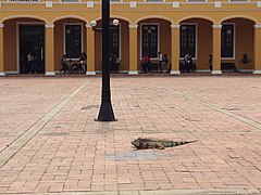
The iguana is a common species in the urban center of Barranquilla.

Ardilla.


Several native species can be found in the urban area, on the periphery and in the ecosystems of the water system (Magdalena river, Mallorquín swamp, streams such as those in the El Country and La Victoria neighborhoods). Some of the animal species that can be found in the city are birds such as the chichafría, the cucarachero, the tierrelita, the cook, the maría mulata, the little owl and the parrot; fish like the mullet and the lebranche (Ciénaga de Mallorquín); insects such as butterflies, bedbugs, flies, mosquitoes, midges, cockroaches and termites; mammals such as domestic cats and dogs, monkeys, and rodents such as squirrels; reptiles such as iguanas, snakes, morrocoyes and little wolves. In some sectors, such as the market and the periphery, equines (horses and donkeys) circulate and cattle, pigs and goats are raised.
Ecology and natural resources
Barranquilla has ecosystems such as the Magdalena river, the Mallorquín swamp and the eastern pipes. The completion of the construction works of the Bocas de Ceniza cutwaters in 1936 brought with it the deterioration of the Mallorquín swamp, which was originally a system of four swamps, as well as the detriment of the beaches surrounding Puerto Colombia.

Around the stream of the La Victoria neighborhood, where it has been proposed to build a botanical garden, there is a communal and recreational green area for public use with an approximate area of 7 hectares, located in the southeast area of the city. Its ecological importance lies in the fact that it is, along with the Country stream, one of the two nature reserves that still exist within the urban perimeter. The abundant vegetation and the crystalline water springs have provided a favorable habitat for the few native plant and animal species found within the city.
Towards the north of Barranquilla, on the border with Puerto Colombia, there are open pit limestone mines, a raw material for the manufacture of cement and used as construction material.
Barranquilla has 4 urban forests that are home to 15,714 trees: Campo Alegre, 5,497 purple oaks; Hogar Caribe sector, 3000 of 17 different species; Suroccidente WWTP, 4,892 of 12 different species, and Ciudad Caribe, 2,325 of 11 different species.
In 2020, the Food and Agriculture Organization of the United Nations (FAO) and the Arbor Day Foundation highlighted Barranquilla as one of the most wooded cities in the world.
The massive planting of trees in the city is promoted by the District Infrastructure Agency (ADI), with the "Siembra Barranquilla" program, started in 2018 by Mayor Alejandro Char and whose objective is to plant 250,000 trees in the city.
In January 2020, Mayor Jaime Pumarejo proposed turning Barranquilla into a divercity with the flagship project of the Mallorquín swamp, which includes environmental recovery of the body of water, an eco-park with ecological trails, palafittic viewpoints, and an area enabled for water sports and bike lanes.
Environmental pollution
- Air quality
According to the orientation of the air flows in Barranquilla, air pollutants move in a north and northeast direction, and in times of light and moderate winds they are more evenly distributed over the city. Regarding suspended particles, the most polluting industrial processes in the city are ammonium sulfate, cement, plaster and paper pulp.

The emission of gases produced by motor vehicle traffic is more critical in the central district, where an important commercial activity takes place. The main source of air pollution is constituted by vehicles with 34% and then industry with 18%. The pollutants emitted by vehicles are: carbon monoxide (89.12%), sulfur dioxide (0.23%), hydrocarbons (6.46%), nitrogen oxides (3.82%) and particles (0. 37%). To help remedy this problem, several state and private sector companies have supported a project to convert vehicles from liquid fuel to natural gas. In addition, more than 12 natural gas service stations are installed in the city and the conversion of vehicles to natural gas has been undertaken. Barranquilla is the fourth city in the country with the largest polluting discharges into the atmosphere.
According to an investigation carried out by the Institute of Hydrology, Meteorology and Environmental Studies of Colombia (Ideam), in Barranquilla there are monthly concentrations of smaller particulate matter greater than 160 micrograms per cubic meter, when the maximum of international standards allows 70. The causes of this problem lie in the low quality of the gasoline and diesel used by the city's motor vehicles, since they register concentrations of 5000 ppm (parts of sulfur per million) and 4500 ppm respectively, when there are countries whose indices they do not exceed 50.
- Water pollution
All the surface waters of the Barranquilla water system, the Magdalena river, the Mallorquín swamp, the eastern pipes and the streams are subject to water pollution as unprocessed wastewater and solid waste dumps by private individuals. The environmental impact has been reduced, mainly on the Mallorquín swamp, with the construction of oxidation ponds and the Wastewater Treatment Plant (EDAR) by Triple A.
- Ruin
The maximum noise limit allowed is 64 decibels for the residential zone, 70 for the commercial zone and 75 for the industrial zone. In the center of Barranquilla, the noise generated by automobile traffic and commercial activity during peak hours can reach levels above 90 decibels, constituting a risk factor for the health of the population.
Political-administrative structure

Branches of public power
- Executive branch
The District Mayor, elected every four years, pronounces himself through decrees and acts as legal, judicial and extrajudicial representative of the district. The local mayors are appointed by the District Mayor from shortlists presented by the corresponding Local Administrative Boards in Public Assemblies called by the burgomaster. The function of the local mayors is to coordinate the administrative action of the district government in each locality together with the mayors elected by vote popular, which make up the Local Administrative Boards of the towns into which the city is divided.

The Government of the Atlantic is in charge of entities that are based in the city such as the Universidad del Atlántico, the Departmental Library and the Regional Autonomous Corporation of the Atlantic (environmental management and parks). Through its headquarters in Barranquilla, it performs functions such as the issuance of passports. It has participated in projects such as the revitalization of the historic center of Barranquilla, the Caribbean Events Center, the Caribbean Cultural Park, the Caribbean Pilot Library and the Atlantic Historical Archive, located in the Cultural Complex of the Old Customs, managed by the Government through a Contribution Agreement with the Luis Eduardo Nieto Arteta Corporation.
Administratively, the Barranquilla mayor's office is made up of the Central District Administration (entities that report directly to the Mayor) and decentralized entities. Decree 941 of 2016 established the organizational structure of the Central District Administration as follows: Office of the Mayor, Office Secretaries (17), Offices (43) and Managements (4). The decentralized entities (6) are economic companies mixed and administrative technical departments that are in charge of advising the mayor, the control of urban and administrative aspects, and the development of different urban projects. The external control and surveillance bodies of the District Administration by legal mandate are the District Comptroller and the District Ombudsman.
| Central Administration | Decentralized entities | |
|---|---|---|
| Mayor's Office | Metropolitan Area of Barranquilla | |
| Private Secretariat | Terminal Metropolitana de Transportes de Barranquilla S.A. | |
| General Service | Water Forum | |
| Legal Secretariat | Transmeter S.A. | |
| Human Management Secretariat | Promotora del Desarrollo del Distrito Central de Barranquilla S.A. - Promocentro | |
| Secretariat of Government | Barranquilla Urban Development Company - Edubar | |
| Planning Secretariat | Barranquilla Environmental Administrative Technical Department - Damab | |
| Ministry of Finance | ||
| Ministry of Health | ||
| Secretariat of Public Works | ||
| Secretariat for Social Management | ||
| Ministry of Education | ||
| Recreation and Sports Secretariat | ||
| Transit and Road Safety Secretariat | ||
| Ministry of Urban Control and Public Space | ||
| Ministry of Culture, Heritage and Tourism | ||
| Secretariat for Communications | ||
| Economic Development Secretariat | ||

- Legislative branch
It is represented in the Barranquilla Council, which issues agreements and is made up of twenty-one councilors elected by popular vote for four years.
- Judicial branch
The Judicial District of Barranquilla is made up of the Superior Court of the Judicial District of Barranquilla, the Judicial Circuit of Barranquilla, the Judicial Circuit of Soledad and the Judicial Circuit of Sabanalarga. The Court is made up of the Civil-Family Chamber (six magistrates), the Labor Chamber (five magistrates) and the Criminal Chamber (three magistrates). The Judicial Circuit of Barranquilla is made up of the civil, family, labor and criminal courts of Barranquilla, and the promiscuous courts of Galapa, Juan de Acosta-Tubará, Piojó and Puerto Colombia.
Administrative division
| Map of localities | Urban-rural map |
|---|---|
 |  |
| Locations: 1. Riomar 2. North-Historical Center 3. South West 4. Metropolitan 5. South East. | Corrections: 1. La Playa (Eduardo Santos) 2. Juan Mina. |
According to Law 768 of 2002, the district of Barranquilla is politically and administratively divided into five localities: Riomar, North-Centro Histórico, Sur Occidente, Metropolitana and Sur Oriente. Each locality is co-administered by the councilors elected by popular vote and by local mayors (one per town) appointed by the District mayor. This election is regulated by the District Administration. In turn, the localities are subdivided into neighborhoods. In the city there are 188 neighborhoods and approximately 7611 blocks.
Legislative Act 01 of 1993 established that the district of Barranquilla also encompasses the territorial understanding of the Las Flores neighborhood, the corregimiento of La Playa (formerly belonging to the municipality of Puerto Colombia), and the western cutwater of Bocas de Ceniza in the Magdalena river, sector of the Mallorquín swamp. The territorial entity also includes the corregimiento of Juan Mina.
Metropolitan Area
The Metropolitan Area of Barranquilla is an urban conglomerate located in the northeast corner of the department of Atlántico. Its main nucleus is the district of Barranquilla and the peripheral municipalities of Soledad, Galapa, Puerto Colombia and Malambo. It was created by Decree Law 3104 of December 14, 1979, in its Article 16, and put into operation by Ordinance 028 of December 11, 1981. Its operation is governed by Law 128 of 1994 (Organic Law of Metropolitan Areas). It is directed by the Metropolitan Board, which is chaired by the Metropolitan mayor, who in turn is the mayor of the Barranquilla district. In addition, the Board is made up of the governor of the department of Atlántico, the mayors of the peripheral municipalities, the representative of the council of Barranquilla and a representative of the councils of the associated municipalities. The director of the entity is the Secretary of the Metropolitan Board.
| Municipalities | Extension km2 | Population (hab) | Density (hab/km2) | Altitude m. n. m. | Distance Barranquilla (km) | Map of the Metropolitan Area |
|---|---|---|---|---|---|---|
| Barranquilla | 154 | 1 274 250 | 8274 | 4 | 0 |  |
| Soledad | 67 | 665 021 | 9925 | 5 | 3 | |
| Malambo | 108 | 139 566 | 1292 | 10 | 12 | |
| Puerto Colombia | 93 | 53 649 | 577 | 0 | 13 | |
| Galapa | 98 | 67 021 | 684 | 83 | 8 | |
| Total | 520 | 2 199 507 | 4230 | - | - | |
| Source: DANE 2005 census - Official municipal websites | ||||||
Defense
Barranquilla is the headquarters of the First Division of the Colombian National Army, partly made up of the Second Mechanized Brigade, which is made up of the 4th Mechanized Infantry Battalion, the 2nd Military Police Battalion and the 2nd Police Support Battalion. Services, among other units.
The Colombian Air Force's Air Combat Command No. 3 (Cacom 3) is located in the municipality of Malambo, whose mission is to guarantee constitutional order and exercise national sovereignty through air operations and whose Jurisdiction covers the northern continental zone of Colombia, the insular area of the San Andrés and Providencia archipelago and the Colombian territorial waters in the Caribbean Sea.
State Institutions

The Colombian State entities have regional offices in Barranquilla, whose purpose is to develop the programs and strategies defined by the national guidelines:
Office of the Attorney General of the Nation, Office of the Attorney General of the Nation, Office of the Comptroller General of the Nation, Administrative Department of Security, National Training Service, National Registry of Civil Status, National Police, National Army, Ombudsman, Colombian Institute of Family Welfare, Colombian Institute of Educational Credit and Technical Studies Abroad, National Department of Statistics, Directorate of National Taxes and Customs, Bank of the Republic, Colombian Air Force), Colombian National Navy, Agustín Codazzi Geographic Institute, among others.
Demographics
| Graphic of demographic evolution of Barranquilla between 1777 and 2018 |
 |
Population according to the DANE |
According to the census carried out by DANE in 2018, adjusted to June 30, 2020, the population of Barranquilla is 1,274,250 people and 1 199 507 in its metropolitan area, which makes it the most populous city on the Colombian Caribbean Coast, and the fourth in the nation after Bogotá, Medellín and Cali.
In accordance with Article 102 of Law 142 of 1994, the different neighborhoods of the city are classified according to the six socioeconomic strata for residential real estate in Colombia. Strata 1 and 2 correspond to the southeastern sectors, southwestern, northwestern and northeastern. Strata 3 and 4 to the south-central zone, to the Center and part of the north, and strata 5 and 6 to the north.
Approximately 1,273,646 people live in the district capital and 604 in the rural area. The population density is 8274 inhabitants per square kilometer. 47.5% of the population is male and the remaining 52.5% is female. Approximately 57.9% of households have four or fewer people.
20.7% of people aged seventeen and over in Barranquilla live in free union. 26.7% of the city's population was born in another municipality and 0.4% in another country. 5.3% of the population of Barranquilla presents some permanent limitation.
61.5% of people live at home, 32.4% in an apartment and 6.2% in a room or other housing solution. Among the causes of change of residence, 63.3% of the population of Barranquilla who You changed your residence in the last five years, you did it for family reasons. 9.2% for difficulty getting a job; 13.3% for another reason and 2.0% due to a threat to their life.
| Population by sex | Type of housing | Population by place of birth |
|---|---|---|
 |  |  |
Ethnography
The intercensal statistics provided by DANE are:
| Etnia | 2005 census | Census 2018 | ||
|---|---|---|---|---|
| Total | Pct. | Total | Pct. | |
| No ethnicity 1 | 956,871 | 86.20% | 1,046,995 | 93.47% |
| Black (a), mulatto, Afro-Colombian | 143,238 | 12.90% | 57.342 | 5.12% |
| Indigenous | 1.015 | 0.09% | 1,272 | 0.11% |
| San Andrés and Providencia Raizal | 482 | 0.04% | 275 | 0.02% |
| Rom (Gitano) | 2.526 | 0.23% | 19 | 0.00% |
| Palenquero | 2.586 | 0.23% | 701 | 0.06% |
| No report | 3,282 | 0.30% | 13.499 | 1.21% |
| Total | 1,110,001 | 100,00% | 1.120.103 2 | 100.00% |
Note 1: This value groups the responses to the question "None of the above" in the 2005 census and to the question "No ethnic group" in the 2018 census. This category includes mixed-race people, Caucasians and other ethnic groups not recognized by DANE.
Note 2: DANE initially provided this initial figure of the total population in the city, although it later modified this figure with an official number in 2018 of 1,206. 319, without extrapolating or indicating changes in the ethnic proportions of the city.
At the beginning of the XX century and during World War II, contingents of Arabs immigrated to the Caribbean Region of Colombia.
Bartality and mortality
In 2007, 29,900 births were registered in Barranquilla, compared to 32,108 of the year 2006. The deaths in 2007 were 4,310, which shows a decrease compared to the 5,938 of the year 2006. Men from Barranquilla have a life expectancy at birth of 72.07 years, and women of 77.71 years, similar to the national average (74.0).
The infant mortality rate is 17.7% per thousand children born, below the country's average (26) and much lower than the world rate (54). The Development Plan "Opportunities for All" of the District Mayor's Office proposes to lower it to 15%, and in children under five years of age from 20.7% to 18%.
Citizen security

In 2012, there were 349 homicides in Barranquilla, 22 more than in 2011, which corresponds to an increase of 6.73%. In 2007 there were 348 homicides against 391 in 2006, that is, a decrease of 11 %.
In Colombia, during 2007 the homicide rate per 100,000 inhabitants of Barranquilla (22) is only surpassed by those of Cali (57), Bucaramanga (32) and Medellin (30). During the last six years (2002-2007), however, the number of homicides has been decreasing, presenting the lowest in 2007, with a peak of 483 murders in 2003. Hit men (42.24%), fights (31.61%) and robbery (14.94%) are the main forms of homicide in the city. Historically, the days with the most homicides are Saturday and Sunday, but in 2007 an even distribution (approximately 15%) is observed on all days. The weapons most used in homicides are firearms (85.23%) and white weapons (9.23%). In 2007 Barranquilla and Cali registered the highest percentage of homicides with firearms in Colombia. The largest number of homicides are concentrated in the center and south of the city. Another form of crime in Barranquilla that has also shown increasing behavior in the last two years is theft: from commercial entities (713 in 2007, 630 in 2006, mainly in the north and in the center), from residences (528 in 2007, 467 in 2006, mainly in the north), financial institutions (20 in 2006, 21 in 2007, mainly in the north) and individuals (2,692 in 2007, 2,146 in 2006, mainly in the center, north, and south). Chartering went from 159 cases in 2006 to 127 in 2007.
The programs developed by the Atlantic Police to improve security are: CAI Mobile Community, Youth Civic Police, DARE and Haz Paz. The Citizen Support Network is made up of the Security Schools, the Security Fronts, the Community Road Information Networks, the Informant and Cooperator Network, the Support and Communications Network and the Reward Mondays. Regarding community management, the Manzana en Bicicleta Police has been implemented, which seeks to increase police presence in the streets and neighborhoods. The Manzana en Bicicleta Police is made up of 1 officer, 3 non-commissioned officers, 8 patrolmen and 60 high school assistants. The National Police emergency telephone system is operational in the city, which through the free telephone number 123 of the Automatic Center for Office attends and directs any emergency situation in terms of citizen security and civil protection. In addition to the National Police, the Civil Defense, the Fire Department and the Red Cross collaborate in maintaining citizen security.
Education

Education in the city is regulated by the Secretary of Education, a dependency of the District Mayor's Office. The city offers the free national education system at the primary and secondary levels. At a higher level, Barranquilla stands out for being the main regional university center on the Caribbean Coast; You can also access technical and technological training. Between the 1960s and 1990s, the city served as a recipient of the neglected student population from other regions of the Coast and some from the rest of the country, who could not pursue higher education studies due to the lack of institutions in their places of origin. This situation tends to decrease at the beginning of the XXI century due to the educational coverage that has been achieved in these regions.
Some of the personalities that have contributed the most to the educational development of the city have been Manuel María Salgado, pioneer of secondary education in Barranquilla, founder of the Institute of Barranquilla in 1849; the German educator Karl Meisel, founder of the Colegio Ribón in 1881, which became the Colegio de Barranquilla in 1908 (initially called the Colegio del Atlántico and later the Colegio Industrial de Barranquilla), at the request of the then governor of Atlántico José Francisco Insignares; Julio Enrique Blanco, founder of the Universidad del Atlántico; Ramón Renowitzky, Secretary of Education around the middle of the XX century; and the Turkish educator and translator Alberto Assa.
- Educational levels
According to the census carried out by DANE in 2005, 66.5% of the population between 3 and 5 years old attends a formal educational establishment; 89.2% of the population from 6 to 10 years old and 83.7% of the population from 11 to 17 years old. 27.5% of the resident population in Barranquilla has reached the basic primary level and 35.7% secondary; 12.8% have reached the professional level and 1.4% have completed specialization, master's or doctoral studies. The resident population without any educational level is 6.2%. 94.1% of the population aged 5 and over in Barranquilla knows how to read and write.
University

In Barranquilla, universities offer undergraduate and postgraduate educational levels (specializations, masters and doctorates). They also carry out extension (community support work) and research in science and technology. The main universities are:
- State
- Atlantic University.
- Instituto Universitaria de Barranquilla
- Private
Universidad del Norte (institutionally accredited by the Ministry of National Education and the first in Colombia to have programs with ABET accreditation), Universidad de la Costa CUC, Universidad Autónoma del Caribe, Universidad Libre, Universidad Simón Bolívar, Metropolitan University, Antonio Nariño University, San Martín University Foundation, Atlantic Coast Polytechnic Corporation, Coastal Educational Corporation.
At the undergraduate level, among the careers offered by the different universities are Engineering (Systems, Civil, Mechanical, Mechatronics, Materials, Electronics, Industrial, Chemical, Electrical and Environmental), Health Sciences (Medicine, Nursing, Physiotherapy, Bacteriology, Nutrition, Optometry, Dentistry, Social Work, Occupational Therapy, Speech Therapy, Surgical Instrumentation and Microbiology), Economic and Administrative Sciences (Business Administration, International Business Administration, Economics, Accounting, Finance, Business International), Basic Sciences (Mathematics, Physics, Microbiology, Chemistry, Biology), Educational Sciences (Social, Natural, Physical Education, Preschool, Mathematics, Spanish, Foreign Languages), Human Sciences (Philosophy, History, Sociology, Psychology, Social Communication, International Relations), the Fine Arts (Music, Plastic Arts, Dramatic Arts, Ar architecture), and Legal Sciences (Law, Political Science), among others.
In terms of postgraduate studies, only the Universidad del Norte has 4 doctorates: in Social Sciences, Industrial Engineering, Mechanical Engineering and Psychology; and the Universidad del Atlántico offers a doctorate in Educational Sciences. The Universidad del Norte offers a significant number of master's degrees in various branches of knowledge such as Engineering, Health Sciences, Education, Environmental, Basic, Administration, among others. Other universities that offer some master's degrees are the Atlántico, the Simón Bolívar and the Autónoma del Caribe. The greatest offer is in specializations, all the universities offer them in the different areas that make up their undergraduate degrees.
Secondary and technology

The city also has public and private secondary education institutions with a high academic level, several of which annually obtain the "Very Superior" level in the state tests carried out by Icfes, such as the Experimental Institute del Atlántico, the German School, the Marymount School, the Karl C. Parrish, the Alexander Von Humboldt Foundation and the British International School.
The state National Learning Service contributes to the technical and technological training of Colombians. Four SENA centers operate in Barranquilla: the Center for Commerce and Services, the Industrial and Aviation Center, the Colombo-German National Center and the Cedagro Center for Agroecological and Agroindustrial Development. Since 2009, the city has a headquarters of the ITSA University Institution, which offers cycle, technical and technological careers such as electromechanical maintenance, electromechanics, electronics, telecommunications, information technology, industrial processes, agro-industrial production, foreign trade and international business, processes business, business management, electrical installations, electrical technology, environmental management and auditing, tourism operation and tourism management. The ITSA University Institution will house 9,600 low-income students from strata 1 and 2.
Educational expansion
In 2008, a plan was launched to reduce the deficit of school places with the construction of educational parks in the stratum one neighborhoods of Las Américas, Lipaya, Siete de Abril and Rebolo through real estate integration. These parks will have community services such as a library, assembly hall, computer rooms, sports courts, and classrooms. In 2011, four modern mega-schools with a total capacity for 5,760 students were delivered: one with a capacity for 2,800 students in the Las Cayenas neighborhood, the "Germán Vargas Castillo", one in the Ciudadela Veinte de Julio and another in Lipaya, the last two with capacity for 1440 students each. In February 2009, the "Pies Descalzos" mega-school in the township of La Playa, built by the singer Shakira Mebarak, and endowed by the District, and the Siete de Abril Educational Park, with capacity for 1,800 students and built with resources that the community contributed through the Valorization for General Benefit program. Within the investment plan of the mega-schools, the Metropolitan Stadium, which has already started classes, and three of the Valorization Program, one that will be built by the cement company, are also underway Argos, another the chemical company Monomeros Colombo Venezolanos S.A. and two the Mario Santo Domingo Foundation.
Science and research

Science and research are carried out mainly in universities at the request of state policies defined by the National System of Science and Technology, the National System of Innovation and Colciencias. The Universidad del Atlántico is the institution with the most research groups recognized by Colciencias and registered in the International Network of Information and Knowledge Sources for Science, Technology and Innovation Management, Red ScienTI Colciencias: 51 groups recognized by Colciencias out of 130 registered. They are followed by the Universidad del Norte with 34 recognized out of 42 registered, the Simón Bolívar University with 26 recognized out of 45 registered, the Autonomous University of the Caribbean with 77 registered groups and 14 recognized, and the Universidad Libre Seccional Barranquilla with 32 registered and 12 recognized. In the universities, scientific and research activities are carried out in various fields such as medicine, chemistry, geophysics, biology, physics, microbiology, law, history, philosophy, Caribbean culture, telecommunications and the different branches of engineering.
Among the city's public libraries, the Departmental Library, the Piloto del Caribe and the Julio Hoenigsberg Library stand out. It is worth mentioning the libraries of the Universidad del Atlántico and Universidad del Norte and those of the Comfamiliar and Combarranquilla compensation funds.
Economy
 | |
Economic indicators | |
| Category | Data |
|---|---|
| GDP: (2006) | US $46 billion COP $ 10 858 185 millions |
| GDP per capita: (2006) | US$ 2209 COP $ 4 945 029 |
| Unemployment rate: (2013) | 8,0% |
| Annual inflation: (2010) | 3.38% |
| Monthly inflation: (2010) | 0.28% |
| Country risk: (2009) | 38,85 points |
| Data taken from Barranquilla Chamber of Commerce Source: DANE. | |


Due to its importance in the national economy, Barranquilla passed to the category of Special, Industrial and Port District in 1993. The city is located in the main tourist region of Colombia, between the main poles of attraction, Cartagena de Indias to the southwest and Santa Marta to the northeast.
Barranquilla is an industrial and commercial center, economic activity is mainly concentrated in industry, commerce, finance, services and fishing. Among the industrial products, vegetable fats and oils, pharmaceutical products, chemicals, footwear, bus bodies, dairy products, sausages, beverages, soaps, construction materials, furniture, plastics, cement, metal-mechanical parts, clothing and boats, among others.
According to the result of the Industrial Density Index by department according to four Cities (IDI) 2000-2006 from DANE, Barranquilla ranks fourth with a coefficient of 1.4338 establishments per km², below Itagüí, Sabaneta and Medellín. The main industrial corridors are Vía 40, the Circunvalación, Calle 30 (Highway to the Airport) and Barranquillita. Several industrial parks have recently been put into service, such as Metroparque, Industrial del Caribe, Industrial Riomar, Industrial, Comercial y Portuario (PIPCA), Industrial del Norte, Industrial La Trinidad, in addition to the already existing Marisol and Almaviva.
According to the 2005 census, 12.0% of establishments are dedicated to industry; 45.2% to trade; 41.3% to services and 1.4% to another activity. 5.7% of households in Barranquilla have economic activity in their homes. 84.8% of occupied rural dwellings, with people present on the day of the census, had agricultural activity. 93.5% of the establishments held between 1 and 10 jobs in the month prior to the census. Percentage of occupied rural dwellings, with people present on the day of the census, and who had agricultural activity: agricultural 92.9%, livestock 89.3%, fish farming 3.6%. Most of the houses have simultaneously 2 or 3 types of activities. In the establishments with the largest number (0 to 10 jobs) Commerce (47.4%) is the most frequent activity and in the group of 10 to 50 people the main activity is Services (52.4%). Of the total crops associated with rural housing, 50% corresponds to transitory alone, 35.7% to transitory associated, 14.3% to permanent alone and 0.0% to permanent associated.

It is worth highlighting the importance of the Great Central de Abastos del Caribe for the collection and distribution of food throughout the region.
The city has a complete infrastructure of free zones. The Barranquilla Free Trade Zone is the oldest and most extensive in the country; It has around 90 companies installed. As of 2007, the construction of three new free zones with all international specifications has been undertaken, the first in Galapa, 11 km and 20 minutes from the port area, the second in Barranquillita and the third in the neighboring corregimiento of Juan Mina, called La Cayena.
The maritime and fluvial terminals are motors of the industrial and commercial development of the Caribbean Region. The port area of Barranquilla covers two main routes, that of the Magdalena River, which connects it with the interior of the country (an advantage that other ports on the Caribbean Coast do not have), and that of the Caribbean Sea, through which millions of tons with Europe and Asia.
Thanks to the growing demand for coal, the need for a deep-water port arose, the construction of which was awarded to the Bocas de Ceniza Port Society. The initial investment of the Superport, as it is known locally, is estimated between 400 and 600 million dollars and construction is expected to start in January 2014.
In October 2008, the Colombian Stock Exchange opened a customer service center at the Universidad del Norte in Barranquilla.
Employment
Barranquilla has unemployment above the national average and that of the main cities in Colombia, with 12.7%. This is what DANE points out in its technical report on the global rate of participation, employment and unemployment. National total and total 13 cities and metropolitan areas. April (2022).[1]
In the data published on May 31, 2022, this city by itself had an unemployment rate of 12.7% and with the Metropolitan Area, only including Soledad, it was slightly lower with 12.3 %. This figure is above the total average (12.1%) of the 13 cities and metropolitan areas included in the study of Colombia for April 2022.
Tourism
In Barranquilla, business and commercial tourism takes place throughout the year and, especially during the carnival season and at the end of the year, it receives a greater influx of visitors. In terms of hotels, the city has an infrastructure focused mainly on the executive market and the carnival season. They can be obtained from inns and residences to five-star hotels of recognized national and international chains. The best hotels are located in the north of the city, close to business areas and shopping centers, which offer all kinds of facilities for holding events, conventions, congresses, among others. Another hotel sector is the Center, more oriented to smaller budgets. Among the main tourist sites include:
- Ceniza Bocas
A place of particular importance for the city is the Bocas de Ceniza, as the mouth of the Magdalena River in the Caribbean Sea is known. Its importance lies in the fact that it constitutes the access to the port area of Barranquilla. In the Las Flores neighborhood, river trips are organized aboard planchas between the Pumarejo bridge and Bocas de Ceniza. You can also make private excursions in boats or motorboats along the river and its arms, enjoy the restaurants in the area and explore the nearby swamps. A city compensation fund organizes a daily tourist train ride on the western cutwater railway line until shortly before its final stretch, which is impossible to travel due to its state of deterioration and the danger it represents.
- Great Malecón of the Magdalena River
Public open space adjacent to the western bank of the Magdalena River that extends 5 km from the Puerta de Oro events center to the island of La Loma. The pedestrian promenade at the height of the events center was inaugurated in July 2017. Divided into four functional units, it includes restaurants, green areas, pedestrian paths, bicycle paths, an amphitheater, a convention center (Cubo de Cristal) among other architectural, urban and recreational elements. It runs parallel to Avenida del Río.
- Window to the World
Architectural complex located on Circunvalación avenue near its intersection with Vía 40.
- Pier de Puerto Colombia
Built in 1893 by The Barranquilla Railway & Pier Company under the direction of Cuban engineer Francisco Javier Cisneros, the Puerto Colombia pier was once one of the longest in the world. Progress and hundreds of immigrants entered the country through it at the end of the XIX century and the beginning of the XX. In 2008 it was partially closed due to its progressive dilapidated state. On March 7, 2009, the final 200 meters of its structure collapsed due to strong breezes, forcing its total closure and the evacuation of the inhabitants of the area. Despite having been declared a National Monument in 1998, restoration work has never been carried out. Because of its state, the local government is taking steps to rebuild it.
- Barranquilla Zoo

The Barranquilla Zoo houses native animal species and those from other continents, emphasizing Colombian fauna and the protection of endangered species. You can see more than 500 animals of about 140 species including mammals, fish, birds, reptiles, amphibians and primates.

- The North
The most modern and best equipped sector in terms of infrastructure, with the best neighborhoods, parks, hotels and shopping centers. It is also one of the axes of the cultural and financial life of Barranquilla. It presents new developments in infrastructure and urban architectural projects.

- Spaniards
Maximum one hour by land are the tourist attractions of neighboring towns. To the northwest of the department there are several resorts on the Caribbean Sea such as Pradomar, Salgar, Sabanilla, Puerto Colombia, Santa Verónica, Caño Dulce, Playa Mendoza, Puerto Velero, Turipaná and Puerto Mocho, as well as the El Rincón swamp (better known as the Lago del Cisne), where you can practice water sports, camping, fishing and excursions. Barranquilla is just over an hour from the spas of Cartagena and Santa Marta, important national tourist centers.
- Surroundings
Paragliding is practiced on Mount Cupino, in the municipality of Puerto Colombia. In Usiacurí you can visit the house of the poet Julio Flórez and buy handicrafts. In Luruaco and Repelón you can also practice water sports and related recreational activities in the Luruaco and Guájaro swamps, respectively. In other towns in the department of Atlántico, livestock fairs (Sabanalarga), cultural, gastronomic, folkloric and musical festivals such as the Arepa de Huevo Festival in Luruaco, the Plum Festival in Campeche, the Pigeon Pig Festival in Sibarco, the Cake Festival in Pital de Megua, carnivals, among others.
Commercial activity
See Shopping Centers in Barranquilla
The main commercial sectors are the Center and the north of the city, and since the mid-2000s, investments have been made in shopping centers in the south.
Party and fun
Among the areas and corridors of entertainment and restaurants are:
- Race 8. Located in the south of the city between the 30th and Murillo streets, it is an area of 2 km of discos and bars.
- Calle 98. Axis of an exclusive sector and expansion of the north of the city. Between 51B and 56, agglomera shopping centers, restaurants, hotels and residential buildings.
- Calle 84. Located in the north of the city between the 43 and 59 races, it became fashionable between 1989 and 1990 as a celebration site during the 1990 World Cup eliminations; at that time it was called "cale de la rumba".
- Carrera 53. Between 76th and 85th Streets, at the height of the neighborhoods El Country and Alto Prado, the Washington Park is the epicenter, around which there are restaurants, bars and nightclubs.
- Race 52. Gourmet zone between 76 and 79 streets.
- Carrera 51B. Restaurants, bars, shopping centers and hotels, between 76th Street and Circunvalar Avenue.
- Carrera 46. Between 82nd and 96th Streets.
- Calle 93. Between 43 and 51B races.
- Calle 82. Between 43 and 55 races.
- Calle 79. Between races 51 and 55.
- Calle Murillo. Extensive area that begins in the Centre and ends in the south of the city, near the Metropolitan Stadium Roberto Meléndez.
Since 2007, a Zona Rosa has been projected in the Miramar sector, in the north of the city. Other entertainment sectors are Carrera 52 (restaurants), Carrera 21 (at Murillo Street), the park on the central boulevard in the Simón Bolívar neighborhood, and the Center.
Others
Estaderos salsa, craft fair at the Romelio Martínez stadium on the corner of 72nd street and Olaya Herrera avenue, typical food restaurants, museums, nightclubs, squares, parks, monuments, the Casa del Carnaval, sports venues, architectural buildings patrimonial character, churches, cultural events, among others.
Culture


An interesting cultural activity takes place throughout the year in the city, the most representative sample of which is the Carnival of Barranquilla, one of the most famous popular festivals in Colombia. It is celebrated annually during the four days prior to Ash Wednesday -Saturday, Sunday, Monday and Carnival Tuesday-, generally in February or early March. In 2001 it was declared "Cultural Heritage of the Nation" by the National Congress of Colombia and in 2003 "Masterpiece of Oral and Intangible Heritage of Humanity" by Unesco.
In the city there are various folkloric manifestations such as dances, dances, songs, games, legends, tales and superstitions, among others, many of which reach their maximum expression during Carnival.
Barranquilla is the venue for various cultural events such as artistic exhibitions, exhibitions, literary workshops, philosophical conversations, plays, poetry days, dances, exhibitions, concerts and festivals, such as the Festival of Orchestras within the framework of Carnival and Barranquijazz. Since 1957, the Concert of the Month has been held, a space for the dissemination of classical music.
Culture is promoted by the District Institute of Culture and Tourism of Barranquilla, attached to the Mayor's Office, and entities such as the Museum of Modern Art of Barranquilla, the Cayena Cultural Center of the Universidad del Norte, the Faculty of Fine Arts of the Universidad del Atlántico, the Comfamiliar Cultural Center, the Barranquilla Carnival Foundation, the Bank of the Republic, the Colombian-French Alliance, the Colombian-American Cultural Center, the Luis Eduardo Nieto Arteta Corporation, which manages the Cultural Complex of the Old Customs, made up of the Caribbean Pilot Library, the Caribbean Pilot Children's Library, the Atlantic Historical Archive and the Hans Federico Neuman Musical Documentation Center; universities and colleges, among other cultural associations.
Theatres

- Teatro Amira de la Rosa
Located in a strategic and traditional sector of the city where the El Prado, Montecristo and Abajo neighborhoods meet, as well as venues such as the Palacio de Combates, the Casa del Carnaval, the Carnival Museum, the Olympic pool and several universities, The Amira de la Rosa theater has fulfilled a cultural diffusion function since 1982 as a space for concerts, exhibitions, gatherings, presentations, meetings, among others. Closed in 2016 for maintenance.
Museums
- Romantic Museum. Located in a republican mansion of the El Prado district where representative objects of the city's history are shown. They can be seen from costumes of Carnival queens to a replica of the old Abello camel, passing through the typewriter with which Gabriel García Márquez wrote his first novel, La Hojarasca. There are also letters from Simon Bolivar, photographs, records, collections of archive newspapers, among other elements that identify the history of the city.
- Caribbean Museum. The main theme of the Caribbean Cultural Park is the history and idiosyncrasy of the Caribbean region of Colombia.
- Anthropological and Ethnological Museum. Located in the building of the Faculty of Fine Arts of the University of the Atlantic. It presents a complete collection of pieces from indigenous cultures that inhabited the region. In addition, it provides hemeroteca services, reading room and displays.
- Museum of Modern Art. Working since 1996, it brings together a selection of works by artists from the second half of the centuryXX.. His collection, which for reasons of space is kept in reserve, is presented to the public through temporary exhibitions and includes works by renowned authors such as Fernando Botero, Alejandro Obregón, Enrique Grau or Luis Caballero. Its new headquarters is built in the Caribbean Cultural Park, in the second phase of the project.
- Aeronautical Museum. Located in the Naval School of ARC Suboffices, founded in 1989 in homage to the impulse given in Barranquilla to commercial aviation at the beginning of the centuryXX..
- Atlantic Museum. Located in the former headquarters of the Atlantic governorate, property declared a national monument by the Ministry of Culture. It has 3200 square meters, it also operates as a parallel headquarters of the municipalities of the Atlantic.
 Atlantic Museum
 - Carnival Museum. Located in race 54 with 49B street, Abajo neighborhood. It makes a tour of the history of the party from its origins, music and tradition.
 Carnival Museum


- Caribbean Cultural Park. Cultural complex, unique regional in Colombia. Designed within the framework of the restoration of the city's historic centre, it promotes the natural, cultural and historical heritage of the Colombian Caribbean. It is integrated in its first stage by the Caribbean Museum, the Caribbean Pilot Children's Library, the Macondo Media Library (specialized in the work of Gabriel García Márquez), a Documentation Centre, a Multiple Events Hall and a public square with outdoor theatre. In its second stage it will be complemented by the Museo de Arte Moderno de Barranquilla and the Cinemateca del Caribe.
 Antigua Customs


- Old Customs. Set of refurbished republican buildings during the 1990s that house the Caribbean Pilot Library, the Historical Archive of the Atlantic, the Hans Federico Neuman Musical Documentation Center, the Montoya Station, the Customs-Elbers Cultural Park (known to the memory of Juan Bernardo Elbers, pioneer of navigation through the Magdalena River), the Locomotora Square, venues and the fresco Symbol of Barranquilla of Alejandro Obregón, made in 1956 for the People's Bank, which donated it to the Atlantic Government in 1994 for its restoration.

Libraries
Some of the libraries and information centers in Barranquilla are the Meira Delmar Departmental Public Library (1945), the Piloto del Caribe Library, the Historical Archive of the Department of the Atlantic, the libraries of the North and Atlantic universities, those of the Comfamiliar and Combarranquilla compensation funds and the Julio Hoenisberg and Popular public libraries in the La Paz neighborhood. It is worth noting the newspaper archive of the newspaper El Heraldo.
- Convention Centre
The Centro de Eventos del Caribe is a multipurpose complex located on the western bank of the Magdalena River, made up of a fairground, a convention center, corporate and business buildings, a hotel, a leisure area, restaurants, bars, and a tourist boardwalk.
Others
La Cueva restaurant-bar. The cultural activity of the Barranquilla Group is made known and it is possible to delve into aspects of the Barranquilla history and culture of the mid-century XX.
The House of Carnival.
Cinematheque of the Caribbean.
Barranquilla Planetarium.
Folk music

Cumbia is the most representative musical rhythm and dance, deeply rooted in the Colombian Caribbean Coast. Other musical rhythms are the jalao, the puya, the garabato, the cumbion, the chandé, the porro, the bagpipe, the bullerengue, the merecumbé, the vallenato and the little bird. In addition to cumbia, other dances are traditional such as Garabato, Congo, Mapalé and Son de Negro; relationship dances, such as the Caimán, the Coyongos, the Goleros, the Pilanderas and the Paloteo; and the special dances (Diablos, del Gusano, Las Farotas). Among the most representative comparsas are the Marimondas, the Monocucos and the Toritos, which, as well as the musical rhythms and the different dances, reach their maximum expression during the Carnival of Barranquilla.
Dialect
In Barranquilla, a variant of coastal Spanish is spoken with particular and defined local traits. The Barranquillero dialect extends to the municipalities of its metropolitan area and surrounding areas, but already in Sabanalarga a dialect with different characteristics is used.
In its phonetics it is characterized, like all Spanish in America, by lisping. Yeísmo is also presented. In addition, it presents the drop of the intervocalic d of the participles, for example, «salty» is pronounced [sa'la.o]. Syllable-final s is aspirated as in “coast” (['koh.ta]) or “searched” ([buh'ko]). The total loss of the s in absolute final position and of the final r of infinitives is also presented: «things» is pronounced [lah 'kosa] and "to walk" [ka.mi'na]. Another characteristic of the Spanish spoken in the city is the nasalization of the vowels that precede m and n («campaña» [kãm'pa.ɲa] and «anda » [ãn.da]). The final n is performed velar: song [kan'sjoŋ]. The jota is realized as a soft aspiration ([h]), sometimes almost disappearing, completely different from the velar articulation of the jota ([x]) in Spain.
There is no gemination of consonants (for example d, t, p or g). >) after the liquids r and l and their suppression: ['kad.do] for broth, ['at.to] por alto, a phenomenon typical of Spanish in the departments of Bolívar, Sucre and Córdoba, and of the Atlantic from Sabanalarga.
Except for localisms and phonetic variants that occur as a normal consequence of the expansion of any language, and thanks to the morphosyntax that is practically identical to that of Spanish in other Spanish-speaking countries, visitors from other latitudes whose mother tongue is the Spaniard will find little or no difficulty in communicating with the Barranquillero.
Events
In addition to the Barranquilla carnival and its related activities, some of the cultural events in the city are:
- Barranquijazz. Musical event that brings together international jazz figures. It is held in September in the Amira de la Rosa theatre among other scenarios.
 Barranquijazz Concert
 - Carnival of the Arts. Cultural event that takes place days prior to Carnival since 2007, involving intellectuals, writers, filmmakers, musicians and artists of national and international renowned.
 International Carnival of the Arts
 - Sabor Barranquilla. International gastronomic event held annually since 2008.
- Toy Fair. Permanent market of toys during the month of December in the park of the Universal Cemetery.
- International Festival of Cuenteros The Caribbean Account. International event of humor and stories held annually in August, organized by the Luneta 50 Foundation.
- International Short Film Festival Film to the Street. Annual event held by the Cine a la Calle Foundation, where the highlights of the short film are presented at national and international levels.
- PoeMaroo. International poetry festival. It takes place annually between July and September in various places of the city.


Gastronomy

The typical dish of the city is arroz de lisa, which is served with a cassava bun. Characteristic of the local cuisine are also the sancocho de guandú with salted meat; the sausage; the yucca buns, clean, from the cob, from angelito; the coastal cheese; Fried as varieties of arepas, such as the egg, the carimañolas, the empanadas, the cupcakes, the patacón, the black bean and sweet corn fritters and the quibbe; the black bean, noodle, chipichipi and cucayo rice dishes; drinks like raspao, boli, panela water, corozo, tamarind, zapote and medlar juices; sweets like alegría, enyucado, arropilla, cocadas and Easter sweets; wrapped like cake and hayaca; fish such as bocachico in kid or fried, mojarra and lebranche; shrimp and oyster cocktails; the rib, tail, bone, tarpon, triphasic (with beef, chicken and pork), tripe and Creole chicken sancochos; and the pork rind.
The gastronomic offer of the city is significant, in whose restaurants you can enjoy from Creole dishes to various international cuisines, such as Syrian-Lebanese (due to the presence of descendants of immigrants from the Middle East), Japanese, Brazilian, Peruvian, French, Italian, Spanish, seafood, fast, vegetarian, fusion cuisine, roasts, among others.
Religion

Among the religious manifestations in Barranquilla, Christianity predominates, with Catholicism being the most professed current, rooted since the Spanish colonial era. There are also Protestants, Jews, Muslims, and Buddhist, Masonic, Rosicrucian, and Gnostic communities.
The official patron of the city is San Nicolás de Tolentino, whose temple was declared a pro-cathedral church when the Holy See created the Diocese of Barranquilla in 1932. In 1982, the Holy See consecrated the María Reina temple as the new Metropolitan Cathedral from Barranquilla. San Roque de Montpellier is considered the popular patron. Barranquilla has been the headquarters of the Archdiocese since 1969, which includes the entire department of Atlántico and is made up of 119 pastoral units or parishes, distributed in the district, municipalities and some corregimientos of the department. It is also the metropolitan episcopal seat of the Ecclesiastical Province, also made up of the suffragan dioceses of Santa Marta, Valledupar, Riohacha and El Banco.
Urbanism

Historic Center

The historic center is located between Carreras 35 and 46 and Calles 30 and 46, and includes parts of the San Roque and Abajo neighborhoods. It is part of the North-Historic Center locality and the Central District, also made up of the sectors of Barranquillita and El Boliche. The administrative powers of the city and the department are located in the historic center. Its axis is Paseo de Bolívar, an avenue that was restored and expanded between 2003 and 2008. The city was born in this sector and the socioeconomic activities of the city were developed almost exclusively around it until the 1980s, when the deterioration of the Center originated the displacement of formal commerce and banking to the north of the city. Despite the abandonment, the Center continues to be the nucleus of the city and its most important sector in economic terms. It concentrates an intense commercial activity in synergy with the neighboring public market. In addition, it houses numerous buildings from the Republican period and the Modern Movement of immense historical and architectural value, which is why it was declared an Asset of National Cultural Interest by the Ministry of Culture through resolution 1614 of 1999. Since the 1990s, the The historic center of Barranquilla is in the process of recovery, which was consolidated in 2008 with the call of the Ministry of Culture for the "Public Contest of Architectural Draft for the Design of Different Urban Sectors for the Recovery of the Public Space of the Historic Center of Barranquilla ». At the local administration level, the development of the center of Barranquilla is promoted by the Promoter of the Development of the Central District of Barranquilla S.A. (Promocentro), a decentralized entity attached to the District Mayor's Office.
- Paseo de Bolívar
Paseo de Bolívar, the axis of the center of Barranquilla, is the most important avenue in the city, around which the city arose, developed and expanded. Until the end of the XIX century, it was called Calle Ancha, when in 1886 the mayor Antonio Abello built a ridge, becoming the ridge beautiful. At the beginning of the XX century, a statue of Christopher Columbus was located at the north end, for which reason it changed its name to Paseo de Colon. In 1937 a plaza was built at its northern end and the equestrian statue of Simón Bolívar, a gift from Andrés Obregón in 1919, was placed in place of the statue of Columbus, since then being called Paseo de Bolívar.
Since the early 2000s, there has been a debate between the national authorities and the local leadership whether the building of the old Caja Agraria, located behind the square, should be demolished (so far it enjoys heritage status) to make way for the expansion of Paseo de Bolívar to Olaya Herrera avenue (carrera 46) and its intersection with Boyacá avenue (calle 30) and Vía 40. Paseo de Bolívar is the axis of the recovery of the historic center of Barranquilla.
Public space

The use of land, particularly public space, and urban planning are regulated by the Territorial Planning Plan that is prepared by the Mayor's Office through the District Planning Secretariat, and approved or reviewed by the District Council.
Barranquilla presents an acute deficiency of public spaces and tree planting, reflected in an average of 0.083 m² of squares and green areas per inhabitant. The area of the city that presents the greatest occupation of public space is the Center, where there are 9,160 stationary informal vendors registered.
Places

Among the squares of the city are:
- Plaza de San Nicolás: located in front of the church of San Nicolás, was the epicenter of the cultural, commercial and religious life of Barranquilla in the early centuryXX..
- Plaza de la Paz San Juan Pablo II: built in 1986 in front of the Metropolitan Cathedral to receive Pope John Paul II. Site of many social, political and cultural manifestations. Remodeled in 2013, expanded in 2018.
- Bolivar Square: located in the north end of the walk of the same name, constitutes the epicenter of the city and the spearhead of the recovery of the historical center. Rebuilt in 2003.
- Plaza de San Roque: annexed to the homonymous church, opened in 2015.
- Plaza de San José: framed by the homonymous church, the old San José school and the departmental library. Opened in 2016.
- Hospital Square: adjacent to Barranquilla Hospital. Opened in 2016.
- Plaza del Río Grande de la Magdalena: attached to the restored Fluvial Intendence, on the banks of the Trampous Canyon. Opened on 10 October 2014.
- Plaza de la Cruz Vieja: possible start site of the population of Barranquilla, located in the race 44 with street 32. Opened in 2013.
Other squares are the Boliche square and the old Ujueta square, both in the Market; the Plaza de San Mateo, in the historic center; the Esthercita Forero square (carrera 43 with calle 74, built in 2003, has a statue of the composer); Mario Santo Domingo square, a public space that is part of the Caribbean Cultural Park, which was his first inaugurated work (2008); and the Plaza de la Locomotora (2002), which is part of the Cultural Complex of the Old Customs, exhibits a locomotive from the time when merchandise was moved by train between Barranquilla and its alternate port located in Puerto Colombia.
Parks
See List of parks in Barranquilla
Some of the city parks are:
- Sacred Heart Park: the largest in the city, located in the Ciudad Garden district. It has a giant statue of the Sacred Heart of Jesus, teatrino, basketball courts, micro football, tennis and gym.
- Parque Tomás Surí Salcedo: Called in honor of the Minister of Finance that impulsed the construction of the tajamares of Bocas de Ceniza and the building of the Customs Administration, built in 1921. Located in the strategic area of 72nd Street with Olaya Herrera Avenue, it offers mechanical games and hosts the Elías Chegwin basketball stadium. It is the annual stage of the Festival of the Sweet in Easter. Built in 1945, remodeled in 1978 and 2013.
- Metropolitan Park: located between the south side of the Metropolitan Stadium Roberto Meléndez and the velodrome, in the south of the city; it also occupies an ear of the Murillo Avenue bridge over the avenue Circunvalation. Built for the Copa América of 2001, in 2006 the sculpture of Shakira was located there.
- Parque Santander: dedicated to the memory of Francisco de Paula Santander in the neighborhood El Prado.
- Parque de Los Fundadores: former central boulevard of the El Prado district, houses various monuments such as eagle in homage to the pioneers of aviation who lost their lives in the 1924 accident when they drove with flyers the construction of Bocas de Ceniza.
- Ernesto McCausland Park: located at the roundabout of 17th Street with race 9 and surrounding area (entered to Barranquilla by the Pumarejo Bridge), houses the megabank of Barranquilla and the bust of Pacho Galán. The design was by the architect Adolfo Schlegel, has an extension of 15 000 m2 and had a cost of 600 million pesos. Opened on 28 November 2012.
- Parque Venezuela: located north of the city. It also has basketball courts, exercise machines and jogging track.
Monuments

See List of monuments of Barranquilla.
Barranquilla pays homage to local and national heroes and personalities from sister nations, as well as national dates, sports, art, culture, historical events and religion. Among the monuments of the city are:
- The equestrian statue of Simon Bolivar (1919), in the square of his name, epicenter of the city.
- Marble statue of Carrara of Christopher Columbus, gift of the Italian colony in 1892 on the occasion of the fourth centenary of the Discovery of America, in the boulevard of the race 50.
- Statue of Liberty in the park of Independence, a gift from the Syrian colony in 1910 on the occasion of the centenary of the Independence of Colombia.
- Statue of General Francisco de Paula Santander (1922) in the park of the same name.
- Monument to the Flag (1932) in the Eleven Park of November.
- Window to the world (2018). Structure in glass, steel and aluminum built by the company Tecnoglass.
 Monument Window to the World

- Road nomenclature

Barranquilla has a road layout in which the roads are braided perpendicularly forming blocks. Since 1940, an alphanumeric nomenclature has been used, which replaced that of names. The roads that run parallel to the Magdalena River from east to west and begin at the Maritime Terminal are called "streets". The "carreras" (formerly called alleys), advance perpendicular to the Magdalena River, from south to north, starting from Circunvalación avenue, in the Metropolitan Stadium sector. To the south of said sports scene, the appendix "South" is added to the races.
If the property is located on a street, its address will begin with "Street", otherwise, with "Carrera", followed by the number of said street or carrera and then, separated by the abbreviation No. or the symbol #, the corresponding race or street separated by a hyphen from the number of the building (usually the approximate number of meters from the property to the corner). For example, Calle 47B # 21-10; Carrera 5 Sur # 50-04.
Architecture
The architectural history of Barranquilla was barely written in the XX century. In the city there are no buildings from the colonial period or the first decades of the independent nation and in formation, but the profusion of styles that flourished from the end of the century XIX give the city a cosmopolitan and sui generis atmosphere in Colombia. This architectural splendor, an obligatory reference for architecture scholars in Colombia, responds to the condition of a port city and entry point to the country, during a good part of the XIX centuries. and XX, of progress and immigrants from the Americas, Europe, the Middle East and Asia, many of whom settled in Barranquilla and they imported the architectural styles that can be seen in the city.
The architectural styles include some as dissimilar as Neoclassical and Art Deco, as well as samples of Neocolonial, Modernist, Contemporary, Eclectic, Mudéjar, Late Spanish Baroque (also known as Californian), Mozarabic, and Caribbean (of the Netherlands Antilles). In some modernist constructions, the influence of international architects such as Oscar Niemeyer, Le Corbusier (who was in Barranquilla at the end of the 1940s), Leopold Rother, Mies Van der Rohe and Richard Neutra, among others, is perceptible.
- Republican Period

Wrongly called «style», the republican is the period in the history of Colombian architecture between 1819, the year of the country's final independence, and around 1930, which brings together different styles in the city such as neoclassical, the Spanish late baroque and the neo-Mediterranean.
Since the beginning of the XX century, neoclassical buildings had a special reception in Barranquilla. Among the most outstanding samples are the La Salle Institute, Villa Heraldo, the Regional Autonomous Corporation of the Atlantic (former residence of the writer Álvaro Cepeda Samudio), the residence of Ezequiel Rosado, the Jardines del Recuerdo Funeral Home, the restored Customs building, the former Banco Comercial de Barranquilla, the former Banco Dugand and La Perla, among others, mainly in the El Prado neighborhood and in the historic center. Other republican buildings are the Hotel El Prado (neo-Mediterranean style), the Faculty of Fine Arts of the Universidad del Atlántico and the Fluvial Administration.
- The Transition (1930-1945)

Stage of Colombian architecture prior to the Modern Movement in which styles other than the republicans were sought, such as art nouveau and art deco.
In the city there are numerous art deco-style buildings, typical of the 1930s, such as the Romelio Martínez stadium (1935), the Departmental Library (1945), the Rex theater (1935), the now-defunct Metro theater (1946, former Apollo), the Águila Brewery building (1942), the Kico building (1948), the Shaare Sedek synagogue (1946-1947), the Agricultural Exhibition building (1936, later converted into the Industrial School), the Eckardt (1939), the former residence of the Cuban architect Manuel Carrerá in the Bellavista neighborhood, the García building (1938-1943), the Colón Theater (1946), the old Avianca building (1934); the last four, designed by Carrerá.
The Romelio Martínez stadium was recognized in 1995 as a National Monument by the Ministry of Culture, being the first art deco building in Barranquilla to obtain this declaration.
- Modern Movement (1945-1970)

Modern architecture is characterized by being free of the ornaments of the buildings of the republican period, and by the tendency towards rationalist concrete. Examples of modern architecture in the city include the National Building, headquarters of the judicial branch, designed by the German architect Leopold Rother in 1945 and completed in 1953; the María Reina Cathedral (started in 1955) and the old building of the Caja de Crédito Agrario (1961-1965), located at the northern end of Paseo de Bolívar and designed by the architect Fernando Martínez Sanabria. In addition, the buildings of the Seine, the Atlantic Assembly, the old Telecom (1965, today the headquarters of the courts, with the Telecóndor sculpture by Alejandro Obregón in the access square), the Atlántico Governor's Office and the Mayor's Office in the Paseo de Bolívar, former building of the Bank of the Republic.
- Latest architecture (1970-1985)

Period in which the UPAC system resulted in the commercialization of architecture to the detriment of spatial and aesthetic quality. The search for safer environments brought with it the proliferation of housing complexes and closed shopping centers. The Postmodern Movement appears briefly trying to enhance the historical styles left aside by the Modern Movement. During this period, the recovery of the architectural heritage and the protection of buildings and urban complexes such as the Center became important. Among the most representative buildings of this period are the Executive Center I (known for its stylized shape as "Miss Universe"), the Girasol building, the towers of the Popular, Bogotá and Bancolombia banks, and the Rodrigo Lara Bonilla building.
- Current architecture
Several skyscrapers were built in the 2010s. In the 1990s, the return to styles such as neoclassical or neo-Mediterranean in buildings such as the Metrotel headquarters (neoclassical), the Carrefour Prado shopping center (neo-Mediterranean) and the Prado Office Center office building (neo-Mediterranean), responded to the interest in building buildings that harmonize with the representative architecture of the El Prado neighborhood, where they are located.

- Religious temples
The city has religious temples that speak of its multicultural nature and exhibit different architectural styles. The most important are: the María Reina Cathedral, of late-modern architecture; the church of San Nicolás de Tolentino, patron saint of Barranquilla, with an eclectic style; the church of San Roque (popular patron saint of the city and one of the few neo-Gothic churches in Colombia); the church of the Immaculate Conception; the church of Our Lady of Perpetual Help; the church of San José; the church of Nuestra Señora del Carmen; the church of the Sacred Heart; the church of Nuestra Señora del Rosario; the church of Our Lady of Chiquinquirá; the church of Nuestra Señora de la Torcoroma; the church of San Francisco; the church of the Holy Family. The chapel of the Liceo de Cervantes, the church of Nuestra Señora de la Caridad del Cobre and the Bet-El synagogue stand out for their avant-garde design.
Sports

Sports activity in Barranquilla is governed and promoted at the governmental level by the Secretary of Recreation and Sports of the District Mayor's Office. Since the beginning of the century XX, football, baseball and boxing have been practiced mainly in the city. Various disciplines are also practiced such as basketball, athletics, swimming, chess, cycling, skating, tennis, golf, shooting, mini-soccer, karate, taekwondo, paragliding, bicicros, go-karts, motor racing, sport fishing, squash, surfing, weightlifting, softball and bowling.
Barranquilla has hosted the Colombian soccer team during the World Cup qualifiers in Italy 1990, the United States 1994, France 1998, Germany 2006, Brazil 2014, Russia 2018 and Qatar 2022. The city hosted:
- V Central American and Caribbean Games in 1946.
- IV Bolivarian Games in 1961.
- XIV National Games in 1992.
- Inauguration and matches of the group A of the Copa América 2001.
- Central American and Caribbean Games 2006 (subsede).
- Inauguration and 5 matches of the 2011 Sub-20 World Cup (four games by the E Group and one of the eighth finals).
- XXIII Central American and Caribbean Games in 2018.
Scenarios
The city has a sports infrastructure that has allowed it to host events of national, regional and global importance such as the V Central American and Caribbean Games of 1946 and 2018, the Bolivarian Games of 1961, World Cup qualifiers, the Copa América 2001 and the 2011 U-20 World Cup. The main sports venues in Barranquilla are:
- Metropolitan Stadium. Opened on 11 May 1986, with capacity 46 692 spectators. It has a soccer field, athletic track for speed racing, semi-fondo, background, long jump, triple, high, with garrocha and release of jabalina, disc and hammer. It has hosted the selection of football in Colombia during the eliminations of the World Cups of 1990, 1994, 1998, 2006, 2014, 2018 and 2022.
- Stadium Municipal Romelio Martínez. Built in 1935 for the III National Olympic Games; capacity for 20 000 people. Remodeled between 2016 and 2018 for the XXIII Central American and Caribbean Games.
- Modern Stadium. First stadium for the practice of football built in Colombia. Expanded and refurbished between 2017 and 2018 for the XXIII Central American and Caribbean Games.
- Édgar Rentería Stadium. Scenario for the practice of baseball that began its construction in 2017 at the site where the Tomás Arrieta stadium was located, demolished in 2016 in the framework of the adequacy of the scenarios of the XXIII Central American and Caribbean Games.
- Colosseum Elijah Chegwin. Built for the 1946 Central American Games and called Suri Salcedo Stadium. Remodeled in 1992 for the XIV National Games. Remodeled between 2016 and 2018 for the XXIII Central American and Caribbean Games. Its capacity is 3000 spectators; it is certified by the International Basketball Federation. The basketball court is made of wood and has digital boards. It bears the name of a basketball player from the 1930s, the first Colombian to play at a university level in the United States in 1938, at the University of Hurón, South Dakota, where he graduated as a sociologist.
- Metropolitan Velódromo Rafael Vásquez. Built in 1992 for the XIV National Games.

- Aquatic Complex. Successor of the Olympic pool that was a replica of Berlin, remodeled between 2011 and 2013, and demolished in 2017 in the context of the adequacy of the scenarios of the XXIII Central American and Caribbean Games. It has three swimming pools: racing, nailing and heating for swimming disciplines, water polo, synchronized swimming and nailing.
- Patinodrome. Located in the Villa Santos neighborhood, it was built for the 2018 Central American and Caribbean Games.
- Rafael Naranjo Pertuz. In addition to the skating track, the inside of the oval is a skateboard hockey court. Located in the Parque Bosques del Norte, built in 1992.
- Tennis District Stadium. Built for the XXIII Central American and Caribbean Games. Opened on November 9, 2017.
- Stadium of Athletics. Scenario adjacent to the Metropolitan Stadium, built between 2017 and 2018 to host the athletic tests of the XXIII Central American and Caribbean Games.

- Combat Palace. Built between 2017 and 2018 on the site of the covered Humberto Perea coliseum, demolished in 2016 in the context of the adequacy of the scenarios of the XXIII Central American and Caribbean Games.
- BMX Track. Located on 93rd Street, race 75. Built in 2018 for the XXIII Central American and Caribbean Games, opened on July 6, 2018. Approximate capacity of 2000 spectators.
- Softball stadium. Located in Parque Bosques del Norte, race 53, street 94.
The city also has a hunting and shooting club, tennis courts in various parks (Macías, Bosques del Norte), a kart track on the road to Juan Mina, golf courses (private social clubs), a bicycle track, a bowling alley, the "Chelo de Castro" coliseums of the Universidad del Atlántico, "Los Fundadores" of the Universidad del Norte and several schools, the sports centers of the Lipaya, La Magdalena and San Felipe neighborhoods, among others.
- Metropolitan Sports Unit
In 2011, the Metropolitan Sports Unit was built, a 53,314 m² sports and recreational complex attached to the Metropolitan Stadium. Remodeled in 2018, one court was used for field hockey practice at the XXIII Central American and Caribbean Games. It has:
- 2 synthetic microphone courts.
- Hockey court in synthetic chart.
- Cancha de microfotbol 8.
- 2 tennis courts.
- Beach volleyball court.
- Multiple court.
- Biohealthy gymnasium.
- 4 ping pong tables.
- Cycloruta for the practice of skating and cycling.
- Outdoor teatrino.
- Kids playground.
- 5951 m2 green areas with irrigation.
- Pedals.
In terms of staffing, the unit has dressing rooms with bathrooms, administrative offices, conference room, first aid infirmary, parking lot, and a square for recreational and cultural activities.
Teams
| Equipment | League | Sport | Headquarters | Foundation | Championships |
|---|---|---|---|---|---|
| Junior | First A | Football | Metropolitan Stadium | 1924 | 9 |
| Barranquilla FC | First B | Estadio Romelio Martínez | 2005 | 0 | |
| Junior Women | Women ' s League | 2018 | |||
| Barranquilla Titans | LPB | Basketball | Colosseum Elijah Chegwin | 7 | |
| Cayman | LCBP | Baseball | Édgar Rentería Stadium | 1984 | 12 |
| Giants | 2018 | 0 | |||
| Ind. Barranquilla | LCFS | Futsal | Coliseum Sugar Baby Rojas | 2012 | |
| Barranquilleros FS | 2018 | ||||
| Barranquilla FC | 2022 |
- Football
The city has been the headquarters of several teams that have played in Colombian professional soccer. Junior competes in the First Division and Barranquilla FC (Junior's affiliate) in the Second Division. Other teams that played in the first division of Colombian professional soccer based in Barranquilla were Juventud Junior (founded in 1929, in 1936 it acquired the name Junior de Barranquilla), Deportivo Barranquilla (1949), Sporting (1950-53, 1988-91), Libertad (1956), Unicosta (1997-98) and Uniautonoma F.C. (2014-15). Since the 2018 season, Junior de Barranquilla Femenino represents the city in the Women's Professional League.
- Baseball
Los Caimanes and Los Gigantes compete in the Colombian Professional Baseball League. Since the first edition of the Colombian professional tournament in 1948, other teams that were based in Barranquilla were Filtta, Armco, Cerveza Águila, Hit, Willard, Vanytor, Olímpica, Café Universal, Vaqueros and Eléctricos.
- Basketball
The Titanes team has participated in the Professional Basketball League at the Elías Chegwin Coliseum since 2018. Barranquilla had the Caimanes team, champion of the Colombian professional tournament in 1995, 1997 and 1998. Atlantas de Barranquilla competed in the Superior League Women's Basketball in 2021, the following year she did not participate due to lack of financial support.
- Futsal
The Independiente Barranquilla Futsal team has played in the professional futsal Liga Argos since 2011 under the name of Uniautónoma FC, since the second half of 2012 as Barranquilla Futsal and since 2015 under its current name. In 2018, Barranquilleros FS participated in the National Futsal Tournament, despite not being promoted, due to the disappearance of said tournament, it was promoted to the Colombian Futsal League. In 2022, Barranquilla FC created its futsal branch, it began to participate in the second semester of that year. Until 2012, it had the Tiburones FSC team, a team that returned to the professional micro-soccer tournament in 2020, but withdrew for the 2021 season for unknown reasons.[citation required]
Events
- International athletic race of San Silvestre in the Chiquinquirá district. It was founded by Rafael Guzmán and is held every 31 December since 1971.
- Tennis World Youth Circuit. Since 1984, Barranquilla hosts a CMJT stop, which takes place annually in January in the Country Club courts.
- Barranquilla Carnival Cup Nozzle Tournament. It is held annually during the carnivals.
| Predecessor: | Central American and Caribbean City 1946 | Successor: |
| Predecessor: | Bolivarian Republic 1961 | Successor: |
| Predecessor: | Central American and Caribbean City 2018 | Successor: |
| Predecessor: | Pan American City 2027 | Successor: |
Infrastructure
Transportation
Terrestrial
Transit in the city and its metropolitan area is regulated since 2009 by the Secretariat for Mobility.
Public
In 2001, the district administration began the development of TransMetro, a metropolitan mass transit system. The system operates with articulated buses that circulate on exclusive lanes and that stop at fixed stops. The works began in 2007, its inauguration in the pedagogical stage was on April 7, 2010, the 197th anniversary of Barranquilla, and it has been operating commercially and operationally since July 10, 2010.
Taxis charge a minimal fare for a distance of up to 3.5 km. For races that cover distances greater than the minimum, the fare is negotiated directly with the driver and can reach up to COP 30,000 (USD 10) depending on the distance deck. The races to the airport or the Transport Terminal have surcharges, as well as the night races from 8:00 p.m. m., and services on holidays and Sundays. These prices are contained in a table that the driver must have located in a visible place in the car. The taxi service can also be hired by the hour. Several private companies provide taxi service in the city, which can also be requested by phone for greater security.
In the city there is a network of bus routes and small buses whose fares vary depending on the model (age) and comforts such as air conditioning. These prices are visible on the windshield of the vehicle. Bus transportation is the most used by the population.
Starting in 2018, a comprehensive public transport system for the metropolitan area is planned to come into operation, which will be made up of buses from all the public transport companies that operate in the city and its area metropolitan. The system is integrated into Transmetro and is called RITMO (Red Integrada de Transporte Mmetropolitanor).
In the municipality of Soledad, to the south of the city, is the Barranquilla Metropolitan Transport Terminal, from which you can travel by land to the main national destinations and to Venezuela.
Since 2009, the pick and plate for taxis has been in force in the city and in 2011 it was in force for private vehicles, for a few months.
- Road infrastructure
According to the Land Management Plan of Barranquilla, the city roads are divided into:
- Principal: made up of interregional roads, arteries and semi-arteries.
- Secondary: constituted by the collectors.
- Premises: made up of pedestrian, service, sideways and cycle-wheels.
Barranquilla is located one hour from the intersection in Ciénaga of two Colombian road arteries: the Troncal del Magdalena, which connects it with Bogotá, and the Troncal del Caribe, which connects it to the east with Santa Marta, Riohacha, Maicao to later connect with the road network of Venezuela, and that towards the southwest communicates Barranquilla with Cartagena and then connects with the Troncal de Occidente, thus communicating it with Sincelejo, Montería and Medellín.
Interregional routes

- Caribbean Troncal. Prolongation of the road Circumvalation through the 19th Street (built of the Simón Bolívar neighborhood) and the 9th race. In Barranquilla, the Caribbean Troncal forks at the Parallel to the Sea and the Cordiality Road.
- Autopista Paralela al Mar. Tramo 90A01, 113 km. Contact Barranquilla with the coastal tourist area of the Atlantic department and Cartagena de Indias. It is the prolongation of the avenue Olaya Herrera (carrera 46) from 96th Street.
- Avenida de La Cordialidad. Tramo 06, 120 km. 56th Street to race 14, 47th Street north. From the crossing with the Circumvalation, it leads to the municipalities of Baranoa, Sabanalarga and Luruaco before entering the department of Bolivar and finishing in Cartagena de Indias.
- Cotton Road. Prolongation of the 38th race or avenue of the Students, from the Avenida Pumarejo, which connects with the correctness of Juan Mina and other municipalities of the Atlantic department such as Tubará, Juan de Acosta and Piojó.
- Avenida Alberto Pumarejo Vengoechea (known as "Circunvalar" or "Circunvalación"). Strategic commercial and industrial road that surrounds the city by the west and empalma with 30th Street and Via 40, thus closing the road ring. It unites the roads of national order: Autopista al Mar, Cordialidad, calle Oriental and road to Santa Marta. Its enlargement to two three lanes each is ahead since 2004.
- Old road to Puerto Colombia. Prolongation of the 51B race from its crossing with the Circumvalation or Avenue Pumarejo.
- West or East Highway (National Route 25). I'm 16. It communicates with different municipalities in the east of the Atlantic department and the center of Bolivar.
| Route | Cities | Description |
|---|---|---|
| Cartagena - Barranquilla - Santa Marta | This route is part of Turbo, Antioquia, which runs along the Caribbean coastline and ends in Paraguay, Guajira. Tramo 90A01 Barranquilla-Cartagena (Vía al Mar): 113 km. Tramo 06 Barranquilla-Cartagena (Vía de la Cordialidad): 120 km. Tramo 07 Barranquilla-Santa Marta: 91 km. | |
| Barranquilla - Calamar (tramo 16) | Length: 80 km. |
Arterial pathways

- 45th Street or Murillo. Strategic path that crosses the city from south to north by its central part.
- 30th Street. It covers the south-east sector; from race 21 to the south it becomes the highway to the airport and from this, on the east road leading to the department of Bolivar. First known as Boyacá Avenue or Cows Street.
- Way 40. Avenue bordering the eastern sector of the city adjacent to the Magdalena River, surrounded by various industries, companies and wineries.
- Carrera 43 (Avenida 20 de Julio). Commercial artery that runs through the city from east to west.
- Carrera 46 (avenida Olaya Herrera). Cross the city from east to west. Part of Barranquillita and, from its crossing with the Avenue Pumarejo, it becomes the old road to Puerto Colombia.
- Race 38 (Student Avenue). Via that runs through the city in its central part, from east to west, starting from the Puerto de Barranquilla. Communicate with Juan Mina's correction and become the Cotton Road.
- Road of the Cordiality or street 47. In its route it becomes street 56 and race 6, prolongation on 39th Street, until race 30, continuing on 38th Street until race 50.
- 17th Street or Soledad Street. Old road that communicates with the neighboring municipality of Soledad.
- Carreras 50-51B, 54.
- Harbour corridor or street 6. Strategic pathway that begins at the exit of the Pumarejo bridge, runs parallel to the Auyama canyon and links with the 6th street until its intersection with the 46th race.
Semiarterial pathways
6 streets in Barranquillita, 54, 58, 70, 70C, 72, 76, 79, 82, 84; carreras 1ª (Avenida de Las Torres), 4, 8, 9G (southwest), 13 (southwest), 14 (southeast), 27 (west), 53 (extension from 98th street), 58; River Avenue.
Collector pathways
Carreras 21, 30 in the east, 44, 45, 53 (from its beginning to 98th street) and 64; streets 50, 51B, 98 and 87 in the southwest.
Statistics
According to the Moovit report in July 2017, the average time people spend on public transportation in Barranquilla, for example to and from work, on a weekday, is 77 minutes, while that 17% of people spend more than 2 hours every day. The average time that people wait at a stop or station is 15 minutes, while 20% of people wait more than 20 minutes each day. The average distance that people usually travel in a single trip is 5.9 km, while 5% travel more than 12 km in one direction.
Aerial

Barranquilla's air terminal is the Ernesto Cortissoz International Airport, located 7 km from the city, in the neighboring municipality of Soledad. In 2007 it was declared "open skies" by the Civil Aeronautics to promote tourism and the projection of the city. In 2008, through the Ernesto Cortissoz, 497,204 passengers were mobilized, 15,359 operations were carried out and 13,136 t of goods were transported, making it the fifth airport in number of passengers and the third in cargo.
At the beginning of 2009, the Ministry of Transportation announced the construction of a mega-airport that would serve Barranquilla and Cartagena, which would come into operation in 2015. The new facilities would be located equidistant from the two cities, in the vicinity of the Highway to the Sea. Its construction would have been due to the fact that the Rafael Núñez de Cartagena airport would have become insufficient for the traffic it handles and the impossibility of its expansion, as well as to promote the consolidation of the Barranquilla-Cartagena megalopolis. The Ernesto Cortissoz airport would have been left for military operations. In this sense, since May 2009, the construction of the Caribbean Air Naval Base attached to the Ernesto Cortissoz airport and attached to the National Navy began in order to optimize maritime interdiction tasks against drug trafficking, supporting the work of the Infantry of Navy in rural areas and the Caribbean Joint Command. However, on January 12, 2011, the national government determined that the project was not economically, financially, environmentally or technically viable.
In January 2016 it was announced that a new airport would be built for Barranquilla, but soon after it was announced that the current one would be modernized, going from 18,000 to 30,000 square meters. The design of the work is in charge of the architect Aníbal Moreno and it will be ready in 2019. The investment of the National Government will be 345,543 million pesos in order to convert the air terminal into the logistics platform from northern Colombia to Central America and the Caribbean.
Maritime and fluvial

The port area of Barranquilla covers some 22 linear kilometers on the western bank of the Magdalena River, from its mouth in the Caribbean Sea to the Pumarejo bridge. Port traffic is regulated by the Captaincy of the Port of Barranquilla, attached to the General Maritime Directorate, which is in charge of the direction, coordination and control of maritime activities such as arrivals, departures, ship status, security, licensing procedures., advertisements, among others. Access to the port area is through the Bocas de Ceniza navigable channel, which requires dredging of sediments to ensure the entry and arrival of ships. To eliminate the bar and ensure the channel's navigability, the Bocas de Ceniza cutwaters were built in 1936; In the 1990s, a directional dam was built and, for sediment control, the port company Puerto de Barranquilla acquired the dredger "La Arenosa" as a concession, which operates under a contract with the government, guaranteeing the operational depth of the navigable channel. area of the private and public terminals of the city.
- Public ports

- Sociedad Portuaria Regional de Barranquilla. Located on the western shore of the Magdalena River. It has the largest port facilities in Colombia, uses some 200 ha integrated into the service of the country's foreign trade. It is a multipurpose port with container capacity, bulk, coal and general load. It has the concession of the maritime and river terminal since 13 December 1993, by the adoption of the 1991 Law 1.a or the Ports Act, which determines that the administration of all the national ports that were in charge of Colpuertos would go to the private sector. In August 2017 he took over the operation of Bitco and Barranquilla Container Terminal, exclusive terminal for containers located at kilometer 18 of the western margin of the Magdalena River, sector of Barranquillita. bitco began operations in January 2014 of the alliance between Bitco, subsidiary of Sociedad Portuaria de Santa Marta and SSA Marine, the private operator of container terminals and largest trains in the world. It has portico Panamax cranes.
- North Port Society. It uses the Argos Cementos quay for the export of coke and mineral coal.
- Palermo Harbour Society. Located on the eastern margin of the Magdalena River. Geographically belongs to the department of Magdalena, but administratively part of the port area of Barranquilla and not Santa Marta. It provides port and logistic services multipurpose as marine and river terminal.
- Other public terminals: Sociedad Portuaria La Loma, Sociedad Portuaria del Caribe, Sociedad Portuaria Bocas de Ceniza, Sociedad Portuaria Las Flores, Sociedad Portuaria Mallorquín, Sociedad Portuaria La Inmaculada, Sociedad Portuaria Pescamar, Sociedad Portuaria Michellmar, Sociedad Portuaria Atlantic Coal, Sociedad Portuaria River Port, Sociedad Portuaria Steckerl, Sociedad Portuaria Frián.
Main private terminals: Colombian-Venezuelan Monomers, Sredni Real Estate, Cementos Argos, Pizano, Siderúrgica del Norte, Vopak, Aquamar Docks, Quintal, Siduport.
Media

The city has a telecommunications infrastructure in which the submarine fiber optic cable that leaves from the coasts of the municipality of Puerto Colombia to the United States stands out, connecting Colombia with the main world communication centers. Since 2008, the South America 1 (Sam1) cable has been operating in Barranquilla, operated by the company Movistar Colombia, which will increase Colombia's access capacity to broadband Internet by 50 percent, which projects Barranquilla as a new area telecommunications frank.
Telephony
In the city, local, national and international fixed public telephony services are available, provided by the companies Metrotel, Claro Colombia, ETB and Movistar Colombia, which also offer broadband Internet services and dedicated business channels, services offered also by UNE.
In terms of cellular telephony, Barranquilla has at its disposal state-of-the-art services such as GSM, 3.5G and PCS, provided by the operators Movistar, Claro, Tigo, Virgin Mobile and Uff.
Television
| Canales de televisión de Barranquilla | |||||
|---|---|---|---|---|---|
| VHF Channels | |||||
| Emissora | Canal | Emissora | Canal | ||
| Telecaribe | 7 UHF (channel 17 DVB-T2) | Canal 23 | 23 | ||
| Subscription television | |||||
| Emissora | Canal | ||||
| ZOOM TV | 72 (Sure TV) | ||||
Since 1986, the Colombian Caribbean coast has had the regional television channel Telecaribe, which has its headquarters in Barranquilla. In mid-2014, it became the first regional channel in Colombia to broadcast content in high definition (HD) through Digital Terrestrial Television. In addition, in Barranquilla, Channel 23 of the Autonomous University of the Caribbean and the five national television channels (RCN, Caracol, Canal Uno, Señal Colombia and Canal Institucional) operate through an open signal, available both in their Analog signal and on Television Digital Terrestrial in the DVB-T2 standard. Likewise, the national university channel ZOOM TV generates a signal from the city with transmission throughout the country. The main cable television operators are Claro Colombia, Movistar Colombia and UNE.
Radius
In Barranquilla, various AM and FM stations broadcast, both local and national, which keep public opinion informed and offer a varied musical program.
Press
Newspapers with local and national circulation circulate in the city, all morning: El Heraldo, La Libertad, Al día (from the publishing house of El Heraldo), Qhubo, and the nationally distributed newspapers El Tiempo, with a special circulation for the Caribbean Region, and El Espectador. Since September 2008, ADN (free national newspaper of the El Tiempo Editorial House) has been circulating.
Health

Health in Colombia is governed by current legislation (Law 100 of 1993) and is regulated by the Ministry of Social Protection. At the local level, it is in charge of two state institutions, the Ministry of Health, which it depends on the District Mayor's Office and, since December 13, 2012, MiRed IPS assumed the operation of the public hospital network. During the first administration of Alejandro Char (2008-2011) the health care model consisting of 30 PASO (Ambulatory Health Care Point), first level care centers, and 8 Camino (Comprehensive Medical Care Center), which provide medium and high complexity care.
Other institutions are the Colombian Red Cross, the Colombian Civil Defense, which deals with emergencies, calamities and natural disasters, and the Colombian Family Welfare Institute (ICBF), in charge of comprehensive protection of the family and childhood.
The district has 4 hospitals (General de Barranquilla, Nazareth, La Manga and Camino Adelita de Char), 6 maternal and child units, 19 health centers and 28 health posts. In each locality of the city there is a health center or post. These institutions can provide first and second level care services, with the exception of the Pediatric Hospital, which provides partial third level services.
In addition, there are private clinics in the city that serve high levels of complexity (3 and 4) and multiple medical specialties, such as the Caribe, Prado, La Asunción, General del Norte, and Reina Catalina clinics, among others.
Since 2008, a special free zone for health services has been prepared with national and foreign capital, which will include a first-class clinic. It will be located between carreras 56 and 51B, the area of the university corridor, on property in Puerto Colombia.

Some of the main public hospitals in the city are:
- Hospital General de Barranquilla (Second level, opened on January 20, 1876).
- Hospital Adelita de Char de Barranquilla (Third Part Level).
- Nazareth Hospital (First Level).
- Hospital La Manga (First Level).
- Maternal-infant units: Santa María, La Playa, La Chinita, Las Flores, La Alboraya, Juan Mina (First Level)
- Health centres and posts (First level).
- Metropolitan University Hospital.
- Hospital Universitario Cari E.S.E (Fourth Level or High Complexity and Mental Health and Rehabilitation).
- Hospital of the University of the North.
- Hospital Niño Jesús.
- Social Security Hospital.
- Surocdent Hospital.
Public services

In terms of public service coverage, 98.8% of the homes in Barranquilla have connection to electricity, 98.3% to sewerage, 99.5% to aqueduct, 89.3% to gas natural and 63.5% by telephone. Public services are entirely in the hands of private companies.
According to the DANE report Basic Indicators of Information and Communication Technologies, Barranquilla and its metropolitan area are the third urban conglomerate with the lowest percentage of households with a computer (18.1%).
- Electrical energy
The city is home to two thermoelectric plants: Termobarranquilla S.A. (Tebsa) and Termoeléctrica Las Flores. Termoflores is made up of three electric power generation units: Flores Uno, Dos and Tres, with an installed capacity of 160, 112 and 175 megawatts respectively. Tebsa has an installed capacity of 870 megawatts, which is planned to be expanded to 910 megawatts. It generates, under normal conditions, more than 10% of the national demand and can supply electricity to most of the Colombian Caribbean Coast. Air-e is in charge of supplying electricity to the city and its metropolitan area.
- Water
Triple A, a mixed economy company, is in charge of water, sewerage and cleaning services. Barranquilla is supplied with water from the Magdalena River, extracting an average flow of about 6.5 m³/s, with an approximate consumption flow of 4 m³/s. The estimated per capita consumption is about 227.3 L/inhab. The Barranquilla aqueduct collects water from the Magdalena River through two independent raw water collection and pumping systems. The first, called low-pressure pumping system # 1, supplies three treatment plants, and low-pressure pumping system # 2, which supplies two treatment plants. The catchment is carried out through a basin common to the two systems, a channel that is derived from the basin and directs its waters to the collection system # 1. The water purification system in Barranquilla is made up of five treatment plants located all on the same property, with respective capacities of nominal production capacity of 1.2; 0.5; 1.8; 1.0 and 3.0 m³/s.
- Sewerage
The city's sewage system is underground and unique. Drainage networks conduct wastewater parallel to the drinking water network to bodies of water without receiving any type of treatment. According to the topography of Barranquilla, the sewerage is divided into three zones: Eastern, Southwestern and Northwestern. La Oriental discharges its wastewater into the Magdalena River passing through the pipes; the other two belong to the basin of the León and Arroyo Grande streams, through which the waters drain towards the bodies of water near the Mallorquín swamp. The Southwestern zone discharges its wastewater into the León stream after being treated by the Wastewater Treatment Plant (EDAR), in the El Pueblito neighborhood. It is estimated that this plant treats 20% of the city's wastewater.
- Asylum
Public cleaning is carried out using mechanical sweeping equipment, with anti-dust filters and powerful suction. In places that are difficult to access, such as boulevards and public stairs, direct labor is used with work and hand tools. Washing down is also implemented, which combines direct labor with the use of high-pressure water for places that require high levels of cleanliness, such as squares and parks. In the public market, the sidewalk or road washing service is provided after sweeping operations. For the collection of waste from large producers (non-residential users) that produce a volume greater than 1 cubic meter of waste per month, 11 macro-routes that use compaction equipment are implemented.
The final disposal of solid waste is carried out in the Los Pocitos environmental park, located at kilometer 11 between Barranquilla and Tubará, which handles some 1,200 tons of garbage and covers a total area of 135 ha, of which which 75 are used for garbage disposal. Another 30 are destined for an eco-park with trails that can be used for ecological walks. Los Pocitos replaced El Henequén, a containment-type sanitary landfill that operated until March 31, 2009. The useful life of Los Pocitos is estimated at thirty years and cost 22 billion Colombian pesos.

- Natural gas
The natural gas distribution service has been operated by the firm Gases del Caribe since 1987. The transportation of natural gas to large consumers of the fuel, that is, those who consume more than 100,000 cubic feet per day (0. 1 MPCD), such as the city's thermoelectric plants, the aforementioned gas distributor, and the cement, petrochemical, and mining industries, is provided by Promigás.
- Telecommunications
As for local telephony, the service is provided by Claro Colombia, Movistar Colombia and Metrotel. These companies also offer telecommunications and Internet services (broadband, dedicated channels), as well as the companies that provide long-distance telephone service, Movistar Colombia, UNE and ETB, as well as Promitel and Claro Colombia. The subscription television service is provided by local and national companies such as GlobalTv, Claro Colombia, Movistar Colombia, UNE and DirecTV (the latter two with satellite television). The cellular mobile telephone service is provided by the companies Claro Colombia and Movistar (850 MHz, GSM technology), and Tigo (1900 MHz, PCS + NGN technology).
Sister cities
| City | Province/State | Country |
|---|---|---|
| Florida | ||
| Buenos Aires | ||
| Bethlehem | ||
| Jiangsu | ||
| Taiwan | ||
| Aberdeen | ||
| Texas | ||
| Florida | ||
| Panama | ||
| Tula |
| Predecessor: | .svg) American Capital of Culture 2013 | Successor: |
Contenido relacionado
Department of Amazonas (Peru)
Orinoco river
Piero della Francesca