Arauca (Colombia)
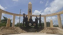
Arauca is one of the thirty-two departments that, together with Bogotá, Capital District, make up the Republic of Colombia. Its capital is the homonymous Arauca. It is located in the east of the country, in the Orinoquía region, bordering Venezuela to the north and east, Vichada and Casanare to the south, and Boyacá to the west.
Toponymy
There are several versions about the origin of its name; This could derive from the name of one of the indigenous ethnic groups that inhabited these regions, the Arawak or Arahuacos, or from the name of a llanera bird called "Arauco".
History
The territory of Arauca was inhabited before the Spanish conquest by araucas, yaruros, chinatos, betoyes, giraras, tunebos, airicos, macaguanes, eles, lipas, guahíbos, achaguas, cuibas, chiricoas, lucalías, piapocos, maipures and cuilotos. Later, in 1536, the conquerors Nicolás de Federman and Jorge de Espira arrived in Araucanian lands, passing through the eastern mountain range. By 1659, the Jesuit missions Francisco Jimeno, Francisco Álvarez and Antonio Monteverde advanced into the jungle on the lands of the Guahíbos, Tunebos, Airicos and Chiricoas tribes, where they founded new towns. In the 18th century the Jesuits were expelled, with Pedro Mesía de la Cerda being viceroy, they were replaced in their evangelizing mission by the Augustinians Recoletos, who founded five catechist centers: Soledad del Cravo, San Javier de Cuiloto, San José del Ele, San Joaquín de Lipa and San Fernando de Arauca.
The community movement of 1781 was concentrated in Tame which, with Fray Ignacio Mariño from 1812, emerged as a subversive group against Spanish rule. Mariño signs the Act of Independence of the province of Tunja on December 10, 1813. In 1816 the city of Arauca temporarily became the capital of New Granada and its president Dr. Fernando Serrano. General Francisco de Paula Santander, after his campaign in Venezuela, returns to Tame, where he definitively centers his headquarters until the arrival of General [Simón Bolívar], who enters the Araucanian territory on June 4, 1819 and arrives in Tame on November 11. June to continue the march on the 16th towards Poder, where Santander's army joined that of the Liberator. He continues his march until he achieves victory in the Pantano de Vargas and the Puente de Boyacá.
For much of the XIX century, Arauca belonged to the province of Casanare, which in 1819 became part of the Department of Boyacá of Gran Colombia; in 1831 With the dissolution of Gran Colombia, Arauca continues to be part of the province of Casanare, although later around 1857 it was annexed to the Sovereign State of Boyacá, later becoming part of the department of Boyacá.
Luis Felipe Laverde on November 5, 1910, with a group of exalted, forced the resignation of the government of Arauca and imposed his authority, in protest for the marginalization to which the region was subjected. Laverde managed to get the central government to create the Arauca police station in 1911, adding it to Boyacá and which had General Pedro León Acosta as its first president. The arbitrary mandate of the Andean commissioner once again fostered the discontent of the Araucanians, who rose up again with Humberto Gómez at their head, who took the city of Arauca on December 31, 1916 and declared the independence of the territory under the name of Republic of Arauca.
Once the legitimacy of the Colombian authority was restored, the territory was again disturbed during the turbulent period known as La Violencia, with uprisings from the plains in 1948, until the surrender of Guadalupe Salcedo, Araucanian revolutionary leader, in 1953. Later With the exploitation of oil settlers and people from all parts of the country arrive. As the oil bonanza consolidates, revolutionary groups appear to disturb the region. By decree 113 of January 20, 1955, the territory was elevated to the category of national administration; Finally, on July 5, 1991, it was established as a department along with the other municipalities and police stations in Colombia.
Geography
Geographic position and limits
Arauca is located between 06º, 02' 40" And 07º 06' 13" north latitude and 69º 25' 54" and 72º 22' 23" longitude west, in the northern region of the Colombian Orinoquia. Its limits are to the north, the Arauca river that separates it from Venezuela, to the east a straight line between the Meta and Arauca rivers, which serves as the border with Venezuela, to the south the Meta and Casanare rivers, which are borders with the departments of Vichada and Casanare respectively, and to the west with the Eastern Cordillera that separates it from Boyacá.
Physiography
Its territory covers an area of 23,818 km², predominantly made up of plains, which represents 2.1% of the national territory. The territory is divided into three physiographic regions: the first is made up of the eastern mountainous part of the Eastern Cordillera, the plains foothills, and the alluvial plain of the Orinoco.
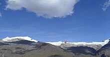
The Eastern Cordillera is located to the west of Arauca, covering a fifth of the departmental surface, comprising elevations from 500 m in the foothills to 5,380 m in the Sierra Nevada del Cocuy; It is characterized by high mountains, páramos covered by pajonales and frailejones, steep slopes, strongly dissected and low slopes with sub-Andean forest. The foothills are made up of alluvial fans and flat to sloping relief terraces, covered by savannah and tropical forest vegetation. Finally, the alluvial plain extends from the foothills to the limits with the Republic of Venezuela, the modeling is of terraces and overflow alluvial plains covered by floodable savannah vegetation and by gallery forest.
Hydrography
Most of the Araucanian rivers originate in the foothills and the Eastern Cordillera, running in a west-east direction. In this region the precipitation is 1500 mm, which is why it is the rainiest area of the department.
The hydrography is formed by the rivers Arauca, Casanare, Bojabá, Ele, Lipa, Cravo Norte, San Ignacio or Tame, Tocoragua, Cusay, Satocá, Tigre, Calafita, San Miguel, Capanaparo, Cinaruco, Limón, Banadía and Tocancia. In addition there are pipes, lagoons and estuaries.
Climate
The main factors that determine the climatic behavior of Arauca are the trade winds from the northeast and southeast, the displacement of the Intertropical Convergence Zone (ITCZ) and the Eastern Cordillera. The rain regime is basically monomodal, with a rainy season that includes the months of March to November. In Arauca there are warm, temperate, cold and snowy thermal floors.
Natural parks
El Cocuy National Natural Park is located in the western part of the department of Arauca, on the mountain range of the same name. and in the jurisdiction of the municipalities of Tame and Fortul. Formerly there was also the Sanctuary of Fauna and Flora Arauca, but due to the great human impact it received, such as excessive deforestation and land invasion for illegal activities, it had to be shut down.
Political-administrative division
The department of Arauca is made up of seven municipalities, one corregimiento (Puerto Jordán), 77 police inspections, and also by numerous hamlets and populated sites. The Araucanian municipalities are grouped into 5 notarial circles that belong to the Villavicencio Judicial District.
Demographics
| Evolution of the population of the department of Arauca (1938-2016) |
 |
Population by census.Population by projection.Source: Statoids. DANE. |
The population for 2005 in the department was 232,118 inhabitants (approximately 0.59% of the national total), of which 140,445 (54.6& of the departmental total) are located in the urban capitals and 91,673 (45.4%) in rural areas.
Arauca, Saravena and Tame are the most populated municipalities and have 70% of the total inhabitants. The capital (Arauca) has been widely urbanized due to migration motivated both by oil activity and by political violence from other regions. The current population originated in the colony, with the mixture of Spanish settlers with indigenous people, while the modern one due to the settlement caused by the oil bonanza of groups of settlers from Santander and Boyacá.
Ethnography
- Mestizos & Blancos (93.70%)
- Black or Afro-Colombian (4.07%)
- Amerindians or Indigenous (2.22%)
- Gypsies (0.01%)
Indigenous population
The total indigenous population of the department amounts to 3,591 people; In Arauca, 26 reservations are located in an area of 128,167 hectares. There are 6 indigenous peoples living there, with the following population: U'wa, 1,124 members; Betoyes with 800; Sikuani, 782; Hitnu, 441; Kuiba, 241; Hitanu, 110; Chiricoa, 63 and Piapoco with 30.
U'wa: is the predominant ethnic group in the department. They are located in the eastern buttress to the north of the eastern mountain range, towards the Nevado del Cocuy. Its total population is estimated at 7,231 people. Their language belongs to the Chibcha linguistic family. In Arauca there are 1,124 u'wa, that is, 15%. His name means "intelligent people who know how to talk."
Betoyes:: due to their population, they constitute the second ethnic group in the department. They live on the banks of the Cravo River and in the Municipality of Tame. The area of its territory is 702 hectares. Its population is estimated at 800 people. Their language comes from the Chibcha linguistic family. Although they do not preserve their original language, they speak a Spanish mixed with betoye, in which certain grammatical structures remain.
Guahibos: denomination by which the Sikuani, Kuiba, Chiricoa, Hitanü (Iguanito) and Hitnü (Macaguane) are known, who speak Guahiban languages.
Afro-Colombian Population
By 2001, the Afro-Colombian population in Arauca was about 6,800 inhabitants, located in the rural areas of Arauquita, Tame, Saravena and the urban area of Arauca. Since 1960, the department has been influenced by migratory movements from the Pacific region, linked to the cultivation of cocoa in the colonization areas directed by INCORA. However, little is known about this population group, its origins, history, problems, culture, causes that contributed to migration from their places of origin and, in general, current conditions as an "ethnic group".
Economy
The main economic activities carried out in Arauca are, in order, oil exploitation, livestock, agriculture, services and commerce.
The region's economy has been significantly affected by the influence of illegal armed groups in the department's productive activities, particularly terrorist acts and the so-called "armed patronage", exercised by the ELN guerrilla, becoming a drag on the development of the economic potential of Arauca.
Traditionally, the department's economy has been based on livestock and agriculture, which support complementary trade in the region. However, oil exploitation has recently become an important source of income for Arauca, which is reflected in its contribution to the departmental GDP, and which has focused its productive effort on multiple activities that include agribusiness and microenterprise. This oil exploitation has been affected by the attacks by the ELN guerrilla against the department's oil pipelines, mainly the Caño Limón pipeline, whose main consequences have been the alteration of the ecosystem and the contamination of rivers and soils.
While the livestock activity is focused on the breeding, raising and fattening of cattle; its commercialization is directed towards Puerto López, Bucaramanga and Cúcuta. The region's soils have shown good conditions for growing cocoa, plantain, cassava, rice, corn, and fruit trees, as well as industrialized crops such as African palm, sorghum, soybeans, and sesame. Livestock is another important line within the economy of the department.
Contenido relacionado
Vega de San Mateo
Surinam
General geography


