Antarctica
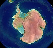
The Antarctica or Antarctic continent (from the Latin adjective antarcticus, and this in turn from the Greek ανταρκτικός antarktikós, 'opposite the Arctic'), is the southernmost continent on Earth. It is located entirely in the southern hemisphere, almost entirely south of the Antarctic Circle, and is surrounded by the Southern Ocean. It contains the geographic South Pole, which is why, colloquially and by extension, it is also known as the South Pole. At 14,000,000 km², it is the fourth largest continent after Asia, the Americas and Africa. Compared to Oceania, Antarctica is almost twice its size. Around 98% of Antarctica is covered in ice, which is on average 1.9 km thick, which extends to all but the northernmost ports of the Antarctic Peninsula.
Antarctica is, on average, the coldest, driest and windiest continent, and has the highest mean altitude of all the continents. Antarctica is a desert of ice, with annual precipitation of only 200 mm in the area coastal and much less inland. The temperature in Antarctica has reached -89.2 °C, although the average for the third quarter (the coldest part of the year) is -63 °C. As of 2016, there were about 135 permanent residents, but 1,000 to 5,000 people reside year-round at research stations scattered across the continent. The native organisms of Antarctica include many types of algae, bacteria, fungi, plants, protists, and certain animals, such as mites, nematodes, penguins, pinnipeds, and tardigrades. The type of vegetation that occurs in some small areas is tundra.
Despite myths and speculations about Terra Australis Ignota ("the unknown land of the south") dating back to antiquity, Antarctica was the last region on Earth to be discovered and/or colonized by humans, being sighted for the first time in the southern summer of 1603 by the Spanish navigator Gabriel de Castilla. Later, in 1820, it was sighted by Russian explorers Fabian Gottlieb von Bellingshausen and Mikhail Lazarev in Vostok and Mirny, who discovered the Fimbul ice barrier. The continent, however, remained unexplored for most of the 19th century due to its hostile environment and isolation. In 1895, the first confirmed landing was led by a Norwegian party.
Antarctica is a de facto condominium, governed by the Antarctic Treaty which has consultative status. Twelve countries signed the Antarctic Treaty in 1959, and thirty-eight have signed it since. The treaty prohibits military activities and mineral extraction, prohibits nuclear explosions and nuclear waste disposal, supports scientific research, and protects the ecozone on the continent. Experiments conducted by more than 4,000 scientists from various nations are ongoing.
Etymology
The term "Antarctica" comes from the romanized version of the Greek compound word "ἀνταρκτική" —antarktiké—, feminine expression of "ἀνταρκτικός" —antarktikós—, meaning "opposite the Arctic" or "opposite north".
The first use of the word dates back to 350 BC. C., when Aristotle referred to an "Antarctic region" in his book Meteorology, and there are records that support that, in the Common Era, the Phoenician Marino of Tire used that term on a map of the century II. The Roman authors Hyginus and Apuleius used the romanized expression "polus antarcticus" to talk about the South Pole, from which the Old French term "pole antartike" was derived — equivalent to the contemporary «pôle antarctique»—recorded in 1270, and from which in turn arose the Middle English expression «pol antartik» —equivalent to « Antarctic Pole"—used in Geoffrey Chaucer's technical treatise, dating from 1391.
According to the Royal Spanish Academy, both "Antártida" and "Antártica" are valid denominations in Spanish for that continent. The etymological form «Antártica», derived from the Latin adjective antarcticus ('opposed to the Arctic'), is in majority use in Chile, where it is also part of the name of one of its regions, the XII Region of Magellan and the Chilean Antarctic. The "Antártida" form is the only one used in Spain and the preferred one in most of America. For the adjective, only the form Antarctic: Antarctic continent is valid.
Before acquiring its geographical connotations, the term was also used to refer to other regions that could bear the attribution of «opposite to the North». An example of this is the French colony established in Brazil in the XVI century, titled Francia Antártica.
The first formal use of "Antarctica" as a continental name is considered to have occurred in the 1890s, when it was used by Scottish cartographer John George Bartholomew.
History
Old Hypotheses
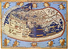
Although there are records that the first sightings of Antarctica occurred in the early 16th century and more strongly from the 19th century, already from the I, with the hypothesis of the astronomer Claudius Ptolemy about the probable symmetry of the terrestrial masses known until then, the belief persisted in a vast continent located in the extreme south of the planet, and referred to in Latin as « Terra Australis Ignota”, or “Unknown Land of the South”, whose existence served as a "balance" for the northern lands of Europe, Asia and North Africa.
In 1539, the King of Spain Carlos V created the governorship of Terra Australis in charge of Pedro Sancho de la Hoz who in 1540 would transfer the title to the conquistador Pedro de Valdivia.
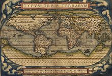
At that time, the expression «Terra Australis» was used to refer to the territories discovered in the southern hemisphere of the Earth. This is how Australia got its name, considering that it should be the southernmost land mass. In the introduction to his book A Voyage to Terra Australis (1814), the British navigator Matthew Flinders helped reinforce this theory:
There is no likelihood that any other body separated from earth, or of equivalent extension, will be discovered in a more southern latitude. The name Terra Australis will continue to describe the geographical importance of this region and its location on the globe: it possesses antiquity and, without referring to either of the two requesting nations, seems to be less undesirable than any other name that might have been chosen.
European maps of the 18th century continued to show the hypothetical territory, until the British James Cook expedition crossed the circle Antarctic ice sheet between 1773 and 1774, aboard the ships HMS Resolution and HMS Adventure, approaching within 120 kilometers of the Antarctic coast on their initial voyage. However, it is thought that the first sighting of the Antarctic ice shelf was not it occurred until 1820, by Cook's own crew, led by officers Fabian Gottlieb von Bellingshausen and Edward Bransfield, of the Russian Imperial Navy and the British Royal Navy, respectively; and by American sealer Nathaniel Palmer.
History of Exploration
Between 1599 and 1603, the Dutch sailor Dirck Gerrits Pomp and the Spanish fleet made up of the ships «Jesús María», «Nuestra Señora de la Visitación» and « Nuestra Señora de las Mercedes”, under the command of Gabriel de Castilla, were the first Europeans to sight Antarctic land, specifically, the South Shetland Islands at 64°S. In addition, there are hypotheses about how the The Spanish ship "San Telmo" was shipwrecked on the Antarctic coast, getting lost south of the Sea of Hoces in 1819, for which its crew would become the first Europeans to set foot on Antarctic soil. An expedition led between 1819 and 1821 by the Russians Fabian Gottlieb von Bellingshausen and Mikhail Lázarev, aboard the corvettes "Vostok" and "Mirni", reached a point 32 kilometers from Queen Maud Land, in addition to recording the sighting of an ice shelf at the coordinates 69°21′28″S 2°14′50″W / -69.3 5778, -2.24722, which would later be known as the Fimbul Ice Shelf. This was three days before Bransfield sighted land, and ten months before Palmer did. Although there are records that support that the American explorer John Davis made the first landing on the Antarctic continent, the truth is that there are doubts about the veracity of this event. The oldest landing on record dates from 1895, at Cape Adare.
On January 22, 1840, two days after the discovery of the west coast of the Balleny Islands, some members of the expedition of the Frenchman Jules Dumont D'Urville arrived at the highest islet of a group of islands rocky, about four kilometers from Cape Géodésie, on the coast of Adélie Land, where they collected samples of minerals, algae and animals. Three days later, on January 25, the so-called Exploring Expedition of the United States announced the discovery of an "Antarctic continent west of the Balleny Islands" that would eventually come to be identified as Wilkes Land.
Other important events related to the Antarctic territory include the expedition of the British James Clark Ross, which traversed what is known as the Ross Sea and discovered Ross Island in 1841. Similarly, the Ross Ice Shelf it received that name after the passage of the navigator, while the names of Mount Erebus and Mount Terror come from the ships used in that expedition. In late January 1853, the American Mercator Cooper landed in East Antarctica.
In 1900, the United Kingdom again sent an expedition to Antarctica, under the command of Captain Robert Falcon Scott. The expedition was popularly known by the name of its ship, the Discovery. The expedition explored the Ross Sea and Edward VII Land, reaching the southernmost point that no known human being had ever reached, when on December 31, 1902, Scott, Ernest Shackleton, and Dr. Edward Adrian Wilson reached the latitude 82º17'.
In 1902, the Swede Otto Nordenskjöld, the Norwegian Carl Anton Larsen and the Argentine José María Sobral are trapped on the continent, each separated with their expeditionary group, when the ship Antarctic of the Expedition Swedish Antarctic runs aground. After surviving the Antarctic winter and later regrouping, they are rescued in 1903 by the Argentine corvette Uruguay under the command of Argentine captain Julián Irizar.
During the Nimrod Expedition led by Ernest Shackleton in 1907, the team led by Edgeworth David became the first to climb Mount Erebus and reach the South Magnetic Pole. Douglas Mawson assumed command of the team on their perilous return from the magnetic pole, leading several more expeditions until their retirement in 1931. In addition, Shackleton himself and three other members of his expedition were pioneers between December 1908 and February 1909: they were the first humans to cross the Ross Ice Shelf, the first to cross the Transantarctic Mountains (via the Beardmore Glacier) and the first to set foot on the Antarctic Plateau.
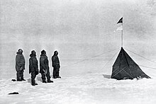
The Norwegian expedition of the ship Fram, led by Roald Amundsen, became the first to reach the geographic South Pole on December 14, 1911, using a route from the Bay of Whales and the Axel Heiberg Glacier. A month later, on January 17, Scott's Terra Nova Expedition from Ross Island also reached the Pole.
Richard Evelyn Byrd led several air voyages to Antarctica in the 1930s and 1940s. He is credited with implementing mechanized land transportation on the continent and conducting extensive geological and biological investigations. foot in Antarctica they did so in the 1930s with Caroline Mikkelsen landing on an Antarctic island in 1935, and Ingrid Christensen setting foot on the continent in 1937.
It wasn't until October 31, 1956 when someone set foot on the South Pole again; that day a group from the United States Navy led by George J. Dufek successfully landed a plane. The first women to set foot on the South Pole were Pam Young, Jean Pearson, Lois Jones, Eileen McSaveney, Kay Lindsay, and Terry Tickhill. in 1969.
The first person to sail solo in Antarctica was New Zealander David Henry Lewis, in 1972, on the thirty-foot sailing ship Ice Bird.
Geography
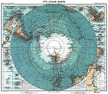
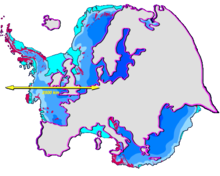
The total area of Antarctica covers a total of 14 million km², which translates into the fourth largest continent, significantly larger than Europe and Oceania. It has a coastline of 17,968 km and its formations of ice are its main characteristic. Antarctica is located around the south pole asymmetrically and mostly inside the Antarctic polar circle, which makes it the southernmost continent of all. Likewise, it is surrounded by the world ocean, which includes the Atlantic, Indian and Pacific Oceans. In addition, there are also some rivers and lakes in the territory, such as the Onyx River —the longest with 32 km— or Lake Vostok, discovered under the base of the same name, which is the largest of the subglacials with 14,000 km². The latter is thought to have sealed its aquatic body for 500,000 or a million years, but a study published in 2006 he theorizes that there are currents that move liquid from one lake to another. There are at least seventy lakes throughout the continent, although the number may be higher as the possibility of more under the ice sheets is being studied.
The Transantarctic Mountains divide the continent near the "neck" between the Ross Sea and the Weddell Sea. The part west to the Weddell Sea and east to the Ross Sea is known as West (or Lesser) Antarctica, while the remainder is East (or Greater) Antarctica, because they roughly correspond to the western and eastern hemispheres along the meridian. Greenwich. About 98% of its surface is covered by the Antarctic ice sheet, which has an average thickness of more than 1,500 m. In fact, the region contains about 90% of the world's ice and consequently 70% of fresh water. Furthermore, if all the ice melted, it is estimated that sea levels would rise by 61 m. The western part is hidden under the West Antarctic ice sheet, which has caused concern due to studies such as the one by of Maine show that there is a real chance of subsidence—with consequent rise in sea level—in a geologically short period. Several glacial streams, accounting for about 10% of total ice, flow toward some of the many ice shelves. ice that is on the continent. For its part, the eastern area is covered by the cover of East Antarctica and is where the lands of Coats, Enderby, Mac. Roberston, Queen Maud, Victoria are located. and Wilkes.
The Vinson Massif is located in the Ellsworth Mountains and is the highest point in the territory, since it has an altitude of 4892 m. There are also more mountains, both on the mainland and on neighboring islands, such as Erebus on Ross Island, which is the southernmost active volcano. There is also another volcano on Deception Island that is well known, as it erupted violently in 1970. Since then, numerous eruptions have been frequently observed. —much milder—, although there are still hidden volcanoes that may be potentially active, as demonstrated in 2004 with the discovery of one (albeit inactive) under the waters of the Antarctic Peninsula by Canadian and American researchers. In contrast, the lowest point in Antarctica is in the Bentley Trench subglacial trench at a depth of 2,540 m, giving a total mean elevation of 2,300 m. In addition to those already mentioned, Antarctica has several islands s or archipelagos mostly concentrated in the area of the Antarctic Peninsula, such as Alexander I Island —the largest with 49,070 km²—, Berkner Island, Thurston Island or the South Orkney Archipelago.
Climate
Antarctica is the coldest continent on Earth and it is there where the lowest temperature since there is data (-89.2 °C) was recorded on July 21, 1983, at the Russian base —then Soviet— from Vostok. This temperature exceeded the record of the previous one recorded on August 24, 1960, with a value of -88.3 °C. For comparison, the most extreme record we have is -10.7 °C colder than the sublimation of dry ice to a partial pressure atmosphere although, since CO2 only makes up 0.039% of the air, temperatures below -140 °C would be necessary to cause dry ice snow in Antarctica. an even lower temperature, of -93.2 °C); however, this could have been influenced by ground temperatures and was not recorded at 2.1 m above the surface, as required to be kept in official records. In 2018 -98 °C was recorded. Generally speaking, the continent is a vast frozen desert with little rainfall; on average, only 10 mm falls at the South Pole. The minimums are usually around 80 °C below zero in the interior during the winter, while the maximums are usually around zero degrees on the coast during the summer. Also, sunburns are common in this area because the snowy surface reflects the ultraviolet rays that come from the star. In fact, the solar irradiance is much higher here than at the equator, since at some times of the year there are periods with completely clear skies and continuous light —and others of complete darkness—, which causes climates to which human beings not used to experiment in most parts of the world.
The eastern area is cooler than its western counterpart due to its higher elevation. As a consequence of the katabatic winds, the fronts rarely penetrate far into the interior of the continent, leaving it cold and dry—with a moderate wind speed. Despite the low rainfall in the center of the territory, the existing ice in the place remains for long periods. On the contrary, in the coastal areas and areas outside the Antarctic plateau, the winds The aforementioned katabatics are strong and precipitation in the form of snow is a fairly common phenomenon.
Antarctica is colder than the Arctic for several reasons. Firstly, many parts of the continent are over 2,000m above sea level, so the temperature - being higher in the troposphere - drops. On the other hand, the north pole is covered by the Arctic Ocean, whose relative heat is transferred through the ice pack and prevents temperatures in this region from reaching the extremes of the Antarctic surface. Finally, the Earth is at aphelion — the planet is farthest from the sun during the southern hemisphere winter—in July, while it is at perihelion—the planet is closest to the sun in the southern hemisphere summer—in January, making this distance an impact in a colder Antarctic winter, although the first two effects have more impact.
The aurora australis is a glow that can be observed in the night sky of Antarctica when contact between the solar wind and the Earth's magnetic field occurs. Other phenomena that can be seen on the continent are prisms ice, which are sheets of ice so small that they appear to form a cloud in the air, or sunshade, an optical phenomenon that occurs when various ice particles reflect light in a scattered manner.
Geology
Geological history and paleontology
More than 170 million years ago, Antarctica formed a central part of the supercontinent Gondwana. During the Triassic and Jurassic, Gondwana gradually broke apart and Antarctica formed, as we know it today, about 25 million years ago. Antarctica was not always cold, dry, and covered in ice sheets. At various points in its long history, it was further north, experienced a tropical or temperate climate, was covered in forests, and inhabited by various ancient forms of life.
Paleozoic Era (540-250 Ma)
During the Cambrian period, Gondwana had a temperate climate. West Antarctica was partially in the northern hemisphere, and large amounts of sandstone, limestone, and shale were deposited during this period. East Antarctica was at the equator, where seafloor invertebrates and trilobites flourished in tropical seas. At the beginning of the Devonian period (416 Ma), Gondwana was in more southern latitudes and the climate was colder, however fossils of land plants are known from that time. The sand and silt were deposited in what are now the Ellsworth Mountains, in the Horlick Mountains, and the Pensacola Mountains. Ice age began at the end of the Devonian period (360 Ma), as Gondwana centered at the south pole and the climate cooled, although the flora remained. During the Permian period, the land was dominated by seed plants such as Glossopteris, a pteridophyte that grew in swamps. Over time these swamps became coal deposits in the Transantarctic Mountains. Towards the end of the Permian period, continued warming led to a hot, dry climate over much of Gondwana.
Mesozoic Era (250-66 Ma)
As a result of continued warming, the polar ice caps melted and much of Gondwana became a desert. In East Antarctica, seed ferns or pteridosperms became abundant, and large amounts of sandstone and shale accumulated at this time. Synapsids or theropsids, commonly known as 'mammalian reptiles', were common in Antarctica during the Early Triassic and included forms such as listrosaurs. The Antarctic Peninsula began to form during the Jurassic period (206-146 Ma), with the islands gradually rising out of the ocean. Ginkgo trees, conifers, bennettitales, horsetails, ferns, and cycads were abundant during this period. In West Antarctica, coniferous forests dominated the entire Cretaceous period (146-66 Ma), although one species of fagales became more prominent towards the end of this period. Ammonites were common in the seas around Antarctica, and dinosaurs were also present, although only three types of Antarctic dinosaurs (Cryolophosaurus and Glacialisaurus, from the Hanson Formation, and Antarctopelta) have been described to date. It was during this was when Gondwana began to break up.
However, there is some evidence of Antarctic marine glaciation during the Cretaceous period.
Separation of Gondwana (160-23 Ma)
The cooling of Antarctica happened step by step, as continental spread changed ocean currents, equalizing the temperature of longitudinal equatorial currents with latitudinal currents, which preserved and accentuated temperature differences in latitude.
Africa separated from Antarctica in the Jurassic, around 160 Ma, followed by the Indian subcontinent in the Early Cretaceous (approximately 125 Ma). At the end of the Cretaceous, around 66 Ma, Antarctica (then connected to Australia) still had a subtropical climate and flora, with a marsupial fauna. In the Eocene epoch, around 40 Ma Australia-New Guinea separated from the Antarctica, so that latitudinal currents were able to isolate Antarctica from Australia and the first ice began to appear. During the Eocene-Oligocene extinction around 34 Ma ago, CO2 levels have been found to be about 760 ppm, having declined from levels of thousands of ppm at earlier times.
Around 23 Ma, the Drake Passage opened between Antarctica and South America, giving rise to the Antarctic Circumpolar Current that completely isolated the continent. Models of the changes suggest that the decline in CO2 levels became more significant. Ice began to spread, replacing the forests that covered the continent.
Neogene Period (23-2.59 Ma)
Since about 15 Ma, the continent has been mostly covered in ice.
The Meyer Desert Formation Biome
Fossil Nothofagus leaves, in the Meyer Desert Formation, were observed intermittently during warm periods, allowing Nothofagus to cling to the Dominion Ridge until the Pliocene epoch (about 3-4 Ma ago). After that, the Pleistocene ice age covered the entire continent and destroyed all plant life.
Currently
The geological study of Antarctica has been very difficult throughout the continent, due to the thick ice sheet that permanently covers it. However, new techniques such as remote sensing, ground-sounding radar, and satellite have begun to reveal the structures under the ice.
Geologically, West Antarctica closely resembles the Andes mountain range of South America. The Antarctic Peninsula was formed by metamorphism and uplift of seafloor sediments during the late Paleozoic and early Mesozoic eras. This sediment uplift was accompanied by igneous rock and volcanic rock. The most common rocks in West Antarctica are volcanic andesite and rhyolite formed during the Jurassic period. There is also evidence of volcanic activity, even after the ice sheet had formed, on Marie Byrd Land and Alexander I Island. The only anomalous area in West Antarctica is the Ellsworth Mountains region, where stratigraphy it is more similar to East Antarctica.
East Antarctica is geologically diverse, dating to the Precambrian supereon, with some rocks formed more than 3 billion years ago. It is made up of metamorphic and igneous rock that is the basis of the continental shield. On top of this base is coal and various modern rocks, such as sandstone, limestone, and shale, laid down during the Devonian and Jurassic periods to form the Transantarctic Mountains. In coastal areas such as the Shackleton Range and Victoria Land some faulting has occurred.
The main known mineral resource on the continent is coal. It was first recorded near the Beardmore Glacier by Frank Wild on the Nimrod Expedition, and low-quality coal has now been discovered in many areas of the Transantarctic Mountains. The Prince Charles Mountains contain significant deposits of iron. The most valuable resources in Antarctica are found in the high seas, the oil and natural gas deposits found in the Ross Sea discovered in 1973. The exploitation of all mineral resources is prohibited until 2048 by the Protocol to the Antarctic Treaty on Environmental Protection.
Biodiversity
Flora and fungi
Most of the flora is made up of bryophytes, such as the approximately one hundred species of mosses. On the other hand, hepaticophytes form around 25 species, while there is only evidence of the existence of three vascular plants, which are mostly settled in the Antarctic Peninsula: Deschampsia antarctica (Antarctic hairy grass), Colobanthus quitensis (Antarctic carnation) and the non-native Poa annua (annual poa).
On the other hand, around 1150 species of fungi have been recorded, which are divided between 750 that do not have the form of lichen and 400 that do. Also, many of them are cryptoendoliths, due to the evolution of the species under extreme conditions, which have contributed significantly to shaping the rock formations of the McMurdo Dry Valleys and adjoining ridges. The apparently simple morphology, with few structural differences, the enzymes and metabolic systems functioning at low temperatures, and the short life cycles shown by each fungus make them particularly suitable for environments with severe climatic conditions, as is the case with McMurdo. Specifically, their thick walls and cells full of melanin make them resistant to ultraviolet radiation. These characteristics can also be observed in algae and cyanobacteria, and suggest that they are adaptations to the prevailing conditions in Antarctica. All this situation has led to speculation that if there had ever been life on Mars, it would have been similar to that of Antarctic fungi. On the other hand, some studies suggest that there are organisms of this type endemic to the continent.
Fauna and other organisms
Very few terrestrial vertebrates live in Antarctica and those that do are found only on the sub-Antarctic islands. Among the invertebrate species that we can find are microscopic beings, to highlight the Alaskozetes antarcticus, lice, nematodes, tardigrades, rotifers, krill and springtails, such as Cryptopygus antarcticus. The Belgica antarctica, a roundworm Flightless, measuring up to 6 mm, it is the largest purely terrestrial animal in Antarctica. For its part, the snowy petrel is one of only three birds that feed exclusively on the continent.
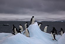
Some species of marine animals depend, directly or indirectly, on Phytoplankton. Antarctic marine life includes penguins, blue whales, orcas, squids, or pinnipeds. The emperor penguin is the only penguin that feeds in Antarctica during the winter, while the Adelaide is able to do the same further south than any other. The rockhopper penguin, for its part, has distinctive feathers around of the eyes, and it is the smallest of all the crested ones. Other penguins that obtain food in the continent are the king penguin, the chinstrap or the gentoo.
Population
Several governments maintain permanent manned research stations on the continent. The number of people carrying out and supporting scientific research and other work on the mainland and its nearby islands varies between 1,000 in winter and around 5,000 in summer, giving it a population density between 70 and 350 per million. of square kilometers at the moment. Many of the stations are staffed year-round, the winter staff normally arriving from their home countries for a year's assignment.
The first semi-permanent inhabitants of the near-Antarctic regions (areas south of the Antarctic convergence) were British and American sealers who used to spend a year or more in South Georgia, beginning in 1786. During During the whaling era, which lasted until 1966, the population of that island ranged from over 1,000 in summer (over 2,000 in some years) to about 200 in winter. Most of the whalers were Norwegian, with a growing proportion British. Settlements included Grytviken, Leith Harbour, King Edward Point Base, Stromness, Husvik, Prince Olav Harbour, New Fortune Harbour, and Good Brook. The managers and other senior officers of the whaling stations often lived together with their families. Among them was the founder of Grytviken and the Argentine Fishing Company, Captain Carl Anton Larsen, a leading Norwegian whaler and explorer who, along with his family.
In the first decades of the XX century, the first two births in the Antarctic area took place. The Norwegian Fridthjof Jacobsen settled in Grytviken, San Pedro Island in the South Georgia archipelago since 1904 to work in the administration of the whaling station of which he was director between 1914 and 1921. Jacobsen and his wife Klara Olette Jacobsen had two of their daughters on the island. Solveig Gunbjörg Jacobsen was born on October 8, 1913 and the birth was registered by James Wilson British judicial officer of the islands and became the first birth south of the Antarctic convergence.
The first birth on the continent took place in 1978 at the Argentine Esperanza base located on the Antarctic peninsula. This is Emilio Marcos Palma, born on January 7. His birth is the southernmost recorded in history, he is also the only man known to have been born for the first time on the continent. For these reasons, it is registered in the Guinness Book of Records. María de las Nieves Delgado was the first Antarctic girl, born at the Esperanza Base on March 27, 1978, daughter of Juana Paula Benítez de Delgado and cook sergeant Néstor Antonio Delgado. By 1980, six more children had been born at the base: Rubén Eduardo de Carli (September 21, 1979), Francisco Javier Sosa (October 11, 1979), Silvina Analía Arnouil (January 14, 1980)., José Manuel Valladares Solís (January 24, 1980), Lucas Daniel Posse (February 4, 1980) and María Sol Cosenza (May 3, 1983).
The Chilean government, which claims sovereignty over the same territory, six years later also sent Chilean citizens to have their own "Antarctic baby." On November 21, 1984, Juan Pablo Camacho was born at the Presidente Eduardo Frei Montalva Base, thus becoming the first Chilean native of Antarctica and unlike Emilio, he was the first to be conceived on the same continent. Then two other Chilean Antarctics were born, Gisella Cortés Rojas, born on December 2, 1984, and the last of them, Ignacio Alfonso Miranda Lagunas, born on January 23, 1985, which is the most recent Antarctic birth to date.
Mining Resources
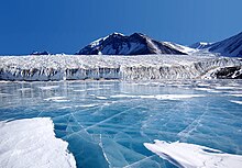
The presence of many mineral resources has been revealed by detailed geological studies. The existence of coal deposits have been verified. The Transantarctic Mountains contain part of what may be the world's largest coal seam, and large iron reserves exist in the Prince Charles Mountains near the East Antarctic coast; A red liquid is spilled in the Blood Falls of the Taylor Glacier, for a long time it was believed that the color was due to the presence of red algae, although it has later been discovered that it is due to the presence of high doses of iron oxide. Antimony, chromium, gold, molybdenum, uranium, petroleum—this in the coastal areas of West Antarctica—and diamonds have also been discovered; but up to now it has been uneconomical to exploit them as well as potentially harmful to the fragile environment. Climatic conditions, the thick layer of ice, and the restrictions of the Antarctic Treaty keep prospecting very limited. In 1990 it was agreed to ban mining for 50 years.
Religion
An Orthodox church - Holy Trinity Church, opened in 2004 at Base Bellingshausen - is served year-round by one or two priests, who also rotate each year. There are also permanently-attended Catholic churches, such as those found in the Argentine bases. The southernmost of them is the Chapel of Our Lady of the Snows, at the Belgrano II Base, in the Nunatak Bertrab, only 1,300 km from the South Pole. Also at an Argentine base, in the South Orkney Islands, the Spanish Jesuit Fr. Felipe Lérida, born in Almarza (Soria) in 1882, officiated the first Catholic mass in Antarctica.
Tourism
Antarctica, the last continent on Earth to be discovered and the most rigorous and exotic, has received tourism since the 1950s, although regular tourism has been developing since the second half of the 1960s, when the state company ELMA shipping company inaugurates tourist cruises to the Antarctic sector claimed by Argentina; At present, cruises that use Ushuaia and the Malvinas as the last pre-Antarctic stopover are quite frequent, cruises that are, almost always and up to now, cabotage, visiting by sea the coasts and bases of the Antarctic peninsula and the great multitude of annexed archipelagos, for example the South Antilles.
Punta Arenas, capital of the Magallanes Region, in southern Chile, seeks to become the "gateway to the Antarctic continent", based on this city, from which various Antarctic cruise companies and direct flights depart through Aerovías DAP, which directly connect the American continent with Antarctica.
Research
As a result of the Antarctic Treaty, practically (at least formally) all human activities (except for limited tourism and limited fishing) are reduced to scientific research, focused mainly on meteorology and climatology, although the range of sciences has widened. expanded: the Antarctic ecosystem is important to study extremophile organisms even with projections to exobiology, subglacial lakes exist in various areas of the Antarctic continent, that is, liquid water basins perennially covered by ice sheets at least 5 m thick, the Water from such subglacial lakes is usually kept liquid by warming derived from volcanic phenomena, one of the most interesting aspects of these basins is the existence of psychrophilic life ('cold lover'). One of the types of extremophile life that could have similarities with the possible forms of extraterrestrial life in stars where the prevailing temperatures are below the freezing point of water. Research published in the journal Science in November 2009 confirmed the existence of more than 10,000 forms of viruses in the limnopolar lake.
The atmosphere of the central areas of Antarctica is the most translucent on Earth, which is why astronomical observatories are installed there. The indlandsis or ice cap encompasses most of the terrestrial cryosphere and its ice in the deep layers is thousands of years old, so that paleoclimatic records can be made in them (mainly by observing the bubbles of air trapped in ancient ice). In certain areas, the Antarctic ice acquires such crystalline and transparent characteristics that a deep subglacial astrophysical observatory has been established at the base of the South Pole to detect neutrinos (the Antarctic Impulse Trasient Antenna/Antena Antártica de Impulso Transitivo or ANITA and the IceCube). The study of magnetic activity is also essential as the south magnetic pole is found in Antarctica and this influences the formation of polar auroras or changes in the ionosphere. On the other hand, the atmosphere in Antarctica, being the driest on planet Earth, is also the clearest, which is why a large observatory with an optical telescope has been installed at the Amundsen-Scott base. This telescope explores and maps the celestial vault of the southern hemisphere.
The Antarctic programs of at least ten countries (Spain, Brazil, China, the United States, Peru, Ecuador, Colombia, South Korea, among others) work from the city of Punta Arenas. In this city, the International Antarctic Center is under construction, administered by the Chilean Antarctic Institute and the University of Magallanes, in which more than 500 scientists from all over the world will work, with a world convention center and the largest Antarctic Interactive Museum in the world. world.
Meteors
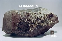
Meteorites found in Antarctica are important material for study since they were formed at the beginning of the solar system; Most scientists believe that such meteorites come from asteroids, although some originate from large planets like Mars. The first meteorite was found in 1912, and was called the Adélie Earth meteorite. The ice usually preserves small and medium-sized meteorites almost intact, such as the famous ALH84001 that comes from Mars. Under the ice sheet, large impact craters are considered to exist, such as the possibly gigantic Wilkes Crater of Earth.
In 1969, a Japanese expedition discovered nine meteorites. Most of these meteorites have fallen on the ice sheet in the last million years. The movement of the ice cap tends to concentrate the meteorites in places where the sliding of the ice is blocked by features of the relief such as mountain ranges; with the erosion of the wind such meteorites are being exposed to the surface after having been centuries under the accumulated snow. Compared with meteorites collected in more temperate regions of the Earth, Antarctic meteorites are very well preserved. Although it is not yet certain that it is a meteorite impact crater, in West Antarctica under the glacial cap or indlandsis is the largest known crater on planet Earth above sea level.
Antarctic Bases
Most Antarctic Treaty member countries maintain scientific research stations in Antarctica. Some of them operate throughout the year, while others are temporary and operate only in summer. There is a notable concentration of bases in the northern half of the Antarctic Peninsula area. The oldest in continuous operation is the Argentine station Orcadas (since February 22, 1904 (118 years). The McMurdo Base in the United States (located in the south of New Zealand), which until a few years ago had a micro atomic power station, is the largest of all.The American station Amundsen-Scott is located almost at the geographic south pole (89°59'51"S-139°16'22"E), while the Russian Vostok (78°28'00"S-106°48'00"E) and French-Italian Concordia (75°06'06"S, 123°23'43& #34;E) are closest to the south geomagnetic pole.
During the austral winter of 2014, 40 bases from 20 nations operated in Antarctica and another 10 countries joined in the Antarctic summer. These bases open all year long belong to:
- Germany: Neumayer III (70°38′00′′S 08°15′48′′ / -70.633, -8.26333), at the end of its activities because it is covered with ice, the Georg von Neumayer base has been abandoned and replaced by Neumayer II and in February 2009 by Neumayer III.
- Argentina: Belgrano II, Esperanza, Carlini (ex Jubany), Marambio, Orcadas, San Martín.
- Australia: Casey, Davis, Mawson.
- Brazil: Commander Ferraz (Brazil)62°05′00′S 58°23′28′′ / -62.08333, -58.39111).
- Chile: Escudero, Frei, O'Higgins, Prat.
- China: Great Wall, Zhongshan.
- South Korea: King Sejong (South Korea)62°13′24′S 58°47′21′ / -62.22333, -58.78917- Jang Bogo.
- USA. U.S.: Amundsen-Scott, McMurdo, Palmer.
- France: Dumont D'Urville.
- France/Italy: Concordia (75°06′06′S 123°23′43′E / -75.10167, 123.39528).
- India: Maitri (India)70°45′57′S 11°44′09′E / -70.76583, 11.73583Bharathi.
- Japan: Syowa (69°00′25′′S 39°35′01′′E / -69.00694, 39.58361).
- Norway: Troll 72°0′7′S 2°32′2′E / -72.00194, 2.53389
- New Zealand: Scott (77°51′00′S 166°45′46′E / -77.85000, 166.76278).
- Poland: Henryk Arctowski (62°09′45′S 58°27′45′ / -62.16250, -58.46250)
- United Kingdom: Halley, Rothera
- Russia: Bellingshausen, Mirni, Novolázarevskaya, Progres, Vostok
- South Africa: SANAE IV (71°40′25′S 2°49′44′ / -71.67361, -2.82889)
- Ukraine: Vernadsky Base65°14′43′S 64°15′24′ / -65.24528, -64.25667). Former British Faraday base, transferred to Ukraine on 6 February 1996.
- Uruguay: Artigas base, on the island Rey Jorge (62°11′04′S 58°54′′09′′ / -62.18444, -582.0050).
Other countries operate scientific stations only in austral summer, such as:
- Bulgaria: Saint Clement of Ohrid (62°38′29′S 60°21′53′′O / -62.64139, -60.36472)
- Ecuador: Pedro Vicente Maldonado62°26′56′S 59°44′29′ / -62.44889, -59.74139), Refugio Republic of Ecuador
- Spain: Juan Carlos I, Gabriel de Castilla
- Finland: Aboa
- Sweden: Wasa
- Pakistan: Jinnah
- Peru: Machu Picchu62°05′29′S 58°28′16′ / -62.09139, -58.47111)
Summer bases operated by countries that also maintain winter bases include:
- Germany: Kohnen
- Argentina: Brown, Camera, Deception, Matienzo, Melchior, Petrel, Spring
- Chile: Boonen Rivera, Carvajal, González Videla, Guesalaga, Huneeus, Parodi, Ripamonti, Risopatrón, Shirreff, Yankee Bay, Yelcho
Ice mass and sea level
Due to its location at the South Pole, Antarctica receives relatively little solar radiation, except during the southern summer. This means that it is a very cold continent where the water is mainly in the form of ice. Precipitation is low (most of Antarctica is a desert) and almost always in the form of snow, which accumulates to form a giant ice sheet that covers the land. Parts of this ice sheet form mobile glaciers known as ice streams, which flow toward the edges of the continent. Next to the mainland coast there are many ice shelves. These are floating extensions of glaciers that break out of the continental ice pack. Offshore, temperatures are also low enough for ice to form from seawater for most of the year. It is important to understand the various types of Antarctic ice to understand the potential effects on sea level and the implications for global cooling.
The extent of sea ice expands annually in the Antarctic winter, and most of this ice melts in the summer. This ice forms from ocean water and floats on the same water and therefore does not contribute to raising sea levels. The extent of sea ice around Antarctica (in terms of km² of coverage) has remained roughly constant over the past few decades, although the amount of variation in its thickness has been unclear.
The melting of floating ice shelves (ice that originated on land) by itself does not contribute much to sea level rise (as the ice displaces only its own body of water). However, it is the removal of ice from the land to form the ice shelf that causes a rise in global sea level. This effect is offset by the snow that falls again on the continent. The last few decades have seen several dramatic collapses of large ice shelves around the coast of Antarctica, especially along the Antarctic Peninsula. Concern has been raised that the calving and breaking of ice shelves may lead to increased glacial outflow from the continental ice sheet.
On the mainland, the large volume of ice present stores about 70% of the world's fresh water. This ice sheet is constantly gaining ice from snowfall and losing ice through outflow to the sea.
Researchers found that different satellite methods for measuring mass and ice change were consistent, and that the combination of methods leads to greater certainty with mass change for East Antarctica, West Antarctica, and the Antarctic Peninsula at +14 ± 43, −65 ± 26, and −20 ± 14 gigatons (Gt) per year. The 2018 systematic review study by the same group of researchers estimated that continent-wide ice loss was 43 gigatons per year on average over the period 1992 to 2002, but accelerated to an average of 220 gigatons per year over the five years from 2012 to 2017. NASA's climate change website indicates a consistent general trend of more than 100 gigatons of ice loss per year since 2002.
| Ice cap | 1992-2011 | 2012-2017 |
|---|---|---|
| East Antarctica | 13 | - 28 |
| West Antarctica | -73 | -159 |
| Antarctic Peninsula | -16 | -33 |
| Total | - 76 | -219 |
A single 2015 study by another group of researchers found instead that the net change in ice mass is slightly positive at about 82 gigatons per year (with significant regional variation) which would result in activity Antarctica to reduce global sea level rise by 0.23 mm per year. However, Eric Rignot of NASA's Jet Propulsion Laboratory has been critical of this study, stating that its findings "are in disagreement." with all other independent methods", and appears to arrive at more precise values than current technology and mathematical approaches would allow.
A satellite record revealed that the overall increase in Antarctic sea ice extents reversed in 2014, with rapid rates of decline in 2014-2017 reducing Antarctic sea ice extents to their lowest values in 40-year records.
East Antarctica is a cold region with a land base above sea level and occupies most of the continent. This area is dominated by small accumulations of snowfall that turn to ice and therefore eventually flow out to sea. The mass balance of the East Antarctic Ice Sheet as a whole is thought to be slightly positive (lowering sea level) or close to equilibrium. However, increased ice outflow has been suggested in some regions.
Antarctic Treaty
The Antarctic Treaty was signed on December 1, 1959 in Washington D.C. and entered into force on June 23, 1961. It establishes the legal framework for the management of Antarctica, and its execution is administered through consultative meetings (biannual until 1991, annually since then). The Treaty provides that:
- The Antarctic area should only be used for peaceful purposes. Military activities, such as weapons testing, are prohibited, but the use of military personnel and equipment is permitted to support scientific activities or other peaceful purposes;
- Freedom of scientific research and cooperation established in the International Geophysical Year of 1957 will continue;
- Information and personnel will be exchanged as widely as possible to promote cooperation and efficiency among signatory States and in cooperation with the United Nations and other international agencies;
- No disputes or claims are made prior to the signature of the Treaty, nor are new claims accepted while the Treaty is in force;
- Nuclear explosions and radioactive waste storage are prohibited;
- All lands and ice barriers south of 60°00' South latitude are included under the jurisdiction of the Treaty, but not the high seas south of that parallel;
- Observers of member States shall have free access to any area, including the right to air observation, and may inspect all stations, facilities and equipment;
- Any activity, as well as the introduction of military personnel, should be reported in advance;
- Observers, exchange scientists and support staff are under the jurisdiction of the State of which they are citizens;
- Frequent consultative meetings will be held between member States, but the amendment of the Treaty requires unanimity;
- Member States shall discourage the activities of any country in Antarctica that are contrary to the objectives of the Treaty;
- The Treaty shall be open to the accession of any State that is a member of the United Nations, or of any other State that may be invited to accede to the Treaty with the consent of all Contracting Parties;
- The disputes will be resolved amicably by the parties involved and, ultimately, by the International Court of Justice.
There are also some 170 recommendations adopted at consultative meetings and ratified by member states, including the Agreed Measures for the Conservation of Antarctic Fauna and Flora (1964), the Convention for the Conservation of Antarctic Seals (1972), the Convention on the Conservation of Antarctic Marine Living Resources (1980), an agreement on mineral resources that was signed in 1988 and later rejected, and the Protocol on Environmental Protection, signed on October 4, 1991 and in force since 14 January 1998. This Protocol seeks to protect the Antarctic environment through five specific annexes on marine pollution, fauna and flora, environmental impact assessments, waste management, and protected areas; it also prohibits all activities related to mineral resources except scientific research.
The Antarctic Treaty considers two classes of members: consultative or full members (with voice, vote and veto in making all decisions related to the southern space) and non-consultative members , or adherents, who only have the right to speak.
Consultative members are Argentina, Australia, Belgium, Brazil, Bulgaria, Chile, China, South Korea, Ecuador, Spain, the United States, Finland, France, India, Italy, Japan, New Zealand, Norway, the Netherlands, Peru, Poland, United Kingdom, Russia, South Africa, Sweden, Ukraine and Uruguay.
Austria, Belarus, Canada, Czech Republic, Colombia, Democratic People's Republic of Korea, Cuba, Denmark, Slovakia, Estonia, Greece, Guatemala, Hungary, Monaco, Papua New Guinea, Portugal, Romania, Switzerland, are non-consultative members. Turkey and Venezuela.
The Antarctic Treaty Secretariat is based in Buenos Aires, Argentina. The secretary in May 2005 was the German Dr. Manfred Reinke. Currently, the executive secretary is the Uruguayan Albert Lluberas.
Territorial claims
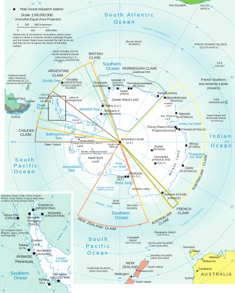
Seven of the Antarctic Treaty consultative member states maintain claims to sectors of Antarctic territory. As a consequence of the signing of the treaty, there is a virtual "freeze" of Antarctic disputes due to the prohibition of military activities not linked to scientific research, which eliminated the danger of incidents and wars, along with the spirit of cooperation and understanding. While the treaty is in force, territorial sovereignty claims over Antarctica that were asserted before the signing of the treaty will remain in force, but they cannot be extended nor are new sovereignty claims allowed. The treaty mentions them but does not recognize or reject them, preserving the rights of all parties.
In general, neither territorial claims nor the rights to make them are recognized by other countries or by the United Nations and almost all of them are based on the theory of polar sectors. Australia, New Zealand, the United Kingdom, Norway, and France mutually recognize their Antarctic claims. Argentina and Chile also mutually recognize Antarctic rights, without establishing a common limit, and call all of their Antarctic territories "South American Antarctica".
The seven countries that maintain sovereignty claims are:
- Argentina (Antártida Argentina), is the territory between 25°O and 74°O south of the 60°S, it is part of the Argentine Antarctic department, one of the five departments of the province of Tierra del Fuego, Antarctica and South Atlantic Islands. The claim was delimited in 1942 and partially overlaps with the Chilean and totally with the British.
- Australia (Australian Antarctic Territory, Australian Antarctic Territory), between 45°E and 136°E and between 142°E and 160°E, south of 60°S, 1933 claim, one of the seven outer territories of Australia.
- Chile (Antarctic Chilean Territory), between the 53°O and the 90°O (without the northern limit) defined in 1940, corresponds to the Antarctic commune, one of the two communes of the Chilean Antarctic Province, XII Magellan and Chilean Antarctic Region. Partially overlapped with the Argentine and British claim.
- France (Adelia Land, in French Terre Adélie), between 136°E and 142°E, south of 60°S, claim of 1924, one of the four districts of the Southern and French Antarctic Lands.
- Norway (Earth of Queen Maud, Norwegian Dronning Maud Land), between 20°O and 45°E (without limits defined in the north or in the south, it is generally understood that it only claimed the coast to protect its ballenary rights) claimed in 1938, and the island Pedro I (68°50'S 90°35'O), claim of 1929.
- New Zealand (Dependencia Ross, in English Ross Dependency), between 150°O and 160°E, south of 60°S, claim of 1923, as a dependent territory of New Zealand.
- United Kingdom (British Antarctic Territory, British Antarctic Territory), between the 20°O and the 80°O, south of the 60°S, claim of 1908 (with its current limits set in 1962) as an overseas territory, completely superimposed with the Argentine claim and partly with the Chilean one.
 |  |  |  |  |  |  |
| Argentina | Australia | Chile | France | New Zealand | Norway | United Kingdom |
Interested in participating in a future territorial distribution of Antarctica
Two original signatories to the treaty had previously rejected other countries' territorial claims, reserving their right to make them at any time if other countries asserted theirs:
- United States. By the expeditions of Admiral Richard Evelyn Byrd there were speculations that the United States would claim the Earth sector of Marie Byrd and tacitly reserved it by the United Kingdom and other claimant countries, but it was not carried out by application of the doctrine established in 1924 by then Secretary of State Charles Evans Hughes.
- Soviet Union (its rights and obligations under the treaty were assumed by Russia). A country that made a declaration of sovereignty over part of the Antarctica before acceding to the Antarctic Treaty.
Some countries made a reservation of rights when adhering to the Antarctic Treaty without specifying what type of right:
- Brazil reserved “the rights to protect its direct and substantial interests in Antarctica”.
- Ecuador made a “reservation of its rights based on the theory of confrontation or confrontation”.
- Peru made a “reservation of its land rights by leaning on the principle of confrontation and Antarctic influence in its climate, ecology and marine biology, also leading geological continuity and historical links”.
- Uruguay reserved “the rights that correspond to it in Antarctica in accordance with international law”.
Music in Antarctica
Despite being a remote continent, the world of music has begun to carry out actions, many of them for charity and to make the population aware of the importance of caring for the planet.
The Jaivas
In November 1983, the Chilean band Los Jaivas arrived in the white continent to record for the Friends always friends program on TVN. The recording was made at the Chilean FACh Teniente Marsh base and the program was broadcast in December 1983. The Guinness Book of Records cataloged it as the first program made in Antarctica.
Metallica
On December 8, 2013, the band Metallica performed for the first time a concert to "raise awareness of the importance of Antarctica for the planet", at the Carlini Antarctic Base. It was for approximately a hundred attendees; Assistants from nearby bases such as: Uruguay, Chile, Poland, South Korea, Russia, Brazil and Germany were also summoned. The recital was without using amplifiers and a rigorous protocol on environmental impact was used.
Other musicians
In 2016, the London bagpiper Irene Robinson offered a concert in Antarctica, as part of a charity campaign. That same year, musicians from the Argentine Armed Forces offered a recital for peace. "Among the songs chosen were Imagine, by John Lennon, and the tango Adiós Nonino, by the Argentine musician and composer Astor Piazzolla, both directed by Lieutenant Commander Ángel Marcelo Zurl", as reported. In November 2018, the Spanish guitarist Rafael Serrallet offered recitals in various places on the Antarctic continent and with this he became the first classical musician to hold concerts on all continents in the same year, with which he obtained a Guinness world record.
Motor Racing
On September 22, 2011, an unprecedented event took place in the history of the Antarctic continent, when it received a visit from a racing car for the first time. It was an expedition organized by the Argentine motoring entity Asociación Corredores de Turismo Carretera, who, after receiving an invitation from the Argentine Air Force and the Ministry of the Interior of that country, formed a delegation that embarked a competition car destined for Marambio Base. The delegation was headed by the then vice-president of the institution, Hugo Mazzacane, and by the former pilot Roberto Urretavizcaya. The entourage arrived at its destination aboard a Hercules plane, taking with it a Torino Cherokee unit decorated with the colors of the Argentine flag and prepared by motorist Alfredo Fernández. The exhibition was held on the runway of the Marambio Base, where for two hours, the vehicle was piloted by Mazzacane and Urretavizcaya to the delight of the inhabitants of the Military Base. Such a feat earned ACTC recognition from the Guinness Record for having been the first racing car to set foot on Antarctic soil and to have circulated on it.
Contenido relacionado
Uppsala Province
Albedo
Ivory Coast

