Annex: Municipalities of Cantabria

format_list_bulleted Contenido keyboard_arrow_down
ImprimirCitar
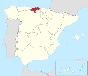
Situation of the community in the north of the Iberian peninsula
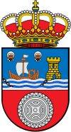
Cantabria shield.

Cantabria is one of the seventeen autonomous communities of Spain and is divided into 102 municipalities, in accordance with the territorial organization included in article 137 of the Spanish Constitution of 1978:

The State is organized territorially in municipalities, provinces and autonomous communities. All these entities enjoy autonomy in the management of their respective interests.
Spanish Constitution of 1978, Title VIII, Article 137.

The figure of the municipality is defined in the Law Regulating the Bases of the Local Regime as “the basic local entity of the territorial organization of the state”, with “legal personality and full capacity for the fulfillment of its purposes" and its elements are "the territory, the population and the organization".

The administration and government of the municipality is carried out through a collegiate body called the city council or mayor's office, headed by a one-person institution: the mayor. Until 2011, the municipalities of Tresviso and Pesquera were governed through a type of traditional assembly system called open council, but with the change in law, both abandoned this system to be governed through representation in mayors and councilors.

In general, municipalities have several locations, one of which is the municipal seat, which usually houses the town hall. Some municipalities have the name of one of their localities —whether it is their municipal seat or not— and others do not share a name with any of them. There may also be other infra-municipal government bodies that enjoy a certain degree of management autonomy. These are the so-called minor local entities, which correspond to villages, parishes or districts, whose legal representation resides in their neighborhood council. Each entity has a municipality code made up of five or six numbers; the first two correspond to the code of the province, the next three to that of the municipality within it and the last one is a control digit to detect errors.

It should be noted that the Campoo-Cabuérniga Commonwealth does not constitute per se a municipality, even despite the extension of its territory. It is a large communal property unique due to its size and characteristics, shared management between the municipalities of the Brotherhood of Campoo de Suso, Cabuérniga, Los Tojos and Ruente.

Municipal elections

Results of the Cantabria Municipal Elections
19871991199519992003200720112015
P 1votes106 58357 901107 823123 429133 907139 555152 423116 049
councillors416227372447424429478433
PSC-PSOEvotes95 171103 87389 77299 135102 97392 42570 88264 498
councillors290349282267256245196190
PRCvotes28 22718 96633 22149 89866 59273 78370 63471 952
councillors1006988217276302319325
IUvotes12 60913 78923 30211 67413 714564410 89014 445
councillors191627141581015
CDSvotes25 59110 66111261832747----
councillors6930020----
UPCAvotes-71 68341 6289179-----
councillors-28517029-----
UCnvotes----8226460---
councillors----151---
TOTALvotes298 552294 365312 772307 522336 708347 360346 383331 749
1 In 1987 it was presented as a Popular Coalition (AP-PDP-UL).

Municipal elections are held on the fourth Sunday of May every four years, coinciding with the regional elections.

The electoral system that they follow is regulated by the Organic Law of the General Electoral Regime (LOREG), and is based on voting through closed lists and the assignment of councilors following the D'Hondt system. The electoral threshold required for each candidacy to obtain representation is 5% of the valid votes cast.

Citizens of the countries of the European Union registered in Cantabria have the right to active and passive suffrage, in accordance with the laws that have been established to comply with European Council Directive 94/80/CE.

Citizens of countries with reciprocity agreements can also vote, including: Argentina, Bolivia, Brazil, Burkina Faso, Cape Verde, Chile, Colombia, South Korea, Ecuador, Iceland, New Zealand, Paraguay, Peru, Trinidad and Tobago, Uruguay, Venezuela. On the other hand, Spanish citizens residing in some non-EU countries such as Norway also enjoy the right to vote, despite the absence of a reciprocity agreement.

The number of councilors per municipality is assigned based on the people registered in it, according to the following relationship:

  • Up to 100 inhabitants, 3 councillors.
  • 101 to 250, 5 councillors.
  • 251 to 1000, 7 councillors.
  • From 1001 to 2000, 9 councillors.
  • From 2001 to 5000, 11 councillors.
  • From 5001 to 10,000, 13 councillors.
  • 10 001 to 20 000, 17 councilors.
  • From 20 001 to 50 000, 21 councillors.
  • 50 001 to 100 000, 25 councillors.

Map

Mapa municipal de Cantabria.PNG

List of municipalities

Code INE Municipality Population
(2022)
Surface
(km2)
Map Shield Flag Brotherhood
39001 Alfoz de Lloredo 2466 46.73 Alfoz de Lloredo (Cantabria) Mapa.svgEscudo de Alfoz de Lloredo (Cantabria) 2.svgAlfoz de Lloredo Spain.svg
39002 Ampu 4384 32,47 Ampuero (Cantabria) Mapa.svgEscudo de Ampuero.svgAmpuero Spain.svgFlag of France.svg Eauze
39003 Anievas 267 21.66 Anievas (Cantabria) Mapa.svgEscudo de Anievas.svg
39004 Arenas de Iguña 1734 86.15 Arenas de Iguña (Cantabria) Mapa.svgEscudo de Arenas de Iguña.svgArenas de Iguna Spain.svg
39005 Argoños 1848 5,56 Argoños (Cantabria) Mapa.svgEscudo de Argoños (Cantabria).svgArgonos Spain.svg
39006 Arnuero 2170 24,70 Arnuero (Cantabria) Mapa.svgEscudo de Arnuero (Cantabria).svgArnuero Spain.svg
39007 Arredondo 471 46,88 Arredondo (Cantabria) Mapa.svgEscudo de Arredondo (Cantabria).svgArredondo Spain.svg
39008 Shipyard, El 18 153 6.56 El Astillero (Cantabria) Mapa.svgEscudo de Astillero (Cantabria) 2.svgBandera de Astillero (Cantabria).svgFlag of Spain.svg Chiclana de la Frontera
39009 Bárcena de Cicero 4503 36,25 Bárcena de Cicero (Cantabria) Mapa.svgEscudo de Bárcena de Cicero.svgBarcena de Cicero Spain.svg
39010 Bárcena de Pie de Concha 663 30.54 Bárcena de Pie de Concha (Cantabria) Mapa.svgEscudo de Bárcena de Pie de Concha (Cantabria).svgFlag of Bárcena de Pie de Concha Spain.svg
39011 Bareyo 2149 32,30 Bareyo (Cantabria) Mapa.svgEscudo de Bareyo.svgBareyo Spain.svg
39012 Salt head 8208 33,23 Cabezón de la Sal (Cantabria) Mapa.svgEscudo de Cabezón de la Sal.svg
39013 Liébana head 574 81.43 Cabezón de Liébana (Cantabria) Mapa.svgEscudo de Cabezón de Liébana (Cantabria).svgCabezon de Liebana Spain.svg
39014 Cabuérniga 994 85.76 Cabuérniga (Cantabria) Mapa.svgEscudo de Cabuérniga.svg
39015 Camaleño 966 161.89 Camaleño (Cantabria) Mapa.svgEscudo de Camaleño (Cantabria).svgCamaleno Spain.svg
39016 Camargo 30 374 36,98 Camargo (Cantabria) Mapa.svgEscudo de Camargo (Cantabria).svgBandera Camargo.svgFlag of France.svg Cugnaux
39017 Campoo de Enmedio 3704 91.31 Campoo de Enmedio (Cantabria) Mapa.svgEscudo de Campoo de Enmedio (Cantabria).svgBandera de Campoo de Enmedio (Cantabria).svg
39018 Yuso field 688 89.47 Campoo de Yuso (Cantabria) Mapa.svgEscudo de Campoo de Yuso (Cantabria).svgCampoo de Yuso Spain.svg
39019 Carts 5781 18,93 Cartes (Cantabria) Mapa.svg
39020 Castañeda 3067 19,22 Castañeda (Cantabria) Mapa.svgEscudo de Castañeda (Cantabria).svgCastaneda Spain.svg
39021 Castro-Urdiales 33 109 96.06 Castro Urdiales (Cantabria) Mapa.svgEscudo de Castro Urdiales (Cantabria) 2.svgFlag of France.svg Air-sur-l'Adour
Flag of the Sahrawi Arab Democratic Republic.svg Bucraa
Flag of France.svg Cabourg
39022 Cieza 548 44,07 Cieza (Cantabria) Mapa.svgEscudo de Cieza (Cantabria).svgCieza Spain.svg
39023 Cillorigo de Liébana 1306 106.58 Cillorigo de Liébana (Cantabria) Mapa.svgEscudo de Cillorigo de Liébana (Cantabria).svgBandera de Cillorigo de Liébana.svg
39024 Colindres 8512 5,92 Colindres (Cantabria) Mapa.svgEscudo de Colindres (Cantabria).svgFlag of France.svg Le Haillan
39025 Comillas 2126 18,46 Comillas (Cantabria) Mapa.svgFlag of Italy.svg Arignano
39026 Corrales de Buelna, Los 10 742 45,29 Los Corrales de Buelna (Cantabria) Mapa.svgLos Corrales de Buelna Spain.svgFlag of France.svg La Haie-Fouassière
39027 Corvera de Toranzo 2115 50.04 Corvera de Toranzo (Cantabria) Mapa.svgEscudo de Corvera de Toranzo (Cantabria).svg
39028 Entrambasaguas 5418 43,19 Entrambasaguas (Cantabria) Mapa.svgEscudo de Entrambasaguas (Cantabria).svg
39029 Scale 759 18,81 Escalante (Cantabria) Mapa.svgEscudo de Escalante (Cantabria).svgEscalante Spain.svg
39030 Guriezo 2432 79.51 Guriezo (Cantabria) Mapa.svgEscudo de Guriezo (Cantabria).svgBandera de Guriezo (Cantabria).svg
39031 Doas de Cesto 1697 21.88 Hazas de Cesto (Cantabria) Mapa.svgEscudo de Hazas de Cesto (Cantabria).svg
39032 Brotherhood of Campoo de Suso 1601 223,02 Hermandad de Campoo de Suso (Cantabria) Mapa.svgEscudo de Hermandad de Campoo de Suso2.svgBandera de la Hdad de Campoo de Suso.svg
39033 Herrerías 594 40,00 Herrerías (Cantabria) Mapa.svgEscudo de Herrerías (Cantabria).svgHerrerias Spain.svg
39034 Lamason 258 70.52 Lamasón (Cantabria) Mapa.svgBandera de Lamasón (Cantabria).svg
39035 Laredo 10 967 15.30 Laredo (Cantabria) Mapa.svgEscudo de Laredo.svgBandera de Laredo (Cantabria).svgFlag of France.svg Cenon
Flag of the United States.svg Laredo
39036 Ling 1235 26,42 Liendo (Cantabria) Mapa.svgLiendo Spain.svg
39037 Liérgans 2423 36,85 Liérganes (Cantabria) Mapa.svgEscudo de Liérganes.svgFlag of Liérganes Spain.svg
39038 Clean 1993 9,977 Limpias (Cantabria) Mapa.svgEscudolimpias.jpgLimpias Spain.svg
39039 Luena 622 90.72 Luena (Cantabria) Mapa.svg
39040 Marina de Cudeyo 5170 29.30 Marina de Cudeyo (Cantabria) Mapa.svgMarina de Cudeyo Spain.svg
39041 Mazerras 2095 56.01 Mazcuerras (Cantabria) Mapa.svgEscudo de Mazcuerras (Cantabria).svgMazcuerras Spain.svg
39042 Middle Cudeyo 7663 26,43 Medio Cudeyo (Cantabria) Mapa.svgEscudo de Medio Cudeyo.svgMedio Cudeyo Spain.svg
39043 Meruelo 2212 16,36 Meruelo (Cantabria) Mapa.svgEscudo de Meruelo (Cantabria).svgMeruelo Spain.svg
39044 Miengo 5123 24,45 Miengo (Cantabria) Mapa.svg
39045 Miera 391 34,11 Miera (Cantabria) Mapa.svgEscudo de Miera.svgBandera de Miera.svg
39046 Molledo 1495 70.98 Molledo (Cantabria) Mapa.svgEscudo de Molledo (Cantabria).svgMolledo Spain.svgFlag of Spain.svg Molleo
39047 Noja 2664 9,27 Noja (Cantabria) Mapa.svgEscudo de Noja (Cantabria).svg
39048 Penagos 2207 31,67 Penagos (Cantabria) Mapa.svgEscudo de Penagos (Cantabria).svg
39049 Peñarrubia 317 53,06 Peñarrubia (Cantabria) Mapa.svgEscudo de Peñarrubia (Cantabria).svg
39050 Pesaguero 287 70.19 Pesaguero (Cantabria) Mapa.svgEscudo de Pesaguero.svgPesaguero Spain.svg
39051 Pesquera 79 8,83 Pesquera (Cantabria) Mapa.svgEscudo de Pesquera.svgBandera de Pesquera.svg
39052 Bats 26 279 84.31 Piélagos (Cantabria) Mapa.svgEscudo de Piélagos (Cantabria).svg
39053 Poles 216 89.76 Polaciones (Cantabria) Mapa.svgEscudo de Polaciones (Cantabria).svg
39054 Polanco 6126 17.61 Polanco (Cantabria) Mapa.svgEscudo de Polanco.svgBandera de Polanco (Cantabria).svgFlag of France.svg Bruges
39055 Potes 1330 7.66 Potes (Cantabria) Mapa.svgEscudo de Potes (Cantabria).svgPotes Spain.svg
39056 Bridge Viesgo 2894 35,91 Puente Viesgo (Cantabria) Mapa.svgEscudo de Puente Viesgo (Cantabria) 2.svg
39057 Branches of Victoria 2958 32,52 Ramales de la Victoria (Cantabria) Mapa.svgEscudo de Ramales de la Victoria.svgFlag of France.svg Malestroit
39058 Rasines 996 43,73 Rasines (Cantabria) Mapa.svgEscudo de Rasines.svgRasines Spain.svg
39059 Kingdom 8660 4.06 Reinosa (Cantabria) Mapa.svgEscudo del Ayto de Reinosa 2.svgBandera del Ayto de Reinosa 2.svgFlag of Spain.svg
Flag of Mexico.svg Reynosa
39060 Reoclin 8455 32.11 Reocín (Cantabria) Mapa.svgEscudo de Reocín.svgBandera de Reocín (Cantabria).svg
39061 Ribamontán al Mar 4695 37,67 Ribamontán al Mar (Cantabria) Mapa.svgEscudo de Ribamontán al Mar (Cantabria).svgRibamontan al Mar Spain.svgFlag of France.svg Bignoux
39062 Ribamontán al Monte 2436 42.30 Ribamontán al Monte (Cantabria) Mapa.svgEscudo de Ribamontán al Monte.svgFlag of Ribamontán al Monte Spain.svg
39063 Rionansa 1026 118.38 Rionansa (Cantabria) Mapa.svgEscudo de Rionansa.svg
39064 Riotuerto 1659 30.40 Riotuerto (Cantabria) Mapa.svgEscudo de Riotuerto.svgRiotuerto Spain.svg
39065 Rozas de Valdearroyo, Las 261 57.54 Las Rozas de Valdearroyo (Cantabria) Mapa.svgEscudo de Las Rozas de Valdearroyo.svgLas Rozas de Valdearroyo Spain.svg
39066 Ruente 1045 66.13 Ruente (Cantabria) Mapa.svgEscudo de Ruente.svgFlag of France.svg Savignac-les-Églises
39067 Ruesga 815 87.59 Ruesga (Cantabria) Mapa.svgEscudo de Ruesga.svgRuesga Spain.svg
39068 Ruiloba 759 15,21 Ruiloba (Cantabria) Mapa.svgEscudo de Ruiloba (Cantabria).svgBandera de Ruiloba (Cantabria).svg
39069 San Felices de Buelna 2373 36,18 San Felices de Buelna (Cantabria) Mapa.svgEscudo de San Felices de Buelna (Cantabria) 2.svg
39070 San Miguel de Aguayo 154 36,20 San Miguel de Aguayo (Cantabria) Mapa.svgEscudo de San Miguel de Aguayo.svgSan Miguel de Aguayo Spain.svg
39071 San Pedro del Romeral 460 57.31 San Pedro del Romeral (Cantabria) Mapa.svgEscudo de San Pedro del Romeral (Cantabria).svg
39072 San Roque de Riomiera 337 35,63 San Roque de Riomiera (Cantabria) Mapa.svg
39073 Saint Vincent de la Barquera 4030 41,74 San Vicente de la Barquera (Cantabria) Mapa.svgBandera de San Vicente de la Barquera (Cantabria).svgFlag of France.svg Pornichet
39074 Santa Cruz de Bezana 13 482 17,34 Santa Cruz de Bezana (Cantabria) Mapa.svgEscudo de Santa Cruz de Bezana.svgSanta Cruz de Bezana Spain.svgFlag of France.svg Martignas-sur-Jalle
39075 Santa Maria de Cayón 9192 47,64 Santa María de Cayón (Cantabria) Mapa.svgEscudo de Santa María de Cayón (Cantabria).svgSanta Maria de Cayon Spain.svg
39076 Santander 171 693 36,08 Santander (Cantabria) Mapa.svgEscudo de Santander.svgSantander.svgFlag of Mexico.svg San Luis Potosí
39077 Santillana del Mar 4250 28,50 Santillana del Mar (Cantabria) Mapa.svgCoat of Arms of Santillana del Mar.svgBandera de Santillana del Mar (Cantabria).svgFlag of France.svg Le Dorat
39078 Santiurde of Reinosa 242 31,14 Santiurde de Reinosa (Cantabria) Mapa.svg
39079 Santiurde de Toranzo 1711 36,32 Santiurde de Toranzo (Cantabria) Mapa.svgEscudo de Santiurde de Toranzo.svgSantiurde de Toranzo Spain.svg
39080 Holy 10 857 11,34 Santoña (Cantabria) Mapa.svgEscudo de Santoña (Cantabria).svgFlag of Santoña.svgFlag of France.svg Lons
Flag of Spain.svg Palos de la Frontera
Flag of Spain.svg The Port of Santa Maria
39081 Saro 520 18,02 Saro (Cantabria) Mapa.svgEscudo de Saro (Cantabria).svg
39082 Selaya 1849 39.12 Selaya (Cantabria) Mapa.svgEscudo de Selaya.svg
39083 Soba 1131 214,45 Soba (Cantabria) Mapa.svgEscudo de Soba (Cantabria).svgSoba Spain.svg
39084 Solórzano 1068 25,48 Solórzano (Cantabria) Mapa.svgEscudo de Solórzano.svgSolorzano Spain.svg
39085 Scope 9115 24,53 Suances (Cantabria) Mapa.svgEscudo de Suances (Cantabria).svgFlag of Suances.svgFlag of France.svg Bassens
39086 Tojos, Los 380 89.49 Los Tojos (Cantabria) Mapa.svg
39087 Torrelavega 51 142 35,53 Torrelavega (Cantabria) Mapa.svgBanderaTorrelavega-Cantabria.svgFlag of the Sahrawi Arab Democratic Republic.svg Zug
Flag of Cuba.svg Old Havana
Flag of Senegal.svg Louga
Flag of France.svg Rochefort-sur-Mer
39088 Three times 54 15,96 Tresviso (Cantabria) Mapa.svg
39089 Tudanca 150 52,57 Tudanca (Cantabria) Mapa.svgEscudo de Tudanca (Cantabria).svg
3909090 You guys 951 19,94 Udías (Cantabria) Mapa.svgEscudo de Udías (Cantabria).svgUdias Spain.svg
39091 Val de San Vicente 2801 51,04 Val de San Vicente (Cantabria) Mapa.svgEscudo de Val de San Vicente (Cantabria) 2.svgBandera de Val de San Vicente (Cantabria).svgFlag of France.svg Mios
39092 Valdáliga 2162 97.77 Valdáliga (Cantabria) Mapa.svgEscudo de Valdáliga (Cantabria).svg
39093 Valdeolea 905 83.64 Valdeolea (Cantabria) Mapa.svgEscudo de Valdeolea (Cantabria).svgValdeolea Spain.svg
39094 Valdeprado del Río 322 88.93 Valdeprado del Río (Cantabria) Mapa.svgEscudo de Valdeprado del Río (Cantabria).svg
39095 Valderredible 945 298,48 Valderredible (Cantabria) Mapa.svgEscudo Valderredible.svg
39096 Villaverde Valley 266 19,65 Valle de Villaverde (Cantabria) Mapa.svgEscudo de Valle de Villaverde (Cantabria).svgValle de Villaverde Spain.svg
39097 Vega de Liébana 713 132.86 Vega de Liébana (Cantabria) Mapa.svgEscudo de Vega de Liébana.svgBandera de Vega de Liebana (Cantabria).svg
39098 Vega de Pas 730 87.52 Vega de Pas (Cantabria) Mapa.svgEscudo de Vega de Pas (Cantabria).svg
39099 Villacarriedo 1640 50.96 Villacarriedo (Cantabria) Mapa.svgEscudo de Villacarriedo (Cantabria).svg
39100 Villaescusa 3937 28,41 Villaescusa (Cantabria) Mapa.svgEscudo de Villaescusa (Cantabria).svg
39101 Villafufre 1030 30.06 Villafufre (Cantabria) Mapa.svgEscudo de Villafufre (Cantabria).svgBandera de Villafufre (Cantabria).svg
39102 Vote 2876 77,82 Voto (Cantabria) Mapa.svgEscudo de Voto (Cantabria).svg

Contenido relacionado

Alba dry village

Aldeaseca de Alba is a Spanish municipality and town in the province of Salamanca, in the autonomous community of Castilla y León. It is integrated into the...

Annex: Municipalities of the province of Zamora

The Spanish province of Zamora, belonging to the autonomous community of Castilla y León, is divided into 248 municipalities, in accordance with the...

Veracruz (disambiguation)

Veracruz can refer to the following...
Más resultados...
Tamaño del texto:
undoredo
format_boldformat_italicformat_underlinedstrikethrough_ssuperscriptsubscriptlink
save