Andorran Geography
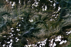
The Principality of Andorra (local name, Principat d'Andorra) is a state in southern Europe, situated in the eastern Pyrenees mountain range. It borders Spain to the south and France to the north.
Physical geography
It is a landlocked state, where there are important crossroads of the Pyrenees.
Relief
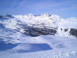
The area of Andorra, included in the Iberian Peninsula, is 468 km². It is on the southern slope of the Pyrenees. It is a region of steep mountain peaks and narrow valleys through which numerous watercourses flow. Its summits of paleozoic materials, in 65 cases above 2500 meters above sea level. The port of Envalira reaches 2410 m. The highest mountain is the Comapedrosa peak, which, with an altitude of 2942 meters above sea level. Its territory is basically divided into three Y-shaped valleys: the valley (vall in Catalan) of Valira del Este, the valley of Valira del Norte that join, then pass through Andorra la Vella and cross a third valley, that of the Valira river, which runs to the south, where it will join the Segre.
Rivers and lakes
Numerous streams flow through the valleys of Andorra, joining to form the Valira River. The Valira basin has the shape of a Y, with its two more tributaries: the Valira del Norte (Valira del Nord) and the Valira del Este (Valira d'Orient). The Valira del Norte is born in the Tristaina lakes, has a 14 km route and passes through the city of Ordino and La Massana until it reaches Escaldes-Engordany, where it joins the Valira del Este. This second tributary of the Valira rises in the easternmost part, has a route of 23 km and passes through the cities of Canillo and Encamp before reaching the city of Escaldes-Engordany. Together they form the Gran Valira, which covers 11.6 km. Its average annual flow is 13 cubic m³ per second. It runs south and ends up flowing into the Segre river, which, in turn, is a tributary of the Ebro.
Throughout the landscape of Andorra there are more than sixty mountain lakes typical of the entire Pyrenees. The most representative are Lake Juclar, whose surface area is the largest of all the lakes in the Principality with 21 hectares, and which, during the summer season and due to the consequent lack of water, seems as if they were three different lakes: Lake de l'Illa with 13 hectares, the Engolasters pond (artificial lake) with 7 hectares and the three lakes of Tristaina.
Climate
Andorra has a high mountain Mediterranean climate in which temperatures are cold in winter and mild in summer. There are variations in the climate depending on the altitude and orientation, because due to this mountainous orientation there are large thermal oscillations. The valleys have a climate that is similar to the temperate climate of Andorra's neighbors, but due to their higher altitude, winters tend to be harsher, humidity lower, and summers slightly cooler. Regions above the alpine tree line, at around 2,100–2,400 masl have an alpine climate and grasslands.
The average maximum and minimum daily temperatures in Escaldes-Engordany are, respectively, 28 °C and 15 °C in July and 11 °C and -2 °C in January. It can drop to 10 degrees below zero in winter and rise to 33 °C in summer. The average annual temperature varies from 11 °C in San Julián de Loria in the south, to 8 °C in La Massana in the center, and 2 °C in Arcalís in the north.
The principality has a very high percentage of sunny days. There are, on average, 300 sunny days a year. Mean daily peak insolation ranges from 1,150 W/m2 in June to 280 W/m² in December.
The climate is dry. The average annual rainfall is 1071.9 mm for the entire country, but it varies depending on the part of the territory, being higher with altitude and from south to north. The driest parish in the country is San Julián de Loria (800 mm per year) in the south, and the rainiest is Canillo (1100 mm per year) in the north. Annual rainfall can exceed 1,220 mm in the higher mountainous areas. The driest months tend to be January and February, and the rainiest, May, June and November. In the summer months there is little rain, but it can be very intense because it is associated with storms. At sunset is when there is more precipitation except in winter, which is mainly snow. Snow completely covers the northern valleys for several months. These moderate rainfalls allow crops in the summer.
Temperatures and precipitations in Andorra| Ene. | Feb. | Mar. | Open up. | May | Jun. | Jul. | Ago. | Sep. | Oct. | Nov. | Dec. | Year | |
| T° max (average) [°C] | 10 | 11 | 14 | 16 | 19 | 22 | 25 | 26 | 23 | 19 | 13 | 11 | 17.42 |
| T° min (average) [°C] | 1 | 2 | 4 | 5 | 9 | 12 | 14 | 14 | 12 | 8 | 4 | 2 | 7.25 |
| Precipitations [mm] | 34 | 37 | 46 | 63 | 105 | 69 | 65 | 98 | 81 | 73 | 68 | 69 | 808 |
Source: "Climate Issues" of Andorra, in colonialvoyage.com.
Environment
Andorra is home to the Pyrenees forest ecoregion, which is part of the "Temperate broad-leaved forest" biome. There are large forested areas of pine and birch due to the high mountain Mediterranean climate that the country has. Forests occupy 2/5 of the territory, according to three altitudinal floors:
- up to 1200 msnm, oaks and oaks;
- up to 1600-1700 msnm predominates the wild pine; and
- up to 2200-2300 msnm abounds the black pine, replaced at the summits by the alpine meadows.
La Massana maintains one of the most important forest masses in Andorra (Bosc D'Arinsal). In 2004, the Madriu-Perafita-Claror valley was declared a World Heritage Site by Unesco. In addition, it has two areas protected as hunting reserves, Enclar (2,500 hectares) and Xixerella (750 ha).
Human Geography
The population is 83,888 inhabitants (July 2009 est.), which gives a population density of 179.25 inhabitants per square kilometer. The urban population is 89% of the total (2008), concentrating on the populations of Andorra la Vella and Escaldes-Engordany, where the main economic activities of the country are carried out. The rest of the population is dispersed in rural areas.
As for ethnic groups, the main one is Spanish 43%, followed by Andorrans 33%, Portuguese 11%, French 7% and others 6% (1998). The official language is Catalan, although Spanish, French and Portuguese are also spoken. The predominant religion is Catholicism. Religion: Catholicism.
The capital is Andorra la Vella, which has 24,574 inhabitants (2007) and is the seat of government. They are followed in population by Les Escaldes, Encamp, San Julián de Loria and La Massana.
Andorra is divided into seven territories called parishes. They are merely administrative without their own autonomy; in turn, have minor divisions. They are: Canillo, Encamp, Ordino, La Massana, Andorra la Vieja, San Julián de Loria and Escaldes-Engordany
Economic geography
Human activity is centered in the northeast-southwest transversal valley, which from the Port of Envalira (2,407 m) descends to 840 m, when the Valira river enters Spain.
Andorra's natural resources are concentrated in hydroelectric power, mineral water, wood, iron ore and lead. Arable land represents 2.13% of land use. 0% is dedicated to permanent crops and another 97.87% (2005). The Les Escaldes hydroelectric power station provides energy for Andorra and the surplus is exported to France and Spain.
Agriculture employs 0.3% of the active population, industry 20.8% and services 79% (2007). There are no data on the composition of GDP by sector. But it is estimated that tourism, the main pillar of Andorra's small and wealthy economy, accounts for more than 80%. An estimated 2 million tourists visit it each year, attracted by its duty-free status and its winter and summer resorts. Andorra's comparative advantage has recently diminished as the economies of neighboring France and Spain have opened up, providing greater availability of consumer products and lower customs duties. The banking sector, with its partial tax haven status, also contributes substantially to the economy. Agricultural production is limited, as only 2% of the land can be plowed. Produces small amounts of rye, wheat, barley, oats, and greens; most of the food must be imported. The main livestock activity is sheep farming. The main industry is tourism, particularly the practice of winter sports, cattle raising, timber, banking, tobacco (cigarettes and cigars), as well as furniture.
It has 320 km of roads (2008). There are no railways or waterways.
See also
- Geography
- Andorra
References
- "Europe:: ANDORRA" Archived on June 12, 2007 at Wayback Machine., CIA - The World Factbook (in English)
- Notes
- ↑ a b Andorra – Escaldes,Weather Underground
- ↑ a bc Climate Atlas of Catalonia. Period 1961-1990. Catalan Meteorological Service, Generality of Catalonia (in Catalan).
- ↑ Andorra – The Principality in Figures (2007), p.16, Andorra Turisme / Department of Studies and Statistics
- ↑ UNESCO World Heritage Centre. Consultation on 6 February 2009.
External links
- Page of the Government of Andorra (in Catalan)
- Portal de información sobre Andorra
Contenido relacionado
Fasnia
Cordoba (Spain)
Saint Sebastian


