
Alvaro Obregon (Mexico City)
Álvaro Obregón is a territorial demarcation of Mexico City, located southwest of the Mexican capital. It borders to the east with the municipalities of Benito Juárez and Coyoacán, to the south with Magdalena Contreras and Tlalpan, to the north with Miguel Hidalgo and to the west with Cuajimalpa de Morelos and the municipality of Tianguistenco, State of Mexico. It is the third most populated demarcation of Mexico City, only behind Iztapalapa and Gustavo A. Madero with more than 750,000 inhabitants.
Geomorphology
The relief in the mayor's office comprises two regions: the plains and hills and the mountains and stony region. The first included to the east of the mayor's office, in its limits with Benito Juárez and Coyoacán, and to the west up to the base of the Sierra de las Cruces. Here are included the low and flat lands, almost at the level of the old lake of Texcoco; the hills can be considered as far as the slopes of the high mountains to the south and west. The plains and the hills do not offer great differences, since the height of the hills, with respect to the level of the plain, does not exceed 100 m; They have a height above sea level of about 2,265 m and the hills are about 2,340 m on average. Its slopes are 1.5° and are made up of a network of ravines that alternate with dividing lines with a maximum width of 100 m.
Toponymy
The mayor's office is named after the revolutionary, politician, and military man Álvaro Obregón, who was president of Mexico from 1920 to 1924.[citation required]
Demographics
Population
The total population of the demarcation was 759,137 inhabitants in 2020. It is the third most populous municipality in Mexico City. The first two are Iztapalapa and Gustavo A. Madero. The study recorded that 47.6% of the population are men (346,041) and 52.4% are women (380,993), therefore, for every 91 men there are 100 women. Regarding the total population and the average annual growth rate, the report indicates that 32,103 more people live in the Álvaro Obregón mayor's office than ten years ago. Regarding the structure of the population, the report indicates that 163,655 Obregonenses are between 0 and 14 years of age; 500,501 people range from 15 to 64 years of age; while 53,672 people are over 65 years of age. The data was collected in the Population and Housing Census carried out in 2020.
- Evolution.
| 1995 | 2000 | 2005 | 2010 | 2020 |
|---|---|---|---|---|
| 676 930 | 687 020 | 706 567 | 727 034 | 759 137 |
Politics
Delegation heads
- (1997 - 2000)
 Guadalupe Rivera Martín
 - (2000 - 2003)
 Luis Eduardo Zuno Chavira
 - (2003 - 2006)
 Leticia Robles Colín
 - (2006 - 2009)
 Leonel Luna Estrada
 - (2009 - 2012) Eduardo Santillán Pérez
- (2012) Erick Alejandro Reyes León
- (2012 - 2015)
 Leonel Luna Estrada
 - (2015 - 2018) María Antonieta Hidalgo Torres
Mayors
- (2018 - 2021)

 Layda Sansores San Román
 - (2021) Alberto Esteva Salinas
- (2021 -)
 Lía Limón García
Administration
The organic structure of the Álvaro Obregón mayor's office is made up as follows:
- Mayor: Lía Limón García (from October 2021 to 2024)
- General Directorate of Government: Mariana Rodríguez Mier and Terán
- General Directorate of Administration: Claudia Islas Lagos
- General Directorate for Social Development: María Antonieta Hidalgo Torres
- General Directorate of Urban Services: Manuel Enrique Pazos Rascón
- General Directorate of Works and Urban Development: Margarito René Chicho Escobar
- General Directorate of Citizen Security: Angel Luna Pacheco
- Directorate General of Culture: Rubén Tepox López
Territorial organization
Álvaro Obregón was assassinated in the La Bombilla restaurant in San Ángel by cartoonist José de León Toral. Four years after the assassination, when Pascual Ortiz Rubio was president of Mexico, he issued a decree to change the name of the Delegación San Ángel to Villa Álvaro Obregón, to commemorate the person who out of the military, president of Mexico and promoter of the Revolution. After 38 years of being called Villa Álvaro Obregón, in 1970 a new decree was formed to reorganize Mexico City. 16 political delegations were established and from then on this demarcation is formally called the Álvaro Obregón delegation. After the political reform of Mexico City in 2015, it received the name of the Álvaro Obregón territorial demarcation.
Territorial addresses
The Álvaro Obregón mayor's office has 7 territorial addresses, these being the following:
- San Angel
- Eagles
- Plates
- Centennial
- The Era
- Jalalpa
- Tolteca
Urbanism
Demarcation environment
It is made up of 257 colonias, subdivisions and neighborhoods, including San Ángel, San Ángel Inn, Tlacopac (which means place between the rockroses or reeds), Ermita Tizapán, Chimalistac, Guadalupe Inn, Florida, Jardines del Pedregal, and the majority of the colonies that make up the Santa Fe area. In addition, this jurisdiction has towns with rural characteristics such as San Bartolo Ameyalco and Santa Rosa Xochiac. Where the Lomas de la Era neighborhood is located, previously there was a river where the first settlers carried water to drink, likewise they went to wash there or in the San Bartolo laundries, unfortunately with the arrival of more people that river has been used to dispose of our drains and most of the trees have been removed to build homes.
The Álvaro Obregón mayor's office is home to some of the wealthiest neighborhoods in the country, such as the towns of San Ángel, Tlacopac, and Chimalistac, or the Colonia Jardines del Pedregal to the south, and the area of Santa Faith in the limits with the Cuajimalpa mayor's office, towards the west. Other neighborhoods with medium-high and high purchasing power converge within them, such as: San Ángel Inn, Florida, Altavista, Campestre, Tlacopac, Guadalupe Inn, Lomas de Tarango, Colinas del Sur, Las Águilas, or Villa Verdún. In the same way, there are middle-class nuclei scattered throughout the demarcation, such as the San Pedro de los Pinos, Tetelpan, Plateros, Merced Gómez, COVE, Progreso Tizapán, Axotla and Alpes neighborhoods; and of a popular nature such as: Observatorio, La Cascada, Presidentes, Américas, Alfonso XIII, Molino de Rosas, Olivar del Conde, and the Town of Santa Fe. In the demarcation there are also several irregular settlements on the ravines and plains of the old rivers of Mixcoac, Tacubaya and San Borja that present high degrees of marginalization. Within these are neighborhoods such as El Cuernito, Golondrinas, La Araña, Punta del Ceguayo, La Providencia, Tepeaca, Ave Real, La Mexicana, El Ruedo, El Queso, Llano Redondo, Primera Victoria, Jalalpa, Barrio Norte, among others.
Neighborhoods and towns
In the mayor's office you can also find small portions of rural and semi-urban towns and colonies with a certain degree of marginalization located on the border with the Desierto de los Leones to the southwest, such as Santa Rosa Xochiac and San Bartolo Ameyalco. The Mayor has 5 towns which are:
| Peoples | |
|---|---|
| San Angel | |
| Axotla | |
| Santa Fe | |
| Santa Rosa Xochiac | |
| San Bartolo Ameyalco |
Álvaro Obregón is also one of the municipalities with a rural area and wooded mountainous areas, among the towns located in the mountains are: San Bartolo Ameyalco, Santa Rosa Xochiac, El Desierto de los Leones and also Tizapán (which comes from tizatl, 'plaster' or 'clay'; pan: 'in', 'on', 'on top', meaning "place on the chalk"), an area that in recent years has changed from being a town as it was called twenty years ago, with the advantage of having all the services since it is surrounded by San Ángel and Pedregal. The mountainous areas located in this municipality reach 3800 m s. no. m. (meters above sea level), where there are ideal places for hiking, camping and high mountain walks.
From north to south, between the road called Altavista - Calzada al Desierto de los Leones and Avenida Barranca del Muerto and to the west, between Calzada de los Leones and Avenida Revolución, there is an old settlement called Pueblo Tlacopac, which In the Nahuatl language it means 'place between the jaras or reeds'. From this place it was possible to access on foot, up to some of the upper parts of what is now called the "Las Águilas" neighborhood.
Tlacopac, is a typical area, the layout of its main street, the location of its parish and its cobbled streets and alleys, invites you to learn about its participation in the history that has forged our country from this city.
The Magdalena River flows through the town hall, the last living river in the city that suffers a serious pollution problem, although its cleaning and beautification of the surrounding environment is planned.
Similarly, in the past, in the surroundings of Periférico and Plateros, the General Asylum of La Castañeda was located, established in the year 1910 by the former president, Porfirio Díaz, to celebrate 100 years of Independence. This had a double function of hospital and asylum for the psychiatric care of mental patients of both sexes, of any age, nationality and religion. Due to the terrible conditions in which the inmates were in La Castañeda. In 1964, President Adolfo López Mateos founded the "Miguel E. Schulz" National Preparatory School 8 in the neighboring territories of La Castañeda. The government of Gustavo Díaz Ordaz decided, in 1967, to inaugurate farm-hospitals located on the outskirts of the city, where the 5,000 inhabitants of the old mental hospital were transferred. The majestic French-style façade of the hospital survived, which stone by stone was moved from Mexico City to Amecameca by the Legionaries of Christ.
Some neighborhoods of the mayor's office are located in areas of sand mines, such as Olivar del Conde, Presidentes, Capula, Piloto, Bellavista among others and are classified as a "high-risk mined area"; in 2005 in the Olivar del Conde neighborhood is where the most cavities have been located, and from last year to date, through a collaboration agreement with engineers from the National Autonomous University of Mexico (UNAM), 21 mines were identified, of three of which were considered very high risk.
This town hall is home to the facilities of the National Defense Secretariat, Military Camp No. 1-F Santa Fe.
Even with the programs that are carried out in these demarcations for the desolvation of the dam with sewage, such as the one located in Minas de Cristo avenues, the population of the surrounding neighborhoods continues to use these places as garbage deposits, for which reason the Authorities have to create new strategies to counteract the problems that exist with the lack of culture in garbage management.
Recently, green areas as well as parks have been recovered, remodeling and placing children's games for the recreation of the families living in this delegation, the green areas have been reforested in places, sports fields and running tracks have been placed, this increases the sport and decreases the misuse of these facilities, security booths were placed; Now you can walk through these places and exercise.
Cleaning tasks are also carried out in avenues and in dams, families still disposing of garbage in them, causing flooding due to their clogging.
On the other hand, to help low-income families, the government has installed soup kitchens where they can go for subsidized food, contributing to the family economy of low-income groups.
Sites of cultural interest
Cultural facilities and entertainment
These are some points of interest that can be found within the Álvaro Obregón demarcation:
- Centro Cultural San Angel
- El Carmen Museum
- Museo Casa Estudio Diego Rivera y Frida Kahlo
- Art Museum Carrillo Gil
- Museo Casa del Risco
- Soumaya Museum of Loreto Square
- The Carmen Art Gallery
- Parque De La Bombilla
- Ecological Park El Batán
- Plaza San Jacinto
Public services
Public administration
The branch office building, which concentrates the administration, is located in the Tolteca neighborhood, next to the Parque de la Juventud.
Some of the services offered by the municipality to its inhabitants are:
- Anonymous reporting of crimes.
- Anonymous denunciation of atros in the colonies.
- Anonymous report on drug sale.
- Legal buffet (free).
- Health Brigades and Social Assistance.
- Prevention programmes for women.
- Days of sterilization of pets.
Programs against alcoholism
It is also in this town hall where the program, pioneer of its kind, of 00:00 (Zero Hours-Zero Alcohol) was implemented, which prohibits the sale of alcohol after 12 a. m., in order to reduce the abuse, damage and serious consequences that alcohol abuse entails, as well as promote the prevention of violence, crime and addictions in the demarcation, promoting better coexistence and security among its inhabitants.
Transportation
Minibus routes
UNION OF LICENSEES AND TAXI DRIVERS TODAY Route 4 (Observatory, Tacubaya to Cuajimalpa de Morelos and the area of Las Águilas)
Union of Permit Holders Taxi Drivers and Ramales A.C. Route 5 (Santa Fe (Mexico City), Lomas de Tarango, La Mexicana, Santa Lucía, Belén de las Flores via Vasco de Quiroga to the Tacubaya Metro)
Route 6 (Mount of Crosses)
Ruta 15 Poniente(It crosses the town hall from north to south)
Route 24 (Cross the neighborhoods in the center of the mayor's office)
General Carrier Organization of Cerro del Judío, Ramales A.C. Route 42 (Hill of the Jew)
Route 43 (Santa Rosa Xochiac and San Bartolo Ameyalco) and Lomas de la Era
Route 45 (San Ángel (Mexico City), Colonia Florida (Mexico City), Chimalistac, San Ángel Inn to Universidad metro (Mexico City Metro station))
Route 46 (The favelas of the mayor's office from Line 7 of the Mexico City Subway from the Tacubaya Subway (station))
Route 47 (Civil Cemetery of Dolores and surrounding colonies)
Route 54 (Molino neighborhood of Santo Domingo)
Route 76 (Lomas de Chapultepec, Santa Fe (Mexico City), Dinamos de Contreras, Monte de las Cruces and the municipalities of Huixquilucan and Ocoyoacac)
Route 114 (Mount of Crosses)
Mexico City Subway

| Station | Line |
|---|---|
| Observatory | |
| Living/Human rights | |
| Miguel Angel de Quevedo | |
| Barranca del Muerto | |
| Valentine's Day | |
| Álvaro Obregón |
Metrobus
Line 1 of the Mexico City Metrobús also provides service to the delegation, having the following stations:
- José María Velasco
- France
- Olives
- Altavista
- The bulb
- Doctor Gálvez
The Poniente Bus Terminal is located in the Real del Monte neighborhood and provides service to many cities, municipalities and states of Mexico such as Jalisco, Querétaro, Michoacán or the State of Mexico. To access said property, you can use the Observatorio Metro station or transiting on Avenida Tacubaya or Camino Real to Toluca.
Line 2 of the Ecobús system (run by Mobility System 1) runs from the Miguel Ángel de Quevedo metro station to the commercial area of Santa Fe.
Roads
Its main roads are:
- West and South peripheral
- Av. Altavista
- Av. Revolution
- Saint Lucia
- Miguel Angel de Quevedo
- Av. Centennial
- Av. South insurgents
- Av. University
- Av. Tacubaya
- Axis 10 South
- Eagles ' Footwear
- Camino Real a Toluca
- Road to the Desert of Lions
- Axis 5 Poniente
- Supervia Poniente
- Av Barranca del Muerto
- South peripheral
- Vasco de Quiroga
- Av. Silver Lomas
Road infrastructure
- Bridges of “Los Poetas Jaime Sabines, Carlos Pellicer and Octavio Paz”
- Peripheral ring
- Avenida Luis Cabrera
- Road distributor "San Antonio"
- Rio Becerra
Education
Primary and secondary schools, and upper secondary institutions
- Instituto de Educación Media Superior del Distrito Federal (IEMS):
- Preparatory «Gral. Lazaro Cárdenas del Río» (SBGDF)
- Alvaro Obregón II Preparatory School “Vasco de Quiroga”
- UNAM National Preparatory School:
- National Preparatory School 8 "Miguel E. Schulz" (UNAM)
- Center for Scientific and Technological Studies No. 4 "Lázaro Cárdenas del Río" (IPN)
- Centro de Estudios Tecnológico Industrial y de Servicios N.o 52 (DGETI)
- Centro de Estudios Tecnológico Industrial y de Servicios N.o 10 (DGETI)
- National College of Technical Professional Education. 101 Alvaro Obregón I (CONALEP)
- National College of Technical Professional Education. 102 Alvaro Obregón II (CONALEP)
- Centro de Estudios de Bachillerato 4/2 «Lic. Jesus Reyes Heroles» (DGB)
- Alberto M. Alvarado Primary School
International private schools:
- ASF Mexico, American International School
- Edron Academy, British International School
- Liceo Mexicano Japanese, the Japanese international school, in Jardines del Pedregal.
- Peterson College Pedregal, an American International School
- Plantel Pedregal, with Kindergarten of the South Campus (Campus Süd) of the German College Alexander von Humboldt, the German international school.
Other private schools:
- Columbia College.
- Kindergarten and elementary schools at Princeton College
- Colegio Olinca plantel Altavista
- Junipero College (private primary school) (Col. Las Américas)
- Colegio Vermont Plantel Pedregal
- Instituto Francisco Possenti
- Instituto Miguel Angel
- Oxford Institute
- College Oxford Baccalaureate
Institutions of Higher Education
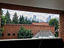 View of the Universidad Iberoamericana towards the corporate Santa Fe

- Tecnológico de Monterrey Campus Santa Fe
- Instituto Tecnológico Autónomo de México (ITAM)
- University Westhill Santa Fe
- Westhill Institute
- Centro de Estudios Superiores de San Angel
- Universidad Iberoamericana Ciudad de México
- Anáhuac University of the South
- University of the Valley of Mexico
- American University
- Universidad Motolinia
- Universidad Latinoamericana
- National School of Child Garden Teachers
- Military War Materials School
- Instituto Tecnológico de Álvaro Obregón (ITAO)
Health services
ISSSTE
The Hospital «Dr. Fernando Quiroz Gutiérrez» of the ISSSTE is located in Calle Canario corner Felipe Ángeles s/n. It is a general hospital, it has adult emergency services, pediatric emergencies, external consultation, North hospitalization, South hospitalization, labor, nurseries, intensive therapy, operating rooms, cafeteria, dining room, government offices. The Sección Sindical XLVII is also located in the hospital.
The Regional Hospital «Lic. Adolfo López Mateos”, is a tertiary care hospital that cares for the beneficiaries of the southern regional delegation of ISSSTE. It is recognized locally and nationally as a reference hospital.
Ministry of Health (Sedesa)
General Hospital "Dr. Enrique Cabrera of the Ministry of Health is located at the intersection of the Prolongación Av. 5 de Mayo and Av. Centenario no. 3170. It has several specialties and services, as well as an emergency area.
IMSS
The "Gilberto López Izquierdo" hospital of the IMSS is the General Hospital of the Zone with Family Medicine and has an Emergency Medical Unit, located at Av. Río Magdalena n.º 289 Colonia Tizápan San Ángel.
The Hospital de Gineco-Obstetricia Luis Castelazo Ayala with UMF no. 4 of the IMSS, located at Av. Río Magdalena without number. Colonia Tizapan San Angel.
Family Medicine Unit with IMSS Outpatient Medical Unit No. 161, located at Av. Toluca # 160 Col. Olivar de los Padres c.p. 098800
Economy
Established companies
Volaris is headquartered in Colonia Zedec, Santa Fe: Antonio Dovalí Jaime, no. 70, Tower B, 13th floor. Another institution is InfoMED, International News Agency (InfoMED News Press) based in the Unidad Habitacional Hills of Plateros. Grupo Bimbo is headquartered in Santa Fe and Álvaro Obregón. Corporativo Bimbo, S.A. de C.V. Prolongation Paseo de la Reforma No. 1000, Col. Peña Blanca Santa Fe, Alcaldía Álvaro Obregón, Mexico City, 01210.
Heritage

The lower part of the mayor's office is distinguished by its neighborhoods with mansions, its neighborhoods with great tradition, parks, and colonial churches located in the San Ángel, San Ángel-Inn, and Chimalistac neighborhoods; contrasting with the modern architecture of Santa Fe in the western part and adjoining the Cuajimalpa City Hall. Some places of interest are: the Plaza de San Jacinto, where the monument in homage to the San Patricio Battalion is located, the Saturday Bazaar, the Flower Market, the Plaza de los Arcángeles, the Casa del Risco, the Monument to General Álvaro Obregón, the ex-Hacienda de Goycochea, the chapel of San Sebastián Chimalistac, the House of the Dolphins, the Church of San Jacinto, the Church of El Carmen, the House of the Mayorazgo de Fagoaga, the House-studio of Diego Rivera, the Chamber of Secrets, Plaza del Carmen, El Desierto de los Leones, Plaza San Jacinto, the corridor of bars and restaurants on Av. de la Paz, the Hellenic Theater, the San Ángel Cultural Center and the Carmen and Carrillo Gil.
The latter has a functionalist architectural plan designed in the mid-1950s by the architect Augusto H. Álvarez, commissioned by Dr. Álvar Carrillo Gil. It is a building made expressly, to serve as a museum, although it was occupied for a few years as a local offices and offices. In 1974 it was inaugurated as a museum; Since then it has undergone several modifications, the most important of which completely transformed the façade of the building in 1985.
The southern part of the City Hall, covered by volcanic rock resulting from the explosion of the Xitle volcano, was hit in the middle of the XX century of a singular urban project upon being chosen by Luis Barragán for the Jardines del Pedregal subdivision; Very little remains of the mansions built under the original concept as they are the object of real estate pressure in the western part of the city.
In the San Ángel area, in the direction of Anillo Periférico Sur, the offices of the Televisa Company are located, which previously belonged to Televisión Independiente de México, but when these facilities merged, they became part of Telesistema Mexicano, the which constituted what is now called Televisa.
In the Alfonso XIII neighborhood there is an emblematic park called Montecarmelo where young people gather to carry out various outdoor activities, and dance and aerobics classes are held at night in the park kiosk.
The Parque de la Juventud was created in the vicinity of the delegation headquarters, next to it, it is equipped with soccer fields, fast football and basketball, as well as two children's play areas. In addition to having the Youth Theater, a multipurpose room, two small forums, which are rented for various events, whether school or cultural, a traffic education area, where children can go with their bicycles, skateboards or tricycles, and they learn as a game how to pay attention to and respect road signs; and a House for the Elderly.
Monument to Álvaro Obregón
Located in a large park on Avenida de los Insurgentes that marks the access to the San Ángel neighborhood, the monument to Álvaro Obregón is an urban landmark of mandatory reference in the south of Mexico City.
This monument was erected in 1935 to commemorate the assassination of President Álvaro Obregón in 1928 in this same place. This event happened in the context of a meal at the elegant restaurant "La Bombilla" that was located in the middle of the Chimalistac orchards that once belonged to the Convento del Carmen. At said meal, held on July 17, 1928, the then president-elect was assassinated by José de León Toral.
The monument consists of a large hollow tower inside that presents a wide access stairway guarded by two large stone sculptures made by the artist Ignacio Asúnsolo. Inside the monument there is a large room that previously housed an extremely grotesque object that consisted of the hand that Obregón had lost in a battle earlier and that has since been withdrawn. In this work it is possible to detect a strong influence of art deco that is manifested in the volume of the monument itself as well as in the geometric character of the sculptural groups that make it up. In front of the Monument there is a large mirror of water lined with cypresses and rose bushes that enhance the place and make it a pleasant place to walk for office workers from nearby corporate buildings.
World Heritage Site
In 2011, the Legislative Assembly of the Federal District (ALDF) requested the Federal District government to promote the Chimalistac area as Cultural Heritage of Mexico City. The initiative seeks to protect the cultural and architectural wealth of the area against the constant increase in departmental developments. It should be noted that the architectural wealth of the Chimalistac area was the source of inspiration for the novel "Santa" written by Federico Gamboa in 1903.
Hall of Multiple Uses and Theater of Youth, in the delegation Alvaro Obregón, CDMX.

Longing 10th Street, Viality of access to the facilities of the Youth Park, in the delegation Alvaro Obregón, CDMX.

Entrance to the Youth Sports Park, in the delegation Alvaro Obregón, CDMX.
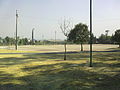
Football courts in the Batallón Park of San Patricio, in the delegation Alvaro Obregón, CDMX.
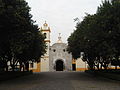
Parroquia de la Asunción de Santa María,Colonia Santa María Nonoalco, Delegación Álvaro Obregón, CDMX.


Festivities and traditions
The celebration of each of the patron saint festivities that are celebrated in the different colonies and that according to their economic possibilities are placed: Fairs, Exhibitions, Sale of Articles and Food, as well as fireworks. In some of the towns there are troupes of dancers such as "Chinelos y Arrieros" who visit the different traditional towns.
| Date | Holiday | Neighborhood, colony or village |
|---|---|---|
| 1 January | Feast of the Virgin of Guadalupe | Col. Santa Rosa Xochiac |
| 1 January | Feast of the Sweet Name of Jesus | Col. San Bartolo Ameyalco |
| 1 January | Kings Day Festival (variable date) | Youth Park |
| 1 January | Patron Festival | Pueblo de Axotla San Sebastián Mártir |
| 5 February | Feast of Saint Philip of Jesus | Col. José Ma. Pino Suárez |
| 13 February | Feast of Our Lady of the Way | Col. Proal Heron |
| 14 February | Variable Dance of Friendship | Theater of Youth |
| 14 February | Variable Higher Middle-level Dance Meeting | Theater of Youth |
| Second Sunday of February | Celebration in the image of Lord Nazarene | Pueblo de Axotla San Sebastián Mártir |
- March
02 Feast of Our Lady of Hearts Col. Olivar de los Padres 03 Feast of the Sacred Heart of Jesus Col. José Ma. Pino Suárez 19 Feast of Saint Joseph Tizapan Progress 19 Feast of Saint Joseph Col. San Jose del Olivar
- April
Variable Children's Day Festival Puppet Carnival. Youth Theater, Youth Park and Social Centers holy week in the chapel of the Sagrada Família cabbage. royal bird
- May
Variable Mother's Day Festival Youth Park Variable Teacher's Day Festival Youth Park
- June
24 Feast of San Juan Col. Molino de Santo Domingo Variable Father's Day Festival Youth Park and Bombilla Park Variable National Environment Day Pinta Bardas Contest A Pigeon for Ecology Youth Park Variable Thursday of Corpus Christy Col. Corpus Christy
- July
16 Patronal Festival of the Virgen del Carmen Col. Alfonso XIII Feast of the Virgen del Carmen Col. Molino de Rosas Feast of the Virgen del Carmen Col. Sacramento Traditional Festival of the Virgen del Carmen Col. San Angel Variable Festival of Flowers Col. San Angel Variable Summer Workshops Youth Park and Social Centers
- August
2 Feast of Our Lady of the Angels Col. Lomas de los Angeles Tetelpan 15 Feast of the Virgin of the Assumption Col. Proletarian Liberation 15 Feast of the Virgin of the Assumption Col. The Tree 24 Patronal Festival of San Bartolo Col. San Bartolo Ameyalco
- September
08 Patronal Festival of the Virgin of the Nativity Col. Tetelpan 15 Ceremony of the Cry of Independence San Angel Cultural Center 24 Feast of the Virgin of Mercy Col. Merced Gomez 29 Feast of Saint Michael Col. La Joya Variable National Holidays Festivities in different colonies and towns.
- October
04 Patronal Feast of Saint Francis of Assisi Col. Town of Santa Fe Feast of Saint Francis of Assisi Col. Zenon Delgado 23 Feast of Saint Raphael Col. Jalalpa - Road
- November
08 Feast of the Virgin of the Conception Col. La Palmita 22 Feast of Saint Cecilia Col. Pirul Santa Lucia Feast of the Virgin of Santa Cecilia Col. Preconcrete Feast of Saint Lucia Col. Olivar del Conde 25 Feast of Santa Catalina Col. Barrio Norte Festival of Axotla and United Peoples (Santa Rosa Xochiac, Santiaguito, San Bartolo, etc.)
- December
08 Feast of the Virgin of the Conception Col. Ladera Grande Patronal Festival of the Virgin of the Conception Col. Alpes Expansion Feast of the Virgin of the Conception Col. La Conchita Feast of the Virgin of the Conception Col. Pirul 1st Expansion 08 Feast of the Virgin of the Immaculate Conception Tlacopac Town
12 Festival of the Virgin of Guadalupe Col. Palmas Axotitla and Col. Jalalpa el Grande.
12 Feast of the Virgin of Guadalupe Col. Lomas de Chamontoya (celebration that begins on the 11th at midnight with the morning).
13 Patronal Festival of Santa Lucía Col. Santa Lucía (the festival consists of a popular festival that lasts all day with different very traditional activities).
12 Feast of the Virgin of Guadalupe, in the Nuestra Sra. de Guadalupe Parish of the María G. de García Ruiz neighborhood, which begins at 5:00 p.m. with the traditional mornings to the Virgin, with mechanical games, food sales, light and sound and ends with fireworks and a castle.
12 Feast of the church of Our Lady of Guadalupe, in the Tizapan San Ángel neighborhood. In which a series of daily rosaries are held until December 12 when there is a fireworks event and a fair.
Sports
Sports centers
These are some sports centers that we can find in the Álvaro Obregón mayor's office:
- Alberca Cristopher Tronco Sánchez
Address: Dr. Francisco P. Miranda, s/n. Col. Lomas de Plateros, C.P. 01480, Álvaro Obregón mayor's office, Mexico City. Semi-Olympic pool 12.50 m wide and 25.00 m long respectively and a depth of 1.65 m.
- Pool and G-3 Gymnasium
Av. Squadron 201 s/n. Col. Bellavista, C.P. 01150, Álvaro Obregón mayor's office, Mexico City.
- Asociación México Japonesa, A. C.
144 Fujiyama Street, Col. Las Águilas. C. P. 01710, Álvaro Obregón, Mexico City. Opening hours: Tuesday to Sunday from 09:00 to 18:00. The Mexican Japanese Association (AMJ) was conceived and created for the good of the community and the promotion of friendship between Mexico and Japan. Currently the AMJ has the sympathy and support of its partners and affiliated institutions. The VMA is affectionately known by the Japanese community as KAIKAN. The institution has its Mexican friends, very frequent meetings of various causes, celebrations, sports tournaments and various traditional Japanese events made it bustling, full of color and enthusiasm. Since its foundation, it has received visits from distinguished personalities starting with the then crown prince Akihito and princess Michiko, current emperors of Japan. Likewise, there has been the crown prince Hiro and the princes Takamado.
Contenido relacionado
Madagascar Geography
Indonesian Geography
Gulf of bengal