
Algarve
The Algarve or Algarve is the southernmost region of mainland Portugal. Its territory corresponds to the inter-municipal community of Algarve. It encompasses a subregion with the same name and with the same dimensions, and which also corresponds, in its breadth, to the traditional province of the same size, the district of Faro and the new Greater Metropolitan Area of the Algarve. It has an area of 4,960 km² and a resident population of 451,006 inhabitants (INE 2011). Its capital is Faro. With more than 9 million foreign tourists per year, the Algarve is the most visited province in Portugal and one of the main tourist destinations in mainland Portugal. It limits to the north with the Alentejo, to the east with Spain, specifically with the province of Huelva (Andalusia), and to the south and west with the Atlantic Ocean.
The Algarve is one of the most developed regions of Portugal and, with a GDP per capita of 86% of the European Union average, it is the third richest in the country (behind Lisbon and Madeira).
Etymology
In Roman times the region was named Kinetics (Cyneticum) after the name of the native Indo-European people, the Cinetes or Conios (cynetes or conii in Latin).
The toponym in Portuguese is Algarve (pronounced) ![]() [al.ala.v]] (?·i)), while in Spanish it coexists with the traditional form "Algarbe". Both terms come from al-Gharb (the West, referred to by antonomasia Garb al-Ándalusin Arabic: الأندلس), name which literally means "the west of al-Ándalus", and which corresponded with the westernmost area of al-Ándalus, which is currently the south of Portugal. However, it can be observed that the traditional Spanish variant that includes the graph with -b- is etymologically the closest to the original denomination granted by Muslims.
[al.ala.v]] (?·i)), while in Spanish it coexists with the traditional form "Algarbe". Both terms come from al-Gharb (the West, referred to by antonomasia Garb al-Ándalusin Arabic: الأندلس), name which literally means "the west of al-Ándalus", and which corresponded with the westernmost area of al-Ándalus, which is currently the south of Portugal. However, it can be observed that the traditional Spanish variant that includes the graph with -b- is etymologically the closest to the original denomination granted by Muslims.
Geography

The Algarve covers 4,960 km² and is home to a permanent population of approximately 420,429 inhabitants (as of 2007), which gives an average of 76 inhabitants per km². The population increases by about a million more people in the high summer season, when the greatest influx of tourists is reached. The highest point is reached at the Fóia peak, which rises 902 m and is located in the Monchique mountain range. Other geographical features are the marshes, and several islands and islets.
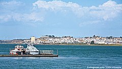
The length of its coastline is approximately 205 km, fifty of which extend from Cape Saint Vincent (the most southwestern point of Europe) to the north and the rest from this same point to the east. The coast stands out for its caves and grottoes opened in the limestone rock, especially around Lagos, which are accessible by boat. There are also many beaches such as Albufeira, Quarteira, Vilamoura, Praia da Rocha, Lagos, Armação de Pêra, Alvor, Monte Gordo, Tavira and Sagres.
The Algarve is bordered to the north by the Alentejo region (subregions of Alentejo Litoral and Bajo Alentejo), to the south and west by the Atlantic Ocean, and to the east by the Guadiana River, which marks the border with Spain. The capital of the region is Faro.
In addition to this, the towns of Albufeira, Lagoa, Lagos, Loulé, Olhão, Portimão, Silves, Tavira, Vila Real de Santo António and Quarteira also have city status. All of them are heads of their municipalities except the last one, which is a freguesia of Loulé.
Municipalities
The region is subdivided into 16 municipalities that fully correspond to the district of Faro: Albufeira, Alcoutim, Aljezur, Castro Marim, Faro, Lagoa, Lagos, Loulé, Monchique, Olhão, Portimão, São Brás de Alportel, Silves, Tavira, Vila do Bispo and Vila Real de Santo António.

Aljezur
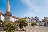
Faro

Silves
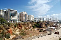
Portimão
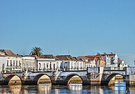
Tavira
Olhão
Vila Real de Santo António


.jpg)


.jpg)
Relief
The relief of the Algarve is characterized by gentle hills crossed by valleys. The main mountainous areas are the Serra de Monchique and the Serra de Caldeirão.
In the Monchique mountain range, which is located to the west of the Algarve, is the Fóia peak that with 902 m s. no. m. is the highest point in the Algarve and one of the most prominent in Portugal. Due to the sub-humid tropical climate of the region, the month of March has an average annual rainfall of between 1,000 and 2,000 mm, which, combined with mild temperatures, allows for rich and varied vegetation, including Monchique oak, adelfeira, chestnut, gall oak or sessile oak.
Several rivers and streams have their origin in the Monchique mountain range, the main rivers are the Seixas, the Aljezur, the Odiáxere, the Monchique and the Beret.


The Caldeirão mountain range is located in the northeastern sector of the Algarve on the border between the coast and the plains of Lower Alentejo. It is part of an old massif, it is composed mainly of slate-greywacke, a rock that originates fine and not very fertile soils. Its highest point is in Lower Alentejo, near the border with the Algarve, and reaches an altitude of 580 m. The towns of Tavira and Loulé have several points where it exceeds 500 m. The Caldeirão mountain range, despite its modest altitude, forms a very peculiar landscape, where the hills are cut by a dense fluvial system that is largely made up of steady-state rivers.
The mountains constitute a barrier to the passage of cold winds from the north and the depression from the northwest, contributing to the existence of a Mediterranean climate on the Algarve coast, with low annual rainfall and mild temperatures in winter. The maximum rainfall is reached in the west, in the highlands of the municipality of Loulé, where it reaches 800 mm per year, and decreases as we approach the Guadiana, until reaching rainfall of less than 500 mm per year in the northeast of the Algarve..
Climate
Located in the south of Portugal, the Algarve has a Mediterranean climate with hot, dry, sunny summers and mild, wet winters. The region is one of the sunniest and warmest in the country. The duration of annual sunlight is approximately 2700 hours per year.
The climatic conditions that common sense generally attributes to the Algarve climate can be found in all their splendor on the southern coast, especially in the central region and in the leeward area of the region. A set of basic characteristics summarize the climate of the region: long and warm summers, mild and short winters, precipitation concentrated in autumn and winter, low annual number of days with precipitation, and high number of hours of sunshine per year. The average temperature of the leeward zone and the central coastal region is the highest in Portugal and one of the highest in the Iberian Peninsula, which is around 18 °C, taking into account the climatic average 1961-1990. The precipitation is concentrated between October and February, and frequently assumes a torrential character. The annual averages are less than 600 mm in a large part of the coast and in the Guadiana valley, and exceed 1000 mm in the Sierra de Monchique. In the coastal region there are five dry months, and between June and September the fall of precipitation is very infrequent.
Fauna and flora
Cape St. Vincent is situated on a bird migration route, allowing for seasonal observation of bird life. The predominant vegetation in the barrocal Algarve is the Mediterranean scrub, characterized by the abundance of plants resistant to lack of water.
.jpg)
.jpg)
The Algarve basement is inhabited by several endemic species, exclusive to the Algarve, some of them recently discovered. ) and Europe's largest terrestrial terrestrial insect, Squamatinia algharbica. [10]
Other plant species, endemic or not, bear the name of the Algarve
- Cistus algarvensis Sims, Bot. Mag. 17: t. 627 (1803).
- Helianthemum algarvense Dunal, Prodr. [TO. P. de Candolle] 1: 268 (1824).
- Herniaria algarvica Chaudhri, Rev. Paronychiinae 346 (1968).
- Limonium algarvense Erben, Mitt. Bot. Staatssamml. Munich 14: 503 (1978).
- Linaria algarviana Chav., Monogr. Antirrh. 142 (1833).
- Ophrys algarvensis D.Tyteca, Benito & M. Walravens, J. Eur. Orch. 35(1): 65 (2003).
- Rhododendron algarvense Page, Prod. Southhampt. Gard. 38.
- Sideritis algarviensis D.Rivera & Obón, Anales Jard. Bot. Madrid 47(2): 500 (1990).
- Stegitris algarviensis Raf., Sylva Tellur. 132 (1838).
Economy
.jpg)

Tourism
The Algarve has beautiful beaches and natural landscapes, being the most touristic of the Portuguese provinces. Two of the largest tourist complexes in Europe are in the Algarve: Vilamoura, next to Falésia beach (municipality of Loulé), and Rocha beach in the town of Portimão.
Most tourists come from Portugal, the United Kingdom, Spain, Germany, the Netherlands and Ireland. There is also a strong presence of tourists from France, Italy and Scandinavia.
Although the great tourist attraction are the region's beaches, in recent years the leisure offer has diversified. In 2004 during the European Championship in Portugal, three games were played in Faro. Various sporting events have also been held such as the Volleyball World Cup, held in Portimão, world golf championships and in 2006 and 2007 some stages of the Lisbon-Dakar took place in the region, as well as the Portugal rally scoring for the Championship of World. In November 2017, exactly between November 9 and 12, the De Castro Marim golf course, very close to the border with Spain, hosted the final of the Capital Cup Footgolf tournament, one of the most prestigious tournaments in the world. which was preceded by the edition held in Adeje (Tenerife), won by Maikel Álvarez from Tenerife.
Agriculture
Figs, almonds and carob are noteworthy traditional agricultural products. The production of arbutus brandy and even bark, mainly in the northeastern regions of the Algarve, are other traditional manufactures.
History
-JM.jpg)
The region was intensely isolated from the world and although it never had the relevance of the southern area of al-Andalus, it was the most important center of Islamic culture, science and technology in the lands of present-day Portugal. The city of Silves was its main cultural center, this constituted in 1027 the taifa of Silves, which occupied the western part of the current Algarve, while in the rest of the region the taifa of the Algarve was created.
The region was extracted by the Seville taifa during the reign of al-Mutadid, a king who inherited the expansionist policy of his father Abu ul-Cásim. In 1051 Seville was annexed by the Algarve taifa and in 1063 by the Silves taifa. After the Almoravid invasion there was a new union of al-Andalus that ended in 1145, when the Taifa kingdoms re-emerged. The Silves taifa then spread to the center of the Algarve while the eastern end was occupied by the Huelva taifa.
In 1150 it was produced from an old union of al-Andalus under the Almohads. With the disintegration of the Almohad empire, the area of today's Algarve formed part of the Taifa of Niebla, ruled by Ibn Mahfut, where it remained until the Portuguese conquest. King Sancho I of Portugal briefly conquered the city of Silves in 1189 (it was said to be ten times the size of Lisbon), but it was not until 1249 that King Alfonso III of Portugal finally conquered the Algarve, proclaiming himself then King of Portugal and the Algarve.
Alfonso X, the Wise, claimed the Algarve from 1252, but the war ended in 1253 when he married a daughter of Alfonso to the King of Portugal. After the Treaty of Badajoz, in 1267, the Algarve was recognized as belonging to Portugal. The kingdom of the Algarve was part of the kingdom of Portugal, which did not imply any type of autonomy for the region. The official name of the kingdom was often called "Kingdom of Portugal and the Algarves" or United Kingdom of Portugal, Brazil and the Algarve, but it never constituted a separate kingdom in fact, although it was in law, known as the Kingdom of the Algarve. With the proclamation of the Portuguese Republic in 1910, the kingdom of the Algarve ceased to exist.
In 1807, when General Junot led the invasion of northern Portugal, the Algarve was occupied by the Spanish troops of Manuel Godoy, who were expelled the following year during the Olhão rebellion.
In the 20th century, the Algarve embarked on an unprecedented social and economic transformation. From being a rural and peripheral region, it came to have an economy based on the culture of nuts, fishing and the canning industry. However, starting in the 1960s, the tourism industry exploded, thus changing its social and economic structure.
Currently, tourism, both national and international, is the economic engine of the Algarve. The old traditional province has some of the best beaches in southern Europe, and exceptional conditions for practicing outdoor activities and sports. The Algarve's beaches are the most urbanized and best equipped with services in the country, as well as being surrounded by holiday resorts, residential areas, hotels and golf courses.
Contenido relacionado
Annex: Place names of Morocco
Stockholm
Barbalos