
Aguascalientes
Aguascalientes, officially Free and Sovereign State of Aguascalientes, is one of the thirty-one states that, together with Mexico City, make up Mexico; It is located in the north-central region of Mexico and part of the Mexican Bajío. Its capital and most populous city is Aguascalientes. It is divided into eleven municipalities.
Prior to the conquest of America, the territory was a meeting point for different fierce Chichimeca lordships. The Spanish established small colonial towns from the mid-XVI century, including the current capital, and the territory belonged to Nueva Galicia (Jalisco) during almost the entire colony; where he played an agricultural role and a resting point on the Ruta de la Plata. It briefly became part of Zacatecas, as it was declared an independent territory in 1835 while the neighboring state revolted, although it was not until the 1857 Constitution that it was recognized as a state. The Porfirian era greatly benefited Aguascalientes with the Mexican Central Railroad industry, causing a population and artistic explosion. It hosted the 1914 Revolutionary Convention, and later was the scene of the Cristero War. Since the 1980s it has re-entered a population explosion, at the hands of the textile, automotive, and electronics industries; without neglecting agricultural activities. It is recognized as one of the safest and fastest growing states in Mexico.
With 5618 km² it represents 0.3% of the national territory, being the fourth smallest federal entity in the country, behind Mexico City, Tlaxcala and Morelos. It is located at a latitude of 22° N, with an average altitude 1950 m above sea level. The state of Aguascalientes lies on a valley of the same name, which forms an eminently north-south corridor with a steppe or semi-dry climate (BSk), connecting the grasslands of the Jalisco Highlands with the Zacatecas desert. To the west it is guarded by mountainous formations that emerge from the Sierra Madre Occidental, with a humid and sub-humid temperate climate; while the eastern mountainous formations, although more scattered, have important mining activity. It is divided into eleven municipalities.
In 2020 it had a population of 1.4 million inhabitants, concentrated predominantly in the metropolitan area of Aguascalientes. It represents 1.1% of the population of Mexico, being the fourth most densely populated entity with 210.93 inhabitants per km² (behind the Mexico City, the State of Mexico, Morelos and Tlaxcala). It is also the fifth least populated entity behind Colima, Baja California Sur, Campeche, Nayarit and Tlaxcala. highest in the country. Its nominal GDP is $310 billion Mexican pesos, being the ninth smallest economy in Mexico, while its GDP per capita is $217,000 / inhab., being the tenth state with the highest GDP per capita.
Some sites in the state are part of the Camino Real de Tierra Adentro, a UNESCO World Heritage Site. Specifically: the Antigua Hacienda de Peñuelas, the Antigua Hacienda de Cieneguilla, the historic complex of the city of Aguascalientes and the Antigua Hacienda de Pabellón de Hidalgo. Also known is its San Marcos Fair, the largest fair in Mexico.
Toponymy
Aguascalientes takes its name from its homonymous capital. The Villa de Nuestra Señora de la Asunción de las Aguas Calientes was founded on October 22, 1575 within the Kingdom of Nueva Galicia, as it was necessary to implement protection and give asylum to the merchants of the Ruta de la Plata —which ran from Ciudad from Mexico to Zacatecas. Nuestra Señora de la Asunción took its name from said virginal dedication while Aguas Calientes took its name from the hot springs that the first Spanish settlers discovered when they settled in that area.
History
Human presence in the territory dates from 20000 BC. C. Later, it was part of the Great Chichimeca, inhabited by the Chichimeca civilizations, especially the Caxcán, Tecuexe, Guamare and white Chichimeca nations.[citation required]
Viceroyalty of New Spain


After the arrival of Cortés and the fall of Tenochtitlán in 1521, the conquest led many adventurous Spaniards to move north in search of their fortune. These lands, in addition to being more arid than those they had found in Veracruz and in the Valley of Mexico, they were inhabited by indigenous people who were mostly nomads and who soon became the terror of the still badly traced roads that connected New Spain with this other part of the territory, to which they gave the name of New Galicia.
Pedro Almíndez Chirino was the first Spaniard to enter this territory, perhaps in late 1530 or early 1531, in compliance with instructions given by Nuño de Guzmán.
The warlike Chichimeca tribes made access and transit through the area especially difficult for the conquerors. In fact, the total occupation of the lands of the Bajío was a task that would take around two centuries. In this regard, Viceroy Luis de Velasco offered municipal benefits to those who established towns to deal with the Chichimecas; For his part, Viceroy Gastón de Peralta decided to confront them directly, which did not give him good results. [citation needed ]
Some forts or prisons were built as a result of the interaction with the so-called Chichimecas Guachichiles, a system devised by Martín Enríquez de Almansa following the strategy that had been developed in Spain throughout the Reconquest period. This, to protect the Ruta de la Plata, which stretched between Zacatecas and Mexico City, thus creating the three prisons, founded by the Indian fighter Juan Domínguez, which are: Las Bocas, later called Las Bocas de Gallardo, located on the border of Aguascalientes, in what was the jurisdiction of the Mayor of Teocaltiche, since then border of Aguascalientes and Zacatecas; that of Palmillas, which was located near what is now Tepezalá, and that of Ciénega Grande, the latter founded around the year 1570 and located in what are now the streets of Moctezuma and Victoria, although some historians place it in the Cinco de Mayo street (formerly Camino Real) and Moctezuma, precisely in front of the Plaza de Armas. This prison had the purpose of protecting the Valle de los Romero and the road to Zacatecas, thus entering to ensure the passage of convoys loaded with silver and other metals.[citation required]
The foundation of Aguascalientes as a town came from the order that King Felipe II gave to the oidor of the audience of Nueva Galicia, Gerónimo de Orozco, in which he established that he should look for a rich man to settle in the territory, in order to expel the Chichimecas and ensure safe passage. Gerónimo de Orozco, in execution of said order, looked for someone to accept the king's commission, finding in the city of Santa María de los Lagos (today Lagos de Moreno) a man named Juan de Montoro, who accepted the commission. and went to the territory, accompanied by eleven other people, thus founding the Villa de las Aguas Calientes on October 22, 1575. In the same act of its erection, the Villa de San Marcos (Aguascalientes) was awarded jurisdiction mayoralty dependent on the Kingdom of Nueva Galicia, administered from the Royal Court of Guadalajara. It has been pointed out that it was originally called San Marcos, changing its name from August 18, 1611 to Villa de Nuestra Señora de la Asunción de las Aguas Calientes.
From December 4, 1786, due to the issuance of the "Ordinance of Intendants", it was transformed into a sub-delegation of Intendance.[citation required]
On April 24, 1789, by order of the Superior Board of the Royal Treasury, the sub-delegation of Aguascalientes became dependent on Zacatecas.[citation required]
Independence of Zacatecas

.svg)
On March 26, 1835, a law was enacted to reduce the state militias. This resulted in the opposition of the Zacatecas government, and the state decreed measures to take up the resistance. The former governor of Zacatecas and commander of the state militias Francisco García Salinas led an army of some four thousand men against the government. President Antonio López de Santa Anna was authorized to lead the federal army in the campaign against Zacatecas.He arrived in Aguascalientes on Friday, May 1, where the streets were cleaned and houses decorated to receive him. The authorities took him to the temple where a Te Deum was held in his honor and then took him to the lodging that had been prepared for him in the house of Don Pedro García Rojas. The next day, he was deposed the political chief of Zacatecas, José María Sandoval, and appointed by the council to replace him Don Pedro García Rojas.[citation required]
According to the legend of freedom through a kiss, it was thanks to the intervention of Doña María Luisa Fernández Villa de García Rojas (wife of Don Pedro García Rojas) that Santa Anna pronounced that Aguascalientes would no longer belong to Zacatecas during a dinner in the García Rojas house. Days later, Francisco García Salinas was surprised by General Santa Anna on May 11 and defeated right there in the Guadalupe field during the Battle of Zacatecas. Taking advantage of the independence of the people of Aguascalientes, and as a punishment for Zacatecas for supporting the cause of the Revolution against him, by Federal Decree of General Antonio López de Santa Anna dated May 23, 1835, within its third article, ordered that Aguascalientes continue to be separated from the territory of Zacatecas, without granting the territory any specific category, with Pedro García Rojas being appointed political chief.[citation required]
Art. 1. The government will immediately give notice to all the legislatures of the states of the request filed by the city of Aguascalientes, demanding that they manifest their consent or opposition.
Art. 2. In the fact that three quarters of the legislature agree on this request, Aguascalientes and peoples of the party will remain erected in the territory of the federation.
Art. 3. Interin verifies what comes from the previous article. Or else is established in the reforms of the constitution, Aguascalientes will continue separated from Zacatecas and governed by the authorities that today govern him, under the inspection of the general government and in the class of territory.Law declaring territory of federation to Aguascalientes (May 23, 1835)
In this regard, it should be mentioned that said decree was not formalized according to the legal requirements for this purpose, since it was necessary for this to happen that two thirds of the chambers, both Senators and Deputies, approved the decree, in addition to the fact that it was required that two thirds of the state legislatures also approve it, the second requirement not being met. Since a constituent congress was convened to elaborate the centralist constitution that was later known as the Seven Laws; Aguascalientes was not recognized as a department (since the States had been replaced by Departments).[citation required]

It was General José Mariano Salas, who on August 5, 1846, spoke out for reestablishing federalism, convening a constituent congress that declared the 1824 constitution valid, but Aguascalientes was not yet considered a state. Subsequently, on May 18, 1847, the act of reforms to the Constitution of 1824 was approved, but neither was Aguascalientes granted the rank of state, which led to a war between Aguascalientes and Zacatecas, resulting in Zacatecas becoming the strength of the Partidos (now Calvillo and Rincón de Romos municipalities). In July 1848, Aguascalientes agreed to peacefully annex Zacatecas, but continued through Miguel García Rojas, making efforts to separate. It was not until December 10, 1853 that López de Santa Anna, using his extraordinary powers, issued a decree declaring Aguascalientes a department, taking as a basis the decrees of December 30, 1836 and June 30, 1838, without ever referring to the one of December 23. March 1835. Finally, in the draft of what would become the Constitution of 1857, which was presented on June 16, 1856, Aguascalientes was included as a state in article 43, The 79 deputies present unanimously approving the subsistence of the state of Aguacalientes on December 10, 1856, the said constitution coming into force on September 16, 1857, with Mr. Jesús Terán Peredo as the constitutional governor of the State. [citation required]
Department of Aguascalientes

During the Second Mexican Empire of the Archduke of Austria Maximilian, the Altos de Jalisco formed part of the Department of Aguascalientes, as a natural continuation, taking cultural and geographical aspects into account.
The territorial divisions throughout the history of Mexico have generally been linked to political changes and not to a spatial distribution tending to improve the administrative, economic and social development of the national territory. On March 3, 1865, one of the most important decrees of the Maximilian government appeared for the first division of the territory of the new Empire and it was published in the Diario del Imperio on March 13 of the same year. This mission was entrusted to Don Manuel Orozco y Berra (1816-1881) and this division was carried out according to the following bases:
- The total extent of the country ' s territory will be divided into at least fifty departments.
- Natural limits for the subdivision shall be chosen as soon as possible.
- For the shallow extension of each department, the configuration of the land, climate and all elements of production will be taken into account in such a way that the equality of the number of inhabitants can be achieved over time.
- The development of this division is of paramount importance within the territorial divisions that were made, since it took into account basically geographical elements for the delimitation of the jurisdictions and the future development of the new demarcations, as well as because within these areas communication would be much easier and this would influence its commercial activity.
Porfiriato
In the 1880s came the construction of a track for the Central Mexican Railroad and the construction of the Morelos Theater. Apparently the progress that the local elite longed for was coming to the city, but due to lack of budget or political instability they postponed these projects. At the beginning of 1882, Governor Rafael Arellano allocated resources to what would be the new works that would bring important benefits to the city. Despite the deficiencies that were found in the council, the works were elaborated with certain speed such that in 1883, Rafael Arellano would declare in his government report that the foundation of the theater would be completed in one year. The importance of the theater was such that it would promote culture and place the city in a status along with cities like Zacatecas and San Luis Potosí.

On August 25, 1885, the Morelos Theater was opened. The inauguration of the enclosure signified the new airs of modernity that prevailed in the capital of the State, in addition, in said space "the most select of society" took place, journalists who did not tire of admiring the beauty of the building and officials satisfied with the function that was carried out there. The inauguration of the Theater monopolized all the media mentioning it as a cultured and dignified place for a city that was flourishing. Aguascalientes already had places like bullfights and neighborhood festivals, but the upper class lacked an entertainment space.
Manuel Jacinto Guerra, owner of a soap factory, declared that the railroads would lead to the ruin of artisan companies. In 1884 the first passenger train had arrived in Aguascalientes, which meant one of the most important events of the 19th century. The construction of tracks and the arrival of the railway brought enlightenment to the city, the government would order the repair of sidewalks and cobblestones, the improvement of public lighting and the arrangement of existing gardens and walks. The day the train made its triumphal entry there was a party and fireworks in Aguascalientes.
Years after the opening of the train station in the capital, another was inaugurated in Chicalote, which connected the cities of San Luis Potosí and Tampico, this entire line connected with the railway system of the North American southeast, turning Aguascalientes into one of the most important junctions of the Mexican railway network.
Revolution
Silvestre Dorador, Román Morales, Pedro Vital, Alfonso Guerrero Aguilera and Alberto Fuentes Dávila were precursors of the Revolution in this state. Well, when the Madero movement broke out, they embraced the cause in the company of some other compatriots, and the rebellious action of the people of the region was formalized.[citation required]
Recent history
On January 25, 1983, the National Institute of Statistics and Geography (INEGI) was created by presidential decree, which integrated into its structure: the General Directorate of Statistics (in office since 1882, when it belonged to the Secretariat Development, Colonization, Industry and Commerce), the General Directorate of Geography, established in 1968 and which was attached to the Secretariat of the Presidency, the General Directorate of Information Policy and the General Directorate of Information Integration and Analysis. Since 1985, the Institute was decentralized to locate its headquarters in the city of Aguascalientes.
Political-administrative division

Aguascalientes consists of eleven municipalities:
- 001: Aguascalientes
- 002: Seats
- 003: Calvillo
- 004: Cosío
- 005: Jesus Mary
- 006: Arteaga Pavilion
- 007: Rincón de Romos
- 008: San José de Gracia
- 009: Tepezalá
- 010: The Llano
- 011: San Francisco de los Romo
The municipalities of El Llano and San Francisco de los Romo were recently created; having been awarded such a distinction in 1992 and 1991, respectively.
Physical geography
Limits
| Northwest: Zacatecas Mexico | North: Zacatecas Mexico | Northeast: Zacatecas Mexico |
| West: Zacatecas Mexico |  | This: Zacatecas Mexico |
| Southwest: Jalisco Mexico | South: Jalisco Mexico | Sureste: Jalisco Mexico |
Location
It is located in the geographic center of the country, about 480 km northwest of Mexico City. To the north, northeast and west it is bordered by the state of Zacatecas, with which it has more than half of its limits, and to the south and southeast by the state of Jalisco, its other neighbor. The state of Aguascalientes is very small, and it only adjoins two other states. It has a territorial extension of 5,471 km², which represents 0.03% of the total area of Mexico. In the state it crosses part of the Sierra Madre Occidental.

Orography
The state is crossed by a north-south corridor called the Aguascalientes Valley. This continues to the south in the Altos de Jalisco and the Bajío, and to the north it intrudes beyond Cosío, to the state of Zacatecas. The main elevations that are counted in the entity are: Cerro de la Ardilla, in the Sierra Fría (3050 masl); Cerro de la Antorcha, in the Sierra del Laurel (2760 masl); Cerro del Mirador (2700 masl); Cerro del Muerto (2660 masl); Cerro de Altamira, in the Sierra de Asientos (2650 masl); San Juan Hill (2,530 masl); Cerro de Juan el Grande (2,500 masl), Cerro El Picacho (2,420 masl) and Cerro de Los Gallos (2,340 masl).
Hydrography

Its main river is the San Pedro (or Aguascalientes River), a tributary of the Santiago River. It crosses the state through the center. On its eastern shore is the capital city (Aguascalientes). Its channel only carries water a few months a year during the rainy season, and not continuously, due to the high number of dams built in its basin (where the main one is the Plutarco Elías Calles dam, in irrigation district 01).
Another important river is the Calvillo, in the municipality of the same name, whose soil does not allow for many or large dams. Both sub-basins fill practically the entire state, and drain into the Santiago River.
Other dams in the state are El Cedazo, Gral. Abelardo L. Rodríguez, Jocoque, Malpaso and Niágara.
Climate
The climates that occur in the region are: temperate semi-dry in 62% of the surface, temperate sub-humid and semi-warm semi-dry in 25%, with rains in summer. Rainfall is concentrated from June to October, with an average of 500 mm per year. The cold climate, with low temperatures almost all year round, is represented by the Sierra Fría, with average annual temperatures between 12 and 16 °C, and average annual rainfall of more than 700 mm.
The last time it snowed in the state of Aguascalientes was on March 9, 2016, in some areas.
The thermal amplitude between the minimums and the maximums is very high throughout the year.
The average annual temperature is 17 to 18 °C. The highest temperature (30 °C or more) occurs in the months of May and June. The lowest is around 4 °C, in the month of January. The rains are scarce and appear during the summer. The total annual rainfall is 526 mm, so agricultural practice requires irrigation.
According to climate-data.org, the climate table for Aguascalientes is as follows:
| Temperature/Mess | January | February | March | April | May | June | July | August | September | October | November | December |
|---|---|---|---|---|---|---|---|---|---|---|---|---|
| Minimum (°C) | 4 | 5.2 | 7.1 | 10 | 12.5 | 14.3 | 13.7 | 13.6 | 13 | 10.2 | 6.6 | 4.9 |
| Average (°C) | 13.2 | 14.6 | 17 | 19.7 | 21.7 | 21.9 | 20.6 | 20.6 | 19.7 | 18.1 | 15.7 | 13.7 |
| Maximum (°C) | 22.5 | 24.2 | 27 | 29.4 | 30.9 | 29.5 | 27.5 | 27.6 | 26.1 | 26 | 24.8 | 22.6 |
| Precipitation (mm) | 16 | 8 | 4 | 7 | 19 | 79 | 118 | 119 | 94 | 40 | 13 | 16 |
- Geography of Aguascalientes

Carretera Pavilion of Arteaga-San José de Gracia. The semi-desert climate dominates the state.

The Sierra de Guajolotes divides Jesus Mary and Saint Joseph of Grace.

Presa Abelardo L. Rodriguez. At the bottom, the Sierra de Guajolotes.
Sierra Fría, San José de Gracia

Boca de Tunel, San José de Gracia.

Presa Calles, San José de Gracia.

The Sierra del Laurel marks the border between the south of Calvillo and the state of Jalisco.

Presa de Malpaso, municipality of Calvillo.


Biodiversity
In the mountains: puma, white-tailed deer, wild boar, owl, bobcat, turkey, coyote, wolf, golden eagle, rabbit, fox and squirrel.[citation needed]
In the valleys: coyote, raccoon, hare, spotted quail, owl, spotted dove, wild boar, white-tailed deer, rabbit and golden eagle.[citation needed]
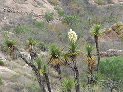
Among the plant species are mainly pine, oak, poplar, laurel and mesquite trees, huizache, juniper, pirul and nopal in the lower parts.[citation required]
- Biodiversity of Aguascalientes

Stenocereus montanus, Opuntia ficus-indica, some kind of Prosopis and Bos primigenius taurus.

Fall in the forest of conifers of the Sierra Fría, northwest of San José de Gracia.

Various species of cactaceae live in Aguascalientes. In image, Mammillaria petterssonii.
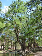
Communities such as Salto de los Salado are known for their forests of enormous sains (also called ahuehuetes, tules or Mexican cypresses).

The mezquite is a thorny tree with little height, abundant in the region.

Fauna de Los Arquitos, Jesus Mary.
Flora del Cerro del Muerto, between the municipalities of Aguascalientes and Jesús María
.jpg)

.jpg)


Demographics


According to the figures provided by the II Population and Housing Census carried out by the National Institute of Statistics and Geography in 2020, the state of Aguascalientes had until then a total of 1 425 607 inhabitants. Of this number, 696,683 were men and 728,924 were women. The annual growth rate for the entity during the period 2010-2020 was 1.2%.
The increase observed during the decade is equivalent to the current residents of the municipalities of Jesús María, Calvillo, Rincón de Romos, Pabellón de Arteaga, San Francisco de los Romo and Cosío, considered together.[citation required]
Thus, during the past decade and the first five years of this one, an average of 22,045 people joined Aguascalientes society each year, including newborns and immigrants, and having discounted the deceased and emigrants.
By its population, the Metropolitan Area of Aguascalientes occupies the thirteenth national position with 1,140,916 inhabitants. As a state, it is the twenty-seventh most populous in the country.
The state has 4 doctors for every 1,000 inhabitants, while the national average is 1.28, according to the National Population Council (Conapo).[citation required]
Main Cities (2020)
The graph shows the 10 cities with the largest population counting only the city, without including Conurbated Areas, Municipality or Metropolitan Area.
Municipalities by population
| Municipality | Population |
|---|---|
| Aguascalientes | 948 990 |
| Jesus | 129 929 |
| San Francisco de los Romo | 61 997 |
| Calvillo | 58 250 |
| Rincón de Romos | 57 369 |
| Seats | 51 536 |
| Arteaga Pavilion | 47 646 |
| Tepezalá | 22 485 |
| The Llano | 20 853 |
| Cos | 17 000 |
| San José de Gracia | 9552 |
The population added by municipalities is 1 425 607 in 2020.
The Metropolitan Area of Aguascalientes is made up of 3 municipalities:
- Aguascalientes
- Jesus
- San Francisco de los Romo
Due to the accelerated growth, the next municipality to be integrated into the metropolitan area will be Pabellón de Arteaga.
Economy

The state is characterized by its intense industrial, livestock and commercial activity. Currently[when?] its main source of income is construction.[citation required] Aguascalientes has important communication routes that link the state with the most important economic zones of the country. Important national and international companies have a presence in the state.
For three consecutive years, the World Bank (WB) has recognized Aguascalientes as the state with the best business climate, labor harmony and rule of law. Aguascalientes has an excellent business climate; where it is easier, faster and cheaper to open a business.
In 2014, an economic census was carried out to verify and collect economic information from all businesses in the state of Aguascalientes, registering 55,463 active establishments on that date.
Primary activities are only 4.65% of state GDP.[citation needed][when?]
Agricultural production is based on the cultivation of corn, wheat, soybeans, sorghum, potatoes, beans, green chili, dried chili, tomato, alfalfa, garlic, avocado, and other fruit trees. The production of grapes and guavas is of cultural importance for the state of Aguascalientes. The most important agricultural zone is the valley of Aguascalientes.[citation required]
In mining we find the production of cement, lime, gold, silver, tin and lead.[citation required]
There are cattle (large dairy basin), horses, sheep, goats, pigs, mules and donkeys.[citation required]
Secondary activities generate 40.18% of GDP. [citation required] Nissan, one of the most important automobile manufacturers worldwide, has been established in the entity. It is the largest Japanese investment assembler installed in the entire country, in addition to some other companies that are equipment suppliers for it. Important technology companies have also been established, which has made the state one of the most advanced in the Mexican territory. Likewise, four important five-star hotel chains are established, one of them classified as five stars and a diamond. In terms of professional services, the four largest global public accounting firms have established themselves in the entity.[citation required]
Tertiary activities generate 55.17% of state GDP.[citation required]
Education


There is an educational offer in the state of all levels and specialties. The main academic centers are, without any particular order:
- Universities:
- Public:
- Polytechnic University of Aguascalientes (UPA).
- Universidad Autónoma de Aguascalientes (UAA), has two campuses for higher education, in addition to several secondary-superior education centers and other types.
- Technological University of Aguascalientes (UTAgs)
- Universidad Tecnológica El Retoño (UTR)
- National Pedagogical University, Aguascalientes Unit
- Polytechnic University of Aguascalientes
- Universidad Tecnológica del Norte de Aguascalientes Campus Rincón de Romos
- Technological University of Calvillo Campus Calvillo
- Instituto Tecnológico de Aguascalientes (ITA)
- Instituto Tecnológico El Llano
- Instituto Tecnológico de Pabellón de Arteaga
- Centre for Economic Research and Teaching, Central Region (CIDE)
- University of Arts
- State Institute for Public Security of Aguascalientes (IESPA)
- Private:
- Universidad Panamericana Campus Bonaterra
- Instituto Tecnológico y de Estudios Superiores de Monterrey, Campus Aguascalientes
- Cuauhtémoc University, Aguascalientes Campus
- Universidad del Valle de México (UVM), Aguascalientes Campus
- Universidad de Desarrollo Profesional UNIDEP Campus Aguascalientes
- University of the Atemajac Valley
- La Concordia University, several countryside.
- University of Durango Campus Aguascalientes
- Universidad de León Campus Aguascalientes
- Centro Universitario Galilea
- Inter-American University for Development (UNID) Aguascalientes Campus
- University of Advanced Studies (UNEA) Aguascalientes Campus
- Villasunción University
- Universidad Las Américas (ULA) Campus Centro Occidente
- Gestalt Psychotherapy Research and Training Center, Fritz Perls
- Technological Institute of Construction
- Institute of Education of Excellence
- Public:
- Research centres:
- Centro Tecnológico de la Industria del Mueble de Aguascalientes, A. C. (CETIMA)
- Clothing Technology Center (CTV)
- Information Technology Research Development Centre. (CEDITI)
- Advanced Technology Center. (CIATEQ)
- Optical Research Centre. (CIO)
- Mathematics Research Centre (CIMAT)
- Centre for Economic Research and Teaching (CIDE)
- Research Center in Geography and Geomatic Ing. Jorge L. Tamayo (Centro Geo)
- Center for Research and Innovation in Information and Communication Technologies (INFOTEC)
- Normal schools:
- Normal School of Aguascalientes (ENA)
- Escuela Normal Superior de Aguascalientes (ENSFA)
- Normal School of Physical Education Romos Corner
- Centro Regional de Educación Normal de Aguascalientes (CRENA)
- Escuela Normal Rural "Justo Sierra Méndez" (Cañada Honda)
Culture
Festivities

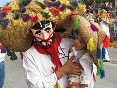
The city of Aguascalientes annually celebrates the San Marcos National Fair, the most important in the country, at the end of April and beginning of May; which is promoted with epithets such as "The Fair of Fairs" or "The Mexico Fair". The San Marcos Fair has its origins in a mainly agricultural and livestock fair, which began in 1828 and was originally held in November. It had its enclosure in the portals of an old parián or half-built market.[citation required]
In 1848, it was arranged that it be celebrated in the Jardín de San Marcos, in the vicinity of the temple of the Virgen del Carmen, but more located like the Temple of San Marcos, a saint that is located in said enclosure and for whom it is named the garden. Likewise, to coincide with the celebration of the Patron Saint of Aguascalientes, on April 25, and to take advantage of the spring harvest, the fair was arranged for that month.[citation required]
Each year a different country and state of the republic is invited to show tourists and citizens its culture, gastronomy, among other things. The fair includes the participation of several renowned artists, with performances by each one daily in the palenque, bullfights, free artistic presentations at the Teatro del Pueblo, an agricultural and livestock exhibition at the Megavelaria and the coronation of the Queen of the Fair, which is the initial act of the fair.[citation required]
During the month of July, the Chicahuales Fair is celebrated in the municipality of Jesús María; Second in importance in the state.

Also in the municipality of Aguascalientes, during the first fortnight of August and particularly on August 15, the Pilgrimage of the Assumption takes place, and pilgrimages to the cathedral begin. These pilgrimages are organized in the diocese of Aguascalientes, which includes the state of Aguascalientes, part of Zacatecas and Jalisco, and a small town of Guanajuato. The diocese has a little more than a million parishioners and is one of the largest in Mexico; in fact, Aguascalientes is listed as the state with the third highest percentage of Catholics in the country, with 93% of its population professing this religion, after Guanajuato and Jalisco.[citation required]
The Day of the Dead is celebrated in a special way, which is amplified by the Festival of the Skulls that runs from the last days of October and the first days of November. The famous engraver and caricaturist from Aguascalientes, José Guadalupe Posada, creator of the world-renowned Catrina, is honored.[citation required]
Among the main cultural centers, it is worth highlighting the Casa de la Cultura and its annex, the Visual Arts Center, which are located within the historic center of the capital; Likewise, there is the Casa Terán, which receives its name from Jesús Terán Peredo, in addition to the various libraries, such as the Central State Library "Jaime Torres Bodet" and the "Enrique Fernández Ledezma" Library.[citation required]
Gastronomy

Due to its geographical position, the gastronomy of the state is influenced by that of its neighboring states and others in the region. Likewise, the cuisine varies in each of its municipalities.
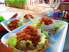
In the capital municipality you can find a great variety of dishes. The establishments known as cenadurías are typical, where, as the name indicates, antojitos are offered for dinner. In these places you can find the traditional flautas, tacos dorados, the very typical enchiladas of the state, accompanied with pickled pork and vegetables. They also offer tamales, atoles, tostadas, pozole, sopes and more. There is also in the capital the traditional Juárez market, where you can find the best birrierías in the state. It is a gastronomic tradition that menudo is eaten for breakfast on Sundays. The colored tacos, which are very varied stews, are also very popular.
The municipality of Jesús María is famous for its gorditas chiqueadas, stuffed with stews such as chicharrón, tinga, moronga, beans, chile relleno, mole, rice, etc. Stalls can be found in the portals of its main square.
The municipality of San Francisco de los Romo has a great tradition in the preparation of carnitas, where you can find crop, nana, rib, chamorro, solid, patitas, and other delicacies accompanied by comal tortillas and sauces such as guacamole, pico de gallo, tomatillo, etc.
In the municipality of Calvillo, its preparations with guava are famous, as it is one of the region's own products. Due to the presence of prey, seafood restaurants are already typical.
For its part, the municipality of Pabellón de Arteaga offers the traditional "burritos," which are tacos filled with different stews, and made with flour tortillas.
As for the bakery, Aguascalientes has a huge tradition. Bread is a very present element at breakfast or dinner time, both sweet and salty. Typical breads are cemitas, sanjuaneras, bricks, pigs, chamucos, crowns, shells, calvitos, bolillo (there are also cream and butter), as well as cream gorditas. The condoches stand out, which are made in wood-fired clay or stone ovens.
- Gastronomy of Aguascalientes

The cultivation of guava and the production of foods derived from it are Calvillo's print.

Enchiladas style Aguascalientes, made with fried tortilla with guajillo pepper, beef, fresh cheese, cream, cabbage and carrots.

Woman preparing nata gorditas.

Gorditas, typical dish of the entity.
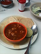
Red Pozole.
Arteaga Pavilion Sopes.

Variety of sweet bread prepared for the day of the dead.


Tourism

The tourist billboard of the small state of Aguascalientes is of great variety and goes beyond the entertainment in its National Fair of San Marcos, which by far is the event that attracts the most visitors. The genuine tourist will only be able to know this state through a journey that brings together historical, cultural and natural attractions.
From pre-Columbian times there are records of rock art in the archaeological site of El Ocote, dated between the VI century and X of the common era.
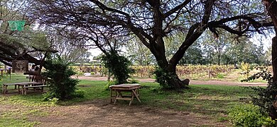
An obligatory cultural destination for every traveler is a tour of the old haciendas in the area; some of them were built in the 16th century. They represented the engine of the regional economy for centuries, first with mining activity and then with agriculture and livestock. Among them are the haciendas of El Soyatal, Santiago (also known as Garabato), San Blas (where the museum of the Insurgency is located, a World Heritage Site), Palo Alto, San Bartolo, Cieneguilla, Peñuelas, and the hacienda of San Luis de Letras, now converted into a vineyard and gastronomic destination.
It is also said that the entity is one of the best places in the world to witness a sunset. One of the favorite places to photograph the sunset, or simply to go on an excursion, is the Cerro del Muerto.

Museo de la Insurgencia (exhacienda de San Blas), in Pabellón de Hidalgo, Rincón de Romos.

Exhacienda de Santiago (Garabato). Arteaga Pavilion.
Viñedos y exhacienda de San Luis de Letras, Pavilion of Arteaga.
Hacienda de Peñuelas, municipality of Aguascalientes.
Fair of the Chicahuales, Jesus Mary.

The "Picacho" of the Dead Hill.

Tepezalá.

.JPG)


Magic Towns
The state has three sites that are part of the Magical Towns tourism program of the Mexican government: Real de Asientos, Calvillo and San José de Gracia.
Seating
Real de Asientos is the oldest municipality in the state, even older than the city of Aguascalientes. The town was founded by the Basque conquistador Diego de Ibarra in 1548, who had also founded the city of Zacatecas two years earlier. Originally it attracted settlers for its silver deposits, although gold was soon found to exist in greater abundance. The parish of Asientos, built between 1705 and 1715 and dedicated to Our Lady of Bethlehem, in addition to its architectural value, has two characteristics that make it special: firstly, there is the route through the old tunnels that surround it, built by indigenous hands to drain the underground spring that threatened to flood the parish. Secondly, inside the parish there is an art gallery with a colonial collection of artists such as Miguel Cabrera, the great painter of the New Spanish Baroque. Other religious sites of interest are the parish of the Virgin of Guadalupe, with the oldest cemetery in the state; and the former Franciscan convent of Señor del Tepozán (1627), converted into a museum that, in addition to old mining and religious objects, houses more valuable paintings by Miguel Cabrera. The typical dish of this municipality is conejo a la chichimeca .

Atardecer in Real de Asientos, magical town of mining origins in the northeast of the state, founded in 1548.

Temple of Our Lady of Bethlehem, Royal Seat.

Exconvento del Tepozán, Seats.

.jpg)

Calvillo
The historic center of Calvillo dates from 1772 and is also a great cultural and gastronomic attraction, thanks to the fact that it houses the National Museum of Magical Towns, the Señor del Salitre Parish from the XIX, with one of the largest domes in all of Latin America, and the neo-Gothic temple of the Virgin of Guadalupe. The typical crafts of this entity are fraying, and it is also one of the most important guava producers nationwide. It is possible to find all kinds of sweets, food and drink made from this fruit. In terms of natural or outdoor destinations, the Malpaso dam, the Sierra del Laurel and the Sierra Fría are popular. In these places have cabins for rent to the public, and activities to do such as rappelling, mountain biking, hiking, motorcycling, gotcha, etc.

Calvillo, magical town.


Guadalupe Temple, Calvillo.

Presa de Malpaso, municipality of Calvillo.
_11.JPG)
.jpg)


Saint Joseph of Grace
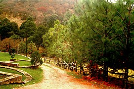
The municipality of San José de Gracia provides several natural sites of interest, such as the Sierra Fría, where you can camp and practice sport fishing. This municipality attracts tourists to its dams throughout the year. The flooded town along with the Broken Christ of the Calles dam have already become an icon of Aguascalientes, and it is a must-see destination for being the third largest religious statue in Mexico. In the Jocoqui Dam you can enjoy delicious gastronomy with views towards the cliff. Boca de Túnel at the Potrerillo Dam is a popular destination for cabin rentals and extreme sports, thanks to its rappelling courses, zip lines, and suspension bridges throughout an impressive landscape.

The broken Christ, Presa Plutarco Elías Calles. Saint Joseph of Grace.

Ecotourism park "Boca de Tunel" in San José de Gracia.

Restaurant and viewpoint in the Presa El Jocoqui, municipality of San José de Gracia.

Forests of the Sierra Fría.

.jpg)


City of Aguascalientes
Tourism in the eponymous municipality occurs mainly at the end of April, the month in which the San Marcos National Fair takes place, with national and international visits that reach up to 8 million tourists per festival. The tradition dates back to 1828, when it was known as La Feria de la Uva, and it took place in the months of October and November to celebrate the harvest and wine. It is considered the most important fair in Mexico, due to its influx, exhibitions, bullfighting serial, the largest livestock exhibition in Mexico; and its recognition outside the entity itself.
Another festival of importance is the Festival of the Skulls, celebrated around Day of the Dead.
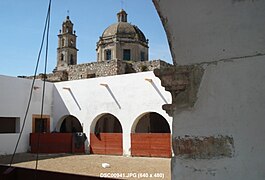
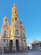
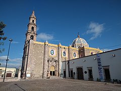
In the historic center of the city of Aguascalientes, the Government Palace (1665-1685) is of interest, a quarry and tezontle mansion that was originally the summer home of the Rincón Gallardo family, wealthy New Spain landowners. It is a double-level corner building with a beautiful archway inside and murals by the Chilean painter Osvaldo Barra Cunningham. Among the earliest religious buildings is the so-called Temple of San Diego, begun in 1640; although in reality it is a construction complex that spans from the s. XVII to XIX (Temple of San Diego, Camarín de la Virgen, Temple of the Third Order). On its sides you can visit the Parián, the National Museum of Death, or walk along the walkways that lead to the main square. Construction of the Cathedral Basilica of Aguascalientes began in 1704, in the New Spanish Baroque style. Other sites of interest are the Casa de la Cultura (built before 1625), the Temple of La Merced (1702-1773), the Temple del Conventito (1850), the Morelos theater (1883-1885), the Temple of San Antonio (1895-1908), the Aguascalientes Museum (1878, where the heritage of Saturnino Herrán, Jesús F. Contreras, Gabriel Fernández is permanently exhibited Ledesma and Manuel M. Ponce). The main road in the historic center is Ignacio Madero street, called Venustiano Carranza after the rear of the cathedral. It connects the neighborhood of the station to the east with the neighborhood of San Marcos, and it turns out to be one of the favorite destinations for nightlife; along with Luis Donaldo Colosio avenues (north of the city) and Avenida de las Américas (south of the city).

Casa de la Cultura de Aguascalientes (1625).

Camarín de la virgin, temple and exconvento de San Diego (1640-1797).

Parián, National Museum of Death and San Diego Temple.

Palacio de gobierno de Aguascalientes (1665-1685).

Cathedral of Aguascalientes (1704-1946).

Calle Carranza, historic center of Aguascalientes.
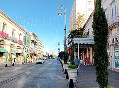
Calle Madero, historic center of Aguascalientes.

Morelos Theatre (1883-1885), sponsored the Revolutionary Convention of 1914.
Temple of San Antonio (1895-1908) and Museum of Aguascalientes (1878).


.jpg)


Also in the city of Aguascalientes, the neighborhoods that gave rise to the city are of interest: San Marcos, Estación, Salud, El Encino and Guadalupe. All of these embrace the historic center of the city, the relevance of which is taken for granted. The Encino or Triana neighborhood (1565) precedes the founding of Villa de Aguascalientes (1575) by ten years. There you can visit the José Guadalupe Posada museum. The neighborhood of San Marcos was born between 1604 and 1608 as a town of Indians. It is known for the fair, its garden and its bullring (the second largest in Mexico). The Guadalupe neighborhood was formed in the mid-18th century century, almost at the same time as the initial construction of its majestic Baroque temple. It is especially visited during the Day of the Dead, since the most important pantheons in the city are located there. The station quarter dates from the late XIX century. In it you can find from neo-Gothic temples and old hot springs to Haussmann-style mansions and Californian neocolonial style. What were once the workshops of the Mexican Central Railway have been restored to give rise to the Tres Centurias railway complex, with museums, sports venues and other attractions.
Temple of the Barrio del Encino (founded in 1565) and José Guadalupe Posada Museum.
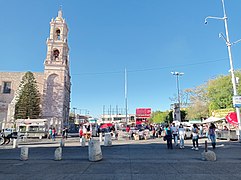
Barrio de San Marcos (founded in the 1600s).

Andador de la Feria Nacional de San Marcos.

Barrio de Guadalupe. The temple was built between 1767 and 1973.

Thermal baths in Ojocaliente, in the Barrio de la Estación.

The Macro Space for Culture and Arts (formerly called the Three Centuries Railway Complex).

Temple of the Pure Conception (1902), District of the Station.


Symbols
Shield
 | The coat of arms of Aguascalientes is thus blasphemed: |
Motto
Bona Terra, Bona Gens, Aqua Clara, Clarum Cœlum | From Latin: “Good land, good people, clear water, clear sky”. |
Anthem
| It was composed in 1867 with lyrics the governor of the State Esteban Ávila Mier (1827-1880) and music of Miguel Meneses (1832-1892). |
Sports
Weightlifting
Motorcycling
Aguascalientes has a tradition in the sport of motorcycling, dating back to the 1960s, with characters such as Joaquín de la Torre Velázquez, Max de la Torre, the famous Suzuki, Los Huerta, Salvador González, Jesús and Francisco Rosales, Marcelino Garcia among others. This sport has very good representatives at the national and international level. The state has won several national championships with drivers such as Jesús Rosales Calvillo, René de la Torre Medina, etc. Currently there are several tracks in the state, from the classic park Mexico to the modern and technical RCLand track.
Motor Racing
The new Aguascalientes International Autodrome is located south of the capital, near its International Airport. It is considered international because it shares unique characteristics with the best racetracks in the world, the dimensions of the track are 7/8 of a mile, it is a concrete track, which makes it a unique racetrack in Latin America.[ citation needed] The first race was held on April 12, 2009 to a sold-out crowd.[citation needed] It also hosted the closing of the NASCAR Corona Series in November 2009, with an attendance of more than 35,000 people. In 2010 the final race of the NASCAR Corona Series was also held.
Football
.jpg)
Los Gallos de Aguascalientes was a professional soccer team from Mexico. Founded in the city of Aguascalientes, it participated in the Second Division of Mexico and in the First Division "A".
Club Necaxa, founded in Mexico City in 1923. It is one of the clubs with the longest tradition and history in Mexican soccer. In 2003, given the low attendance that they had in the capital in the shadow of América and the popular teams Cruz Azul and Pumas de la UNAM, it was decided to move it to the city of Aguascalientes where the modern Victoria Stadium was even built, which has with all modern conveniences including a restaurant and dancing fountains.
Initially, the Necaxa Club started its stay in Aguascalientes well. He even qualified for a couple of tournaments and played a Copa Libertadores. But the mismanagement caused their sporting decline that led them to descend to the Liga de Ascenso de México in 2009.
Necaxa was quickly crowned in his first tournament in the Liga de Ascenso de México, a championship that he endorsed in the following tournament, for which he achieved the return to the First Division of Mexico in just one year. However, he returned to the Ascenso de México league in the 2011 Apertura.
Real Aguascalientes FC is a professional soccer team from Mexico. Founded in the city of Aguascalientes, it participates in the Third Division of Mexico.
It intends to continue the tradition of the late Gallos de Aguascalientes, since the president of the club is the son of the former president of the Gallos de Aguascalientes, the only club to be entirely from the city.
Basketball
It is home to the Aguascalientes Panteras that plays in the National Professional Basketball League of Mexico. Currently the Aguascalientes Panthers play in the Hermanos Carreón gym.
Baseball
The state is home to the Rieleros de Aguascalientes professional baseball team that plays in the Mexican Baseball League. He currently plays in the Alberto Romo Chávez Park.
Other sports
Aguascalientes is also characterized by having a regularly active population, it has different social clubs and sports complexes, private and state, which are constantly training people for competitions organized in the state, and other more important ones such as regional championships, National and international.
The main sports facilities in Aguascalientes are:
- Multidisciplinary gym
- Olympic Pool
- CECADI
- Sports Unit IV Centenary
- Bicentennial sports complex
- Railway Park
Among the sports that Aguascalientes is characterized by producing competent athletes, are:
Women's and Men's Swimming
Women's Basketball
tae kwon do
archery
Featured Characters
Sister States
The State has signed the following twinning agreements:
 Kanagawa, Japan, since 22 October 2013.
Contenido relacionado
ARPANET
San Salvador
Egypt