
Abuja

Abuja (in English, Abuja; popularly, it is also known by the name "Beautiful City") is the federal capital and the fourth most populous city in Nigeria. It is located in the Federal Capital Territory, in the center of the country, and has a population of 778,567 inhabitants, according to the 2006 census, reaching more than one million in its metropolitan area. It is a planned city that began to be built in 1976, in a place chosen for its centrality, its easy access and its mild climate. It administers a territory of 7,315 km². The city has an airport.
Geographically, Aso Rock stands out, a 400-meter monolith created by water erosion. The seat of government, the National Assembly, the Supreme Court, and most of the city lie south of the rock.
Places of interest include the Nigerian National Mosque, the National Christian Center of Nigeria and Millennium Park. Nnamdi Azikiwe International Airport is close to the city. Abuja is known for being the best planned city in Africa, as well as being one of the healthiest and most expensive. However, the population in semi-developed neighborhoods lives in informal settlements, such as Karu, built to house the capital's working classes and low-income families, where there is no running water, sanitation or electricity.
Etymology
Abuja, in English, Abuja is a city planned to be the capital of Nigeria. It takes its name from the nearby city of Abuja (now Suleja, Niger State), which was founded under that name by Abubakr Jatau dan Ishaqu, second king of Zazzau in 1828, after the Fulani Jihad.. Jatau had the nickname Abu Ja, literally 'Abu the Red', alluding to his fair complexion. The name of the city evokes that of its founder. After the transfer of the capital, the old Abuja was renamed Suleja (after Abuja's descendant Emir Suleiman NuBarao). Abuja is the recommended form in Spanish considering the pronunciation.
History
Given Nigeria's ethnic and religious divisions, plans had been in the works since independence to set the capital at a neutral location for all parties. The location was finally designated in the center of the country in 1976, for its significance of neutrality and national unity. Furthermore, the population of Lagos (the former national capital) had skyrocketed, making it an overcrowded and with miserable living conditions, which favored the idea of creating a new capital. The logic used was similar to that of Brazil, when Brasilia was built.
Construction began in the late 1970s, but due to economic and political instability, the initial phases of the city were not completed until the late 1980s.
The plan for Abuja and the Federal Capital Territory was developed by International Planning Associates, a consortium made up of three US companies: PRC Corporation, Wallace, McHarg, Roberts and Todd, and Archisystems, which was a division of Hughes Organization. The plan defined the general forms and layout of the main elements of the city; however, a refinement of this design was made by the Japanese architect Kenzō Tange and the Urtec company.[citation needed]
In December 1991, it replaced Lagos as the capital.
Most countries moved their embassies to Abuja and kept their old embassies as consulates in the country's commercial capital, Lagos.
In addition to being the government center of the country, it is the headquarters of the Economic Community of West African States, as well as the regional headquarters of the Organization of the Petroleum Exporting Countries.
Abuja and the Federal Capital Territory have experienced large population growth. Some reports say that some areas around the capital have grown by around 20-30%. Several shanty towns and informal settlements have expanded rapidly into the city limits. Tens of thousands of people have been evacuated from that the former Minister of the Federal Capital Territory, Nasir Ahmad el-Rufai, launched a demolition campaign in 2003.
Geography
The city of Abuja is located in the center of the country, near the confluence of the Benue and Niger rivers, in a savannah region. On the outskirts of the city, there is a huge monolith 400 meters high, formed by water erosion. "Aso" means "victorious", in the language of the Asokoro, whose name means "the people of victory". In Aso Rock, the Aso Rock Declaration was produced in 2003, issued by the heads of government of the British Commonwealth of Nations, during the meeting that took place in the part of the city near the monolith. In it, the principles of the Commonwealth were reaffirmed, as detailed in the Harare Declaration, but the "promotion of democracy and development" as an organizational priority.
Climate

In the area of the city there are three seasons in the year. This includes a hot and humid rainy season and a dry season. Between them, there is an interval of dry wind called harmattan, characterized by clouds of sand and a feeling of cold and dryness. The rainy season begins in April and ends in October, when daytime temperatures reach 28 or 30 °C and night temperatures drop to 22 or 23 degrees. In the dry season, temperatures can rise to 40 °C during the day, while at night they can drop to 12 degrees. The high altitude and undulating terrain of the region acts as a moderator of the influence of weather in the territory. Precipitation reflects the location of the territory on the windward side of the Jos Plateau and the zone of increased air masses. Annual rainfall is between 1,100 mm and 1,600 mm.
| Month | Ene. | Feb. | Mar. | Open up. | May. | Jun. | Jul. | Ago. | Sep. | Oct. | Nov. | Dec. | Annual |
|---|---|---|---|---|---|---|---|---|---|---|---|---|---|
| Average temperature (°C) | 34.7 | 36.8 | 36.9 | 35.6 | 32.7 | 30.6 | 29.1 | 28.9 | 30.0 | 32.0 | 34.4 | 34.6 | 33 |
| Temp. medium (°C) | 20.4 | 25.5 | 24.3 | 24.7 | 19.5 | 18.3 | 21.9 | 17.7 | 17.5 | 21.4 | 15.7 | 15.5 | 20.2 |
| Rains (mm) | 1.7 | 5.4 | 11.3 | 62.8 | 134.1 | 164.2 | 217.5 | 262.7 | 253.4 | 103.2 | 3.7 | 1.2 | 1221.2 |
| Days of rain (≥ 1 mm) | 1 | 1 | 2 | 5 | 9 | 16 | 20 | 20 | 19 | 10 | 3 | 1 | 107 |
| Source: World Meteorological Organization. | |||||||||||||
Districts
Abuja City Phase 1 is divided into five districts. These are: Central, Garki, Wuse, Maitama and Asokoro. Also the Phase 2 construction of the city is divided into another five districts, namely: Kado, Durumi, Gudu, Utako and Jabi. Continuing with this arrangement, the city consists of a Phase 3, equally divided into districts, which are: Mabuchi, Katampe, Wuye and Gwarimpa. Finally, Abuja has five suburban districts, which are: Nyanja, Karu, Gwagwalada, Kubwa and Jukwoyi.
Economy and infrastructures
The real estate sector
Real estate is one of the main drivers of Abuja's economy. This is related to the considerable growth and investment that the city has experienced as it has developed. The sources of this investment have been both foreign and local. The real estate sector continues to have a positive impact on the city, as it is an important avenue of employment.
Postal system
Abuja is served by the Nigerian Postal Service which maintains postal codes, street names and zones.
Transportation
Airport
Nnamdi Azikiwe International Airport is the main airport serving Abuja and the surrounding capital region. It is named after the first president of Nigeria, Nnamdi Azikiwe. The airport has international and national terminals.
Nnamdi Azikiwe International Airport is the only airport in the area; it has an international terminal and a local one, and it was remodeled to host an event like the Commonwealth Games, to which it opted for 2014, although in the end the winning city turned out to be Glasgow.
Highways

Abuja is also connected to Nasarawa, Plateau, Benue and North East Nigeria by the A234 federal highway, which leaves the city as the Goodluck Jonathan Highway, some sections of which are still under construction. A direct motorway link to Minna in the state of Niger is still under construction. The A2 highway links Abuja with Kaduna in the north and Lokoja in the south. There are also other road links to the outlying region, such as the one linking the suburb of Dutse Alhaji to the Lower Usuma and Gurara dams, which supply water to the city.


Train
Abuja lies on the route of the planned Lagos-Kano standard gauge railway, which has been completed between Abuja and Kaduna. Trains to Kaduna depart from the Idu railway station in Abuja. There is a car park at the railway station for passengers traveling to the city centre. The Abuja Light Rail System, serving the city centre, Idu industrial district and the airport, was launched in 2018 and is became the first rapid transit in the country and West Africa.

Image Gallery
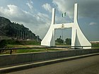
Abuya city gate

Zuma rock
National Assembly Building of Nigeria
The Ministry of Foreign Affairs.
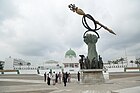
Shehu Musa Yar'adua Center

Crystal Dome of the Shehu Musa Yar'adua Center

Side view of Central Bank of Nigeria

Usman Dam, Bwari Abuja

Nigerian Senate Building (Red Chamber)

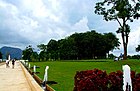
Millennium Park
Abuja Millennium Park


.jpg)


Twinned cities
 Brasilia, Brazil
 Toluca, Mexico
Contenido relacionado
The Realejos
Mantua
The Count's Houses