Condado
| FIPS código
| Asiento del condado
| Est. | Formado desde
| Etymology | Densidad
| Población
| Zona
| Mapa
|
|---|
| Alachua County
| 001
| Gainesville | 1824 | Duval y St. Johns | De una palabra Seminole-Creek que significa "jug", aparentemente en referencia a los sumideros comunes en la zona | 319.49
| 279,238 | 874sq mi
()2.264km2) |  |
|---|
| Baker County
| 003
| Macclenny | 1861 | Nuevo Río | James McNair Baker (1821-1892), senador confederado y luego juez en el cuarto distrito judicial | 49.09
| 28.715 | 585sq mi
()1,515km2) | 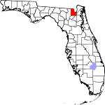 |
|---|
| Bay County
| 005
| Ciudad de Panamá | 1913 | Calhoun y Washington | St. Andrew's Bay, la característica geográfica central del condado | 234.51
| 179,168 | 764sq mi
()1 979km2) |  |
|---|
| Bradford County
| 007
| Starke | 1858 | Columbia
Nuevo Río hasta 1861 | Richard Bradford, el primer oficial de Florida en morir en la Guerra Civil; fue asesinado durante la Batalla de la Isla Santa Rosa | 97.41
| 28.540 | 293sq mi
()759km2) | 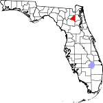 |
|---|
| Brevard County
| 009
| Titusville | 1844 | Hillsborough y Mosquito
llamado St. Lucie hasta 1855 | Theodore Washington Brevard, colonizador temprano y luego contralor estatal de 1853 a 1861 | 605.72
| 616.628 | 1.018sq mi
()2.637km2) |  |
|---|
| Condado Broward
| 011
| Fort Lauderdale | 1915 | Miami-Dade y Palm Beach | Napoleón Bonaparte Broward (1857-1910), 19o gobernador de Florida de 1905 a 1909 | 1597.17
| 1 930.983 | 1.209sq mi
()3.131km2) |  |
|---|
| Condado de Calhoun
| 013
| Blountstown | 1838 | Franklin, Jackson y Washington | John C. Calhoun (1782-1850) principal político del sur de Carolina del Sur | 24.06
| 13,641 | 567sq mi
()1.469km2) | 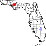 |
|---|
| Charlotte County
| 015
| Punta Gorda | 1921 | DeSoto | Probablemente una corrupción del nombre de la Calusa, un grupo de nativos americanos de la zona | 280.75
| 194,843 | 694sq mi
()1,797km2) |  |
|---|
| Citrus County
| 017
| Inverness | 1887 | Hernando | Los cítricos del condado | 270.69
| 158.083 | 584sq mi
()1,513km2) | 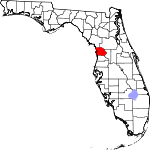 |
|---|
| Clay County
| 019
| Green Cove Springs | 1858 | Duval | Henry Clay (1777-1852), Secretario de Estado de 1825 a 1829 bajo John Quincy Adams | 369.99
| 222,361 | 601sq mi
()1.557km2) |  |
|---|
| Collier County
| 021
| Este de Nápoles | 1923 | Lee | Barron Collier (1873-1939), empresario de publicidad que desarrolló gran parte de la tierra en el sur de Florida | 190.51
| 385.980 | 2.026sq mi
()5.247km2) |  |
|---|
| Columbia County
| 023
| Lake City | 1832 | Alachua | Cristóbal Colón (c. 1451–1506), explorador de las Américas | 88.31
| 70.385 | 797sq mi
()2.064km2) | 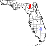 |
|---|
| DeSoto County
| 027
| Arcadia | 1887 | Manatee | Hernando de Soto (c. 1496/1497–1542), explorador y conquistador español | 54.02
| 34,408 | 637sq mi
()1.650km2) |  |
|---|
| Dixie County
| 029
| Cross City | 1921 | Lafayette | Dixie, el apodo común para los Estados Unidos del Sur | 24.29
| 17.102 | 704sq mi
()1.823km2) | 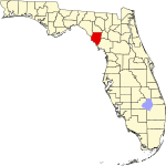 |
|---|
| Condado de Duval
| 031
| Jacksonville | 1822 | St. Johns | William Pope Duval (1784-1854), el primer gobernador del Territorio de la Florida | 1291.91
| 999.935 | 774sq mi
()2 005km2) |  |
|---|
| Condado de Escambia
| 033
| Pensacola | 1821 | Uno de los dos condados originales | Origen controvertido; posiblemente de la palabra indígena americana Shambia, que significa "agua limpia", o de la palabra española "cambiar", que significa barter | 485.53
| 322,390 | 664sq mi
()1.720km2) |  |
|---|
| Flagler County
| 035
| Bunnell | 1917 | San Juan y Volusia | Henry Morrison Flagler (1830–1913), fundador de la Florida East Coast Railway | 249.34
| 120.932 | 485sq mi
()1.256km2) |  |
|---|
| Condado Franklin
| 037
| Apalachicola | 1832 | Gadsden y Washington | Benjamin Franklin (1706-1790), uno de los Padres Fundadores de los Estados Unidos de América | 23.54
| 12.572 | 534sq mi
()1,383km2) |  |
|---|
| Gadsden County
| 039
| Quincy | 1823 | Jackson | James Gadsden (1788-1858), diplomático americano y el nombre de la Compra Gadsden | 84.72
| 43.714 | 516sq mi
()1.336km2) | 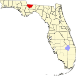 |
|---|
| Gilchrist County
| 041
| Trenton | 1925 | Alachua | Albert W. Gilchrist (1858-1926), el 20o gobernador de Florida | 52.61
| 18.360 | 349sq mi
()904km2) |  |
|---|
| Glades County
| 043
| Moore Haven | 1921 | DeSoto | Los Everglades de Florida | 15.81
| 12.234 | 774sq mi
()2 005km2) |  |
|---|
| Gulf County
| 045
| Port St. Joe | 1925 | Calhoun | El Golfo de México | 25.42
| 14,363 | 565sq mi
()1.463km2) |  |
|---|
| Condado Hamilton
| 047
| Jasper | 1827 | Jefferson | Alexander Hamilton (1757–1804), el primer Secretario de los Estados Unidos del Tesoro y un Padre Fundador | 27.17
| 13,993 | 515sq mi
()1.334km2) | 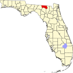 |
|---|
| Hardee County
| 049
| Wauchula | 1921 | DeSoto | Cary A. Hardee (1876-1957), gobernador de Florida en el momento de la creación del condado de Hardee | 39.91
| 25.425 | 637sq mi
()1.650km2) |  |
|---|
| Hendry County
| 051
| LaBelle | 1923 | Lee | Francis A. Hendry (1833-1917), pionero y político floridiano | 34.96
| 40.313 | 1.153sq mi
()2.986km2) |  |
|---|
| Condado Hernando
| 053
| Brooksville | 1843 | Alachua y Hillsborough
Benton de 1844 a 1850 | Hernando de Soto (c.1496/1497–1542), explorador y conquistador español | 419.74
| 200.638 | 478sq mi
()1.238km2) |  |
|---|
| Highlands County
| 055
| Sebring | 1921 | DeSoto | Nombre para el terreno montañoso del condado | 100.48
| 103.296 | 1.028sq mi
()2.663km2) | 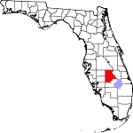 |
|---|
| Hillsborough
| 057
| Tampa | 1834 | Alachua | Wills Hill, Earl de Hillsborough (1718-1793), ex Secretario de Estado para las Colonias | 1406.46
| 1,478,194 | 1.051sq mi
()2.2722km2) |  |
|---|
| Condado Holmes
| 059
| Bonifay | 1848 | Jackson y Walton | Holmes Creek, que forma el límite oriental del condado | 41.05
| 19.784 | 482sq mi
()1.248km2) |  |
|---|
| Indian River County
| 061
| Vero Beach | 1925 | St. Lucie | La Laguna del Río Indio, que fluye por el condado | 325.37
| 163,662 | 503sq mi
()303km2) |  |
|---|
| Jackson County
| 063
| Marianna | 1822 | Escambia | Andrew Jackson (1767-1845), el séptimo Presidente de los Estados Unidos | 52.07
| 47,694 | 916sq mi
()2.372km2) |  |
|---|
| Jefferson County
| 065
| Monticello | 1827 | Leon | Thomas Jefferson (1743-1826), el tercer Presidente de los Estados Unidos y autor principal de la Declaración de Independencia | 24.34
| 14,555 | 598sq mi
()1.549km2) |  |
|---|
| Lafayette County
| 067
| Mayo | 1856 | Madison | Gilbert du Motier, marqués de La Fayette (1757-1834), aristócrata francés y general en la Guerra Revolucionaria Americana | 15.44
| 8.382 | 543sq mi
()1.406km2) |  |
|---|
| Lake County
| 069
| Tavares | 1887 | Naranja y Sumter | Nombre para los numerosos lagos de la región | 415.32
| 395,804 | 953sq mi
()2.468km2) | 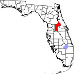 |
|---|
| Condado Lee
| 071
| Fort Myers | 1887 | Monroe | Robert E. Lee (1807-1870), comandante del Ejército Confederado del Norte de Virginia en la Guerra Civil Americana | 980.07
| 787.976 | 804sq mi
()2.082km2) | 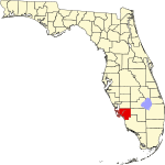 |
|---|
| Condado de Leon
| 073
| Tallahassee | 1824 | Gadsden | Juan Ponce de León (1474–1521), explorador español que nombró Florida | 439.01
| 292,817 | 667sq mi
()1.728km2) | 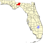 |
|---|
| Levy County
| 075
| Bronson | 1845 | Alachua | David Levy Yulee (1810-1886), uno de los senadores estadounidenses originales del estado | 39.50
| 44.158 | 1.118sq mi
()896km2) |  |
|---|
| Liberty County
| 077
| Bristol | 1855 | Gadsden | El ideal patriótico de la libertad | 9.45
| 7.900 | 836sq mi
()2.165km2) |  |
|---|
| Madison County
| 079
| Madison | 1827 | Jefferson | James Madison (1751–1836), cuarto Presidente de los Estados Unidos | 26.43
| 18.288 | 692sq mi
()1,792km2) | 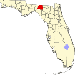 |
|---|
| Manatee County
| 081
| Bradenton | 1855 | Hillsborough | El manatee, o vaca marina, es originario de las aguas de Florida. | 556.95
| 412,703 | 741sq mi
()1 919km2) |  |
|---|
| Condado Marion
| 083
| Ocala | 1844 | Alachua, Hillsborough y Mosquito | Francisco Marion (c. 1732-1795), oficial militar durante la Revolución Americana | 244.40
| 385.915 | 1.579sq mi
()4.090km2) |  |
|---|
| Condado Martin
| 085
| Stuart | 1925 | Palm Beach | John W. Martin (1884-1958), gobernador de Florida en el momento de la creación del condado | 287.67
| 159.942 | 556sq mi
()1.440km2) |  |
|---|
| Miami-Dade County
| 086
| Miami | 1836 | Monroe
llamado Dade hasta 1997 | Ciudad de Miami y Francis L. Dade (c. 1793-1835), Mayor en el Ejército de los Estados Unidos durante la Segunda Guerra del Semino | 1368.33
| 2,662,777 | 1 946sq mi
()5,040km2) |  |
|---|
| Condado Monroe
| 087
| Key West | 1823 | St. Johns | James Monroe (1758-1831), quinto Presidente de los Estados Unidos | 82.42
| 82.170 | 997sq mi
()2.582km2) |  |
|---|
| Condado de Nassau
| 089
| Fernandina Beach | 1824 | Duval | Ducado de Nassau en Alemania | 144.46
| 94.189 | 652sq mi
()1.689km2) |  |
|---|
| Okaloosa County
| 091
| Crestview | 1915 | Santa Rosa y Walton | Una palabra nativa que significa "un lugar agradable", "agua negra", o "lugar hermoso" | 227.84
| 213,255 | 936sq mi
()2.424km2) |  |
|---|
| Okeechobee County
| 093
| Okeechobee | 1917 | Osceola y St. Lucie | Lago Okeechobee, que a su vez es de las palabras Hitchiti para "agua grande" | 52.02
| 40.266 | 774sq mi
()2 005km2) | 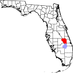 |
|---|
| Condado de Orange
| 095
| Orlando | 1824 | St. Johns
llamado Mosquito hasta 1845 | La fruta que era el producto principal del condado | 1566.90
| 1.422.746 | 908sq mi
()2.352km2) |  |
|---|
| Condado de Osceola
| 097
| Kissimmee | 1887 | Brevard y Orange | Osceola (1804-1838), líder del Seminole durante la Segunda Guerra Seminole | 305.05
| 403,282 | 1.322sq mi
()3.424km2) |  |
|---|
| Palm Beach County
| 099
| West Palm Beach | 1909 | Miami Dade County | Las grandes cantidades de palmeras del condado | 736.47
| 1.497.987 | 2.034sq mi
()5.268km2) | 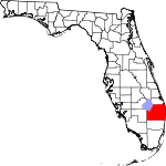 |
|---|
| Condado de Pasco
| 101
| Dade City | 1887 | Hernando | Samuel Pasco (1834-1917), Senador de Estados Unidos en el momento de la creación del condado | 783.98
| 584,067 | 745sq mi
()1 930km2) | 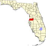 |
|---|
| Condado de Pinellas
| 103
| Agua limpia | 1912 | Hillsborough | Del español Punta Piñal, o "Punto de Pines" | 3416.48
| 956,615 | 280sq mi
()725km2) |  |
|---|
| Polk County
| 105
| Bartow | 1861 | Brevard y Hillsborough | James K. Polk (1795–1849), el 11o Presidente de los Estados Unidos | 401.88
| 753,520 | 1.875sq mi
()4.856km2) |  |
|---|
| Condado de Putnam
| 107
| Palatka | 1849 | Alachua y San Juan | Benjamin A. Putnam (1801-1869), soldado durante la Segunda Guerra Seminola y legislador floridiano | 102.72
| 74.167 | 722sq mi
()1.870km2) |  |
|---|
| St. Johns County
| 109
| St. Augustine | 1821 | Uno de los dos condados originales | Nombre derivado del río San Juan, que a su vez deriva su nombre de San Juan del Puerto | 480.24
| 292,466 | 609sq mi
()1,577km2) |  |
|---|
| St. Lucie County
| 111
| Fort Pierce | 1905 | Brevard | Santa Lucía (283–304), el mártir cristiano | 600.66
| 343,579 | 572sq mi
()1.481km2) | 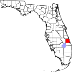 |
|---|
| Santa Rosa Condado
| 113
| Milton | 1842 | Escambia | Santa Rosa Isla, que a su vez es llamada por Santa Rosa de Viterbo (1235-1252), un santo nacido en Viterbo, Italia | 190.94
| 193,998 | 1.016sq mi
()2.631km2) |  |
|---|
| Condado de Sarasota
| 115
| Sarasota | 1921 | Manatee | Palabra nativa americana, de significado incierto, para el área | 781.57
| 447.057 | 572sq mi
()1.481km2) |  |
|---|
| Condado de Seminole
| 117
| Sanford | 1913 | Naranja | La tribu indígena Seminole | 1526.28
| 470.093 | 308sq mi
()798km2) |  |
|---|
| Sumter County
| 119
| Bushnell | 1853 | Marion | Thomas Sumter (1734-1832), general en la Revolución Americana | 248.42
| 135.638 | 546sq mi
()1.414km2) |  |
|---|
| Condado de Suwannee
| 121
| Roble vivo | 1858 | Columbia | El río Suwannee, un río largo de 266 millas en el norte de Florida | 64.66
| 44.485 | 688sq mi
()1,782km2) |  |
|---|
| Taylor County
| 123
| Perry | 1856 | Madison | Zachary Taylor (1784-1850), 12a Presidente de los Estados Unidos | 20.94
| 21.815 | 1.042sq mi
()2.699km2) | 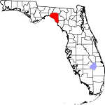 |
|---|
| Union County
| 125
| Lake Butler | 1921 | Bradford | Nombre para los residentes de la zona deseo unido de dividirse en un condado separado | 68.06
| 16.335 | 240sq mi
()622km2) |  |
|---|
| Condado de Volusia
| 127
| DeLand | 1854 | Naranja | El puerto de Volusia, cuya etimología es incierta; posiblemente derivado de la palabra indígena americana para "Land of the Euchees", el término para los habitantes nativos de la zona | 510.32
| 564.412 | 1.106sq mi
()2,865km2) |  |
|---|
| Wakulla County
| 129
| Crawfordville | 1843 | Leon | El río Wakulla, llamado por una corrupción española de una palabra Timucuan usada para describir el cuerpo del agua, pero eso es de significado incierto | 57.15
| 34.690 | 607sq mi
()1.572km2) | 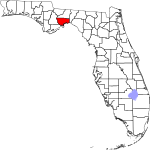 |
|---|
| Walton County
| 131
| DeFuniak Springs | 1824 | Escambia y Jackson | George Walton, primer secretario del Territorio de Florida | 75.68
| 80.069 | 1.058sq mi
()2.740km2) | 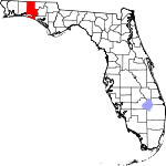 |
|---|
| Washington County
| 133
| Chipley | 1825 | Jackson y Walton | George Washington (1732–1799), primer presidente de los Estados Unidos | 43.86
| 25.436 | 580sq mi
()1.502km2) |  |
|---|