
Lista de ciudades de Estados Unidos por población
Esta es una lista de los lugares incorporados más poblados de los Estados Unidos. Según lo definido por la Oficina del Censo de Estados Unidos, un lugar incorporado incluye ciudades, pueblos, aldeas, distritos y municipios. Algunos lugares excepcionales designados por el censo (CDP) también se incluyen en la lista de lugares incorporados de la Oficina del Censo. Las ciudades-condados consolidados representan un tipo distinto de gobierno que incluye a toda la población de un condado, o su equivalente. Algunas ciudades-condados consolidadas, sin embargo, incluyen múltiples lugares incorporados. Esta lista presenta solo la parte de dichas ciudades-condados consolidados que no forman parte de otro lugar incorporado.
Esta lista se refiere únicamente a la población de municipios individuales dentro de sus límites definidos; las poblaciones de otros municipios considerados suburbios de una ciudad central se enumeran por separado y no se incluyen las áreas no incorporadas dentro de aglomeraciones urbanas. Por lo tanto, es evidente una clasificación diferente al considerar las áreas urbanas o metropolitanas de Estados Unidos.
50 estados y Washington, D.C.
Esta tabla enumera los 333 lugares incorporados en los Estados Unidos, excluidos los territorios de los EE. UU., con una población de al menos 100 000 habitantes al 1 de julio de 2022, según lo estimado por la Oficina del Censo de los EE. UU. Cinco estados no tienen ciudades con poblaciones superiores a 100.000 habitantes. Ellos son: Delaware, Maine, Vermont, Virginia Occidental y Wyoming.
La tabla muestra:
- La ciudad ocupa el puesto de población al 1 de julio de 2022, según lo estimado por la Oficina del Censo de los Estados Unidos
- El nombre de la ciudad
- El nombre del estado en el que se encuentra la ciudad
- Población urbana al 1 de julio de 2022, según lo estimado por la Oficina del Censo de los Estados Unidos
- La población de la ciudad al 1 de abril de 2020, como se indica en el censo de 2020 de los Estados Unidos
- La población porcentual de la ciudad cambia del 1 de abril de 2020, al 1 de julio de 2022
- La zona de tierra de la ciudad al 1 de enero de 2020
- La densidad poblacional de la ciudad al 1 de abril de 2020 (residentes por unidad de área terrestre)
- Las coordenadas de latitud y longitud de la ciudad
Descargar coordenadas como:
- KML
- GPX (todas las coordenadas)
- GPX (coordinaciones primarias)
- GPX (coordinaciones secundarias)

| Capital estatal | |
| Ciudad más grande del Estado | |
| Capital estatal y ciudad más grande | |
| Capital federal |
| Ciudad | ST | 2022 Estimación | 2020 Censo | Cambio | Zona terrestre 2020 | Densidad 2020 | Ubicación | ||
|---|---|---|---|---|---|---|---|---|---|
| #2 | km2 | / mi2 | / km2 | ||||||
| Nueva York | NY | 8.335.897 | 8.804.190 | 5,32% | 300,5 | 778.3 | 29.298 | 11,312 | 40°40′N 73°56′W / 40.66°N 73.94°W / 40.66; -73.94 (Nueva York) |
| Los Ángeles | CA | 3,822.238 | 3,898,747 | −1,96% | 469,5 | 1,216.0 | 8.304 | 3.206 | 34°01′N 118°25′W / 34.02°N 118.41°W / 34.02; -118.41 (Los Ángeles) |
| Chicago | IL | 2.665 039 | 2,746,388 | −2.96% | 227,7 | 589,7 | 12.061 | 4.657 | 41°50′N 87°41′W / 41.84°N 87.68°W / 41.84; -87.68 (Chicago) |
| Houston | TX | 2.302.878 | 2.304,580 | 0.0−7% | 640,4 | 1.658,6 | 3.599 | 1.390 | 29°47′N 95°23′W / 29.79°N 95.39°W / 29.79; -95.39 (Houston) |
| Phoenix | AZ | 1,644,409 | 1,608,139 | +2.26% | 518.0 | 1.341,6 | 3,105 | 1.199 | 33°34′N 112°05′W / 33.57°N 112.09°W / 33.57; -112.09 (Phoenix) |
| Philadelphia | PA | 1.567.258 | 1,603,797 | −2.28% | 134.4 | 348.1 | 11,933 | 4.607 | 40°01′N 75°08′W / 40.01°N 75.13°W / 40.01; -75.13 (Philadelphia) |
| San Antonio | TX | 1,472,909 | 1,434,625 | +2.67% | 498,8 | 1.291,9 | 2.876 | 1.110 | 29°28′N 98°31′W / 29.46°N 98.52°W / 29.46; -98.52 (San Antonio) |
| San Diego | CA | 1,381,162 | 1.386.932 | 0,42% | 325.9 | 844.1 | 4.256 | 1,643 | 32°49′N 117°08′W / 32.81°N 117.14°W / 32.81; -117.14 (San Diego) |
| Dallas | TX | 1.299.544 | 1.304.379 | 0,37% | 339.6 | 879.6 | 3,841 | 1.483 | 32°47′N 96°46′W / 32.79°N 96.77°W / 32.79; -96.77 (Dallas) |
| Austin | TX | 974,447 | 961.855 | +1.31% | 319.9 | 828,5 | 3,007 | 1.161 | 30°18′N 97°45′W / 30.30°N 97.75°W / 30.30; -97.75 (Austin) |
| Jacksonville | FL | 971,319 | 949.611 | +2.29% | 747.3 | 1 935,5 | 1.271 | 491 | 30°20′N 81°40′W / 30.34°N 81.66°W / 30.34; -81.66 (Jacksonville) |
| San José | CA | 971,233 | 1.013.240 | −4.15% | 178.3 | 461.8 | 5,683 | 2.194 | 37°18′N 121°49′W / 37.30°N 121.81°W / 37.30; -121.81 (San José) |
| Fort Worth | TX | 956,709 | 918.915 | +4.11% | 347.3 | 899,5 | 2.646 | 1.022 | 32°47′N 97°21′W / 32.78°N 97.35°W / 32.78; -97.35 (Fort Worth) |
| Columbus | Oh. | 907,971 | 905,748 | +0,25% | 220.0 | 569,8 | 4.117 | 1.590 | 39°59′N 82°59′W / 39.99°N 82.99°W / 39.99; -82.99 (Columbus) |
| Charlotte | NC | 897.720 | 874,579 | +2.65% | 308.3 | 798,5 | 837 | 1.095 | 35°13′N 80°50′W / 35.21°N 80.83°W / 35.21; -80.83 (Charlotte) |
| Indianapolis | INTRODUCCIÓN | 880.621 | 887,642 | 0,79% | 361.6 | 936,5 | 2.455 | 948 | 39°47′N 86°09′W / 39.78°N 86.15°W / 39.78; -86.15 (Indianapolis) |
| San Francisco | CA | 808,437 | 873,965 | −7.50% | 46.9 | 121,5 | 18.635 | 7,195 | 37°44′N 123°02′W / 37.73°N 123.03°W / 37.73; -123.03 (San Francisco) |
| Seattle | WA | 749.256 | 737.015 | +1,66% | 83,8 | 217.0 | 8.795 | 3.396 | 47°37′N 122°21′W / 47.62°N 122.35°W / 47.62; -122.35 (Seattle) |
| Denver | CO | 713.252 | 715.522 | 0,32% | 153.1 | 396,5 | 4.674 | 1,805 | 39°46′N 104°53′W / 39.76°N 104.88°W / 39.76; -104.88 (Denver) |
| Oklahoma City | OK | 694,800 | 681.054 | +2,02% | 606.2 | 1.570,1 | 1.123 | 434 | 35°28′N 97°31′W / 35.47°N 97.51°W / 35.47; -97.51 (Ciudad de Oklahoma) |
| Nashville | TN | 683,622 | 689.447 | 0,84% | 475,8 | 1.232,3 | 1.449 | 559 | 36°10′N 86°47′W / 36.17°N 86.79°W / 36.17; -86.79 (Nashville) |
| El Paso | TX | 677,456 | 678.815 | 0,20% | 258,4 | 669,3 | 2.627 | 1.014 | 31°51′N 106°26′W / 31.85°N 106.43°W / 31.85; -106.43 (El Paso) |
| Washington | DC | 671,803 | 689.545 | −2.57% | 61.1 | 158.2 | 11.286 | 4.358 | 38°54′N 77°01′W / 38.90°N 77.02°W / 38.90; -77.02 (Washington, D.C.) |
| Las Vegas | NV | 656,274 | 641,903 | +2.24% | 141.8 | 367.3 | 4,527 | 1.748 | 36°14′N 115°16′W / 36.23°N 115.26°W / 36.23; -115.26 (Las Vegas) |
| Boston | MA | 650.706 | 675.647 | −3.69% | 48.3 | 125.1 | 13,989 | 5.401 | 42°20′N 71°01′W / 42.34°N 71.02°W / 42.34; -71.02 (Boston) |
| Portland | O | 635.067 | 652,503 | −2.67% | 133,5 | 345.8 | 4.888 | 1.887 | 45°32′N 122°39′W / 45.54°N 122.65°W / 45.54; -122.65 (Portlandia) |
| Louisville | KY | 624.444 | 633,045 | −1,36% | 324.9 | 841,5 | 1 948 | 752 | 38°10′N 85°39′W / 38.17°N 85.65°W / 38.17; -85.65 (Louisville) |
| Memphis | TN | 621.056 | 633,104 | −1,90% | 297.0 | 769.2 | 2.132 | 823 | 35°07′N 89°58′W / 35.11°N 89.97°W / 35.11; -89.97 (Memphis) |
| Detroit | MI | 620.376 | 639.111 | −2.93% | 138,7 | 359.2 | 4.608 | 1.779 | 42°23′N 83°06′W / 42.38°N 83.10°W / 42.38; -83.10 (Detroit) |
| Baltimore | MD | 569.931 | 585,708 | −2.69% | 80,9 | 209.5 | 7.240 | 2.800 | 39°18′N 76°37′W / 39.30°N 76.61°W / 39.30; -76.61 (Baltimore) |
| Milwaukee | WI | 563,305 | 577,222 | −2.41% | 96.2 | 249.2 | 6.000 | 2.300 | 43°04′N 87°58′W / 43.06°N 87.97°W / 43.06; -87.97 (Milwaukee) |
| Albuquerque | NM | 561,008 | 564,559 | 0,63% | 187.3 | 485.1 | 3014 | 1.164 | 35°06′N 106°39′W / 35.10°N 106.65°W / 35.10; -106.65 (Albuquerque) |
| Tucson | AZ | 546.574 | 542,629 | +0,73% | 241.0 | 624.2 | 2.2252 | 870 | 32°09′N 110°52′W / 32.15°N 110.87°W / 32.15; -110.87 (Tucson) |
| Fresno | CA | 545.567 | 542,107 | +0,64% | 115.2 | 298,4 | 4.706 | 1.817 | 36°47′N 119°47′W / 36.78°N 119.79°W / 36.78; -119.79 (Fresno) |
| Sacramento | CA | 528.001 | 524.943 | +0,58% | 98.6 | 255.4 | 5.324 | 2.056 | 38°34′N 121°28′W / 38.57°N 121.47°W / 38.57; -121.47 (Sacramento) |
| Mesa | AZ | 512,498 | 504,258 | +1,63% | 138,7 | 359.2 | 3.636 | 1.404 | 33°24′N 111°43′W / 33.40°N 111.72°W / 33.40; -111.72 (Mesa) |
| Kansas City | MO | 509,297 | 508,090 | +0,24% | 314.7 | 815.1 | 1.615 | 624 | 39°07′N 94°34′W / 39.12°N 94.56°W / 39.12; -94.56 (Kansas City, MO) |
| Atlanta | GA | 499.127 | 498.715 | +0.08% | 135.3 | 350,4 | 3.686 | 1.423 | 33°46′N 84°25′W / 33.76°N 84.42°W / 33.76; -84.42 (Atlanta) |
| Colorado Springs | CO | 486,248 | 478.961 | +1,52% | 195.4 | 506.1 | 2.451 | 946 | 38°52′N 104°46′W / 38.87°N 104.76°W / 38.87; -104.76 (Colorado Springs) |
| Omaha | NE | 485,153 | 486,051 | 0,18% | 141,6 | 366,7 | 3.433 | 1.325 | 41°16′N 96°03′W / 41.26°N 96.05°W / 41.26; -96.05 (Omaha) |
| Raleigh | NC | 476,587 | 467.665 | +1,91% | 147.1 | 381.0 | 3.179 | 1.227 | 35°50′N 78°38′W / 35.83°N 78.64°W / 35.83; -78.64 (Raleigh) |
| Virginia Beach | VA | 455,618 | 459,470 | 0,84% | 244.7 | 633,8 | 1.878 | 725 | 36°47′N 76°02′W / 36.78°N 76.03°W / 36.78; -76.03 (Virginia Beach) |
| Long Beach | CA | 451,307 | 466,742 | −3.31% | 50,7 | 131.3 | 9,206 | 3.554 | 33°47′N 118°10′W / 33.78°N 118.17°W / 33.78; -118.17 (Long Beach) |
| Miami | FL | 449.514 | 442,241 | +1,64% | 36.0 | 93.2 | 12.284 | 4.743 | 25°47′N 80°13′W / 25.78°N 80.21°W / 25.78; -80.21 (Miami) |
| Oakland | CA | 430.553 | 440.646 | −2.29% | 55,9 | 144.8 | 7,883 | 3.044 | 37°46′N 122°14′W / 37.77°N 122.23°W / 37.77; -122.23 (Oakland) |
| Minneapolis | MN | 425.096 | 429.954 | −1.13% | 54.0 | 139,9 | 7,962 | 3,074 | 44°58′N 93°16′W / 44.96°N 93,27°W / 44.96; -93.27 (Minneapolis) |
| Tulsa | OK | 411.867 | 413.066 | 0,29% | 197.5 | 511,5 | 2.091 | 807 | 36°08′N 95°54′W / 36.13°N 95.90°W / 36.13; -95.90 (Tulsa) |
| Bakersfield | CA | 410.647 | 403,455 | +1,78% | 149,8 | 388.0 | 2.693 | 1.040 | 35°21′N 119°02′W / 35.35°N 119.04°W / 35.35; -119.04 (Bakersfield) |
| Tampa | FL | 398.173 | 384,959 | +3.43% | 114.0 | 295.3 | 3.377 | 304 | 27°58′N 82°28′W / 27.97°N 82.47°W / 27.97; -82.47 (Tampa) |
| Wichita | KS | 396.192 | 397.532 | 0,34% | 162.0 | 419.6 | 2.454 | 947 | 37°41′N 97°21′W / 37.69°N 97.35°W / 37.69; -97.35 (Wichita) |
| Arlington | TX | 394,602 | 394,266 | +0.09% | 95,9 | 248.4 | 4.111 | 1.587 | 32°42′N 97°07′W / 32.70°N 97.12°W / 32.70; -97.12 (Arlington) |
| Aurora | CO | 393,537 | 386,261 | +1,88% | 160.1 | 414.7 | 2.413 | 932 | 39°42′N 104°43′W / 39.70°N 104.72°W / 39.70; -104.72 (Aurora) |
| Nueva Orleans | Los Ángeles | 369.749 | 383,997 | −3.71% | 169,5 | 439.0 | 2.265 | 875 | 30°03′N 89°56′W / 30.05°N 89.93°W / 30.05; -89.93 (Nueva Orleans) |
| Cleveland | Oh. | 361,607 | 372,624 | −2.96% | 77,7 | 201.2 | 4.796 | 1.852 | 41°29′N 81°41′W / 41.48°N 81.68°W / 41.48; -81.68 (Cleveland) |
| Anaheim | CA | 344.461 | 346.824 | 0,68% | 50,3 | 130.3 | 6.895 | 2662 | 33°52′N 117°46′W / 33.86°N 117.76°W / 33.86; -117.76 (Anaheim) |
| Honolulu | HI | 343,421 | 350.964 | −2.15% | 60,5 | 156,7 | 5.801 | 2.240 | 21°19′N 157°51′W / 21.32°N 157.85°W / 21.32; -157.85 (Honolu) |
| Henderson | NV | 331,415 | 317,610 | +4,35% | 106.2 | 275.1 | 2991 | 1.155 | 36°01′N 115°02′W / 36.01°N 115.04°W / 36.01; -115.04 (Henderson) |
| Stockton | CA | 321,819 | 320.804 | +0,32% | 62.2 | 161.1 | 5.158 | 1.992 | 37°59′N 121°19′W / 37.98°N 121.31°W / 37.98; -121.31 (Stockton) |
| Riverside | CA | 320.764 | 314,998 | +1.83% | 81.2 | 210.3 | 3,879 | 1.498 | 33°56′N 117°23′W / 33.94°N 117.39°W / 33.94; -117.39 (Riverside) |
| Lexington | KY | 320.347 | 322,570 | 0,69% | 283.6 | 734,5 | 1.137 | 439 | 38°02′N 84°28′W / 38.04°N 84.46°W / 38.04; -84.46 (Lexington) |
| Corpus Christi | TX | 316,239 | 317,863 | −0,51% | 162.2 | 420.1 | 1 960 | 760 | 27°45′N 97°10′W / 27.75°N 97.17°W / 27.75; -97.17 (Corpus Christi) |
| Orlando | FL | 316,081 | 307,573 | +2,77% | 110.6 | 286,5 | 2.781 | 1.074 | 28°25′N 81°15′W / 28.41°N 81.25°W / 28.41; -81.25 (Orlando) |
| Irvine | CA | 313,685 | 307,670 | +1,96% | 65.6 | 169,9 | 4.690 | 1.810 | 33°41′N 117°46′W / 33.68°N 117.77°W / 33.68; -117.77 (Irvine) |
| Cincinnati | Oh. | 309,513 | 309,317 | +0.06% | 77.8 | 201.5 | 3.976 | 1.535 | 39°08′N 84°31′W / 39.14°N 84.51°W / 39.14; -84.51 (Cincinnati) |
| Santa Ana | CA | 308,189 | 310.227 | 0,66% | 27.3 | 70,7 | 11.364 | 4.388 | 33°44′N 117°53′W / 33.74°N 117.88°W / 33.74; -117.88 (Santa Ana) |
| Newark | NJ | 305,344 | 311,549 | −1,99% | 24.1 | 62,4 | 12.927 | 4.991 | 40°43′N 74°10′W / 40.72°N 74.17°W / 40.72; -74.17 (Newark) |
| San Pablo | MN | 303,176 | 311,527 | −2.68% | 52.0 | 134,7 | 5,991 | 2.313 | 44°57′N 93°06′W / 44.95°N 93.10°W / 44.95; -93.10 (San Pablo) |
| Pittsburgh | PA | 302,898 | 302,971 | 0.0−2% | 55.4 | 143.5 | 5.469 | 2.112 | 40°26′N 79°59′W / 40.44°N 79.98°W / 40.44; -79.98 (Pitsburgh) |
| Greensboro | NC | 301,115 | 299,035 | +0,70% | 129.6 | 335,7 | 2.307 | 891 | 36°06′N 79°50′W / 36.10°N 79.83°W / 36.10; -79.83 (Greensboro) |
| Lincoln | NE | 292,627 | 291.082 | +0,53% | 97,7 | 253.0 | 2.979 | 1.150 | 40°49′N 96°41′W / 40.81°N 96.68°W / 40.81; -96.68 (Lincoln) |
| Durham | NC | 291,928 | 283,506 | +2.97% | 112.8 | 292.2 | 2,513 | 970 | 35°59′N 78°54′W / 35.98°N 78.90°W / 35.98; -78.90 (Durham) |
| Plano | TX | 289,547 | 285,494 | +1.42% | 71,7 | 185,7 | 3.982 | 1.537 | 33°03′N 96°45′W / 33.05°N 96.75°W / 33.05; -96.75 (Plano) |
| Anclaje | AK | 287,145 | 291,247 | −1.41% | 1.706,8 | 4.420.6 | 171 | 66 | 61°10′N 149°17′W / 61.17°N 149.28°W / 61.17; -149.28 (Anchorage) |
| Jersey City | NJ | 286,670 | 292,449 | −1,98% | 14.7 | 38.1 | 19.894 | 7,681 | 40°43′N 74°04′W / 40.71°N 74.06°W / 40.71; -74.06 (Jersey City) |
| St. Louis | MO | 286,578 | 301,578 | −4.97% | 61.7 | 159.8 | 4.888 | 1.887 | 38°38′N 90°14′W / 38.64°N 90.24°W / 38.64; -90.24 (St. Louis) |
| Chandler | AZ | 280.711 | 275,987 | +1,71% | 65.3 | 169.1 | 4.226 | 1.632 | 33°17′N 111°51′W / 33.28°N 111.85°W / 33.28; -111.85 (Chandler) |
| North Las Vegas | NV | 280,543 | 262,527 | +6,86% | 101.3 | 262.4 | 2.592 | 1.001 | 36°17′N 115°05′W / 36.28°N 115.09°W / 36.28; -115.09 (North Las Vegas) |
| Chula Vista | CA | 279,170 | 275,487 | +1.34% | 49.6 | 128,5 | 5.554 | 2,144 | 32°38′N 117°01′W / 32.63°N 117.02°W / 32.63; -117.02 (Chula Vista) |
| Buffalo | NY | 276,486 | 278,349 | −0,67% | 40,4 | 104.6 | 6.890 | 2.660 | 42°53′N 78°52′W / 42.89°N 78.86°W / 42.89; -78.86 (Búfalo) |
| Gilbert | AZ | 275,346 | 267,918 | +2,77% | 68.6 | 177,7 | 3.906 | 1.508 | 33°19′N 111°44′W / 33.31°N 111.74°W / 33.31; -111.74 (Gilbert) |
| Reno | NV | 273,448 | 264,165 | +3.51% | 108,8 | 281.8 | 2.428 | 937 | 39°33′N 119°51′W / 39.55°N 119.85°W / 39.55; -119.85 (Reno) |
| Madison | WI | 272,903 | 269,840 | +1.14% | 79,6 | 206.2 | 3.390 | 1.310 | 43°05′N 89°26′W / 43.09°N 89.43°W / 43.09; -89.43 (Madison) |
| Fort Wayne | INTRODUCCIÓN | 267,927 | 263,886 | +1.53% | 110.7 | 286,7 | 2.384 | 920 | 41°05′N 85°08′W / 41.09°N 85.14°W / 41.09; -85.14 (Fort Wayne) |
| Toledo | Oh. | 266,301 | 270.871 | −1.69% | 80,5 | 208.5 | 3.365 | 1.299 | 41°40′N 83°35′W / 41.66°N 83.58°W / 41.66; -83.58 (Toledo) |
| Lubbock | TX | 263,930 | 257,141 | +2.64% | 134.6 | 348.6 | 1 910 | 740 | 33°34′N 101°53′W / 33.57°N 101.89°W / 33.57; -101.89 (Lubbock) |
| San Petersburgo | FL | 261,256 | 258,308 | +1.14% | 61.8 | 160.1 | 4,180 | 1.610 | 27°46′N 82°38′W / 27.77°N 82.64°W / 27.77; -82.64 (St. Petersburg) |
| Laredo | TX | 256,187 | 255,205 | +0,38% | 106,5 | 275,8 | 2.396 | 925 | 27°34′N 99°29′W / 27.56°N 99.49°W / 27.56; -99.49 (Laredo) |
| Irving | TX | 254,715 | 256,684 | 0,77% | 67.0 | 173.5 | 3,831 | 1.479 | 32°52′N 96°58′W / 32.86°N 96.97°W / 32.86; -96.97 (Irving) |
| Chesapeake | VA | 252,488 | 249,422 | +1,23% | 338,5 | 876.7 | 737 | 285 | 36°41′N 76°18′W / 36.68°N 76.30°W / 36.68; -76.30 (Chesapeake) |
| Glendale | AZ | 252,136 | 248,325 | +1.53% | 61.6 | 159,5 | 4.031 | 1,556 | 33°32′N 112°11′W / 33.53°N 112.19°W / 33.53; -112.19 (Glendale) |
| Winston-Salem | NC | 251,350 | 249,545 | +0,72% | 132.7 | 343.7 | 1.881 | 726 | 36°06′N 80°16′W / 36.10°N 80.26°W / 36.10; -80.26 (Winston-Salem) |
| Scottsdale | AZ | 243,050 | 241,361 | +0,70% | 184.0 | 476.6 | 1.312 | 507 | 33°41′N 111°52′W / 33.68°N 111.86°W / 33.68; -111.86 (Scottsdale) |
| Garland | TX | 240.854 | 246,018 | −2.10% | 57.1 | 147.9 | 4.309 | 1,664 | 32°55′N 96°38′W / 32.91°N 96.63°W / 32.91; -96.63 (Garland) |
| Boise | ID | 236,634 | 235,684 | +0,40% | 84.0 | 217.6 | 2,806 | 1.083 | 43°36′N 116°14′W / 43.60°N 116.23°W / 43.60; -116.23 (Boise) |
| Norfolk | VA | 232,995 | 238,005 | −2.10% | 53.3 | 138.0 | 4.465 | 1.724 | 36°55′N 76°14′W / 36.92°N 76.24°W / 36.92; -76.24 (Norfolk) |
| Port St. Lucie | FL | 231,790 | 204,851 | +13,15% | 119.2 | 308.7 | 1.719 | 664 | 27°17′N 80°23′W / 27.28°N 80.39°W / 27.28; -80.39 (Port St. Lucie) |
| Spokane | WA | 230,160 | 228,989 | +0,51% | 68,8 | 178.2 | 3.328 | 1.285 | 47°40′N 117°26′W / 47.67°N 117.43°W / 47.67; -117.43 (Spokane) |
| Richmond | VA | 229,395 | 226,610 | +1,23% | 59,9 | 155.1 | 3.783 | 1.461 | 37°32′N 77°29′W / 37.53°N 77.48°W / 37.53; -77.48 (Richmond) |
| Fremont | CA | 223,871 | 230,504 | −2.88% | 78.3 | 202.8 | 2.944 | 1.137 | 37°29′N 121°56′W / 37.49°N 121.94°W / 37.49; -121.94 (Fremont) |
| Huntsville | AL | 221,933 | 215,006 | +3.22% | 218.1 | 564.9 | 986 | 381 | 34°47′N 86°32′W / 34.78°N 86.53°W / 34.78; -86.53 (Huntsville) |
| Tacoma | WA | 221,776 | 219,346 | +1.11% | 49,7 | 128,7 | 4.413 | 1,704 | 47°15′N 122°28′W / 47.25°N 122.46°W / 47.25; -122.46 (Tacoma) |
| Baton Rouge | Los Ángeles | 221,453 | 227,470 | −2.65% | 86.3 | 223.5 | 2.636 | 1.018 | 30°26′N 91°08′W / 30.44°N 91.13°W / 30.44; -91.13 (Baton Rouge) |
| Santa Clarita | CA | 221,345 | 228,673 | −3.20% | 70,8 | 183.4 | 3.230 | 1.250 | 34°25′N 118°29′W / 34.41°N 118.49°W / 34.41; -118.49 (Santa Clarita) |
| San Bernardino | CA | 220.328 | 222,101 | 0,80% | 62.1 | 160,8 | 3.577 | 1.381 | 34°08′N 117°17′W / 34.14°N 117.29°W / 34.14; -117.29 (San Bernardino) |
| Hialeah | FL | 220.292 | 223,109 | −1,26% | 21.6 | 55,9 | 10.329 | 3.988 | 25°52′N 80°18′W / 25.87°N 80.30°W / 25.87; -80.30 (Hialeah) |
| Frisco | TX | 219,587 | 200.509 | +9,51% | 68.6 | 177,7 | 2,923 | 1.129 | 33°10′N 96°49′W / 33.16°N 96.82°W / 33.16; -96.82 (Frisco) |
| Modesto | CA | 218,069 | 218,464 | 0,18% | 43.0 | 111.4 | 5,081 | 1.962 | 37°38′N 121°00′W / 37.64°N 121.00°W / 37.64; -121.00 (Modesto) |
| Cape Coral | FL | 216,992 | 194,016 | +11,84% | 106.0 | 274.5 | 1.830 | 710 | 26°39′N 81°59′W / 26.65°N 81.99°W / 26.65; -81.99 (Cape Coral) |
| Fontana | CA | 212,475 | 208,393 | +1,96% | 43.1 | 111.6 | 4.835 | 1.867 | 34°07′N 117°28′W / 34.11°N 117.46°W / 34.11; -117.46 (Fontana) |
| Valle Moreno | CA | 211,924 | 208,634 | +1,58% | 51.3 | 132,9 | 4.067 | 1.570 | 33°55′N 117°13′W / 33.92°N 117.21°W / 33.92; -117.21 (Valle Moreno) |
| Des Moines | IA | 211.034 | 214,133 | −1.45% | 88.2 | 228,4 | 2.428 | 937 | 41°34′N 93°37′W / 41.57°N 93.61°W / 41.57; -93.61 (Des Moines) |
| Rochester | NY | 209,352 | 211,328 | 0,94% | 35,8 | 92,7 | 5,903 | 2.279 | 43°10′N 77°37′W / 43.17°N 77.62°W / 43.17; -77.62 (Rochester) |
| Fayetteville | NC | 208,873 | 208,501 | +0,18% | 148.3 | 384.1 | 1.406 | 543 | 35°05′N 78°58′W / 35.08°N 78.97°W / 35.08; -78.97 (Fayetteville) |
| Yonkers | NY | 208,121 | 211,569 | −1,63% | 18.0 | 46.6 | 11.754 | 4,538 | 40°57′N 73°52′W / 40.95°N 73.87°W / 40.95; -73.87 (Yonkers) |
| McKinney | TX | 207,507 | 195.308 | +6,25% | 67.0 | 173.5 | 2.915 | 1.125 | 33°12′N 96°40′W / 33.20°N 96.66°W / 33.20; -96.66 (McKinney) |
| Worcester | MA | 205,319 | 206,518 | 0,58% | 37,4 | 96.9 | 5.522 | 2.132 | 42°16′N 71°49′W / 42.27°N 71.81°W / 42.27; -71.81 (Worcester) |
| Salt Lake City | UT | 204,657 | 199,723 | +2.47% | 110.3 | 285.7 | 1.811 | 699 | 40°47′N 111°56′W / 40.78°N 111.93°W / 40.78; -111.93 (Salt Lake City) |
| Little Rock | AR | 202,864 | 202,591 | +0,13% | 120.0 | 310.8 | 1.688 | 652 | 34°43′N 92°22′W / 34.72°N 92.36°W / 34.72; -92.36 (Pequeño Rock) |
| Columbus | GA | 202,616 | 206,922 | - 2,08% | 216,5 | 560,7 | 956 | 369 | 32°31′N 84°52′W / 32.51°N 84.87°W / 32.51; -84.87 (Columbus) |
| Augusta | GA | 202.096 | 202.081 | +0.01% | 302.3 | 783.0 | 668 | 258 | 33°22′N 82°04′W / 33.37°N 82.07°W / 33.37; -82.07 (Augusta) |
| Sioux Falls | SD | 202.078 | 192,517 | +4,97% | 79.1 | 204.9 | 2.434 | 940 | 43°32′N 96°44′W / 43.54°N 96.73°W / 43.54; -96.73 (Sioux Falls) |
| Grand Prairie | TX | 201,843 | 196,100 | +2.93% | 72.6 | 188.0 | 2.701 | 1.043 | 32°41′N 97°01′W / 32.69°N 97.02°W / 32.69; -97.02 (Grand Prairie) |
| Tallahassee | FL | 201,731 | 196,169 | +2.84% | 100.9 | 261.3 | 1.944 | 751 | 30°28′N 84°15′W / 30.46°N 84.25°W / 30.46; -84.25 (Tallahassee) |
| Amarillo | TX | 201,291 | 200.393 | +0,45% | 102.3 | 265.0 | 1,959 | 756 | 35°12′N 101°50′W / 35.20°N 101.83°W / 35.20; -101.83 (Amarillo) |
| Oxnard | CA | 200.415 | 202,063 | 0,82% | 26,5 | 68.6 | 7.625 | 2.944 | 34°12′N 119°13′W / 34.20°N 119.21°W / 34.20; -119.21 (Oxnard) |
| Peoria | AZ | 197,866 | 190.985 | +3.60% | 176.1 | 456.1 | 1.085 | 419 | 33°47′N 112°19′W / 33.79°N 112.31°W / 33.79; -112.31 (Peoria) |
| Overland Park | KS | 197,726 | 197,238 | +0,25% | 75.2 | 194.8 | 2,623 | 1.013 | 38°53′N 94°41′W / 38.89°N 94.69°W / 38.89; -94.69 (Parque continental) |
| Montgomery | AL | 196,986 | 200.603 | −1,80% | 159.9 | 414.1 | 1.255 | 485 | 32°21′N 86°16′W / 32.35°N 86.27°W / 32.35; -86.27 (Montgomery) |
| Birmingham | AL | 196,910 | 200.733 | −1,90% | 147.0 | 380,7 | 1.366 | 527 | 33°32′N 86°48′W / 33.53°N 86.80°W / 33.53; -86.80 (Birmingham) |
| Grand Rapids | MI | 196,908 | 198,917 | 1.0−1% | 44,8 | 116.0 | 4.440 | 1.710 | 42°58′N 85°40′W / 42.96°N 85.66°W / 42.96; -85.66 (Grand Rapids) |
| Knoxville | TN | 195.889 | 190.740 | +2.70% | 98,7 | 255.6 | 1,933 | 746 | 35°58′N 83°57′W / 35.97°N 83.95°W / 35.97; -83.95 (Knoxville) |
| Vancouver | WA | 194,512 | 190.915 | +1,88% | 48,7 | 126.1 | 3.920 | 1,510 | 45°38′N 122°36′W / 45.64°N 122.60°W / 45.64; -122.60 (Vancouver) |
| Huntington Beach | CA | 194,310 | 198,711 | −2.21% | 27.0 | 69,9 | 7.360 | 840 | 33°42′N 118°00′W / 33.70°N 118.00°W / 33.70; -118.00 (Huntington Beach) |
| Providence | RI | 189.563 | 190.934 | −0,72% | 18.4 | 47,7 | 10.377 | 4,007 | 41°49′N 71°25′W / 41.82°N 71.42°W / 41.82; -71.42 (Provincia) |
| Brownsville | TX | 189.382 | 186.738 | +1.42% | 131,5 | 340,6 | 1.420 | 550 | 26°00′N 97°27′W / 26.00°N 97.45°W / 26.00; -97.45 (Brownsville) |
| Glendale | CA | 189.221 | 196,543 | −3.73% | 30,5 | 79.0 | 6.444 | 2.488 | 34°11′N 118°15′W / 34.18°N 118.25°W / 34.18; -118.25 (Glendale) |
| Akron | Oh. | 188.509 | 190.469 | 1.0−03% | 61.9 | 160,3 | 3.077 | 1.188 | 41°05′N 81°31′W / 41.08°N 81.52°W / 41.08; -81.52 (Akron) |
| Tempe | AZ | 185.950 | 180.587 | +2.97% | 39.9 | 103.3 | 4,526 | 1.747 | 33°23′N 111°56′W / 33.39°N 111.93°W / 33.39; -111.93 (Tempe) |
| Noticias de Newport | VA | 184,306 | 186.247 | 1.0−4% | 69.0 | 178.7 | 2.699 | 1.042 | 37°05′N 76°31′W / 37.08°N 76.52°W / 37.08; -76.52 (Newport News) |
| Chattanooga | TN | 184,086 | 181.099 | +1.65% | 142.4 | 368.8 | 1.272 | 491 | 35°04′N 85°15′W / 35.07°N 85.25°W / 35.07; -85.25 (Chattanooga) |
| Móvil | AL | 183,289 | 187.041 | −2.01% | 139,5 | 361.3 | 1.341 | 518 | 30°40′N 88°06′W / 30.67°N 88.10°W / 30.67; -88.10 (Mobile) |
| Fort Lauderdale | FL | 183,146 | 182.760 | +0,21% | 34.6 | 89.6 | 5.282 | 2.039 | 26°08′N 80°09′W / 26.14°N 80.15°W / 26.14; -80.15 (Fort Lauderdale) |
| Cary | NC | 180.388 | 174.721 | +3.24% | 59.2 | 153.3 | 2,951 | 1.139 | 35°47′N 78°49′W / 35.78°N 78,82°W / 35.78; -78.82 (Cary) |
| Shreveport | Los Ángeles | 180.153 | 187.593 | −3.97% | 107.8 | 279.2 | 1.740 | 670 | 32°28′N 93°47′W / 32.47°N 93.79°W / 32.47; -93.79 (Shreveport) |
| Ontario | CA | 179,061 | 175.265 | +2.17% | 50.0 | 129,5 | 3,505 | 1.353 | 34°02′N 117°36′W / 34.04°N 117.60°W / 34.04; -117.60 (Ontario) |
| Eugene | O | 177,923 | 176,654 | +0,72% | 44.2 | 114,5 | 3.997 | 1,543 | 44°04′N 123°07′W / 44.06°N 123.12°W / 44.06; -123.12 (Eugenio) |
| Aurora | IL | 177,866 | 180,542 | −1.48% | 45.0 | 116,5 | 4.012 | 1.549 | 41°46′N 88°17′W / 41.76°N 88.29°W / 41.76; -88.29 (Aurora) |
| Elk Grove | CA | 177.558 | 176.124 | +0,81% | 42.0 | 108,8 | 4.193 | 1.619 | 38°25′N 121°23′W / 38.41°N 121.38°W / 38.41; -121.38 (Elk Grove) |
| Salem | O | 177.487 | 175.535 | +1.11% | 48.8 | 126.4 | 3.597 | 1.389 | 44°55′N 123°01′W / 44.92°N 123.02°W / 44.92; -123.02 (Salem) |
| Santa Rosa | CA | 177.181 | 178.127 | 0,53% | 42,5 | 110.1 | 4.191 | 1.618 | 38°27′N 122°43′W / 38.45°N 122.71°W / 38.45; -122.71 (Santa Rosa) |
| Clarksville | TN | 176,974 | 166.722 | +6,15% | 99,4 | 257.4 | 1,677 | 647 | 36°34′N 87°21′W / 36.57°N 87.35°W / 36.57; -87.35 (Clarksville) |
| Rancho Cucamonga | CA | 176,336 | 174.453 | +1.08% | 40.1 | 103,9 | 4.350 | 1.680 | 34°07′N 117°34′W / 34.12°N 117.56°W / 34.12; -117.56 (Rancho Cucamonga) |
| Oceanside | CA | 172,199 | 174.068 | ,0,07% | 41.3 | 107.0 | 4.215 | 1.627 | 33°13′N 117°19′W / 33.22°N 117.31°W / 33.22; -117.31 (Oceanside) |
| Springfield | MO | 170.067 | 169.176 | +0,53% | 82,4 | 213.4 | 2.003 | 793 | 37°11′N 93°17′W / 37.19°N 93.29°W / 37.19; -93.29 (Springfield) |
| Pembroke Pines | FL | 169.876 | 171,178 | 0,76% | 32,7 | 84.7 | 5.235 | 2.021 | 26°01′N 80°20′W / 26.01°N 80.34°W / 26.01; -80.34 (Pembroke Pines) |
| Garden Grove | CA | 169.254 | 171,949 | −1,57% | 18.0 | 46.6 | 9.553 | 3.688 | 33°47′N 117°58′W / 33.78°N 117.96°W / 33.78; -117.96 (Garden Grove) |
| Fort Collins | CO | 169.249 | 169.810 | −0.33% | 57.2 | 148.1 | 2.969 | 1.146 | 40°33′N 105°04′W / 40.55°N 105.06°W / 40.55; -105.06 (Fort Collins) |
| Lancaster | CA | 169.185 | 173,516 | −2.50% | 94,3 | 244.2 | 1.840 | 710 | 34°41′N 118°11′W / 34.69°N 118.18°W / 34.69; -118.18 (Lancaster) |
| Palmdale | CA | 163,463 | 169.450 | −3.53% | 106.1 | 274.8 | 1.597 | 617 | 34°35′N 118°07′W / 34.59°N 118.11°W / 34.59; -118.11 (Palmdale) |
| Murfreesboro | TN | 162.398 | 152.769 | +6,30% | 62,9 | 162,9 | 2.429 | 938 | 35°51′N 86°25′W / 35.85°N 86.42°W / 35.85; -86.42 (Murfreesboro) |
| Salinas | CA | 161.020 | 163,542 | −1,54% | 23,5 | 60,9 | 6.959 | 2.687 | 36°41′N 121°38′W / 36.69°N 121.63°W / 36.69; -121.63 (Salinas) |
| Corona | CA | 159.567 | 157.136 | +1.55% | 39.9 | 103.3 | 3.938 | 1,520 | 33°52′N 117°34′W / 33.86°N 117.57°W / 33.86; -117.57 (Corona) |
| Killeen | TX | 159,172 | 153.095 | +3,97% | 54.8 | 141,9 | 2,794 | 1.079 | 31°05′N 97°44′W / 31.08°N 97.73°W / 31.08; -97.73 (Killeen) |
| Hayward | CA | 156.754 | 162.954 | −3.80% | 45,8 | 118.6 | 3.558 | 1.374 | 37°38′N 122°06′W / 37.63°N 122.10°W / 37.63; -122.10 (Hayward) |
| Paterson | NJ | 156.661 | 159,732 | −1,92% | 8.4 | 21.8 | 19016 | 7,342 | 40°55′N 74°10′W / 40.91°N 74.16°W / 40.91; -74.16 (Paterson) |
| Macon | GA | 156.197 | 157.346 | 0,73% | 249.4 | 645,9 | 631 | 244 | 32°49′N 83°41′W / 32.81°N 83.69°W / 32.81; -83.69 (Macón) |
| Lakewood | CO | 156,120 | 155.984 | +0.09% | 43,5 | 112,7 | 3.586 | 1.385 | 39°42′N 105°07′W / 39.70°N 105.12°W / 39.70; -105.12 (Lakewood) |
| Alexandria | VA | 155.525 | 159.467 | −2.47% | 14.9 | 38.6 | 10.702 | 4,132 | 38°49′N 77°05′W / 38.82°N 77.08°W / 38.82; -77.08 (Alexandria) |
| Roseville | CA | 154.817 | 147,773 | +4,77% | 44.1 | 114.2 | 3.351 | 1.294 | 38°46′N 121°19′W / 38.77°N 121.32°W / 38.77; -121.32 (Roseville) |
| Sorpresa | AZ | 154.198 | 143.148 | +7,72% | 110.3 | 285.7 | 1.298 | 501 | 33°40′N 112°27′W / 33.67°N 112.45°W / 33.67; -112.45 (Sorpresa) |
| Springfield | MA | 154,064 | 155.929 | −1,20% | 31.9 | 82.6 | 4.888 | 1.887 | 42°07′N 72°32′W / 42.12°N 72.54°W / 42.12; -72.54 (Springfield) |
| Charleston | SC | 153,672 | 150.227 | +2.29% | 114.8 | 297.3 | 1.309 | 505 | 32°50′N 79°58′W / 32.83°N 79.97°W / 32.83; -79.97 (Charleston) |
| Kansas City | KS | 153.345 | 156.607 | - 2,08% | 124,7 | 323.0 | 1.256 | 485 | 39°07′N 94°44′W / 39.12°N 94.74°W / 39.12; -94.74 (Ciudad de Kansas) |
| Sunnyvale | CA | 153.091 | 155.805 | - 1,74% | 22.1 | 57.2 | 7,050 | 2.720 | 37°23′N 122°02′W / 37.39°N 122.03°W / 37.39; -122.03 (Sunnyvale) |
| Bellevue | WA | 152.767 | 151.854 | +0,60% | 33,5 | 86.8 | 4,533 | 1.750 | 47°36′N 122°10′W / 47.60°N 122.16°W / 47.60; -122.16 (Bellevue) |
| Hollywood | FL | 152.650 | 153.067 | −0,27% | 27.3 | 70,7 | 5.607 | 2.165 | 26°02′N 80°10′W / 26.03°N 80.16°W / 26.03; -80.16 (Hollywood) |
| Denton | TX | 150.353 | 139.869 | +7,50% | 96.4 | 249.7 | 1.451 | 560 | 33°13′N 97°08′W / 33.22°N 97.14°W / 33.22; -97.14 (Denton) |
| Escondido | CA | 150.270 | 151.038 | −0,51% | 37.3 | 96.6 | 4.049 | 1.563 | 33°08′N 117°04′W / 33.13°N 117.07°W / 33.13; -117.07 (Escondido) |
| Joliet | IL | 150,033 | 150,362 | 0,22% | 64,5 | 167.1 | 2.331 | 900 | 41°31′N 88°09′W / 41.52°N 88.15°W / 41.52; -88.15 (Joliet) |
| Naperville | IL | 149.936 | 149.540 | +0,26% | 39.1 | 101.3 | 3,825 | 1.477 | 41°45′N 88°10′W / 41.75°N 88.16°W / 41.75; -88.16 (Naperville) |
| Bridgeport | CT | 148.377 | 148,654 | 0,19% | 16.1 | 41,7 | 9,233 | 3.565 | 41°11′N 73°12′W / 41.19°N 73.20°W / 41.19; -73.20 (Bridgeport) |
| Savannah | GA | 148,004 | 147.780 | +0,15% | 106.8 | 276.6 | 1.384 | 534 | 32°00′N 81°09′W / 32.00°N 81.15°W / 32.00; -81.15 (Savannah) |
| Mesquite | TX | 147.899 | 150.108 | −1,47% | 48,5 | 125.6 | 3,095 | 1.195 | 32°46′N 96°35′W / 32.76°N 96.59°W / 32.76; -96.59 (Mesquite) |
| Pasadena | TX | 147.662 | 151.950 | −2.82% | 43,7 | 113.2 | 3.477 | 1,342 | 29°39′N 95°09′W / 29.65°N 95.15°W / 29.65; -95.15 (Pasadena) |
| Rockford | IL | 146.713 | 148.655 | −1.31% | 64,5 | 167.1 | 2.305 | 890 | 42°16′N 89°04′W / 42.26°N 89.06°W / 42.26; -89.06 (Rockford) |
| Pomona | CA | 146.017 | 151.713 | −3.75% | 23.0 | 59.6 | 6.596 | 2.547 | 34°04′N 117°46′W / 34.06°N 117.76°W / 34.06; -117.76 (Pomona) |
| Jackson | MS | 145.995 | 153,701 | 5.0−0,5% | 111,7 | 289.3 | 1.376 | 531 | 32°19′N 90°13′W / 32.32°N 90.21°W / 32.32; -90.21 (Jackson) |
| Olathe | KS | 145.616 | 141.290 | +3,06% | 61.9 | 160,3 | 2.283 | 881 | 38°53′N 94°49′W / 38.88°N 94,82°W / 38.88; -94.82 (Olathe) |
| Gainesville | FL | 145.214 | 141.085 | +2.93% | 63.2 | 163.7 | 2.232 | 862 | 29°41′N 82°21′W / 29.68°N 82.35°W / 29.68; -82.35 (Gainesville) |
| McAllen | TX | 144,579 | 142.210 | +1,67% | 62.3 | 161.4 | 2.283 | 881 | 26°13′N 98°15′W / 26.22°N 98.25°W / 26.22; -98.25 (McAllen) |
| Syracuse | NY | 144.451 | 148.620 | −2.81% | 25.1 | 65.0 | 5.921 | 2.286 | 43°02′N 76°08′W / 43.04°N 76.14°W / 43.04; -76.14 (Syracuse) |
| Waco | TX | 143,984 | 138.486 | +3,97% | 88,7 | 229,7 | 1,561 | 603 | 31°34′N 97°11′W / 31.56°N 97.19°W / 31.56; -97.19 (Waco) |
| Visalia | CA | 143,966 | 141.384 | +1.83% | 37,9 | 98.2 | 3.730 | 1.440 | 36°20′N 119°20′W / 36.33°N 119.33°W / 36.33; -119.33 (Visalia) |
| Thornton | CO | 143,282 | 141.867 | +1.00% | 35,9 | 93.0 | 3.952 | 1,526 | 39°55′N 104°56′W / 39.92°N 104.94°W / 39.92; -104.94 (Thornton) |
| Torrance | CA | 141.126 | 147.067 | −4.04% | 20,5 | 53.1 | 7,174 | 2.770 | 33°50′N 118°22′W / 33.83°N 118.36°W / 33.83; -118.36 (Torrance) |
| Fullerton | CA | 140.541 | 143.617 | −2.14% | 22.4 | 58.0 | 6.411 | 2.475 | 33°53′N 117°56′W / 33.89°N 117.93°W / 33.89; -117.93 (Fullerton) |
| Columbia | SC | 139.698 | 136.632 | +2.24% | 136,8 | 354.3 | 999 | 386 | 34°02′N 80°55′W / 34.04°N 80.91°W / 34.04; -80.91 (Columbia) |
| Lakewood | NJ | 139.506 | 135.158 | +3.22% | 24.7 | 64.0 | 5.472 | 2.113 | 40°05′N 74°12′W / 40.08°N 74.20°W / 40.08; -74.20 (Lakewood) |
| New Haven | CT | 138.915 | 134.023 | +3.65% | 18,7 | 48.4 | 7.167 | 2.767 | 41°19′N 72°55′W / 41.31°N 72.92°W / 41.31; -72.92 (New Haven) |
| Hampton | VA | 138.037 | 137.148 | +0,65% | 51,5 | 133.4 | 2.663 | 1.028 | 37°03′N 76°18′W / 37.05°N 76.30°W / 37.05; -76.30 (Hampton) |
| Miramar | FL | 137.228 | 134.721 | +1,86% | 28.9 | 74,9 | 4.662 | 1.800 | 25°58′N 80°20′W / 25.97°N 80.34°W / 25.97; -80.34 (Miramar) |
| Victorville | CA | 137.221 | 134.810 | +1,79% | 73,7 | 190,9 | 1.829 | 706 | 34°32′N 117°21′W / 34.53°N 117.35°W / 34.53; -117.35 (Victorville) |
| Warren | MI | 137,107 | 139.387 | - 1,64% | 34,4 | 89.1 | 4.052 | 1,564 | 42°29′N 83°02′W / 42.49°N 83.03°W / 42.49; -83.03 (Warren) |
| West Valley City | UT | 136.650 | 140.230 | −2.55% | 35,8 | 92,7 | 3.917 | 1,512 | 40°41 "N 112°01"W / 40.69°N 112.01°W / 40.69; -112.01 (West Valley City) |
| Cedar Rapids | IA | 136.429 | 137.710 | 0,93% | 72.1 | 186,7 | 1 910 | 740 | 41°58′N 91°41′W / 41.97°N 91.68°W / 41.97; -91.68 (Cedar Rapids) |
| Stamford | CT | 136,188 | 135.470 | +0,53% | 37,6 | 97,4 | 3.603 | 1.391 | 41°05′N 73°33′W / 41.08°N 73.55°W / 41.08; -73.55 (Stamford) |
| Orange | CA | 136.178 | 139.911 | −2.67% | 25.7 | 66.6 | 5.444 | 2,102 | 33°47′N 117°52′W / 33.79°N 117.86°W / 33.79; -117.86 (Orange) |
| Dayton | Oh. | 135.944 | 137,644 | −1,24% | 55,8 | 144,5 | 2.467 | 953 | 39°47′N 84°12′W / 39.78°N 84.20°W / 39.78; -84.20 (Dayton) |
| Midland | TX | 134,444 | 132.524 | +1.45% | 75,5 | 195,5 | 1,755 | 678 | 32°01′N 102°07′W / 32.02°N 102.11°W / 32.02; -102.11 (Midland) |
| Kent | WA | 134.392 | 136.588 | −1.61% | 33.8 | 87,5 | 4041 | 1,560 | 47°23′N 122°13′W / 47.39°N 122.21°W / 47.39; -122.21 (Kent) |
| Elizabeth | NJ | 134,283 | 137.298 | −2.20% | 12.3 | 31.9 | 11.162 | 4.310 | 40°40′N 74°11′W / 40.67°N 74.19°W / 40.67; -74.19 (Elizabeth) |
| Pasadena | CA | 134.211 | 138.699 | −3.24% | 23.0 | 59.6 | 6.030 | 2.330 | 34°10′N 118°08′W / 34.16°N 118.14°W / 34.16; -118.14 (Pasadena) |
| Carrollton | TX | 133.820 | 133.434 | +0,29% | 36,7 | 95.1 | 3.636 | 1.404 | 32°59′N 96°54′W / 32.99°N 96.90°W / 32.99; -96.90 (Carrollton) |
| Coral Springs | FL | 133.369 | 134.394 | 0,76% | 22.9 | 59.3 | 5.869 | 2.266 | 26°16′N 80°16′W / 26.27°N 80.26°W / 26.27; -80.26 (Coral Springs) |
| Sterling Heights | MI | 132.567 | 134.346 | −1,32% | 36.4 | 94,3 | 3.691 | 1.425 | 42°35′N 83°02′W / 42.58°N 83.03°W / 42.58; -83.03 (Sterling Heights) |
| Fargo | ND | 131.444 | 125,990 | +4,33% | 49.8 | 129.0 | 2.530 | 980 | 46°52′N 96°50′W / 46.86°N 96.83°W / 46.86; -96.83 (Fargo) |
| Lewisville | TX | 131.215 | 111.822 | +17,34% | 37.0 | 95,8 | 3.022 | 1.167 | 33°03′N 96°59′W / 33.05°N 96.98°W / 33.05; -96.98 (Lewisville) |
| Meridian | ID | 129.736 | 117.635 | +10,29% | 35.1 | 90,9 | 3.351 | 1.294 | 43°37′N 116°24′W / 43.61°N 116.40°W / 43.61; -116.40 (Meridiano) |
| Norman | OK | 129.627 | 128.026 | +1,25% | 178.8 | 463.1 | 716 | 276 | 35°14′N 97°21′W / 35.24°N 97.35°W / 35.24; -97.35 (Norman) |
| Palm Bay | FL | 129.234 | 119.760 | +7,91% | 86.4 | 223.8 | 1.386 | 535 | 27°58′N 80°40′W / 27.96°N 80.66°W / 27.96; -80.66 (Palm Bay) |
| Atenas | GA | 128.561 | 127.315 | +0,98% | 116.3 | 301.2 | 1.095 | 423 | 33°57′N 83°22′W / 33.95°N 83.37°W / 33.95; -83.37 (Atenciones) |
| Columbia | MO | 128.555 | 126,254 | +1,82% | 66,5 | 172.2 | 1.899 | 733 | 38°57′N 92°20′W / 38.95°N 92.33°W / 38.95; -92.33 (Columbia) |
| Abilene | TX | 127.385 | 125.182 | +1,76% | 106,7 | 276.4 | 1.173 | 453 | 32°27′N 99°44′W / 32.45°N 99.74°W / 32.45; -99.74 (Abilene) |
| Pearland | TX | 126,949 | 125.828 | +0,89% | 48,7 | 126.1 | 2.584 | 998 | 29°34′N 95°19′W / 29.56°N 95.32°W / 29.56; -95.32 (Pearland) |
| Santa Clara | CA | 126.930 | 127.647 | 0,56% | 18.3 | 47.4 | 6.975 | 2.693 | 37°22′N 121°58′W / 37.36°N 121.97°W / 37.36; -121.97 (Santa Clara) |
| Round Rock | TX | 126.697 | 119.468 | +6.05% | 37,6 | 97,4 | 3.177 | 1.227 | 30°32′N 97°40′W / 30.53°N 97.66°W / 30.53; -97.66 (Round Rock) |
| Topeka | KS | 125.449 | 126.587 | 0,90% | 61,4 | 159.0 | 2.062 | 796 | 39°02′N 95°41′W / 39.03°N 95.69°W / 39.03; -95.69 (Topeka) |
| Allentown | PA | 125.094 | 125.845 | 0,60% | 17.6 | 45,6 | 7.150 | 2.760 | 40°35′N 75°29′W / 40.59°N 75.48°W / 40.59; -75.48 (Allentown) |
| Clovis | CA | 124,556 | 120.124 | +3.69% | 25.4 | 65.8 | 4.729 | 1.826 | 36°50′N 119°41′W / 36.83°N 119.68°W / 36.83; -119.68 (Clovis) |
| Simi Valley | CA | 124.398 | 126,356 | −1.55% | 41,5 | 107,5 | 3.045 | 1.176 | 34°16′N 118°45′W / 34.27°N 118.75°W / 34.27; -118.75 (Simi Valley) |
| College Station | TX | 124.319 | 120.511 | +3,16% | 51.2 | 132.6 | 2.354 | 909 | 30°35′N 96°18′W / 30.59°N 96.30°W / 30.59; -96.30 (College Station) |
| Mil robles | CA | 124.265 | 126,966 | −2.13% | 55.3 | 143.2 | 2.296 | 886 | 34°11′N 118°52′W / 34.19°N 118.87°W / 34.19; -118.87 (Thousand Oaks) |
| Vallejo | CA | 123.564 | 126.090 | 2,00% | 30.4 | 78,7 | 4.148 | 1.602 | 38°07′N 122°16′W / 38.11°N 122.26°W / 38.11; -122.26 (Vallejo) |
| Concord | CA | 122.625 | 125.410 | −2.22% | 30.6 | 79.3 | 4.098 | 1.582 | 37°58′N 122°00′W / 37.97°N 122.00°W / 37.97; -122.00 (Concordia) |
| Rochester | MN | 121.878 | 121.395 | +0,40% | 55,5 | 143.7 | 2.187 | 844 | 44°01′N 92°29′W / 44.02°N 92.48°W / 44.02; -92.48 (Rochester) |
| Arvada | CO | 121.581 | 124.402 | −2.27% | 38.9 | 100,8 | 3.198 | 1.235 | 39°50′N 105°09′W / 39.83°N 105.15°W / 39.83; -105.15 (Arvada) |
| Lafayette | Los Ángeles | 121.389 | 121,374 | +0.01% | 55,8 | 144,5 | 2.175 | 840 | 30°13′N 92°02′W / 30.21°N 92.03°W / 30.21; -92.03 (Lafayette) |
| Independencia | MO | 121.202 | 123.011 | −1,47% | 78.0 | 202.0 | 1,577 | 609 | 39°05′N 94°21′W / 39.09°N 94.35°W / 39.09; -94.35 (Independencia) |
| West Palm Beach | FL | 120.932 | 117.415 | +3.00% | 53.8 | 139.3 | 2,182 | 842 | 26°45′N 80°08′W / 26.75°N 80.13°W / 26.75; -80.13 (West Palm Beach) |
| Hartford | CT | 120.686 | 121.054 | 0,30% | 17.4 | 45.1 | 6.957 | 2.686 | 41°46′N 72°41′W / 41.77°N 72.68°W / 41.77; -72.68 (Hartford) |
| Wilmington | NC | 120.324 | 115,451 | +4,22% | 51.4 | 133.1 | 2.246 | 867 | 34°13′N 77°53′W / 34.21°N 77.89°W / 34.21; -77.89 (Wilmington) |
| Lakeland | FL | 120.071 | 112,641 | +6,60% | 66.2 | 171.5 | 1,702 | 657 | 28°04′N 81°57′W / 28.06°N 81.95°W / 28.06; -81.95 (Lakeland) |
| Facturas | MT | 119.960 | 117.116 | +2.43% | 44,8 | 116.0 | 2.614 | 1.009 | 45°47′N 108°33′W / 45.79°N 108.55°W / 45.79; -108.55 (Billings) |
| Ann Arbor | MI | 119.875 | 123.851 | −3.21% | 28.2 | 73.0 | 4.392 | 1.696 | 42°17′N 83°44′W / 42.28°N 83.73°W / 42.28; -83.73 (Ann Arbor) |
| Fairfield | CA | 119.338 | 119.881 | 0,45% | 41,6 | 107.7 | 2.882 | 1.113 | 38°16′N 122°02′W / 38.26°N 122.03°W / 38.26; -122.03 (Fairfield) |
| Berkeley | CA | 118.950 | 124.321 | −4.32% | 10.4 | 26.9 | 11.954 | 4.615 | 37°52′N 122°18′W / 37.87°N 122.30°W / 37.87; -122.30 (Berkeley) |
| Richardson | TX | 118,802 | 119.469 | 0,56% | 28.6 | 74.1 | 4.177 | 1,613 | 32°58′N 96°43′W / 32.97°N 96.71°W / 32.97; -96.71 (Richardson) |
| North Charleston | SC | 118.608 | 114.852 | +3,27% | 77.6 | 201.0 | 1.480 | 570 | 32°55′N 80°04′W / 32.92°N 80.07°W / 32.92; -80.07 (North Charleston) |
| Cambridge | MA | 118.488 | 118.403 | +0.07% | 6.4 | 16.6 | 18.500 | 7.100 | 42°23′N 71°07′W / 42.38°N 71.12°W / 42.38; -71.12 (Cambridge) |
| Flecha rota | OK | 117,911 | 113.540 | +3,85% | 63.0 | 163.2 | 1.802 | 696 | 36°02′N 95°47′W / 36.04°N 95.78°W / 36.04; -95.78 (Broken Arrow) |
| Agua limpia | FL | 117.027 | 117,292 | 0,23% | 26.1 | 67.6 | 4.494 | 1.735 | 27°59′N 82°46′W / 27.98°N 82.77°W / 27.98; -82.77 (Clearwater) |
| West Jordan | UT | 116,664 | 116.961 | −0,25% | 32.3 | 83,7 | 3.621 | 1.398 | 40°36′N 112°00′W / 40.60°N 112.00°W / 40.60; -112.00 (West Jordan) |
| Evansville | INTRODUCCIÓN | 115,749 | 117.298 | −1,32% | 47.4 | 122,8 | 2.475 | 956 | 37°59′N 87°32′W / 37.99°N 87.53°W / 37.99; -87.53 (Evansville) |
| League City | TX | 115,418 | 114.392 | +0,90% | 51.3 | 132,9 | 2.230 | 860 | 29°29′N 95°07′W / 29.49°N 95.11°W / 29.49; -95.11 (Ciudad de la Lengua) |
| Antioquía | CA | 115,264 | 115,291 | 0.0−2% | 29.2 | 75,6 | 3.948 | 1.524 | 37°59′N 121°48′W / 37.98°N 121.80°W / 37.98; -121.80 (Antioquía) |
| Manchester | NH | 115,141 | 115,644 | 0,43% | 33.1 | 85,7 | 3.494 | 1.349 | 42°59′N 71°26′W / 42.98°N 71.44°W / 42.98; -71.44 (Manchester) |
| Alto punto | NC | 115,067 | 114.059 | +0,88% | 56,4 | 146.1 | 2.022 | 781 | 35°59′N 79°59′W / 35.99°N 79.99°W / 35.99; -79.99 (High Point) |
| Waterbury | CT | 115,016 | 114.403 | +0,54% | 28,5 | 73.8 | 4.014 | 1.550 | 41°34′N 73°02′W / 41.56°N 73.04°W / 41.56; -73.04 (Waterbury) |
| Westminster | CO | 114,533 | 116.317 | −1,53% | 31.6 | 81.8 | 3.681 | 1.421 | 39°53′N 105°04′W / 39.88°N 105.06°W / 39.88; -105.06 (Westminster) |
| Richmond | CA | 114.301 | 116.448 | - 1,84% | 30.1 | 78.0 | 3,869 | 1.494 | 37°57′N 122°22′W / 37.95°N 122.36°W / 37.95; -122.36 (Richmond) |
| Carlsbad | CA | 114.160 | 114.746 | −0,51% | 37,8 | 97,9 | 3.036 | 1.172 | 33°08′N 117°17′W / 33.13°N 117.28°W / 33.13; -117.28 (Carlsbad) |
| Las Cruces | NM | 113.888 | 111.385 | +2.25% | 76,9 | 199.2 | 1.448 | 559 | 32°20′N 106°47′W / 32.33°N 106.79°W / 32.33; -106.79 (Las Cruces) |
| Murrieta | CA | 113.783 | 110.949 | +2.55% | 33.6 | 87.0 | 3.302 | 1.275 | 33°34′N 117°11′W / 33.57°N 117.19°W / 33.57; -117.19 (Murrieta) |
| Lowell | MA | 113.608 | 115,554 | - 1,68% | 13.6 | 35.2 | 8.497 | 3.281 | 42°38′N 71°19′W / 42.64°N 71.32°W / 42.64; -71.32 (Lowell) |
| Provo | UT | 113.523 | 115,162 | −1,42% | 41,7 | 108.0 | 2.762 | 1.066 | 40°15′N 111°39′W / 40.25°N 111.65°W / 40.25; -111.65 (Provo) |
| Springfield | IL | 113.273 | 114.394 | 0,98% | 61.1 | 158.2 | 1.872 | 723 | 39°47′N 89°38′W / 39.79°N 89.64°W / 39.79; -89.64 (Springfield) |
| Elgin | IL | 113.177 | 114.797 | −1.41% | 38.0 | 98.4 | 3.021 | 1.166 | 42°02′N 88°20′W / 42.04°N 88.33°W / 42.04; -88.33 (Elgin) |
| Odessa | TX | 112.906 | 114.428 | −1,33% | 51.1 | 132.3 | 2.239 | 864 | 31°53′N 102°21′W / 31.88°N 102.35°W / 31.88; -102.35 (Odesa) |
| Lansing | MI | 112.537 | 112,644 | 0.0−9% | 39.1 | 101.3 | 2.881 | 1.112 | 42°43′N 84°34′W / 42.71°N 84.56°W / 42.71; -84.56 (Lansing) |
| Pompano Beach | FL | 112.302 | 112.046 | +0,23% | 24.0 | 62.2 | 4.669 | 1,803 | 26°14′N 80°08′W / 26.24°N 80.13°W / 26.24; -80.13 (Pompano Beach) |
| Beaumont | TX | 112.089 | 115,282 | −2.77% | 82,5 | 213.7 | 1.397 | 539 | 30°05′N 94°09′W / 30.08°N 94.15°W / 30.08; -94.15 (Beaumont) |
| Temecula | CA | 111.752 | 110,003 | +1.59% | 37.3 | 96.6 | 2.949 | 1.139 | 33°29′N 117°08′W / 33.49°N 117.13°W / 33.49; -117.13 (Temecula) |
| Gresham | O | 111.621 | 114.247 | −2.30% | 23,5 | 60,9 | 4.862 | 1,877 | 45°30′N 122°26′W / 45.50°N 122.44°W / 45.50; -122.44 (Gresham) |
| Allen | TX | 111.551 | 104.627 | +6,62% | 26.4 | 68.4 | 3.963 | 1.530 | 33°07′N 96°40′W / 33.11°N 96.67°W / 33.11; -96.67 (Allen) |
| Pueblo | CO | 111.456 | 111.876 | 0,38% | 55.4 | 143.5 | 2.019 | 780 | 38°16′N 104°37′W / 38.27°N 104.61°W / 38.27; -104.61 (Pueblo) |
| Everett | WA | 111.337 | 110.629 | +0,64% | 33.2 | 86.0 | 3.332 | 1.286 | 47°57′N 122°11′W / 47.95°N 122.19°W / 47.95; -122.19 (Everett) |
| South Fulton | GA | 111.158 | 107.436 | +3.46% | 85.2 | 220,7 | 1.261 | 487 | 33°40′N 84°34′W / 33.66°N 84.57°W / 33.66; -84.57 (South Fulton) |
| Peoria | IL | 111.021 | 113.150 | - 1,88% | 48.0 | 124.3 | 2.357 | 910 | 40°45′N 89°37′W / 40.75°N 89.62°W / 40.75; -89.62 (Peoria) |
| Nampa | ID | 110.951 | 100.200 | +10,73% | 33,5 | 86.8 | 2991 | 1.155 | 43°35′N 116°34′W / 43.58°N 116.56°W / 43.58; -116.56 (Nampa) |
| Tuscaloosa | AL | 110.602 | 99.600 | +11.05% | 61.9 | 160,3 | 1.609 | 621 | 33°14′N 87°32′W / 33.23°N 87.53°W / 33.23; -87.53 (Tuscaloosa) |
| Miami Gardens | FL | 110.497 | 111.640 | 1,02% | 18.2 | 47.1 | 6.134 | 2.368 | 25°57′N 80°14′W / 25.95°N 80.24°W / 25.95; -80.24 (Miami Gardens) |
| Santa María | CA | 110.125 | 109.707 | +0,38% | 22.8 | 59.1 | 4.812 | 1.858 | 34°56′N 120°26′W / 34.93°N 120.44°W / 34.93; -120.44 (Santa Maria) |
| Downey | CA | 109.934 | 114.355 | −3.87% | 12.4 | 32.1 | 9,222 | 3,561 | 33°56′N 118°08′W / 33.94°N 118.13°W / 33.94; -118.13 (Downey) |
| Concord | NC | 109.896 | 105.240 | +4.42% | 63,5 | 164,5 | 1.657 | 640 | 35°23′N 80°38′W / 35.39°N 80.64°W / 35.39; -80.64 (Concordia) |
| Ventura | CA | 109.527 | 110.763 | −1.12% | 21.9 | 56,7 | 5.058 | 1,953 | 34°16′N 119°15′W / 34.27°N 119.25°W / 34.27; -119.25 (Ventura) |
| Costa Mesa | CA | 109.521 | 111.918 | −2.14% | 15.8 | 40,9 | 7,083 | 2.735 | 33°40′N 117°55′W / 33.67°N 117.91°W / 33.67; -117.91 (Costa Mesa) |
| Tierra del azúcar | TX | 109.414 | 111.026 | −1.45% | 40,5 | 104,9 | 2.741 | 1.058 | 29°35′N 95°38′W / 29.59°N 95.63°W / 29.59; -95.63 (Tierra Azúcar) |
| Menifee | CA | 109.399 | 102.527 | +6,70% | 46,5 | 120,4 | 2.205 | 851 | 33°41′N 117°11′W / 33.69°N 117.18°W / 33.69; -117.18 (Menifee) |
| Tyler | TX | 109.286 | 105.995 | +3.10% | 57,5 | 148.9 | 1.843 | 712 | 32°19′N 95°19′W / 32.32°N 95.31°W / 32.32; -95.31 (Tyler) |
| Sparks | NV | 109.226 | 108.445 | +0,72% | 36.4 | 94,3 | 2.979 | 1.150 | 39°34′N 119°43′W / 39.57°N 119.72°W / 39.57; -119.72 (Espacios) |
| Greeley | CO | 109.209 | 108.795 | +0,38% | 48,9 | 126.7 | 2.225 | 859 | 40°25′N 104°46′W / 40.41°N 104.77°W / 40.41; -104.77 (Greeley) |
| Rio Rancho | NM | 108.082 | 104.046 | +3,88% | 103,4 | 267.8 | 1.006 | 388 | 35°17′N 106°42′W / 35.29°N 106.70°W / 35.29; -106.70 (Rio Rancho) |
| Sandy Springs | GA | 107.763 | 108.080 | 0,29% | 37,7 | 97,6 | 867 | 1.107 | 33°56′N 84°22′W / 33.93°N 84.37°W / 33.93; -84.37 (Sandy Springs) |
| Queridos hijos | MI | 107.710 | 109.976 | - 2,06% | 24.2 | 62,7 | 4,544 | 1,754 | 42°19′N 83°13′W / 42.31°N 83.21°W / 42.31; -83.21 (Querido) |
| Valle de Jurupa | CA | 107.609 | 105.053 | +2.43% | 42.9 | 111.1 | 2.449 | 946 | 34°00′N 117°28′W / 34.00°N 117.47°W / 34.00; -117.47 (Valle de la Jurupa) |
| Edison | NJ | 107.361 | 107.588 | 0,21% | 30.1 | 78.0 | 3,574 | 1.380 | 40°30′N 74°21′W / 40.50°N 74.35°W / 40.50; -74.35 (Edison) |
| Spokane Valley | WA | 107.325 | 102.976 | +4,22% | 37,7 | 97,6 | 2.731 | 1.054 | 47°40′N 117°14′W / 47.66°N 117.23°W / 47.66; -117.23 (Valle de la Espocaína) |
| Hillsboro | O | 107.299 | 106.447 | +0,80% | 25.7 | 66.6 | 4.142 | 1.599 | 45°32′N 122°56′W / 45.53°N 122.94°W / 45.53; -122.94 (Hillsboro) |
| Davie | FL | 106.513 | 105.691 | +0,78% | 34.9 | 90,4 | 3.028 | 1.169 | 26°05′N 80°17′W / 26.08°N 80.28°W / 26.08; -80.28 (Davie) |
| Green Bay | WI | 106.095 | 107.395 | −1,21% | 45,5 | 117.8 | 2.360 | 910 | 44°31′N 87°59′W / 44.52°N 87.99°W / 44.52; -87.99 (Bay Verde) |
| Centenario | CO | 105.865 | 108.418 | −2.35% | 29.7 | 76,9 | 3.650 | 1.410 | 39°35′N 104°52′W / 39.59°N 104.87°W / 39.59; -104.87 (Centennial) |
| Buckeye | AZ | 105.567 | 91.502 | +15,37% | 393.0 | 1.017,9 | 233 | 90 | 33°26′N 112°38′W / 33.43°N 112.64°W / 33.43; -112.64 (Buckeye) |
| Boulder | CO | 105.485 | 108.250 | −2.55% | 26.3 | 68.1 | 4.116 | 1.589 | 40°01 "N 105°15"W / 40.02°N 105.25°W / 40.02; -105.25 (Boulder) |
| Goodyear | AZ | 105.406 | 95.294 | +10,61% | 191.3 | 495,5 | 498 | 192 | 33°15′N 112°22′W / 33.25°N 112.37°W / 33.25; -112.37 (Goodyear) |
| El Monte | CA | 105.312 | 109.450 | −3.78% | 9.6 | 24.9 | 11,401 | 4.402 | 34°04′N 118°02′W / 34.07°N 118.03°W / 34.07; -118.03 (El Monte) |
| West Covina | CA | 105.013 | 109.501 | −4.10% | 16.0 | 41,4 | 6.884 | 2,642 | 34°04′N 117°55′W / 34.06°N 117.91°W / 34.06; -117.91 (West Covina) |
| Brockton | MA | 104.826 | 105,643 | 0,77% | 21.3 | 55.2 | 4.960 | 1.920 | 42°05′N 71°01′W / 42.08°N 71.02°W / 42.08; -71.02 (Brockton) |
| Nuevos braunfels | TX | 104.707 | 90.403 | +15.82% | 45.2 | 117.1 | 2.000 | 770 | 29°42′N 98°07′W / 29.70°N 98.12°W / 29.70; -98.12 (New Braunfels) |
| El Cajon | CA | 104.414 | 106.215 | −1,70% | 14.5 | 37,6 | 7.325 | 828 | 32°48′N 116°58′W / 32.80°N 116.96°W / 32.80; -116.96 (El Cajón) |
| Edinburg | TX | 104.294 | 100.243 | +4.04% | 44,7 | 115.8 | 2.243 | 866 | 26°19′N 98°10′W / 26.32°N 98.16°W / 26.32; -98.16 (Edinburgo) |
| Renton | WA | 104,047 | 106.785 | −2.56% | 23,5 | 60,9 | 4,544 | 1,754 | 47°29′N 122°11′W / 47.48°N 122.19°W / 47.48; -122.19 (Renton) |
| Burbank | CA | 103.920 | 107.337 | −3.18% | 17.3 | 44,8 | 6.204 | 2.395 | 34°11′N 118°20′W / 34.19°N 118.33°W / 34.19; -118.33 (Burbank) |
| Inglewood | CA | 103.621 | 107.762 | −3.84% | 9.1 | 23.6 | 11.842 | 4.572 | 33°58′N 118°20′W / 33.96°N 118.34°W / 33.96; -118.34 (Inglewood) |
| Rialto | CA | 103.545 | 104.026 | 0,46% | 24.1 | 62,4 | 4.316 | 1.666 | 34°07′N 117°23′W / 34.12°N 117.39°W / 34.12; -117.39 (Rialto) |
| Cumbre de Lee | MO | 103.465 | 101.108 | +2.33% | 63,9 | 165,5 | 1.582 | 611 | 38°55′N 94°23′W / 38.92°N 94.38°W / 38.92; -94.38 (Cumbre de la ley) |
| Bend | O | 103.254 | 99.178 | +4.11% | 33.6 | 87.0 | 2.952 | 1.140 | 44°04′N 121°19′W / 44.06°N 121.31°W / 44.06; -121.31 (Bend) |
| Woodbridge | NJ | 103.229 | 103.639 | 0,40% | 23.3 | 60.3 | 4.448 | 1.717 | 40°34′N 74°17′W / 40.56°N 74.29°W / 40.56; -74.29 (Woodbridge) |
| South Bend | INTRODUCCIÓN | 103,110 | 103.453 | −0.33% | 42.0 | 108,8 | 2.463 | 951 | 41°41′N 86°16′W / 41.68°N 86.27°W / 41.68; -86.27 (South Bend) |
| Wichita Falls | TX | 102.664 | 102.316 | +0,34% | 72.0 | 186,5 | 1.421 | 549 | 33°55′N 98°32′W / 33.91°N 98.53°W / 33.91; -98.53 (Wichita Falls) |
| St. George | UT | 102.519 | 95.342 | +7,53% | 78,5 | 203.3 | 1.215 | 469 | 37°05′N 113°34′W / 37.08°N 113.56°W / 37.08; -113.56 (St. George) |
| Fishers | INTRODUCCIÓN | 101.966 | 98.977 | +3,02% | 35,6 | 92.2 | 2.780 | 1.070 | 39°58′N 85°58′W / 39.96°N 85.97°W / 39.96; -85.97 (Fishers) |
| Carmel | INTRODUCCIÓN | 101.964 | 99.757 | +2.21% | 49.1 | 127.2 | 2.032 | 785 | 39°58′N 86°09′W / 39.97°N 86.15°W / 39.97; -86.15 (Carmel) |
| Vacaville | CA | 101.918 | 102.386 | 0,46% | 29.9 | 77,4 | 3.424 | 1.322 | 38°22′N 121°58′W / 38.36°N 121.97°W / 38.36; -121.97 (Vacaville) |
| Quincy | MA | 101.727 | 101.636 | +0.09% | 16.6 | 43.0 | 6.123 | 2.364 | 42°16′N 71°01′W / 42.26°N 71.01°W / 42.26; -71.01 (Quincy) |
| Conroe | TX | 101.405 | 89.956 | +12,73% | 72.0 | 186,5 | 1.249 | 482 | 30°19′N 95°29′W / 30.32°N 95.49°W / 30.32; -95.49 (Conroe) |
| Chico | CA | 101.299 | 101.475 | −0,17% | 34.1 | 88.3 | 2.976 | 1.149 | 39°46′N 121°49′W / 39.76°N 121.82°W / 39.76; -121.82 (Chico) |
| San Mateo | CA | 100.984 | 105.661 | −4.43% | 12.1 | 31.3 | 8.732 | 3.371 | 37°34′N 122°19′W / 37.56°N 122.31°W / 37.56; -122.31 (San Mateo) |
| Lynn | MA | 100.891 | 101.253 | 0,36% | 10.7 | 27,7 | 9.463 | 3.654 | 42°28′N 70°58′W / 42.47°N 70.96°W / 42.47; -70.96 (Lynn) |
| Albany | NY | 100.826 | 99.224 | +1.61% | 21.4 | 55.4 | 4.637 | 1.790 | 42°40′N 73°48′W / 42.67°N 73.80°W / 42.67; -73.80 (Albany) |
| Hesperia | CA | 100.744 | 99.818 | +0,93% | 72,7 | 188.3 | 1.373 | 530 | 34°24′N 117°19′W / 34.40°N 117.32°W / 34.40; -117.32 (Hesperia) |
| New Bedford | MA | 100,682 | 101.079 | −0,39% | 20.0 | 51.8 | 5,054 | 1,951 | 41°40′N 70°56′W / 41.66°N 70.94°W / 41.66; -70.94 (New Bedford) |
| Davenport | IA | 100.486 | 101.724 | −1,22% | 63,8 | 165.2 | 1.594 | 615 | 41°34′N 90°36′W / 41.56°N 90.60°W / 41.56; -90.60 (Davenport) |
| Daly City | CA | 100,007 | 104.901 | −4.67% | 7.6 | 19,7 | 13,803 | 5.329 | 37°41′N 122°28′W / 37.69°N 122.47°W / 37.69; -122.47 (Daly City) |
Distribución
La población total enumerada en 2020 de todas las ciudades de más de 100 000 habitantes es 96 598 047, lo que representa el 29,14 % de la población de Estados Unidos (excluidos los territorios) y cubre una superficie total de 29 588 millas cuadradas (76 630 km2) . La población media de la ciudad es 301.765 y la densidad media es 4.151 habitantes por milla cuadrada (1.603/km2).
| Población | Número de gobiernos municipales |
|---|---|
| 1,000,000+ | 9 |
| 700.000–999,999 | 10 |
| 500.000–699,999 | 18 |
| 400.000 a 499,999 | 11 |
| 300.000 a 399,999 | 21 |
| 200.000–299,999 | 56 |
| 100.000–199,999 | 208 |
| Total | 333 |
| Estado | Número de ciudades incluidas |
|---|---|
| CA | 75 |
| TX | 42 |
| FL | 22 |
| AZ, CO | 12 |
| NC | 10 |
| MA, WA | 9 |
| GA, IL | 8 |
| MI, NJ, VA | 7 |
| MO, IN, NY, OH, OR, TN | 6 |
| AL, CT, KS, NV, UT | 5 |
| LA, OK | 4 |
| IA, ID, MN, NM, PA, SC, WI | 3 |
| KY, NE | 2 |
| AK, AR, DC, HI, MD, MS, MT, ND, NH, RI, SD | 1 |
| DE, ME, VT, WV, WY | 0 |
Galería
 1. Nueva York, Nueva York
 2. Los Ángeles, California
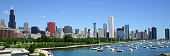 3. Chicago, Illinois
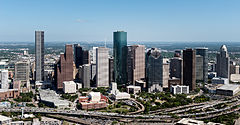 4. Houston, Texas
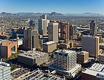 5. Phoenix, Arizona
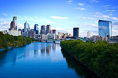 6. Philadelphia, Pennsylvania
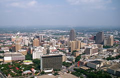 7. San Antonio, Texas
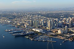 8. San Diego, California
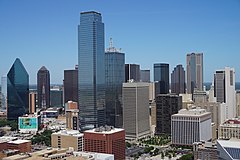 9. Dallas, Texas
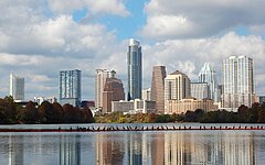 10. Austin, Texas
 11. Jacksonville, Florida
 12. San José, California
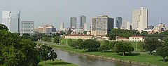 13. Fort Worth, Texas
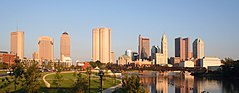 14. Columbus, Ohio
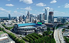 15. Charlotte, North Carolina
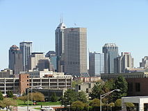 16. Indianapolis, Indiana
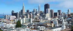 17. San Francisco, California
 18. Seattle, Washington
 19. Denver, Colorado
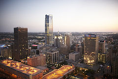 20. Oklahoma City, Oklahoma
 21. Nashville, Tennessee
 22. El Paso, Texas
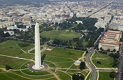 23. Washington, District of Columbia
 24. Las Vegas, Nevada
 25. Boston, Massachusetts
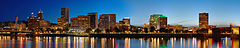 26. Portland, Oregon
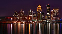 27. Louisville, Kentucky
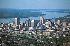 28. Memphis, Tennessee
 29. Detroit, Michigan
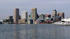 Baltimore, Maryland
 31. Milwaukee, Wisconsin
 32. Albuquerque, Nuevo México
 33. Tucson, Arizona
 34. Fresno, California
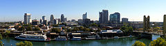 35. Sacramento, California
 36. Mesa, Arizona
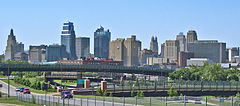 37. Kansas City, Missouri
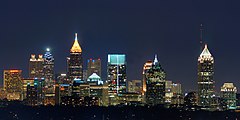 38. Atlanta, Georgia
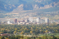 39. Colorado Springs, Colorado
 40. Omaha, Nebraska
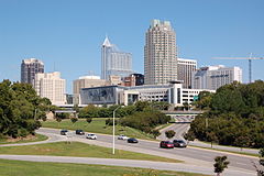 41. Raleigh, North Carolina
 42. Virginia Beach, Virginia
 43. Long Beach, California
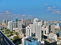 44. Miami, Florida
 45. Oakland, California
 46. Minneapolis, Minnesota
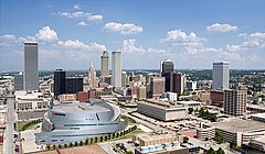 47. Tulsa, Oklahoma
 48. Bakersfield, California
 49. Tampa, Florida
 50. Wichita, Kansas


.jpg)


.jpg)

.jpg)


.jpg)


.jpg)


Puerto Rico

La siguiente tabla enumera los cinco municipios (municipios) de Puerto Rico con una población mayor a 100,000 habitantes en 1 de julio de 2022, según lo estimado por la Oficina del Censo de Estados Unidos.
Si Puerto Rico fuera incluido en la lista más amplia de Estados Unidos, San Juan sería la 57ª ciudad más grande del país.
La siguiente tabla contiene la siguiente información:
- El municipio ocupa el puesto de población al 1 de julio de 2022, según lo estimado por la Oficina del Censo de los Estados Unidos
- El municipio
- Población municipal al 1o de julio de 2022, según estimaciones de la Oficina del Censo de los Estados Unidos
- La población municipal al 1 de abril de 2020, como se indica en el censo de 2020 de los Estados Unidos
- El municipio por ciento de la población cambia del 1 de abril de 2020, al 1 de julio de 2022
- La zona del municipio al 1 de enero de 2020
- Densidad de la población municipal al 1 de abril de 2020 (residentes por área terrestre)
- Coordenadas de latitud municipio y longitud
| Municipio | 2022 estimaciones | Censo 2020 | Cambio | Zona terrestre 2020 | Densidad 2020 | Ubicación | ||
|---|---|---|---|---|---|---|---|---|
| San Juan | 334,776 | 342,259 | −2.19% | 39,8 metros cuadrados | 103,1 km2 | 8,599/sq mi | 3.320 km/km2 | 18°24′N 66°04′W / 18.40°N 66.06°W / 18.40; -66.06 (San Juan) |
| Bayamón | 181,577 | 185.187 | −1,95% | 27.0 metros cuadrados | 69,9 km2 | 6,859/sq mi | 2,648/km2 | 18°23′N 66°10′W / 18.38°N 66.16°W / 18.38; -66.16 (Bayamón) |
| Carolina | 151.571 | 154.815 | −2.10% | 20,7 metros cuadrados | 53,6 km2 | 7,479/sq mi | 2.888/km2 | 18°25′N 65°59′W / 18.41°N 65.98°W / 18.41; -65.98 (Carolina) |
| Ponce | 132.138 | 137.491 | −3.89% | 28,4 metros cuadrados | 73,6 km2 | 4,841/sq mi | 1.869 km/km2 | 18°00′N 66°37′W / 18.00°N 66.62°W / 18.00; -66.62 (Ponce) |
| Caguas | 125.136 | 127.244 | - 1,66% | 10,9 metros cuadrados | 28,2 km2 | 11,674/sq mi | 4,507/km2 | 18°14′N 66°02′W / 18.23°N 66.04°W / 18.23; -66.04 (Caguas) |
Otros territorios estadounidenses
A partir de 2023, cuatro territorios estadounidenses — Samoa Americana, Guam, las Islas Marianas del Norte y las Islas Vírgenes de los Estados Unidos— no tienen ciudades con al menos 100.000 personas.
Lugares designados por el censo
Los siguientes cuadros enumeran los lugares censados de Estados Unidos (CDPs) con poblaciones de al menos 100.000 según el censo de 2020. A CDP is a concentration of population identified by the United States Census Bureau for statistical purposes. Los desplazados internos se delinean para cada censo decenal como contrapartes estadísticas de lugares incorporados como ciudades, pueblos y aldeas. CDPs are populated areas that lack separate municipal government, but which otherwise physically resemble incorporated places. A diferencia de las ciudades incorporadas en la lista principal, la Oficina del Censo de los Estados Unidos no publica estimaciones anuales de población para los desplazados internos.
La siguiente tabla contiene la siguiente información:
- El lugar censado
- El estado
- La población local censal designada hasta el 1 de abril de 2020, como se indica en el censo de 2020 de los Estados Unidos
- La población local censada designada al 1 de abril de 2010, como se indica en el censo de 2010 de los Estados Unidos
- El porcentaje de población censada cambia del 1 de abril de 2010 al 1 de abril de 2020
- El área de tierra de lugar censado al 1 de enero de 2020
- Densidad de población local censada al 1 de abril de 2020 (residentes por área terrestre)
- Coordenadas de latitud y longitud de lugar censadas
| Censo... Lugar designado | ST | Censo 2020 | Censo de 2010 | Cambio | Zona terrestre 2020 | Densidad 2020 | Ubicación | ||
|---|---|---|---|---|---|---|---|---|---|
| Arlington | VA | 238,643 | 207,627 | +14,94% | 26.0 metros cuadrados | 67,340 km2 | 9,179/sq mi | 3.544 km2 | 38°53′N 77°06′W / 38.88°N 77.10°W / 38.88; -77.10 (Arlington) |
| Enterprise | NV | 221,831 | 108.481 | +104,49% | 66.0 metros cuadrados | 170.939 km2 | 3,361/sq mi | 1.298 km2 | 36°01 "N 115°14"W / 36.01°N 115.23°W / 36.01; -115.23 (Enterprise) |
| Spring Valley | NV | 215,597 | 178.395 | +20.85% | 35,5 metros cuadrados | 91.945 km2 | 6,073/sq mi | 2.345 km/km2 | 36°06′N 115°16′W / 36.10°N 115.26°W / 36.10; -115.26 (Valle de la primavera) |
| Sunrise Manor | NV | 205,618 | 189.372 | +8.58% | 33,7 metros cuadrados | 87,283 km2 | 6,101/sq mi | 2.356 km2 | 36°11′N 115°03′W / 36.18°N 115.05°W / 36.18; -115.05 (Sunrise Manor) |
| Paraíso | NV | 191,238 | 223,167 | −14,31% | 42,4 metros cuadrados | 109.815 km2 | 4,510/sq mi | 1.740 km/km2 | 36°05′N 115°08′W / 36.09°N 115.14°W / 36.09; -115.14 (Paradise) |
| Metairie | Los Ángeles | 143,507 | 138.481 | +3.63% | 23,3 metros cuadrados | 60,347 km2 | 6,159/sq mi | 2.38/km2 | 30°00′N 90°11′W / 30.00°N 90.18°W / 30.00; -90.18 (Metairie) |
| East Los Ángeles | CA | 118.786 | 126.496 | −6,10% | 7.5 metros cuadrados | 19.425 km2 | 15,838/sq mi | 6.115 km/km2 | 34°02′N 118°10′W / 34.03°N 118.17°W / 34.03; -118.17 (Este de Los Ángeles) |
| Brandon | FL | 114.626 | 103.483 | +10,77% | 33,1 metros cuadrados | 85,729 km2 | 3,463/sq mi | 1,337/km2 | 27°56′N 82°18′W / 27.94°N 82.30°W / 27.94; -82.30 (Brandon) |
| Los bosques | TX | 114.436 | 93.847 | +21,94% | 43.3 metros cuadrados | 112.146 km2 | 2,643/sq mi | 1.020 km/km2 | 30°10′N 95°31′W / 30.17°N 95.51°W / 30.17; -95.51 (Los bosques) |
| Lehigh Acres | FL | 114.287 | 86.784 | +31.69% | 92,7 metros cuadrados | 240.092 km2 | 1,233/sq mi | 476/km2 | 26°37′N 81°38′W / 26.61°N 81.64°W / 26.61; -81.64 (Acciones altas) |
| Spring Hill | FL | 113.568 | 98.621 | +15,16% | 59,9 metros cuadrados | 155.140 km2 | 1,896/sq mi | 732/km2 | 28°29′N 82°32′W / 28.48°N 82.53°W / 28.48; -82.53 (Spring Hill) |
| Riverview | FL | 107.396 | 71.050 | +51,16% | 46.2 metros cuadrados | 119.657 km2 | 2.325 metros cuadrados | 898/km2 | 27°49′N 82°18′W / 27.82°N 82.30°W / 27.82; -82.30 (Vista previa) |
| Columbia | MD | 104.681 | 99.615 | +5.09% | 31,9 metros cuadrados | 82.621 km2 | 3,282/sq mi | 1.267 km2 | 39°12′N 76°52′W / 39.20°N 76.86°W / 39.20; -76.86 (Columbia) |
| Highlands Ranch | CO | 103.444 | 96.713 | +6,96% | 24,3 metros cuadrados | 62,937 km2 | 4,257/sq mi | 1,644 km2 | 39°32′N 104°58′W / 39.54°N 104.97°W / 39.54; -104.97 (Highlands Ranch) |
Ciudades antes de más de 100.000 personas
La siguiente tabla enumera las ciudades de EE. UU. que, en censos anteriores, tenían poblaciones de al menos 100 000 habitantes, pero desde entonces han disminuido por debajo de este umbral o se han consolidado o anexado a una ciudad vecina.
| Ciudad | ST | 2022 Estimación | Peak población | % declinación desde el pico | Peak año | |
|---|---|---|---|---|---|---|
| Allegheny | PA | NA | 129.896 | NA | 1907 | |
| Brooklyn | NY | NA | 806,343 | NA | 1898 | |
| Camden | NJ | 70.996 | 124,555 | −43−00% | 1950 | |
| Cantón | Oh. | 69.671 | 116.912 | −40.41% | 1950 | |
| Citrus Heights | CA | 86.433 | 107.439 | −19,55% | 1990 | |
| Clinton Township | MI | 99.448 | 100.513 | 1.0−6% | 2020 | |
| Duluth | MN | 86.619 | 107.312 | −19,28% | 1960 | |
| Erie | PA | 93.511 | 138.440 | −32,45% | 1960 | |
| Río Otoño | MA | 93.682 | 120.485 | −22,25% | 1920 | |
| Federal Way | WA | 97.863 | 101.030 | −3.13% | 2020 | |
| Flint | MI | 79.854 | 196,940 | −59,45% | 1960 | |
| Gary | INTRODUCCIÓN | 67.972 | 178.320 | 61,88% | 1960 | |
| Hammond | INTRODUCCIÓN | 76.575 | 111.698 | −31,44% | 1960 | |
| Livonia | MI | 93.779 | 110,109 | −14.83% | 1970 | |
| Longmont | CO | 98.687 | 100.758 | - 2,06% | 2021 | |
| Cataratas de Niagara | NY | 47.993 | 102.394 | 53,13% | 1960 | |
| Norwalk | CA | 98.537 | 105.549 | −6.64% | 2010 | |
| Parma | Oh. | 79.358 | 100.216 | −20,81% | 1970 | |
| Portsmouth | VA | 97.029 | 114,773 | −15.46% | 1960 | |
| Lectura | PA | 94.858 | 111.171 | −14,67% | 1930 | |
| Roanoke | VA | 97.847 | 100.220 | −2.37% | 1980 | |
| Scranton | PA | 75.848 | 143.333 | 47,08% | 1930 | |
| Somerville | MA | 79.762 | 103.908 | −23.24% | 1930 | |
| St. Joseph | MO | 70.656 | 102.979 | −31,39% | 1900 | |
| Trenton | NJ | 89.661 | 128.009 | 29,96% | 1950 | |
| Utica | NY | 64,081 | 101.740 | −37.01% | 1930 | |
| Wilmington | DE | 71.569 | 112,504 | −36,39% | 1940 | |
| Youngstown | Oh. | 59,144 | 170,002 | −65.21% | 1930 |
Ubicaciones de las 50 ciudades más pobladas
